
Visitor Essentials
Determining the Best Time to Visit Loch Lomond and The Trossachs National Park
Determining the best time to visit Loch Lomond and The Trossachs National Park requires balancing the promise of long, daylight-rich summer days against the area's characteristic volatility in weather. For many visitors, the period between May and September offers the most reliable window for outdoor pursuits, such as hiking the Munros or exploring the loch shores. However, this park remains a landscape where precipitation is a persistent feature of the climate, regardless of the month. Travelers often find that the choice of when to go depends less on finding a perfectly dry window and more on managing expectations regarding daylight duration, temperature, and the intensity of seasonal visitor interest.
The Relationship Between Daylight and Geography
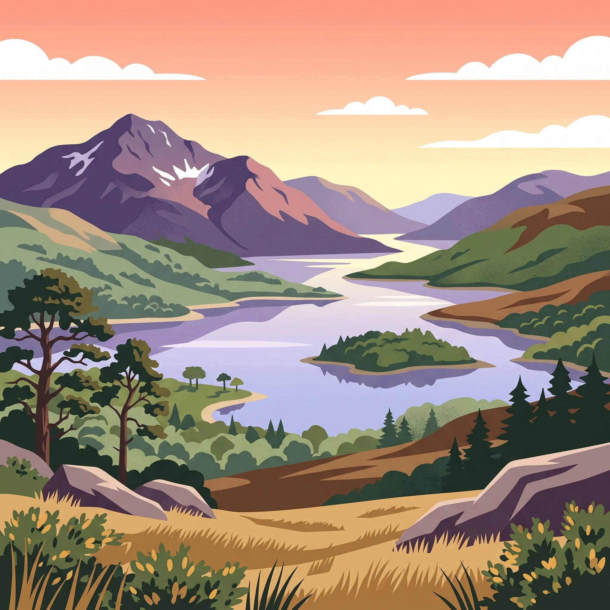
Loch Lomond and The Trossachs spans a significant range of terrain, from the lush, lower-lying southern reaches near the Highland Boundary Fault to the rugged, alpine-like peaks of the north. This diverse topography influences how visitors experience the seasons. In late spring and throughout the summer, the extended daylight,reaching over 17 hours in June,provides a functional advantage for those aiming to complete longer treks or navigate remote glens. Conversely, the shorter, darker days of late autumn and winter redefine the park as a place for quieter, more atmospheric exploration, provided visitors are prepared for the frequent rainfall and lower mean temperatures that define the colder months.
Managing Seasonal Trade-offs
The climate at an elevation of approximately 387 metres reflects a pattern that complicates simple seasonal categorization. While spring brings a rapid increase in maximum temperatures, rising from the single digits into the high teens, it also marks the beginning of a shift in park activity levels. Summer is the period of greatest accessibility for those prioritizing water-based activities or access to higher-altitude paths, yet it is also when the region attracts the highest volume of visitors. The transition into autumn is often marked by a decline in temperatures and a subtle change in light quality, which can transform the dense Caledonian pine forests and Atlantic oakwoods into vibrant displays of seasonal colour.
Ultimately, there is no single best time to visit that satisfies every priority. The most successful trips are those that accept the inherent variability of the Scottish Highlands. Whether one prefers the energy of the busier summer months or the solitude of the shoulder seasons, the key is to approach planning with an understanding that the park's dramatic scenery is a product of the very weather patterns that visitors must navigate. Regardless of the month chosen, visitors should always verify current access status and local forecasts before arriving, as the park's sensitive ecological zones and remote mountainous terrain require careful, informed preparation.
Visitor Timeline
Best Months to Visit Loch Lomond and The Trossachs: Seasonal Snapshots
Peak Activity Windows: May to September
The most effective window for those prioritizing outdoor recreation and longer daylight hours occurs between May and September. During this period, daylight peaks, reaching over 17 hours in June, which provides an expansive timeframe for mountain hiking, water sports on Loch Lomond, and exploring the Trossachs glens. Mean temperatures during these months reach their annual highs, with daily maximums averaging near 20 degrees Celsius in July. Visitors during this window benefit from the most stable temperature profiles, though this season also coincides with higher visitor density at popular trailheads and access points.
Transition and Shoulder Periods: April and October
For travelers seeking a balance between moderate weather and fewer crowds, the shoulder months of April and October offer a distinct trade-off. April provides increasing daylight, reaching nearly 14 hours by the end of the month, and signals the start of the primary growing season, though average daily maximum temperatures remain cooler at approximately 13 degrees Celsius. This period is often characterized by crisp, clear conditions, though it remains prone to the rapid weather shifts typical of the Highland climate. October marks the transition toward shorter days, with daylight dropping to roughly 10 hours. While temperatures begin to decline, the park experiences a distinct shift in scenery as the woodland foliage changes, making this period attractive for those prioritizing photography and quieter trail conditions over heat and long daylight hours.
Winter Challenges: November to March
Visiting between November and March requires careful preparation for significantly reduced daylight and colder, more volatile weather. Daylight hours are at their shortest in December, dipping below 7 hours, which restricts the amount of time available for safe hillwalking and outdoor exploration. Average maximum temperatures during these months often drop below 10 degrees Celsius, with January experiencing the lowest mean temperatures. While these months offer a stark, dramatic landscape and the possibility of seeing the mountains under snow, the primary compromise is the limited time for activity and the increased likelihood of precipitation and wind, which can affect visibility and ground conditions in exposed mountain terrain. Travelers during this window should verify local alerts and weather forecasts, as the Highland environment is prone to rapid deterioration during the winter months.
Climate and Weather
Loch Lomond and The Trossachs Monthly Weather and Climate Patterns
Understanding the climate within Loch Lomond and The Trossachs National Park requires moving beyond simple temperature averages. The park spans a diverse range of elevations and microclimates, from the sheltered loch shores to the exposed alpine-like moors of the high Munros. While long-term climate normals provide a useful baseline for planning, they represent data collected at a specific reference elevation and do not serve as a reliable local forecast for specific days on the trail or mountain summits.
The Shift in Daylight and Thermal Trends
The most dramatic annual transition in the park is the fluctuation in daylight hours. From a low of approximately 6.7 hours in December, daylight expands rapidly during the spring, peaking at over 17 hours in June. This extended photoperiod significantly increases the effective time available for outdoor activities during the summer months. Temperature trends follow a more gradual curve, with mean values rising from a chilly 1.16 degrees Celsius in January to a peak of 12.42 degrees Celsius in July. While these figures may appear moderate, the sensation of cold is frequently amplified by high relative humidity, which remains consistently above 85 percent throughout the year, peaking at nearly 97 percent in the depths of winter. This persistent humidity ensures that even relatively mild temperatures can feel penetrating, especially when combined with wind.
Precipitation Patterns and Atmospheric Stability
Rainfall is a constant consideration for anyone visiting the park, as the region experiences significant precipitation throughout all twelve months. The climate data indicates a relatively consistent atmospheric profile where the driest periods, generally observed in April and May, offer only a slight reduction in daily precipitation compared to the wetter autumn and winter months. Rather than a distinct dry season, visitors should anticipate a variable pattern where wet days can occur at any time. The transition into autumn, starting in September and October, typically sees an increase in precipitation frequency, coinciding with cooler temperatures and decreasing daylight. Because the park straddles the Highland Boundary Fault, weather patterns can shift rapidly, and the mountainous topography of the Trossachs and Arrochar Alps often traps moisture, leading to localized conditions that differ significantly from those in the low-lying areas near the loch shores.
Wind and the Reality of Highland Exposure
Wind is a critical factor for mountain travel within the park, with average speeds remaining notably consistent through the year. While the data suggests a modest decrease in wind speeds during the late spring and summer months, the exposed nature of the higher Munros means that wind chill remains a factor even when base-level temperatures seem comfortable. Visitors should interpret the lower wind values recorded in July and August as a general indicator of increased atmospheric stability, rather than a guarantee of calm conditions on the peaks. The relationship between wind and humidity often dictates the actual feeling of the air, and those venturing into the Breadalbane region or the Arrochar Alps should prepare for conditions to be windier and cooler than the annual mean suggests. Always check current, localized forecasts for the specific area of the park you intend to visit, as mountain weather in Scotland is famously dynamic and resistant to long-term averaging.
Seasonal dynamics
Understanding Seasonal Weather Patterns in Loch Lomond and The Trossachs
Defining the Highland Weather Phases
Rather than relying on a strict four-season calendar, the weather in Loch Lomond and The Trossachs is best understood through two primary environmental phases: the prolonged light-filled season and the period of atmospheric transition and cooling. Because the park spans from lowland shores near the Highland Boundary Fault to alpine terrain in the north, visitors experience distinct shifts in environmental conditions that do not align perfectly with conventional spring, summer, autumn, and winter markers. The annual rhythm is driven more by daylight hours and the frequency of Atlantic-borne weather systems than by stable, predictable temperature tiers.
The Extended Light Season: May to September
This period serves as the primary window for stable, accessible outdoor exploration. Defining characteristics include the longest daylight hours of the year, peaking with over 17 hours in June, and a more consistent, albeit never guaranteed, reprieve from the most severe wind and rain patterns. During these months, the park undergoes a noticeable transition from the cooler, damp conditions of early spring into a cycle of milder temperatures, where daily maximums often reach their peak. The increase in daylight significantly influences the park environment, drying out lower-level trails and allowing for safer access to more remote highland glens. Visitors will notice the landscape shifts from the muted tones of late winter to vibrant greens as vegetation takes hold. While this is the most reliable time for activity, it remains dynamic, and visitors should expect the potential for sudden cloud cover and localized precipitation even during the brightest months.
The Transitional and Cooling Phase: October to April
As daylight hours contract significantly throughout the autumn, the park shifts into a phase defined by atmospheric volatility and cooling temperatures. This phase encompasses the late autumn transition, the mid-winter low-light months, and the early spring thaw. Precipitation patterns shift during this time, with higher humidity levels and a greater frequency of wind events, particularly in the exposed Highland terrain and the Arrochar Alps.
November through February marks the deepest part of this cycle, characterized by minimal daylight, often dropping below 8 hours in December. During these months, the park atmosphere is dominated by persistent cloud cover, mist, and the increased likelihood of precipitation falling as rain at lower elevations or sleet and snow on the Munros. The transition into March and April is gradual; while daylight begins to expand, the lingering effects of the winter period mean that alpine trails often remain subject to cold, unpredictable conditions long after the lowlands appear to be warming. This phase requires visitors to adjust their expectations regarding trail accessibility and the time available for exploration, as the combination of earlier sunsets and potential terrain instability creates a more challenging environment for those venturing beyond the main valley floors.
Seasonal Experiences
Experiencing Loch Lomond and The Trossachs National Park Throughout the Year
Navigating Highland Terrain and Mountain Walking
The ability to access high-altitude terrain in the park is heavily influenced by the seasonal progression of daylight and ground conditions. For those aiming to climb Munros like Ben Lomond or the steeper ridges of the Arrochar Alps, the period from late May through August provides the most reliable daylight window for extended, non-rushed ascents. With daylight hours reaching their zenith in mid-summer, walkers gain significant flexibility in their start times, which is essential for managing the unpredictable nature of Highland weather. During the shorter days of late autumn and winter, the window for safe navigation on peaks like Ben More narrows drastically, requiring earlier starts and a higher degree of self-reliance, as the potential for rapid weather shifts increases significantly.
Seasonal Accessibility of Trail Networks
The character of popular routes, including sections of the West Highland Way, changes noticeably throughout the year. The southern portion near Drymen and the lochside paths toward Rowardennan and Inversnaid are susceptible to muddy conditions, especially during months with higher precipitation and lower evaporation rates, such as November, December, and January. Hikers should expect slower progress on the boulder-strewn sections between Inversnaid and Ardleish during wet periods. Conversely, the transition months of April and May often provide a firmer ground profile before the high vegetation growth of mid-summer, though these months remain subject to the park's characteristic variability in temperature and wind speed.
Water-Based Exploration and Cycling
Water sports on Loch Lomond and cycling along the West Loch Lomond Cycle Path follow a rhythm dictated by wind and daylight. The summer months offer the best environment for water-based activities, as mean temperatures peaking in July and August provide a more comfortable experience for those venturing out on the loch. However, the park's wind normals indicate consistent air movement throughout the year, which remains a factor regardless of the season. Cycling along the disused railway tracks remains an accessible option through most of the year, provided visitors account for shorter daylight hours in the winter months. During peak summer, the longer daylight allows for more expansive rides toward Callander or across the Trossachs, but cyclists should remain prepared for sudden changes in conditions that characterize the Highland boundary landscape.
Cultural Events and Outdoor Gatherings
The park's calendar is punctuated by regional gatherings, often held during the summer weekends. These events, which may include agricultural shows or traditional sports, align with the period of highest temperatures and longest daylight. Visitors planning around these occurrences should verify specific schedules locally, as these represent seasonal focal points rather than year-round activities.
Visitor Priorities
Timing Your Visit to Loch Lomond and The Trossachs by Activity and Preference
Balancing Daylight and Stability for Mountain Hiking
For those prioritising mountain hiking, including Munro bagging or long-distance trails like the West Highland Way, the window from May through early July offers the most consistent support. The combination of extended daylight hours (climbing to over 17 hours in June) and lower probability of sustained wind gusts compared to the winter months provides a safer margin for longer days on exposed ridges. While May can experience cooler temperatures,with averages hovering near 7.87°C,the reduced precipitation relative to the autumn months makes it a preferred choice for hikers who want to avoid waterlogged terrain on the steep sections of the Arrochar Alps or the rocky ascent of Ben Lomond. The primary trade-off is that these months often precede the peak growth of bracken and the maturation of highland vegetation, which can sometimes obscure less-defined paths, and visitors must still be prepared for the characteristic rapid shifts in weather that occur at elevation regardless of the month.
Prioritising Warmer Weather for Water-Based Recreation
Visitors focusing on water sports, such as kayaking or open-water swimming on Loch Lomond, generally find late June through mid-August the most suitable period. This window coincides with the warmest monthly mean temperatures, which reach approximately 12.42°C in July. Although these temperatures remain moderate by global standards, the relative humidity and daylight duration contribute to a more comfortable experience on the water. The trade-off for choosing this warmest period is the higher frequency of summer precipitation events. While rainfall is distributed throughout the year, the increased warmth can lead to more convective weather patterns, meaning that sunny mornings can quickly transition into showery afternoons. For those who view water activities as the main purpose of their trip, this period offers the best balance of air warmth, provided they accept the necessity of waterproof gear for intermittent rain.
Selecting for Cooler Temperatures and Fewer Crowds
Travelers who prefer to avoid the peak activity cycles of mid-summer often find the shoulder period of September to be the most compelling. By September, the air temperature begins a gradual decline, averaging 9.9°C, and the intensity of the summer visitor cycle begins to diminish. This period allows for more contemplative photography of the changing landscape colours, particularly in the Trossachs, where the woods begin to reflect autumnal shifts. The compromise for choosing this time is the noticeable contraction in daylight hours, which drop toward 12.4 hours by the end of the month. Hikers choosing this window should adjust their routes to shorter, lower-elevation trails to ensure they finish well before sunset, as the risk of rapid, low-light conditions increases compared to the mid-summer months.
Access and Logistics
Seasonal Access and Practical Trip Planning Considerations for the National Park
Access to the national park is primarily defined by its proximity to the Scottish central belt, making it highly reachable for both day-trippers and those planning multi-day explorations. Major transport corridors, including the A82 and A84, provide the primary road arteries into the heart of the Highlands. While these routes are open year-round, travelers should note that the Highland geography can experience localized congestion during peak summer months and significant disruptions during extreme winter weather events. Because road conditions change rapidly due to both seasonal maintenance and Highland climate patterns, always check the Traffic Scotland website for real-time updates on closures, accidents, or temporary speed restrictions before setting out on your journey.
Strategic Transportation and Public Access
Public transport remains a viable and frequently used method for reaching the park, particularly for visitors aiming to access the West Highland Line. Trains from Glasgow offer reliable connections to key hubs like Balloch, Tarbet, and Crianlarich. The frequency and reach of these services are generally stable, but schedules can shift based on seasonal demand or engineering works. For those relying on bus networks, services from major cities like Glasgow and Edinburgh provide connections to towns such as Callander and Tyndrum. It is important to remember that these services function as public transport for residents and visitors alike, and demand for popular tourist routes can lead to high occupancy. Always confirm current timetables with transport providers or travel aggregators before finalising your itinerary, as bus routes and frequencies are subject to change and are not guaranteed to align with your personal travel window.
Navigating Operational Information
While climate data indicates shifting trends between seasons, these normals should not be mistaken for current operating status reports. Whether you are planning a visit to a specific visitor centre, checking the availability of a ferry, or anticipating the opening of a seasonal trail facility, you must rely on direct information from the park authority. The park website provides the most current position on facility hours, potential access restrictions, and any conservation-related guidance that may affect your visit. Never assume a facility remains open simply because the calendar indicates a popular tourist month. Always verify specific site access via official park channels, as management decisions and environmental factors can necessitate sudden changes in how specific glens, parking areas, or mountain trails are serviced. By confirming operational details shortly before your departure, you ensure your planning accounts for any temporary closures or maintenance projects that historical data cannot predict.
Safety and Preparation
Seasonal Weather Hazards and Packing for Loch Lomond and The Trossachs
Adapting to Highland Weather Patterns
Preparation for a visit to the park relies on understanding that long-term climate normals demonstrate high variability rather than consistency. Even in the peak summer months, when temperatures are at their highest and daylight hours are most abundant, the atmospheric conditions remain prone to rapid changes. Travelers should expect that the park's Highland geography can produce localized weather shifts, with clouds, precipitation, and wind speeds fluctuating significantly over short distances. Because the park spans both lowland areas and mountain terrain, your preparation must account for the reality that the summit environment is distinct from the sheltered glens.
Essential Gear and Layering Strategies
Given the year-round prevalence of rainfall and consistent humidity levels, the most effective approach to packing is a modular layering system. Avoid heavy, bulky items that are difficult to adjust as conditions change. Focus instead on high-quality, weather-resistant outer shells that provide protection against both rain and wind, which are frequent features even during the milder months of May through September. While climate data suggests that mid-summer months experience lower wind speeds and higher average temperatures, moisture remains a persistent factor in the Highland environment. Waterproof footwear and clothing are essential for any outdoor excursion, as terrain often retains water long after precipitation has ceased. Always carry a secondary layer to provide warmth if temperatures drop due to elevation or reduced sunlight, particularly when planning activities in the more remote mountainous regions of the Trossachs.
Safety Considerations for Mountain Terrain
Navigation and safety in the park are heavily influenced by daylight duration and atmospheric visibility. During the winter months, daylight is limited to as little as seven hours, which narrows the window for safe outdoor exploration and increases the risk of being caught in darkness. In the shoulder seasons and winter, the combination of cold temperatures, potential for mist, and slippery terrain requires careful route planning. Always treat hill-walking and mountain navigation as activities requiring pre-planned routes and the ability to orient yourself without reliance on mobile technology, as signal can be unreliable in deeper glens and high terrain.
Verifying Conditions Before Departure
Climate averages provide a baseline for planning, but they are not a substitute for current forecasts. Before heading out, always consult specialized mountain weather forecasts, which provide essential detail on wind chill, visibility, and precipitation specific to higher elevations. Check official park alerts for any temporary path closures or environmental warnings that may impact your planned route. By aligning your gear and expectations with the reality of day-to-day conditions rather than solely relying on historical averages, you ensure a more prepared and safer experience across the park's diverse landscapes.
Trip Decision
How to choose the right time to visit Loch Lomond and The Trossachs
Deciding when to visit Loch Lomond and The Trossachs depends entirely on which environmental trade-offs you are most comfortable navigating. Because the park features a temperate maritime climate that lacks a distinct dry season, your choice of timing should focus on matching daylight availability with your intended intensity of activity. The period between May and September remains the most reliable for visitors seeking maximum daylight for mountain navigation and easier access to higher elevations. During these months, the extended hours provide a crucial safety buffer for hiking Munros or exploring the more rugged terrain of the Arrochar Alps, where weather can shift rapidly regardless of the season.
Prioritizing Your Experience
If your primary goal is to avoid the highest visitor numbers, the shoulder months of April and October often present the most effective compromise. These periods offer reasonable daylight while avoiding the peak summer surge, though you must accept a higher statistical probability of persistent rain and cooler ambient temperatures. Visitors focused on the quieter, atmospheric qualities of the Highland landscape may find the late autumn and early spring months rewarding, provided they are equipped with robust, waterproof gear and a flexible itinerary. Conversely, those prioritizing water-based recreation on Loch Lomond or extended cycling tours should aim for the warmer July and August window, when mean temperatures are at their highest and the humidity levels are relatively lower than in the deep winter months.
Making Your Final Decision
To finalize your travel dates, consider the physical requirements of your planned activities against your personal tolerance for variable Highland conditions. If you are planning a trip involving high-mountain access, the longer daylight hours of early summer are objectively safer and more practical. If your itinerary is centered on the lower-lying glens and accessible woodland paths of the Trossachs, your window for a comfortable visit is significantly wider, extending well into the autumn. Remember that the climate data presented here reflects long-term normals, not current conditions. Before finalizing any bookings or departing for the park, always verify the latest mountain weather forecasts, local flood alerts, and current operational status of transport links and visitor facilities through official Scottish park and traffic resources.