
Mori Atlas logo
National parkLoch Lomond and The Trossachs National Park

Tracing the dramatic geological transitions from lowland shores to wild mountain ranges and lochs.

Loch Lomond and The Trossachs National Park: A Study of Scottish Highland Geography

Loch Lomond and The Trossachs National Park serves as a gateway to the Scottish Highlands, encompassing 1,865 square kilometres of protected terrain. The park straddles the Highland Boundary Fault, creating a distinct geographic contrast between cultivated southern fields and the rugged, mountainous landscape of the north. From the expansive waters of Loch Lomond to the ancient Caledonian pine forests and craggy Munros, this protected area offers a clear view into the diverse natural structures defining Scotland.

National ParkScotlandMountainsLochsCaledonian ForestHillwalking
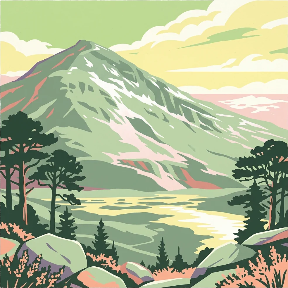
Stylized illustration showing a mountain with snow patches, surrounded by trees and a body of water under a cloudy sky

Loch Lomond and The Trossachs National Park

National park

Park overview

Structured park overview, official facts, and landscape profile for Loch Lomond and The Trossachs National Park

Loch Lomond and The Trossachs National Park park facts, protected area profile, and essential visitor context

Review the core facts for Loch Lomond and The Trossachs National Park, including designation, size, terrain, visitor scale, habitats, and operating context in one park-focused overview.

About Loch Lomond and The Trossachs National Park

Loch Lomond and The Trossachs National Park represents Scotland's commitment to protecting its natural heritage through national park designation, a process that took over fifty years from initial proposals to actual establishment. The park was formally created on 1 July 2002 under the National Parks (Scotland) Act 2000, becoming the first of Scotland's two national parks, followed by the Cairngorms in 2003. Unlike many national parks worldwide that protect wilderness areas largely untouched by human activity, Scotland's national parks must manage semi-natural landscapes shaped by thousands of years of human activity including agriculture, historical deforestation, overgrazing, and twentieth-century afforestation with introduced tree species.

The park is administratively divided into four distinct sections by the park authority: Breadalbane in the north, Loch Lomond at the centre, The Trossachs to the east, and Cowal in the west. Each section offers a different character and landscape experience. Breadalbane encompasses the steep hills and mountains of the southern Highlands, centred on the villages of Crianlarich and Tyndrum, and includes the park's highest peak, Ben More. The Cowal peninsula in the western part of the park is largely covered by the Argyll Forest Park and includes the Arrochar Alps, a popular location for hillwalking and climbing.

The park lies close to Scotland's heavily populated Central Belt, making it exceptionally accessible for day trips and weekend excursions from Glasgow, Edinburgh, and Stirling. This accessibility, combined with the quality of the scenery, has resulted in the area being one of Scotland's most visited protected areas. The park authority works to balance the needs of visitors with conservation objectives, managing recreational access while protecting the natural and cultural heritage that makes the area special.

Quick facts and research context for Loch Lomond and The Trossachs National Park

Loch Lomond and The Trossachs National Park spans 1,865 square kilometres in the southern Scottish Highlands, making it the fourth-largest national park in the British Isles. The park contains 21 Munros including Ben Lomond, the most southerly Munro in Scotland at 973.7 metres, and Ben More, the highest peak in the park at 1,173.9 metres. Loch Lomond itself covers 71 square kilometres and contains the largest freshwater island in the British Isles, Inchmurrin. The park is administered by a national park authority based in Balloch and is classified as an IUCN Category V protected landscape. The area has been a tourist destination since at least the 18th century, with James Boswell and Samuel Johnson visiting in 1773.

Protection and recognition

Examine documented protection scope, management frameworks, and international recognition records.

Loch Lomond and The Trossachs National Park Protection Status and Designation Data

Loch Lomond and The Trossachs National Park maintains a documented mixed protection status within regional conservation frameworks. Review official designation details, management parameters, and recorded international recognition sources for this protected area.

Protection details

Protection scope
Mixed
Transboundary protection
No
Buffer area
350 km²
Park context

Deeper park guide and search-rich context for Loch Lomond and The Trossachs National Park

Loch Lomond and The Trossachs National Park history, landscape, wildlife, and travel context

Explore Loch Lomond and The Trossachs National Park through its history, landscape character, ecosystems, wildlife, conservation priorities, cultural context, and seasonal travel timing in a structured park guide built for atlas discovery and search intent.

Why Loch Lomond and The Trossachs National Park stands out

The park is best known for its combination of accessible Highland scenery, featuring prominently the iconic Loch Lomond with its islands and surrounding mountains. The Trossachs area represents a classic Scottish High landscape of wooded hills, misty glens, and sparkling lochs that has inspired visitors and writers for generations. The park protects significant remnants of Scotland's ancient Caledonian pine forest and supports populations of iconic Highland wildlife including golden eagles, red deer, red squirrels, and the rare capercaillie. The area is also famous for its outdoor recreation opportunities, particularly hillwalking, with peaks like Ben Lomond and The Cobbler being among the most climbed mountains in Scotland, and for water sports on Loch Lomond.
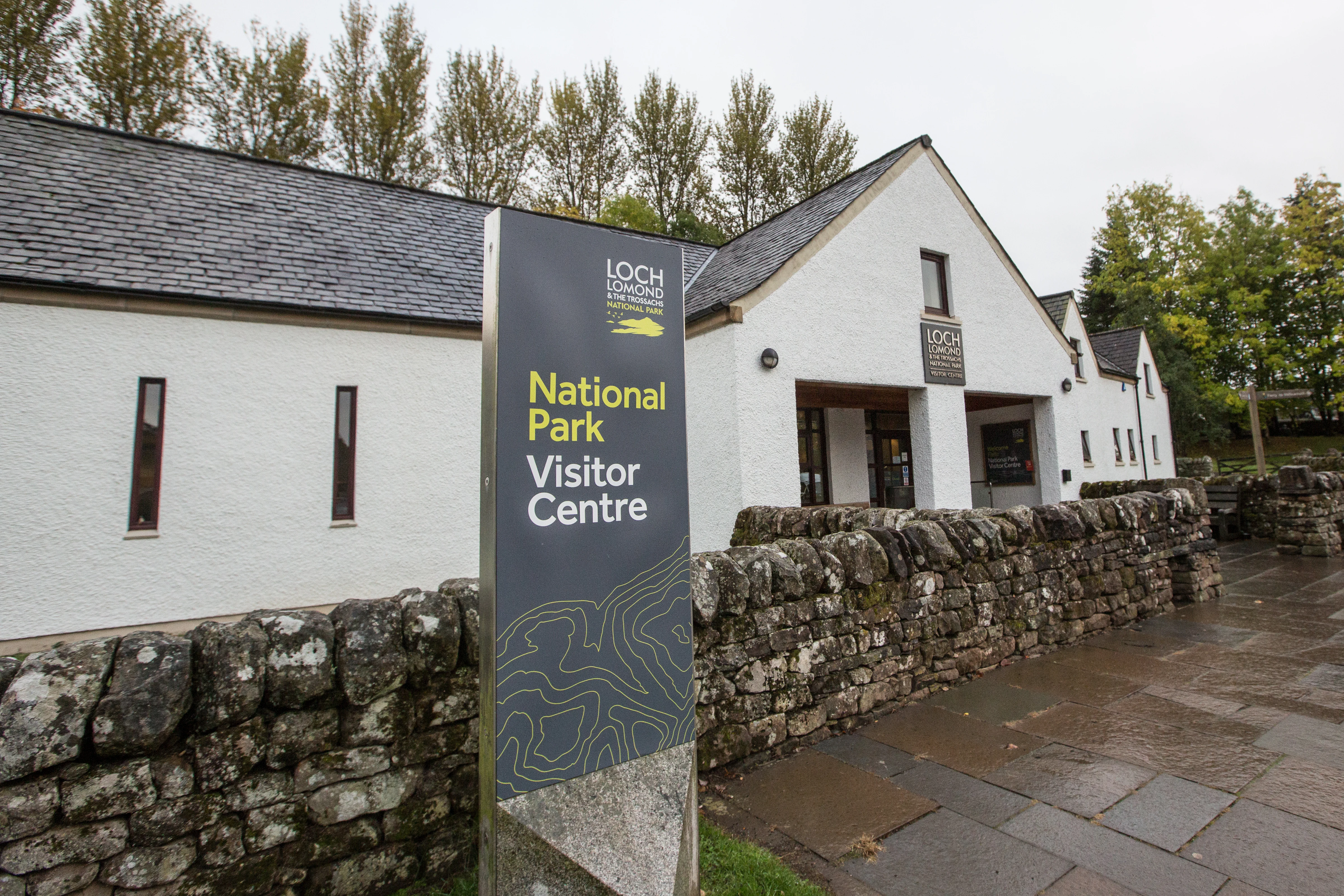
Sign reading 'National Park Visitor Centre' with 'Loch Lomond' logo, white building with stone wall, and trees in background
National Park Visitor Centre sign in front of a white building with stone wall

Loch Lomond and The Trossachs National Park history and protected-area timeline

The establishment of Loch Lomond and The Trossachs National Park represents the culmination of over half a century of advocacy and political debate about protecting Scotland's landscape. Following the Second World War, a committee was established to consider national parks in Scotland, and their 1945 report proposed national parks in five areas, including Loch Lomond and The Trossachs. The government designated these five areas as "National Park Direction Areas," giving powers for planning decisions to be reviewed by central government, but full national park status was not granted.

In 1981, the direction areas were replaced by National Scenic Areas, of which there are now 40 in Scotland. The 1990 Countryside Commission for Scotland produced a report recommending that four areas under particular pressure should be designated as national parks with independent planning boards, and again Loch Lomond and The Trossachs was among those identified. No action was taken until the establishment of the Scottish Parliament in 1999 under the Scotland Act 1998. The National Parks (Scotland) Act 2000 was one of the first pieces of legislation passed by the new parliament, and Loch Lomond and The Trossachs became Scotland's first national park on 1 July 2002.

The park authority operates under a broader mandate than English and Welsh national parks, with four aims specified in the legislation: conserving and enhancing natural and cultural heritage, promoting sustainable use of natural resources, promoting understanding and enjoyment of the area's special qualities, and promoting sustainable economic and social development of the area's communities.

Loch Lomond and The Trossachs National Park landscape and geographic character

The park's landscape is defined by the Highland Boundary Fault, a major geological feature that runs diagonally across Scotland and divides the park into two contrasting regions. South of the fault, the landscape is characterised by lower, more rolling hills, green fields, and cultivated agricultural land. North of the fault, the terrain becomes dramatically different, with steep mountains, deep glens, and a wilder character typical of the Scottish Highlands. This geological transition is most clearly visible at Loch Lomond, where the fault runs across the islands of Inchmurrin, Creinch, Torrinch, and Inchcailloch and over the ridge of Conic Hill.

The park contains 22 large lochs and over 50 rivers and larger burns, making it one of Scotland's most lake-rich protected areas. Loch Lomond itself is the largest lake in Great Britain by surface area at 71 square kilometres, containing numerous islands including Inchmurrin, the largest freshwater island in the British Isles. The Trossachs, originally referring to a small woodland glen at the centre of the area, now describes a broader region of wooded hills, glens, and lochs to the east of Loch Lomond. The landscape features 21 Munros, including Ben Lomond on the eastern shore of Loch Lomond at 973.7 metres, and 20 Corbetts, giving the park excellent hillwalking terrain. The Arrochar Alps in the Cowal section provide particularly dramatic mountain scenery and are popular with climbers.
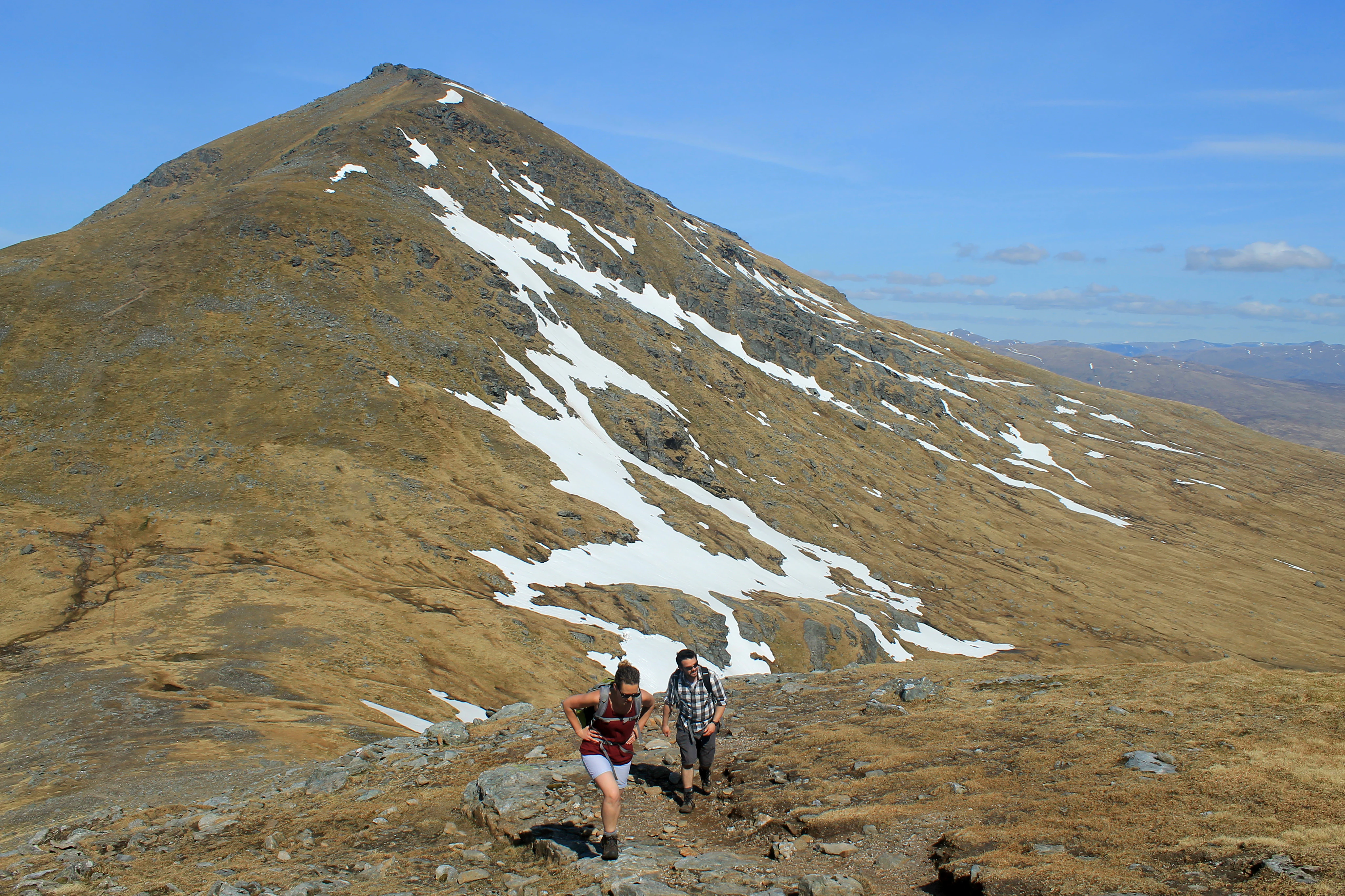
Two hikers on a rocky mountain ridge with Ben More mountain featuring snow patches in the background under a clear blue sky
Hikers on a rocky ridge with Ben More mountain and snow patches in the background, Loch Lomond and The Trossachs National Park

Loch Lomond and The Trossachs National Park ecosystems, habitats, and plant life

The park supports a remarkable diversity of habitats and ecological communities shaped by Scotland's varied geology, climate, and human history. Woodland covers approximately 30% of the park, with around 22.5% of the total area given over to commercial conifer plantations and 7.5% to native woodlands. The native woodlands include remnants of the Caledonian pinewoods, Atlantic oakwoods, and areas of wet woodland, representing what remains of forests that once covered much of Scotland. These native woodland areas are ecologically significant, supporting species adapted to old-growth forest conditions.

Higher ground in the park features important upland habitats including heathland, blanket bog, and willow scrub. The park's water environments are extensive, with 22 large lochs, 50 rivers and larger burns, and numerous smaller lochs, lochans, and burns. These freshwater environments support fish species including Atlantic salmon, trout, Arctic charr, powan, and various lamprey species. The park also includes 63 kilometres of coastline around three sea lochs (Loch Long, Loch Goil, and the Holy Loch), featuring rocky shores, cliffs, and areas of salt marsh and mudflats that support marine invertebrates and coastal bird populations.
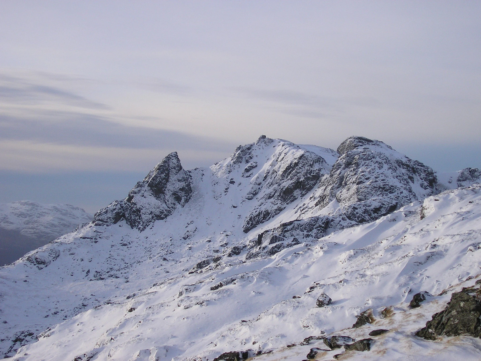
Snow-covered rocky mountain peaks under a pale sky, with snow-covered slopes and exposed rock faces
Snow-covered Cobbler mountain in Loch Lomond and The Trossachs National Park, Scotland

Loch Lomond and The Trossachs National Park wildlife and species highlights

The park is home to over 200 bird species and more than a quarter of all plant species found in Britain, making it one of Scotland's most biodiverse protected areas. Iconic Highland species feature prominently in the park's wildlife population, including capercaillie, red deer, red squirrel, Scottish wildcat, golden eagle, peregrine falcon, black grouse, buzzard, and osprey. Many of these species are associated with Scotland's mountain and forest habitats and represent the ecological character of the Scottish Highlands.

The park also contains some unexpected wildlife inhabitants. A colony of wallabies has lived on Inchconnachan island in Loch Lomond since 1940, a legacy of a private collection. More recently, Eurasian beavers have colonised the park, with signs of beaver activity observed on Loch Achray in the Trossachs during a survey in 2017-18, believed to have spread from an existing population on the River Tay. The coastal areas support harbour seals and porpoises, while freshwater environments host populations of Atlantic salmon, trout, and the specialized Arctic charr and powan.
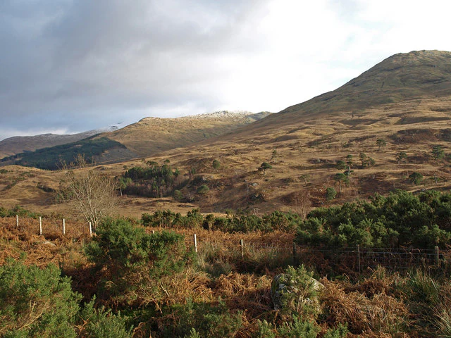
Landscape of Glen Falloch in Loch Lomond and The Trossachs National Park with rolling hills, heather, and scattered Scots Pine trees under a partly cloudy sky.
View of Glen Falloch from the West Highland Way, showing Scots Pine remnants on the hillside.

Loch Lomond and The Trossachs National Park conservation status and protection priorities

The park is classified as an IUCN Category V protected landscape, reflecting its designation as an area where the interaction of people and nature over time has produced significant natural and cultural values. Within the park, 63 sites hold some form of conservation designation, including eight Special Areas of Conservation and two Special Protection Areas under European nature legislation. Two of Scotland's National Scenic Areas, Loch Lomond NSA and the Trossachs NSA, lie wholly within the park.

The park contains two national nature reserves, Loch Lomond National Nature Reserve and The Great Trossachs Forest National Nature Reserve, both managed by partnerships involving the National Park Authority, conservation organisations, and government agencies. The Great Trossachs Forest represents one of the largest native woodland restoration projects in Scotland, creating a forested corridor connecting remnant Caledonian pinewoods. The park's conservation challenges include managing the tension between high visitor numbers and ecological sensitivity, balancing commercial forestry with native woodland restoration, and maintaining the semi-natural character of a landscape shaped by centuries of human activity.

Loch Lomond and The Trossachs National Park cultural meaning and human context

The Trossachs area holds a special place in Scottish cultural history, being one of the first parts of Scotland to become a recognised tourist destination. The region's association with the legendary outlaw Rob Roy MacGregor helped establish its romantic reputation in the 18th and 19th centuries. When James Boswell and Samuel Johnson visited in 1773 on their return from touring the Western Isles, Boswell noted that describing the area would be unnecessary as it was already so firmly established as a destination.

The area has long inspired artists, writers, and poets, with its combination of accessible mountain scenery, tranquil lochs, and mysterious glens embodying the romantic image of the Scottish Highlands. The park contains communities with deep roots in the landscape, including villages like Callander, Aberfoyle, Balmaha, Luss, and Killin. The population within the park, as recorded in the 2011 census, is 15,168. The West Highland Way, Scotland's first officially designated long-distance footpath, passes through the park along the eastern shore of Loch Lomond, connecting the area to the broader Scottish outdoor recreation tradition.
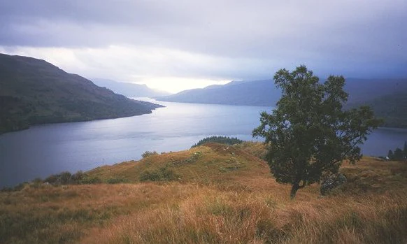
Landscape view of Loch Katrine with rolling hills in the background, a lone tree on a grassy hillside, and overcast sky
Eastward view of Loch Katrine from above Stronachlachar

Top sights and standout views in Loch Lomond and The Trossachs National Park

Loch Lomond stands as the park's centrepiece, Britain's largest lake by surface area, dotted with islands including the largest freshwater island in the British Isles. The Trossachs offer an accessible introduction to Highland scenery, with wooded hills, misty glens, and sparkling lochs. The park contains 21 Munros, including Ben Lomond, the most southerly Munro in Scotland and one of the most frequently climbed mountains in the country, and Ben More, the highest peak in the park. Significant areas of Caledonian pine forest and Atlantic oakwoods represent some of Scotland's most important native woodland habitats. The Arrochar Alps provide dramatic climbing terrain overlooking Loch Lomond. The park's location within easy reach of Glasgow and Edinburgh makes Highland scenery accessible to millions of people.

Best time to visit Loch Lomond and The Trossachs National Park

The park can be visited throughout the year, with each season offering different experiences and atmospheric qualities. Summer months typically bring the warmest weather and longest daylight hours, making them ideal for hillwalking, water sports, and exploring the outdoors, though this is also the busiest period. Autumn can bring dramatic lighting, particularly in the native woodlands as trees display their autumn colours, and the hills may be quieter than in summer. Winter offers the possibility of snow on the higher peaks and a quieter, more atmospheric experience of the landscape, though daylight hours are limited and some facilities may have reduced opening times. Spring brings the return of longer days and the opportunity to see wildlife emerging, with birdlife particularly active as species breed during this season. The park's proximity to the Central Belt means it can be enjoyed as a day trip year-round, though staying overnight allows for deeper exploration of the more remote areas.
Park guides

Targeted readings addressing visitor timing and seasonal regional conditions

Loch Lomond and The Trossachs National Park Published Guides and Focused Answers

Focused park guides provide structured answers to specific visitor questions regarding regional protected areas. Published reference materials explore the best time to visit Loch Lomond and The Trossachs National Park based on daylight hours and seasonal weather.
Monthly climate preview

Long term temperature and precipitation patterns across representative coordinates

Loch Lomond and The Trossachs National Park Climate Normals and Weather by Month

Loch Lomond and The Trossachs National Park registers measured monthly temperatures ranging from low winter means to higher summer maximums alongside consistent daily precipitation records. Examining the complete twelve month climate profile illuminates comprehensive long term meteorological patterns across representative terrain.
Annual mean6 °C
1 °C12 °C
Jan
Feb
Mar
Apr
May
Jun11°
Jul12°
Aug12°
Sep10°
Oct
Nov
Dec
Warmest month
July

12.4 °C

Coolest month
January

1.2 °C

Wettest month
January

5.1 mm/day

Driest month
April

3.2 mm/day

Park location guide

Geography guide, regional context, and park location map for Loch Lomond and The Trossachs National Park

Loch Lomond and The Trossachs National Park park geography, regions, and map view in United Kingdom

Understand where Loch Lomond and The Trossachs National Park sits in United Kingdom through a broader geographic reading of the surrounding landscape, nearby location context, and its mapped position within the national park landscape.

How Loch Lomond and The Trossachs National Park fits into United Kingdom

The United Kingdom is a parliamentary constitutional monarchy located in northwestern Europe, consisting of four constituent countries: England, Scotland, Wales, and Northern Ireland. As a major global power with over 69 million residents, it maintains significant international influence in politics, economics, and culture.

Wider geography shaping Loch Lomond and The Trossachs National Park in United Kingdom

The United Kingdom is an island nation located in northwestern Europe, surrounded by the Atlantic Ocean, North Sea, English Channel, Celtic Sea, and Irish Sea. It shares a land border with the Republic of Ireland to the west. The territory includes the island of Great Britain, the northeastern portion of Ireland, and most of the smaller British Isles islands.

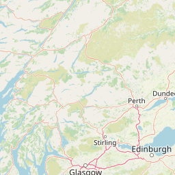
Map view of Loch Lomond and The Trossachs National Park

Use this park location map to pinpoint Loch Lomond and The Trossachs National Park in United Kingdom, understand its exact geographic position, and read its mapped placement within the surrounding landscape more clearly.

Pigeon | © OpenStreetMap contributors

Location context for Loch Lomond and The Trossachs National Park

Argyll and ButePerth and KinrossStirlingWest Dunbartonshire
Natural feature types

Explore Named Natural Features in Loch Lomond and The Trossachs National Park

Continue your geographic study of Loch Lomond and The Trossachs National Park by navigating its complex natural landscape. Use this MoriAtlas index to trace the distribution of mountains, lochs, and forests that form the core of this expansive Scottish protected territory.
Recorded earthquake history

Explore Recorded Earthquake History for Loch Lomond and The Trossachs National Park

Examine the historical archive of seismic activity documented near Loch Lomond and The Trossachs National Park. This MoriAtlas collection presents event data including magnitudes and proximity, helping to build a clearer understanding of the geological context surrounding this protected Scottish landscape.

Loch Lomond and The Trossachs National Park Earthquake History

Catalogued events

4 events

Strongest magnitude

Magnitude 3.9

Most recent event

Apr 16, 2026

This history includes earthquakes recorded inside the park or within 50 km of its borders

Visualizing Highland terrain, ancient woodlands, and iconic loch environments across Scotland

Loch Lomond and The Trossachs National Park Photos and Protected Landscape Scenery

Visual records capture the striking geological contrast of Loch Lomond and The Trossachs National Park across the Highland Boundary Fault. Photographic collections provide detailed reference for evaluating native habitats, mountain summits, and protected valley floors.

Sign reading 'National Park Visitor Centre' with 'Loch Lomond' logo, white building with stone wall, and trees in background

A village with houses and trees surrounded by hills and a body of water, viewed from a high vantage point

Two hikers on a rocky mountain ridge with Ben More mountain featuring snow patches in the background under a clear blue sky

Snow-covered rocky mountain peaks under a pale sky, with snow-covered slopes and exposed rock faces

Landscape of Glen Falloch in Loch Lomond and The Trossachs National Park with rolling hills, heather, and scattered Scots Pine trees under a partly cloudy sky.

Panoramic view of Loch Lomond with mountains in the background under a partly cloudy sky, sunlight reflecting on the water

Landscape view of Loch Katrine with rolling hills in the background, a lone tree on a grassy hillside, and overcast sky

Park atlas

Compare nearby protected areas and surrounding regional highland landscapes

Other Parks Near Loch Lomond And The Trossachs National Park

Visitors exploring Loch Lomond and The Trossachs National Park can continue into nearby national parks and protected landscapes across the surrounding region. Comparing adjacent terrain provides broader geographic context for Scottish highland topography and regional conservation areas.
A soft watercolor painting of a landscape featuring green rolling hills, a suggestion of a reflective body of water, and layers of purple distant mountains against a light sky.
National parkScotland
Mapped location lies within the park boundary#1 closest

South

Loch Lomond and The Trossachs National Park: Geographic and Protected Area Overview

Tracing Highland and Lowland transition zones in Scotland

This protected area captures the contrast between the rugged mountainous terrain of the northern Trossachs and the gentler southern loch basins. By examining the Highland Boundary Fault, users can analyze how glaciers carved the landscape, creating the deep fjord-like trenches and islands that define the region's unique natural geography.

Area
71 km²
Established
2002
Relief
Mountain
Climate
Temperate
A soft, artistic watercolor painting of a Scottish sea loch surrounded by gentle, green hills against a faint mountainous background.
Marine protected areaArgyll and Bute
About 0.4 km away#2 closest

Southwest

Loch Goil Marine Protected Area: Geography and Landscape Overview

Protected marine habitats in the Argyll and Bute region

Loch Goil offers a distinct look at an enclosed, sea loch landscape in western Scotland. Surrounded by the Arrochar Alps and steep conifer slopes, this marine protected area demonstrates the intersection of Highland wilderness and formal conservation zones. Use this atlas resource to understand its topographical form and regional context.

Established
2014
Relief
Mountain
Climate
Temperate
Access
Moderate access
A soft watercolor illustration depicting green rolling hills and a body of water in a minimalist style.
Marine protected areaArgyll and Bute
About 13 km away#3 closest

Southwest

Loch Fyne Marine Protected Area and Highland Coastal Geography

Mapped sea loch landscapes in Argyll and Bute

Loch Fyne represents a unique intersection of maritime tradition and protected natural terrain. This entry maps the loch as it winds through the Cowal Peninsula, highlighting the contrast between northern mountain hinterlands and southern coastal inlets. Users can examine the extent of its protected waters, the surrounding topography, and its historical significance within the geography of western Scotland.

Established
2014
Relief
Mixed relief
Climate
Temperate
Access
Easy access
Marine protected areaArgyll and Bute
31 km away#4 closest

Northwest

Loch Creran Marine Protected Area: Atlas and Coastal Geography of Argyll and Bute

Mapped tidal basins, flame shell reefs, and Atlantic oakwood habitats

Loch Creran is a primary example of integrated marine and coastal conservation on the west coast of Scotland. Characterized by its long, narrow form and dramatic bathymetry, the loch creates a rich environment where rapid tidal currents meet sheltered forest shorelines. This record provides a detailed look at the geographic structure, protected seabed zones, and the transition from sea loch to the ancient woodlands at the head of the inlet.

Area
12 km²
Established
2014
IUCN
IV
Relief
Lowland
Marine protected areaArgyll and Bute
About 35 km away#5 closest

Southwest

Loch Sween Marine Protected Area: Coastal Geography and Regional Atlas Map

A distinctive sea loch ecosystem in Argyll and Bute.

Investigate the coastal topography and protected marine boundaries of Loch Sween. This sea loch is defined by its irregular branching inlets and islands, creating a unique habitat mosaic of maerl beds and burrowed mud within the broader context of the western Scottish coastline.

Area
41 km²
Established
2014
IUCN
IV
Access
Access unknown
A horizontal watercolor painting showing a soft, impressionistic view of green hills, trees, and a lake, set against a light background.
Protected landscapePerth and Kinross
About 35 km away#6 closest

Northeast

Loch Tummel National Scenic Area: Geography and Mapped Protected Landscape Features

Highland landscape corridor in Perth and Kinross

Loch Tummel National Scenic Area encompasses a vital Highland corridor where freshwater lochs, river gorges, and managed woodlands intersect. This overview focuses on the physical geography of the Tummel valley, providing a detailed look at the protected land, elevation changes, and the hydro-electric history that shaped the current terrain of this scenic region.

Area
90.1 km²
Established
1981
Relief
Upland
Climate
Temperate
Watercolor painting depicting mountains, forested hills, and a river in a scenic landscape
National parkScotland
38 km away#7 closest

Northeast

Cairngorms National Park: Explore Scotland's Largest Protected Mountain Landscape

Mapped boundaries and arctic-alpine geography.

As the United Kingdom's largest national park, Cairngorms National Park in Scotland presents a vast expanse of distinctive arctic-alpine terrain and ancient Caledonian forests. This protected landscape offers a unique opportunity to explore mapped geographic features, from its extensive mountain plateaus to its vital river systems. Discover the contours and context of this significant natural area within the broader atlas of Scotland's protected lands.

Area
4,528 km²
Established
2003
IUCN
V
Visitors
1.9M annual
Protected landscapeArgyll and Bute
About 39 km away#8 closest

West

Scarba, Lunga and the Garvellachs National Scenic Area: Protected Island Geography

Coastal landscapes and tidal seascapes of Argyll and Bute

Gain insight into the distinct protected landscape of the Scarba, Lunga and the Garvellachs National Scenic Area. This area balances mountainous moorland with green meadows, while its submerged marine reefs and fierce tidal waters contribute to a complex ecological and geographic identity within the Firth of Lorn.

Area
65 km²
Established
1981
Relief
Upland
Climate
Temperate

Common questions about visiting, size, designation, and location context for Loch Lomond and The Trossachs National Park

Loch Lomond and The Trossachs National Park FAQs for park facts, access, geography, and protected area context

Find quick answers about Loch Lomond and The Trossachs National Park, including protected-area facts, park geography, trail and visitor context, and how the park fits into its surrounding country and regional landscape.
MoriAtlas Explorer

Continue Your Protected Areas Search Across the Global Atlas

Deepen your exploration by continuing the structured search for national parks and protected areas worldwide. Utilize the comprehensive filtering capabilities to compare different conservation landscapes and refine your understanding of global park geography. Discover more about the distribution and characteristics of protected natural areas.

Global natural geography