
Viewpoints
Park geography
Analyzing regional boundaries, mapped terrain features, and landscape composition
Geographic Profile of Loch Lomond and The Trossachs National Park in Scotland
This geographic profile details the physical scope of Loch Lomond and The Trossachs National Park, covering an area of 1865 square kilometers across Scotland. Explore the diverse mountain relief and associated peaks, such as Ben Lomond and Ben More, alongside the park's characteristic lake, forest, and coastal landscape features.
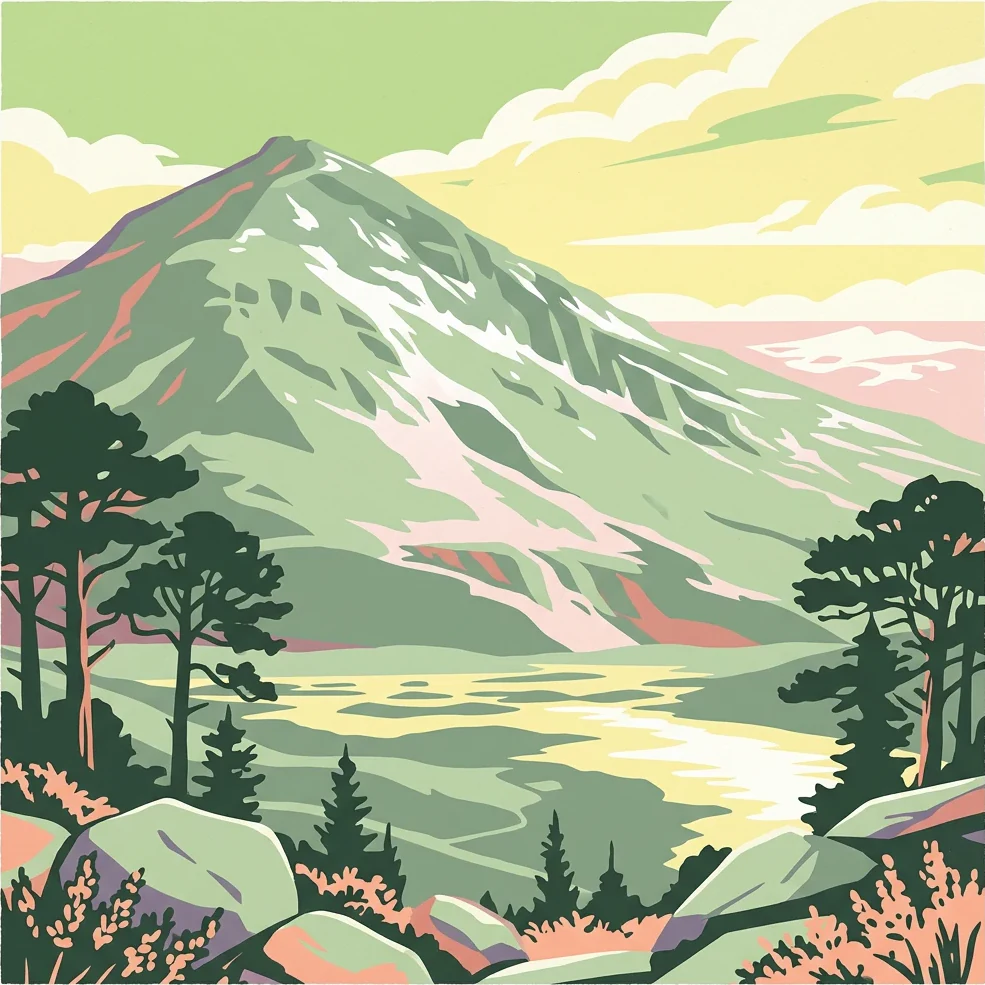
Scotland's first national park, protecting lochs, mountains, and ancient forests
Loch Lomond and The Trossachs National Park
Loch Lomond and The Trossachs National Park is Scotland's first national park, established in 2002 by the Scottish Parliament. Covering 1,865 square kilometres, it occupies much of the western part of the southern Highlands, lying north of Glasgow and stretching from the shores of Loch Lomond northward into the Breadalbane mountains. The park straddles the Highland Boundary Fault, a major geological division that creates a sharp contrast between the lowland landscapes to the south with their green fields and cultivated land and the wild highland terrain to the north with its dramatic mountains and glens. The park protects a remarkable diversity of landscapes, including the largest lake in Great Britain by surface area, 21 Munros (mountains exceeding 3,000 feet), ancient Caledonian pine forests, and over 50 rivers and large burns. The park is centred on Loch Lomond, a landmark so iconic that a 2005 poll of Radio Times readers voted it the sixth greatest natural wonder in Britain. The surrounding Trossachs region, once a small woodland glen, now refers to a broader area of wooded hills, glens, and lochs that has welcomed visitors for centuries. The combination of accessibility from major population centres like Glasgow and Stirling, and the quality of scenery representing a microcosm of typical Highland landscape, has made this area one of Scotland's most visited protected landscapes, with nearly three million visits recorded in 2017. The park's ecological significance is substantial, with over 200 bird species and more than a quarter of all plant species found in Britain recorded within its boundaries. It contains significant areas of native woodland, including remnants of the once-extensive Caledonian forest, Atlantic oakwoods, and upland habitats such as heathland and blanket bog. The park also includes 63 kilometres of coastline around sea lochs, supporting marine wildlife and coastal bird populations.
- Location
- United Kingdom
- Park type
- National park
- Established
- 2002
- Area
- 1,865 km²
- Highest point
- 1,174 m
Location overview
Recorded country memberships, regional administrative spread, and coastal park status
Geographic Overview of Loch Lomond and The Trossachs National Park in Scotland
Loch Lomond and The Trossachs National Park spans the United Kingdom and Scotland across West Dunbartonshire, Stirling, Argyll and Bute, and Perth and Kinross. Recorded geographic memberships outline the protected area through administrative boundaries and coastal classification.
- Countries
- Scotland, United Kingdom
- Regions
- Argyll and Bute, Perth and Kinross, Stirling, West Dunbartonshire
- Primary location
- Scotland
- Geographic setting
- Coastal
Boundary and coordinates
Interactive boundary geometry and derived spatial measurements
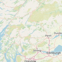
Loch Lomond and The Trossachs National Park Boundary Map and Spatial Extent
The mapped outline provides clear spatial context for the protected territory and its surrounding geography. Recorded boundary measurements detail the calculated area and perimeter spans without establishing legal survey precision.
- Boundary area
- 1,863 km²
- Boundary perimeter
- 350 km
- Northernmost point
- 56.478° N
- Southernmost point
- 55.9827° N
- Easternmost point
- 4.0817° W
- Westernmost point
- 5.1016° W
- Geographic centre
- 56.2359° N, 4.5918° W
- North–south span
- 55.1 km
- East–west span
- 63.3 km
Elevation and terrain
Mountain relief statistics and recorded natural feature records
Loch Lomond and The Trossachs National Park Terrain and Elevation Summary
Recorded park statistics establish a maximum elevation of 1174 meters across mountainous terrain. Individual cards detail named natural features, types, and spatial relationships within the protected area.
- Maximum elevation
- 1,174 m
- Highest point
- 1,174 m
Selected named natural features
Streams
Kendrum Burn
Peaks
Troisgeach
734 m
Streams
Burn of Ample
Streams
Alltana Chaoruinn
Streams
Burn of Balloch
Environmental setting
Temperate climate zones, mountain relief, and major water presence across diverse habitats
Loch Lomond and The Trossachs National Park Environmental Setting and Geography
Recorded landscape features, temperate forest types, and seasonal profiles serve as interpretive categories for the physical setting. Associated data classifications connect recorded terrain types to relevant atlas destinations.
- Relief
- Mountain
- Climate
- Temperate
- Water
- Major water bodies
- Forest cover
- Partial forest
- Seasonality
- Year-round
Landscape features
Mountains · Woodland · Lakes · Rivers · Coast · Cliffs
Habitat types
Temperate broadleaf forest · Temperate coniferous forest · Boreal forest · Heath · Wetland · Riverine habitat · Coastal habitat
Park atlas
Compare nearby protected areas and surrounding regional highland landscapes
Other Parks Near Loch Lomond And The Trossachs National Park
Visitors exploring Loch Lomond and The Trossachs National Park can continue into nearby national parks and protected landscapes across the surrounding region. Comparing adjacent terrain provides broader geographic context for Scottish highland topography and regional conservation areas.
National parkScotland
Mapped location lies within the park boundary#1 closest
South

Loch Lomond and The Trossachs National Park: Geographic and Protected Area Overview
Tracing Highland and Lowland transition zones in Scotland
This protected area captures the contrast between the rugged mountainous terrain of the northern Trossachs and the gentler southern loch basins. By examining the Highland Boundary Fault, users can analyze how glaciers carved the landscape, creating the deep fjord-like trenches and islands that define the region's unique natural geography.
- Area
- 71 km²
- Established
- 2002
- Relief
- Mountain
- Climate
- Temperate
Marine protected areaArgyll and Bute
About 0.4 km away#2 closest
Southwest
Loch Goil Marine Protected Area: Geography and Landscape Overview
Protected marine habitats in the Argyll and Bute region
Loch Goil offers a distinct look at an enclosed, sea loch landscape in western Scotland. Surrounded by the Arrochar Alps and steep conifer slopes, this marine protected area demonstrates the intersection of Highland wilderness and formal conservation zones. Use this atlas resource to understand its topographical form and regional context.
- Established
- 2014
- Relief
- Mountain
- Climate
- Temperate
- Access
- Moderate access
Marine protected areaArgyll and Bute
About 13 km away#3 closest
Southwest
Loch Fyne Marine Protected Area and Highland Coastal Geography
Mapped sea loch landscapes in Argyll and Bute
Loch Fyne represents a unique intersection of maritime tradition and protected natural terrain. This entry maps the loch as it winds through the Cowal Peninsula, highlighting the contrast between northern mountain hinterlands and southern coastal inlets. Users can examine the extent of its protected waters, the surrounding topography, and its historical significance within the geography of western Scotland.
- Established
- 2014
- Relief
- Mixed relief
- Climate
- Temperate
- Access
- Easy access
Marine protected areaArgyll and Bute
31 km away#4 closest
Northwest
Loch Creran Marine Protected Area: Atlas and Coastal Geography of Argyll and Bute
Mapped tidal basins, flame shell reefs, and Atlantic oakwood habitats
Loch Creran is a primary example of integrated marine and coastal conservation on the west coast of Scotland. Characterized by its long, narrow form and dramatic bathymetry, the loch creates a rich environment where rapid tidal currents meet sheltered forest shorelines. This record provides a detailed look at the geographic structure, protected seabed zones, and the transition from sea loch to the ancient woodlands at the head of the inlet.
- Area
- 12 km²
- Established
- 2014
- IUCN
- IV
- Relief
- Lowland
Marine protected areaArgyll and Bute
About 35 km away#5 closest
Southwest
Loch Sween Marine Protected Area: Coastal Geography and Regional Atlas Map
A distinctive sea loch ecosystem in Argyll and Bute.
Investigate the coastal topography and protected marine boundaries of Loch Sween. This sea loch is defined by its irregular branching inlets and islands, creating a unique habitat mosaic of maerl beds and burrowed mud within the broader context of the western Scottish coastline.
- Area
- 41 km²
- Established
- 2014
- IUCN
- IV
- Access
- Access unknown
Protected landscapePerth and Kinross
About 35 km away#6 closest
Northeast
Loch Tummel National Scenic Area: Geography and Mapped Protected Landscape Features
Highland landscape corridor in Perth and Kinross
Loch Tummel National Scenic Area encompasses a vital Highland corridor where freshwater lochs, river gorges, and managed woodlands intersect. This overview focuses on the physical geography of the Tummel valley, providing a detailed look at the protected land, elevation changes, and the hydro-electric history that shaped the current terrain of this scenic region.
- Area
- 90.1 km²
- Established
- 1981
- Relief
- Upland
- Climate
- Temperate
National parkScotland
38 km away#7 closest
Northeast
Cairngorms National Park: Explore Scotland's Largest Protected Mountain Landscape
Mapped boundaries and arctic-alpine geography.
As the United Kingdom's largest national park, Cairngorms National Park in Scotland presents a vast expanse of distinctive arctic-alpine terrain and ancient Caledonian forests. This protected landscape offers a unique opportunity to explore mapped geographic features, from its extensive mountain plateaus to its vital river systems. Discover the contours and context of this significant natural area within the broader atlas of Scotland's protected lands.
- Area
- 4,528 km²
- Established
- 2003
- IUCN
- V
- Visitors
- 1.9M annual
Protected landscapeArgyll and Bute
About 39 km away#8 closest
West
Scarba, Lunga and the Garvellachs National Scenic Area: Protected Island Geography
Coastal landscapes and tidal seascapes of Argyll and Bute
Gain insight into the distinct protected landscape of the Scarba, Lunga and the Garvellachs National Scenic Area. This area balances mountainous moorland with green meadows, while its submerged marine reefs and fierce tidal waters contribute to a complex ecological and geographic identity within the Firth of Lorn.
- Area
- 65 km²
- Established
- 1981
- Relief
- Upland
- Climate
- Temperate
MoriAtlas Explorer
Explore the Geographic Boundaries of Loch Lomond and The Trossachs National Park
Continue mapping the diverse terrain of Scotland's premier protected area. MoriAtlas provides a clear look at the mountains, glens, and loch systems that define this significant Highland landscape.
Browse next
Global natural geography
Explore related park routes
Explore MoriAtlas Global ParksBrowse All MoriAtlas ParksGlobal Park Map DiscoveryMoriAtlas: Browse All CountriesBrowse All MoriAtlas ContinentsNational Park Environment AtlasGrand Canyon National Park AtlasYellowstone National Park AtlasYosemite National Park Atlas and GeographySerengeti National Park AtlasGalápagos National Park Protected LandscapeBanff National Park Geography and AtlasKruger National Park Atlas EntryUluṟu-Kata Tjuṯa National Park AtlasExplore Uluru-Kata Tjuta National Park GeographyPlitvice Lakes National Park AtlasFiordland National Park Protected LandscapeGreat Smoky Mountains National Park AtlasAfghanistan National Parks and Protected AreasAlbania National Parks and Protected AreasAlgeria National Parks and Protected AreasAmerican Samoa National Parks and Protected AreasAndorra National Parks and Protected AreasAngola National Parks and Protected AreasAntarctica National Parks and Protected AreasAntigua and Barbuda Park List