
Why Lord Howe Island Marine Park stands out
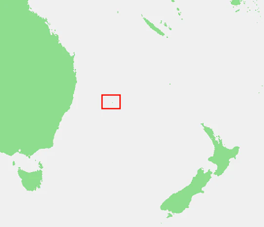
Lord Howe Island Marine Park is best known for hosting the world's southernmost true coral reef ecosystem. The park's reefs and lagoon sit at the extreme latitude limit of coral reef formation, where tropical reef-building species coexist with temperate marine life. This unusual overlap produces exceptionally high endemism among reef fishes, echinoderms, and benthic algae, making the waters around Lord Howe Island a globally significant reference point for understanding the margins of coral reef distribution. Equally distinctive is the park's combination of a large western barrier reef and lagoon, fringing reefs along the eastern shore, and a geologically ancient island setting built from calcarenite and uplifted reef sediments. The result is a compact marine reserve where unusual geological history, isolated geography, and mixed tropical-temperate oceanography combine into a reef system unlike any other in Australian waters.
Lord Howe Island Marine Park history and protected-area timeline
Lord Howe Island Marine Park was declared on 26 February 1999 under the NSW Marine Parks Act 1997, after the waters around Lord Howe Island were recognised as holding outstanding natural, cultural, and socio-economic values. Although the park was proclaimed at this time, a formal zoning scheme was not put in place until 2004, following an extended process of public consultation and stakeholder negotiation that included an Issues Paper released in August 2001, a draft zoning plan in June 2002, and a finalised plan released for public comment in December 2003.
In parallel with the state-level process, the Commonwealth Government designated a federal marine park covering waters between three and twelve nautical miles offshore on 21 June 2000, reflecting national recognition of Lord Howe Island's marine importance. The state and Commonwealth marine parks together reinforce the broader protection already afforded to the island group through its 1982 inscription on the UNESCO World Heritage List.
Since zoning came into effect in 2004, the marine park has served as the primary management framework for the coastal waters of Lord Howe Island. Habitat Protection Zones cover the majority of the park area and allow most forms of recreational and charter fishing while excluding spearfishing, while seven Sanctuary Zones restrict extractive activities to protect biodiversity. Limited species-specific regulations also apply, and visitor numbers on the island are managed to reduce pressure on the marine environment.
Lord Howe Island Marine Park landscape and geographic character
Lord Howe Island Marine Park surrounds an island group shaped by ancient volcanic activity, long-term reef building, and exposure to open ocean weather systems. The dominant geological signature is calcarenite, a white sedimentary rock formed from cemented coral fragments, calcareous algae, and sand that accumulated during the Pleistocene, when sea levels were higher than today. Calcarenite underlies much of the central and northern parts of the island and continues below sea level, contributing to both the island's low-lying northern areas and the substrates of nearshore reef habitats.
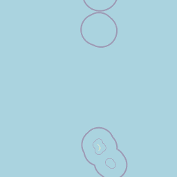
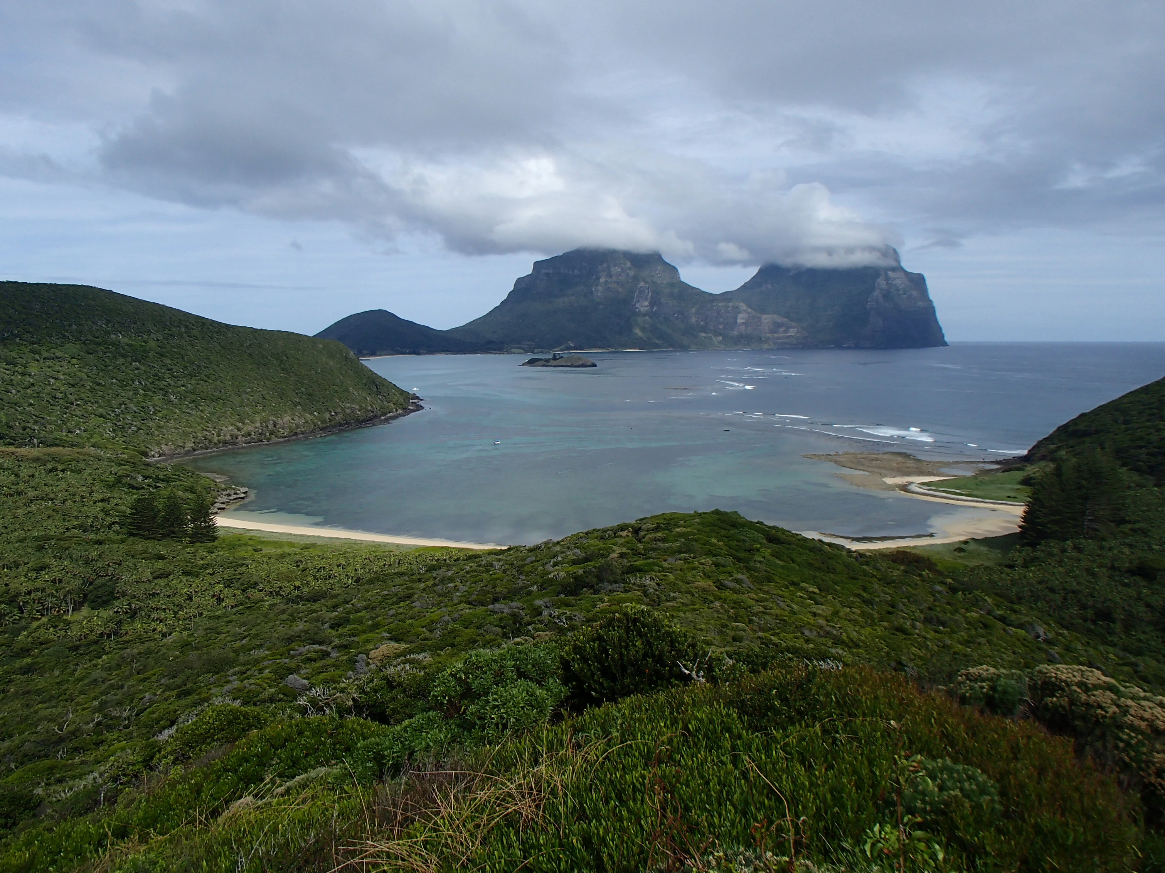
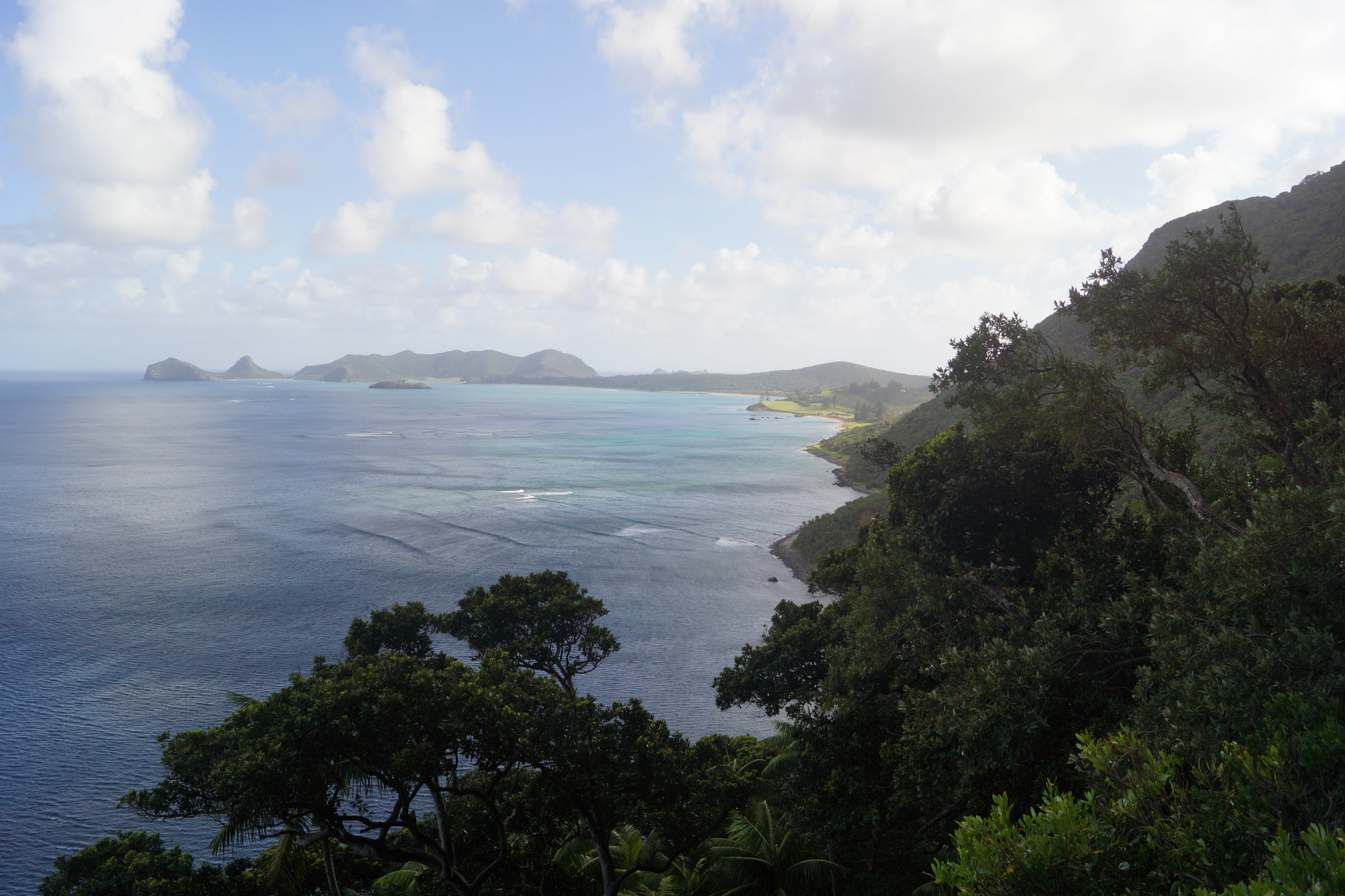
The underwater landscape is equally varied. A long barrier reef on the western, leeward side of the island shelters a broad sandy-bottomed lagoon around six kilometres long and 1.5 kilometres wide. The lagoon contains lagoonal corals, gravel sheets, algal flats, and patch reefs, creating a mosaic of hard and soft substrates. Fringing reefs lie close offshore along the more exposed eastern coast, where wave energy is higher. Offshore rocky reef and open ocean environments extend beyond the fringing reef, particularly around Balls Pyramid, where the underwater topography drops steeply.
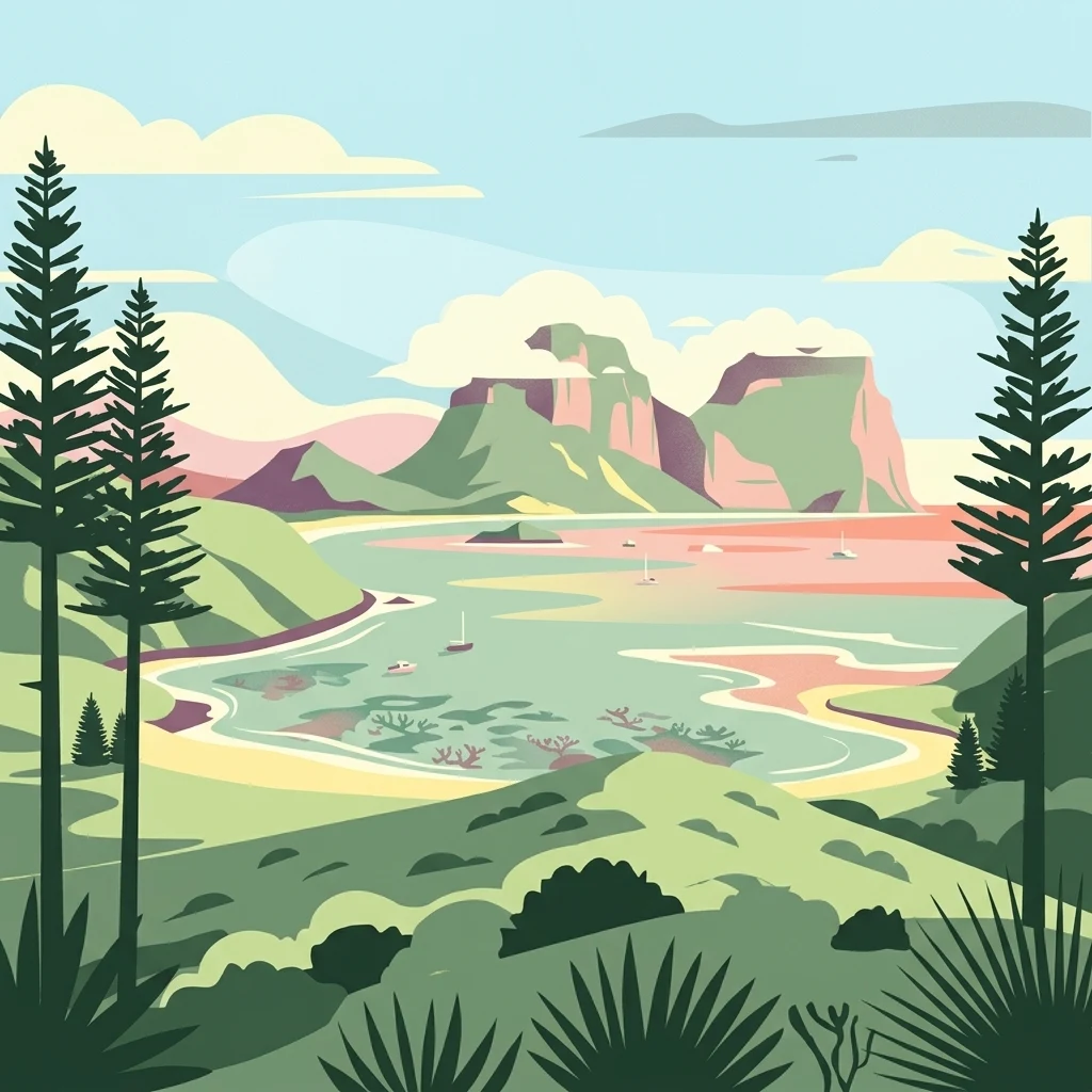
Above water, the surrounding island setting is striking in its concentration of physical contrast. Twin forested mountains, Mount Gower and Mount Lidgbird, rise behind the settled area of the island in the south, while low-lying calcarenite flats and beaches dominate the central and northern sections. The 37 kilometres of shoreline include only a small portion, roughly eight kilometres, that is readily accessible, with most of the coastline remaining relatively undisturbed. This combination of sheltered lagoon, reef flats, fringing reef, and dramatic volcanic peaks gives the marine park a distinct and easily visualised physical identity.
Lord Howe Island Marine Park ecosystems, habitats, and plant life
Lord Howe Island Marine Park protects an unusually diverse marine environment at the boundary between tropical and temperate reef ecosystems. The mixing of warm-water and cool-water species is driven largely by the southerly flow of the East Australian Current, which delivers tropical influences to a latitudinal position well south of most reef systems. The result is a marine park where corals, tropical reef fishes, and warm-water algae live alongside temperate kelp-associated species and other cooler-water organisms.
Three broad marine habitat community types have been identified within the park: coral reefs, macroalgal beds, and offshore or open coast communities. Their distribution is strongly shaped by wave exposure, with the more sheltered western side dominated by lagoon and algal habitats and the more exposed eastern and northern coasts featuring dense fringing reef and turf algal communities. Seagrass meadows also occur in the park, formed by eelgrass and paddleweed, which add soft-sediment habitat structure to inshore areas.
Vegetation diversity is exceptionally high for such a small marine area. The Lord Howe Island Group supports more than 305 species of benthic algae, including a substantial proportion that are endemic to the region. Combined with extensive coral cover, varied reef morphology, and offshore rocky habitats, the marine park represents one of the most complete and compact reef systems in Australian waters, occupying a transitional zone that is globally rare.
Lord Howe Island Marine Park wildlife and species highlights
The marine park's wildlife reflects the same tropical-temperate overlap that defines its broader ecology. Inshore fish diversity is particularly high, with more than 400 species recorded around the island group. Roughly ten percent of these inshore fish species are endemic, meaning they are found nowhere else, while around eight percent of the 110 echinoderm species recorded in the region are also endemic. This combination of high species richness and high endemism places the marine park among the most distinctive marine faunal areas in the southwestern Pacific.
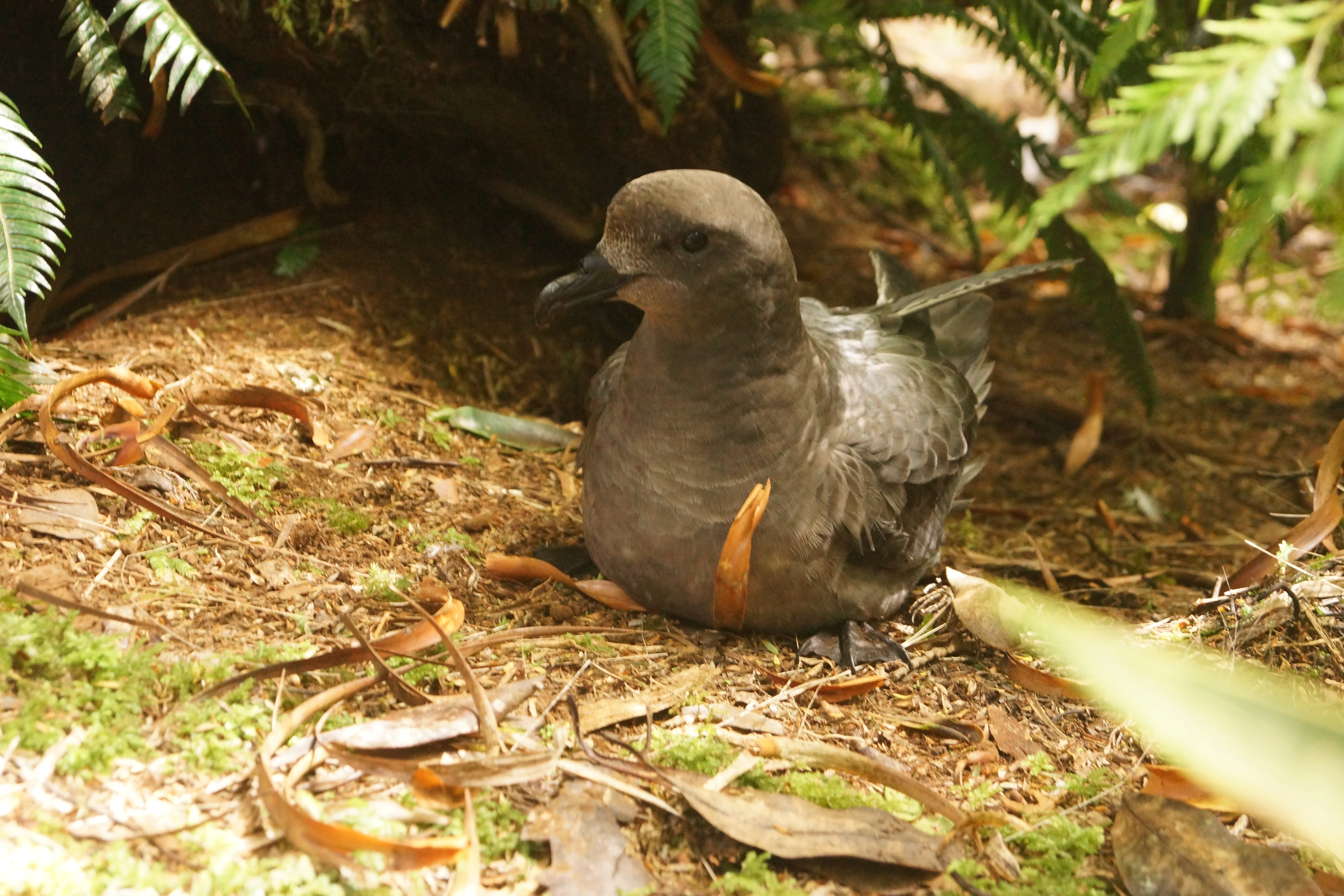
Marine invertebrates are similarly diverse, ranging from reef-building corals to sea urchins and a wide range of benthic invertebrates. White seabirds, including species such as the Providence Petrel, which is listed as Vulnerable under the NSW Threatened Species Conservation Act, roost and nest on the island and feed in the surrounding waters on schools of fish and squid. The seabird fauna connects the marine park's productivity to terrestrial breeding sites on Lord Howe Island and Balls Pyramid.
Two notable fish species have drawn particular attention in management studies. The endemic double-header wrasse has shown increased abundance in sanctuary zones, reflecting the recovery benefits of fishing exclusion. However, sea urchin populations, including habitat-modifying urchins, have grown substantially in some areas since zoning began, illustrating the complex ecological adjustments still underway in the marine park's food webs.
Lord Howe Island Marine Park conservation status and protection priorities
Lord Howe Island Marine Park was established specifically because its waters were recognised as holding outstanding natural, cultural, social, and economic values. Its conservation significance is anchored in the park's position at the extreme southern limit of coral reef formation and in the unusually high levels of endemism among its reef fishes, echinoderms, and benthic algae. The marine park complements the broader conservation status of the Lord Howe Island Group, which has been on the UNESCO World Heritage List since 1982, and reinforces a layered system of protection that includes the island's terrestrial reserves and the Commonwealth marine park in adjacent offshore waters.
The zoning plan is the main active conservation tool for the marine park. Habitat Protection Zones cover most of the area and allow sustainable recreational and charter fishing while excluding spearfishing. Seven Sanctuary Zones cover roughly a quarter of the park and prohibit fishing, anchoring, and other harmful activities, creating refuges in which fish populations, biomass, and coral cover have been observed to be higher than in surrounding waters. A small Special Purpose Zone is used for limited fish feeding under controlled conditions.
Management addresses several recognised threats. Climate change poses a particular risk to seabird breeding through shifts in sea surface temperature, while pollution, marine debris, localised overfishing, anchor damage, groundwater-driven water quality changes in the lagoon, and coral bleaching all influence the park's ecological condition. Monitoring following zoning has shown clear conservation gains in sanctuary zones, but also highlighted challenges such as increasing sea urchin densities and declines in some fish populations in habitat protection zones, underscoring the need for ongoing adaptive management.
Lord Howe Island Marine Park cultural meaning and human context
Lord Howe Island Marine Park is closely tied to the identity and economy of its small island community. Because Lord Howe Island is remote and has limited access, the surrounding waters have long shaped daily life on the island, supporting recreational fishing, charter operations, diving, and tourism. The marine park's zoning plan was deliberately designed to balance protection of natural values with continued sustainable use, and visitor numbers on the island are managed in part to reduce pressure on the marine environment.
The park also sits within a broader cultural setting shaped by the island's relatively recent human history. Lord Howe Island was only discovered by humans in 1778, leaving its original flora and fauna largely intact compared with many other inhabited islands. The waters around the island are valued for their maritime heritage and for their role in sustaining a community that remains tightly connected to the sea, giving the marine park both ecological and cultural significance.
Top sights and standout views in Lord Howe Island Marine Park
The marine park contains the southernmost true coral reef ecosystem on Earth, a globally distinctive feature at the latitudinal limit of reef formation. The combination of a western barrier reef and lagoon, fringing reefs on the eastern coast, and offshore habitats around Balls Pyramid creates unusually varied reef environments within a small marine area. High endemism among fishes, algae, and echinoderms reinforces the park's international conservation value, while the layered protection of state zoning, Commonwealth marine park, and World Heritage status provides a strong framework for long-term management.
Best time to visit Lord Howe Island Marine Park
Lord Howe Island has a temperate oceanic climate, moderated by mild sea temperatures and prevailing winds from the southeast and northeast. Water temperatures are warmest in summer, around 25 degrees Celsius, and cooler in winter, around 18 degrees Celsius, while annual rainfall is substantial, especially in the lowlands. These conditions support year-round reef and lagoon activity, but visitors often prefer late spring through early autumn for the combination of warmer water, calmer weather, and clearer diving and snorkeling conditions. Wind speeds tend to be highest in late winter and spring, which can affect boat access and visibility in exposed areas.