
Mori Atlas logo
Marine protected areaSolitary Islands Marine Park

Tracing the biogeographic transition of reef and estuary systems in New South Wales

Solitary Islands Marine Park: An Atlas of Australia Coastal Marine Protected Landscapes

Solitary Islands Marine Park encompasses 72,000 hectares of diverse marine terrain stretching along the northern coast of New South Wales. This protected landscape defines a critical transition zone where tropical and temperate biological currents meet, fostering extensive coral communities and essential reef habitats. The area spans from the high water mark to three nautical miles offshore, incorporating coastal islands, estuaries, and deep reef systems into a coherent geographic record for systematic study and exploration.

marine parksubtropical-temperate transitionisland chaincoral reefmangrovesseagrass beds
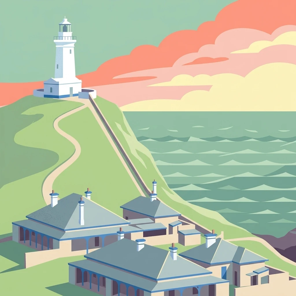
A minimalist, flat-style digital illustration depicting a white lighthouse on a grassy cliff above a group of coastal buildings, with a stylized ocean and pastel-colored sunset sky in the background.

Solitary Islands Marine Park

Marine protected area

Park overview

Structured park overview, official facts, and landscape profile for Solitary Islands Marine Park

Solitary Islands Marine Park park facts, protected area profile, and essential visitor context

Review the core facts for Solitary Islands Marine Park, including designation, size, terrain, visitor scale, habitats, and operating context in one park-focused overview.

About Solitary Islands Marine Park

Solitary Islands Marine Park is a coastal and marine protected area on the north coast of New South Wales, Australia, recognised for the unusual way it blends tropical and temperate marine ecosystems along a relatively short stretch of shoreline. Running from Muttonbird Island at Coffs Harbour in the south to Plover Island near Red Rock in the north, it covers estuaries, coastal lakes, beach and rocky headland habitats, mangrove stands, seagrass beds, intertidal and subtidal reef systems, and the open waters of the inner continental shelf.

Five principal islands define the park's geography: North Solitary, North West Solitary, South West (Groper) Solitary, South Solitary, and Split Solitary Island, alongside significant features such as Muttonbird Island and Pimpernel Rock. The park borders and links with several terrestrial protected areas, including Yuragir National Park to the north, Moonee Beach Nature Reserve, Garby Nature Reserve at Arrawarra, Coffs Coast Regional Park, and a network of nature reserves on the individual islands, creating an intertwined marine and coastal conservation landscape.

Ecologically, the park is shaped by the warm East Australian Current, which transports tropical larvae southward and creates a transition zone between tropical and temperate biogeographic regions. This produces patterns in which both tropical species such as mangrove jack, brown sweetlip, and spangled emperor, and temperate species such as snapper, bream, and red morwong, share the same waters. The result is significant species richness, a high degree of endemism in adjoining coastal areas, and a strong scientific interest in understanding how climate-driven shifts in current strength may alter species ranges.

Because of its biodiversity and ecological gradients, the park has long attracted attention not just for conservation but also for research, sustainable fishing, and public engagement with marine environments, supported by a zoned management system that balances strict protection with compatible recreational and commercial uses.

Quick facts and research context for Solitary Islands Marine Park

Solitary Islands Marine Park lies within New South Wales state waters along the state's mid-north coast, adjoining and complementing the Solitary Islands Marine Reserve in Commonwealth waters. It was initially declared as a marine reserve in 1991, then re-established as a marine park under the Marine Parks Act 1997 (NSW) in January 1998, making it one of the earliest such designations in NSW.

The park runs roughly 75 kilometres of coastline with a marine footprint on the order of 72,000 hectares, extending three nautical miles offshore from the mean high water mark. Five main islands anchor the marine park (North Solitary, North West Solitary, South West Solitary, South Solitary, and Split Solitary), along with Muttonbird Island and other submerged reefs. Its defining ecological fact is its position at the overlap of tropical and temperate marine provinces, partly driven by the influence of the East Australian Current.

Protection and recognition

Examine the documented marine protection scope and designation metrics

Solitary Islands Marine Park Protection Status and Conservation Data

Solitary Islands Marine Park protection status details the documented marine designation framework and management scope. Review the verified conservation metrics and institutional records associated with this marine environment.

Protection details

Protection scope
Marine
Transboundary protection
No
Park context

Deeper park guide and search-rich context for Solitary Islands Marine Park

Solitary Islands Marine Park history, landscape, wildlife, and travel context

Explore Solitary Islands Marine Park through its history, landscape character, ecosystems, wildlife, conservation priorities, cultural context, and seasonal travel timing in a structured park guide built for atlas discovery and search intent.

Why Solitary Islands Marine Park stands out

Solitary Islands Marine Park is best known for being a meeting point of tropical and temperate marine life along the eastern Australian coast, where oceanic conditions produce unusual overlaps of species that otherwise do not share ranges. The park contains the southernmost extensive coral communities in coastal eastern Australia, with around 90 coral species recorded, roughly a quarter of the diversity seen on the Great Barrier Reef. The area is also recognised for its rich reef fish fauna, its globally and nationally threatened shark species such as the grey nurse shark, and its diversity of seabirds and shorebirds, including highly threatened species like the Beach Stone-curlew and Gould's Petrel. The transition between warm-current tropical influences and cooler temperate waters creates distinctive cross-shelf biological gradients that are central to the park's identity.
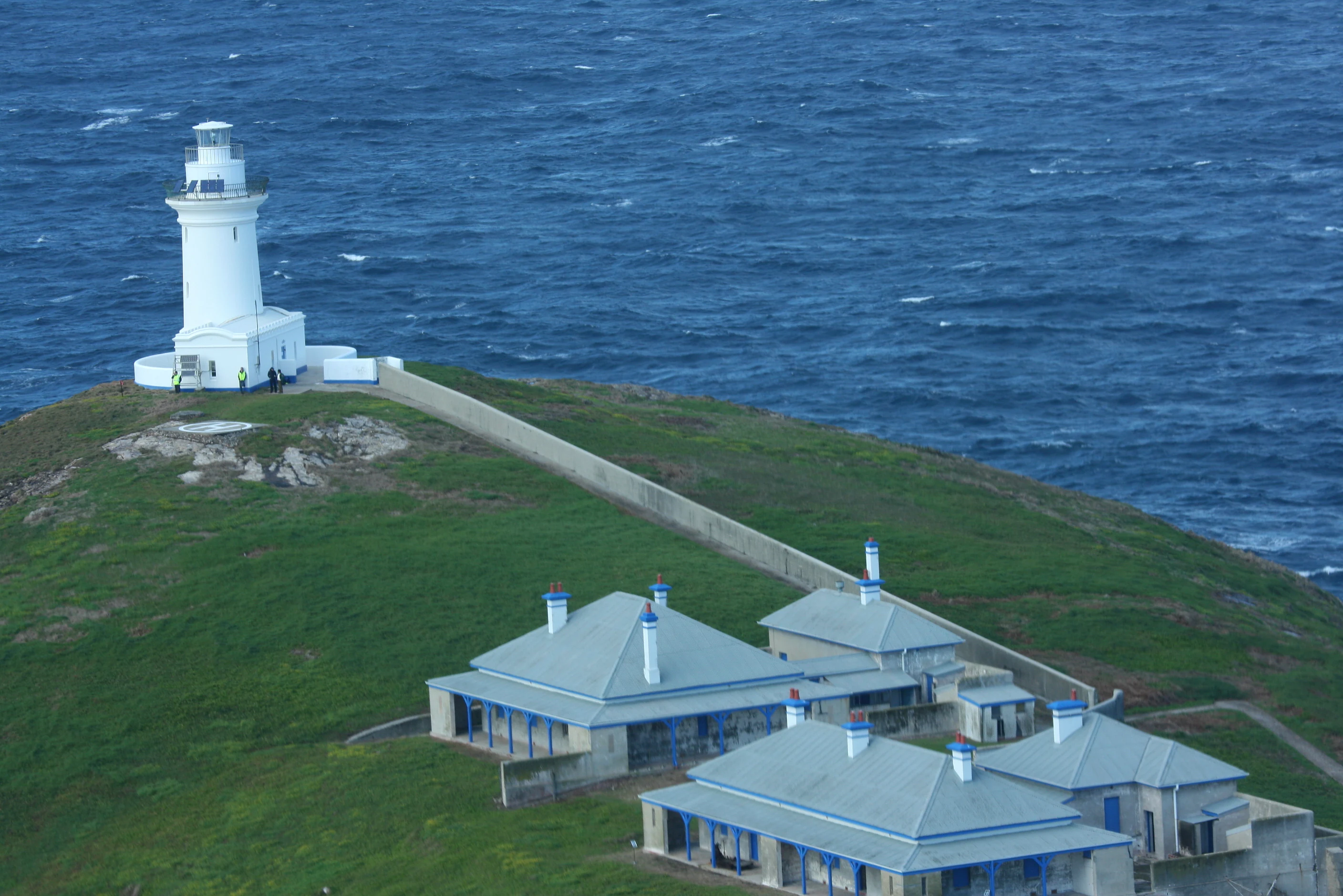
An aerial view of the white South Solitary Island lighthouse and several adjacent grey-roofed keeper cottages on a grassy island slope, with the deep blue ocean in the background.
The South Solitary Island lighthouse and historic keepers cottages, situated on a grassy headland surrounded by the ocean.

Solitary Islands Marine Park history and protected-area timeline

The islands of the Solitary group were first formally recorded for Europeans on 15 May 1770, when Lieutenant James Cook sailed past and noted their position in his journal, charting them as the 'Solitary Isles'.

In 1991 the area was declared a marine reserve, and in January 1998 it was re-established under the Marine Parks Act 1997 of New South Wales as the Solitary Islands Marine Park, becoming one of the earliest marine parks declared in the state. The marine park was set up to formalise protection of habitats and wildlife across state waters out to three nautical miles from the coast, complementing the adjoining Commonwealth Solitary Islands Marine Reserve that covers deeper waters offshore.

The island-based parts of the broader Solitary Islands area also carry a longer human history. While none of the islands were inhabited, burned, or grazed by animals before European contact, the construction of the South Solitary Island lighthouse in the 1870s introduced rabbits, goats, and dogs that significantly altered the island's vegetation and soils. Subsequent conservation management, including the removal of these introduced animals, has been central to restoring fragile island ecologies, and several islands now have formal nature reserve status alongside the marine park designation. The South Solitary Island lighthouse and keepers' cottages remain a recognised historic site within the broader protected-area framework.

Solitary Islands Marine Park landscape and geographic character

The landscape of Solitary Islands Marine Park is shaped by the meeting of long, sandy beaches, rocky headlands, sheltered estuaries, and a chain of small offshore islands that step north along the New South Wales mid-north coast. The coastline stretches about 75 kilometres from Coffs Harbour to the Sandon River, with the marine park boundary running from the mean high water mark out to three nautical miles offshore.

Five main islands dominate the seascape. North Solitary, North West Solitary, South West (Groper) Solitary, South Solitary, and Split Solitary Island rise off the coast together with smaller outcrops and islets such as Birdie and Korfs Islet, as well as Muttonbird Island at Coffs Harbour's edge. The islands themselves are small, with shallow soils and exposure to salt-laden winds, supporting low grassy and rocky heaths rather than closed forest.

Onshore, the park interfaces with mangrove-fringed estuaries, coastal lakes and lagoons, frontal and high dune systems, and beach and headland communities. Submerged features are equally important: subtidal reefs, intertidal platforms, sandy sediments, seagrass beds, and deeper rocky reefs at and below roughly 25 metres all contribute to a varied underwater topography that directly shapes the marine park's biology. The South Solitary Island lighthouse, perched on the most prominent of the islands, gives the isolated chain a strong navigational and cultural landmark within an otherwise rugged, open-coast setting.
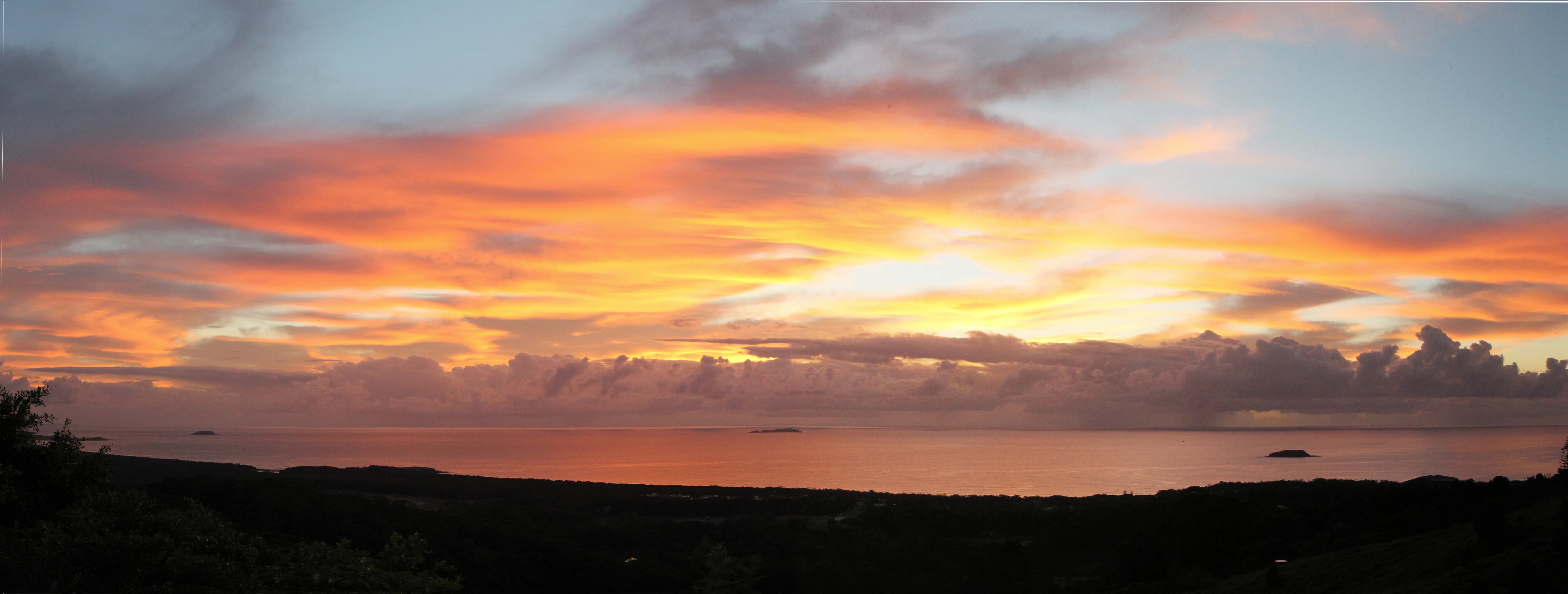
Panoramic view of a vibrant sunrise over the ocean with dark silhouettes of coastal terrain in the foreground.
Sunrise over the horizon of Solitary Islands Marine Park.

Solitary Islands Marine Park ecosystems, habitats, and plant life

The park's ecological character arises from the unusually wide range of habitats it bundles together within a comparatively narrow coastal strip. Intertidal and subtidal reefs alternate with soft-sediment seafloor, fringing seagrass meadows, mangrove stands, saltmarsh, and open oceanic water, meaning that very different biological communities sit within the same protected boundary.

A particularly distinctive feature is the location of the southernmost extensive coral communities in coastal eastern Australia, an outcome of the East Australian Current transporting tropical coral larvae far south of where they would normally settle. With around 90 coral species recorded, the area provides habitat for reef-building corals that coexist with largely temperate reef fish and macroalgae.

Onshore, mangrove communities dominated by grey mangrove and river mangrove establish in sheltered estuarine transitions, while sand-dune and headland vegetation communities are dominated by low, hardy species such as pigface, saltbush, couch grasses, and pigweed. Endemic and threatened plant species, including the Carpet Star (Zieria prostrata), are found on headlands near Coffs Harbour, underlining the connection between the marine park and the broader terrestrial flora of the region.
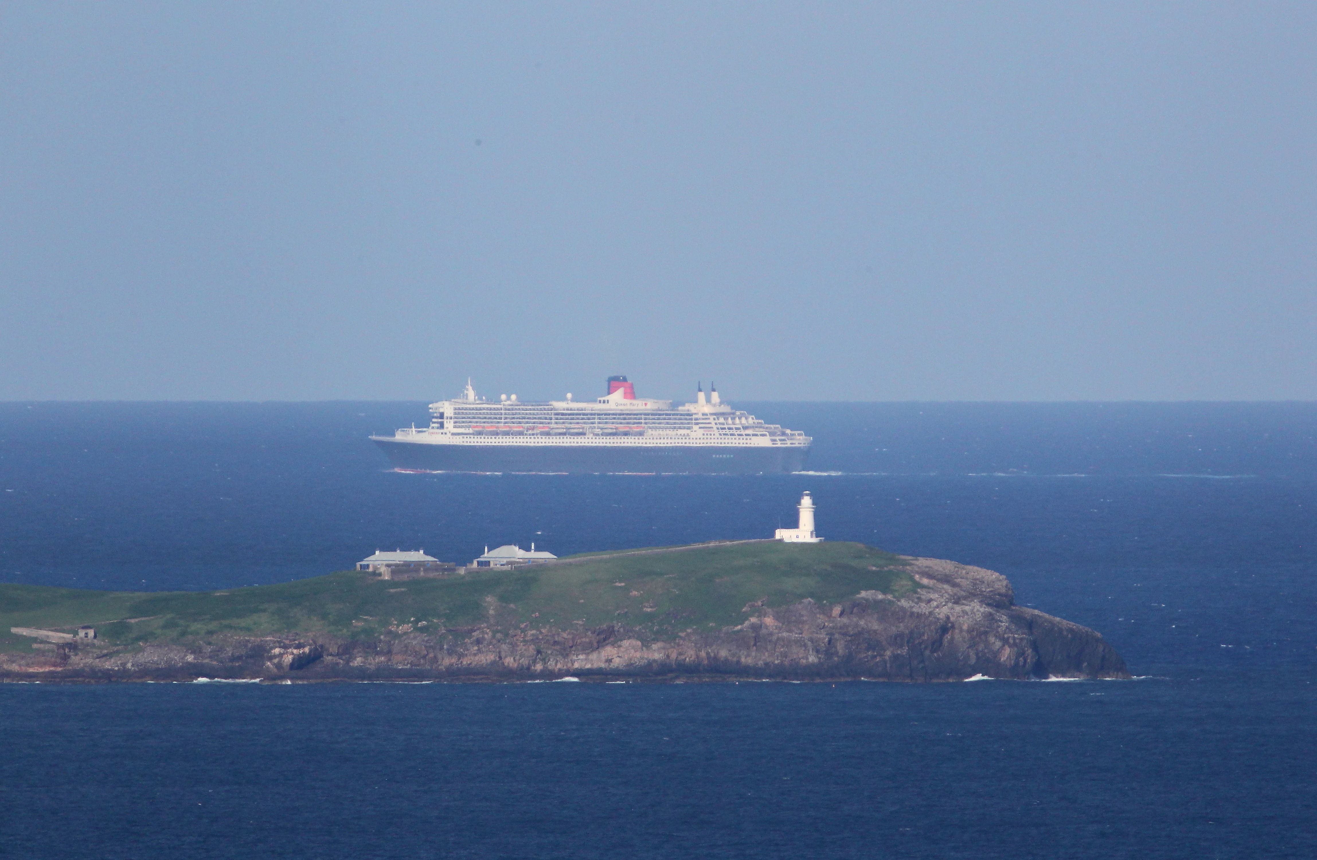
A large cruise ship sailing on the open ocean behind a green island topped with a white lighthouse.
The cruise ship Queen Mary 2 passes South Solitary Island within the Solitary Islands Marine Park.

Solitary Islands Marine Park wildlife and species highlights

The marine park's wildlife reflects its position at the overlap of tropical and temperate marine provinces. Roughly 858 fish species have been recorded, including reef species such as snapper, tusk fish, blue morwong, pearl perch, and pelagic kingfish, alongside tropical visitors such as mangrove jack, spangled emperor, bigeye trevally, and brown sweetlip. The endangered grey nurse shark is associated particularly strongly with reef gutters and submarine caves around South Solitary Island and the Commonwealth waters' Pimpernel Rock, and the great white shark is also observed in the area.

Seabirds and shorebirds are a major element of the park's wildlife values. Muttonbird Island hosts over 5,500 breeding pairs of wedge-tailed shearwaters, while threatened breeding shorebirds include Australian pied oystercatcher, sooty oystercatcher, and beach stone-curlew. Endangered little terns nest on beaches near Coffs Harbour, and the area periodically hosts endangered marine birds such as Gould's petrel, wandering albatross, and southern giant petrel. Migratory waders, including bar-tailed godwit, eastern curlew, and ruddy turnstone, travel between the Arctic and the park's estuarine shorelines.

Marine mammals are another significant presence, with around 30 species recorded, including resident common and bottlenose dolphins, seasonally present humpback whales moving north in winter and south in spring, southern right whales, blue whales, and smaller marine fauna. Marine turtles (green, loggerhead, hawksbill, and occasional leatherback) and sea snakes such as the elegant sea snake and yellow-bellied sea snake are also part of the broader fauna. On land, the endangered little bent-wing bat roosts in coastal headland caves adjoining the park.

Solitary Islands Marine Park conservation status and protection priorities

The park matters from a conservation perspective because it safeguards a transition zone of unusual biological importance, where warm-current tropical species and temperate species meet at the limits of their natural ranges. Protecting habitats across estuaries, beaches, reef systems, and open water simultaneously helps preserve populations of shorebirds, seabirds, marine mammals, sharks, and corals that are either threatened or facing range shifts as ocean temperatures change.

The southernmost extensive coral communities in coastal eastern Australia, around 90 coral species in total, are a critical focus of conservation interest, alongside key habitats for the endangered grey nurse shark. Nesting sites for little terns, breeding colonies of wedge-tailed shearwaters, and migratory shorebird feeding areas all depend on the integrity of the park's beaches, islands, and estuaries.

The park uses a four-zone management system managed by the NSW Maritime Parks Authority: small highly protected sanctuary zones, larger habitat protection zones, a general use zone that permits commercial fishing, and very limited special purpose zones covering Aboriginal cultural sites, research areas, and oyster leases. This zoning is complemented by active management against introduced pests (such as the Pacific oyster and crown-of-thorns starfish), eradication of introduced mammals on islands, and programs such as the Little Tern Recovery Program run by National Parks and Wildlife Service.

Solitary Islands Marine Park cultural meaning and human context

The Solitary group carries a rich record of European maritime history. The islands were first charted in 1770 by Lieutenant James Cook, whose journal entries refer to them as the 'Solitary Isles', a name that has endured in essentially the same form. Shipwrecks along the rocky northern NSW coast later contributed to the construction of a network of lighthouses, with the South Solitary Island lighthouse completed in 1870 and accompanied by keepers' cottages that remain a recognised historic site within the broader protected area.

The presence of Special Purpose zones in the marine park covering sites of cultural significance to Aboriginal communities reflects an additional layer of heritage value, recognising that these coastal and island landscapes are part of longer Indigenous engagement with the Solitary Islands region. The islands themselves, while not permanently inhabited in the pre-contact period, formed part of Country for Aboriginal peoples of the north coast, and present-day management explicitly incorporates cultural heritage alongside ecological protection.

Top sights and standout views in Solitary Islands Marine Park

Five island clusters and a chain of sandy and rocky coastlines compressed into 75 kilometres of northern NSW, where one can encounter both tropical and temperate marine species on a single dive or coastal walk.

Possibly the most remarkable single feature in the park is the area locally known as 'Fish Soup', on the western side of North West Rock, renowned for extremely high fish diversity. The threatened grey nurse shark uses deep reef gutters and submarine caves around South Solitary Island and Pimpernel Rock, while the same waters support breeding colonies of wedge-tailed shearwaters on Muttonbird Island and endangered little terns on adjacent beaches. Historically, the South Solitary Island lighthouse and keepers' cottages add cultural and navigational heritage to the park's natural values.

Best time to visit Solitary Islands Marine Park

The marine park's character shifts with the seasons in ways that reflect both wildlife patterns and climate. Winter and early spring bring humpback whales migrating north along the coast, with sightings commonly peaking in June and July, before the southern return migration passes through between roughly September and November. This overlaps with cooler water temperatures that can favour temperate reef species.

Spring and summer are the most biologically active periods for seabird breeding in and around the park: little terns nest on beaches north and south of Coffs Harbour between October and February, while wedge-tailed shearwaters are present at Muttonbird Island in the warmer months. Cyclone season, hot humid conditions, and rougher seas can affect boat-based access in late summer, while cooler months often bring calmer weather and clearer visibility on subtropical reefs. Visiting the South Solitary Island lighthouse site is tightly restricted, with public access only available via helicopter on two weekends of July each year.

Monthly climate preview

Long term representative temperature ranges and monthly precipitation averages

Solitary Islands Marine Park Climate Normals and Annual Weather Patterns

Representative coordinate measurements for Solitary Islands Marine Park show a measured annual rhythm of changing temperatures and precipitation amounts across twelve distinct months. Examining the complete monthly climate profile reveals specific long term averages that define the protected area environment in detail.
Annual mean20 °C
15 °C24 °C
Jan24°
Feb24°
Mar22°
Apr20°
May18°
Jun16°
Jul15°
Aug15°
Sep18°
Oct20°
Nov21°
Dec23°
Warmest month
January

24 °C

Coolest month
July

14.7 °C

Wettest month
February

6.5 mm/day

Driest month
September

1.5 mm/day

Park location guide

Geography guide, regional context, and park location map for Solitary Islands Marine Park

Solitary Islands Marine Park park geography, regions, and map view in Australia

Understand where Solitary Islands Marine Park sits in Australia through a broader geographic reading of the surrounding landscape, nearby location context, and its mapped position within the national park landscape.

How Solitary Islands Marine Park fits into Australia

Australia is a constitutional monarchy and federal parliamentary democracy comprising six states and ten territories. With a population of nearly 28 million, it is one of the world's most urbanised countries, with most people concentrated on the eastern seaboard. The country has a high Human Development Index and is known for its cultural diversity, ancient Aboriginal heritage, and unique wildlife.

Wider geography shaping Solitary Islands Marine Park in Australia

Australia occupies the entire Australian continent, the island of Tasmania, and numerous smaller islands. It is the world's flattest and driest inhabited continent, featuring vast deserts in the interior (the Outback), tropical rainforests along the eastern coast, and a coastline bordering the Indian and Pacific Oceans.

Map view of Solitary Islands Marine Park

Use this park location map to pinpoint Solitary Islands Marine Park in Australia, understand its exact geographic position, and read its mapped placement within the surrounding landscape more clearly.

Pigeon | © OpenStreetMap contributors

Location context for Solitary Islands Marine Park

New South Wales

Explore protected marine habitats, offshore island chains, and submerged reef topography.

Solitary Islands Marine Park Photos and Scenery: Visualizing Coastal Landscapes

Visual documentation reveals the distinct coastal terrain, rocky headlands, and submerged reef ecosystems that define Solitary Islands Marine Park. Examining these protected habitats provides deeper insight into the rare convergence of tropical and temperate marine environments.

An aerial view of the white South Solitary Island lighthouse and several adjacent grey-roofed keeper cottages on a grassy island slope, with the deep blue ocean in the background.

Two Australian Pied Oystercatchers with black and white feathers and bright orange beaks standing on sandy ground with the ocean in the background.

Panoramic view of a vibrant sunrise over the ocean with dark silhouettes of coastal terrain in the foreground.

A large cruise ship sailing on the open ocean behind a green island topped with a white lighthouse.

Park atlas

Compare adjacent marine reserves and regional conservation landscapes along the coast

Parks Near Solitary Islands Marine Park and Related Coastal Protected Areas

Browse nearby national parks and protected areas to compare regional marine geography and coastal habitats. Extending your research beyond Solitary Islands Marine Park reveals connected ecosystems and broader protected landscapes.
Watercolor painting of a soft landscape with distant purple and grey hills, green fields, trees, and a small pinkish flower cluster near a small pool of water.
Nature reserveNew South Wales
About 15 km away#1 closest

Northwest

Sherwood Nature Reserve: Coastal Protected Forest Boundaries in New South Wales, Australia

Mapping subtropical rainforest and creek-side biodiversity.

Sherwood Nature Reserve preserves key subtropical rainforest remnants and regenerating forest patches along the Woolgoolga Creek system in New South Wales. This protected landscape offers valuable insight into the recovery of coastal forest ecosystems and rare invertebrate habitats, serving as a critical segment of the regional natural geography.

Area
22.8 km²
Relief
Upland
Climate
Subtropical
Scope
Terrestrial
National parkNew South Wales
About 17 km away#2 closest

West

Ulidarra National Park: New South Wales Strict Nature Reserve and Wildlife Sanctuary

Explore its elevation range, mapped forest ecosystems, and protected habitats.

Ulidarra National Park represents a small yet ecologically vital protected area within New South Wales, Australia. Classified as a strict nature reserve, it preserves significant old-growth eucalyptus forests and intact rainforests across a notable elevation gradient. The park is recognized for providing critical habitat for species like koalas and various native birds, making it a key site for understanding regional wildlife diversity and protected landscape conservation through detailed mapping and geographic context.

Area
6.8 km²
Established
1999
IUCN
Ia
Relief
Mixed relief
National parkNew South Wales
About 22 km away#3 closest

North

Yuraygir National Park: New South Wales Protected Area Geography and Landscape Atlas

Discover mapped boundaries and natural terrain context.

Delve into the detailed geography of Yuraygir National Park, a protected natural landscape in New South Wales, Australia. This entry provides core atlas-relevant information, focusing on its mapped protected area boundaries and the intrinsic geographic character of the region, essential for understanding its place in conservation landscapes.

Area
313.71 km²
Established
1980
IUCN
II
Climate
Temperate
A horizontal watercolor illustration depicting rolling green hills, distant mountains in muted tones, and grassy foreground vegetation.
Nature reserveNew South Wales
About 24 km away#4 closest

West

Coramba Nature Reserve: Protected Lowland Rainforest Geography in New South Wales

A vital forest fragment in the Clarence River valley

Coramba Nature Reserve stands as a significant ecological sanctuary in coastal New South Wales. This protected area preserves a rare lowland sub-tropical rainforest, serving as an important reference site for botanical study and forest conservation within the broader geography of the Clarence River valley region.

Area
0.094 km²
Established
1982
IUCN
IV
Relief
Lowland
National parkNew South Wales
About 25 km away#5 closest

Southwest

Bongil Bongil National Park: Exploring New South Wales' Protected Landscape Identity

Mapped boundaries and regional geography of a national park.

This entry for Bongil Bongil National Park provides an atlas-focused view of its protected landscape within New South Wales. Understand the park's geographic context, its designation as a national park, and how its mapped boundaries contribute to the broader regional geography. It serves as a distinct point of entry for exploring the specific conservation lands and natural terrain that define this Australian park entity for detailed atlas-based study.

Area
42.33 km²
Established
1995
IUCN
II
Relief
Lowland
Watercolor illustration of a mountainous landscape with trees and rolling hills
National parkNew South Wales
About 29 km away#6 closest

West

Bindarri National Park: National Park Protected Area Atlas and Geographic Setting

Explore mapped boundaries and New South Wales regional context.

Bindarri National Park is a designated national park within New South Wales, Australia, serving as a vital point for understanding protected landscapes. This entry focuses on its geographic identity, mapped boundaries, and its contribution to the regional atlas of conservation areas. Users can gain insight into the specific natural terrain and spatial distribution of this protected land, facilitating a deeper appreciation of its geographical significance within Australia.

Area
55.95 km²
Established
1999
IUCN
II
Scope
Terrestrial
National parkNew South Wales
About 36 km away#7 closest

West

Dorrigo National Park: National Park Geography and Mapped Protected Landscape

Explore the regional context and unique geographic boundaries of this New South Wales park.

Dorrigo National Park serves as a significant protected area within the broader geographic tapestry of New South Wales. This entry offers detailed insights into its mapped boundaries and landscape characteristics, positioning it within Australia's network of national parks. Users seeking structured geographic information and an atlas-style understanding of protected lands will find valuable context here, focusing on the park's inherent natural features and regional setting.

Area
119 km²
Established
1967
IUCN
II
Relief
Highland
National parkNew South Wales
About 40 km away#8 closest

West

Cascade National Park: National Park in New South Wales with Mapped Protected Boundaries

Explore the unique geography and landscape context of this protected area.

Delve into Cascade National Park, a protected national park located in New South Wales, Australia. This entity is crucial for understanding the mapped geographic extent and specific landscape characteristics of one of Australia's protected natural areas. Its inclusion within the atlas provides a grounded point for examining regional conservation lands and their spatial distribution.

Area
36 km²
Established
1999
IUCN
II
Climate
Temperate

Common questions about visiting, size, designation, and location context for Solitary Islands Marine Park

Solitary Islands Marine Park FAQs for park facts, access, geography, and protected area context

Find quick answers about Solitary Islands Marine Park, including protected-area facts, park geography, trail and visitor context, and how the park fits into its surrounding country and regional landscape.
MoriAtlas Explorer

Continue Your Protected Areas Search Across the Global Atlas

Deepen your exploration by continuing the structured search for national parks and protected areas worldwide. Utilize the comprehensive filtering capabilities to compare different conservation landscapes and refine your understanding of global park geography. Discover more about the distribution and characteristics of protected natural areas.

Global natural geography