
Mori Atlas logo
Protected areaMaudacher Bruch

A diverse horseshoe-shaped green belt preserving marshland and woodland habitats in Ludwigshafen

Maudacher Bruch Protected Area: Mapping the Ancient Rhine Meander and Wetland Landscape

(Landschaftsschutzgebiet Maudacher Bruch)

Maudacher Bruch represents an expansive 523-hectare protected wetland complex located within the urban landscape of Ludwigshafen, Rhineland-Palatinate. This former arm of the River Rhine features a distinct horseshoe shape, offering a vital transition between open marsh meadows, reedy banks, and damp forest patches. By examining the terrain and the elevated vantage point of the Michaelsberg, observers can gain a clear perspective on the geography of the Upper Rhine Plain and the surrounding regional environment.

wetlandformer Rhine meanderoxbowmiremoor landscapeurban nature reserve
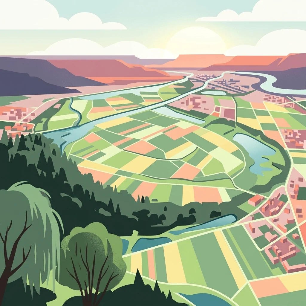
A flat-style digital illustration showing a winding river flowing through a patchwork landscape of agricultural fields, forests, and small settlements under a setting sun.

Maudacher Bruch

Protected area

Park overview

Structured park overview, official facts, and landscape profile for Maudacher Bruch

Maudacher Bruch park facts, protected area profile, and essential visitor context

Review the core facts for Maudacher Bruch, including designation, size, terrain, visitor scale, habitats, and operating context in one park-focused overview.

About Maudacher Bruch

Maudacher Bruch represents a rare example of a substantial wetland landscape preserved inside a large German industrial city. Although Ludwigshafen am Rhein is known primarily for its chemical industry and dense urban development, the Bruch forms a green arc that curves between the residential districts of Gartenstadt, Oggersheim, and Maudach. This shape reflects the geological origin of the area: it follows the curve of an old Rhine channel that was severed from the main river long before the modern city existed.

Ecologically, the site is one of the most species-rich surviving wetland fragments in the Upper Rhine Plain. Since agriculture in the surroundings shifted to drawing process water directly from the Rhine, the natural groundwater table in the Bruch has recovered, allowing the landscape to regain much of its moor-like character. Fallen trees are deliberately left in place, reinforcing a process-based approach to habitat development. The resulting mosaic of wet meadows, sedge stands, marshy pools, and reedy edges supports a wide variety of plants, breeding birds, and insects.

Beyond its natural value, Maudacher Bruch is shaped by layers of human history. Bronze Age artifacts have been recovered from beneath the peat, mammoth bones from the Ice Age have surfaced during peat-cutting operations, and the long tradition of peat extraction left a deep mark on both the landscape and local identity. Today the area continues to serve practical urban functions: it hosts a drinking-water catchment area, a fitness trail restored in 2024, festival grounds, and walking routes that connect residents to a slice of semi-natural Rhine countryside only minutes from the city center.

Quick facts and research context for Maudacher Bruch

Maudacher Bruch is a protected landscape (Landschaftsschutzgebiet) under the legal designation 07-LSG-7314-013, located within the city of Ludwigshafen am Rhein in Rhineland-Palatinate, Germany. The protected area covers approximately 523 hectares and stretches for about five kilometers in length, with a width ranging from around 300 to 500 meters, the majority lying within the district of Maudach.

The wetland originated as an oxbow of the Rhine that became isolated in prehistoric times and subsequently filled with peat. It is now recolonized by marsh vegetation, more than 140 grass and herbaceous species, over 50 tree and shrub species, nearly 160 recorded bird species, and more than 350 butterfly species. The site also contains the Maudach/Oggersheim waterworks, which has supplied roughly half of the city's drinking water since 1970.

Protection and recognition

Explore the documented territorial conservation framework established in 1978.

Maudacher Bruch Protection Status and Designation History Overview

Maudacher Bruch maintains a documented terrestrial protection status established through historical designation records from 1978. Structured administrative details outline the conservation framework and official management scope assigned to the protected landscape.

Protection details

Protection scope
Terrestrial
Designated year
1978
Transboundary protection
No
Park context

Deeper park guide and search-rich context for Maudacher Bruch

Maudacher Bruch history, landscape, wildlife, and travel context

Explore Maudacher Bruch through its history, landscape character, ecosystems, wildlife, conservation priorities, cultural context, and seasonal travel timing in a structured park guide built for atlas discovery and search intent.

Why Maudacher Bruch stands out

Maudacher Bruch is best known as an unusually large inner-city wetland complex that preserves the legacy of an ancient Rhine meander. Its defining character is the combination of boggy meadows, reed and sedge vegetation, deadwood-rich wet woodland, and a diverse avifauna, all situated within the urban territory of Ludwigshafen. The area is also widely recognized for its cultural symbolism: the lapwing (Kiebitz) and the peat cutter (Torfstecher) are the emblematic figures of Maudach, reflecting the deep historical connection between the local community and the marshland. The presence of the Jägerweiher pond, the Michaelsberg viewpoint, and a network of walking paths further shape the site's identity as a hybrid of nature reserve and recreational landscape.
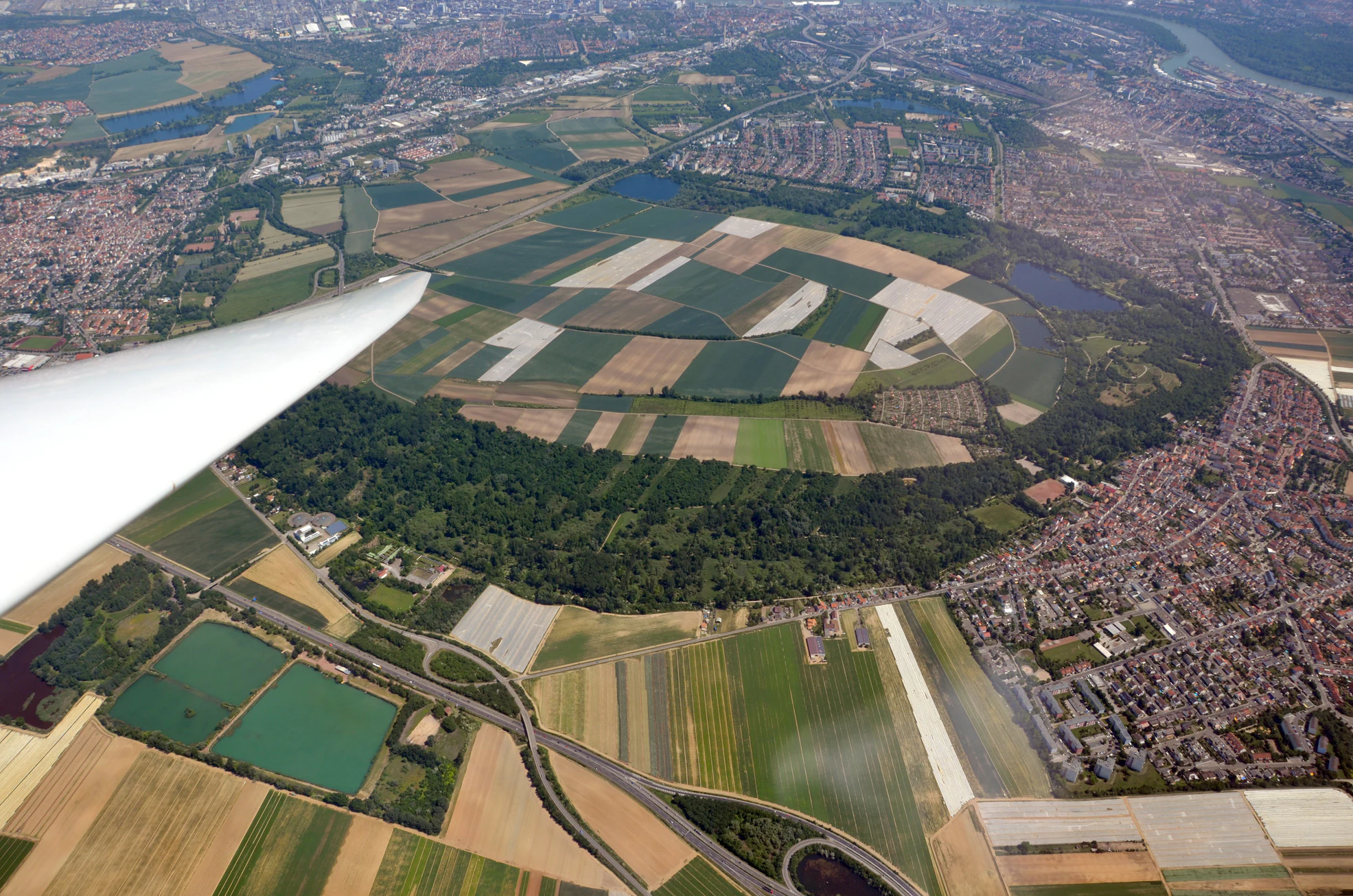
An aerial view from a glider showing agricultural fields and a central forested wetland area surrounded by suburban housing.
Aerial view of the Maudacher Bruch protected wetland area near Ludwigshafen.

Maudacher Bruch history and protected-area timeline

The history of Maudacher Bruch begins long before Ludwigshafen existed. The area originated as a meander of the Rhine that was cut off from the main river around 900 BCE. Over time the isolated channel silted up, forming peat layers up to two meters thick. Pollen analyses conducted by the Mannheim prehistorian Hermann Gropengießer showed that by the early Hallstatt period the former arm had already largely turned into land.

Archaeological finds underline the antiquity of human contact with the wetland. A Bronze Age sword from the early Hallstatt culture was recovered under a 1.42-meter peat layer near the Kreuzgraben, and 19th-century peat diggers unearthed mammoth bones dating back to the Ice Age. During these peat-cutting operations, the technique was highly organized: workers first removed the topsoil, then extracted peat in brick-sized prisms, dried them in stacked rings, and sold them by the thousand. This trade became so central to Maudach village life that the peat cutter became one of its two official symbols, alongside the lapwing.

In the 20th century, the site was substantially altered. Fast-growing poplars and alders were planted before and during the Second World War to supply wood gas for vehicles, and further afforestation continued through the 1950s. When groundwater levels dropped in the dry years after 1970, many of these trees suffered severe damage. At the same time the area gained new functions: a waste heap, originally known as Monte Scherbelino and later named Michaelsberg, was greened and turned into a 125-meter viewpoint; the Maudach/Oggersheim waterworks began supplying about half of Ludwigshafen's drinking water from deep wells; and a fitness trail was established in the 1970s, later restored in 2024 by the Wald- und Wiesenfreunde 2010 association together with the city.

Maudacher Bruch landscape and geographic character

The landscape of Maudacher Bruch is defined by the gentle curve of a former Rhine meander, giving the protected area its distinctive horseshoe shape between the districts of Gartenstadt, Oggersheim, and Maudach. The terrain is essentially flat, dominated by wet meadows, marshy depressions, reedy banks, and patches of damp woodland. Occasional ponds, including the Jägerweiher, break up the open ground and create valuable habitat transitions.

A surprising topographic feature within this lowland setting is the Michaelsberg, a 32-meter-high former rubble and waste mound that, after greening, became the highest point in Ludwigshafen at 125 meters above sea level. From its summit the view sweeps across the city, the Vorderpfalz, and the Rhine Plain all the way to the forested ridge of the Palatinate Forest (Pfälzerwald) on the horizon.

The visual rhythm of the Bruch alternates between open marsh vistas and denser tree stands, with paths threading through tall grasses and along the edges of water-filled hollows. In winter the area takes on a stark, quiet character, while in summer the wet meadows and adjacent festival grounds host a livelier scene that still preserves the broad feel of an open floodplain landscape.
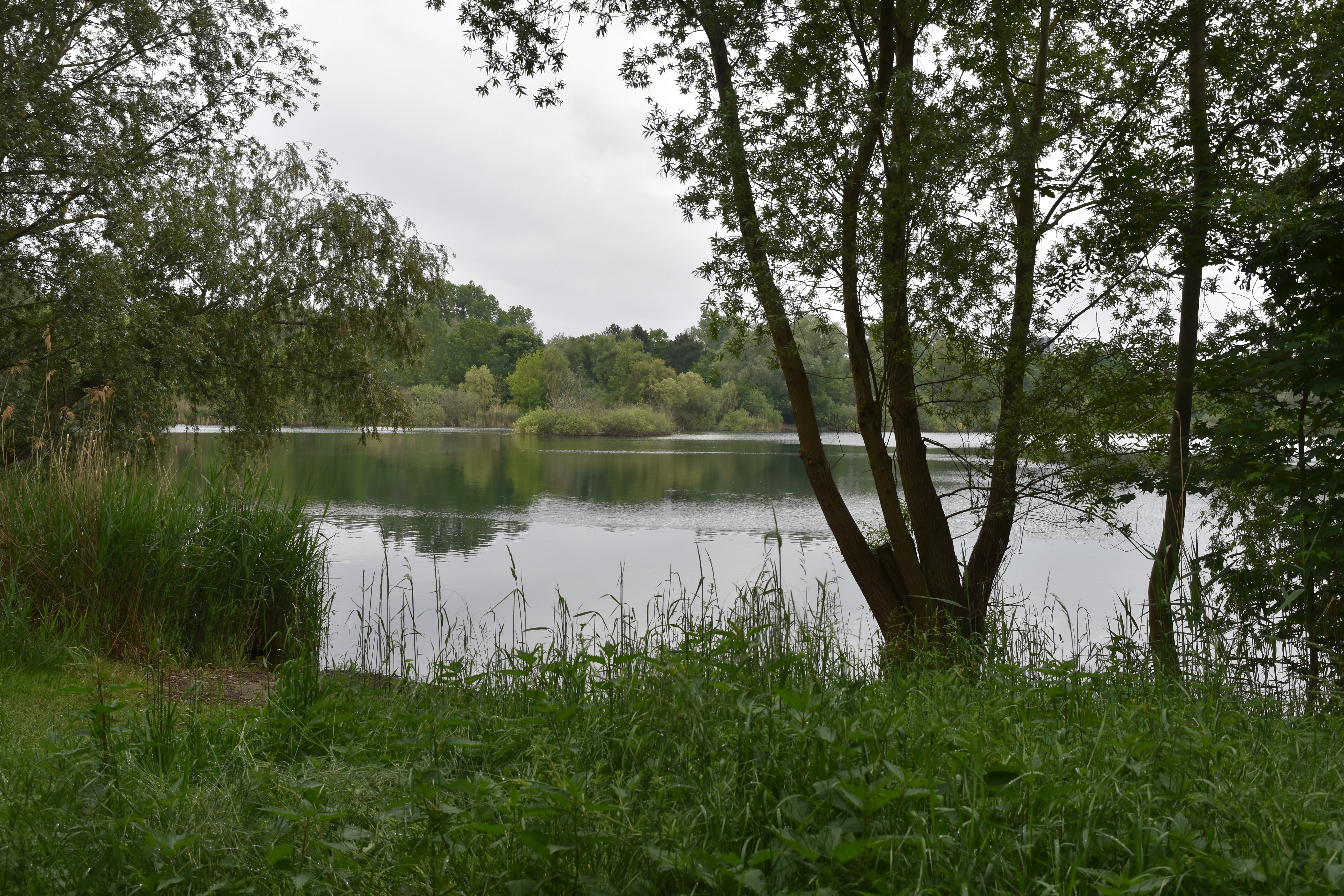
A peaceful, still pond surrounded by dense green trees and reeds under a cloudy sky.
The calm waters of the Jägerweiher pond within the Maudacher Bruch nature reserve.

Maudacher Bruch ecosystems, habitats, and plant life

Ecologically, Maudacher Bruch functions as a refuge of wetland habitats that have become rare in the heavily cultivated Upper Rhine Plain. The recovery of groundwater levels, combined with a hands-off approach to fallen timber, has allowed the area to develop a more natural bog-like character, with saturated soils, reed beds, sedge stands, and damp grassland forming a fine-grained mosaic.

Botanical surveys have documented more than 140 species of grasses and herbaceous plants along with over 50 tree and shrub species. Characteristic marsh flora include marsh bedstraw, bog bedstraw, marsh forget-me-not, arrowhead, common bird's-foot trefoil, marsh speedwell, and various stonecrops and campions adapted to seasonally wet conditions. The diversity of microhabitats, from open water margins to drier sandy edges, supports this unusually rich flora within a relatively small urban footprint.

Because the Bruch lies along traditional bird migration routes and contains a mix of open and wooded wetland, it is also an important site for ornithological observation. Roughly 160 bird species have been recorded, and the value of the area is further underlined by the presence of more than 350 butterfly species, including about 35 diurnal butterflies, indicating a robust insect community supported by varied nectar sources and host plants.
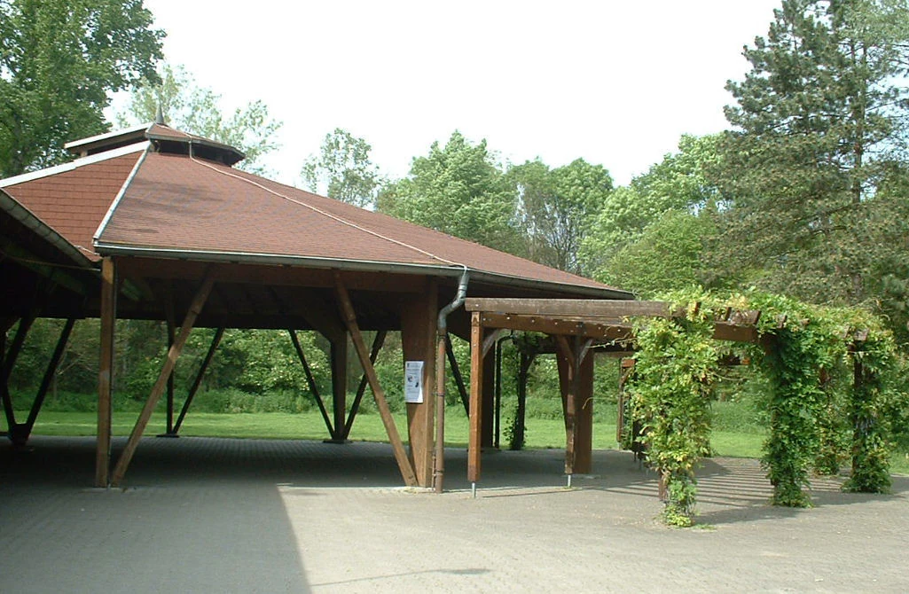
A large, open-air wooden pavilion with a reddish roof and a vine-covered pergola extension, situated in a green park environment.
The Bruchfestplatz pavilion located within the Maudacher Bruch protected area.

Maudacher Bruch wildlife and species highlights

The wildlife profile of Maudacher Bruch is dominated by its rich birdlife, reflecting the site's position along the Rhine as a key migratory corridor. The local ornithological observation station has logged close to 160 bird species, ranging from typical wetland and meadow species to woodland and passage migrants. The lapwing, historically a breeding species of wet farmland and now symbolic of the district of Maudach, is closely associated with the cultural identity of the area.

Beyond birds, the mosaic habitats support a striking insect fauna, with over 350 recorded butterfly species, of which approximately 35 are day-flying butterflies. The combination of diverse nectar plants, varied vegetation structure, and standing water sustains populations that would otherwise be unusual in such a densely settled region. Small mammals, amphibians, and invertebrates associated with marshy ground and deadwood further enrich the ecological network.

Although large charismatic mammals are not characteristic of this urban wetland, the presence of populations of more cryptic species, together with the abundance and diversity of birds and insects, makes the area ecologically significant within the regional context. It therefore serves both as a biodiversity reservoir and as a living laboratory for ongoing observation and citizen science projects.
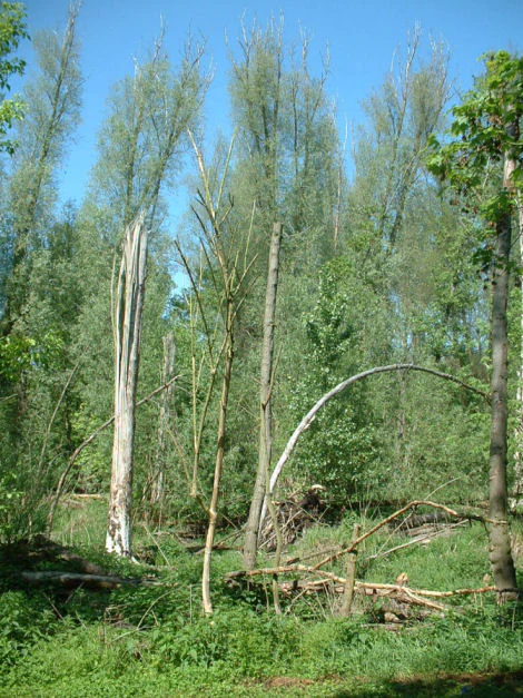
A sunny forest scene with tall trees, dense green undergrowth, and several broken or dead tree trunks in the foreground.
A view of the riparian forest habitat in Maudacher Bruch, showing tall trees and fallen timber.

Maudacher Bruch conservation status and protection priorities

Maudacher Bruch's conservation value rests on its role as one of the largest surviving wetland complexes embedded in an urban-industrial setting in the Upper Rhine Plain. By preserving a former Rhine meander, its peat soils, and its associated wet vegetation, the protected landscape safeguards habitats that have been heavily reduced elsewhere in the region through drainage, agriculture, and development.

The legal designation as a Landschaftsschutzgebiet under the identifier 07-LSG-7314-013 provides a framework for managing land use, preventing further drainage, and maintaining the open character of the meadows and woodland. Restoration of higher groundwater levels following a shift in agricultural water sourcing has been central to ecological recovery, allowing bog-like vegetation to re-establish and deadwood to remain in place as habitat structure.

The area also contributes to broader environmental functions for the city: it buffers groundwater, supports a drinking-water catchment operated by the Maudach/Oggersheim waterworks, and provides climate-regulating green space amid dense urban surroundings. Its combination of legal protection, hydrological recovery, and citizen-science monitoring gives the Bruch a substantive conservation profile beyond symbolic protection.

Maudacher Bruch cultural meaning and human context

Maudacher Bruch is deeply embedded in the cultural identity of the surrounding districts, especially Maudach itself. The peat cutter and the lapwing have long served as the village's symbolic figures, reflecting a community whose livelihood and self-image were historically tied to the marsh. The Torfstecherdenkmal, a monument to the peat diggers, stands as a physical reminder of this heritage.

Seasonal traditions, including the annual Bruchfest and gatherings on the Bruchfestplatz, keep the connection between local residents and the wetland alive. Educational and recreational infrastructure, such as the fitness trail restored in 2024, continues this lineage by encouraging direct, everyday engagement with the landscape rather than treating it solely as a remote nature reserve.

Top sights and standout views in Maudacher Bruch

Preservation of a former Rhine meander within a major industrial city, providing roughly 523 hectares of protected wetland habitat. Horseshoe-shaped green belt connecting the Ludwigshafen districts of Gartenstadt, Oggersheim, and Maudach. Rich biodiversity, with around 140 plant species, more than 50 tree and shrub species, nearly 160 bird species, and over 350 recorded butterfly species. Layered cultural history ranging from Bronze Age finds and Ice Age mammoth bones to 19th-century peat extraction, commemorated by the Torfstecherdenkmal. Functional contributions to the city, including the Maudach/Oggersheim waterworks, and recreational roles via walking paths, the restored fitness trail, and the elevated viewpoint at Michaelsberg.

Best time to visit Maudacher Bruch

Maudacher Bruch can be enjoyed year-round, but the character of a visit shifts noticeably with the seasons. Spring is a particularly rewarding time for birdwatching, as returning and passage species use the wetland, while rising groundwater and fresh growth revive the marsh vegetation. Summer offers the greenest, most colorful expression of the meadow and reed habitats, and coincides with local festivals and the most active outdoor use of the area.

Autumn brings quieter trails, softer light over the wet meadows, and good conditions for observing migratory birds. In winter the landscape becomes more open and stark, with frost highlighting the interplay of water, reeds, and bare woodland. Because the Bruch is a working protected area with active groundwater management and periodic events, visitors will find a different but consistently atmospheric experience in every season.

Monthly climate preview

Trace monthly weather patterns across representative park coordinates in Rhineland-Palatinate

Maudacher Bruch Climate Normals: Annual Temperature and Precipitation Rhythm

Representative coordinate records outline long-term average temperature ranges and precipitation rates for Maudacher Bruch across twelve distinct periods. Examining the complete monthly climate profile reveals detailed thermal shifts and moisture distributions that define the landscape.
Annual mean10 °C
0 °C20 °C
Jan
Feb
Mar
Apr
May14°
Jun18°
Jul20°
Aug20°
Sep15°
Oct10°
Nov
Dec
Warmest month
July

20.4 °C

Coolest month
January

0.3 °C

Wettest month
July

2.2 mm/day

Driest month
April

1.4 mm/day

Park location guide

Geography guide, regional context, and park location map for Maudacher Bruch

Maudacher Bruch park geography, regions, and map view in Germany

Understand where Maudacher Bruch sits in Germany through a broader geographic reading of the surrounding landscape, nearby location context, and its mapped position within the national park landscape.

How Maudacher Bruch fits into Germany

Germany is a federal republic in Western and Central Europe with a population of over 83 million across sixteen constituent states. It is Europe's largest economy by nominal GDP and a major global exporter and importer. The capital is Berlin, and the country borders Denmark, Poland, Czech Republic, Austria, Switzerland, France, Luxembourg, Belgium, and the Netherlands.

Wider geography shaping Maudacher Bruch in Germany

Germany is located in Western and Central Europe, spanning 357,022 km². It borders Denmark to the north, Poland and the Czech Republic to the east, Austria and Switzerland to the south, and France, Luxembourg, Belgium, and the Netherlands to the west. The country has coastlines on the Baltic Sea and North Sea to the north, with the Alps located in the southern region.

Map view of Maudacher Bruch

Use this park location map to pinpoint Maudacher Bruch in Germany, understand its exact geographic position, and read its mapped placement within the surrounding landscape more clearly.

Pigeon | © OpenStreetMap contributors

Location context for Maudacher Bruch

Rhineland-Palatinate

Visual reference guide to the wetland habitats, terrain, and ancient river meanders of Maudacher Bruch.

Maudacher Bruch Photos and Protected Landscape Scenery

Visual documentation captures the flat marsh vegetation, damp woodlands, and open meadows defining the Maudacher Bruch protected area. Field photography reveals the distinct environmental character of this urban wetland and its surrounding Upper Rhine Plain viewpoints.

An aerial view from a glider showing agricultural fields and a central forested wetland area surrounded by suburban housing.

A snow-covered walking path lined with trees and a low wooden fence under a winter sky.

A peaceful, still pond surrounded by dense green trees and reeds under a cloudy sky.

A large, open-air wooden pavilion with a reddish roof and a vine-covered pergola extension, situated in a green park environment.

A sunny forest scene with tall trees, dense green undergrowth, and several broken or dead tree trunks in the foreground.

A group of people walk along a dirt path through a sun-dappled, leafy forest in the Maudacher Bruch nature area.

Park atlas

Compare surrounding regional reserves, wetland sanctuaries, and nearby floodplain terrain.

Explore Protected Areas and Parks Near Maudacher Bruch in the Upper Rhine Region

Visitors exploring Maudacher Bruch can continue discovering adjacent regional nature reserves and protected wetland corridors across the surrounding Upper Rhine Plain. Expanding the search connects urban green spaces with broader ecological networks, revealing diverse regional park geography.
A pale, soft watercolor painting showing a flat, grassy landscape with distant rolling hills and patches of trees.
Nature reserveRhineland-Palatinate
About 5.4 km away#1 closest

Southeast

Pfälzische Rheinauen Nature Reserve: Protected Alluvial Landscapes in Rhineland-Palatinate

Regional floodplain geography and protected area map context

The Pfälzische Rheinauen is a major landscape protection area encompassing a mosaic of habitats along the Upper Rhine. From the Haardt mountains eastward, this region features rare alluvial forests, reclaimed gravel pit lakes, and complex river systems. It remains a focal point for understanding the integration of floodplain biodiversity with long-standing human activity in Western Germany.

Area
208.33 km²
Established
1971
Relief
Lowland
Climate
Temperate
A soft, light watercolor painting of a rolling rural landscape featuring rows of vineyards in the foreground and tree-covered hills in the distance.
Nature reserveRheinland-Pfalz
About 6.4 km away#2 closest

Southwest

Haardtrand Nature Reserve: Geographic Overview and Protected Landscape Mapping

Bird protection area within the Rheinland-Pfalz region.

Spanning roughly 14,700 hectares, Haardtrand serves as a critical link between the Palatinate Forest and the Rhine valley. This nature reserve is composed of a distinctive mosaic of habitat types, including mature broadleaf woodlands, traditional orchard meadows, and sandy terraces, which together create a highly structured environment for diverse raptors and forest-dwelling bird species.

Area
147.28 km²
Established
2004
Protected landscapeBaden-Württemberg
About 6.4 km away#3 closest

East

Waldpark Mannheim: Protected Floodplain Landscape and Riparian Geography

Natural fluvial terrain along the Rhine in Baden-Württemberg

Waldpark Mannheim encompasses 150 hectares of protected floodplain forest, meadows, and old Rhine river channels. This landscape serves as a crucial ecological zone, defined by shifting water levels and a lack of artificial flood defenses, illustrating the natural rhythm of riparian habitats in southwestern Germany.

Area
1.496 km²
Established
1975
IUCN
V
Relief
Lowland
A soft watercolor illustration of a wetland scene with a small pool of water in the foreground, a line of deciduous trees in the midground, and rolling hills in the background.
Nature reserveRheinland-Pfalz
About 7.3 km away#4 closest

Southeast

Neuhofener Woog Nature Reserve: Exploring Rhine Floodplain Geography in Rheinland-Pfalz

Mapping protected swamp forests and ancient river meander ecosystems

Neuhofener Woog serves as a vital protected area in the Rhein-Pfalz-Kreis district. This former Rhine meander preserves a natural transition between water-dominated basins, ash-alder swamp woodlands, and reed beds. It stands as a defined natural landscape within the heavily modified Upper Rhine Plain, offering a clear view of floodplain hydrological patterns.

Area
1 km²
Established
1999
A minimalist watercolor illustration featuring a soft, light-toned marsh landscape with green trees, reeds, and rolling hills in the background.
Nature reserveLandkreis Bad Dürkheim
About 7.5 km away#5 closest

West

Dürkheimer Bruch: An Ecological Mosaic in the Palatinate Landscape of Germany

A protected Natura 2000 wetland and salt meadow reserve

Dürkheimer Bruch features a finely textured lowland mosaic of wet meadows, streams, and shrubs. This nature reserve, located within the broader geography of Landkreis Bad Dürkheim, is notable for its rare inland salt meadows and its critical role in supporting protected bird species and wetland fauna.

Area
6.98 km²
Established
2005
IUCN
IV
Relief
Lowland
A soft watercolor painting depicting a winding river landscape with lush green vegetation, grassy banks, and a treeline in the distance, set against a plain white background.
Nature reserveRheinland-Pfalz
About 10 km away#6 closest

Southeast

Horreninsel Nature Reserve: Detailed Rhine Floodplain Geography and Protected Land Map

A preserved riparian zone in Rheinland-Pfalz, Germany.

Horreninsel represents a significant protected floodplain along the Upper Rhine, featuring a narrow, elongated strip of habitat between the river and its western dike. This reserve hosts diverse terrain, from old river channels and lush Auwald forests to unique Stromtalhalbtrockenrasen dry grasslands, offering a deep look into regional fluvial ecosystems.

Area
0.55 km²
Established
1978
Relief
Lowland
Climate
Temperate
A horizontal watercolor painting showing a stylized, soft-focus forest landscape with green trees against a pale, warm-toned ground.
Protected areaRhineland-Palatinate
About 10 km away#7 closest

South

Speyerer Wald: Protected Alluvial Forest and Inland Sand Dune Landscape

Regional geography and protected area context in Rhineland-Palatinate.

Speyerer Wald offers a look into the formation of Rhine Plain alluvial fans and the survival of forest ecosystems on poor, sandy soils. This protected expanse showcases the intersection of inland dunes, dry sand grasslands, and riparian stream corridors. It serves as a key case study in regional landscape evolution, highlighting how ice age deposits continue to dictate current habitat distribution and nature conservation priorities.

Established
1981
Relief
Lowland
Climate
Temperate
Access
Easy access
A horizontal watercolor painting showing a soft, abstract landscape with patches of green forest, yellow meadows, and pale pink marshland against a light background.
Nature reserveRheinland-Pfalz
About 13 km away#8 closest

West

Forster Bruch Nature Reserve: Geography and Protected Habitat Mapping in Rhineland-Palatinate

Ecological transition zone between forest slopes and agricultural loess plains.

Forster Bruch represents a rare surviving patch of Feuchtgrünland, providing a essential refuge for meadow-dwelling birdlife within the highly cultivated landscape of the Palatinate. This protected area highlights the intersection of historic rail infrastructure and natural wetland restoration, serving as a distinct geographic landmark that contrasts sharply with the surrounding vineyards and forested Haardtrand slopes.

Area
0.49 km²
Established
2008
IUCN
IV
Relief
Lowland

Common questions about visiting, size, designation, and location context for Maudacher Bruch

Maudacher Bruch FAQs for park facts, access, geography, and protected area context

Find quick answers about Maudacher Bruch, including protected-area facts, park geography, trail and visitor context, and how the park fits into its surrounding country and regional landscape.
MoriAtlas Explorer

Continue Your Protected Areas Search Across the Global Atlas

Deepen your exploration by continuing the structured search for national parks and protected areas worldwide. Utilize the comprehensive filtering capabilities to compare different conservation landscapes and refine your understanding of global park geography. Discover more about the distribution and characteristics of protected natural areas.

Global natural geography