
Mori Atlas logo
Nature reserveHorreninsel

A preserved riparian corridor featuring rare dry grasslands and dynamic forest ecosystems.

Horreninsel Nature Reserve: Mapped Rhine Floodplain Geography and Protected Landscape Analysis

(Naturschutzgebiet Horreninsel)

Horreninsel functions as a protected nature reserve along the active Rhine riverbank in Rheinland-Pfalz, Germany. This 55-hectare landscape showcases a vital riparian network, encompassing softwood and hardwood floodplain forests alongside rare dry grasslands on ancient alluvial sediment. Users can study the linear geography defined by the modern Rhine river and the western flood protection dike, illustrating the complex interplay of managed river boundaries and preserved floodplain habitats.

floodplain forestRhine floodplainAuwaldold river channelsdry grasslandStromtalhalbtrockenrasen
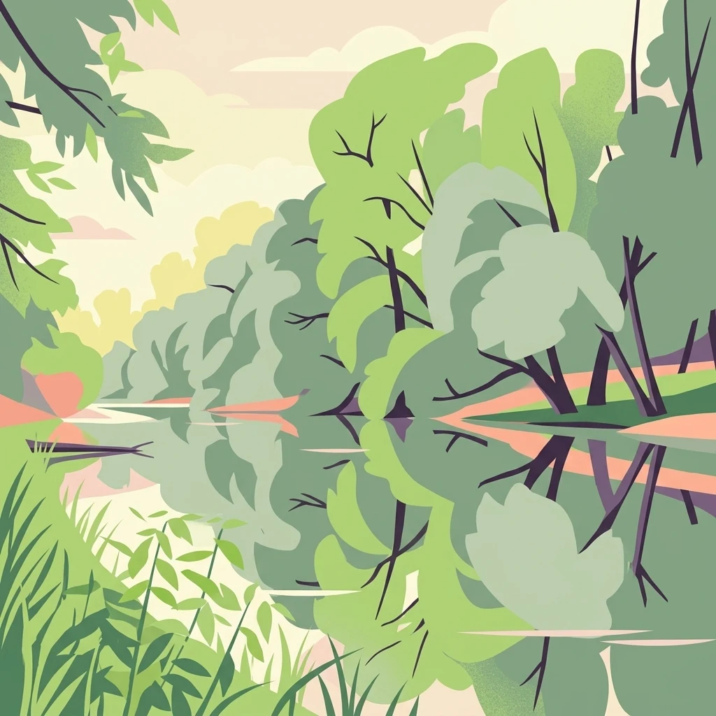
A flat-style vector illustration of a quiet river winding through a dense, green alluvial forest, with the trees reflected in the calm water.

Horreninsel

Nature reserve

Park overview

Structured park overview, official facts, and landscape profile for Horreninsel

Horreninsel park facts, protected area profile, and essential visitor context

Review the core facts for Horreninsel, including designation, size, terrain, visitor scale, habitats, and operating context in one park-focused overview.

About Horreninsel

Horreninsel is a compact nature reserve on the left bank of the Upper Rhine, in the densely settled lowlands of the Rhein-Pfalz-Kreis in Rhineland-Palatinate. Despite its small size of about 55 hectares, the reserve concentrates a notable range of floodplain habitats within an area directly bordered by one of Europe's largest rivers.

The site's character is defined by the interplay between active and former river landscapes. Along the eastern edge, the modern Rhine still shapes the boundary, while the interior retains old river channels, periodic flooding influences, and the structural variety of Auwald forest. The transition from softwood floodplain communities, dominated by willow and poplar on frequently inundated ground, to hardwood floodplain forest on higher, more stable surfaces gives the reserve a clear ecological gradient within a short distance.

A separate, distinctive element of the reserve is its Stromtalhalbtrockenrasen, a type of dry grassland restricted to old alluvial soils in major river valleys. These open, sun-exposed surfaces contrast sharply with the surrounding woodland and wetland and provide habitat for plant communities that have largely disappeared from the intensively farmed Rhine plain. The combination of forest, water bodies, and dry grassland within a single protected area is the defining quality of Horreninsel.

As one of several Altrhein-related reserves in the Rhein-Pfalz-Kreis, Horreninsel contributes to the regional network of protected floodplain landscapes. Its 1978 protection status reflects an early recognition of the importance of preserving even small, partially disturbed floodplain remnants in a working agricultural and infrastructural landscape.

Quick facts and research context for Horreninsel

Horreninsel is a designated Naturschutzgebiet in Rhineland-Palatinate, Germany, located south of Altrip in the Rhein-Pfalz-Kreis. The reserve covers approximately 55 hectares and is registered in the World Database on Protected Areas under the identifier 389604. It has been officially protected since 1978.

The reserve is bounded on the east by the active channel of the Rhine, on the west by the main Rhine dike, and on the north by the built-up area of Altrip. The east-west extent is relatively narrow, reaching just over 400 meters at its maximum, while the site stretches for about 1.6 kilometers along the riverbank. The protected landscape combines Auwald (floodplain forest) with old Rhine water bodies and inland dry grassland, giving it a layered ecological profile within a small footprint.

Protection and recognition

Analysis of terrestrial protected area records and international recognition data

Horreninsel Protection Status and Documented Conservation Scope

Terrestrial protected area records for Horreninsel outline documented management scope and official conservation metrics. Official database registers provide verified conservation status details without external recognition sources.

Protection details

Protection scope
Terrestrial
Transboundary protection
No
WDPA ID
389604
Park context

Deeper park guide and search-rich context for Horreninsel

Horreninsel history, landscape, wildlife, and travel context

Explore Horreninsel through its history, landscape character, ecosystems, wildlife, conservation priorities, cultural context, and seasonal travel timing in a structured park guide built for atlas discovery and search intent.

Why Horreninsel stands out

Horreninsel is best known for its preserved Rhine floodplain ecology, particularly the combination of softwood and hardwood Auwald, old Rhine arms, and a rare Stromtalhalbtrockenrasen dry grassland on alluvial sediment. The grassland is the defining botanical feature of the reserve, hosting uncommon species such as the willow-leaved inula (Weidenblättriger Alant) and the true hog's fennel (Echter Haarstrang). Equally important is the reserve's tight integration with an active stretch of the Rhine. The eastern boundary follows the modern river for roughly 1.6 kilometers, while the western boundary follows the flood protection dike. This juxtaposition of engineered river control and preserved floodplain habitat makes Horreninsel a representative example of managed Upper Rhine conservation.
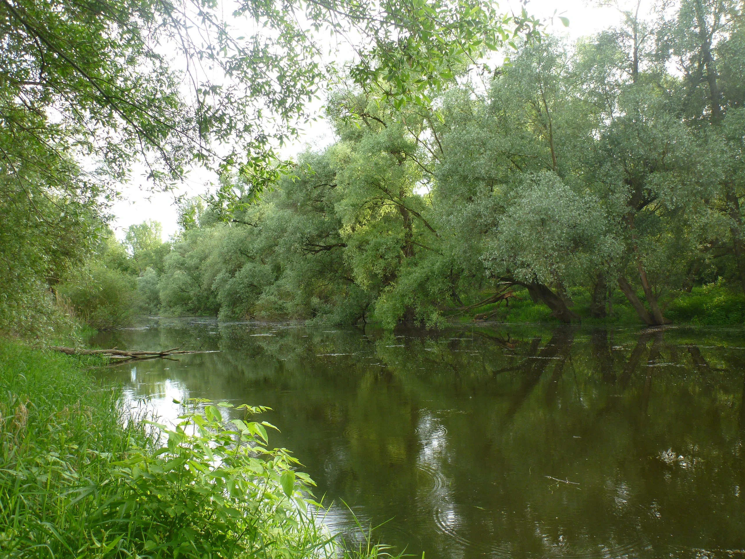
A peaceful, still body of water flanked by lush green riparian forest with overhanging trees reflected in the surface.
A tranquil view of the floodplain forest and calm water at Horreninsel.

Horreninsel history and protected-area timeline

Horreninsel was formally designated as a Naturschutzgebiet in 1978, placing it among the earlier generation of small, targeted nature reserves established in the Upper Rhine lowlands during that decade. The reserve's protected status was defined around the preservation of its floodplain forest, its old river water bodies, and the unusual dry grassland communities distributed across the site.

The naming of the area as Horreninsel reflects its historical character as a relatively elevated patch of land within the broader Rhine floodplain, set apart by surrounding old channels and lower-lying areas. Long before its formal protection, the land was shaped by the shifting course of the Rhine, the construction of flood control works such as the main dike running along the western edge, and the gradual conversion of the surrounding landscape to agriculture and settlement.

Within the regional conservation network, Horreninsel stands alongside other protected sites in the Rhein-Pfalz-Kreis that focus on Altrhein (old Rhine) habitats, including the Neuhofener Altrhein, Roxheimer Altrhein reserves, and several meadow and oxbow sites. Together, these reserves represent efforts to maintain functioning examples of the floodplain ecology that historically dominated the Upper Rhine valley before extensive engineering and agricultural intensification.

Horreninsel landscape and geographic character

Horreninsel's landscape is a narrow, elongated floodplain strip set between the Rhine and the main river dike. Its maximum east-west extent is just over 400 meters, but it stretches for about 1.6 kilometers along the eastern riverside boundary, giving the reserve a linear, riverside shape.

The terrain consists primarily of Auwald, a floodplain woodland shaped by periodic inundation and sediment deposition. Within and around this forest lie old Rhine water bodies and seasonally flooded zones that reflect the area's fluvial origins. The presence of these old channels and water-level fluctuations gives the reserve a mosaic of wet, moist, and elevated surfaces.

On slightly higher, well-drained alluvial ground, the landscape opens into a Stromtalhalbtrockenrasen, a dry grassland type typical of large river valleys. This open, herb-rich surface contrasts with the surrounding forest and adds visible structural diversity to the otherwise wooded floodplain. From the dike on the west to the active riverbank on the east, Horreninsel compresses several characteristic floodplain landforms into a narrow band of protected land.

Horreninsel ecosystems, habitats, and plant life

The nature of Horreninsel is best understood as a layered floodplain ecosystem combining forest, water, and dry grassland. The Auwald forms the dominant habitat, with both softwood communities on frequently inundated ground and hardwood communities on more stable surfaces. This forest mosaic supports a range of plant and animal species adapted to periodic flooding, high groundwater, and natural disturbance.

The old Rhine water bodies and water-level fluctuation zones add an important aquatic and semi-aquatic component. These features create habitats for amphibians, aquatic invertebrates, and wetland-associated bird species, and they reinforce the reserve's connection to the broader Rhine floodplain system.

A particularly distinctive ecological feature is the reserve's Stromtalhalbtrockenrasen, a dry alluvial grassland. This habitat type is restricted to major river valleys and has become increasingly rare due to agricultural conversion and changes in land use. Within Horreninsel, it supports uncommon plant species and contributes significantly to the overall biodiversity of the small reserve.

Horreninsel wildlife and species highlights

Horreninsel supports wildlife communities typical of Upper Rhine floodplain reserves. The combination of Auwald, old river channels, and dry grassland provides habitat for amphibians, invertebrates, and bird species associated with both wetland and open-ground environments.

The reserve's old Rhine water bodies and seasonally flooded zones offer breeding and feeding habitat for amphibians such as frogs and toads, while the structural diversity of the floodplain forest supports a range of forest-dwelling bird species. The open dry grassland areas attract insect populations that in turn support predatory bird species and other grassland fauna.

The protection ordinance explicitly recognizes the area's role as a Lebensraum seltener Tierarten, a habitat for rare animal species. While specific species inventories are not detailed in the source documentation, the reserve is positioned as part of the regional network of floodplain refuges that sustain wildlife in an otherwise heavily cultivated Rhine lowland.

Horreninsel conservation status and protection priorities

Horreninsel was designated as a Naturschutzgebiet in 1978 with an explicit conservation purpose centered on preserving the site's mosaic of habitats: its water bodies and water fluctuation zones, its softwood and hardwood floodplain forests, and its Halbtrockenrasen grasslands that serve as refuges for rare plant communities and animal species.

The reserve's conservation significance lies in protecting a compact, ecologically diverse floodplain remnant within an intensively cultivated and densely populated stretch of the Upper Rhine. Even at roughly 55 hectares, the site retains a structural complexity that makes it valuable as a habitat island in a working agricultural landscape.

The presence of rare plant species such as the Weidenblättriger Alant (willow-leaved inula) and the Echte Haarstrang (true hog's fennel) on the Stromtalhalbtrockenrasen highlights the reserve's role in safeguarding plant communities that have become scarce elsewhere in the region. Through its 1978 designation, Horreninsel contributes to the long-term preservation of Rhine floodplain biodiversity in Rhineland-Palatinate.

Top sights and standout views in Horreninsel

Horreninsel's standout features include its position directly along an active stretch of the Rhine, with about 1.6 kilometers of modern riverbank forming the eastern boundary, and a rare Stromtalhalbtrockenrasen dry grassland that supports uncommon plant species within an otherwise wooded floodplain reserve.

The reserve also stands out for the way it compresses multiple characteristic Upper Rhine habitats into a narrow protected strip, from open dry grassland through hardwood and softwood Auwald to old river water bodies. Its 1978 designation status makes it an established part of the regional Altrhein conservation network in the Rhein-Pfalz-Kreis.

Best time to visit Horreninsel

As a small floodplain nature reserve, Horreninsel changes character with the hydrological and seasonal cycles of the Upper Rhine. Periods of lower water levels and stable weather tend to make the dry grassland and forest paths more accessible, while seasonal flooding or high water can restrict access to lower-lying zones.

Spring and early summer typically bring the most active display of the reserve's rare grassland plants, including the willow-leaved inula and true hog's fennel that define the Stromtalhalbtrockenrasen. Bird activity in the floodplain forest and along the old channels is also generally higher in these seasons. For visitors focused on the reserve's herbaceous flora, late spring into early summer offers the strongest botanical interest, while autumn can emphasize the structure of the Auwald itself.

Monthly climate preview

Long-term representative temperature ranges and monthly precipitation distributions across the terrain

Horreninsel Climate Normals and Measured Annual Weather Patterns

Representative coordinates record measured monthly temperature swings from freezing minimums to warm maximums alongside steady precipitation averages throughout the year. Reviewing the complete twelve-month dataset provides a detailed baseline of long-term climate normals across the protected landscape.
Annual mean10 °C
0 °C20 °C
Jan
Feb
Mar
Apr
May14°
Jun18°
Jul20°
Aug20°
Sep15°
Oct10°
Nov
Dec
Warmest month
July

20.3 °C

Coolest month
January

0.1 °C

Wettest month
July

2.4 mm/day

Driest month
April

1.5 mm/day

Park location guide

Geography guide, regional context, and park location map for Horreninsel

Horreninsel park geography, regions, and map view in Germany

Understand where Horreninsel sits in Germany through a broader geographic reading of the surrounding landscape, nearby location context, and its mapped position within the national park landscape.

How Horreninsel fits into Germany

Germany is a federal republic in Western and Central Europe with a population of over 83 million across sixteen constituent states. It is Europe's largest economy by nominal GDP and a major global exporter and importer. The capital is Berlin, and the country borders Denmark, Poland, Czech Republic, Austria, Switzerland, France, Luxembourg, Belgium, and the Netherlands.

Wider geography shaping Horreninsel in Germany

Germany is located in Western and Central Europe, spanning 357,022 km². It borders Denmark to the north, Poland and the Czech Republic to the east, Austria and Switzerland to the south, and France, Luxembourg, Belgium, and the Netherlands to the west. The country has coastlines on the Baltic Sea and North Sea to the north, with the Alps located in the southern region.

Map view of Horreninsel

Use this park location map to pinpoint Horreninsel in Germany, understand its exact geographic position, and read its mapped placement within the surrounding landscape more clearly.

Pigeon | © OpenStreetMap contributors

Location context for Horreninsel

Rheinland-Pfalz

Explore detailed imagery of Rhine riverbanks, floodplain forests, and rare dry grasslands.

Horreninsel Photos and Landscape Views: Visualizing the Upper Rhine Floodplain Reserve

Visual documentation captures the complex terrain of Horreninsel, featuring dense floodplain woodland and active river channels along the Upper Rhine. Examining these protected habitats reveals the distinct ecological character and seasonal dynamics of the regional nature reserve.

A peaceful, still body of water flanked by lush green riparian forest with overhanging trees reflected in the surface.

Park atlas

Compare adjacent floodplain reserves and connected riparian landscapes across the Upper Rhine valley.

Parks Near Horreninsel And Related Protected Areas In The Surrounding Region

Visitors exploring Horreninsel can browse nearby protected areas to examine similar floodplain forests and riparian ecosystems. Expanding the search helps contextualize regional conservation networks and river valley habitats.
Protected landscapeBaden-Württemberg
About 4.6 km away#1 closest

Northwest

Waldpark Mannheim: Protected Floodplain Landscape and Riparian Geography

Natural fluvial terrain along the Rhine in Baden-Württemberg

Waldpark Mannheim encompasses 150 hectares of protected floodplain forest, meadows, and old Rhine river channels. This landscape serves as a crucial ecological zone, defined by shifting water levels and a lack of artificial flood defenses, illustrating the natural rhythm of riparian habitats in southwestern Germany.

Area
1.496 km²
Established
1975
IUCN
V
Relief
Lowland
A pale, soft watercolor painting showing a flat, grassy landscape with distant rolling hills and patches of trees.
Nature reserveRhineland-Palatinate
About 4.9 km away#2 closest

Northwest

Pfälzische Rheinauen Nature Reserve: Protected Alluvial Landscapes in Rhineland-Palatinate

Regional floodplain geography and protected area map context

The Pfälzische Rheinauen is a major landscape protection area encompassing a mosaic of habitats along the Upper Rhine. From the Haardt mountains eastward, this region features rare alluvial forests, reclaimed gravel pit lakes, and complex river systems. It remains a focal point for understanding the integration of floodplain biodiversity with long-standing human activity in Western Germany.

Area
208.33 km²
Established
1971
Relief
Lowland
Climate
Temperate
A soft watercolor illustration of a wetland scene with a small pool of water in the foreground, a line of deciduous trees in the midground, and rolling hills in the background.
Nature reserveRheinland-Pfalz
About 5.8 km away#3 closest

West

Neuhofener Woog Nature Reserve: Exploring Rhine Floodplain Geography in Rheinland-Pfalz

Mapping protected swamp forests and ancient river meander ecosystems

Neuhofener Woog serves as a vital protected area in the Rhein-Pfalz-Kreis district. This former Rhine meander preserves a natural transition between water-dominated basins, ash-alder swamp woodlands, and reed beds. It stands as a defined natural landscape within the heavily modified Upper Rhine Plain, offering a clear view of floodplain hydrological patterns.

Area
1 km²
Established
1999
A watercolor painting showing a winding river flowing through a green valley with rolling hills in the background, executed in a soft, impressionistic style with light greens, purples, and pinks.
Protected landscapeRhein-Neckar-Kreis
About 8 km away#4 closest

Northeast

Neckartal I-Kleiner Odenwald: Protected Landscape and Regional Geography in Rhein-Neckar-Kreis

Mapping the sandstone ridges and river valley systems of southwestern Germany.

The Neckartal I-Kleiner Odenwald protected landscape serves as a prime example of a transitional natural region where the Neckar river cuts through the Odenwald highlands. This record provides a detailed look at the area's physical geography, including its signature abandoned river bends, block-strewn slopes, and the dense forest canopy that characterizes this significant protected land in the Rhein-Neckar-Kreis district.

Area
63.159 km²
Established
2002
IUCN
V
Relief
Mountain
Watercolor painting showing a calm river shoreline with soft green trees and light pinkish ground accents.
Protected areaRhineland-Palatinate
About 8.2 km away#5 closest

South

Angelhofer Altrhein: Protected Riparian Environment in Rhineland-Palatinate

Historic river oxbow, floodplain forests, and Natura 2000 habitats

Located in the heart of the Upper Rhine plain, the Angelhofer Altrhein constitutes an essential protected area known for its distinct floodplain meadow and forest ecosystems. This backwater environment, once a main channel of the Rhine, provides critical habitat for diverse species and serves as a natural contrast to the surrounding industrial and recreational landscapes of the region.

Relief
Lowland
Climate
Temperate
Access
Easy access
Scope
Terrestrial
A minimalist watercolor illustration of a wetland scene with soft green hills in the distance, a central water body, and faint pink and green vegetation in the foreground against a white background.
Protected areaRhineland-Palatinate
About 10 km away#6 closest

Northwest

Maudacher Bruch: Protected Wetland and Historical Meander in Rhineland-Palatinate

Mapping the urban marshes and meadows of Ludwigshafen

Maudacher Bruch is a significant protected area in Rhineland-Palatinate, defined by its origin as an ancient silted-up meander of the River Rhine. This horseshoe-shaped landscape sustains diverse wetland habitats and serves as a natural counterpoint to the surrounding industrial city. Explore its complex geography, from the central marshland meadows and ponds to the elevated views across the Upper Rhine Plain.

Area
5.23 km²
Relief
Lowland
Climate
Temperate
Access
Easy access
A horizontal watercolor painting showing a stylized, soft-focus forest landscape with green trees against a pale, warm-toned ground.
Protected areaRhineland-Palatinate
About 10 km away#7 closest

Southwest

Speyerer Wald: Protected Alluvial Forest and Inland Sand Dune Landscape

Regional geography and protected area context in Rhineland-Palatinate.

Speyerer Wald offers a look into the formation of Rhine Plain alluvial fans and the survival of forest ecosystems on poor, sandy soils. This protected expanse showcases the intersection of inland dunes, dry sand grasslands, and riparian stream corridors. It serves as a key case study in regional landscape evolution, highlighting how ice age deposits continue to dictate current habitat distribution and nature conservation priorities.

Established
1981
Relief
Lowland
Climate
Temperate
Access
Easy access
A watercolor-style illustration of a soft, grassy landscape featuring sparse coniferous trees and a gently rolling, light-colored horizon.
Nature reserveHessen
About 13 km away#8 closest

North

Glockenbuckel von Viernheim: Mapping the Protected Dunes of Hessen

Nature reserve featuring dry grassland and inland sand biotopes

Located in the Bergstrasse district, Glockenbuckel von Viernheim is a protected area preserving rare inland sand dune landscapes. The site features nutrient-poor sandy soils and open grassland patches maintained for specialized species, reflecting an unusual conservation history born from former military training grounds within the Upper Rhine plain.

Area
0.411 km²
Established
1998
IUCN
IV

Common questions about visiting, size, designation, and location context for Horreninsel

Horreninsel FAQs for park facts, access, geography, and protected area context

Find quick answers about Horreninsel, including protected-area facts, park geography, trail and visitor context, and how the park fits into its surrounding country and regional landscape.
MoriAtlas Explorer

Continue Your Protected Areas Search Across the Global Atlas

Deepen your exploration by continuing the structured search for national parks and protected areas worldwide. Utilize the comprehensive filtering capabilities to compare different conservation landscapes and refine your understanding of global park geography. Discover more about the distribution and characteristics of protected natural areas.

Global natural geography