

Mori Atlas logo
National parkMontagne d'Ambre National Park

Mapping the isolated volcanic terrain and humid ecological boundaries of northern Madagascar

Montagne d'Ambre National Park: Volcanic Massif and Montane Rainforest Geography in Diana Region

(Parc National de la Montagne d'Ambre)

Montagne d'Ambre National Park sits as an isolated volcanic massif within the Diana Region of northern Madagascar, rising sharply above the surrounding arid lowlands. As a critical island of humid montane rainforest, the park features a diverse terrain of crater lakes, waterfalls, and basaltic slopes that support high levels of endemism. This protected landscape serves as a vital water catchment for the region, preserving unique ecological zones within its clearly defined geographic boundaries.

montane rainforestvolcanic landscapeendemic wildlifelemursbirdwatchingwaterfalls

Montagne d'Ambre National Park

National park

Park overview

Structured park overview, official facts, and landscape profile for Montagne d'Ambre National Park

Montagne d'Ambre National Park park facts, protected area profile, and essential visitor context

Review the core facts for Montagne d'Ambre National Park, including designation, size, terrain, visitor scale, habitats, and operating context in one park-focused overview.

About Montagne d'Ambre National Park

Montagne d'Ambre National Park sits in the Diana Region of northern Madagascar, not far from the Indian Ocean coast and the regional capital Antsiranana. The park is built around Mount Ambohitra, the highest mountain in northern Madagascar and the dominant geographical feature of the area. Because the massif is volcanic in origin and made largely of basaltic rock, it captures moisture from passing weather systems, generating a dramatically wetter microclimate than the dry deciduous forests and semi-desert lowlands that surround it on every side.

The result is an isolated ecological island of montane rainforest rising out of a much drier regional landscape. Within the park, tall trees, dense lianas, orchids, ferns, mosses, and humid forest understory form a continuous green cover. Outside its boundaries, the vegetation shifts abruptly to sparse dry forest and succulent-rich semi-desert. This sharp ecological contrast is one of the defining characteristics of Montagne d'Ambre and helps explain why the park harbours so many species found nowhere else on Earth.

Montagne d'Ambre is also closely tied to the human geography of the north. Local Sakalava and Antankarana communities live in and around the park, and the protected area itself supplies fresh water to Antsiranana through a network of streams and rivers that originate on the mountain. The park's relative accessibility from the city, combined with its biological richness, makes it one of the key entry points for visitors exploring northern Madagascar's natural heritage.

Ecologically, the park is celebrated for its lemurs, endemic birds, amphibians, and reptiles, including species whose entire world range is restricted to the slopes and summit of Amber Mountain. Botanically, it is home to more than a thousand recorded plant species, ranging from native rainforest flora to introduced conifer plantations. The mix of natural forest, plantations, waterfalls, crater lakes, and endemic wildlife gives Montagne d'Ambre a layered identity as both a conservation area and a place of dramatic natural scenery.

Quick facts and research context for Montagne d'Ambre National Park

Montagne d'Ambre National Park lies in the Diana Region of northern Madagascar, close to the regional capital Antsiranana. It was formally established in 1958 and is managed under Madagascar's national park system.

The park protects an isolated volcanic massif of basaltic rock that carries montane rainforest, waterfalls, crater lakes, rivers, and streams. Annual rainfall inside the park is several times higher than in the dry deciduous forests and semi-desert landscapes that surround the mountain, which is the main reason the area functions as a natural water catchment for Antsiranana.

The park is recognised as one of Madagascar's most biodiverse protected areas, with high counts of recorded plant species, lemurs, endemic birds, reptiles, and amphibians, many of which occur nowhere else.

Protection and recognition

Examine the terrestrial protection scope and documented designation framework for this protected area.

Montagne d'Ambre National Park Protection Status and Conservation Geography

Montagne d'Ambre National Park maintains a documented terrestrial protection scope within its designated geographic boundary. Structured records outline the established conservation framework, management designations, and recognized international status attributes for the protected area.

Protection details

Protection scope
Terrestrial
Transboundary protection
No
Park context

Deeper park guide and search-rich context for Montagne d'Ambre National Park

Montagne d'Ambre National Park history, landscape, wildlife, and travel context

Explore Montagne d'Ambre National Park through its history, landscape character, ecosystems, wildlife, conservation priorities, cultural context, and seasonal travel timing in a structured park guide built for atlas discovery and search intent.

Why Montagne d'Ambre National Park stands out

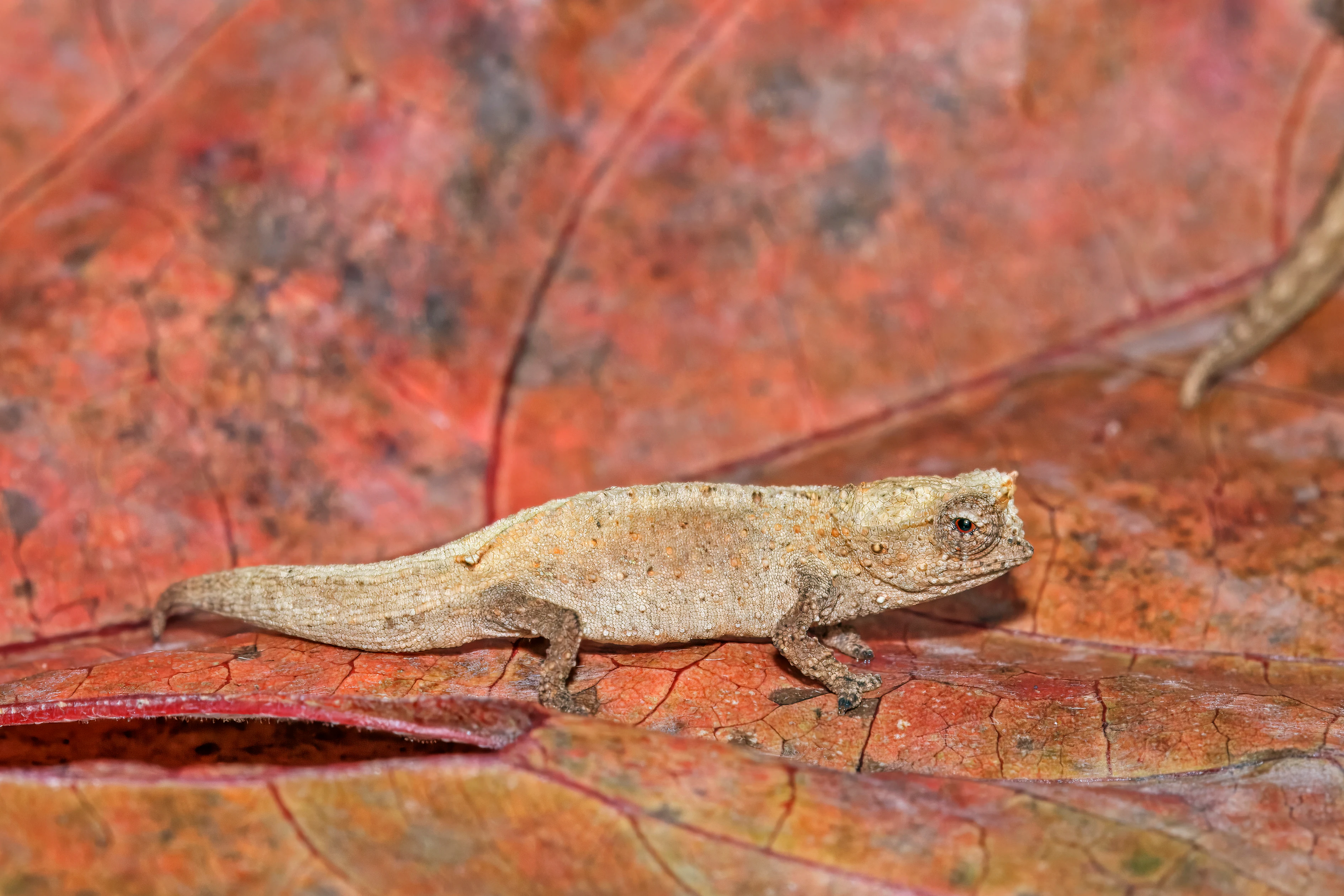
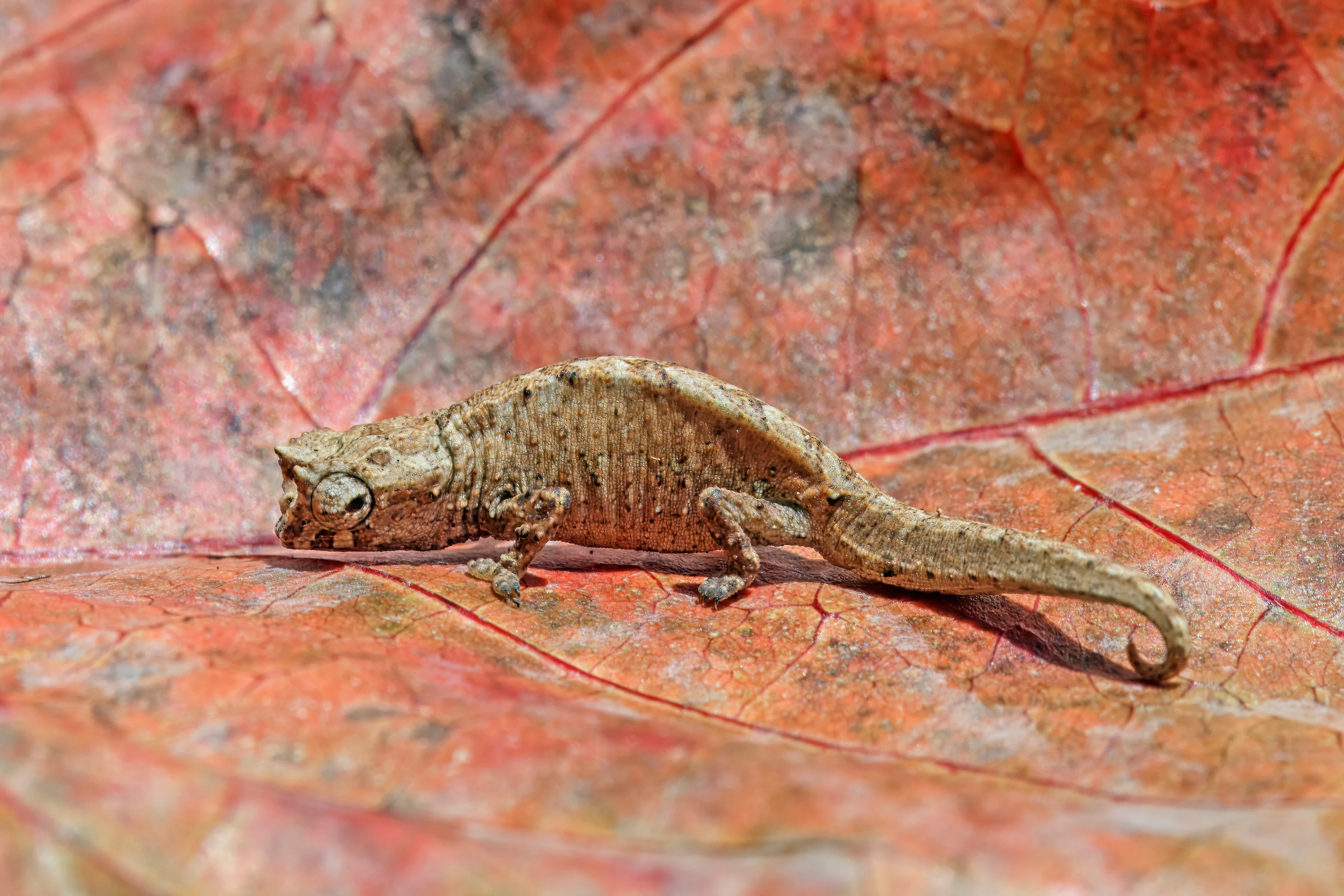
Montagne d'Ambre is best known for being an island of humid montane rainforest perched above the dry northern landscapes of Madagascar, supporting an exceptional concentration of endemic wildlife. The park is especially associated with its eight lemur species, its rich endemic birdlife, and its population of micro-endemic reptiles such as the tiny Amber Mountain leaf chameleon. It is also recognised for its volcanic landscape, with basaltic rock formations, crater lakes, waterfalls, and rivers that together create the catchment supplying water to the nearby city of Antsiranana. The combination of an isolated humid ecosystem inside an otherwise arid region gives the park its distinctive scientific and ecological identity.
Montagne d'Ambre National Park history and protected-area timeline

Montagne d'Ambre was formally established as a national park on 28 October 1958, making it one of the older protected areas in Madagascar and a long-standing component of the country's network of national parks. Since its establishment it has been managed within the national system that became Madagascar National Parks.

The name of the park comes from the deposits of copal, a soft form of amber, that occur on the mountain. Over the decades, the area has become increasingly recognised for its ecological value, particularly the unusually high concentration of endemic plants and animals that live on its isolated humid massif, surrounded by far drier landscapes. The park's role as a water catchment supplying Antsiranana has reinforced its regional importance over time.

Montagne d'Ambre National Park landscape and geographic character

The landscape of Montagne d'Ambre is defined by an isolated volcanic massif built mainly of basaltic rock, rising above the surrounding dry lowlands of northern Madagascar. The park covers this elevated terrain together with the forested slopes, valleys, streams, and waterfalls that descend from it.

Within the park's boundaries, visitors encounter a sequence of striking volcanic landforms. There are numerous rivers and streams cutting through the forested slopes, several crater lakes in the higher reaches of the massif, and a number of waterfalls that are among the park's most recognisable scenic features. The contrast between the cool, lush mountain environment and the hot, dry surroundings is sharp and visible from many vantage points.

At lower elevations, parts of the landscape include plantations of eucalyptus and exotic conifers such as pine and Araucaria, introduced timber species that were established within the broader forested zone. The mountain itself acts as an ecological barrier, separating humid rainforest communities from the dry forests and semi-desert vegetation that characterise the surrounding Diana Region.
Montagne d'Ambre National Park ecosystems, habitats, and plant life

The natural environment of Montagne d'Ambre is dominated by montane rainforest, much of which forms a dense, humid canopy reaching impressive heights. The forest is rich in lianas, orchids, ferns such as the bird's-nest fern, and other moisture-loving plants, while over one thousand plant species have been recorded across the park.

Because the mountain massif is geographically isolated from other humid forest areas by surrounding dry habitat, the ecosystems inside the park have evolved in relative separation. This isolation has encouraged a high level of endemism, with many species restricted to Amber Mountain and unable to survive in the drier lowlands around it. Annual rainfall inside the park is several times higher than in nearby lowland areas, sustaining the year-round humidity that the rainforest depends on.

The forest is interspersed with plantations of eucalyptus, pine, and Araucaria, and also with patches invaded by the introduced shrub Lantana camara. Together, these features give the park a mosaic character, blending intact native rainforest, modified vegetation, and planted timber areas within a single protected landscape.
Montagne d'Ambre National Park wildlife and species highlights

Montagne d'Ambre is one of Madagascar's most important strongholds for endemic wildlife, supported by the isolation of its montane rainforest from the surrounding dry habitats. The park's fauna reflects both typical Malagasy rainforest species and a remarkable set of creatures found only on Amber Mountain.

Among mammals, the park is known for harbouring eight lemur species, alongside other local endemics such as the ring-tailed mongoose and the Malagasy civet. The lemur community is one of the park's signature features and contributes strongly to its reputation as a biodiversity hotspot.

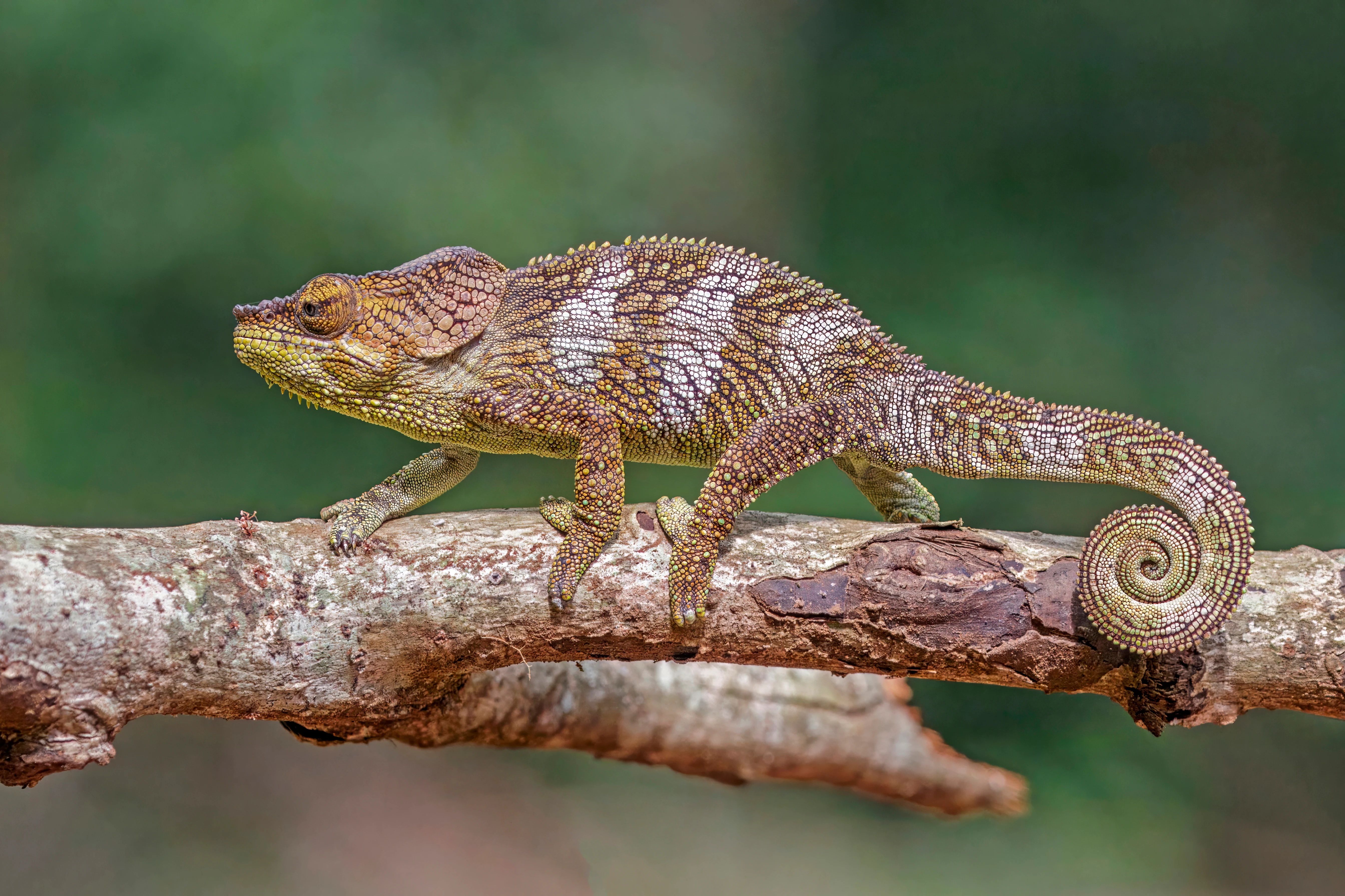
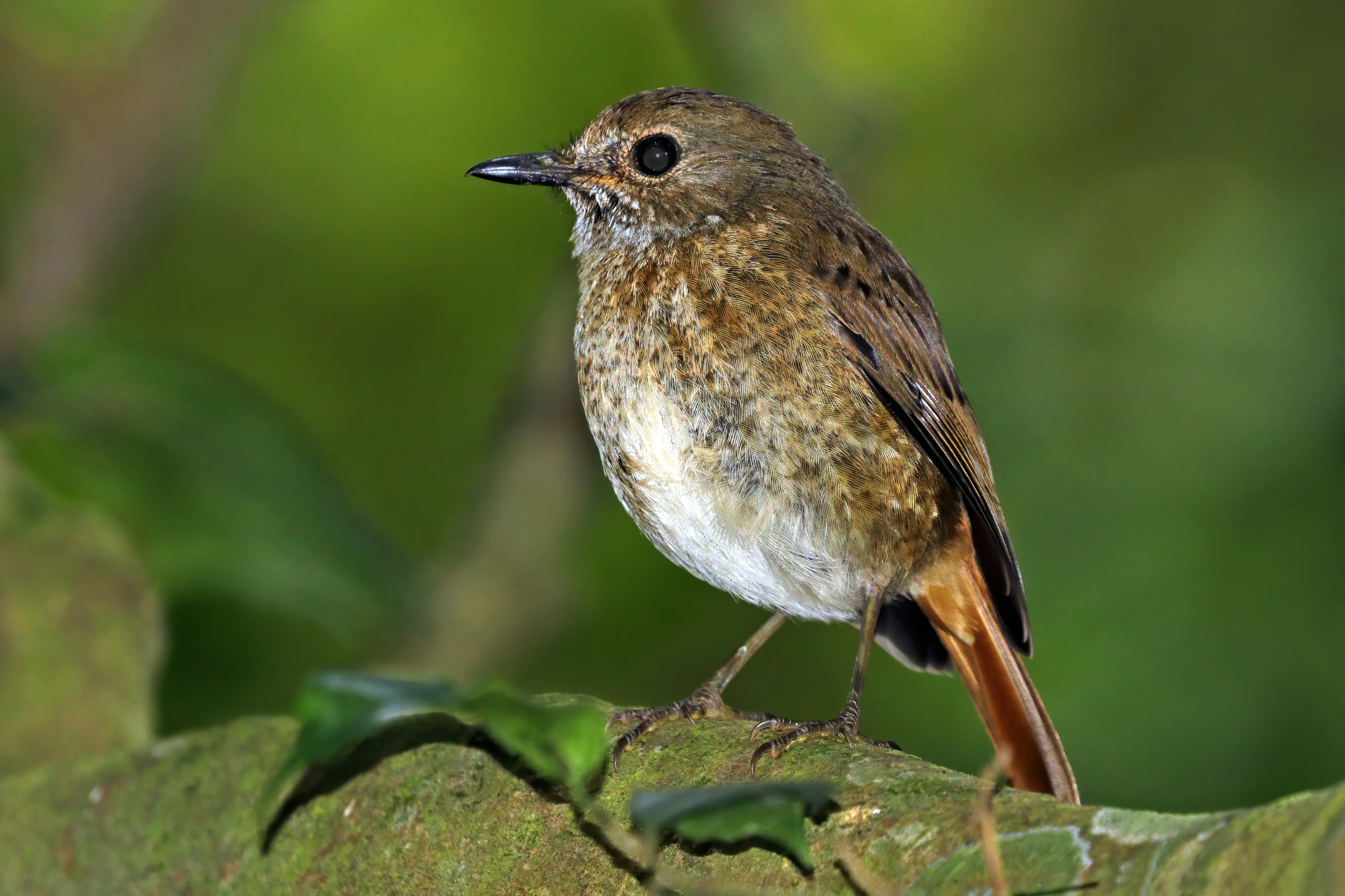
Birdlife is equally significant, with around seventy-five recorded species, of which roughly thirty-five are endemic. The Amber Mountain rock thrush is especially notable because its entire global range is limited to a single area on the massif. Reptiles and amphibians are also a major highlight, including the Amber Mountain leaf chameleon, one of the smallest reptiles in the world and a species restricted to this mountain, as well as a wide variety of frogs and other reptiles that thrive in the humid forest interior.
Montagne d'Ambre National Park conservation status and protection priorities

Montagne d'Ambre plays a disproportionately important conservation role in northern Madagascar because it preserves an entire humid forest ecosystem on a volcanic island surrounded by dry, degraded, and semi-arid landscapes. Without the protected area, much of the mountain's rainforest would be exposed to similar pressures to those faced in the surrounding lowlands, threatening the many species that depend on persistent humidity and closed-canopy forest.

The park is significant for the protection of endemic and micro-endemic species, including lemurs, birds, reptiles, and amphibians whose survival depends entirely on the survival of Amber Mountain's forests. It also supports broader ecosystem services, most notably as the water catchment that supplies streams and freshwater resources to Antsiranana, demonstrating the direct link between forest conservation and human wellbeing in the region.

The presence of introduced plantations and invasive plants such as Lantana camara highlights ongoing management challenges, including the need to balance timber production, restoration, and the protection of native biodiversity. As one of Madagascar's older national parks, Montagne d'Ambre remains a cornerstone of conservation in the Diana Region.

Montagne d'Ambre National Park cultural meaning and human context

The cultural landscape around Montagne d'Ambre is shaped by the Sakalava and Antankarana peoples, who have historic ties to the lands in and around the park. These communities form part of the broader cultural mosaic of northern Madagascar and continue to live in small villages scattered along the routes leading up to the mountain.

The name of the park itself reflects a different kind of local heritage. It derives from deposits of copal, a soft form of amber found on the slopes of Mount Ambohitra, giving the area both its French and English names. Together, the indigenous communities, the mountain's resource history, and the park's role in supplying water to Antsiranana give Montagne d'Ambre a cultural identity that extends beyond its ecological importance.

Top sights and standout views in Montagne d'Ambre National Park

Montagne d'Ambre stands out for the dramatic contrast between its humid montane rainforest and the dry, semi-desert lowlands that surround it, packing an unusually wide range of habitats into a relatively small, isolated massif.

Its wildlife roster combines broad Malagasy rainforest species with highly localised endemics, particularly the Amber Mountain rock thrush and the Amber Mountain leaf chameleon. Layered on top of this are volcanic landforms, crater lakes, and waterfalls, making the park both an ecological refuge and a scenic landscape.

Best time to visit Montagne d'Ambre National Park

The dry season in northern Madagascar, generally running from around May through October, is typically the most comfortable period for experiencing Montagne d'Ambre, when rainfall is lower, trails are more accessible, and cooler, less humid conditions make exploring the forest and waterfalls more pleasant. This period is also favoured for wildlife observation, when animals are often more active along forest edges and around water sources.

The wetter months bring heavy rainfall that feeds the park's streams, waterfalls, and crater lakes, intensifying the forest's lushness and supporting amphibians and reptiles that thrive in humid conditions. While travel can be more challenging during peak rains, the wet season showcases the mountain at its greenest and most dramatic.
Monthly climate preview

Long-term temperature and precipitation patterns across representative coordinates

Montagne d'Ambre National Park Climate Normals and Monthly Weather Records

Representative coordinate measurements reveal annual shifts in average temperature and daily precipitation at Montagne d'Ambre National Park. Comprehensive monthly normals provide deeper analytical context for long-term climate variations across the protected landscape.
Annual mean25 °C
23 °C27 °C
Jan26°
Feb26°
Mar26°
Apr26°
May25°
Jun24°
Jul23°
Aug23°
Sep24°
Oct25°
Nov26°
Dec27°
Warmest month
December

26.7 °C

Coolest month
July

22.8 °C

Wettest month
January

8.1 mm/day

Driest month
September

0.5 mm/day

Park location guide

Geography guide, regional context, and park location map for Montagne d'Ambre National Park

Montagne d'Ambre National Park park geography, regions, and map view in Madagascar

Understand where Montagne d'Ambre National Park sits in Madagascar through a broader geographic reading of the surrounding landscape, nearby location context, and its mapped position within the national park landscape.

How Montagne d'Ambre National Park fits into Madagascar

Madagascar is an island nation in the Indian Ocean, positioned off the southeastern coast of Africa. As the world's fourth-largest island and second-largest island country, it stands out for its exceptional biodiversity, over 90% of its wildlife is endemic, making it one of 17 megadiverse countries. The population is approximately 32 million, with Antananarivo as both the capital and largest city.

Wider geography shaping Montagne d'Ambre National Park in Madagascar

Madagascar lies in the Indian Ocean off the southeastern coast of Africa, separated from the mainland by the Mozambique Channel. The island is situated approximately 400 km from the African continent. As the world's fourth-largest island, it also includes numerous smaller peripheral islands.

Map view of Montagne d'Ambre National Park

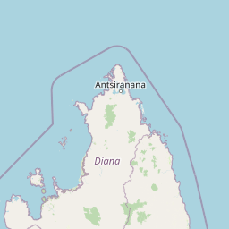
Use this park location map to pinpoint Montagne d'Ambre National Park in Madagascar, understand its exact geographic position, and read its mapped placement within the surrounding landscape more clearly.

Pigeon | © OpenStreetMap contributors

Location context for Montagne d'Ambre National Park

Diana Region
Park atlas

Compare surrounding regional geography and connected protected landscapes

Other Parks and Protected Areas Near Montagne d'Ambre National Park

Browse nearby national parks and protected areas to compare the volcanic terrain, humid rainforests, and arid lowlands of northern Madagascar. Expanding the geographic scope reveals how isolated ecological zones and regional watersheds connect across the surrounding landscape.
National parkMadagascar
Mapped park locations coincide#1 closest

Montagne d'Ambre National Park: Mapped Volcanic Massif and Rainforest Boundaries in Madagascar

Protected montane landscape in the Diana Region of northern Madagascar

Centered around the prominent Mount Ambohitra, this national park showcases a distinct volcanic basaltic massif that creates a dramatic contrast with the nearby semi-desert terrain. Explore the geographic footprint of this biodiversity hotspot, featuring dense montane rainforests, numerous crater lakes, and cascading mountain waterfalls within the northern territory of Madagascar.

Nature reserveDiana Region
About 25 km away#2 closest

Southwest

Ankarana Special Reserve: A Detailed Geographic Atlas of the Diana Region's Limestone Plateau

Mapping the karst landscape, subterranean rivers, and cliff formations.

Examine the rugged topography of Ankarana Special Reserve, featuring a 25-kilometre-long cliff known as the Wall of Ankarana and 100 kilometres of mapped cave passages. This protected area offers deep insight into Madagascar's geological history and rare endemic lemur habitats within its dense, jagged tsingy ridges.

Area
182 km²
Established
1956
IUCN
IV
Relief
Upland
Wildlife reserveDiana
About 31 km away#3 closest

East

Réserve spéciale d'Analamerana: Mapped Geography and Protected Karst Ecosystems

Northern Madagascar wilderness and dry forest topography

Navigate the rugged limestone corridors and canyon networks of Réserve spéciale d'Analamerana. This protected area showcases a distinctive dry forest landscape shaped by seasonal tropical climates and serves as a critical habitat for rare endemic species within the Diana region.

Area
347 km²
Established
1956
IUCN
IV
Relief
Upland
National parkDiana Region
About 42 km away#4 closest

North

Nosy Hara National Park: Mapped Protected Landscape and Regional Geographic Context

Atlas exploration of national park boundaries and natural terrain.

Nosy Hara National Park is a designated national park situated within the Diana Region of Madagascar. This entry provides detailed geographic information, focusing on the park's mapped boundaries and its role as a protected landscape. Explore the unique regional geography and understand how this protected area contributes to the broader atlas of natural landscapes.

Area
2.7 km²
Relief
Lowland
Climate
Tropical
Access
Access unknown
National parkMadagascar
About 127 km away#5 closest

Southwest

Lokobe National Park: Madagascar's Protected Natural Landscape and Geographic Context

Explore mapped boundaries and regional park geography.

Lokobe National Park is a protected national park situated within Madagascar, an island country recognized globally for its exceptional biodiversity and unique ecosystems. This page offers a detailed, atlas-oriented perspective on Lokobe National Park, focusing on its designation as a protected area, its specific geographic location, and the natural landscape features that define its territory. Users can explore the park's mapped boundaries and understand its contribution to Madagascar's remarkable natural heritage.

Area
15.23 km²
Established
1927
IUCN
II
Climate
Tropical
National parkMadagascar
About 140 km away#6 closest

Southwest

Nosy Tanikely National Park: Madagascar National Park & Protected Landscape Identity

Mapped geography and regional park context in Madagascar.

Nosy Tanikely National Park is a designated national park in Madagascar, offering a focused entry point for understanding protected land geography. As a key entity within the island's conservation landscape, it provides valuable context for exploring mapped park boundaries and regional geographic features. Discover how this protected area contributes to the broader atlas of Madagascar's natural heritage.

Area
3.41 km²
Established
2011
Relief
Lowland
Climate
Tropical
Nature reserveDiana
About 155 km away#7 closest

South

Réserve naturelle intégrale de Tsaratanana: Highland Massif and Protected Mountain Terrain

High-altitude geography in the Diana region of northern Madagascar

Spanning tens of thousands of hectares, the Réserve naturelle intégrale de Tsaratanana protects the highest mountain terrain in Madagascar. The landscape is defined by the crystalline Vohibory massif, creating a complex topography of deep valleys and dramatic elevation gradients that support endemic primate habitats and montane forest ecosystems.

Area
486.22 km²
Established
1927
IUCN
Ia
Wildlife reserveDiana
About 180 km away#8 closest

Southwest

Manongarivo Special Reserve: Protected Wildlife and River Landscapes in Northern Madagascar

Examining the humid forest terrain and geographic boundaries of the Diana region

Located in the Diana region, Manongarivo Special Reserve serves as a critical protected area within the northern humid rainforest system of Madagascar. The territory is defined by steep forested hills, narrow river valleys, and diverse ecological niches. By analyzing its specific topographic markers and river systems, this entry details the natural landscape and protected status of this significant biodiversity reserve.

Area
327.35 km²
Established
1956
IUCN
IV
Climate
Tropical

Common questions about visiting, size, designation, and location context for Montagne d'Ambre National Park

Montagne d'Ambre National Park FAQs for park facts, access, geography, and protected area context

Find quick answers about Montagne d'Ambre National Park, including protected-area facts, park geography, trail and visitor context, and how the park fits into its surrounding country and regional landscape.
MoriAtlas Explorer

Continue Your Protected Areas Search Across the Global Atlas

Deepen your exploration by continuing the structured search for national parks and protected areas worldwide. Utilize the comprehensive filtering capabilities to compare different conservation landscapes and refine your understanding of global park geography. Discover more about the distribution and characteristics of protected natural areas.

Global natural geography