Why Moriah Harbour Cay National Park stands out
Moriah Harbour Cay National Park is best known for its extensive mangrove systems that serve as productive nursery habitats for various marine species. The park provides important nesting sites for several bird species including gull-billed terns, least terns, nighthawks, oystercatchers, and plovers. A resident pair of ospreys also nests within the park boundaries. The combination of coastal mangroves, sandy shoreline, and tidal zones creates a diverse habitat that supports both terrestrial and marine wildlife.
Moriah Harbour Cay National Park history and protected-area timeline
Moriah Harbour Cay National Park was established in 2002 as a protected area within the Bahamas' national park system. In 2015, the park underwent a significant expansion that increased its total area to 16,800 acres (68 square kilometers). This expansion reflected the growing recognition of the park's ecological importance, particularly its mangrove systems and the wildlife they support. The Bahamas National Trust has governed the park since its establishment, maintaining the protected status of this coastal area within the Exuma district.
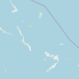
Moriah Harbour Cay National Park landscape and geographic character
The landscape of Moriah Harbour Cay National Park is characterized by coastal and marine environments typical of the Bahamas' out islands. The terrain includes sandy beaches, tidal flats, and the distinctive mangrove forests that fringe much of the shoreline in this region. The park encompasses both the terrestrial landmass of Moriah Harbour Cay and surrounding marine waters, creating a unified coastal protected area. The gentle topography of the cays and low-lying coastal areas defines the physical character of the landscape, with vegetation adapted to the saline and periodically flooded conditions of the mangrove zones.
Moriah Harbour Cay National Park ecosystems, habitats, and plant life
The nature of Moriah Harbour Cay National Park centers on its mangrove-dominated coastal ecosystems. The park's mangroves provide critical ecological functions, filtering coastal waters and offering protected nursery areas for juvenile marine organisms. The vegetation on the cay itself includes buttonwood, bay cedar, palmetto palms, and sea oats, representing typical Caribbean coastal plant communities. These plant communities support the bird species that nest within the park while the mangrove waters below sustain diverse marine life.
Moriah Harbour Cay National Park wildlife and species highlights
The wildlife of Moriah Harbour Cay National Park includes both avian and marine species that rely on the park's diverse habitats. Bird species nesting within the park include gull-billed terns, least terns, nighthawks, oystercatchers, and plovers. A resident pair of ospreys also inhabits the park, using the coastal environment for hunting and nesting. The park's mangrove systems serve as nurseries for numerous marine species including crabs, crawfish, conch, mangrove snappers, yellowtails, and groupers. This combination of bird nesting sites and marine nursery habitat makes the park ecologically significant for multiple wildlife groups.
Moriah Harbour Cay National Park conservation status and protection priorities
Moriah Harbour Cay National Park plays an important role in the conservation framework of the Bahamas. The park protects mangrove ecosystems that provide critical services including coastal protection, water filtration, and marine habitat provision. The designation of this area as a national park ensures the preservation of nesting sites for several bird species and maintains nursery habitat for commercially and ecologically important marine species. The Bahamas National Trust manages the park as part of a broader network of protected areas aimed at conserving the biodiversity of the Bahamian archipelago.
Moriah Harbour Cay National Park cultural meaning and human context
Moriah Harbour Cay National Park is located within the Exuma district, an area with a long history of human settlement and maritime activity in the Bahamas. The park's name references Moriah Harbour, indicating the historical significance of this coastal area to local communities. While the Wikipedia source does not provide extensive detail on cultural history, the protected area exists within a context of traditional fishing and maritime use that continues in surrounding areas of Exuma.
Top sights and standout views in Moriah Harbour Cay National Park
The highlights of Moriah Harbour Cay National Park include its extensive mangrove systems that support diverse marine life, its role as a nesting ground for multiple bird species including terns, oystercatchers, and ospreys, and its protected marine waters that serve as nurseries for fish and shellfish species. The park's expansion in 2015 demonstrates its conservation significance within the Bahamas' protected areas network.
Best time to visit Moriah Harbour Cay National Park
The best time to visit Moriah Harbour Cay National Park would generally align with the Bahamian dry season, which typically runs from late autumn through spring. This period offers more predictable weather conditions for exploring the outdoor environments of the park. However, specific seasonal guidance is not provided in the available source material, and visitors should consult current local information for planning purposes.