
Mori Atlas logo
Protected areaMount Sneffels Wilderness

Discover the high-altitude alpine ridges, glacial cirques, and dramatic vertical terrain of this iconic wilderness area.

Mount Sneffels Wilderness: A Landmark Protected Landscape within the Colorado San Juan Mountains

Mount Sneffels Wilderness represents a core block of federally protected backcountry in southwestern Colorado, defined by its steep granite faces and alpine tundra above the Uncompahgre National Forest. This high-country landscape centers on the iconic Mount Sneffels, showcasing a rugged transition from lush subalpine forests to jagged ridgelines. The wilderness offers deep insight into the geological character of the San Juan Mountains through its glacial basins and complex mountain topography.

alpine wildernessSan Juan Mountainsfourteenerhigh-countrysubalpine forestalpine tundra
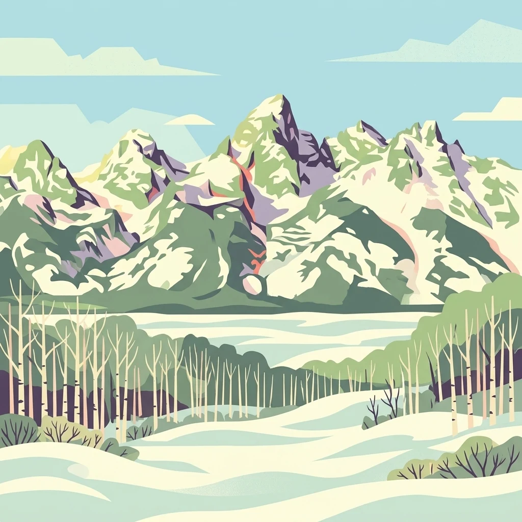
A stylized vector illustration of a jagged, snow-covered mountain range behind a foreground forest of leafless white trees and snowy ground.

Mount Sneffels Wilderness

Protected area

Park overview

Structured park overview, official facts, and landscape profile for Mount Sneffels Wilderness

Mount Sneffels Wilderness park facts, protected area profile, and essential visitor context

Review the core facts for Mount Sneffels Wilderness, including designation, size, terrain, visitor scale, habitats, and operating context in one park-focused overview.

About Mount Sneffels Wilderness

Mount Sneffels Wilderness preserves a representative slice of high-elevation terrain in the San Juan Mountains, one of the great mountain ranges of the southern Rockies. The wilderness lies within the broader Uncompahgre National Forest, where it functions as a core protected zone that buffers some of the range's most distinctive peaks, basins, and ridgelines from logging, road building, and mechanized use. Although relatively modest in size compared with neighboring wilderness areas, it captures an exceptional variety of elevation, geology, and habitat within its boundaries.

The defining geographic feature of the wilderness is the Sneffels subrange, anchored by Mount Sneffels, a fourteener long associated with Colorado mountaineering culture and often cited as a classic San Juan climb. Around this central peak, a constellation of summits, cirques, and ridgelines forms a tightly packed high-alpine landscape that has remained largely undisturbed since wilderness designation.

On a broader level, the Mount Sneffels Wilderness contributes to the ecological and scenic integrity of the San Juan region, complementing nearby protected areas and helping sustain habitat connectivity across a substantial block of the southern Rockies. Its accessible location near the mountain communities of Ouray and Ridgway also makes it an influential reference point for how wilderness landscapes connect to Colorado's broader outdoor recreation and conservation heritage.

Quick facts and research context for Mount Sneffels Wilderness

Mount Sneffels Wilderness is a designated U.S. Wilderness Area covering roughly 16,566 acres across Ouray and San Miguel counties in southwest Colorado. Managed by the U.S. Forest Service as part of the Uncompahgre National Forest, it was established on January 1, 1980 and is classified as an IUCN Category Ib protected landscape, reflecting its emphasis on preserving unmodified natural conditions.

The wilderness is dominated by Mount Sneffels, one of Colorado's most recognizable fourteeners at 14,150 feet, along with a cluster of neighboring high peaks in the Sneffels subrange of the San Juan Mountains. It lies a short distance west of the town of Ouray, a well-known base for alpine recreation in the region.

Protection and recognition

Terrestrial protected area management scope and records

Mount Sneffels Wilderness Protection Status and Recognition Data

Mount Sneffels Wilderness holds a documented terrestrial protection status with structured management parameters and designation records. Visitors and researchers can review verified conservation metrics and international recognition parameters associated with this protected landscape.

Protection details

Protection scope
Terrestrial
Transboundary protection
No
Park context

Deeper park guide and search-rich context for Mount Sneffels Wilderness

Mount Sneffels Wilderness history, landscape, wildlife, and travel context

Explore Mount Sneffels Wilderness through its history, landscape character, ecosystems, wildlife, conservation priorities, cultural context, and seasonal travel timing in a structured park guide built for atlas discovery and search intent.

Why Mount Sneffels Wilderness stands out

Mount Sneffels Wilderness is best known for the towering presence of Mount Sneffels itself, frequently described as one of the most photogenic fourteeners in Colorado, whose steep face and pyramidal profile loom over the surrounding high country. The wilderness protects a dense concentration of high San Juan peaks, making it a signature destination for climbers, hikers, and photographers drawn to alpine ridgelines above and below tree line. The area is equally prized for its transitional scenery, where dense conifer forests and subalpine meadows give way to exposed granite, scree slopes, and broad alpine basins. The combination of accessible roadside trailheads near Ouray with deeply rugged interior terrain has helped establish the Sneffels area as a defining landscape of the Uncompahgre high country.

A wide panoramic landscape showing a snow-covered valley in the foreground with a jagged, snow-capped mountain range in the distance under a blue sky with scattered clouds.
Panoramic view of the snow-covered Sneffels Range in the San Juan Mountains.

Mount Sneffels Wilderness history and protected-area timeline

Mount Sneffels Wilderness was formally designated on January 1, 1980, as part of the U.S. Wilderness Preservation System. Its establishment reflected the late-1970s push to identify and protect high-quality backcountry landscapes in Colorado's national forests, particularly within the Uncompahgre National Forest, where alpine terrain had long supported sheep grazing, mining exploration, and early mountaineering activity.

The wilderness takes its name from Mount Sneffels, a peak that was already deeply embedded in regional identity by the time of designation, often illustrated on nineteenth- and twentieth-century imagery of the San Juan region. The unusual spelling, a probable Americanization of the Old Norse Snæfell, meaning snow mountain, links the Colorado peak etymologically to Iceland's Snæfellsnes peninsula and Snæfellsjökull glacier volcano, reflecting the wanderlust of early American naming conventions.

Since designation, the wilderness has remained a protected, non-motorized landscape under U.S. Forest Service administration, allowing its alpine ecosystems, trails, and route networks to evolve with minimal human infrastructure development.

Mount Sneffels Wilderness landscape and geographic character

The landscape of Mount Sneffels Wilderness is dominated by high-alpine terrain typical of the eastern San Juan Mountains. Glacier-carved cirques, sharp ridgelines, broad U-shaped valleys, and exposed rocky faces define the upper elevations, while lower slopes transition through dense bands of subalpine forest into mixed montane woodlands.

Mount Sneffels itself, rising to 14,150 feet, gives the wilderness its vertical signature, with steep cliff bands and prominent flanks that drop toward the surrounding basins. Around the central peak, a series of companion summits forms a tightly clustered high country that includes extensive talus fields, persistent snowfields in shaded pockets, and narrow ridgelines connecting isolated peaks.

Below tree line, the terrain is shaped by conifer forest, rolling subalpine meadows, and the deepening canyons that drain toward the Uncompahgre River corridor. The result is a compact but varied landscape, where the visual drama of high San Juan peaks is paired with quieter forested terrain and the characteristic ruggedness of southwestern Colorado.

Mount Sneffels Wilderness ecosystems, habitats, and plant life

The ecosystems of Mount Sneffels Wilderness span a full Rocky Mountain elevational gradient, from montane forest up through subalpine woodland to expansive alpine tundra. This compressed range of habitats is one of the defining ecological qualities of the area, allowing relatively distinct plant communities to exist in close proximity to one another.

Dense stands of spruce, fir, and pine dominate the forested slopes, with characteristic subalpine tree island patterns giving way to open alpine terrain near the upper ridgelines. Wildflower-rich meadows and wet basins occur where snowmelt gathers, particularly in the lower portions of glacial valleys, while exposed alpine zones above tree line support hardy grasses, cushion plants, and other tundra-adapted vegetation.

The wilderness's elevation, terrain, and protected status combine to sustain habitat conditions favorable to wildlife species that depend on remote, undisturbed high-country environments. The mosaic of forest, meadow, talus, and snowfield habitats makes the area ecologically rich despite its relatively compact footprint.

Mount Sneffels Wilderness wildlife and species highlights

Mount Sneffels Wilderness supports wildlife communities typical of Colorado's high San Juan ecosystems, where dense conifer forests and open alpine terrain meet along sharp ecological boundaries. Large ungulates such as elk and mule deer use the forested slopes and meadows throughout much of the year, with seasonal movements between summer alpine habitat and lower winter range.

Predators and scavengers associated with Colorado's southern Rocky Mountains, including black bears and mountain lions, are part of the wilderness's broader ecological character, while raptors such as hawks and other soaring birds are regularly observed along the high ridges and cliffs of the Sneffels subrange. Pikas and marmots occupy the rocky alpine zones, and small mammals more broadly shape the predator-prey balance across the area.

Mount Sneffels Wilderness conservation status and protection priorities

The protected status of Mount Sneffels Wilderness is its core conservation contribution. Designation under the U.S. Wilderness Preservation System restricts road building, mechanized use, and commercial development, preserving the area's largely unmodified character in a region otherwise influenced by mining, grazing, and motorized recreation.

The wilderness safeguards an important block of high San Juan habitat, including alpine tundra, subalpine forest, and the elevational transitions between them. These habitats are particularly sensitive to disturbance, and the wilderness designation helps maintain ecological processes such as predator-prey dynamics, seasonal wildlife migrations, and the slow recovery trajectories of high-elevation vegetation.

At a regional scale, Mount Sneffels Wilderness complements nearby public lands in the Uncompahgre National Forest and across the San Juan Mountains, contributing to a broader landscape of connected and partially protected land that supports long-term ecological integrity in southwest Colorado.

Mount Sneffels Wilderness cultural meaning and human context

The Mount Sneffels Wilderness is closely tied to the cultural identity of the surrounding mountain communities, especially the historic town of Ouray, often called the Switzerland of America. Outdoor recreation, mountaineering tradition, and a strong local sense of place are tightly bound to the surrounding peaks, including Mount Sneffels.

The unusual name Sneffels itself carries cultural meaning: it appears to be an Americanized form of the Old Norse Snæfell, meaning snow mountain, and has historically been linked to Iceland's Snæfellsnes peninsula and Snæfellsjökull glacier. This etymology reflects the broader nineteenth-century American practice of borrowing evocative place names from distant languages, and it gives the wilderness a distinctive onomastic identity that continues to invite curiosity.

Top sights and standout views in Mount Sneffels Wilderness

Among the standout features of Mount Sneffels Wilderness are the unmistakable silhouette of Mount Sneffels itself, the tightly packed high peaks of the Sneffels subrange, and the visual transition between subalpine forest and alpine tundra within a short distance of the trail corridor.

The wilderness also stands out for its accessible location near Ouray, which allows visitors to move quickly from a historic mountain town into rugged backcountry terrain. Combined with its compact but dramatic elevation range, these qualities make the area one of the most recognizable wilderness landscapes of the Uncompahgre National Forest.

Best time to visit Mount Sneffels Wilderness

Summer and early autumn are the most workable windows for visiting Mount Sneffels Wilderness, when snow has largely receded from most trails and high routes, wildflower meadows are at their peak, and the alpine terrain is most safely accessible. Outside this season, deep snow, lingering winter hazards, and high avalanche risk in the steep Sneffels drainage can make backcountry travel difficult and at times dangerous.

Seasonal variation strongly shapes character of any visit: late summer brings the warmest conditions and the most reliable trail access, while early autumn offers cooler temperatures, larch color in subalpine basins, and a quieter atmosphere before winter settles across the San Juan high country. Winter visitors, in turn, encounter a deeply transformed alpine landscape dominated by snow, frozen basins, and dramatic low-angle sunlight on the surrounding peaks.
Monthly climate preview

Long-term representative temperature and precipitation patterns across twelve recorded months

Mount Sneffels Wilderness Climate Normals and Monthly Weather Statistics

Historical data recorded at a representative coordinate highlights a measured range of average monthly temperatures alongside consistent daily precipitation patterns. Analyzing the complete twelve-month record clarifies long-term climate normals and regional weather variation across the protected landscape.
Annual mean4 °C
-7 °C18 °C
Jan-7°
Feb-6°
Mar-1°
Apr
May
Jun14°
Jul18°
Aug16°
Sep12°
Oct
Nov-1°
Dec-6°
Warmest month
July

17.5 °C

Coolest month
January

-7 °C

Wettest month
August

1.8 mm/day

Driest month
June

0.7 mm/day

Park location guide

Geography guide, regional context, and park location map for Mount Sneffels Wilderness

Mount Sneffels Wilderness park geography, regions, and map view in United States of America

Understand where Mount Sneffels Wilderness sits in United States of America through a broader geographic reading of the surrounding landscape, nearby location context, and its mapped position within the national park landscape.

How Mount Sneffels Wilderness fits into United States of America

The United States of America is a federal presidential republic and one of the world's largest countries by area and population. It consists of 50 states across a vast territory spanning multiple time zones, with its capital in Washington, D.C. and largest city in New York City. The nation has a diverse economy, influential political system, and significant cultural and military presence globally.

Wider geography shaping Mount Sneffels Wilderness in United States of America

The United States occupies a vast territory in North America, bordered by Canada to the north and Mexico to the south. The 48 contiguous states stretch from the Atlantic to the Pacific Ocean, while Alaska occupies the northwestern region and Hawaii is an archipelago in the Pacific. The country encompasses diverse terrain including the Rocky Mountains, Appalachian Mountains, Great Plains, and extensive river systems.

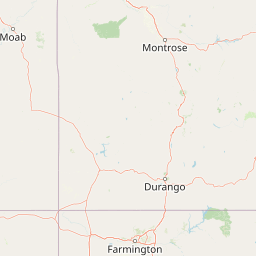
Map view of Mount Sneffels Wilderness

Use this park location map to pinpoint Mount Sneffels Wilderness in United States of America, understand its exact geographic position, and read its mapped placement within the surrounding landscape more clearly.

Pigeon | © OpenStreetMap contributors

Location context for Mount Sneffels Wilderness

Colorado
Recorded earthquake history

Review Recorded Earthquake History for Mount Sneffels Wilderness

Consult the historical catalogue of seismic activity associated with the geography of Mount Sneffels Wilderness. This MoriAtlas dataset organizes recorded earthquake events to help you trace regional seismic patterns through verified geographic data.

Mount Sneffels Wilderness Earthquake History

Catalogued events

5 events

Strongest magnitude

Magnitude 4.4

Most recent event

Mar 10, 2023

This history includes earthquakes recorded inside the park or within 50 km of its borders

Visual reference of alpine tundra, glacial cirques, and protected mountain habitats in Colorado.

Mount Sneffels Wilderness Photos and Scenery: High Alpine Landscapes of the San Juan Mountains

Visual documentation reveals the rugged high country, steep rocky ridges, and transitional forest environments defining Mount Sneffels Wilderness. Photographic collections capture the dramatic vertical relief, alpine basins, and protected terrain characterizing the San Juan Mountains.

A wide panoramic landscape showing a snow-covered valley in the foreground with a jagged, snow-capped mountain range in the distance under a blue sky with scattered clouds.

A wide view of the snow-capped, jagged peak of Mount Sneffels rising above a snow-covered field and a treeline in the San Juan Mountains.

Park atlas

Compare nearby alpine landscapes and connected high-country protected areas across the region.

Other Parks Near Mount Sneffels Wilderness and Surrounding Mountain Protected Areas

Browsing parks near Mount Sneffels Wilderness reveals matching high-elevation terrain and rugged mountain reserves throughout the surrounding region. Extending the geographic comparison helps trace broader protected-landscape patterns across the southern Rocky Mountain range.
Protected landscapeColorado
About 1.4 km away#1 closest

Southeast

Uncompahgre National Forest: Protected Landscapes and Geographic Features in Colorado

Mapping the arid plateau and high-country San Juan wilderness zones.

Uncompahgre National Forest represents a vast protected area in the American West, spanning iconic landscapes from the dry, pinyon-juniper covered Uncompahgre Plateau to the dramatic, jagged ridges of the northern San Juan Mountains. This atlas entry provides essential context on its alpine wilderness designations, high-country topography, and the unique geological transitions that define its status as a critical Colorado resource for regional landscape analysis.

Area
3,865.68 km²
Established
1905
Relief
Mountain
Climate
Alpine
Wildlife reserveColorado
10 km away#2 closest

Southwest

Lizard Head Wilderness: Mapping the San Juan Mountains Protected Alpine Terrain

High elevation geography and volcanic wilderness in Colorado

Lizard Head Wilderness is a federally protected area in southwestern Colorado characterized by steep ridgelines, dramatic volcanic geology, and alpine basins. It protects a rugged mountain landscape featuring the iconic Lizard Head spire and a cluster of high-elevation peaks including Mount Wilson, El Diente Peak, and Wilson Peak. The area offers a significant study in remote high-mountain geography and watershed protection within the San Juan range.

Area
167.17 km²
Established
1980
IUCN
Ib
Relief
Mountain
Protected landscapeColorado
11 km away#3 closest

South

San Juan National Forest: Geographic Overview of a Major Southern Colorado Protected Landscape

Mapped terrain across the Southern San Juan Mountains

San Juan National Forest represents a massive protected landscape in western Colorado, defined by its rugged alpine peaks, dense conifer forests, and glacial valleys. This atlas entry details the forest boundary, its position along the Continental Divide, and the surrounding transition into the Colorado Plateau. It provides a structured look at the terrain that connects diverse ecosystems, from high-altitude tundra to expansive mesa country, within one of the largest national forests in the American West.

Area
7,603.42 km²
Established
1905
Relief
Mountain
Climate
Alpine
Watercolor painting of soft, layered mountain ranges behind green hills and patches of evergreen trees on a white background.
Protected landscapeColorado
30 km away#4 closest

East

Rio Grande National Forest: Atlas and Geographic Profile of a Southern Colorado Landscape

Watershed geography and Continental Divide terrain analysis.

Rio Grande National Forest represents an immense protected landscape encompassing diverse terrain from high desert steppe to rugged alpine peaks. This profile details the forest's hydrological significance as the source of the Rio Grande and its role as a massive ecological transition zone in the Mountain West. Examine the boundaries and mountain geography that define this critical protected area.

Area
7,500 km²
Established
1908
Relief
Mountain
Climate
Boreal
A horizontal watercolor painting depicting soft green rolling hills and distant mountains under a white sky.
Wildlife reserveColorado
47 km away#5 closest

East

Powderhorn Wilderness: A High-Elevation Protected Landscape in the San Juan Mountains

Basaltic plateaus and vast alpine tundra in Colorado

Powderhorn Wilderness protects a distinct highland environment in southwestern Colorado. Characterized by dark basaltic caprocks and deep glacial cirques, this area serves as a critical headwaters system for the Gunnison River, supporting a complex transition from sagebrush steppe to subalpine forest and wind-swept tundra. The geography remains largely defined by its volcanic heritage and the primitive character of its remote plateau summits.

Area
251.1 km²
Established
1993
IUCN
Ib
Relief
Mountain
A pale watercolor painting showing a panoramic view of mountain ranges in the background, a coniferous forest on a small hill, and a meadow with wildflowers in the foreground.
Wildlife reserveColorado
54 km away#6 closest

East

La Garita Wilderness: Exploring the High Alpine Geography of Southern Colorado

Volcanic terrain and protected mountain wilderness atlas

La Garita Wilderness serves as a primary example of protected high-alpine geography in southern Colorado. This atlas entry examines the undulating volcanic ridges, glacial cirques, and alpine basins that define the area, including the prominent peak of San Luis. It highlights the integration of significant trail systems within this protected landscape, offering a clear perspective on the physical geography and conservation value of the La Garita mountain range.

Area
524.58 km²
Established
1964
IUCN
Ib
Relief
Mountain
National parkMontrose County
54 km away#7 closest

North

Black Canyon of the Gunnison National Park: Protected Area Geography and Mapped Landscape

Explore the natural terrain and protected boundaries in Montrose County.

Black Canyon of the Gunnison National Park is a national park defined by its profound geological features and its status as a protected landscape. Located within Montrose County, it offers a distinct geographic profile for atlas-based exploration. Users can understand the park's mapped boundaries, its relation to the surrounding regional geography, and the unique natural terrain that defines this protected area, contributing to a structured discovery of its natural landscape identity.

Area
124.4 km²
Established
1999
IUCN
II
Visitors
357.1K annual
A minimalist watercolor illustration showing soft green hills, purple mountains in the background, and a reflective water body in the foreground.
Protected areaColorado
About 65 km away#8 closest

Northeast

Curecanti National Recreation Area: Mapped Geography and Protected Landscapes of Western Colorado

River-based recreation and volcanic canyon terrain

Curecanti National Recreation Area stretches across Gunnison and Montrose counties, serving as a primary water-based protected landscape in Colorado. The area preserves the geologic transitions from the broad expanse of Blue Mesa Reservoir to the granite-walled canyons of Morrow Point and Crystal, offering a deep look into the regional geography and historical infrastructure of the Gunnison basin.

Area
174.4 km²
Established
1965
Visitors
807.1K annual
Relief
Mountain

Common questions about visiting, size, designation, and location context for Mount Sneffels Wilderness

Mount Sneffels Wilderness FAQs for park facts, access, geography, and protected area context

Find quick answers about Mount Sneffels Wilderness, including protected-area facts, park geography, trail and visitor context, and how the park fits into its surrounding country and regional landscape.
MoriAtlas Explorer

Continue Your Protected Areas Search Across the Global Atlas

Deepen your exploration by continuing the structured search for national parks and protected areas worldwide. Utilize the comprehensive filtering capabilities to compare different conservation landscapes and refine your understanding of global park geography. Discover more about the distribution and characteristics of protected natural areas.

Global natural geography