
Mori Atlas logo
Protected landscapeUncompahgre National Forest

A detailed atlas of transitions between the Uncompahgre Plateau and the San Juan mountain peaks.

Uncompahgre National Forest: Mapped Geography and Protected Landscapes of the Colorado Rockies

Uncompahgre National Forest encompasses nearly one million acres of western Colorado, defining a sharp geographic contrast between the arid, mesa-like Uncompahgre Plateau and the glacially carved, high-elevation terrain of the northern San Juan Mountains. This protected landscape contains three distinct wilderness areas, including Mount Sneffels and Lizard Head, which preserve alpine tundra, exposed rock, and remote backcountry cirques. The area remains a primary subject for understanding Rocky Mountain topography, geological features, and the ecological shifts between desert-like highlands and dense alpine systems.

national forestalpine wildernessSan Juan MountainsUncompahgre PlateauRocky Mountainsscenic byway
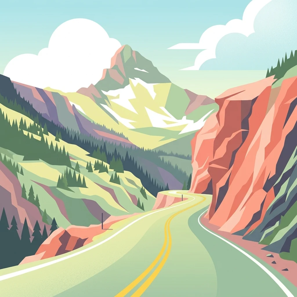
A graphic illustration of a winding road leading toward a snow capped mountain peak between canyon walls and coniferous forests.

Uncompahgre National Forest

Protected landscape

Park overview

Structured park overview, official facts, and landscape profile for Uncompahgre National Forest

Uncompahgre National Forest park facts, protected area profile, and essential visitor context

Review the core facts for Uncompahgre National Forest, including designation, size, terrain, visitor scale, habitats, and operating context in one park-focused overview.

About Uncompahgre National Forest

Uncompahgre National Forest occupies a significant portion of western Colorado, extending across eight counties with Montrose County holding the largest portion of the forest's acreage. The forest's geography is defined by two major and contrasting landscapes: the flat-topped, arid Uncompahgre Plateau to the west and the jagged, snowcapped peaks of the northern San Juan Mountains to the south. This juxtaposition of high desert mesas and alpine summits gives the forest an unusually wide range of ecosystems, vegetation types, and climate zones within a single protected area.

The forest was established on June 14, 1905, as part of the early wave of national forest designations in the American West. For decades it was administered separately from neighboring forests, but in 1954 Grand Mesa and Uncompahgre began joint administration, with Gunnison National Forest joining the consolidated unit in 1973. Today the three forests share a single Forest Supervisor's Office in Delta, Colorado, with local ranger district offices in Montrose, Gunnison, and Norwood.

Recreation is a central part of the forest's identity. The combination of varied climate, sparse population, and abundant sunshine has made it especially popular for scenic driving, jeep and ATV touring, sightseeking, and backcountry hiking. The Million Dollar Highway along the Uncompahgre Gorge near Ouray is among the most celebrated scenic drives in the United States. Other attractions include Trout Lake and Bridal Veil Falls near Telluride. Paved scenic byways within and around the forest include the San Juan Skyway, the Alpine Loop, and the Unaweep-Tabeguache Scenic and Historic Byway, while gravel roads like Owl Creek Pass offer more remote alternatives. Many of the forest's dirt roads trace their origins to the 1800s mining era, when prospectors crisscrossed the mountains in search of silver and gold.

In 2024, the Grand Mesa, Uncompahgre and Gunnison National Forests acquired the West Gold Hill Dinosaur Tracksite near Ouray, a paleontological site containing 134 fossilized footprints of a Late Jurassic sauropod, including the world's only known example of a 270-degree looped turn in a dinosaur trackway. This acquisition reflects a broader mandate of national forest stewardship that extends beyond scenery and recreation into the protection of significant natural and scientific heritage.

Quick facts and research context for Uncompahgre National Forest

Uncompahgre National Forest is located in western Colorado and spans eight counties, with Montrose County holding the largest share. Its headquarters are in Delta, Colorado, and the forest was established on June 14, 1905, making it over a century old as a federally protected landscape.

The forest is managed by the U.S. Forest Service and administered jointly with Grand Mesa and Gunnison National Forests from a shared Forest Supervisor's Office. It contains three alpine wilderness areas totaling significant backcountry terrain, and borders San Juan National Forest to the south. Key scenic byways such as the Million Dollar Highway, San Juan Skyway, Alpine Loop, and Unaweep-Tabeguache Byway traverse or border its boundaries.

Protection and recognition

Documented terrestrial protection scope, designation metrics, and recognition records

Uncompahgre National Forest Protection Status and International Recognition Data

Uncompahgre National Forest holds recorded terrestrial protection status within official conservation databases. Structured records assemble verified management parameters and designated recognition context.

Protection details

Protection scope
Terrestrial
Transboundary protection
No
WDPA ID
2249938
Park context

Deeper park guide and search-rich context for Uncompahgre National Forest

Uncompahgre National Forest history, landscape, wildlife, and travel context

Explore Uncompahgre National Forest through its history, landscape character, ecosystems, wildlife, conservation priorities, cultural context, and seasonal travel timing in a structured park guide built for atlas discovery and search intent.

Why Uncompahgre National Forest stands out

Uncompahgre National Forest is best known for containing the arid Uncompahgre Plateau and the northern portion of the rugged San Juan Mountains, two distinctly different landscapes within a single administrative boundary. The forest is recognized for its three alpine wilderness areas: Uncompahgre, Mount Sneffels, and Lizard Head, which protect some of Colorado's most dramatic high-country terrain. The Million Dollar Highway, which winds along the Uncompahgre Gorge south of Ouray, is one of the most iconic scenic drives in the American West and passes through the forest. The area is also notable for its abandoned mining roads left over from the 1800s mineral rush, which now serve as recreational routes for jeeping and ATV riding.
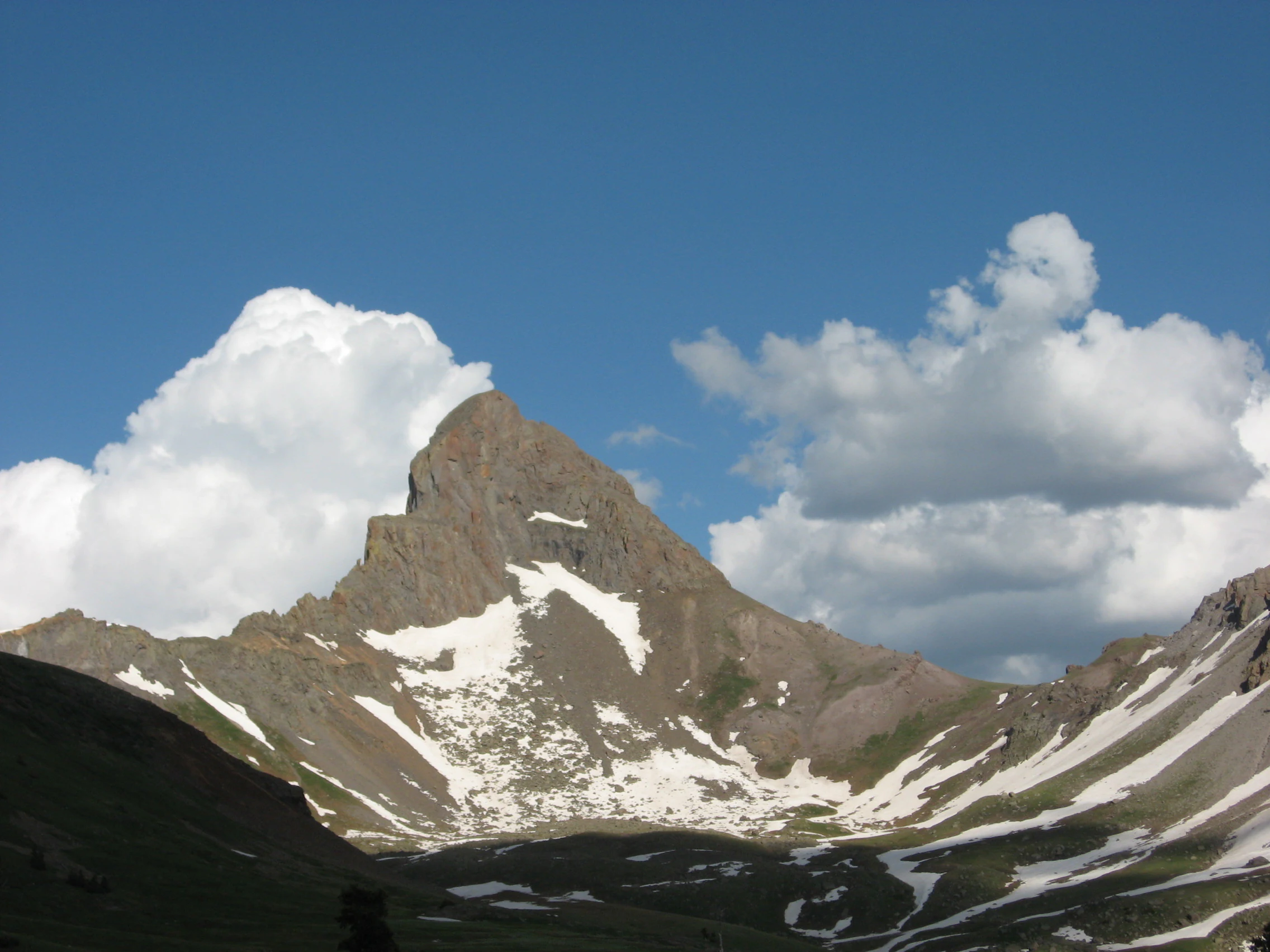
A jagged, triangular mountain peak with patches of snow on its steep slopes, set against a deep blue sky with white clouds.
Wetterhorn Peak rising above snow-dusted slopes in the San Juan Mountains.

Uncompahgre National Forest history and protected-area timeline

Uncompahgre National Forest was established on June 14, 1905, during the early era of national forest creation in the western United States. The forest's name derives from the Uncompahgre Plateau and the broader Uncompahgre Valley region, which were themselves named for the Uncompahgre people, a band of the Ute tribe historically associated with this part of Colorado.

For nearly half a century after its establishment, Uncompahgre was administered as a standalone national forest. In 1954, the U.S. Forest Service began jointly administering Uncompahgre and Grand Mesa National Forests as a single administrative unit, reflecting the practical logic of consolidating management across adjacent forest lands. In 1973, the Gunnison National Forest was added to the joint administration, creating the Grand Mesa, Uncompahgre, and Gunnison (GMUG) National Forests as they are known today. The shared Forest Supervisor's Office is located in Delta, Colorado, with local ranger district offices in Montrose, Gunnison, and Norwood.

Much of the forest's visible infrastructure, including many of its dirt roads, dates back to the mineral mining rushes of the 1800s, when prospectors traveled through the San Juan Mountains in search of silver, gold, and other ores. These historic mining roads have since been repurposed for recreational use, particularly by jeep and ATV enthusiasts, adding a layer of human history to the forest's natural and scenic character. In 2024, the forest's administration expanded its stewardship mandate with the acquisition of the West Gold Hill Dinosaur Tracksite near Ouray, a Late Jurassic sauropod trackway recognized for its unique 270-degree looping turn and its high concentration of continuous fossilized footprints.

Uncompahgre National Forest landscape and geographic character

Uncompahgre National Forest's landscape is shaped by the dramatic meeting of two major geographic features: the Uncompahgre Plateau and the northern San Juan Mountains. The Uncompahgre Plateau is a large, relatively flat-topped highland that rises above the surrounding valleys, characterized by arid conditions, pinyon-juniper woodland, sagebrush, and expansive mesa-like terrain. Its climate is notably dry, and the plateau's open vistas and remoteness contrast sharply with the mountains to its east.

The northern portion of the San Juan Mountains, which falls within the forest, presents a far different physical character. Here, the terrain is rugged and heavily dissected, with deep gorges, steep ridges, alpine cirques, and numerous peaks rising well above timberline. The Uncompahgre Gorge, carved along the route of the Million Dollar Highway south of Ouray, is one of the most dramatic features of this mountainous terrain. Peaks such as Wetterhorn Peak exemplify the sharp, glacially carved summits that define the San Juan skyline as seen from within the forest.

The forest also encompasses significant alpine wilderness areas: the Uncompahgre Wilderness, Mount Sneffels Wilderness, and Lizard Head Wilderness. These areas preserve the highest-elevation terrain, including alpine tundra, exposed rock, and remote backcountry settings. The transitions between the arid plateau and the wetter, snowier mountains occur over relatively short distances, producing a landscape of striking ecological and visual contrasts.

Uncompahgre National Forest ecosystems, habitats, and plant life

Within Uncompahgre National Forest, two broadly different ecological systems sit side by side. The Uncompahgre Plateau supports a semi-arid ecosystem typical of the Colorado Plateau's margins, dominated by pinyon pine, Utah juniper, scattered ponderosa pine, sagebrush, and native grassland communities. The dry climate, rocky soils, and elevation of the plateau produce a sparse but hardy vegetative cover adapted to limited moisture and intense sunlight.

Moving eastward and upward into the San Juan Mountains, the ecology shifts dramatically. Montane and subalpine forests of Douglas fir, aspen, Engelmann spruce, and subalpine fir clothe the slopes, giving way to alpine tundra above treeline. The moisture-catching effect of the high peaks supports denser forests, wetter meadows, and a richer understory than on the plateau. Riparian corridors along streams and around lakes like Trout Lake provide yet another ecological niche supporting aquatic species and water-dependent vegetation.

The combination of arid plateau forest and moist mountain forest within a single administrative boundary gives Uncompahgre National Forest a notable ecological range, spanning cold desert to alpine tundra, with the wilderness areas serving as anchor points for the highest-elevation and most ecologically sensitive habitat.

Uncompahgre National Forest wildlife and species highlights

The varied elevations and habitats within Uncompahgre National Forest support a correspondingly broad mix of wildlife. On the dry Uncompahgre Plateau, characteristic species include mule deer, black bears, mountain lions, coyotes, and a variety of smaller mammals adapted to semi-arid conditions, along with birds such as jays, ravens, and raptors that hunt across the open terrain.

In the forested slopes and alpine zones of the San Juan Mountains portion of the forest, wildlife communities shift to species more associated with montane and subalpine environments. Elk are a major presence in these mountain forests, particularly in the wilderness areas during summer and rutting season. Bighorn sheep inhabit some of the steeper, rockier terrain. Black bears and mountain lions continue to roam these elevations as well, alongside pine martens, red foxes, and various squirrel and chipmunk species. The alpine tundra and rock fields above treeline host marmots, pikas, and white-tailed ptarmigan in the highest elevations.

The forest's rivers, streams, and lakes also support trout and other cold-water fish, making the area significant for both aquatic ecosystems and recreational fishing. Birdlife in the mountain forests includes woodpeckers, nuthatches, grouse, and a range of songbirds and raptors, while the cliffs and gorges near Ouray provide nesting habitat for species adapted to vertical rock environments. The 2024 acquisition of the West Gold Hill Dinosaur Tracksite also adds a paleontological dimension to the forest's natural heritage, preserving fossil evidence of Late Jurassic sauropods that once traversed the region roughly 150 million years ago.

Uncompahgre National Forest conservation status and protection priorities

Uncompahgre National Forest plays a significant role in conserving the ecological diversity of western Colorado. By protecting both the arid Uncompahgre Plateau ecosystem and the northern San Juan Mountains under a single federal forest designation, it preserves a striking ecological gradient that would otherwise be subject to varying degrees of development, grazing pressure, and resource extraction.

The three designated wilderness areas within the forest; Uncompahgre, Mount Sneffels, and Lizard Head, offer the highest level of protection available within the National Forest System, shielding alpine habitats, watersheds, and wildlife corridors from mechanized use and road construction. These wilderness areas are particularly important for maintaining habitat quality for sensitive alpine species and for protecting the headwaters of regional streams.

The forest's conservation mission has expanded beyond traditional forestry and wildlife management. The 2024 acquisition of the West Gold Hill Dinosaur Tracksite near Ouray reflects a broader stewardship role that includes the protection of scientifically significant paleontological resources. The trackway contains 134 fossilized sauropod footprints from the Late Jurassic period and is recognized as the world's only known example of a 270-degree looped turn in a dinosaur trackway. By bringing this site under federal ownership and management, the GMUG National Forests have ensured its long-term protection as a unique natural and scientific treasure.

Uncompahgre National Forest cultural meaning and human context

The Uncompahgre Plateau and the surrounding valley take their name from the Uncompahgre band of the Ute people, whose historical homeland extended across much of western Colorado. This Indigenous connection remains part of the cultural geography of the region, though the National Forest itself is primarily discussed in terms of its natural and recreational identity.

The forest's cultural landscape is also deeply shaped by the mining heritage of the San Juan Mountains. The 1800s mineral rushes brought an influx of prospectors and settlers into the region, leaving behind a network of mining roads, abandoned workings, and small historic communities. Many of the dirt roads within the forest today are remnants of this era, repurposed over time from industrial routes into recreational byways for jeep and ATV touring.

Nearby towns such as Telluride, Ouray, Montrose, and Norwood contribute to the cultural setting of the forest. Telluride in particular has become both a historic mining town and a modern cultural destination, while Ouray is known for its hot springs and its Victorian-era architecture nestled within the Uncompahgre Gorge.

Top sights and standout views in Uncompahgre National Forest

Uncompahgre National Forest's most distinctive features include the dramatic juxtaposition of the arid Uncompahgre Plateau with the rugged northern San Juan Mountains, and the protection of three alpine wilderness areas that anchor its high-country terrain. The forest is traversed by some of Colorado's most celebrated scenic drives, including the Million Dollar Highway along the Uncompahgre Gorge and the San Juan Skyway.

Other standout qualities include the forest's deep mining-road network dating to the 1800s mineral rush, trout fishing opportunities at lakes such as Trout Lake, the iconic Bridal Veil Falls near Telluride, and the recently acquired West Gold Hill Dinosaur Tracksite, a globally unique Late Jurassic sauropod trackway featuring the world's only known 270-degree looping turn in a dinosaur footprint trail.

Best time to visit Uncompahgre National Forest

Uncompahgre National Forest can be enjoyed across much of the year, but the experience varies significantly with season and elevation. Summer, from roughly June through September, is the most popular time to visit, offering the best conditions for scenic driving along high-elevation byways, hiking into the wilderness areas, and accessing the higher alpine roads. The relatively dry climate and abundant sunshine that characterize the plateau and the mountain valleys make summer attractive for jeep tours, ATV riding, and outdoor recreation.

Fall brings cooler temperatures and golden aspens at mid-elevations, making the San Juan Mountains portion of the forest especially scenic for photography and sightseers. Winter transforms the higher elevations into a snowy landscape with opportunities for snowmobiling, cross-country skiing, and backcountry travel, though many of the higher roads close seasonally. Spring tends to be brief and variable, with snowmelt swelling rivers and streams and gradually reopening the higher passes and trails as conditions improve.
Monthly climate preview

Measured temperature ranges and monthly precipitation baselines for high elevation terrain

Uncompahgre National Forest Climate Normals and Annual Weather by Month

Long-term representative records track monthly average temperatures ranging from severe winter lows to mild summer highs alongside steady precipitation baselines. Detailed twelve-month climate profiles provide complete statistical context for evaluating annual weather patterns across the protected landscape.
Annual mean0 °C
-11 °C13 °C
Jan-11°
Feb-10°
Mar-6°
Apr-2°
May
Jun10°
Jul13°
Aug12°
Sep
Oct
Nov-5°
Dec-10°
Warmest month
July

13.3 °C

Coolest month
January

-11 °C

Wettest month
August

1.9 mm/day

Driest month
June

0.8 mm/day

Park location guide

Geography guide, regional context, and park location map for Uncompahgre National Forest

Uncompahgre National Forest park geography, regions, and map view in United States of America

Understand where Uncompahgre National Forest sits in United States of America through a broader geographic reading of the surrounding landscape, nearby location context, and its mapped position within the national park landscape.

How Uncompahgre National Forest fits into United States of America

The United States of America is a federal presidential republic and one of the world's largest countries by area and population. It consists of 50 states across a vast territory spanning multiple time zones, with its capital in Washington, D.C. and largest city in New York City. The nation has a diverse economy, influential political system, and significant cultural and military presence globally.

Wider geography shaping Uncompahgre National Forest in United States of America

The United States occupies a vast territory in North America, bordered by Canada to the north and Mexico to the south. The 48 contiguous states stretch from the Atlantic to the Pacific Ocean, while Alaska occupies the northwestern region and Hawaii is an archipelago in the Pacific. The country encompasses diverse terrain including the Rocky Mountains, Appalachian Mountains, Great Plains, and extensive river systems.

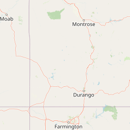
Map view of Uncompahgre National Forest

Use this park location map to pinpoint Uncompahgre National Forest in United States of America, understand its exact geographic position, and read its mapped placement within the surrounding landscape more clearly.

Pigeon | © OpenStreetMap contributors

Location context for Uncompahgre National Forest

Colorado

Visualizing high desert mesas, alpine peaks, and protected wilderness terrain.

Uncompahgre National Forest Photos and Landscape Scenery

Uncompahgre National Forest images capture the striking transition from arid plateau woodlands to rugged alpine summits across the Rocky Mountains. Examining these protected area views reveals the distinct geological features and remote habitats defining the regional landscape.

A jagged, triangular mountain peak with patches of snow on its steep slopes, set against a deep blue sky with white clouds.

A winding asphalt road with double yellow lines snakes through a steep rocky gorge with mountain slopes in the distance.

Park atlas

Compare adjacent mountain terrain, alpine wilderness, and high desert reserves across western Colorado.

Parks Near Uncompahgre National Forest and Surrounding Protected Landscapes

Browsing other protected areas near Uncompahgre National Forest reveals the broader geographic spread of the Rocky Mountains. Examining these adjacent reserves helps connect high plateau ecosystems with rugged alpine summits in regional context.
Watercolor painting of a mountain landscape with light green rolling hills in the midground and pale, soft-toned mountain peaks in the background.
Protected areaColorado
About 1.4 km away#1 closest

Northwest

Mount Sneffels Wilderness: Mapping the High Alpine Terrain of the San Juan Mountains

Protected mountain geography in southwestern Colorado

Mount Sneffels Wilderness protects a dramatic cluster of peaks in the San Juan range, characterized by glacial cirques, expansive talus fields, and sharp ridgelines. As a vital component of the Colorado backcountry, this area provides a window into high-altitude ecological transition zones, from dense conifer forests to exposed granite summits that define the character of the Uncompahgre National Forest.

Area
67.04 km²
Established
1980
IUCN
Ib
Relief
Mountain
Protected landscapeColorado
About 9.4 km away#2 closest

South

San Juan National Forest: Geographic Overview of a Major Southern Colorado Protected Landscape

Mapped terrain across the Southern San Juan Mountains

San Juan National Forest represents a massive protected landscape in western Colorado, defined by its rugged alpine peaks, dense conifer forests, and glacial valleys. This atlas entry details the forest boundary, its position along the Continental Divide, and the surrounding transition into the Colorado Plateau. It provides a structured look at the terrain that connects diverse ecosystems, from high-altitude tundra to expansive mesa country, within one of the largest national forests in the American West.

Area
7,603.42 km²
Established
1905
Relief
Mountain
Climate
Alpine
Wildlife reserveColorado
About 16 km away#3 closest

Southwest

Lizard Head Wilderness: Mapping the San Juan Mountains Protected Alpine Terrain

High elevation geography and volcanic wilderness in Colorado

Lizard Head Wilderness is a federally protected area in southwestern Colorado characterized by steep ridgelines, dramatic volcanic geology, and alpine basins. It protects a rugged mountain landscape featuring the iconic Lizard Head spire and a cluster of high-elevation peaks including Mount Wilson, El Diente Peak, and Wilson Peak. The area offers a significant study in remote high-mountain geography and watershed protection within the San Juan range.

Area
167.17 km²
Established
1980
IUCN
Ib
Relief
Mountain
Watercolor painting of soft, layered mountain ranges behind green hills and patches of evergreen trees on a white background.
Protected landscapeColorado
About 29 km away#4 closest

East

Rio Grande National Forest: Atlas and Geographic Profile of a Southern Colorado Landscape

Watershed geography and Continental Divide terrain analysis.

Rio Grande National Forest represents an immense protected landscape encompassing diverse terrain from high desert steppe to rugged alpine peaks. This profile details the forest's hydrological significance as the source of the Rio Grande and its role as a massive ecological transition zone in the Mountain West. Examine the boundaries and mountain geography that define this critical protected area.

Area
7,500 km²
Established
1908
Relief
Mountain
Climate
Boreal
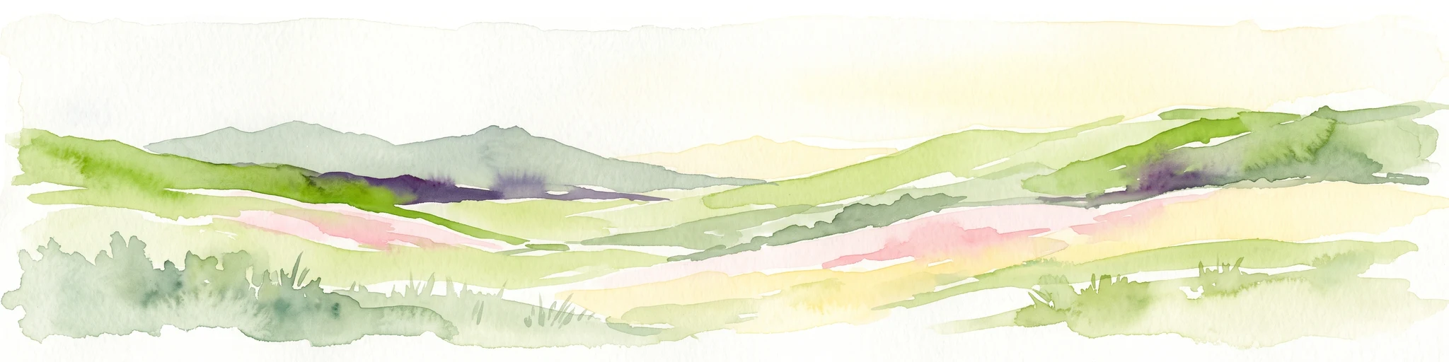
A horizontal watercolor painting depicting soft green rolling hills and distant mountains under a white sky.
Wildlife reserveColorado
About 47 km away#5 closest

East

Powderhorn Wilderness: A High-Elevation Protected Landscape in the San Juan Mountains

Basaltic plateaus and vast alpine tundra in Colorado

Powderhorn Wilderness protects a distinct highland environment in southwestern Colorado. Characterized by dark basaltic caprocks and deep glacial cirques, this area serves as a critical headwaters system for the Gunnison River, supporting a complex transition from sagebrush steppe to subalpine forest and wind-swept tundra. The geography remains largely defined by its volcanic heritage and the primitive character of its remote plateau summits.

Area
251.1 km²
Established
1993
IUCN
Ib
Relief
Mountain
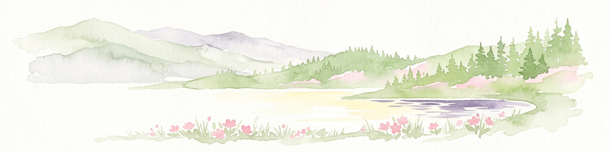
A pale watercolor painting showing a panoramic view of mountain ranges in the background, a coniferous forest on a small hill, and a meadow with wildflowers in the foreground.
Wildlife reserveColorado
About 53 km away#6 closest

East

La Garita Wilderness: Exploring the High Alpine Geography of Southern Colorado

Volcanic terrain and protected mountain wilderness atlas

La Garita Wilderness serves as a primary example of protected high-alpine geography in southern Colorado. This atlas entry examines the undulating volcanic ridges, glacial cirques, and alpine basins that define the area, including the prominent peak of San Luis. It highlights the integration of significant trail systems within this protected landscape, offering a clear perspective on the physical geography and conservation value of the La Garita mountain range.

Area
524.58 km²
Established
1964
IUCN
Ib
Relief
Mountain
National parkMontrose County
About 59 km away#7 closest

North

Black Canyon of the Gunnison National Park: Protected Area Geography and Mapped Landscape

Explore the natural terrain and protected boundaries in Montrose County.

Black Canyon of the Gunnison National Park is a national park defined by its profound geological features and its status as a protected landscape. Located within Montrose County, it offers a distinct geographic profile for atlas-based exploration. Users can understand the park's mapped boundaries, its relation to the surrounding regional geography, and the unique natural terrain that defines this protected area, contributing to a structured discovery of its natural landscape identity.

Area
124.4 km²
Established
1999
IUCN
II
Visitors
357.1K annual
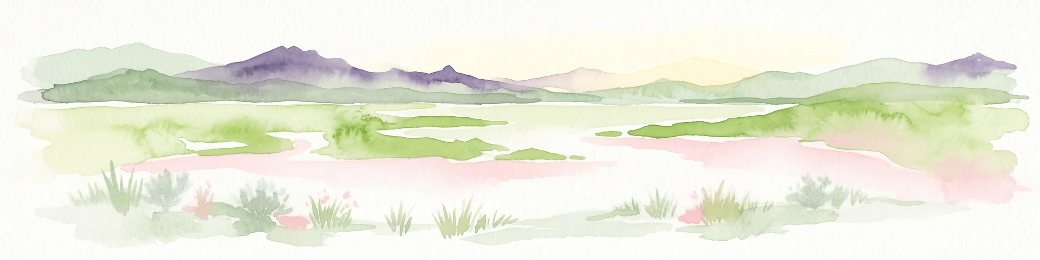
A minimalist watercolor illustration showing soft green hills, purple mountains in the background, and a reflective water body in the foreground.
Protected areaColorado
About 66 km away#8 closest

Northeast

Curecanti National Recreation Area: Mapped Geography and Protected Landscapes of Western Colorado

River-based recreation and volcanic canyon terrain

Curecanti National Recreation Area stretches across Gunnison and Montrose counties, serving as a primary water-based protected landscape in Colorado. The area preserves the geologic transitions from the broad expanse of Blue Mesa Reservoir to the granite-walled canyons of Morrow Point and Crystal, offering a deep look into the regional geography and historical infrastructure of the Gunnison basin.

Area
174.4 km²
Established
1965
Visitors
807.1K annual
Relief
Mountain

Common questions about visiting, size, designation, and location context for Uncompahgre National Forest

Uncompahgre National Forest FAQs for park facts, access, geography, and protected area context

Find quick answers about Uncompahgre National Forest, including protected-area facts, park geography, trail and visitor context, and how the park fits into its surrounding country and regional landscape.
MoriAtlas Explorer

Continue Your Protected Areas Search Across the Global Atlas

Deepen your exploration by continuing the structured search for national parks and protected areas worldwide. Utilize the comprehensive filtering capabilities to compare different conservation landscapes and refine your understanding of global park geography. Discover more about the distribution and characteristics of protected natural areas.

Global natural geography