

Mori Atlas logo
National parkNahanni National Park Reserve

Explore the protected area geography and mapped terrain of this significant Canadian national park.

Nahanni National Park Reserve National Park: Mapped Boundaries and Geographic Landscape Context

Nahanni National Park Reserve represents a key protected landscape within the Northwest Territories, offering a unique geographic identity for atlas-style exploration. This page focuses on understanding the park's specific boundaries and its place within the regional natural terrain, providing essential context for discovery without delving into visitor logistics. It serves as a dedicated entry point to explore the mapped contours and landscape features that define this important national park.

UNESCO World Heritage SiteCanadian Heritage RiverRiver CanyonsNorthern CanadaWilderness Protected AreaHot Springs

Nahanni National Park Reserve

National park

Park overview

Structured park overview, official facts, and landscape profile for Nahanni National Park Reserve

Nahanni National Park Reserve park facts, protected area profile, and essential visitor context

Review the core facts for Nahanni National Park Reserve, including designation, size, terrain, visitor scale, habitats, and operating context in one park-focused overview.

About Nahanni National Park Reserve

Nahanni National Park Reserve represents one of Canada's most spectacular and remote wilderness treasures, protecting a vast landscape of deep river canyons, towering waterfalls, and pristine northern ecosystems in the heart of the Mackenzie Mountains. The park's centrepiece, the South Nahanni River, flows the entire length of the protected area, carving four magnificent canyons that rank among the most dramatic river canyons in North America. Each canyon possesses distinct character, from the steep, vertical walls of First Canyon to the longer, more gradual slopes of Third Canyon where strata of shale, sandstones and limestone create varied terrain. The river is a rare example of an antecedent river, having maintained its course as the mountains rose slowly around it over geological time. This creates the unique situation where the canyons meander in the same pattern as the ancient river that carved them. The landscape's geological diversity is extraordinary, with sedimentary rock layers stacked roughly six kilometres deep containing fossilised remnants of organisms that swam in ancient seas hundreds of millions of years ago, long before the age of dinosaurs. The park's name derives from the local Dene term Nahʔa Dehé, meaning river of the land of the Nahʔa people, referring to a mountain-dwelling tribe whose mysterious disappearance is woven into local oral history. Access to this wilderness is extremely limited, with most visitors arriving by floatplane from Fort Simpson or other gateway communities, making Nahanni one of the most remote and inaccessible national parks in Canada.

Quick facts and research context for Nahanni National Park Reserve

Nahanni National Park Reserve covers approximately 30,050 square kilometres in Canada's Northwest Territories, making it one of the nation's largest protected wilderness areas. The South Nahanni River, a Canadian Heritage River since 1987, runs the entire length of the park as its central feature. Virginia Falls, known as Nailicho in Dene, drops 90 metres and is flanked by Mason's Rock, a dramatic spire named after the famous Canadian canoeist Bill Mason. The park contains the highest mountains in the Northwest Territories, including Mount Nirvana at 2,773 metres. The region has been inhabited by Dene peoples for an estimated 9,000 to 10,000 years. In 2007, Nahanni was voted one of the Seven Wonders of Canada in a national competition.

Protection and recognition

Documenting terrestrial designation history, management scope, and global conservation details.

Official Protection Status and UNESCO Recognition of Nahanni National Park Reserve

Nahanni National Park Reserve features a terrestrial designation established in 1978 to protect the regional geography. Tracking the official conservation status and UNESCO World Heritage listing provides essential geographic framework for understanding global protection history.

International recognition

Protection details

Protection scope
Terrestrial
Designated year
1978
Transboundary protection
No
Park context

Deeper park guide and search-rich context for Nahanni National Park Reserve

Nahanni National Park Reserve history, landscape, wildlife, and travel context

Explore Nahanni National Park Reserve through its history, landscape character, ecosystems, wildlife, conservation priorities, cultural context, and seasonal travel timing in a structured park guide built for atlas discovery and search intent.

Why Nahanni National Park Reserve stands out

Nahanni National Park Reserve is best known for its extraordinary river canyon system, where four successive canyons cut through ancient limestone formations along the South Nahanni River. Virginia Falls, one of North America's most spectacular waterfalls, crashes 90 metres into a thunderous plume with a prominent central rock spire. The park is also famous for the Rabbitkettle hotsprings and their massive tufa mound formations, the largest in Canada, formed over approximately 10,000 years. The rugged Ragged Range features granite towers created by ancient volcanic activity, while the Cirque of the Unclimbables contains iconic peaks like Lotus Flower Tower that have become legendary among rock climbers worldwide.

Nahanni National Park Reserve history and protected-area timeline

The lands around Nahanni have been home to Dene peoples for thousands of years, with archaeological evidence suggesting human occupation stretching back 9,000 to 10,000 years. The first European contact came in the 18th century through fur traders expanding into the region, particularly following Alexander Mackenzie's exploration of the Mackenzie River. During the 19th century, most Dene families transitioned from nomadic lifestyles to permanent communities near trading posts at locations like Fort Simpson, Fort Liard and Nahanni Butte. The late 19th century saw Mountain Indians travel down the Nahanni River each spring in mooseskin boats to trade winter catches of furs, constructing vessels up to 20 metres long from spruce frames and untanned moose hides. The region's reputation took a darker turn during the Klondike Gold Rush when prospectors attempted to use the Nahanni as a route to Yukon gold fields. After the headless corpses of Métis prospectors Willie and Frank McLeod were discovered around 1908, legends of haunted valleys and lost gold emerged, giving rise to alternative names like Deadmen Valley, Headless Creek and the Funeral Range. In 1946, geologist Frank Henderson returned from the valley reporting his partner John Patterson had disappeared under mysterious circumstances, adding to the region's sinister reputation. Explorer Jean Poirel conducted four consecutive expeditions between 1964 and 1972, discovering over 250 caverns and conducting detailed topographic surveys that paved the way for the park's creation. In 1972, Prime Minister Pierre Trudeau established the park as a 4,766 square kilometre reserve pending Aboriginal land claim settlement. The park expanded significantly in 2003 and 2007, reaching its current size of over 30,000 square kilometres.

Nahanni National Park Reserve landscape and geographic character

The landscape of Nahanni National Park Reserve is characterized by extraordinary topographical diversity created over millions of years of geological processes. Ancient inland seas that existed some 500 to 200 million years ago left behind coloured layers of sedimentary rock stacked approximately six kilometres deep, containing fossilised remains of prehistoric marine organisms. When the North American and Pacific Plates collided, forces pushed layers of rock upward to form the mountain ranges visible today. Volcanic activity sent magma into the sedimentary rock, creating igneous batholiths that were pushed upward to form the granite towers of the Ragged Range. The South Nahanni River, a rare antecedent river, runs the full length of the park from Moose Ponds to its confluence with the Liard River near Nahanni Butte. Four major canyons line the river, named by early prospectors as First, Second, Third and Fourth Canyon. Fourth Canyon begins at Virginia Falls and extends downstream due to the falls having eroded their way backwards through limestone over centuries. Third Canyon runs through the Funeral Range for approximately 40 kilometres, characterized by long slopes rather than steep walls due to its composition of shale, sandstone and limestone. First Canyon, considered the most beautiful, boasts the highest and most vertical walls as it cuts through resistant limestone, ending near Kraus Hotsprings after about 30 kilometres. Notable mountains include Mount Nirvana at 2,773 metres, the highest in the Northwest Territories, Mount Sir James MacBrien at 2,759 metres, and the Lotus Flower Tower at 2,570 metres, all part of the Cirque of the Unclimbables.

Nahanni National Park Reserve ecosystems, habitats, and plant life

Nahanni National Park Reserve encompasses remarkable ecological diversity, lying within three of Canada's major ecozones: the Taiga Cordillera in the west, the Taiga Plains in the east, and a small southern portion in the Boreal Cordillera. The park's varied landscape of sulphur hot springs, alpine tundra, mountain ranges, and forests of spruce and aspen supports extraordinary biodiversity. More than 700 species of vascular plants and 300 species of both bryophytes and lichen have been recorded in the park, giving it a richer variety of plant life than any other area in the Northwest Territories. The Nahanni aster, a very rare species of aster, is found only within the park. The diverse range of soils offers several specialized and uncommon habitats. At Virginia Falls, the constant mists and insulating cliff walls create a favourable microclimate fostering rich botanical biodiversity, including several boreal orchid species such as Calypso bulbosa, Cypripedium parviflorum, and various Platanthera species. The tufa mound system at Rabbitkettle hotsprings represents one of Canada's most significant geological and biological formations, created over approximately 10,000 years through the deposition of calcium carbonate particles as heated water from deep in the Earth's crust reaches the surface.

Nahanni National Park Reserve wildlife and species highlights

Nahanni National Park Reserve supports an impressive diversity of wildlife, with approximately 42 mammal species, 180 bird species, 16 fish species and several amphibians calling the park home. The park provides critical habitat for ten species designated as special concern, threatened or endangered by the Committee on the Status of Endangered Wildlife in Canada, including the grizzly bear, woodland caribou, wood bison, peregrine falcon, rusty blackbird, short-eared owl, wolverine, yellow rail, common nighthawk and olive-sided flycatcher. The park contains the only known nesting site of the whooping crane in Canada, one of the most endangered bird species in North America. Notable mammal species include the American black bear, Canada lynx, Dall sheep, grey wolf, moose, Rocky Mountain goat, and the smaller but characteristic collared pika and hoary marmot of alpine zones. The park's bird population is exceptionally diverse, featuring bald and golden eagles, great grey owl, barred owl, trumpeter swan, and numerous waterfowl including various loon species. Fish species in the park's waters include Arctic grayling, lake trout, northern pike, bull trout and inconnu, supporting both recreational fishing and the ecological food web.

Nahanni National Park Reserve conservation status and protection priorities

Nahanni National Park Reserve holds exceptional conservation significance as Canada's first UNESCO World Heritage Site, inscribed in 1978 in recognition of its outstanding universal natural value. The park protects a representative sample of the Mackenzie Mountains Natural Region and its ecological processes, geological features, and wilderness character. The South Nahanni River was designated a Canadian Heritage River in 1987, recognizing its outstanding wilderness character and recreational value. The Rabbitkettle hotsprings and tufa mounds are protected as a Zone 1, Special Preservation Area, the highest level of protection, requiring all visitors to be accompanied by Parks Canada staff to minimize impact. The 2009 expansion increased the protected area to approximately 30,050 square kilometres, covering 91 percent of the Greater Nahanni ecosystem in the Dehcho Region and most of the South Nahanni River watershed. This expanded area is estimated to support around 500 grizzly bears, two herds of woodland caribou, and populations of alpine sheep and goats. The cooperative management approach between Parks Canada and the Dehcho First Nations, through the Naha Dehe Consensus Team established in 2000, represents an innovative model for Indigenous participation in protected area management.

Nahanni National Park Reserve cultural meaning and human context

The Nahanni region holds deep cultural significance for the Dene peoples, particularly the Dehcho First Nations whose traditional territory encompasses the park area. The Dene, sometimes historically called Slavey, have used the lands around Nahanni for thousands of years, with the first human occupation estimated at 9,000 to 10,000 years ago. Evidence of prehistoric human use has been found at Yohin Lake and several other sites within the park. Local oral history contains references to the Naha tribe, a mountain-dwelling people who reportedly raided settlements in the adjacent lowlands before mysteriously disappearing. The name Nahanni derives from the Dene term Nahʔa Dehé, meaning river of the land of the Nahʔa people. During the 19th century, most Dene families transitioned from nomadic lifeways to permanent communities near trading posts, establishing settlements at locations including Nahanni Butte, Fort Liard and Fort Simpson. The park's cooperative management reflects this ongoing connection, with the Naha Dehe Consensus Team formed in 2000 by Canada and the Dehcho First Nations working together on ecological integrity statements, park management and expansion issues.

Top sights and standout views in Nahanni National Park Reserve

Nahanni National Park Reserve stands as one of the world's most spectacular wilderness areas, combining dramatic geological features with remarkable ecological diversity and deep cultural significance. The four canyons of the South Nahanni River represent a river canyon system of exceptional quality, while Virginia Falls ranks among North America's most impressive waterfalls. The Rabbitkettle tufa mounds represent a geological formation of national significance, formed over millennia by mineral-rich hot springs. The park protects the highest mountains in the Northwest Territories and serves as critical habitat for endangered species including the whooping crane. As Canada's first World Heritage Site and a Canadian Heritage River, Nahanni represents the intersection of natural preservation and cultural stewardship, with ongoing cooperative management between federal and Indigenous authorities.

Best time to visit Nahanni National Park Reserve

Nahanni National Park Reserve is open year-round, though the vast majority of visitors arrive during the summer months of June, July and August when conditions are most favourable for wilderness travel. The short northern summer offers extended daylight hours and relatively mild temperatures for hiking, paddling and wildlife viewing. Winter visits are possible but present extreme challenges including severe cold, limited daylight and very limited access options. The South Nahanni River is best run during high water conditions typically occurring in early summer, with rapids including the famous Figure Eight, George's Riffle and Lafferty's Riffle drawing experienced paddlers. Wildlife viewing opportunities are particularly good during the summer months when animals are more active and visible in the alpine zones. Advance reservations are required for Virginia Falls, the only area with a reservation system, and should be made months ahead to secure access.
Monthly climate preview

Long term temperature baselines and monthly precipitation cycles in the Northwest Territories

Average Temperature and Climate Normals for Nahanni National Park Reserve

Long-term meteorological data sampled at a representative elevation of 1105 meters reveals a subarctic climate profile marked by severe cold and a brief mild period with a distinct precipitation peak near the middle of the year. Accessing the complete climate dashboard provides detailed monthly temperature spans, average daily precipitation rates, and historical baseline data across all twelve months.
Annual mean-6 °C
-21 °C12 °C
Jan-21°
Feb-18°
Mar-15°
Apr-6°
May
Jun10°
Jul12°
Aug
Sep
Oct-6°
Nov-17°
Dec-20°
Warmest month
July

11.7 °C

Coolest month
January

-21.1 °C

Wettest month
July

4.3 mm/day

Driest month
February

0.8 mm/day

Park location guide

Geography guide, regional context, and park location map for Nahanni National Park Reserve

Nahanni National Park Reserve park geography, regions, and map view in Canada

Understand where Nahanni National Park Reserve sits in Canada through a broader geographic reading of the surrounding landscape, nearby location context, and its mapped position within the national park landscape.

How Nahanni National Park Reserve fits into Canada

Canada is a federal parliamentary constitutional monarchy spanning North America from the Atlantic to the Pacific and Arctic Oceans. With a population of over 41 million, it is officially bilingual in English and French at the federal level. The country gained independence from the United Kingdom through a gradual process culminating in 1982.

Wider geography shaping Nahanni National Park Reserve in Canada

Canada occupies the northern portion of North America, sharing its longest international border with the United States. The country extends from the Atlantic Ocean to the Pacific Ocean and northward into the Arctic Ocean, giving it the longest coastline of any nation.

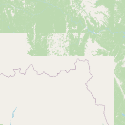
Map view of Nahanni National Park Reserve

Use this park location map to pinpoint Nahanni National Park Reserve in Canada, understand its exact geographic position, and read its mapped placement within the surrounding landscape more clearly.

Pigeon | © OpenStreetMap contributors

Location context for Nahanni National Park Reserve

Dehcho RegionNorthwest Territories
Natural feature types

Explore the Natural Landscapes and Geological Features of Nahanni National Park Reserve

Navigate the physical geography of Nahanni National Park Reserve through this structured collection of named natural features. Use MoriAtlas to trace the distribution of canyons, summits, and springs that define this protected landscape, offering a clearer understanding of the terrain beyond the park boundaries.
Recorded earthquake history

Explore the Historical Seismic Records for Nahanni National Park Reserve

Discover the documented history of earthquakes associated with the region surrounding Nahanni National Park Reserve. This MoriAtlas catalogue provides event-specific data, including magnitude and epicentre proximity, to help visualize recorded seismic activity near the park's expansive wilderness landscapes.

Nahanni National Park Reserve Earthquake History

Catalogued events

139 events

Strongest magnitude

Magnitude 6.9

Most recent event

May 12, 2023

This history includes earthquakes recorded inside the park or within 50 km of its borders

Park atlas

Trace the regional spread of protected landscapes and mapped geography across Canada's North.

Explore Related National Parks and Protected Areas Near Nahanni National Park Reserve

After exploring Nahanni National Park Reserve, browse an expanded list of national parks and protected areas in the surrounding wilderness regions of Canada. Compare these distinct conservation landscapes to understand the broader geographic patterns and protected-area context of Northern Canada's vast territories.
National parkNorthwest Territories
Park boundaries overlap#1 closest

Northwest

Nááts'ihch'oh National Park Reserve: Mapped Protected Landscape in Northwest Territories

Explore its geographic boundaries and regional context.

Gain a structured understanding of Nááts'ihch'oh National Park Reserve, a significant protected national park within the Northwest Territories. This detail provides context for its geographical placement and the extent of its protected landscape, vital for anyone exploring the region's natural areas through maps and atlas data.

Area
4,850 km²
Established
2014
IUCN
II
Visitors
109 annual
State or regional parkBritish Columbia
About 125 km away#2 closest

Southeast

Maxhamish Lake Provincial Park and Protected Area: Mapping Northern British Columbia Wilderness

Boreal lake ecosystems and protected indigenous heritage lands

Spanning over 27,500 hectares, Maxhamish Lake Provincial Park and Protected Area is a remote boreal refuge characterized by its central lake and extensive coniferous forests. This park provides a critical habitat for moose, deer, and cold-water fish species while maintaining deep ties to the Fort Nelson First Nation and Acho Dene Koe. Its geography reveals a distinct northern basin, offering insight into the ecological character and protected landscape features of northeastern British Columbia.

Area
275.16 km²
IUCN
II
Water
Major water bodies
Season
Seasonal
State or regional parkBritish Columbia
About 151 km away#3 closest

South

Liard River Hot Springs Provincial Park: Boreal Geothermal Mapping and Regional Geography

Protected northern wilderness, thermal water systems, and muskeg wetland terrain

Liard River Hot Springs Provincial Park serves as a protected geographic nexus where thermal water discharge creates a unique biological oasis. The park landscape combines expansive boreal forest with sensitive muskeg wetlands, centered around a natural hot spring system that supports orchid populations and regular wildlife sightings. This atlas entry provides essential context on the physical boundaries and ecological features that define this significant regional park in northern British Columbia.

Area
10.82 km²
Established
1957
IUCN
III
Relief
Lowland
State or regional parkBritish Columbia
About 189 km away#4 closest

Southeast

Jackpine Remnant Provincial Park: Protected Boreal Landscape and Regional Map Context

Conservation and terrain data for the Fort Nelson region

Jackpine Remnant Provincial Park provides a critical study in northern conservation geography. Located in the Fort Nelson area of British Columbia, this 148-hectare site protects a rare stand of jack pine trees. Its mapped boundaries and boreal forest terrain offer a focused look at small-scale protected landscapes and their significance within the broader regional ecosystem of the Canadian north.

Area
1.48 km²
Established
2001
IUCN
II
Relief
Lowland
State or regional parkBritish Columbia
About 198 km away#5 closest

South

Horneline Creek Provincial Park: Protected Canyon Landscapes and Rocky Mountain Trench Geography

Remote glacial-terrace wilderness in northern British Columbia

Located deep in the Rocky Mountain Trench, Horneline Creek Provincial Park is defined by its deep-cut canyon and ancient glacial terraces. This protected area offers an intimate view of sub-boreal terrain where mineral-stained walls and aspen-dotted grasslands create a concentrated, ecologically significant landscape within a remote corner of northern British Columbia.

Area
2.98 km²
Established
1999
IUCN
II
Relief
Upland
State or regional parkBritish Columbia
224 km away#6 closest

South

Denetiah Provincial Park and Protected Area: Regional Geography and Wilderness Mapping

An undisturbed boreal reserve in the Stikine Region

Discover the geographic structure of Denetiah Provincial Park and Protected Area, a vast roadless landscape in northern British Columbia. This park protects pristine boreal forests, elongated glacial lake basins, and critical river headwaters that serve as a benchmark for northern conservation within the Muskwa-Kechika Management Area.

Area
1,053.49 km²
Established
1999
IUCN
II
Relief
Upland
State or regional parkBritish Columbia
About 264 km away#7 closest

South

Dune Za Keyih Provincial Park and Protected Area: Watershed and Terrain Geography

Remote wilderness landscape in northern British Columbia

Dune Za Keyih Provincial Park and Protected Area protects the largest unlogged watershed in British Columbia. Situated within the Muskwa-Kechika Management Area, this remote wilderness is defined by the geological structures of the Rocky Mountain Trench, providing a continuous corridor of undisturbed mountain forest, riparian zones, and highland terrain.

Area
3,468.33 km²
Established
2001
IUCN
Ib
Relief
Mountain
Wildlife reserveYukon
272 km away#8 closest

West

Nisutlin River Delta National Wildlife Area: Yukon Delta and Wetland Geography

Protected boreal river delta and lake ecosystem.

The Nisutlin River Delta National Wildlife Area occupies a strategic position where riverine flow meets the expansive basin of Teslin Lake. The reserve is characterized by its dramatic seasonal transitions, transforming from high-water spring channels to expansive autumn mudflats. This dynamic geography supports essential migratory corridors through the boreal forest terrain of the southern Yukon.

Area
54.83 km²
Established
1995
IUCN
III

Common questions about visiting, size, designation, and location context for Nahanni National Park Reserve

Nahanni National Park Reserve FAQs for park facts, access, geography, and protected area context

Find quick answers about Nahanni National Park Reserve, including protected-area facts, park geography, trail and visitor context, and how the park fits into its surrounding country and regional landscape.
MoriAtlas Explorer

Continue Your Protected Areas Search Across the Global Atlas

Deepen your exploration by continuing the structured search for national parks and protected areas worldwide. Utilize the comprehensive filtering capabilities to compare different conservation landscapes and refine your understanding of global park geography. Discover more about the distribution and characteristics of protected natural areas.

Global natural geography