
Mori Atlas logo
Protected landscapeNaturpark Kellerwald-Edersee

Tracing the forest-dominated mountain terrain and reservoir boundaries in northern Hessen

Naturpark Kellerwald-Edersee: A Comprehensive Geographic Overview of the Protected Landscape

Naturpark Kellerwald-Edersee stands as a significant protected landscape in northern Hessen, defined by its dense cover of unfragmented European beech forests and deeply incised low mountain topography. The territory stretches from the dramatic shoreline of the Edersee reservoir across the Kellerwald uplands to the Oberhessische Schwelle ridge. Through this atlas entry, analyze the structural composition of these woodlands, the interplay between river systems and reservoir basins, and the broader regional geography of a major German conservation area.

beech forestlow mountain rangeKellerwaldEderseereservoir landscapeprotected forest
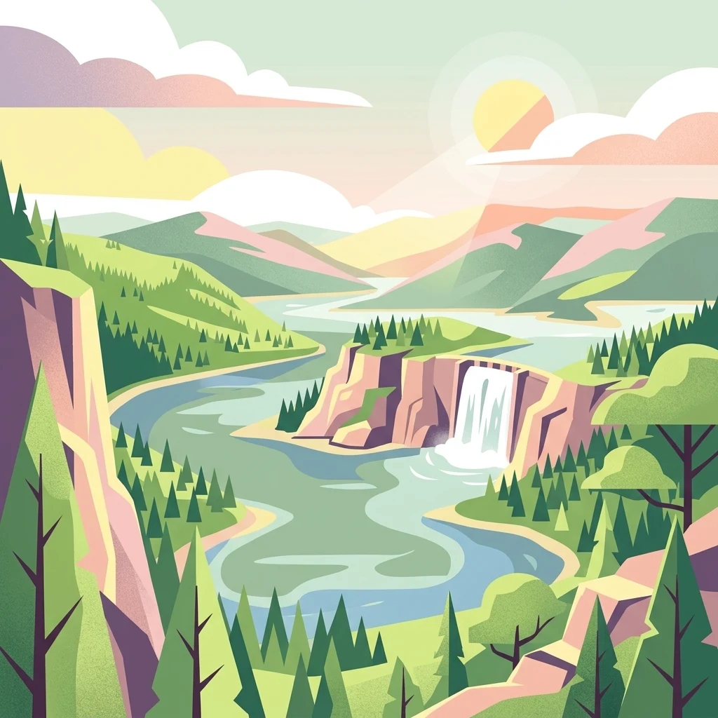
A flat-style digital illustration of a mountainous landscape featuring a winding river, a central waterfall flowing over a cliff, and dense evergreen forests under a bright sun.

Naturpark Kellerwald-Edersee

Protected landscape

Park overview

Structured park overview, official facts, and landscape profile for Naturpark Kellerwald-Edersee

Naturpark Kellerwald-Edersee park facts, protected area profile, and essential visitor context

Review the core facts for Naturpark Kellerwald-Edersee, including designation, size, terrain, visitor scale, habitats, and operating context in one park-focused overview.

About Naturpark Kellerwald-Edersee

Naturpark Kellerwald-Edersee is a regional-scale nature park in the German state of Hesse, focused on the protection, care, and ecological development of one of the country's most significant beech forest landscapes. The park belongs to the official system of German Naturparks, areas that combine landscape conservation with sustainable regional development, education, and low-impact recreation. Its name reflects its two defining elements: the Kellerwald, a low mountain range in northern Hesse, and the Edersee, a large reservoir at the northern edge of that range.

Geographically, the park occupies the transition zone between the Kellerwald core and the surrounding uplands. It lies in the districts of Waldeck-Frankenberg and Schwalm-Eder, southwest of Kassel, and covers an area of roughly 595 square kilometers after its 2019 expansion. The terrain rises from about 194 meters above sea level near the Affolderner See to 675.3 meters at the Wüstegarten, with numerous summits above 500 and 600 meters shaping a deeply incised, forested landscape. The Edersee reservoir in the north and the Affolderner See downstream provide large open water elements within an otherwise woodland-dominated setting.

The park is notable for containing, in its northern section, the much smaller but strictly protected Nationalpark Kellerwald-Edersee. This arrangement creates a layered conservation landscape: the national park focuses on wilderness-oriented protection, while the surrounding nature park supports compatible land use, ecological restoration, regional development, and visitor infrastructure. The broader park also includes farmland, small villages, castles such as Schloss Waldeck, historic chapels, and educational centers like the Kellerwald-Informationszentrum Fagutop and the Wildpark Edersee with its falconry.

Institutionally, the park is run by a municipal Zweckverband that brings together the towns of Edertal, Gilserberg, Haina, Jesberg, Vöhl, Bad Zwesten, Frankenau, Fritzlar, Lichtenfels, Waldeck, and Bad Wildungen, together with the Schwalm-Eder-Kreis and the Landkreis Waldeck-Frankenberg. This cooperative structure allows coordinated planning across municipal boundaries in a region where forest, water management, tourism, and agriculture strongly interact. Combined with major conservation programs, long-distance trails, and its position within the German nature park network, the Naturpark Kellerwald-Edersee stands out as a representative example of how a low mountain forest landscape can be protected and developed at a regional scale.

Quick facts and research context for Naturpark Kellerwald-Edersee

Naturpark Kellerwald-Edersee is a nature park in northern Hesse, Germany, centered on the Kellerwald low mountain range and the Edersee reservoir. It has existed as a designated nature park since 1 June 2001 and was enlarged by roughly 30 percent in 2019 through the addition of areas belonging to the towns of Lichtenfels, Fritzlar, Bad Wildungen and the municipality of Vöhl. A portion of the park, in its northern section south of the Edersee, has been managed as the strictly protected Nationalpark Kellerwald-Edersee since 1 January 2004.

The park is run as a municipal Zweckverband (special-purpose association) made up of several towns, municipalities and two counties in northern Hesse, allowing coordinated landscape management across administrative boundaries. Its elevation ranges from around 194 meters above sea level near Affoldern to 675.3 meters at the Wüstegarten, the highest peak in the Kellerwald. The park is home to major long-distance hiking routes, including the Kellerwaldsteig and the Urwaldsteig Edersee, and since 2023 the Edersee region has held the German hiking quality seal "Qualitätsregion Wanderbares Deutschland."

Protection and recognition

Documented terrestrial protection scope and designation framework facts

Naturpark Kellerwald-Edersee Protection Status and Recognition

Naturpark Kellerwald-Edersee maintains documented terrestrial protection status within a regional conservation framework. Official records compile management scope and recognition details without external designations.

Protection details

Protection scope
Terrestrial
Transboundary protection
No
Park context

Deeper park guide and search-rich context for Naturpark Kellerwald-Edersee

Naturpark Kellerwald-Edersee history, landscape, wildlife, and travel context

Explore Naturpark Kellerwald-Edersee through its history, landscape character, ecosystems, wildlife, conservation priorities, cultural context, and seasonal travel timing in a structured park guide built for atlas discovery and search intent.

Why Naturpark Kellerwald-Edersee stands out

Naturpark Kellerwald-Edersee is best known for protecting one of the largest contiguous tracts of European beech forest in Germany, with extensive old-growth and near-natural stands that include rare habitat features like gnarled veteran trees and dry oak woods on steep north-facing slopes. The beech woodlands south of the Edersee are the ecological heart of the park and the basis of its national-park-level protection status. Equally distinctive is the park's dramatic combination of dense forest with a significant reservoir landscape: the Edersee, with its steep wooded shores, the Affolderner See downstream, and the surrounding ridges of the Kellerwald. Together, these elements create a scenery where water, cliffs, and ancient beech forest meet, making the park a focal point for both forest conservation and low mountain landscape preservation in Hesse.
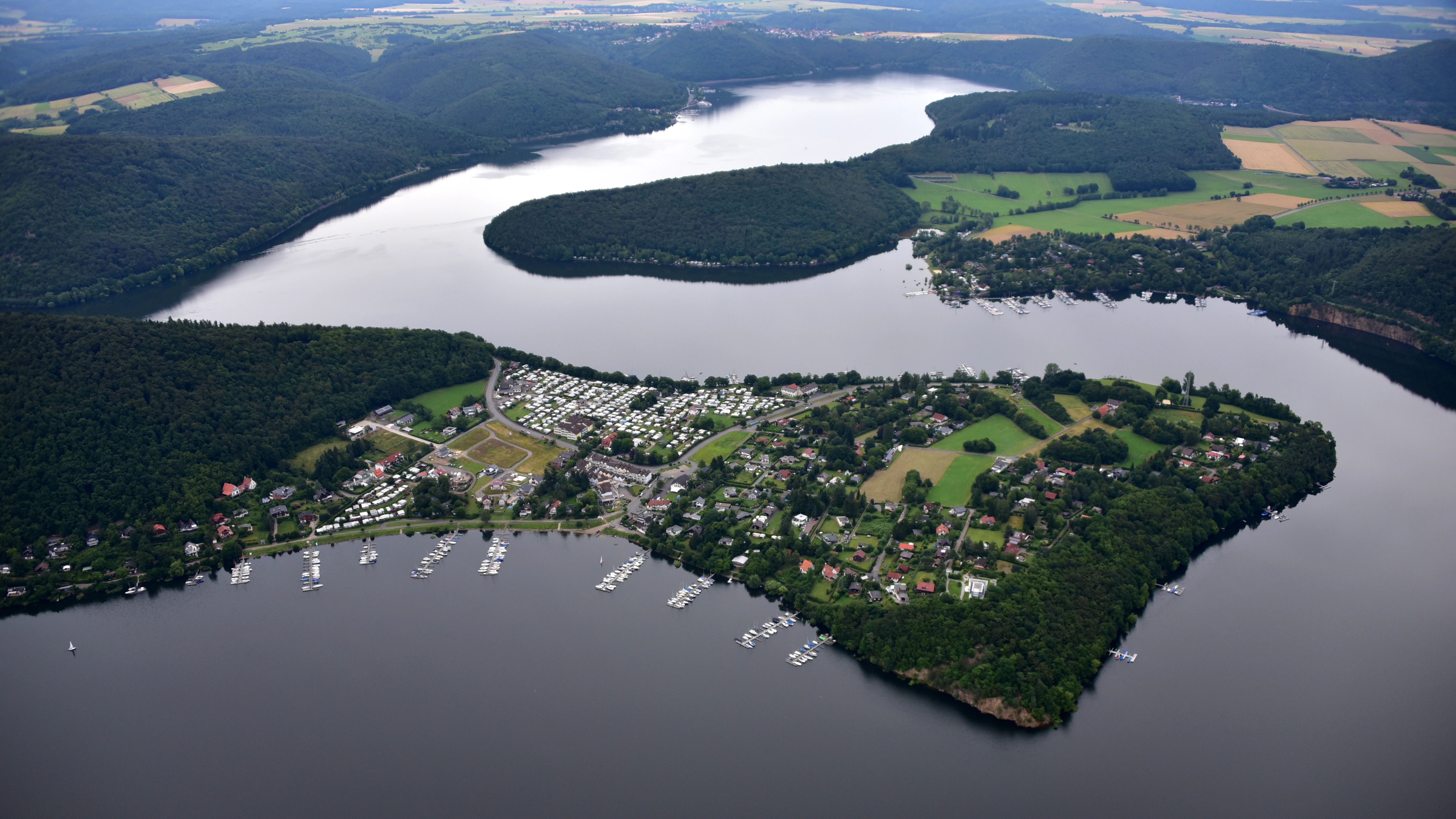
An aerial view of a lake and a large peninsula with a residential area, docks, and boats, surrounded by dense green forest.
An aerial view of the Scheid peninsula extending into the Edersee reservoir, surrounded by the forests of Naturpark Kellerwald-Edersee.

Naturpark Kellerwald-Edersee history and protected-area timeline

The Naturpark Kellerwald-Edersee was formally designated on 1 June 2001, creating a unified protected-area framework around the Kellerwald low mountain range and the Edersee reservoir in northern Hesse. From the outset, its purpose was to coordinate conservation, recreation, and sustainable regional development across the municipalities and districts whose territories encompassed this landscape.

A key step in the park's conservation history came on 1 January 2004, when a portion in the northern section of the park, south of the Edersee, became the Nationalpark Kellerwald-Edersee. This created the present layered structure of the area: the nature park providing a broader management framework, and the national park applying substantially stricter protection within its core.

In 2005, the federal government launched the Naturschutzgroßprojekt Kellerwald-Region within the park, a large-scale conservation program managed by the Bundesamt für Naturschutz and focused on habitats of national significance. The project's first phase ran from 2005 to 2008 and produced a management and development plan as well as a socioeconomic study, followed by a planning approval phase. The implementation phase then ran from 2009 to 2015, with about six million euros of funding dedicated to forest conversion, land acquisition, river restoration, and habitat management. A follow-up phase from 2016 to 2018 emphasized forest protection and the establishment of a permanent system of protected areas.

In 2019, the park was enlarged through the addition of land from the towns of Lichtenfels, Fritzlar, and Bad Wildungen as well as the municipality of Vöhl, increasing its area by roughly 30 percent. This expansion strengthened the park's connectivity and broadened its landscape buffer around the national park core. In 2023, the Edersee region, closely tied to the park, was recognized with the German hiking quality seal "Qualitätsregion Wanderbares Deutschland."

Naturpark Kellerwald-Edersee landscape and geographic character

The landscape of Naturpark Kellerwald-Edersee is defined by the contrast between a dense, broad-leafed forest cover and a deeply incised low mountain topography. Much of the park lies on the Kellerwald uplands, a mid-elevation range in northern Hesse shaped by long-running erosion of Devonian and older bedrock into ridge-and-valley terrain. The northern boundary of the park is set by the Edersee, a large reservoir whose wooded shores, bays, steep slopes, and peninsulas create a dramatic meeting of water and forest.

Elevations within the park range from about 194 meters near the Eder river below the Affolderner See, up to 675.3 meters at the Wüstegarten, the highest peak of the Kellerwald. The summit region of the Wüstegarten, together with the nearby Hunsrück and Sauklippe, forms a prominent ridge known as the Keller or Hoher Keller in the southeast of the range. Other notable heights include the Hohes Lohr, Große Aschkoppe, Traddelkopf (the highest point within the national park core), Auenberg, Jeust, Talgang, and the Homberg with its viewing tower.

South of the Kellerwald core, the park extends into parts of the Oberhessische Schwelle, an upland ridge that forms a transitional landscape toward Hesse's central lowlands. The Hundskopf, at 470.6 meters, marks the highest point of this southern ridge. Throughout the park, small valleys carry streams and brooks toward larger rivers such as the Eder, Werbe, Wilde, Schwalm, and Wohra, while the Edersee and Affolderner See provide the park's main standing water bodies. Viewpoints such as the Uhrenkopf and the Kanzel offer elevated outlooks over the reservoir and surrounding woods, reinforcing the park's visual identity as a deeply wooded, water-rich low mountain landscape.
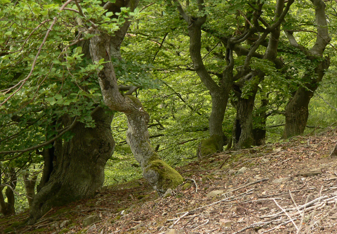
A sloped forest floor covered in brown leaf litter leading up to a grove of mature, moss-covered beech trees with thick, twisted trunks.
Gnarly beech trees along the Urwaldsteig hiking trail in Naturpark Kellerwald-Edersee.

Naturpark Kellerwald-Edersee ecosystems, habitats, and plant life

Ecologically, Naturpark Kellerwald-Edersee is dominated by extensive deciduous forest, in particular by beech woodlands that rank among the largest contiguous such stands in Germany. The Kellerwald has long been recognized for its well-preserved, near-natural beech forests, and a key portion of these forests has been placed under the stricter protection regime of the Nationalpark Kellerwald-Edersee since 2004. Within the nature park as a whole, the beech woods form a continuous matrix that connects the national park core with surrounding hill country, providing vital habitat continuity for forest species.

In addition to the beech forests, the park supports dry oak woodlands on steep, sun-exposed slopes around the Edersee, including the famous Trockeneichenwälder along parts of the Urwaldsteig trail. These dry oak forests are an unusual and ecologically valuable element within the broader beech-dominated landscape. The mosaic of woodland types has been further shaped by active forest conversion from former spruce-dominated stands toward more natural broadleaf forest composition, a central goal of the Naturschutzgroßprojekt Kellerwald-Region.

Streams and small rivers crisscross the park, including the Lorfe, Aselbach, Werbe, Netze, Wesebach, Wilde, Schwalm, Urff, and the upper Wohra. These waters, along with the Edersee and Affolderner See and the upper reservoirs of the Waldeck pumped-storage power stations, contribute to a diverse freshwater environment. Wet meadows, dry grassland, heath patches, and nutrient-poor grasslands on former farmland add open-land habitat components, and targeted conservation measures have been developed for species such as the Pfingstnelke, a notable plant adapted to dry, open habitats. Educational and information trails, including those linked to the Wildpark Edersee and the Fagutop visitor center, help interpret this varied ecological setting for visitors.
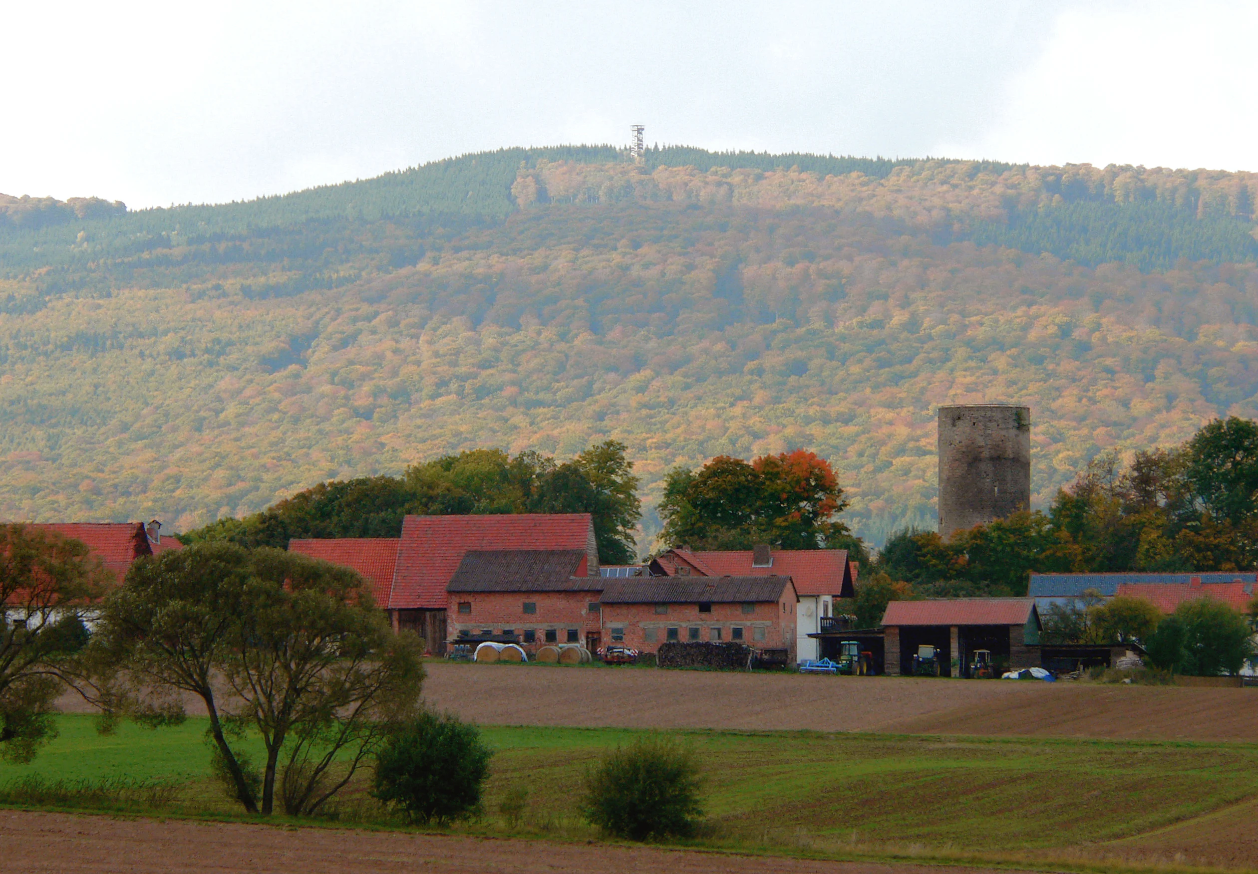
A wide shot of a forested hill, the Wuestegarten, featuring an observation tower on the summit, rising behind a rural village and farmland.
View of the Wuestegarten hill and its observation tower, seen from near Jesberg.

Naturpark Kellerwald-Edersee wildlife and species highlights

The wildlife of Naturpark Kellerwald-Edersee is closely tied to its extensive beech forests, mixed woodland, freshwater systems, and open dry habitats. The large, unfragmented forest blocks provide habitat for typical central European woodland species, while the Edersee and its surroundings add birds, mammals, and aquatic fauna associated with water bodies and lakeshore environments.

Near the southern shore of the Edersee, the Wildpark Edersee is a wildlife park focused on native species of the region, and its associated Greifenwarte Wildpark Edersee, a falconry center, keeps and displays birds of prey typical of the area. Together they provide both conservation-relevant breeding work and direct public engagement with native fauna, which is unusual for visitors accustomed to seeing wildlife only at a distance. Game species typical of central European deciduous forests, including deer and wild boar, inhabit the broader forested areas.

Birdlife benefits from the combination of mature beech forest, dry oak woodland, lakeshore habitats, and open grasslands. Raptors of forest and cliff habitats are a particular feature around the Edersee, where the falconry contributes to public understanding of local birds of prey. In freshwater habitats, fish populations associated with the Eder system and the Edersee reservoir itself occur alongside typical riverine species in the park's smaller streams. Overall, the park's wildlife character is shaped more by habitat continuity and forest complexity than by single charismatic species, reflecting the broader significance of the Kellerwald as one of Germany's key forest landscapes.
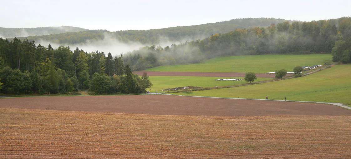
A wide landscape view of brown plowed fields and green pastures in the foreground leading to a dense forest and rolling hills under a cloudy, misty sky.
Misty view over the agricultural fields and forested mountain ranges of the Kellerwald area.

Naturpark Kellerwald-Edersee conservation status and protection priorities

The conservation significance of Naturpark Kellerwald-Edersee lies in its role as a regional framework around one of Germany's most important beech forest landscapes. The park contains within it the Nationalpark Kellerwald-Edersee, the fifteenth national park in Germany and an area with the highest level of habitat protection. This nesting of a national park inside a broader nature park creates a multi-layered conservation system: the national park core focuses on natural processes and wilderness development, while the surrounding nature park extends compatible land use, restoration, and stewardship across a much larger area.

A central element of the park's conservation work is the Naturschutzgroßprojekt Kellerwald-Region, launched in 2005 and extended through 2018. This federally funded program, administered by the Bundesamt für Naturschutz, has focused on habitat creation and protection in areas of nationally representative significance. Activities have included the purchase of land for conservation, the conversion of spruce-dominated forests into more natural broadleaf forests, the designation of totalreservate (areas left entirely to natural dynamics), the ecological restoration of streams and riverbanks, and management measures for heathland, dry grassland, and other open habitats. Special conservation actions have also been carried out for the Pfingstnelke and other characteristic species of these habitats.

Beyond habitat measures, the park supports an intensive public engagement effort: information trails, indoor and mobile exhibitions, environmental education programs, and visitor centers such as the Fagutop information center reinforce conservation awareness. The combination of strict core protection, broad landscape-level management, ecological restoration of forests and waters, and education makes the Naturpark Kellerwald-Edersee a representative example of modern, integrated conservation practice in Germany's low mountain ranges.

Naturpark Kellerwald-Edersee cultural meaning and human context

The cultural context of Naturpark Kellerwald-Edersee is rooted in the long human history of the Kellerwald and its surrounding valleys. The landscape carries traces of medieval and early modern settlement, including castles such as Schloss Waldeck high above the Edersee, the ruins of Quernstkirche and the Quernstkapelle on the Talgang, and the historic Burg Jesberg. These monuments reflect a region shaped by small territorial lordships, ecclesiastical foundations, and a sparsely populated upland agriculture tradition.

Small villages and market towns such as Frankenau, Bad Wildungen, Fritzlar, Vöhl, and Bad Zwesten lie within or around the park. Many of these places combine centuries-old townscapes with a long tradition of health, spa, and resort culture: Bad Wildungen and Bad Zwesten carry the "Bad" designation associated with mineral springs and therapeutic use, and the Edersee region has long functioned as a recreation area for central Germany. Forest use, including charcoal burning, timber management, and small-scale grazing, has shaped both the structure of the woodland and the cultural identity of the local communities for generations.

In the modern era, the area has also become a place where conservation, recreation, and regional identity intersect. The hiking trails of the Kellerwaldsteig and Urwaldsteig, the Wildpark Edersee and its Greifenwarte, the information center Fagutop, and the recognition of the Edersee region as a Qualitätsregion Wanderbares Deutschland reflect a deliberate effort to link ecological protection with a continuing regional identity grounded in landscape, water, and forest.

Top sights and standout views in Naturpark Kellerwald-Edersee

Among the most distinctive highlights of Naturpark Kellerwald-Edersee are the extensive beech forests of the Kellerwald, considered among the largest unfragmented beech forest complexes in Germany, and the dramatic shorelines of the Edersee reservoir with its wooded bays, peninsulas, and viewpoints such as the Kanzel and Uhrenkopf. The combination of ancient woodland and a large lake in a low mountain setting gives the park a strong visual identity.

Equally notable are the park's flagship protected areas and programs: the nested Nationalpark Kellerwald-Edersee, which applies the highest level of federal protection to part of the forest, and the Naturschutzgroßprojekt Kellerwald-Region, a long-running federal program for landscape-scale conservation including forest conversion, totalreservate establishment, river restoration, and dry grassland management. Wildlife experiences are highlighted by the Wildpark Edersee and its Greifenwarte falconry, while hiking is anchored by major long-distance trails such as the 156-kilometer Kellerwaldsteig and the 68-kilometer Urwaldsteig Edersee.

Best time to visit Naturpark Kellerwald-Edersee

The character of a visit to Naturpark Kellerwald-Edersee shifts with the seasons in ways that reflect both the forest and the lake. Late spring and early summer are generally favorable for exploring the beech forests and hiking trails, as varied green tones return to the canopy and temperatures remain mild in the lower valleys. This period is also when the rivers and streams are typically at their most vigorous.

Summer is the most active season for hiking, water-based recreation around the Edersee, and visits to educational facilities such as the Wildpark Edersee and the Fagutop information center. Autumn is particularly valued for its foliage display in the broadleaf forests, with the beech and oak woods producing rich color contrasts against the lake and reservoir scenery. Winter typically brings a quieter atmosphere, with low temperatures, occasional snow on the higher summits such as the Wüstegarten and Hohes Lohr, and the Edersee operating as a calm, low-traffic landscape; visitor infrastructure may be reduced, but the trails and viewpoints remain attractive for those seeking a quieter experience of the woodland.

Monthly climate preview

Long-term temperature ranges and precipitation patterns across representative coordinates

Naturpark Kellerwald-Edersee Climate Normals and Monthly Weather Records

Naturpark Kellerwald-Edersee exhibits a measured annual cycle of long-term average temperatures and daily precipitation rates recorded across representative elevations. Examining the complete monthly climate profile provides deeper statistical insight into historical temperature variations and precipitation distributions.
Annual mean8 °C
-1 °C18 °C
Jan-1°
Feb
Mar
Apr
May12°
Jun15°
Jul18°
Aug17°
Sep13°
Oct
Nov
Dec
Warmest month
July

17.6 °C

Coolest month
January

-1 °C

Wettest month
July

2.6 mm/day

Driest month
April

1.7 mm/day

Park location guide

Geography guide, regional context, and park location map for Naturpark Kellerwald-Edersee

Naturpark Kellerwald-Edersee park geography, regions, and map view in Germany

Understand where Naturpark Kellerwald-Edersee sits in Germany through a broader geographic reading of the surrounding landscape, nearby location context, and its mapped position within the national park landscape.

How Naturpark Kellerwald-Edersee fits into Germany

Germany is a federal republic in Western and Central Europe with a population of over 83 million across sixteen constituent states. It is Europe's largest economy by nominal GDP and a major global exporter and importer. The capital is Berlin, and the country borders Denmark, Poland, Czech Republic, Austria, Switzerland, France, Luxembourg, Belgium, and the Netherlands.

Wider geography shaping Naturpark Kellerwald-Edersee in Germany

Germany is located in Western and Central Europe, spanning 357,022 km². It borders Denmark to the north, Poland and the Czech Republic to the east, Austria and Switzerland to the south, and France, Luxembourg, Belgium, and the Netherlands to the west. The country has coastlines on the Baltic Sea and North Sea to the north, with the Alps located in the southern region.

Map view of Naturpark Kellerwald-Edersee

Use this park location map to pinpoint Naturpark Kellerwald-Edersee in Germany, understand its exact geographic position, and read its mapped placement within the surrounding landscape more clearly.

Pigeon | © OpenStreetMap contributors

Location context for Naturpark Kellerwald-Edersee

Hessen

Visualizing ancient beech forests, low mountain terrain, and reservoir shorelines

Naturpark Kellerwald-Edersee Photos and Protected Landscapes

Explore detailed photography capturing the dense old-growth beech woodlands and rugged low mountain topography of Naturpark Kellerwald-Edersee. Visual documentation of the Edersee reservoir shores and protected forest habitats reveals the distinct ecological character of this German upland region.

An aerial view of a lake and a large peninsula with a residential area, docks, and boats, surrounded by dense green forest.

An elevated view looking down into a forested river valley, featuring a calm river winding through dense green trees and a small concrete dam structure.

A sloped forest floor covered in brown leaf litter leading up to a grove of mature, moss-covered beech trees with thick, twisted trunks.

A wide shot of a forested hill, the Wuestegarten, featuring an observation tower on the summit, rising behind a rural village and farmland.

A wide landscape view of brown plowed fields and green pastures in the foreground leading to a dense forest and rolling hills under a cloudy, misty sky.

Park atlas

Compare surrounding mid-mountain terrain and neighboring conservation areas across northern Hesse.

Parks near Naturpark Kellerwald-Edersee: Exploring Connected Protected Landscapes

Browsing parks near Naturpark Kellerwald-Edersee reveals a diverse network of protected natural areas across the surrounding low mountain region. Regional park comparison provides essential geographic context for understanding contiguous beech forests, river valleys, and reservoir landscapes.
Watercolor painting showing a landscape with hills, forest, and a body of water
National parkHesse
About 4.6 km away#1 closest

North

Kellerwald-Edersee National Park: Hesse's Protected Landscape Exploration

Mapped boundaries and geographic context for this German national park.

Navigate the protected landscape of Kellerwald-Edersee National Park, a key national park situated in the German state of Hesse. This atlas entry focuses on its precise geographic definition, mapped terrain features, and the broader regional context it occupies within central Germany. Gain structured insights into the park's conservation significance and its place in the mapped landscape.

Area
76.88 km²
Established
2004
IUCN
II
Relief
Highland
A soft watercolor painting showing layered, gentle green hills and rolling terrain against a light, pale sky.
Nature reserveHessen
About 16 km away#2 closest

South

Kalkkuppen bei Winterscheid: Protected Geological Landscapes in the Gilserberg Heights

A detailed atlas view of this Hessen nature reserve

This nature reserve in the Schwalm-Eder-Kreis district protects four distinctive limestone hills built from Lower Muschelkalk. These outcrops stand as a geological anomaly within a region otherwise dominated by sandstone. The site serves as a vital component of the European Habitats Directive, offering a rare opportunity to study calcareous vegetation patterns and structural geology within the rolling terrain of northern Hesse.

Area
0.429 km²
Established
1986
IUCN
IV
A watercolor painting showing a tranquil lake shore with soft green vegetation and distant muted hills.
Nature reserveSchwalm-Eder-Kreis
About 16 km away#3 closest

East

Borkener See Nature Reserve: Geographic Overview of a Reclaimed Wetland and Bird Sanctuary

A protected landscape featuring oligotrophic lake waters in Schwalm-Eder-Kreis.

Borkener See serves as a focal point for understanding the reclamation of mining landscapes in northern Germany. As an officially protected nature reserve, it provides a stable habitat for migratory bird species, with deep water basins and carefully managed wetland buffers defining its physical and ecological presence in the Westhessische Senke.

Area
3.5 km²
Established
1990
Relief
Lowland
Climate
Temperate
A watercolor painting depicting a soft-focus landscape with rolling green hills in the distance, a grassy foreground, and a single bare-branched tree on the right side.
Nature reserveHessen
About 18 km away#4 closest

Southwest

Merzhäuser Teiche Nature Reserve: Geographic Atlas and Protected Landscape Overview

A dense wetland mosaic in the Burgwald region of Hessen.

Merzhäuser Teiche is a compact nature reserve situated on the edge of the Burgwald, Hesse's largest contiguous forest. Centered on three small ponds linked by the Kimmelbach, the area protects a transition zone of alder swamp, wet meadows, and nutrient-poor grassland. This site serves as a crucial habitat for waterbirds, amphibians, and rare butterflies within a characteristic central German landscape.

Area
0.201 km²
Established
1990
IUCN
IV
Relief
Lowland
A pale watercolor painting showing a rolling landscape with soft green hills, scattered trees, and a hazy mountain silhouette against a white background.
Nature reserveHesse
About 19 km away#5 closest

Northeast

Auf den Hesseln bei Naumburg Nature Reserve: Protected Landscape and Geography Atlas

A calcareous grassland mosaic within the Kassel district of Hesse

This protected area in northern Hesse encompasses a complex relief of Triassic mussel limestone slopes and alluvial woodland. The site highlights the importance of managed limestone dry grasslands and former quarry habitats in supporting specialized flora, serving as a concentrated example of habitat diversity within the surrounding agricultural landscape.

Area
0.196 km²
Established
1996
Relief
Upland
Climate
Temperate
A minimalist watercolor painting of rolling hills and a stream, using soft greens, purples, and pale yellows on a white background.
Protected landscapeHesse
About 20 km away#6 closest

Northeast

Naturpark Habichtswald: Protected Landscape and Basalt Terrain Atlas in Northern Hesse

Exploration of forested ridges and medieval castle ruins.

Explore the geographic identity of Naturpark Habichtswald, a prominent protected landscape in northern Hesse. This record covers the park's volcanic basalt hills, broad wooded ridges, and the diverse historical ruins that define its unique topographic character across the Habichtswälder Bergland.

Area
474.28 km²
Established
1962
Relief
Mountain
Climate
Temperate
Watercolor illustration depicting a serene wetland landscape with a small forest patch on the left, grassy marshland in the center, and a pink-toned shoreline on the right.
Nature reserveHessen
About 21 km away#7 closest

Southwest

Franzosenwiesen/Rotes Wasser: Protected Nature Reserve and Lowland Stream Geography

Hessen regional conservation and Burgwald foothills terrain

The Franzosenwiesen/Rotes Wasser reserve offers a window into the lowland stream geography of central Germany. This site preserves a vital corridor of wet meadows and riparian habitat along the Rotes Wasser brook, serving as a key example of the conservation landscapes found within the rolling foothills of the Burgwald region in Hessen.

Area
0.898 km²
Established
1987
Relief
Lowland
Climate
Temperate
A watercolor painting of soft, green rolling hills and clusters of trees set against a pale, light-washed sky on a white background.
Nature reserveHesse
About 22 km away#8 closest

South

Biedenbacher Teiche bei Florshain Nature Reserve, Hesse Protected Wetland Geography

A rare refuge of stream-fed ponds and meadows in northern Hesse

The Biedenbacher Teiche bei Florshain nature reserve protects a dense concentration of wetland microhabitats along the Biedenbach stream. Spanning ponds, sedge beds, and floodplain woodlands, this site offers a look into the vital ecological character of the Schwalm-Eder region. It remains an essential, undisturbed archive of local wetland flora and fauna within the larger, intensively cultivated Hessian agricultural landscape.

Area
0.035 km²
Established
1983
Relief
Lowland
Climate
Temperate

Common questions about visiting, size, designation, and location context for Naturpark Kellerwald-Edersee

Naturpark Kellerwald-Edersee FAQs for park facts, access, geography, and protected area context

Find quick answers about Naturpark Kellerwald-Edersee, including protected-area facts, park geography, trail and visitor context, and how the park fits into its surrounding country and regional landscape.
MoriAtlas Explorer

Continue Your Protected Areas Search Across the Global Atlas

Deepen your exploration by continuing the structured search for national parks and protected areas worldwide. Utilize the comprehensive filtering capabilities to compare different conservation landscapes and refine your understanding of global park geography. Discover more about the distribution and characteristics of protected natural areas.

Global natural geography