
Mori Atlas logo
Protected landscapeNaturpark Lüneburger Heide

Mapping the extensive heathlands and glacial terrain of northern Germany

Naturpark Lüneburger Heide: A Comprehensive Protected Landscape and Geographic Atlas

Naturpark Lüneburger Heide represents a vital protected landscape in Lower Saxony, encompassing vast contiguous inland dwarf-shrub heaths and significant glacial landforms. This geographic entry provides an overview of the region centered on the Wilseder Berg, tracing its history as the first designated nature park in Germany. Explore the mosaic of moors, forested ridges, and traditional cultural landscapes that define this unique ecological corridor.

heathlandnature parkLower Saxonycultural landscapemoorbiodiversity
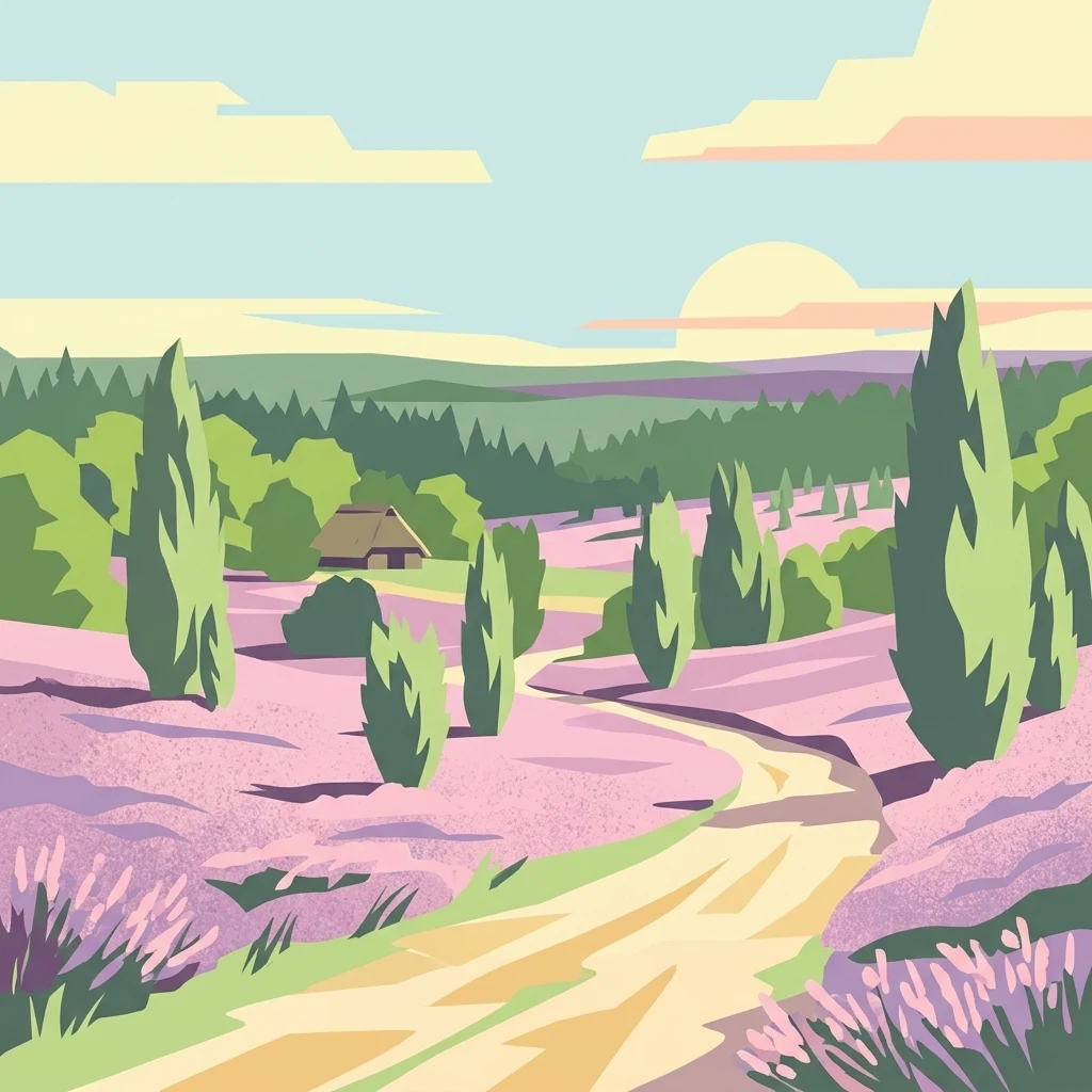
A stylized flat illustration featuring a dirt path winding through purple blooming heathland with scattered juniper trees and a small thatched roof cottage in the distance under a pale sun.

Naturpark Lüneburger Heide

Protected landscape

Park overview

Structured park overview, official facts, and landscape profile for Naturpark Lüneburger Heide

Naturpark Lüneburger Heide park facts, protected area profile, and essential visitor context

Review the core facts for Naturpark Lüneburger Heide, including designation, size, terrain, visitor scale, habitats, and operating context in one park-focused overview.

About Naturpark Lüneburger Heide

Naturpark Lüneburger Heide is a foundational landscape in Germany's nature conservation history and remains one of its most distinctive cultural landscapes. Situated in northern Lower Saxony, it stretches across the gently undulating, glacially shaped countryside between the cities of Hamburg, Bremen, and Hannover, spanning parts of the Lüneburg, Harburg, and Heidekreis districts. The protected area forms part of the broader Lüneburger Heide tourism region and includes 37 associated towns and municipalities.

At the heart of the park lies the Naturschutzgebiet Lüneburger Heide, also referred to as the Naturschutzpark, a roughly 234 square kilometer nature reserve centered on the Wilseder Berg. This reserve has been protected since 1922 and constitutes the original nucleus of the present-day nature park, which expanded nearly fivefold in 2007 and again in late 2023 to reach its current size of about 1,098 square kilometers.

The cultural landscape within the park is shaped by a centuries-old interplay of human activity and natural process. Sheep grazing, particularly with the iconic Heidschnucke heath sheep, juniper management, controlled burning, and low-intensity agriculture have preserved open heathlands that would otherwise have transitioned into forest. More than 30 percent of the park area is forested, while extensive bog and moor complexes, several protected individually, add to the biodiversity of the region.

Beyond conservation, the park serves as a model region for sustainable regional development. It coordinates environmental education programs, promotes regional products such as the protected geographical indication (g.g.A) Lüneburger Heidekartoffel, heath honey, and Heidschnucken meat, and supports hiking, cycling, horseback riding, and carriage-based recreation across a network of themed trails. The Heide-Shuttle, a seasonal bus service operating from mid-July to mid-October, connects more than 100 stops across the park free of charge, including bicycle trailers for cyclists.

Quick facts and research context for Naturpark Lüneburger Heide

Naturpark Lüneburger Heide is the oldest nature park in Germany, established in 1922 in Lower Saxony. It is classified as an IUCN Category V Protected Landscape, spanning approximately 1,098 square kilometers across the districts of Lüneburg, Harburg, and Heidekreis. Around 100,000 people live within its boundaries, and the park encompasses 37 towns and municipalities united under the Verein Naturparkregion Lüneburger Heide. Its 234 square kilometer core nature reserve shelters the largest contiguous inland heathlands of Central Europe, an outcome of centuries of grazing and land management.

Protection and recognition

Examine the documented conservation framework and protection details for this protected area.

Naturpark Lüneburger Heide Protection Status and Terrestrial Conservation Scope

Naturpark Lüneburger Heide features a documented terrestrial protection scope without imported international recognition sources. Review the official conservation framework, territorial classification, and designation records associated with this landscape.

Protection details

Protection scope
Terrestrial
Transboundary protection
No
Core area
234 km²
Park context

Deeper park guide and search-rich context for Naturpark Lüneburger Heide

Naturpark Lüneburger Heide history, landscape, wildlife, and travel context

Explore Naturpark Lüneburger Heide through its history, landscape character, ecosystems, wildlife, conservation priorities, cultural context, and seasonal travel timing in a structured park guide built for atlas discovery and search intent.

Why Naturpark Lüneburger Heide stands out

The park is internationally known for its vast heath landscapes, particularly the violet blooming heather of Calluna vulgaris that colors the countryside in late summer. Within the core reserve, the Wilseder Berg rises as a distinctive landmark surrounded by more than 5,500 hectares of heath, the largest contiguous inland dwarf-shrub heath of agricultural origin in Central Europe. The park is equally recognized for hosting the most significant remaining population of black grouse (Birkhuhn) in the Central European lowlands, surviving thanks to decades of dedicated habitat management by the Verein Naturschutzpark and the Stiftung Naturschutzpark Lüneburger Heide.
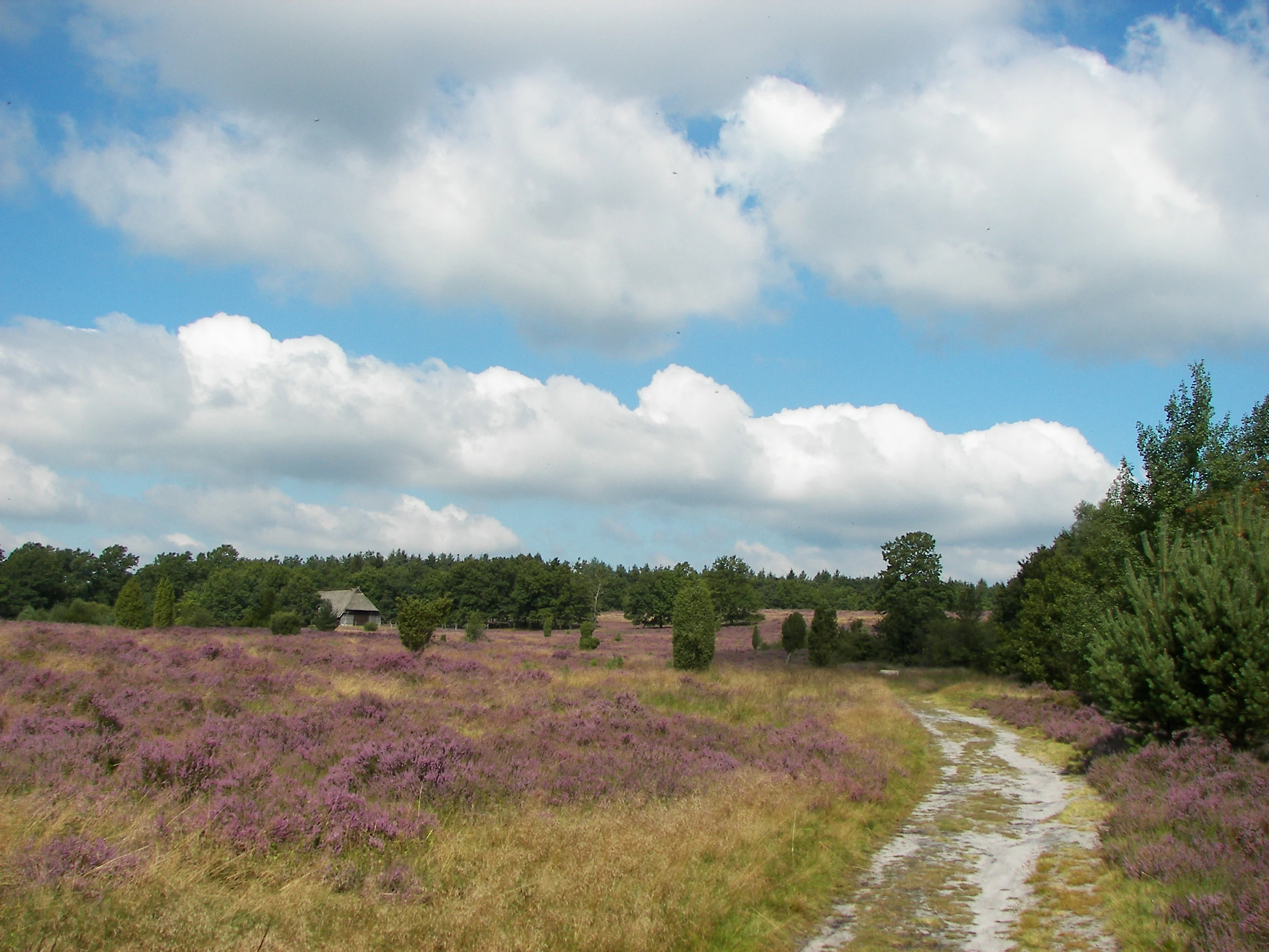
A dirt trail winds through rolling heathland with purple blooming heather, scattered small shrubs, and a backdrop of green forest under a partly cloudy blue sky.
Heathland landscape in the Naturpark Lüneburger Heide during late summer blooming season.

Naturpark Lüneburger Heide history and protected-area timeline

The origins of Naturpark Lüneburger Heide reach back to the early conservation movement in Germany. In 1910, Pastor Wilhelm Bode persuaded the Verein Naturschutzpark (VNP) to acquire land around the Wilseder Berg in the Lüneburger Heide. In 1922, the Prussian government declared these areas a nature reserve, formally establishing what would later become core of the nature park and making Germany home to the first nature park in the country.

A second founding figure was Alfred Toepfer, who served as chairman of the VNP from 1954 to 1985 and was instrumental in advancing the Naturpark concept throughout Germany. For many decades, the boundaries of the original nature reserve and the nature park were essentially identical, making the Lüneneburger Heide the smallest nature park in Germany.

In June 2006, the Verein Naturparkregion Lüneburger Heide was founded to assume stewardship of a larger, expanded park. In early 2007 the park grew roughly four-and-a-half times in size to about 1,078 square kilometers, and in December 2023 a second expansion added additional land from the Hanseatic city of Lüneburg, bringing the current total to about 1,098 square kilometers. Since 2015 the region has been recognized as a LEADER region, channeling European Union support for sustainable regional development. Since 2023 it is also part of the Nationale Naturlandschaften alliance.

Naturpark Lüneburger Heide landscape and geographic character

The landscape of Naturpark Lüneburger Heide is a gentle, glacially shaped terrain of low uplands, valleys, moors, and heath plains. The terrain around the Wilseder Berg, the most prominent summit in the reserve, rises modestly above the surrounding countryside, providing wide panoramas over the heath expanse. Across the broader park area, the relief and drainage pattern reflects the influence of past glaciation, with bogs and small mires occupying low-lying basins and sandy ridges supporting both heath and forest.

Two of the most distinctive landforms in the park are geological features that have been designated as natural monuments. The Grundlose Kuhle near Soltau is a remarkable karst sinkhole roughly 40 meters in diameter with a near-circular pond about 20 meters across and 5 meters deep, formed by salt leaching in the subsurface. The Schwindebach spring near Schwindebeck is among the strongest natural springs in northern Germany, discharging about 60 liters per second and protected since 1936. Such features add geological depth to a landscape otherwise defined by sweeping open vistas.
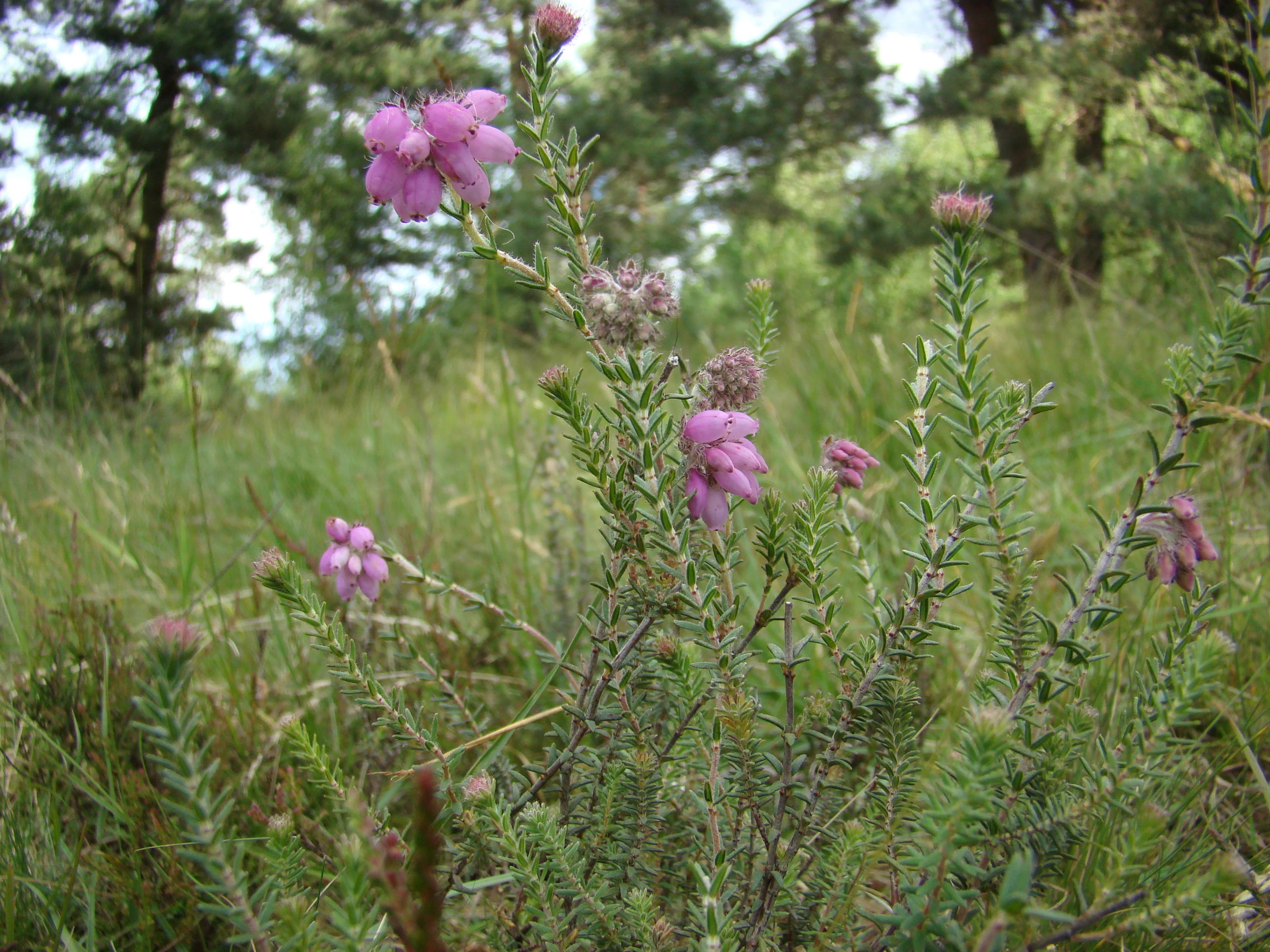
A close-up view of cross-leaved heath flowers with small bell-shaped pink blossoms on green stems, set against a blurry natural background of grasses and trees.
Cross-leaved heath, Erica tetralix, blooming in the Lüneburger Heide.

Naturpark Lüneburger Heide ecosystems, habitats, and plant life

Ecologically, the park is dominated by a finely balanced cultural landscape of heath, bog, and forest. The most iconic vegetation is the common heather (Calluna vulgaris), whose purple bloom shapes the visual character of the core reserve each August and September. On wetter, nutrient-poor sites, cross-leaved heath (Erica tetralix) forms gentler carpets in moors and damp heaths. Common juniper (Juniperus communis), a pioneer of open heath, dots the landscape as both shrub and column-like small tree and provides crucial shelter for saplings against grazing animals.

In addition to open heath, the park supports extensive bog systems, including several protected nature reserves such as the Oberes Fintautal, the Riensheide with Stichter See and Sägenmoor, and the Seemoor und Schwarzes Moor bei Zahrensen. Forests, covering more than 30 percent of the park area, range from pine-dominated stands on sandy soils to mixed deciduous communities on richer sites. The interplay of these habitats, maintained through traditional land management, is what gives the park its distinct ecological character and supports its status as a refuge for species of the open cultural landscape.
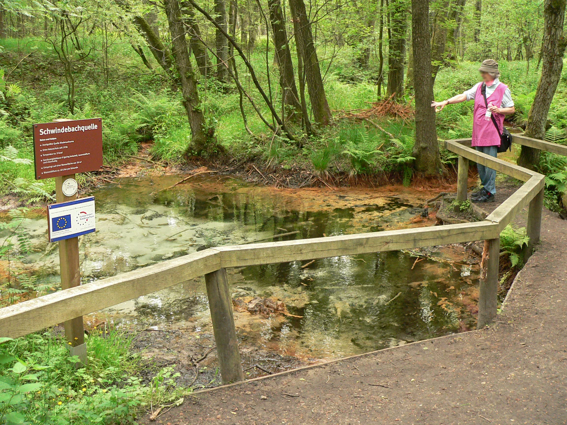
A person standing on a wooden boardwalk, pointing toward a small forest spring marked by an informational sign labeled Schwindebachquelle.
A visitor viewing the Schwindebach spring in Naturpark Lüneburger Heide.

Naturpark Lüneburger Heide wildlife and species highlights

The park is most celebrated for its black grouse (Birkhuhn) population, which survives in the core nature reserve thanks to decades of effort by the Verein Naturschutzpark and other conservation bodies. The Lüneburger Heide hosts the largest contiguous population of black grouse in the Central European lowlands, an unusual concentration given that the species is classified as endangered (Gefährdungsstufe 2) on Germany's Red List. The birds depend on open moorland and heath with scattered birch and spruce and a rich herb layer; threats include predation by foxes and wild boar as well as ongoing habitat loss.

The Heidschnucke, a hardy breed of heath sheep, is itself a defining element of the park's fauna and the primary tool of habitat management. Grazing by these animals and other livestock suppresses tree seedlings and maintains the open character of the heath. Other characteristic species of the cultural landscape find refuge in the mixture of heath, bog, and forest edges.
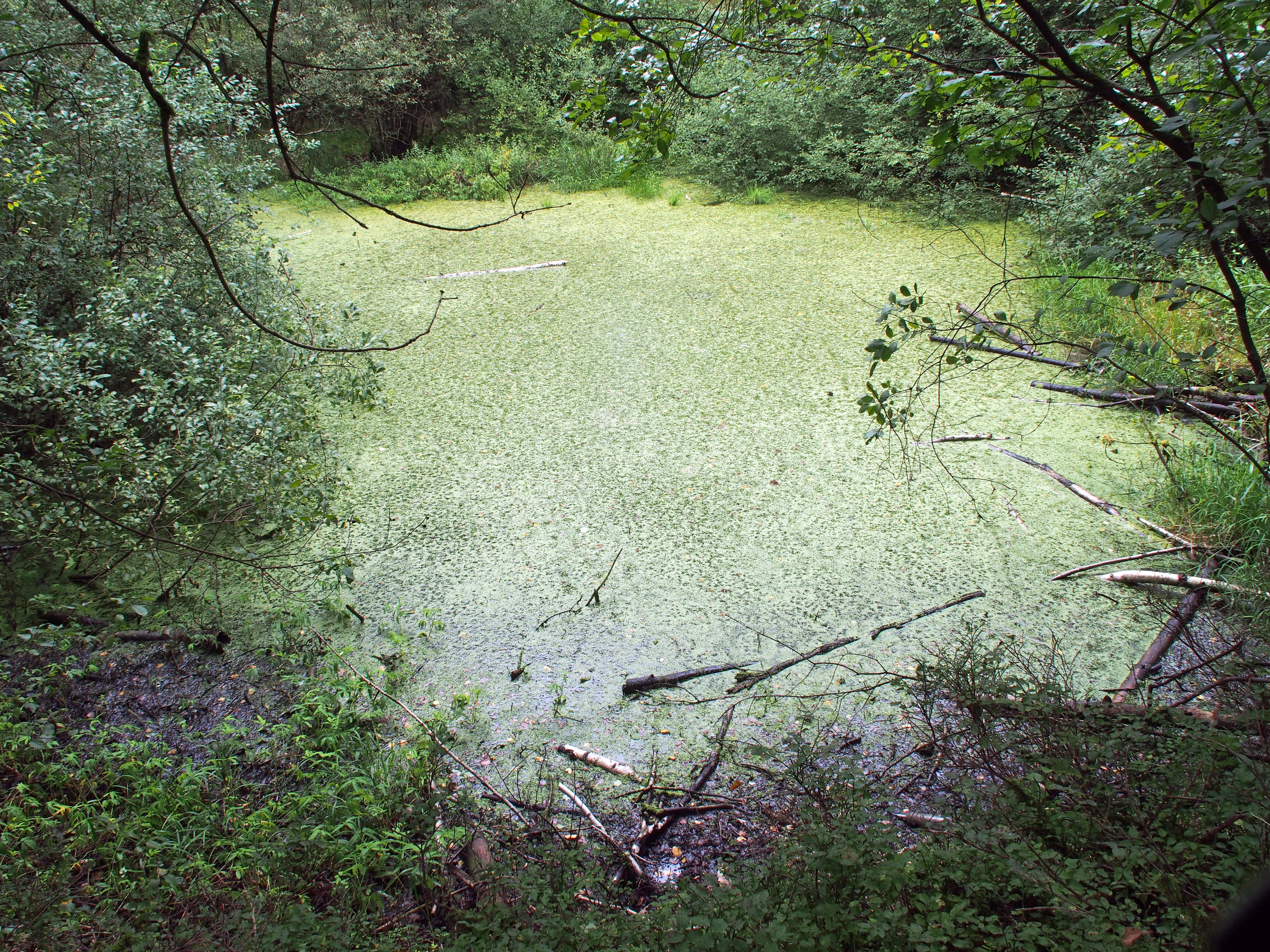
A small pond covered in green algae and duckweed, framed by deciduous trees and bushes, with fallen branches visible on the water surface.
The Grundlose Kuhle, a small karst pond surrounded by forest near Soltau in the Lüneburger Heide.

Naturpark Lüneburger Heide conservation status and protection priorities

Beyond its visual and cultural appeal, Naturpark Lüneburger Heide is a landscape of significant conservation value. As Germany's oldest nature park and an IUCN Category V Protected Landscape, it has shaped thinking about integrated conservation, sustainable land use, and public engagement with protected landscapes for more than a century.

The park embodies a conservation philosophy that history matters as much as biology, recognizing that its heathlands are not natural wilderness but rather the product of centuries of careful grazing, mowing, controlled burning, and woodland management. Sustaining them therefore requires continuing traditional land use, supported by the Stiftung Naturschutzpark Lüneburger Heide, the Verein Naturschutzpark, and the Verein Naturparkregion Lüneburger Heide along with numerous farmers and local volunteers. Authorities use a suite of tools including nature reserves (Naturschutzgebiete), landscape protection areas (Landschaftsschutzgebiete), and designated natural monuments (Naturdenkmale) ranging from ancient oaks and erratic boulders to the karst sinkhole and the Schwindebach spring. Membership in the Nationale Naturlandschaften alliance since 2023 underlines the park's national importance for biodiversity conservation.

Naturpark Lüneburger Heide cultural meaning and human context

The Lüneburger Heide is a landscape inseparable from human culture. The heathland itself is a cultural artifact, kept open by generations of shepherds and farmers using traditional methods such as grazing with Heidschnucken, hand-cutting, and controlled burning. Local dialects, village layouts, memorial stones (such as the Findling at Raven), and traditional crafts rooted in the heath still shape the identity of the region. Cultural figures such as Pastor Wilhelm Bode, often regarded as a father of the Lüneburger Heide conservation movement, are part of the regional memory, and a dedicated Pastor-Bode-Weg long-distance path runs through the park.

Regional food culture reinforces this identity. Heidehonig (heath honey), Heidschnuckenfleisch (heath lamb meat), the protected Lüneburger Heidekartoffel, heath blueberries, asparagus, and buckwheat are all signature products of the park landscape, supported by a network of more than 90 regional partner businesses in the nationwide RegioAPP and sustained by the Schutzgemeinschaft Lüneburger Heidekartoffeln.

Top sights and standout views in Naturpark Lüneburger Heide

Naturpark Lüneburger Heide stands out for the combination of historical weight and ecological richness. It is the founding example of Germany's Naturpark system, a status that gives it not only longevity but exceptional institutional knowledge. Its heathlands are unique in Central Europe, representing the largest contiguous inland dwarf-shrub heaths of agricultural origin on the continent and providing a refuge for the last substantial Central European lowland population of black grouse.

Visitors encounter a working cultural landscape shaped by sustainable traditions: the centuries-old practice of Heidschnucken grazing, the heritage of horse-drawn carriages that have traversed the heath for more than a century, and the dedicated conservation work of institutions such as the Stiftung Naturschutzpark. Layered on top are modern sustainability efforts, certification schemes, education programs, and a free seasonal shuttle bus, all of which make the park both a conservation site and a model of integrated rural development.

Best time to visit Naturpark Lüneburger Heide

The most celebrated moment in the park's annual cycle is the heath bloom, when the Calluna vulgaris heather erupts into a sweep of pale violet across the reserve and surrounding districts. As a traditional rule of thumb, the bloom occurs between about August 8 and September 9, though weather can shift the peak by more than a week in either direction.

Beyond the bloom season, late spring through early autumn is generally the most rewarding time to experience the open heath landscape, the bogs, and the juniper stands at their most accessible. Summer and early autumn also coincide with the Heide-Shuttle season, which runs from mid-July to mid-October, providing free public access to the park by bus with bicycle trailers.


Monthly climate preview

Examining long term monthly temperature ranges and precipitation averages at a representative coordinate

Naturpark Lüneburger Heide Climate Normals and Annual Weather Patterns

Historical records from 1991 to 2020 document long term temperature ranges and precipitation averages across the representative park coordinate. Accessing the complete monthly database reveals finer fluctuations in seasonal weather patterns and multi year averages.
Annual mean9 °C
0 °C18 °C
Jan
Feb
Mar
Apr
May13°
Jun16°
Jul18°
Aug18°
Sep14°
Oct
Nov
Dec
Warmest month
July

18.3 °C

Coolest month
January

0.4 °C

Wettest month
July

2.6 mm/day

Driest month
April

1.4 mm/day

Park location guide

Geography guide, regional context, and park location map for Naturpark Lüneburger Heide

Naturpark Lüneburger Heide park geography, regions, and map view in Germany

Understand where Naturpark Lüneburger Heide sits in Germany through a broader geographic reading of the surrounding landscape, nearby location context, and its mapped position within the national park landscape.

How Naturpark Lüneburger Heide fits into Germany

Germany is a federal republic in Western and Central Europe with a population of over 83 million across sixteen constituent states. It is Europe's largest economy by nominal GDP and a major global exporter and importer. The capital is Berlin, and the country borders Denmark, Poland, Czech Republic, Austria, Switzerland, France, Luxembourg, Belgium, and the Netherlands.

Wider geography shaping Naturpark Lüneburger Heide in Germany

Germany is located in Western and Central Europe, spanning 357,022 km². It borders Denmark to the north, Poland and the Czech Republic to the east, Austria and Switzerland to the south, and France, Luxembourg, Belgium, and the Netherlands to the west. The country has coastlines on the Baltic Sea and North Sea to the north, with the Alps located in the southern region.

Map view of Naturpark Lüneburger Heide

Use this park location map to pinpoint Naturpark Lüneburger Heide in Germany, understand its exact geographic position, and read its mapped placement within the surrounding landscape more clearly.

Pigeon | © OpenStreetMap contributors

Location context for Naturpark Lüneburger Heide

Lower Saxony

Visual reference for heathlands, glacial terrain, and rare lowland habitats

Naturpark Lüneburger Heide Landscape and Protected Area Scenery Photos

Visual documentation reveals the expansive dwarf shrub heathlands and varied glacial terrain defining Naturpark Lüneburger Heide. Detailed photography captures the protected landscape character, native vegetation, and sweeping open vistas across the reserve.

A dirt trail winds through rolling heathland with purple blooming heather, scattered small shrubs, and a backdrop of green forest under a partly cloudy blue sky.

Wide landscape view of an expansive heathland area filled with numerous tall, thin juniper trees under a clear sky.

A close-up view of cross-leaved heath flowers with small bell-shaped pink blossoms on green stems, set against a blurry natural background of grasses and trees.

A person standing on a wooden boardwalk, pointing toward a small forest spring marked by an informational sign labeled Schwindebachquelle.

A small pond covered in green algae and duckweed, framed by deciduous trees and bushes, with fallen branches visible on the water surface.

Park atlas

Compare regional landscapes, glacial terrain, and connected conservation zones across northern Germany

Explore Parks Near Naturpark Lüneburger Heide and Surrounding Protected Areas

Browse other protected areas near Naturpark Lüneburger Heide to examine regional landforms, vast heathlands, and glacial valleys. Evaluating adjacent nature reserves provides deeper geographic context for low-lying northern European terrain and conservation networks.
Nature reserveLandkreis Rotenburg (Wümme)
About 24 km away#1 closest

West

Wümmeniederung mit Rodau, Wiedau und Trochelbach: Protected Wetland and Heath Landscape

Regional geography and floodplain connectivity in Landkreis Rotenburg

This nature reserve protects a sprawling lowland landscape characterized by the Wümme, Rodau, Wiedau, and Trochelbach rivers. The terrain features a mosaic of near-natural meandering streams, species-rich wet meadows, and rare raised bog remnants, providing a comprehensive overview of northern German lowland ecology.

Area
28.96 km²
Established
2020
IUCN
IV
Relief
Lowland
Nature reserveLower Saxony
About 24 km away#2 closest

North

Stemmbruch Nature Reserve: Protected Lowland Bog Geography in Lower Saxony, Germany

A resilient moorland habitat near the Seeve floodplain

Stemmbruch serves as a vital nature reserve in the Harburg district, protecting a rare hanging spring bog system. This compact protected area features a mosaic of bog pools, heath, and swamp woodland, demonstrating the complex hydrologic connectivity between the sandy geest ridge and the surrounding northern German lowland plains.

Area
0.56 km²
Established
1989
IUCN
IV
Relief
Lowland
Nature reserveLower Saxony
About 25 km away#3 closest

South

Wittenmoor Nature Reserve: Geographic Atlas of a Protected Raised Bog in Lower Saxony

Peatland conservation and wetland terrain in the Heidekreis district

Wittenmoor offers a focused view into the peatland dynamics of Lower Saxony. The protected area features two distinct sections characterized by hand-cut peat extraction pools, floating moss mats, and bog-adapted flora. This site provides a clear look at how small-scale reserve management restores hydrological health to marshy meadows and transition-zone moor heath environments within an agricultural landscape.

Area
0.28 km²
Established
1999
IUCN
IV
Relief
Lowland
Nature reserveLower Saxony
About 26 km away#4 closest

Northeast

Wittsaal Nature Reserve: Mapped Wetland Geography and Protected Landscape in Lower Saxony

A rare mosaic of moor ponds and swamp woodland

Wittsaal is a specialized nature reserve in the Lüneburg region of Lower Saxony, Germany. The area protects a peat-cut moor pond currently undergoing natural silting, surrounded by willow-dominated swamp woodland, reedbeds, and sedge marshes. This compact site provides a critical, quiet refuge for wetland ecology within a wider landscape of agricultural fields and transitional glacial terrain.

Area
0.13 km²
Established
1985
IUCN
IV
Relief
Lowland
Nature reserveLandkreis Uelzen
About 28 km away#5 closest

Southeast

Wettenbosteler Moor Protected Area: Geographic Overview and Mapped Landscape Features

A resilient raised bog remnant in the Landkreis Uelzen heath forest

Spanning roughly thirteen hectares, Wettenbosteler Moor preserves a rare spring-fed bog habitat characterized by peat-forming vegetation and pine forest borders. This nature reserve offers deep insights into the drainage networks and lowland terrain of the Lüneburg Heath, mapping the transition between upland forest and valley mire.

Area
0.128 km²
Established
1977
IUCN
IV
Relief
Lowland
Nature reserveLandkreis Heidekreis
About 29 km away#6 closest

Southeast

Tal der Kleinen Örtze Nature Reserve: Geographic Atlas and Protected Area Context

Stream valley restoration in the Lüneburg Heath region

An essential look at the Tal der Kleinen Örtze nature reserve, which encompasses restored brook courses and floodplain woodland in Lower Saxony. This protected area serves as a significant example of hydrological recovery and habitat transition, ranging from alder forests to heathland remnants along the valley margins within the broader Heidekreis geography.

Area
4.5 km²
Established
1993
IUCN
IV
Relief
Lowland
Nature reserveNiedersachsen
About 30 km away#7 closest

South

Wietzendorfer Moor: Geographic Analysis of Protected Bog and Wetland Landscapes

Nature reserve terrain in Niedersachsen, Germany

Discover the physical layout of Wietzendorfer Moor, an intricate nature reserve defined by restored raised bog habitats and historical polders. This atlas entry provides geographic context on the wet meadow systems and sand trails that define this unique Lüneburg Heath landscape, highlighting the spatial distribution of its protected parcels.

Area
2.1 km²
Established
1998
IUCN
IV
Relief
Lowland
Nature reserveHamburg
About 31 km away#8 closest

Northeast

Zollenspieker Nature Reserve: Geographic Overview and Protected Riverine Landscapes

Tidal Elbe floodplain and inland brack wetland ecology

Located in the Hamburg borough of Bergedorf, Zollenspieker protects a significant stretch of the tidal Elbe. This nature reserve contains approximately 80 hectares of diverse terrain, from freshwater mudflats exposed at low tide to sheltered oak-dominated forests and old brack wetlands known as Carlsbrack and Riepenburger Brack.

Area
0.8 km²
Established
1988
IUCN
IV
Relief
Lowland

Common questions about visiting, size, designation, and location context for Naturpark Lüneburger Heide

Naturpark Lüneburger Heide FAQs for park facts, access, geography, and protected area context

Find quick answers about Naturpark Lüneburger Heide, including protected-area facts, park geography, trail and visitor context, and how the park fits into its surrounding country and regional landscape.
MoriAtlas Explorer

Continue Your Protected Areas Search Across the Global Atlas

Deepen your exploration by continuing the structured search for national parks and protected areas worldwide. Utilize the comprehensive filtering capabilities to compare different conservation landscapes and refine your understanding of global park geography. Discover more about the distribution and characteristics of protected natural areas.

Global natural geography