
Mori Atlas logo
Protected areaÁrea de Conservación e Importancia Ecológica Ñembi Guasu

A vast conservation corridor spanning the Chaco plain and sub-Andean piedmont transitions.

Área de Conservación e Importancia Ecológica Ñembi Guasu: Mapped Protected Landscapes in Bolivia

Área de Conservación e Importancia Ecológica Ñembi Guasu serves as a vital ecological connector within the southeastern Bolivian Chaco. This protected territory encompasses a diverse physiographic gradient, ranging from the sub-Andean foothills through the transitional piedmont to the expansive, dry-forest-covered Chaco plain. The area represents a significant Indigenous-led conservation framework, safeguarding ancestral lands and continuous dry-forest ecosystems.

dry forestChaco ecoregionIndigenous territoryGuarani Charagua IyambaeAyoreo homelandlarge protected area
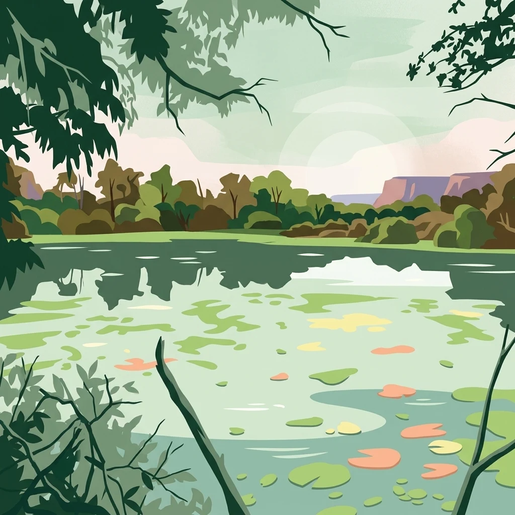
Stylized digital illustration of a calm body of water with lily pads, framed by tree branches in the foreground, with distant low hills under a soft sky.

Área de Conservación e Importancia Ecológica Ñembi Guasu

Protected area

Park overview

Structured park overview, official facts, and landscape profile for Ñembi Guasu Conservation and Ecological Importance Area

Ñembi Guasu Conservation and Ecological Importance Area park facts, protected area profile, and essential visitor context

Review the core facts for Ñembi Guasu Conservation and Ecological Importance Area, including designation, size, terrain, visitor scale, habitats, and operating context in one park-focused overview.

About Ñembi Guasu Conservation and Ecological Importance Area

Ñembi Guasu is a conservation and ecological importance area in the lowland Chaco of southeastern Bolivia, established in 2019 within the framework of Charagua Iyambae, one of Bolivia's pioneering autonomous Indigenous territories. The reserve lies in the Cordillera province of the Santa Cruz department, not far from the town of Roboré and near the border with Paraguay, and extends across a broad transition of landscapes that characterize the southern Bolivian Chaco.

Physiographically, the area ranges from sub-Andean terrain in the west through a transitional piedmont into the open Chaco plain, encompassing forest types and habitats typical of one of the world's most extensive dry tropical forest ecosystems. Together with the Otuquis National Park to the south and the Kaa Iya National Park of the Gran Chaco to the west, Ñembi Guasu completes a remarkable sequence of connected protected areas that safeguard a continuous block of Chaco habitat at a regional scale.

Beyond its ecological role, Ñembi Guasu is defined by its Indigenous governance model. It was declared under the autonomous authority of Charagua Iyambae and overlaps with the ancestral territory of the Ayoreo nation, whose presence in the area includes groups that continue to live in voluntary isolation. This combination of large-scale dry-forest protection, regional ecological connectivity, and Indigenous-led territorial stewardship makes Ñembi Guasu one of the most distinctive conservation areas in lowland South America.

Quick facts and research context for Ñembi Guasu Conservation and Ecological Importance Area

Ñembi Guasu is a municipal-level protected area of roughly 12,046 square kilometers in the Cordillera province of the Santa Cruz department, Bolivia, in the Chaco ecoregion near the Paraguayan border. Established on 30 April 2019 through the consolidation and boundary law of Charagua Iyambae, it is administered under the autonomous Indigenous government of Charagua.

It forms a continuous protected landscape with the Otuquis and Kaa Iya national parks, preserves Chaco dry forest across sub-Andean, piedmont, and Chaco plain zones, and shelters the ancestral territory of the Ayoreo people, including groups in voluntary isolation.

Protection and recognition

Documented terrestrial protection scope and international recognition data

Área de Conservación e Importancia Ecológica Ñembi Guasu Protection Status

Territorial protection status for Área de Conservación e Importancia Ecológica Ñembi Guasu covers documented terrestrial conservation frameworks. Official designation details and recorded management scopes provide structured metrics for natural area analysis.

Protection details

Protection scope
Terrestrial
Transboundary protection
No
Park context

Deeper park guide and search-rich context for Ñembi Guasu Conservation and Ecological Importance Area

Ñembi Guasu Conservation and Ecological Importance Area history, landscape, wildlife, and travel context

Explore Ñembi Guasu Conservation and Ecological Importance Area through its history, landscape character, ecosystems, wildlife, conservation priorities, cultural context, and seasonal travel timing in a structured park guide built for atlas discovery and search intent.

Why Ñembi Guasu Conservation and Ecological Importance Area stands out

Ñembi Guasu is best known for its sheer size as one of Bolivia's largest protected areas and for sitting within the Chaco, often described as the largest dry forest ecosystem on Earth. The reserve is particularly recognized for combining large-scale dry-forest conservation with Indigenous territorial protection under Guaraní self-governance, and for serving as the ancestral home of the Ayoreo people, including communities that remain in voluntary isolation. Its role as a connective node between the Otuquis and Kaa Iya protected areas also gives it strong landscape-scale conservation significance in the Gran Chaco region.
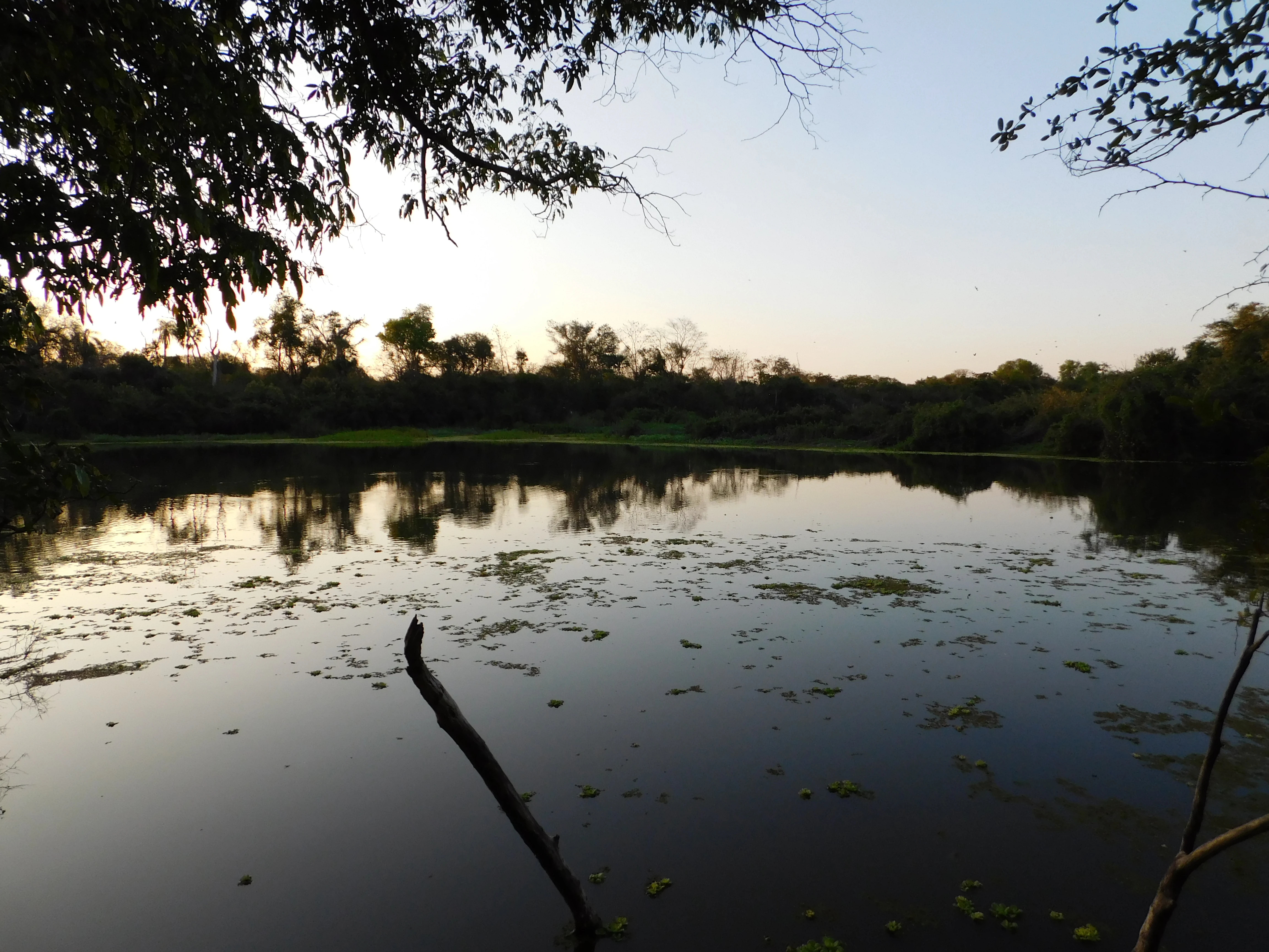
A calm, still pool of water reflecting the soft light of a setting sun, surrounded by a dense dry forest canopy with silhouettes of trees in the distance.
Sunset reflecting over a calm body of water in the Ñembi Guasu conservation area.

Ñembi Guasu Conservation and Ecological Importance Area history and protected-area timeline

Ñembi Guasu was formally established on 30 April 2019 through the Law of Consolidation and Establishment of Boundaries of the Ñembi Guasu Conservation and Ecological Importance Area. The reserve was created under the framework of Charagua Iyambae, the autonomous Indigenous territory of the Guaraní people in the Bolivian Chaco, making it a landmark in Indigenous-led conservation governance in Bolivia.

In 2019, the same year the area was declared, major wildfires in Bolivia affected a large portion of the territory, highlighting both the vulnerability of the dry-forest ecosystem and the importance of the new protection status.

In October 2024, the governor of Santa Cruz held a meeting with the governor of Alto Paraguay, Paraguay, regarding a proposed highway project that would cross Ñembi Guasu. The proposal was firmly rejected by the Ayoreo community and the Central Ayorea Nativa del Oriente Boliviano (Canob), who argued that the road would threaten ancestral territories, voluntary-isolation peoples, and unique biodiversity. Charagua's Guaraní decision-making body also opposed the project. By June 2025, Canob reported that the Santa Cruz departmental legislature was promoting a law to enable the road's construction, and the organization reiterated its rejection due to concerns about fragmentation of the protected area and the involvement of Paraguayan authorities and agribusiness interests.

Ñembi Guasu Conservation and Ecological Importance Area landscape and geographic character

The landscape of Ñembi Guasu follows the classic physiographic gradient of the southern Bolivian Chaco. The western portion of the area reaches into the sub-Andean zone, where terrain begins to feel the influence of the Andes foothills. From there, the land descends through a transition or piedmont belt, a mosaic where Andean influence gradually blends into the lowland plain.

The bulk of the reserve lies within the Chaco plain, the flat, expansive lowland that defines this part of South America. Open skies, thorny dry forest, and seasonal water bodies, including lagoons scattered across the terrain, characterize this environment. Together, these zones give the conservation area a layered geography, with successive transitions from Andean fringe to Chaco lowland supporting different vegetation structures and wildlife communities.
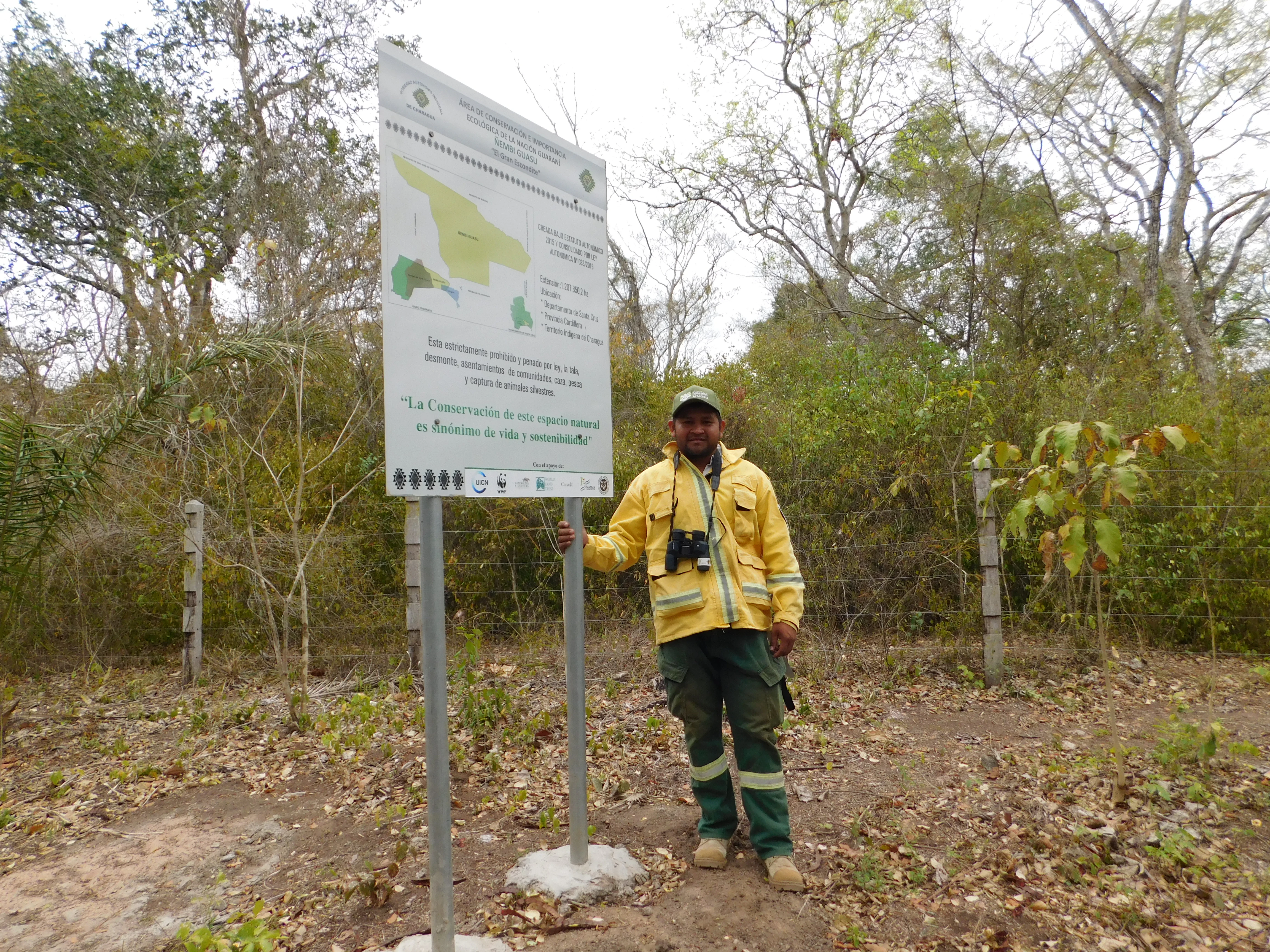
A person in a yellow uniform and dark pants standing next to a tall white informational sign in a dry forest setting.
A park official standing next to the entrance signage for the Ñembi Guasu Conservation Area.

Ñembi Guasu Conservation and Ecological Importance Area ecosystems, habitats, and plant life

Ñembi Guasu protects a major block of the Bolivian Chaco ecoregion, widely regarded as one of the largest dry forest ecosystems in the world. The Chaco here combines dry tropical forest, thorn scrub, seasonally inundated wetlands, and open savanna-like formations across its sub-Andean, piedmont, and plain zones, producing a varied mosaic of habitats despite the overall dry-forest character.

This habitat diversity supports a correspondingly rich animal community. The area sustains numerous mammal species, a particularly rich birdlife, and a diverse herpetofauna, all within a continuous landscape that links Ñembi Guasu to the Otuquis and Kaa Iya protected areas and strengthens the resilience of the broader Chaco ecosystem.

Ñembi Guasu Conservation and Ecological Importance Area wildlife and species highlights

The wildlife of Ñembi Guasu reflects its position within the Gran Chaco, one of South America's most ecologically distinctive dry regions. The area is home to a substantial mammal community that includes large predators and other characteristic Chaco species, alongside a notable micromammal presence typical of dry-forest ecosystems.

Among the species documented in the area are the jaguar, the puma, the nocturnal monkey (Aotus azarae), and the lesser anteater (Tamandua tetradactyla). The reserve also supports a rich herpetofauna and around 300 bird species, making it a significant area for both lowland wildlife conservation and regional birdlife. Because Ñembi Guasu adjoins other major Chaco reserves, its fauna effectively moves across a much larger connected landscape.

Ñembi Guasu Conservation and Ecological Importance Area conservation status and protection priorities

Ñembi Guasu is one of Bolivia's largest protected areas, covering well over a million hectares of Chaco dry forest and playing a central role in safeguarding one of the world's largest remaining dry tropical forest ecosystems. Its conservation importance extends well beyond its borders: together with Otuquis National Park and the Kaa Iya National Park of the Gran Chaco, it forms a continuous protected corridor through the Chaco ecoregion, helping maintain ecological connectivity for wide-ranging species such as the jaguar.

What sets Ñembi Guasu apart is its governance model. Declared under the autonomous authority of Charagua Iyambae, it is administered within an Indigenous Guaraní territorial framework. This integrates ecological protection with cultural and territorial safeguarding, particularly for the Ayoreo people, including those who still live in voluntary isolation. The area is therefore not only a conservation reserve but also a defensive buffer around ancestral lands, and conservation proposals around infrastructure, such as the contested road project discussed in 2024 and 2025, are evaluated largely in terms of their impact on both ecological integrity and Indigenous rights.

Ñembi Guasu Conservation and Ecological Importance Area cultural meaning and human context

Ñembi Guasu is deeply intertwined with the territorial and cultural identity of the Guaraní people of Charagua Iyambae and the Ayoreo nation. The reserve overlaps with the ancestral homeland of the Ayoreo, a portion of whose population continues to live in voluntary isolation within the Chaco, making the area not only an ecological sanctuary but also a space of profound cultural and human significance.

The Guaraní autonomous government of Charagua Iyambae has exercised direct stewardship over the declaration of the area, embedding Indigenous self-governance into the legal foundation of the reserve. Recent debates over external development projects, particularly the proposed road that would bisect the protected area, have emphasized the role of Ñembi Guasu as a living cultural territory where Indigenous peoples actively defend their land, their legal autonomy, and their way of life.

Top sights and standout views in Ñembi Guasu Conservation and Ecological Importance Area

One of the largest protected areas in Bolivia, covering roughly 12,000 square kilometers in the Bolivian Chaco; an Indigenous-led conservation area under the autonomous Guaraní territory of Charagua Iyambae; a key ecological connector between the Otuquis and Kaa Iya protected areas in a continuous Chaco dry-forest landscape; includes the ancestral territory of the Ayoreo people, including communities in voluntary isolation; protects a transition of sub-Andean, piedmont, and Chaco plain environments rich in mammals, birds, and herpetofauna.

Best time to visit Ñembi Guasu Conservation and Ecological Importance Area

The Chaco has a strongly seasonal climate with a distinct dry season and a wet season that concentrates most of the rainfall. Visiting during or shortly after the wet season tends to offer greener vegetation, more active wildlife, and fuller wetland and lagoon systems, while the dry season brings clearer skies and easier access across the flat landscape, though with hotter temperatures and more forest stress, including elevated wildfire risk as seen in 2019. The most rewarding visits typically align with cooler periods of the dry season or the transition into the wet season, when wildlife viewing and landscape conditions are often most balanced.
Monthly climate preview

Long-term monthly temperature and precipitation patterns across the conservation area

Área de Conservación e Importancia Ecológica Ñembi Guasu Climate Normals

Representative baseline data reveals a distinct annual cycle of measured temperatures and precipitation rates for Área de Conservación e Importancia Ecológica Ñembi Guasu. Reviewing the comprehensive monthly profile provides a deeper look into the long-term climatic rhythm governing this protected landscape.
Annual mean26 °C
22 °C29 °C
Jan29°
Feb28°
Mar28°
Apr26°
May23°
Jun22°
Jul22°
Aug25°
Sep27°
Oct29°
Nov29°
Dec29°
Warmest month
October

29.2 °C

Coolest month
July

22.4 °C

Wettest month
February

4.5 mm/day

Driest month
July

0.6 mm/day

Park location guide

Geography guide, regional context, and park location map for Ñembi Guasu Conservation and Ecological Importance Area

Ñembi Guasu Conservation and Ecological Importance Area park geography, regions, and map view in Bolivia

Understand where Ñembi Guasu Conservation and Ecological Importance Area sits in Bolivia through a broader geographic reading of the surrounding landscape, nearby location context, and its mapped position within the national park landscape.

How Ñembi Guasu Conservation and Ecological Importance Area fits into Bolivia

Bolivia, officially the Plurinational State of Bolivia, is a landlocked country in central South America. It features diverse geography including the Andean mountain range, Amazonian plains, Gran Chaco, and the Pantanal wetland. The country has a population of approximately 11.4 million and is administratively divided into nine departments, with La Paz as the seat of government and Sucre as the constitutional capital.

Wider geography shaping Ñembi Guasu Conservation and Ecological Importance Area in Bolivia

Bolivia is located in central South America, bordered by Brazil to the north and east, Paraguay to the southeast, Argentina to the south, Chile to the southwest, and Peru to the west. The country is divided between a western Andean region and tropical lowlands to the east and north. It includes the Amazonian plain, Gran Chaco, temperate valleys, the high-altitude Altiplano plateau, and part of the Pantanal wetland along its eastern border.

Map view of Ñembi Guasu Conservation and Ecological Importance Area

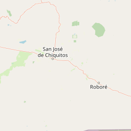
Use this park location map to pinpoint Ñembi Guasu Conservation and Ecological Importance Area in Bolivia, understand its exact geographic position, and read its mapped placement within the surrounding landscape more clearly.

Pigeon | © OpenStreetMap contributors

Location context for Ñembi Guasu Conservation and Ecological Importance Area

Departamento de Santa Cruz

Visual reference collection showcasing dry forest habitats and terrain across the Bolivian Chaco

Área de Conservación e Importancia Ecológica Ñembi Guasu Photos and Protected Landscape Scenery

Visual documentation captures the expansive Chaco dry forest ecosystems and transitional lowland terrain protected within Área de Conservación e Importancia Ecológica Ñembi Guasu. Field photography provides clear context on the physical geography and vegetative structure defining this protected territory.

A calm, still pool of water reflecting the soft light of a setting sun, surrounded by a dense dry forest canopy with silhouettes of trees in the distance.

A wide landscape view of a lagoon filled with grasses and low-lying vegetation surrounded by dense dry forest under a clear sky.

A person in a yellow uniform and dark pants standing next to a tall white informational sign in a dry forest setting.

Park atlas

Compare connected dry-forest reserves and neighboring Chaco lowland landscapes.

Explore Protected Areas Near Área de Conservación e Importancia Ecológica Ñembi Guasu

Browse neighboring protected areas and connected dry-forest reserves that share the expansive Chaco landscape surrounding Área de Conservación e Importancia Ecológica Ñembi Guasu. Comparing adjacent regional habitats reveals broader ecological patterns across the southern Bolivian plains and sub-Andean transition zones.
National parkSanta Cruz Department
About 107 km away#1 closest

East

Otuquis National Park and Integrated Management Natural Area: Mapped Protected Landscape in Santa Cruz Department

Bolivia's designated national park for atlas exploration.

Gain detailed geographic context for Otuquis National Park and Integrated Management Natural Area, a significant protected landscape within Bolivia's Santa Cruz Department. This page serves as a dedicated entry point for understanding the park's mapped boundaries, its role as a national park, and its natural terrain within the regional atlas. Explore its unique geographic features and its place within Bolivia's network of protected areas.

Area
10,059.5 km²
Established
1997
IUCN
II
Relief
Lowland
A soft, horizontal watercolor painting depicting a calm wetland landscape with distant rolling hills, green vegetation, and small islands in the water.
Protected landscapeSanta Cruz
About 113 km away#2 closest

Northeast

Área Natural de Manejo Integrado San Matías: Mapping Bolivia’s Largest Protected Wetland

Ecological transitions across the Santa Cruz eastern lowlands

Área Natural de Manejo Integrado San Matías serves as a critical bridge between the Chiquitano forest, the Cerrado, and the Bolivian Pantanal. The landscape showcases a dramatic seasonal flood cycle that defines the regional hydrology and supports high biodiversity within its crystalline rock hills and sprawling lowland basins.

Area
29,185 km²
Established
1997
Relief
Mixed relief
Climate
Tropical
National parkAlto Paraguay
About 157 km away#3 closest

Southeast

Nationalpark Río Negro: Mapping Protected Landscapes in the Alto Paraguay Department

Ecological transition zone between Pantanal, Chaco, and cerrado

Nationalpark Río Negro encompasses a critical mosaic of habitats at the edge of the Bolivian border. This protected area acts as a meeting point for three major South American biomes, resulting in diverse terrain ranging from seasonal wetlands to dry quebracho forests. The park provides an essential geographic anchor for understanding the ecological connectivity of the Paraguayan Pantanal and its unique environmental transitions.

Area
1,238 km²
Established
2004
Relief
Lowland
Climate
Tropical
National parkBolivia
About 163 km away#4 closest

West

Kaa-Iya del Gran Chaco National Park and Integrated Management Natural Area: Bolivia's National Park and Protected Landscape

Explore the mapped geography and regional natural landscape.

Kaa-Iya del Gran Chaco National Park and Integrated Management Natural Area stands as a crucial component of Bolivia's protected lands, offering a distinct entry point for exploring its natural geography. This page details the park's status as a national park and integrated management natural area, providing context for its mapped boundaries and its role within the country's diverse landscapes. Engage with structured information designed to illuminate the park's geographic setting and its significance for atlas-style exploration and understanding of Bolivia's protected areas.

Area
34,411.1 km²
Established
1995
Relief
Upland
Climate
Subtropical
Protected areaSanta Cruz
About 348 km away#5 closest

West

Área Protegida Municipal Palmera de Saó: Mapping the Chaco Lowlands and Protected Forest Zones

A vital protected landscape in the Santa Cruz department.

The Área Protegida Municipal Palmera de Saó represents a critical effort to safeguard the saó palm and associated dry forest ecosystems in eastern Bolivia. Stretching along the Río Grande, this protected area features a mosaic of riverine vegetation and alluvial terrain. Understanding its geographic setting reveals how this compact, municipal-level reserve supports both native Chaco wildlife and the cultural crafts of surrounding Guaraní and local communities.

Area
7.58 km²
Established
2006
Relief
Lowland
Scope
Terrestrial
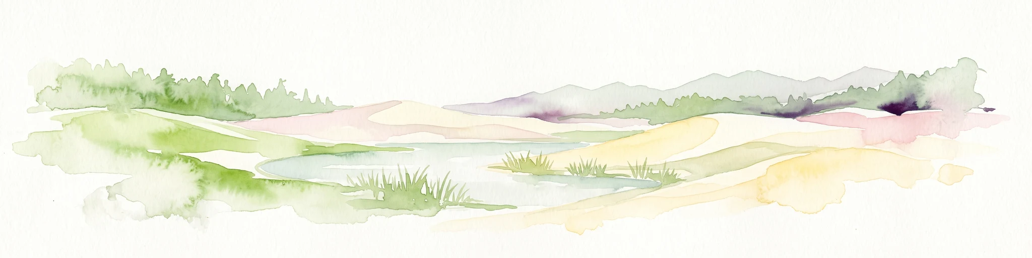
A watercolor painting showing a landscape of sandy dunes, small pools of water, and green vegetation against a white background.
Regional parkSanta Cruz
About 383 km away#6 closest

West

Parque Regional Lomas de Arena: Protected Landscapes and Geographic Features

Inland dune and Chaco forest ecosystems in the Santa Cruz lowlands

Covering 14,000 hectares near Santa Cruz de la Sierra, Parque Regional Lomas de Arena showcases a rare inland sand dune field anchored by transitional Chaco forest and savanna. This protected area provides a unique window into the geography of the Bolivian lowlands, where lagoon habitats and sandy ridges create a distinct ecological mosaic that bridges historical Chané heritage with modern conservation efforts.

Area
140.759 km²
Established
1989
IUCN
V
Relief
Lowland
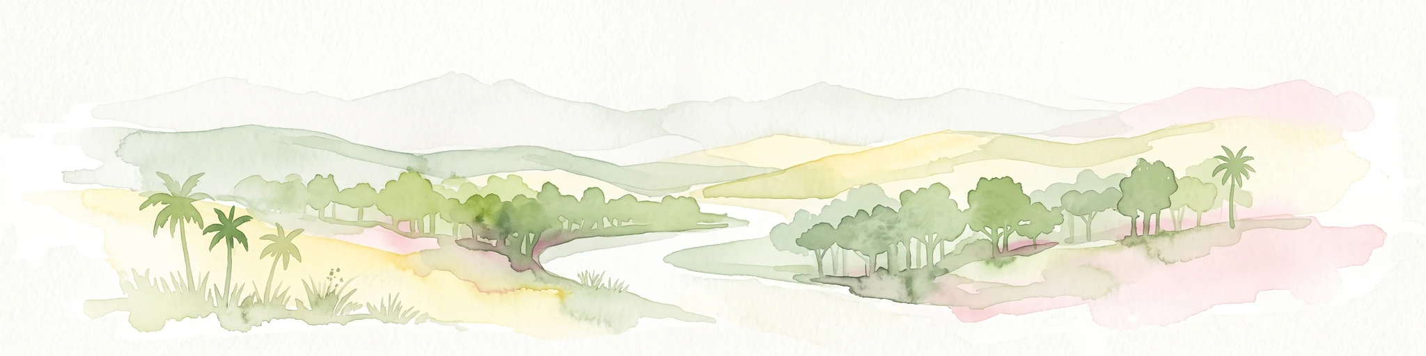
A soft watercolor painting showing a winding river through a valley with trees and palms on the banks and rolling hills in the background.
Nature reserveSanta Cruz
About 396 km away#7 closest

West

Parque de Protección Ecológica del Río Piraí: Protected Geography and Riverine Landscapes

Nature reserve and flood-control corridor in Santa Cruz, Bolivia

This nature reserve encompasses a narrow, sediment-rich corridor following the Río Piraí. It protects representative lowland habitats including Chiquitano dry forest and gallery woodlands, while balancing vital flood-mitigation roles against the pressures of urban expansion. Explore the map of this unique alluvial landscape to understand its ecological significance and role in the regional geography of Santa Cruz.

Area
15.868 km²
Established
1991
Relief
Lowland
Climate
Tropical
Nature reserveDepartamento de Tarija
About 411 km away#8 closest

Southwest

Reserva natural El Corbalán: Gran Chaco Protected Landscape and Regional Geography

A private nature reserve in Tarija Department, Bolivia.

Spanning the dry plains of the Chaco Boreal, Reserva natural El Corbalán provides essential protection for a representative sample of South American dry forest. The terrain, characterized by sparse thorny woodlands and flat lowland scrub, serves as a crucial habitat refuge. This resource offers insights into the unique ecological structure and mapped boundaries of one of Bolivia's most significant private conservation initiatives.

Area
47.78 km²
Established
1996
Relief
Lowland
Water
Minor water

Common questions about visiting, size, designation, and location context for Ñembi Guasu Conservation and Ecological Importance Area

Ñembi Guasu Conservation and Ecological Importance Area FAQs for park facts, access, geography, and protected area context

Find quick answers about Ñembi Guasu Conservation and Ecological Importance Area, including protected-area facts, park geography, trail and visitor context, and how the park fits into its surrounding country and regional landscape.
MoriAtlas Explorer

Continue Your Protected Areas Search Across the Global Atlas

Deepen your exploration by continuing the structured search for national parks and protected areas worldwide. Utilize the comprehensive filtering capabilities to compare different conservation landscapes and refine your understanding of global park geography. Discover more about the distribution and characteristics of protected natural areas.

Global natural geography