
Mori Atlas logo
Protected landscapeNor Yauyos-Cochas Landscape Reserve

High-Andean landscapes; deep karst systems and glacial basins within the Lima Region

Nor Yauyos-Cochas Landscape Reserve: A Comprehensive Geographical and Protected Area Mapping

(Reserva Paisajística Nor Yauyos-Cochas)

Nor Yauyos-Cochas Landscape Reserve encompasses a high-altitude territory in the Peruvian Andes, defined by its dramatic glacial lakes, deep valleys, and significant subterranean karst formations. This protected landscape preserves both the rugged puna grasslands of the Lima Region and traditional Andean land management practices. Through detailed mapping of the Pariacaca massif and extensive cave systems like Sima Pumaqucha, this atlas provides clear context for one of the most geologically and culturally significant protected areas in South America.

Andean landscapeshigh-altitude grasslandswet punaYungasglacial lakeskarst caves
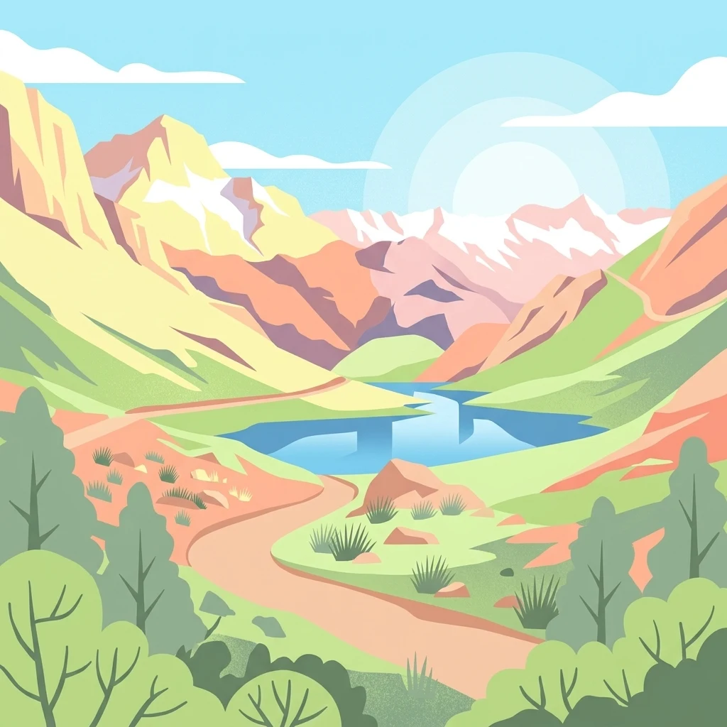
A flat-style vector illustration of a mountain valley with a central blue lake, surrounding peaks, and a winding dirt path.

Nor Yauyos-Cochas Landscape Reserve

Protected landscape

Park overview

Structured park overview, official facts, and landscape profile for Nor Yauyos-Cochas Landscape Reserve

Nor Yauyos-Cochas Landscape Reserve park facts, protected area profile, and essential visitor context

Review the core facts for Nor Yauyos-Cochas Landscape Reserve, including designation, size, terrain, visitor scale, habitats, and operating context in one park-focused overview.

About Nor Yauyos-Cochas Landscape Reserve

The Nor Yauyos-Cochas Landscape Reserve is a high-elevation protected area in the central Peruvian Andes, placed along a region where the western cordillera drops toward deep river valleys. Topographically, the reserve's identity is shaped by a stepwise descent from snowy summits such as Pariacaca down through grassy puna plateaus, rocky escarpments, and narrow valleys where the Yauyos landscape opens into wider basins filled with glacial lakes and wetland systems.

The reserve sits within two major Andean ecoregions, the Peruvian Yungas and the Central Andean wet puna. This transition zone allows the park to combine humid mountain forest characteristics with the open, wind-swept grasslands of the puna. The result is an environmental gradient that supports a broad range of ecological niches across a relatively compact geographic area, despite the high-altitude conditions that dominate the landscape.

A defining feature of the reserve is the interaction between its surface geology and its underground karst systems. The eastern limestone formations of the Andes have given rise to deep cave systems that are central to the park's identity above and below ground. The presence of Sima Pumaqucha and Qaqa Mach'ay near high-Andean lakes has attracted speleological attention and helps the reserve stand out among Andean protected areas.

The cultural layer of the landscape is equally important. The reserve surrounds and protects a network of pastoral valleys and traditional Andean villages, where communities practice a centuries-old combination of transhumant livestock herding and terraced agriculture. The protected area's designation as a landscape reserve, rather than a strict national park, reflects this balance between ecological conservation and recognition of long-established human land use. Together, these qualities make the Nor Yauyos-Cochas Landscape Reserve an unusually layered environment, where geology, ecology, and living cultural tradition meet on a single Andean stage.

Quick facts and research context for Nor Yauyos-Cochas Landscape Reserve

The Nor Yauyos-Cochas Landscape Reserve extends across the Lima and Junín regions of Peru, with its core in Yauyos Province and a smaller area in Jauja Province. It spans roughly 2,200 square kilometers of central Andean terrain. The reserve was established in 2001 and is administered by SERNANP, Peru's national service of natural protected areas.

Landscapes within the reserve belong primarily to the Peruvian Yungas and the Central Andean wet puna ecoregions, giving it a strong identity built around high-altitude grasslands, steep valleys, and glacial-fed water systems. The area is internationally notable for the presence of Sima Pumaqucha and Qaqa Mach'ay, making it one of the most geologically significant protected landscapes in the Andes.

Park context

Deeper park guide and search-rich context for Nor Yauyos-Cochas Landscape Reserve

Nor Yauyos-Cochas Landscape Reserve history, landscape, wildlife, and travel context

Explore Nor Yauyos-Cochas Landscape Reserve through its history, landscape character, ecosystems, wildlife, conservation priorities, cultural context, and seasonal travel timing in a structured park guide built for atlas discovery and search intent.

Why Nor Yauyos-Cochas Landscape Reserve stands out

Nor Yauyos-Cochas is best known internationally for the two remarkable caves within its boundaries. Sima Pumaqucha is counted among the deepest caves in South America, while Qaqa Mach'ay holds the distinction of being the highest surveyed cave in the world. Together, these features position the reserve as a globally significant site for karst and speleological research. Above ground, the reserve is equally distinguished for its high-Andean scenery, including the snow-capped peak Pariacaca, which rises to 5,750 meters, and a chain of glacial lakes such as Pumaqucha. The protected area's elevation gradient supports a transition between Andean forest communities and the open puna grasslands that give the landscape its wide-open character.
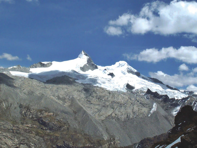
A wide view of the snow-capped Nevado Pariacaca mountain range under a blue sky with scattered clouds.
The snow-covered peaks of Nevado Pariacaca in the Nor Yauyos-Cochas Landscape Reserve.

Nor Yauyos-Cochas Landscape Reserve history and protected-area timeline

The Nor Yauyos-Cochas Landscape Reserve was officially established in 2001 as part of Peru's national system of protected natural areas. Its creation reflected a national strategy of designating larger landscape-scale reserves in densely populated Andean regions, where purely strict-protection models would have been difficult to apply. By choosing a landscape reserve designation, the Peruvian state recognized the long-standing presence of human communities within the territory.

From its foundation, the reserve has been administered by SERNANP, the national service responsible for managing Peru's protected areas. The governance framework has emphasized the integration of conservation with the maintenance of traditional land use, an approach that has shaped reserve management decisions concerning grazing, water resources, and archaeological heritage.

Earlier or more ancient history of the reserve's territory includes archaeological occupations of the Yauyos and Junín highland valleys. Sites such as Khuchi Mach'ay, Pirqa Pirqa, Quchawasi, Qutu Qutu, and Wamanmarka attest to long-term human settlement in the valleys now encompassed by the protected landscape, providing the reserve with a deep pre-Columbian and historic-period cultural background.

Nor Yauyos-Cochas Landscape Reserve landscape and geographic character

The reserve's landscape is built around variation in altitude, with elevations reaching well above 5,000 meters in the high cordillera and descending into sheltered valleys below. Pariacaca, peaking at 5,750 meters, anchors the reserve's western side and is one of its most visually dominant mountains. Below the snowfields, glacial activity has shaped deep U-shaped valleys and carved out basins that today hold clear alpine lakes.

Lakes such as Pumaqucha, in the vicinity of the Sima Pumaqucha cave system, contribute strongly to the visual identity of the park. These glacial lakes, set against rocky cliffs and steeply inclined puna slopes, form a network of reflective surfaces that punctuate the reserve's open grasslands. The combination of water, cliff, and high snow-capped terrain produces some of the most characteristic scenery in the Lima Region.

Below the puna, the valleys of Yauyos narrow into vegetated corridors where vegetation grows denser. Steep slopes, scattered forest patches, and the meeting of high-Andean grasslands with shrubland give the reserve a strong contrast between wide-open terrain above and more enclosed, cultivated bottomlands below. Rivers feeding the Pacific slope drain much of this terrain, and their headwaters within the reserve are critical to the hydrology of the surrounding region.

Nor Yauyos-Cochas Landscape Reserve ecosystems, habitats, and plant life

The ecological identity of Nor Yauyos-Cochas is defined by the meeting of two distinct Andean ecological zones. The Peruvian Yungas ecoregion contributes humid montane forest environments at intermediate elevations, with a mix of evergreen and semi-deciduous species adapted to cloud cover and persistent moisture. This zone gives the reserve a wooded character along parts of its river valleys and shadowed slopes.

Above the Yungas, the Central Andean wet puna dominates the higher parts of the reserve. The wet puna is characterized by grasslands of ichu and other tough bunch grasses, cushion plants, and scattered wetlands, all adapted to freezing nights, intense sunlight, and seasonal precipitation. The wet designation reflects a relatively rainier climate than neighboring Andean regions, which supports the abundance of lakes, peatlands, and small wetland corridors that mark the upper elevations.

The combination of these two environments gives the reserve notable ecological diversity. The Yungas and wet puna together create a transition that few protected areas in central Peru preserve so completely. This gradient supports a wide range of plant communities and microhabitats within a relatively compact landscape, and it underpins the reserve's importance as a continuous ecological corridor along the western Andes.

Nor Yauyos-Cochas Landscape Reserve wildlife and species highlights

The high-Andean habitats of Nor Yauyos-Cochas support the wildlife expected of Peru's wet puna and upper Andean forest, including native camelids such as the vicuña and alpaca, which graze in the open grasslands and are emblematic of the broader Andean landscape. Native and introduced livestock also share these grazing grounds as part of the long-standing pastoral economy of the region.

Smaller mammals native to Andean forests and pastures are also part of the reserve's fauna. The common opossum is documented in the park and represents the broader wild mammal community that inhabits transitional habitats between the wooded valleys and surrounding puna. Birdlife tied to high-Andean wetlands and lakes is resident in the reserve, while raptors and other birds adapted to cliff and grassland habitats use the elevation gradients of the reserve extensively.

The combination of forested valleys, open grasslands, and aquatic habitats allows wildlife to move vertically across the landscape through different ecological zones, a feature that strengthens the biodiversity of the reserve and gives its fauna a layered identity typical of complex Andean regions.

Nor Yauyos-Cochas Landscape Reserve conservation status and protection priorities

The reserve's conservation significance lies in the protection of two interconnected Andean ecological zones, the Peruvian Yungas and the Central Andean wet puna. By protecting a continuous altitudinal corridor in an area where human land use has long been intense, the reserve preserves ecological processes that would otherwise be highly fragmented across central Peru.

Water is a central conservation theme. The reserve encompasses headwaters of valleys that drain toward the Pacific, and the high lakes and wetlands of the puna are essential to maintaining the seasonal flow of these systems. Their protection is meaningful both for the local hydrology and for downstream communities dependent on consistent water resources throughout the year.

The reserve also carries strong geological and cultural conservation value through its cave systems and archaeological sites. By safeguarding both Sima Pumaqucha and Qaqa Mach'ay, as well as pre-Columbian sites such as Wamanmarka and Pirqa Pirqa, the reserve conserves features that go beyond the strictly biological, making it an integrated natural and cultural landscape rather than a purely ecological preserve.

Nor Yauyos-Cochas Landscape Reserve cultural meaning and human context

The Nor Yauyos-Cochas region has a long history of human occupation, recorded in archaeological sites such as Khuchi Mach'ay, Pirqa Pirqa, Quchawasi, Qutu Qutu, and Wamanmarka. These reflect indigenous Andean settlement, with Wamanmarka (Huamanmarca) being one of the most notable cultural references embedded within the reserve.

Modern cultural identity in the reserve continues the long Andean tradition of high-altitude pastoralism and of valley agriculture built on terraces. Communities within the reserve practice transhumance between the puna above and settlements in the sheltered valleys below, an arrangement that is often centuries old. The design of the reserve as a landscape reserve, rather than a stricter category, reflects the recognition of these living traditions as integral to the landscape's value and continuity.

Top sights and standout views in Nor Yauyos-Cochas Landscape Reserve

The strongest highlights of the reserve are Sima Pumaqucha, one of the deepest caves in South America, and Qaqa Mach'ay, the highest surveyed cave in the world. Together these two cave systems give the reserve international recognition in the fields of geology and speleology.

Equally compelling are the high-Andean landscapes surrounding the Pariacaca massif and the glacial lakes below it, including Pumaqucha. These form the surface identity of the reserve, where puna grasslands, rock, snow, and water combine with traditional cultural landscapes to create an inclusive Andean protected environment of considerable depth.

Best time to visit Nor Yauyos-Cochas Landscape Reserve

The dry season is generally the most favorable period for visiting the high Andean valleys and lakes of the reserve, when landscapes are most accessible and the puna skies are clearer, offering better visibility of the surrounding cordillera. This is also when roads and rural routes through the Yauyos valleys tend to be in their best condition.

The wet season brings a more dramatic transformation, intensifying the green character of the puna and supporting richer flora and wetland behavior, but travelers should expect more challenging conditions on mountain roads and the possibility of cloud-covered landscapes reducing long-distance views. Neither season is universally superior; choices depend on whether the visitor prioritizes geological highlights, cultural landscapes, or alpine wildlife observation.
Monthly climate preview

Long-term temperature and precipitation patterns from a representative high-elevation coordinate

Nor Yauyos-Cochas Landscape Reserve Climate Normals and Weather by Month

Representative coordinates at 4,166 meters elevation record consistent annual temperature rhythms alongside distinct monthly precipitation variations across the reserve. Reviewing the complete twelve-month baseline profile clarifies long-term thermal averages and precipitation shifts across the protected landscape.
Annual mean7 °C
5 °C8 °C
Jan
Feb
Mar
Apr
May
Jun
Jul
Aug
Sep
Oct
Nov
Dec
Warmest month
November

7.6 °C

Coolest month
July

5.4 °C

Wettest month
February

1.1 mm/day

Driest month
June

0.1 mm/day

Park location guide

Geography guide, regional context, and park location map for Nor Yauyos-Cochas Landscape Reserve

Nor Yauyos-Cochas Landscape Reserve park geography, regions, and map view in Peru

Understand where Nor Yauyos-Cochas Landscape Reserve sits in Peru through a broader geographic reading of the surrounding landscape, nearby location context, and its mapped position within the national park landscape.

How Nor Yauyos-Cochas Landscape Reserve fits into Peru

Peru is a megadiverse country in western South America with a population of over 34 million. It spans three distinct geographic regions: the Pacific coastal desert in the west, the Andes mountains running north to south, and the Amazon rainforest in the east. The country has one of the longest histories of civilization in the world, tracing back to the Caral-Supe civilization of the 10th millennium BCE, and was home to the Inca Empire before Spanish colonization in the 16th century.

Wider geography shaping Nor Yauyos-Cochas Landscape Reserve in Peru

Peru is located in western South America along the Pacific coast. The country encompasses three major geographic regions: the coastal desert plains along the Pacific, the Andes mountain range extending from north to southeast, and the Amazon basin rainforest in the eastern interior. It shares borders with Ecuador and Colombia to the north, Brazil to the east, Bolivia to the southeast, and Chile to the south.

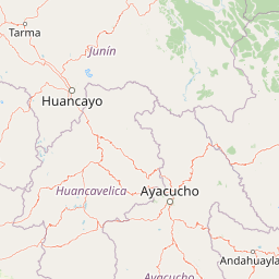
Map view of Nor Yauyos-Cochas Landscape Reserve

Use this park location map to pinpoint Nor Yauyos-Cochas Landscape Reserve in Peru, understand its exact geographic position, and read its mapped placement within the surrounding landscape more clearly.

Pigeon | © OpenStreetMap contributors

Location context for Nor Yauyos-Cochas Landscape Reserve

Junín RegionLima Region
Recorded earthquake history

Explore the Historical Earthquake Catalogue for Nor Yauyos-Cochas Landscape Reserve

Review recorded seismic events, magnitudes, and epicentre distances associated with the Nor Yauyos-Cochas Landscape Reserve geography. This MoriAtlas dataset offers a clear, chronological perspective on regional earthquake activity, helping users trace the seismic history of the central Peruvian Andes.

Nor Yauyos-Cochas Landscape Reserve Earthquake History

Catalogued events

71 events

Strongest magnitude

Magnitude 6.3

Most recent event

Aug 31, 2026

This history includes earthquakes recorded inside the park or within 50 km of its borders

Visual reference of glacial lakes, puna grasslands, and rugged mountain terrain

Nor Yauyos-Cochas Landscape Reserve Photos and High Andean Scenery

Nor Yauyos-Cochas Landscape Reserve photos reveal high-altitude glacial lakes, alpine grasslands, and deep river valleys across the central Peruvian Andes. Protected area imagery provides visual context for steep mountain terrain, snow-capped peaks, and traditional pastoral landscapes.

A wide view of the snow-capped Nevado Pariacaca mountain range under a blue sky with scattered clouds.

A gravel road in the foreground with a parked pickup truck and people near it, leading toward a small blue lake nestled in a valley surrounded by rocky, snow-dusted mountains under a clear blue sky.

Park atlas

Compare adjacent Andean geography and connected conservation lands across the region

Parks Near Nor Yauyos-Cochas Landscape Reserve and Regional Protected Areas

Browsing other protected areas near Nor Yauyos-Cochas Landscape Reserve reveals shared high-mountain terrain, glacial watersheds, and puna grasslands. Extending the geographic comparison clarifies regional conservation patterns and connects high-altitude mountain reserves.
A horizontal watercolor illustration depicting rolling green hills and foreground vegetation on a white background.
Nature reserveLima Region
44 km away#1 closest

West

Bosque de Zárate Reserved Zone: Mapped Geography and Protected Landscape Analysis

Andean fog forest terrain within the Lima Region

Bosque de Zárate Reserved Zone provides a distinct look at the transition from arid western Andean slopes to lush mist forests. The reserve preserves critical habitat for endemic bird species and stabilizes vital gorge terrain along the San Bartolomé River, serving as a model for protected landscapes in central Peru.

Area
5.46 km²
Established
2010
Water
Minor water
A horizontal watercolor illustration depicting a serene wetland landscape with low green hills, winding water channels, and light pink clouds in the background.
Wildlife reservePeru
99 km away#2 closest

West

Pantanos de Villa Wildlife Refuge: A Protected Coastal Marsh in Metropolitan Lima

Mapping the brackish lagoons and desert wetland geography

Pantanos de Villa Wildlife Refuge functions as a rare coastal wetland system located in the Chorrillos district of Lima, Peru. Its marshy terrain of brackish lagoons and reed beds represents a vital protected landscape that stands in sharp relief against the surrounding Pacific subtropical desert. This refuge provides essential habitat for migratory waterbirds and serves as a key site for understanding urban-edge conservation and hydrology.

Area
2.63 km²
Established
2006
IUCN
IV
Relief
Lowland
Nature reserveLima Region
About 124 km away#3 closest

West

Ancón Reserved Zone: Protected Coastal Desert and Bay Ecosystems in Lima Region

Coastal desert landscapes and marine habitat protection

The Ancón Reserved Zone represents a key protected area where the dry coastal plains of Peru reach the Pacific Ocean. Its mapped boundaries encompass a critical transition zone between arid desert terrain and marine environments, offering a concentrated look at specialized regional ecology within the Lima Province.

Area
21.93 km²
Established
2013
Relief
Lowland
Climate
Arid
National parkPasco Region
134 km away#4 closest

North

Yanachaga, Chemillén National Park: Protected Area in Pasco Region, Peru

Mapped terrain, Pleistocene refuge, and rich biodiversity.

Yanachaga, Chemillén National Park, a national park situated in Peru's Pasco Region, preserves over 122,000 hectares of mountainous cloud forest and rainforest ecosystems. Its landscape is characterized by dramatic canyons and steep forested slopes, creating significant altitudinal variation from 460 to 3,643 meters. Recognized as a Pleistocene refuge, the park shelters ancient forest remnants and harbors exceptional biodiversity, including hundreds of bird species and iconic mammals, offering rich context for geographic and protected-area exploration.

Area
1,220 km²
Established
1986
IUCN
II
Relief
Mountain
A horizontal watercolor painting showing rolling green hills and pinkish ground vegetation under a soft, light-yellow sky.
Protected areaPasco Region
138 km away#5 closest

Northeast

San Matías, San Carlos Protection Forest: Geographic Boundaries and Protected Landscape Context

A vital watershed corridor in the Pasco Region of central Peru.

San Matías, San Carlos Protection Forest protects fragile mountain soils and downstream infrastructure from erosion and flooding. Stretching from 300 to 2,250 metres in elevation, the reserve supports a continuous block of highland habitat that serves as a bridge between the Peruvian Yungas and Ucayali moist forest ecoregions, while acting as a cornerstone of the Oxapampa-Asháninka-Yánesha Biosphere Reserve.

Area
1,458 km²
Established
1987
IUCN
VI
Relief
Mountain
Protected areaOxapampa Province
156 km away#6 closest

North

Yanesha Communal Reserve: Geography and Protected Area Context in Oxapampa Province

A vital transition zone between the Andes and the Amazon

Gain insight into the physical character of Yanesha Communal Reserve, where humid tropical forests and river channels converge to form a complex ecosystem. This protected area offers a look at how sustainable land use and conservation intersect within the Palcazu River basin. Browse the geographic boundaries and mapped landscape features that define this essential region in central Peru.

Area
347.45 km²
Established
1988
IUCN
VI
Scope
Terrestrial
Nature reservePeru
170 km away#7 closest

Northwest

Cordillera Huayhuash Reserved Zone: Protected Mountain Geography and Andean Watersheds

High-altitude glacial terrain in central Peru

Cordillera Huayhuash Reserved Zone comprises a dense concentration of glacial peaks and highland basins. As a major source of water for both the Pacific coast and the Amazon, this protected area represents a unique geographic crossroads where ice fields and alpine puna support critical regional ecosystems in the heart of the Andes.

Area
675.9 km²
Established
2002
Relief
Mountain
Climate
Alpine
National parkPeru
179 km away#8 closest

East

Otishi National Park: A Protected National Park Landscape in Peru's Geography

Explore the mapped boundaries and regional landscape of Otishi National Park.

Otishi National Park represents a significant protected area within Peru, offering a unique lens through which to explore regional geography and conservation landscapes. As a designated national park, it highlights the mapped boundaries and the natural terrain that defines this part of South America. Understanding Otishi National Park provides essential context for regional park discovery and the broader atlas of protected lands in Peru.

Area
3,059.73 km²
Established
2003
IUCN
II
Relief
Mountain

Common questions about visiting, size, designation, and location context for Nor Yauyos-Cochas Landscape Reserve

Nor Yauyos-Cochas Landscape Reserve FAQs for park facts, access, geography, and protected area context

Find quick answers about Nor Yauyos-Cochas Landscape Reserve, including protected-area facts, park geography, trail and visitor context, and how the park fits into its surrounding country and regional landscape.
MoriAtlas Explorer

Continue Your Protected Areas Search Across the Global Atlas

Deepen your exploration by continuing the structured search for national parks and protected areas worldwide. Utilize the comprehensive filtering capabilities to compare different conservation landscapes and refine your understanding of global park geography. Discover more about the distribution and characteristics of protected natural areas.

Global natural geography