Mori Atlas logo
National parkOtishi National Park

Mapped geographic context and protected area boundaries for Otishi National Park.

Otishi National Park: Peru's Protected Landscape in the National Park Atlas

Otishi National Park stands as a significant protected natural area within the megadiverse landscapes of Peru. This dedicated national park offers a unique focal point for understanding protected land distribution and regional geography. Delve into its mapped boundaries and explore how Otishi National Park contributes to the atlas of Peru's natural heritage, providing essential context for its unique terrain and conservation landscapes.

National ParkPeruVilcabamba RangeAndean MountainsJunín RegionCusco Region

Otishi National Park

National park

Park overview

Structured park overview, official facts, and landscape profile for Otishi National Park

Otishi National Park park facts, protected area profile, and essential visitor context
Review the core facts for Otishi National Park, including designation, size, terrain, visitor scale, habitats, and operating context in one park-focused overview.

About Otishi National Park

Otishi National Park occupies a significant footprint in the central Peruvian highlands, situated where the boundaries of Junín Region and Cusco Region meet along the spine of the Vilcabamba mountain range. This range, running roughly north-south through the Andes, is one of the more prominent mountain systems in Peru and has historically served as both a geographical and cultural boundary within the country. The park was formally designated in January 2003, establishing permanent protection for the wildlife populations and the distinctive geological formations found throughout this highland landscape. The Vilcabamba range features rugged terrain characterized by steep ridges, deep valleys, and elevations that place much of the area in alpine or subalpine conditions. This dramatic topography creates diverse microhabitats and ecological zones within the park, supporting vegetation communities adapted to high-altitude life. The establishment of Otishi National Park reflected Peru's broader strategy of preserving representative samples of its diverse ecological systems, with the Vilcabamba range representing a particularly important mountainous ecosystem type. The park remains under the administration of SERNANP, which manages Peru's network of protected areas with the goal of conserving natural heritage while allowing for sustainable relationship with the landscape where appropriate.

Quick facts and research context for Otishi National Park

Otishi National Park is located in the Vilcabamba mountain range of the Peruvian Andes, spanning Junín and Cusco Regions. The protected area covers 305,973 hectares, making it one of the larger national parks in Peru. It was established on January 14, 2003, and is managed by SERNANP, Peru's national service for natural protected areas. The park protects a section of the Vilcabamba range, preserving both wildlife habitats and geological formations in this remote highland region.

Park context

Deeper park guide and search-rich context for Otishi National Park

Otishi National Park history, landscape, wildlife, and travel context
Explore Otishi National Park through its history, landscape character, ecosystems, wildlife, conservation priorities, cultural context, and seasonal travel timing in a structured park guide built for atlas discovery and search intent.

Why Otishi National Park stands out

Otishi National Park is best known for its protection of the Vilcabamba mountain range, a storied geographical formation in the Peruvian Andes. The park preserves the wildlife and geological character of this highland environment, with the Vilcabamba range itself being a notable feature known for its dramatic elevation changes, remote character, and ecological significance. The area represents a substantial contiguous block of protected Andean mountain wilderness.

Otishi National Park history and protected-area timeline

Otishi National Park was established on January 14, 2003, through formal designation by the Peruvian government. The creation of the park reflected growing recognition of the conservation importance of the Vilcabamba mountain range and the need to protect the wildlife populations and geological features found in this relatively remote highland region. The establishment came during a period when Peru was expanding its protected area network to better cover the country's ecological diversity, with particular attention to Andean mountain ecosystems that had historically received less formal protection than lowland Amazon forests or coastal environments. The park was assigned to SERNANP, the National Service of Natural Protected Areas, which serves as the governing body for Peru's national parks, reserves, and other protected area categories. The 2003 designation provided formal legal protection for the Vilcabamba range section within the park's boundaries, establishing the framework for ongoing conservation management of the area's natural resources.

Otishi National Park landscape and geographic character

The landscape of Otishi National Park is defined by its position within the Vilcabamba mountain range, a major geographical feature of the Peruvian Andes. The terrain is characteristically rugged and mountainous, with steep-sided valleys, sharp ridgelines, and significant elevation changes across relatively short distances. The Vilcabamba range forms a north-south oriented spine through the park, with the higher elevations reaching into alpine zones where vegetation becomes sparse and rocky terrain predominates. The geological formations within the park reflect the complex tectonic history of this part of the Andes, with exposed rock faces, craggy peaks, and the kind of dramatic mountain scenery that distinguishes the Vilcabamba from adjacent ranges. The combination of elevation, isolation, and rugged topography has limited human development in the area, leaving much of the landscape in a relatively natural state.

Otishi National Park ecosystems, habitats, and plant life

The natural systems within Otishi National Park reflect the high-altitude character of the Vilcabamba mountain environment. The park supports vegetation communities adapted to the cool temperatures, reduced oxygen, and strong seasonal variations typical of Andean elevations above approximately 3,000 meters. Alpine grasslands, shrubland zones, and patches of forest in sheltered valleys characterize the vegetation patterns, with species composition varying according to aspect, elevation, and moisture availability. The ecological diversity of the Vilcabamba range includes both humid forest types on the more sheltered slopes and drier vegetation communities on exposed ridgelines. The park's protected status ensures the preservation of these highland ecosystems and the ecological processes that sustain them, from watershed function to nutrient cycling in the mountain soils.

Otishi National Park wildlife and species highlights

The wildlife of Otishi National Park encompasses the fauna characteristic of high-altitude Andean environments, though detailed species inventories are not extensively documented in available sources. The protected status of the area ensures continuity of habitat for wildlife populations adapted to the mountain environment, including species that rely on the diverse elevations and terrain features found within the Vilcabamba range. Mammals, birds, and smaller animals that call this Andean landscape home benefit from the protection afforded by the park's designation, which guards against habitat conversion and other threats that have affected lower-elevation environments in the Peruvian highlands.

Otishi National Park conservation status and protection priorities

Otishi National Park serves as an important conservation unit within Peru's protected area system, preserving a substantial portion of the Vilcabamba mountain range and the ecosystems it supports. The park's Category II designation reflects its primary purpose of protecting natural landscapes and the biodiversity they contain. The Vilcabamba range represents a significant geographical feature whose conservation value is enhanced by the park's size and its position spanning two regions. By protecting both wildlife populations and geological formations, the park addresses multiple dimensions of natural heritage preservation in this part of the Andes. The ongoing management by SERNANP ensures that conservation priorities guide use and development within the park boundaries.

Otishi National Park cultural meaning and human context

The cultural context of the Otishi area relates to its position within the broader Vilcabamba region, which holds historical significance in Peruvian history as a center of Incan resistance during the colonial period. The Vilcabamba range served as a retreat and stronghold for Manco Inca Yupanqui and subsequent rebel leaders following the Spanish conquest, giving the region a place in the narrative of Andean history and resistance. While the park itself is designated primarily for nature conservation, the cultural landscape surrounding the protected area includes historical sites and traditional land-use patterns that reflect the long human presence in this part of the Andes.

Top sights and standout views in Otishi National Park

Otishi National Park's defining highlight is its protection of the Vilcabamba mountain range, one of the most significant mountain systems in the Peruvian Andes. The park's large area of approximately 306,000 hectares preserves a contiguous block of highland wilderness with dramatic terrain, diverse elevations, and relatively limited human impact. The combination of geological and wildlife protection within a single protected area reflects the comprehensive conservation approach represented by the park. The Vilcabamba range itself provides the structural backbone of the park's landscape, creating the conditions for the ecological diversity and scenic character that make this protected area notable within Peru's national park system.
Park location guide

Geography guide, regional context, and park location map for Otishi National Park

Otishi National Park park geography, regions, and map view in Peru
Understand where Otishi National Park sits in Peru through a broader geographic reading of the surrounding landscape, nearby location context, and its mapped position within the national park landscape.

How Otishi National Park fits into Peru

Peru is a megadiverse country in western South America with a population of over 34 million. It spans three distinct geographic regions: the Pacific coastal desert in the west, the Andes mountains running north to south, and the Amazon rainforest in the east. The country has one of the longest histories of civilization in the world, tracing back to the Caral-Supe civilization of the 10th millennium BCE, and was home to the Inca Empire before Spanish colonization in the 16th century.

Wider geography shaping Otishi National Park in Peru

Peru is located in western South America along the Pacific coast. The country encompasses three major geographic regions: the coastal desert plains along the Pacific, the Andes mountain range extending from north to southeast, and the Amazon basin rainforest in the eastern interior. It shares borders with Ecuador and Colombia to the north, Brazil to the east, Bolivia to the southeast, and Chile to the south.

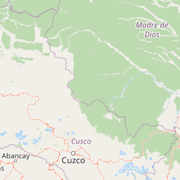
Map view of Otishi National Park

Use this park location map to pinpoint Otishi National Park in Peru, understand its exact geographic position, and read its mapped placement within the surrounding landscape more clearly.

Pigeon | © OpenStreetMap contributors

Location context for Otishi National Park

Cusco RegionJunín Region
Park atlas

Trace the geography of additional protected landscapes across the Peruvian Andes and compare national park features.

Explore Other National Parks and Protected Areas Near Otishi National Park
After exploring Otishi National Park, browse other national parks and protected areas situated within Peru's Vilcabamba mountain range and surrounding Andean highlands. Compare their unique geographical features, conservation priorities, and regional protected landscapes, expanding your atlas-style discovery of this crucial mountain system.
National parkMadre de Dios Region

Manu National Park: A National Park with Mapped Boundaries in Madre de Dios Region

Explore its protected landscape and regional geography.

Gain a detailed understanding of Manu National Park, a key protected area situated in Peru's Madre de Dios Region. This page offers in-depth information on its geographic context, allowing for focused exploration of its mapped terrain and its identity as a national park. Understand how this protected landscape contributes to the regional geography and provides a solid anchor for atlas-based research and discovery.

Area
17,162.9 km²
Established
1973
IUCN
II
Relief
Mixed relief
National parkPasco Region

Yanachaga, Chemillén National Park: Protected Area in Pasco Region, Peru

Mapped terrain, Pleistocene refuge, and rich biodiversity.

Yanachaga, Chemillén National Park, a national park situated in Peru's Pasco Region, preserves over 122,000 hectares of mountainous cloud forest and rainforest ecosystems. Its landscape is characterized by dramatic canyons and steep forested slopes, creating significant altitudinal variation from 460 to 3,643 meters. Recognized as a Pleistocene refuge, the park shelters ancient forest remnants and harbors exceptional biodiversity, including hundreds of bird species and iconic mammals, offering rich context for geographic and protected-area exploration.

Area
1,220 km²
Established
1986
IUCN
II
Relief
Mountain
National parkHuánuco Region

Tingo María National Park: National Park Protected Landscape in Huánuco Region, Peru

Atlas exploration of park boundaries and regional geography.

Investigate Tingo María National Park, a key protected area situated in the Huánuco Region of Peru. This national park designation signifies its importance for understanding the country's natural landscapes and mapped geography. Explore its protected territory and discover its place within the regional atlas.

Area
47.778 km²
Established
1965
IUCN
II
Relief
Mountain
National parkPeru

Bahuaja-Sonene National Park: A Major Amazon Frontier National Park in Peru's Geography

Explore its mapped protected landscape and diverse terrain.

Bahuaja-Sonene National Park is an extensive national park situated on the Amazon frontier in southern Peru, encompassing a crucial transition zone between lowland rainforest and higher-elevation forest ecosystems. Its diverse topography, from river valleys to mountainous slopes, creates varied natural landscapes. The park's protected boundaries are integral to the regional conservation strategy, offering a unique lens through which to study the mapped geography and ecological significance of this vast Amazonian protected area.

Area
10,914.2 km²
Established
1996
IUCN
II
Relief
Mixed relief
National parkPeru

Sierra del Divisor National Park: Peru's Sacred Amazonian Protected Landmark

Explore dramatic mountain terrain and protected lowland rainforest.

Sierra del Divisor National Park in Peru is a vital protected area conserving over 1.35 million hectares of Amazon rainforest. Characterized by the unique Sierra del Divisor mountain range and the sacred pyramid peak of Cerro El Cono, the park offers a distinct landscape within the broader Amazon basin. As one of Peru's newer national parks, it represents a significant commitment to preserving critical biodiversity corridors and understanding the geographic context of protected lands in a region facing environmental pressures.

Area
13,544.8 km²
Established
2015
IUCN
II
Relief
Mixed relief
National parkAncash

Huascarán National Park: Protected Landscape and Regional Geography in Ancash, Peru

Explore the mapped boundaries of this significant national park.

Huascarán National Park is a protected national park located in the Ancash region of Peru, offering valuable insights for geographic and atlas exploration. This destination provides detailed information on the park's mapped boundaries, its designation as a national park, and its integration into the regional geography. Understanding Huascarán National Park helps contextualize protected land distribution and landscape features within Peru for those interested in structured geographic discovery and atlas-style mapping.

Area
3,400 km²
Established
1975
IUCN
II
Relief
Mountain
National parkPeru

Cordillera Azul National Park: A National Park for Geographic Discovery in Peru

Explore Peru's protected landscape and regional map context.

Cordillera Azul National Park serves as a dedicated entry point for understanding Peru's protected natural areas through a geographic lens. This park's identity is tied to its specific mapped boundaries and its contribution to the nation's diverse terrain. Focusing on Cordillera Azul National Park allows for detailed atlas exploration of its unique landscape context within western South America, providing factual data for geographic understanding.

Area
13,531.9 km²
Established
2001
IUCN
II
Relief
Mountain
National parkSan Martín Region

Rio Abiseo National Park: Peru's Protected Landscape Identity and Geographic Context

Discover the mapped boundaries and regional atlas information.

Investigate Rio Abiseo National Park, a designated national park situated within the San Martín Region of Peru. This detailed entry focuses on its protected landscape characteristics and its specific geographic placement. Understand the park's mapped boundaries and its role in the broader atlas of protected areas, offering a structured approach to geographic discovery.

Area
2,745.2 km²
Established
1983
IUCN
II
Relief
Mountain

Common questions about visiting, size, designation, and location context for Otishi National Park

Otishi National Park FAQs for park facts, access, geography, and protected area context
Find quick answers about Otishi National Park, including protected-area facts, park geography, trail and visitor context, and how the park fits into its surrounding country and regional landscape.
MoriAtlas Explorer

Continue Your Protected Areas Search Across the Global Atlas

Deepen your exploration by continuing the structured search for national parks and protected areas worldwide. Utilize the comprehensive filtering capabilities to compare different conservation landscapes and refine your understanding of global park geography. Discover more about the distribution and characteristics of protected natural areas.

Global natural geography