
Mori Atlas logo
Nature reservePadyshata State Nature Reserve

Analyzing the forest cover, alpine terrain, and watershed boundaries of the Chatkal Range

Padyshata State Nature Reserve: A Detailed Geographic Atlas of Western Tien Shan Protected Landscapes

Padyshata State Nature Reserve represents a key protected landscape in the western Tien Shan, encompassing rugged northern slopes of the Chatkal Range in Kyrgyzstan. This detailed entry traces the reserve's topography, from its dense juniper woodlands to the high-elevation alpine zones and critical watershed systems. It serves as a scientific reference for the preservation of rare Semenov fir and coniferous forest habitats in Central Asia.

strict nature reservejuniper forestmountain forestChatkal Rangewestern Tien ShanKyrgyzstan
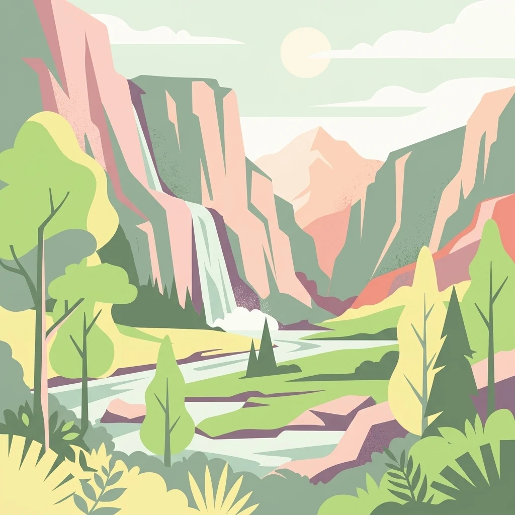
A flat, vector-style illustration of a mountain valley scene with a cascading waterfall, a winding river, and stylized trees under a soft sun.

Padyshata State Nature Reserve

Nature reserve

Park overview

Structured park overview, official facts, and landscape profile for Padyshata State Nature Reserve

Padyshata State Nature Reserve park facts, protected area profile, and essential visitor context

Review the core facts for Padyshata State Nature Reserve, including designation, size, terrain, visitor scale, habitats, and operating context in one park-focused overview.

About Padyshata State Nature Reserve

Padyshata State Nature Reserve is one of Kyrgyzstan's strictly protected forest reserves, occupying a substantial section of the Chatkal Range in the Jalal-Abad Region. The reserve was created by decree of the Government of the Kyrgyz Republic in 2003, with an explicit focus on preserving the area's unique juniper forests, its stands of Semenov fir, and the broader biological diversity supported by these mountainous landscapes. Its establishment was guided by the country's obligations under Article 8 of the Convention on Biological Diversity, placing it within a wider regional and international framework for habitat protection.

Geographically, the reserve sits in the western Tien Shan mountains, a region characterized by deeply dissected ridges, steep forested slopes, and high-elevation pastures. Much of the reserve consists of montane and subalpine zones, where coniferous forest cover transitions into open slopes and rocky terrain. The terrain supports both forested and unforested areas, and the reserve includes substantial pastureland alongside its woodland, illustrating the traditional land use mosaic that surrounds it.

The reserve falls within Kyrgyzstan's network of specially protected natural territories and carries the IUCN Category Ia classification, meaning it is managed primarily for ecological integrity, scientific study, and biodiversity conservation. Public access is generally restricted compared to other protected-area categories, which aligns with its purpose as a strict natural reserve. As a result, Padyshata functions as a long-term conservation anchor for Kyrgyzstan's montane forest heritage, complementing other protected areas in the Chatkal and broader western Tien Shan system.

Quick facts and research context for Padyshata State Nature Reserve

Padyshata State Nature Reserve lies on the Chatkal Range in Jalal-Abad Region of western Kyrgyzstan. It was formally established in 2003 by government decree to protect unique juniper forests and the rare Semenov fir, and to safeguard the country's broader biodiversity in line with the Convention on Biological Diversity. The reserve is administered under Kyrgyzstan's system of specially protected natural territories and carries the IUCN Category Ia designation of a strict nature reserve, emphasizing conservation of natural conditions over human use.

Protection and recognition

Documented terrestrial protection scope and international recognition facts

Padyshata State Nature Reserve Protection Status and Recognized Designations

Padyshata State Nature Reserve maintains a defined terrestrial protection scope within its designated conservation boundaries. Verified administrative records outline the official protection status and international recognition data associated with the protected area.

Protection details

Protection scope
Terrestrial
Transboundary protection
No
Park context

Deeper park guide and search-rich context for Padyshata State Nature Reserve

Padyshata State Nature Reserve history, landscape, wildlife, and travel context

Explore Padyshata State Nature Reserve through its history, landscape character, ecosystems, wildlife, conservation priorities, cultural context, and seasonal travel timing in a structured park guide built for atlas discovery and search intent.

Why Padyshata State Nature Reserve stands out

The reserve is best known for its extensive juniper woodlands and its protection of Semenov fir, a forest species acknowledged in the Red Data Book of Kyrgyzstan as requiring active protection. Together, these coniferous forests define the ecological character of the reserve and represent one of the principal reasons the area was placed under strict protection in 2003. Because it sits on the northern slopes of the Chatkal Range, the reserve also embodies the typical vertical zonation of the western Tien Shan, where montane forests give way to subalpine and alpine landscapes higher up. This combination of rare tree species, mountain forest cover, and watershed habitat makes Padyshata an important reference site for forest conservation in Central Asia.
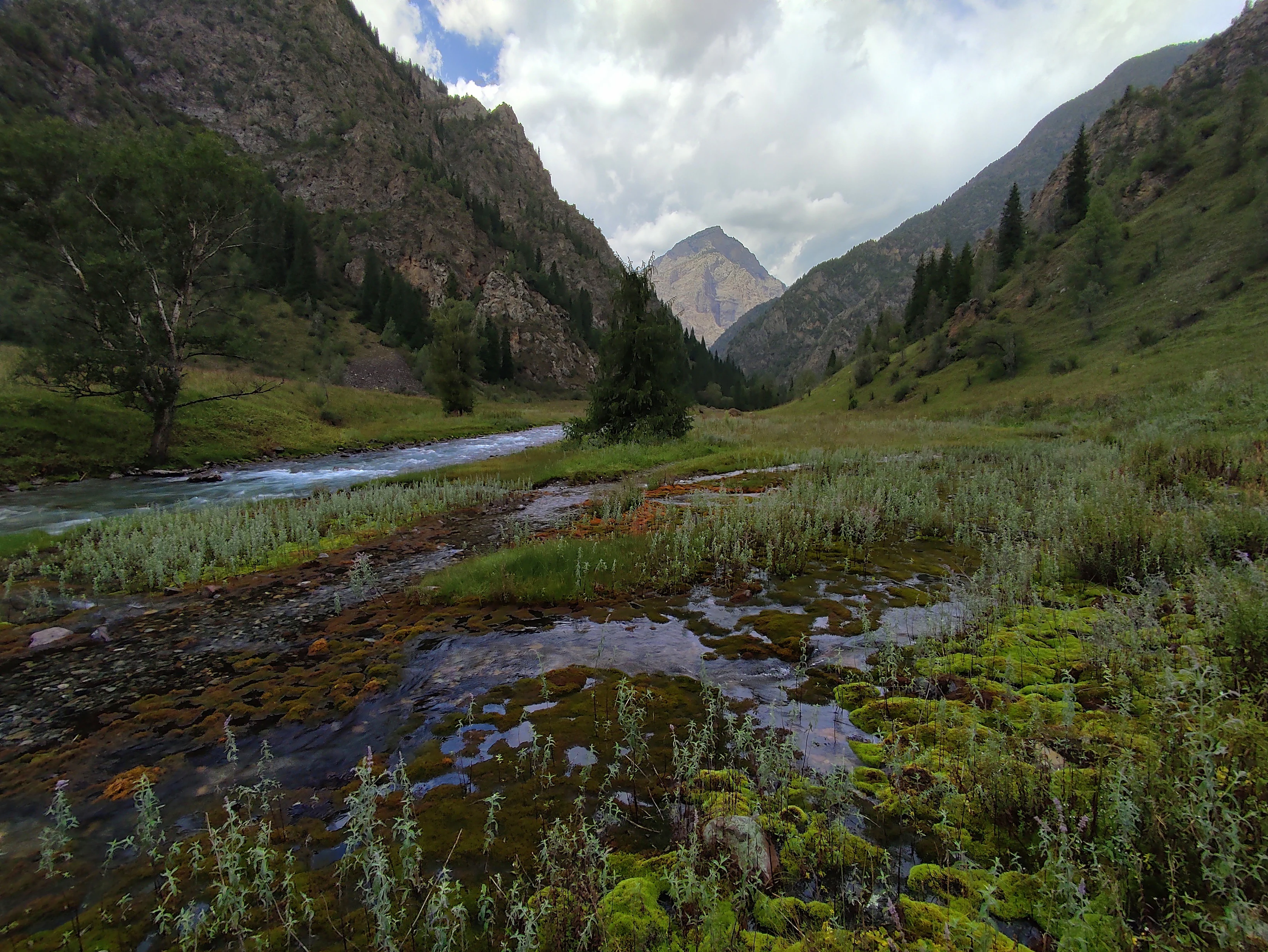
A clear, shallow mountain stream winds through a green, grassy valley surrounded by steep, rocky mountains in Kyrgyzstan.
A mountain spring flows through the lush, green landscape of Padyshata State Nature Reserve.

Padyshata State Nature Reserve history and protected-area timeline

The reserve was established in 2003 by a formal decree of the Government of the Kyrgyz Republic, dated 3 July 2003, under decree number 405. The creation of the reserve was motivated by the need to protect unique juniper forests, rare Semenov fir populations listed in the Red Data Book of Kyrgyzstan, and the country's overall biodiversity.

The legal basis for creation referenced Article 8 of the Convention on Biological Diversity, situating the reserve within national and international frameworks aimed at conserving ecosystems, species, and genetic diversity. Since its official founding, the reserve has been managed as part of Kyrgyzstan's system of specially protected natural territories, with an emphasis on long-term ecological preservation rather than recreational use.

Padyshata State Nature Reserve landscape and geographic character

The reserve occupies a section of the Chatkal Range on the northern slopes of the western Tien Shan, with terrain shaped by uplift and erosion into ridges, valleys, and steep mountain slopes. Elevations rise across montane and subalpine zones, with characteristic profiles of rocky outcrops, forested hillsides, and open highland sections.

Forested areas, unforested rocky slopes, pastures, and small estate plots together define a heterogeneous mountain landscape. Springs and small streams emerge throughout the area, contributing to local hydrology and to the broader watersheds of the Chatkal system. The combination of rugged topography and forest patches gives the reserve a distinctly Central Asian mountain character.

Padyshata State Nature Reserve ecosystems, habitats, and plant life

Padyshata protects montane forest ecosystems of the western Tien Shan, where juniper woodlands dominate much of the tree cover. Among the coniferous communities, the reserve harbors stands of Semenov fir, a regionally important conifer included in the Red Data Book of Kyrgyzstan because of its rarity and conservation significance.

The vegetation mosaic reflects the vertical zonation typical of the Chatkal Range: juniper and fir forests on suitable slopes, transitioning to unforested rocky areas and subalpine habitats higher up. Around and between these forests, pasturelands and regeneration zones contribute to habitat diversity. The reserve's habitat mix supports a range of forest, edge, and highland ecological niches that together maintain regional biodiversity within an otherwise heavily grazed mountain landscape.

Padyshata State Nature Reserve wildlife and species highlights

The reserve's combination of juniper forest, rare fir stands, rocky slopes, and highland pasture supports a varied mountain fauna typical of the western Tien Shan. The forested zones provide shelter and forage for wildlife adapted to montane coniferous environments, while the open slopes and pastures host species associated with highland meadows and rocky terrain.

Because the reserve is classified as a strict nature reserve, wildlife protection is prioritized over human access, allowing natural ecological processes to continue with minimal disturbance. This makes Padyshata an important refuge for species that rely on intact juniper and fir forest habitats, including the many forest-dependent birds and mammals of the Chatkal Range.

Padyshata State Nature Reserve conservation status and protection priorities

Padyshata holds a central place in Kyrgyzstan's forest conservation strategy as one of the country's designated protected areas focused specifically on juniper woodlands and Semenov fir. The reserve's IUCN Category Ia classification, a strict nature reserve, signals an emphasis on maintaining natural conditions and ecological processes rather than on multiple-use management.

Its establishment under the framework of the Convention on Biological Diversity highlights the reserve's role in safeguarding genetic, species, and ecosystem diversity within the western Tien Shan. By protecting a representative block of montane forest habitat on the Chatkal Range, Padyshata contributes to connectivity and resilience across the broader network of protected areas in Kyrgyzstan.

Top sights and standout views in Padyshata State Nature Reserve

Padyshata stands out as a strict nature reserve dedicated to the protection of juniper forests and the rare Semenov fir, both of which are defining features of the western Tien Shan. Its location on the northern slopes of the Chatkal Range places it within a key mountain ecosystem corridor, where forest cover, springs, pastures, and rocky slopes together form a representative Kyrgyz mountain landscape.

The reserve's strict protection status, its 2003 establishment under explicit biodiversity-conservation objectives, and its role within Kyrgyzstan's protected-area network make it a notable example of modern Central Asian forest conservation.
Monthly climate preview

Long-term representative temperature and precipitation patterns across the year

Padyshata State Nature Reserve Climate Normals and Monthly Temperature Rhythm

Representative coordinates record measured monthly averages spanning from subzero winter minima to warm summer highs alongside recorded precipitation rates. Analyzing complete monthly climate normals reveals detailed shifts in temperature and moisture for this protected location.
Annual mean11 °C
-3 °C25 °C
Jan-3°
Feb-1°
Mar
Apr11°
May17°
Jun22°
Jul25°
Aug24°
Sep18°
Oct11°
Nov
Dec-1°
Warmest month
July

24.9 °C

Coolest month
January

-2.6 °C

Wettest month
April

1.2 mm/day

Driest month
August

0.2 mm/day

Park location guide

Geography guide, regional context, and park location map for Padyshata State Nature Reserve

Padyshata State Nature Reserve park geography, regions, and map view in Kyrgyzstan

Understand where Padyshata State Nature Reserve sits in Kyrgyzstan through a broader geographic reading of the surrounding landscape, nearby location context, and its mapped position within the national park landscape.

How Padyshata State Nature Reserve fits into Kyrgyzstan

Kyrgyzstan is a landlocked Central Asian country located in the Tian Shan and Pamir mountain ranges. With a population of approximately 7.4 million, it is bordered by Kazakhstan to the north, Uzbekistan to the west, Tajikistan to the south, and China to the east. The capital and largest city is Bishkek. Ethnic Kyrgyz make up the majority of the population, with significant Uzbek and Russian minorities. The country gained independence from the Soviet Union in 1991.

Wider geography shaping Padyshata State Nature Reserve in Kyrgyzstan

Kyrgyzstan is located in Central Asia, situated in the Tian Shan and Pamir mountain ranges. It is landlocked, bordered by Kazakhstan to the north, Uzbekistan to the west, Tajikistan to the south, and China to the east and southeast. The capital Bishkek lies on the northern border with Kazakhstan.

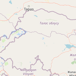
Map view of Padyshata State Nature Reserve

Use this park location map to pinpoint Padyshata State Nature Reserve in Kyrgyzstan, understand its exact geographic position, and read its mapped placement within the surrounding landscape more clearly.

Pigeon | © OpenStreetMap contributors

Location context for Padyshata State Nature Reserve

Jalal-Abad Region

Visual reference of juniper forests, rocky ridges, and alpine terrain across the Chatkal Range

Padyshata State Nature Reserve Photos and Mountain Landscape Scenery

Examine detailed photographs of Padyshata State Nature Reserve to study the rugged topography, juniper woodlands, and steep mountain slopes of the western Tien Shan. Visual records provide essential geographic context for understanding the protected forest habitats, rare conifer zones, and watershed terrain of Kyrgyzstan.

A clear, shallow mountain stream winds through a green, grassy valley surrounded by steep, rocky mountains in Kyrgyzstan.

Park atlas

Continue exploring regional mountain landscapes and protected zones in western Kyrgyzstan.

Parks Near Padyshata State Nature Reserve And Related Protected Areas

Browse other protected areas and mountain habitats located near Padyshata State Nature Reserve in the Chatkal Range. Comparing adjacent reserves helps reveal broader ecological patterns across the western Tien Shan mountain system.
Nature reserveJalal-Abad Region
About 51 km away#1 closest

East

Ryazan-Say Botanical Zakaznik: Protected Botanical Landscapes in the Jalal-Abad Region

Nature reserve geography and relict plant conservation in Kyrgyzstan

Ryazan-Say Botanical Zakaznik is a concentrated nature reserve dedicated to the survival of rare, relict subtropical flora. The protected area encompasses a narrow, steep-walled gorge system that funnels moisture to sustain species like wild fig and pomegranate. This site provides a critical reference for studying how sheltered mountain canyons maintain ecological diversity within the wider landscape of western Kyrgyzstan.

Area
1.1 km²
Established
1987
IUCN
IV
Relief
Upland
Protected areaKyrgyzstan
About 60 km away#2 closest

Northeast

Alatay State Nature Park Protected Area: Mapped Landscape and Regional Geography

Explore the protected boundaries and geographic context of this Kyrgyz natural landscape.

Alatay State Nature Park is a designated protected area within Kyrgyzstan, contributing to the country's vast network of natural landscapes. This page provides detailed geographic information, emphasizing the park's mapped boundaries and its role within the broader regional context of the Tian Shan mountains. It serves as a crucial point for understanding the park's landscape identity and its atlas-level significance as a protected natural territory in Central Asia.

Access
Access unknown
Watercolor illustration of a mountainous landscape with green valleys, a winding river, and distant purple mountains
National parkTashkent Region
About 72 km away#3 closest

West

Ugam-Chatkal National Park: Mapped Alpine Landscapes of Uzbekistan's Tashkent Region

Explore protected mountain terrain and regional geography.

Ugam-Chatkal National Park is a vast national park located in the Tashkent Region of Uzbekistan, renowned for its spectacular alpine scenery and significant protected mountain landscapes. This protected area covers approximately 668,350 hectares, dominated by the imposing Ugam Range with peaks up to 4,000 meters. The park's terrain features a rich mosaic of ecosystems, from dense forests on northern slopes to more open southern exposures, offering a detailed look at mountain geography and biodiversity within a conservation context. Its designation as a national park underscores its critical role in preserving the natural heritage of this Central Asian region.

Area
6,683.5 km²
Established
1992
IUCN
II
Relief
Mountain
National parkKyrgyzstan
About 91 km away#4 closest

Northeast

Besh-Tash Nature Park National Park: Mapped Geography and Protected Landscape Identity

Explore the natural terrain and park boundaries in Kyrgyzstan.

Discover Besh-Tash Nature Park, a designated national park located within the mountainous terrain of Kyrgyzstan. This page focuses on its role as a protected landscape, providing insight into its mapped geographic context and regional significance. Understanding Besh-Tash Nature Park involves examining its natural setting and its contribution to conservation efforts in Central Asia, offering a factual atlas perspective for explorers.

State or regional parkKyrgyzstan
About 102 km away#5 closest

Northwest

Kara-Buura State Nature Park: Kyrgyzstan's Protected Mountain Landscapes and Natural Terrain

Explore the mapped geography and protected area context.

Kara-Buura State Nature Park is a designated state or regional park within Kyrgyzstan, crucial for understanding the country's protected natural areas. Located in the Tian Shan mountain range, the park encompasses diverse alpine and semi-arid landscapes, typical of this high-altitude region. Its mapped boundaries and geographic setting provide valuable context for atlas exploration and appreciating the conservation efforts aimed at preserving Kyrgyzstan's natural heritage, offering a unique lens into the country's mountainous terrain.

IUCN
II
Watercolor painting of a landscape featuring green hills, grassy foreground, and distant mountains under a soft sky
National parkSouth Kazakhstan Region
About 115 km away#6 closest

West

Sayram-Ugam National Park: Protected Landscape and Geographic Context in South Kazakhstan

Explore dramatic alpine terrain and ancient juniper forests.

Delve into Sayram-Ugam National Park, a protected national park situated in the South Kazakhstan Region. This expansive area showcases striking mountain topography with seven natural altitude zones, from mountain steppe to permanent snowfields. It is distinguished by its vast juniper forests and serves as a crucial conservation site for wild fruit and nut tree genetic diversity, offering a unique lens for understanding Central Asian mountain ecology and landscape context.

Area
1,490 km²
Established
2007
IUCN
II
Relief
Mountain
State or regional parkKyrgyzstan
About 163 km away#7 closest

East

Kan-Achuu Nature Park: Kyrgyzstan's State or Regional Protected Landscape

Explore mapped boundaries and regional geography in Central Asia.

Kan-Achuu Nature Park, a designated state or regional park in Kyrgyzstan, offers an opportunity for detailed geographic exploration. This protected area serves as a focal point for understanding the mapped landscape and natural terrain of Central Asia. Engage with its specific protected boundaries and its placement within the country's diverse geography, ideal for atlas-style discovery.

IUCN
II
State or regional parkKyrgyzstan
About 183 km away#8 closest

East

Saymaluu-Tash State Nature Park: Mapped Protected Landscape in Kyrgyzstan

Explore its geographic setting and natural terrain.

Saymaluu-Tash State Nature Park is a designated protected area offering crucial insights into Kyrgyzstan's natural geography. This page focuses on the park's mapped boundaries and its place within the regional landscape context of Central Asia. Utilize this resource to understand the specific geographic features and protected status of this significant nature park, contributing to a comprehensive atlas of protected lands.

IUCN
II
Scope
Terrestrial

Common questions about visiting, size, designation, and location context for Padyshata State Nature Reserve

Padyshata State Nature Reserve FAQs for park facts, access, geography, and protected area context

Find quick answers about Padyshata State Nature Reserve, including protected-area facts, park geography, trail and visitor context, and how the park fits into its surrounding country and regional landscape.
MoriAtlas Explorer

Continue Your Protected Areas Search Across the Global Atlas

Deepen your exploration by continuing the structured search for national parks and protected areas worldwide. Utilize the comprehensive filtering capabilities to compare different conservation landscapes and refine your understanding of global park geography. Discover more about the distribution and characteristics of protected natural areas.

Global natural geography