
Mori Atlas logo
State or regional parkParc de Vaugrenier

Explore the geography of inland wetlands, exotic botanical collections, and ancient Roman sites.

Parc de Vaugrenier: A Protected Regional Landscape on the French Riviera Coastline

(Parc naturel départemental de Vaugrenier)

Parc de Vaugrenier serves as a vital protected green space in the Alpes-Maritimes department, offering a calm inland retreat amidst the busy French Riviera. The park features a central freshwater pond that hosts an ornithological observatory, providing a rare wetland biotope within a Mediterranean coastal setting. Beyond its natural terrain, the area preserves historical depth through its visible Roman foundations and remnants of ancient Greek occupation, creating a landscape that merges heritage with environmental conservation.

Mediterranean parkcoastal inland parkwetland habitatornithological observatoryFrench RivieraAlpes-Maritimes
A minimalist, geometric illustration featuring a tall waterfall cascading down a mountain into a river, surrounded by pine forests.

Parc de Vaugrenier

State or regional park

Park overview

Structured park overview, official facts, and landscape profile for Parc de Vaugrenier

Parc de Vaugrenier park facts, protected area profile, and essential visitor context

Review the core facts for Parc de Vaugrenier, including designation, size, terrain, visitor scale, habitats, and operating context in one park-focused overview.

About Parc de Vaugrenier

Parc de Vaugrenier stands out among protected natural sites on the French Riviera for combining ecological value, exotic botanical interest, and archaeological heritage within a compact departmental park. Managed by the Conseil départemental des Alpes-Maritimes, the park functions as a publicly accessible green space between the coastal towns of Villeneuve-Loubet and Antibes, just a short distance from the Mediterranean shoreline.

Although geographically close to the sea, the park is separated from the coast by the RD 6007 road and the coastal railway, which insulates it from the most intense urbanization of the Côte d'Azur. This inland position allows the park to preserve a quieter atmosphere, supporting Mediterranean woodland, wetland habitats, and a central freshwater pond that anchors much of its biodiversity.

The park's ecological identity is shaped by the contrast between native Mediterranean species and a deliberately diverse collection of exotic trees and plants from other climates. A particularly notable specimen is a coast redwood from California, planted in a setting far removed from its natural foggy Pacific range. This blend of regional and global vegetation has helped make Vaugrenier both a botanical curiosity and a familiar local recreation area.

Its location on a historically strategic stretch of the Mediterranean coast adds a second layer of significance. The same coastal corridor that frames the park today was once part of the ancient Via Julia Augusta, and the wider site carries evidence of Greek and then Roman occupation over many centuries. This combination of natural beauty, accessible trails, and deep antiquity gives Parc de Vaugrenier a profile unusual for a small departmental park.

Quick facts and research context for Parc de Vaugrenier

Parc de Vaugrenier is a departmental nature reserve managed by the Conseil départemental des Alpes-Maritimes, situated in the Provence-Alpes-Côte d'Azur region. The park covers about one hundred hectares and lies between Villeneuve-Loubet and Antibes, just inland from the Mediterranean coast.

The park was rehabilitated in 1995 and combines Mediterranean ecosystems with exotic plantings, including a California coast redwood. A central freshwater pond supports a rich biotope equipped with an ornithological observatory. The site also preserves archaeological remains from the Roman coastal road system and receives around half a million visitors per year.

Protection and recognition

Documented terrestrial protection scope and international recognition data

Parc de Vaugrenier Protection Status and Conservation Framework

Terrestrial protection status and administrative management records define the conservation framework established for Parc de Vaugrenier. Factual reference data outlines designated land management scopes and available recognition records for natural area analysis.

Protection details

Protection scope
Terrestrial
Park context

Deeper park guide and search-rich context for Parc de Vaugrenier

Parc de Vaugrenier history, landscape, wildlife, and travel context

Explore Parc de Vaugrenier through its history, landscape character, ecosystems, wildlife, conservation priorities, cultural context, and seasonal travel timing in a structured park guide built for atlas discovery and search intent.

Why Parc de Vaugrenier stands out

Parc de Vaugrenier is best known for its freshwater pond and its associated ornithological observatory, which together form a rare wetland habitat within a Mediterranean coastal park. The combination of a calm inland biotope with the urbanized backdrop of the French Riviera gives the park a distinctive identity. It is also recognized for the unusual mix of Mediterranean and exotic plant species, most notably a coast redwood growing far from its native California range. Finally, the park carries an unusual historical layer for a natural area, preserving evidence of Greek colonization and Roman coastal infrastructure connected to the ancient Via Julia Augusta.
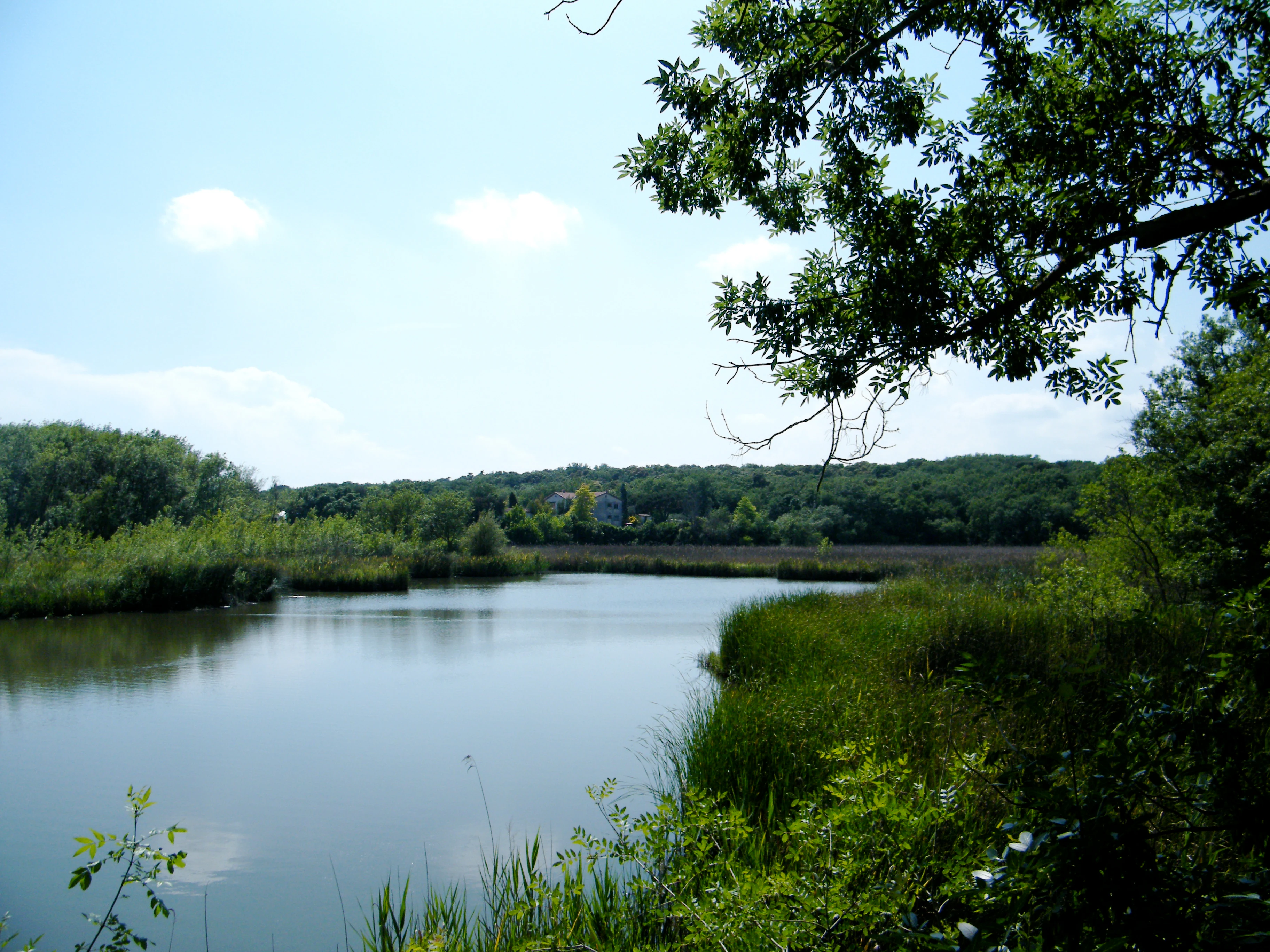
A peaceful, reflective pond surrounded by lush green trees and marsh vegetation under a clear sky.
The pond at Parc naturel départemental de Vaugrenier, a key freshwater habitat within the park.

Parc de Vaugrenier history and protected-area timeline

The Vaugrenier site has been inhabited and used for more than two and a half millennia. Greek settlers from Massalia adopted the location as early as the seventh century BC, drawn by its strategic position along the Ligurian coast. After the Romans defeated the local Oxybian people in 154 BC, the area came under Roman control and was integrated into the expanding coastal infrastructure of the empire.

Between roughly 20 and 10 BC, a temple, possibly dedicated to Mercury, was constructed on or near the site. Its presence is associated with the opening of the Via Julia Augusta, the major Roman coastal road that reorganized travel and trade along the Riviera. The remaining vestiges of this period connect the natural park directly to one of the most important classical arteries in the region.

In the modern era, the park took its present shape in 1995, when the site was rehabilitated as a departmental nature park under the management of the Conseil départemental des Alpes-Maritimes. In August 2009 accessibility improvements allowed visitors with reduced mobility to enjoy a nearly one kilometer stretch of adapted path. In 2016 outdoor fitness equipment was added for walkers, and in July 2018 the children's play area was fully renovated in a landscaped style, completing a series of upgrades that turned the park into a year-round destination for both nature and leisure visitors.

Parc de Vaugrenier landscape and geographic character

Parc de Vaugrenier occupies a gently inland portion of the Alpes-Maritimes coastal plain, set between the dense urban fabric of the French Riviera and the agricultural and wooded edges of the Var valley. Although close to the Mediterranean, the park itself is shielded from the sea by the RD 6007 and the coastal railway, which keeps its atmosphere distinctly inland and sheltered.

The terrain is mostly low-lying, with walking paths winding through Mediterranean woodland, open meadows, and wetland margins. Its central feature is a freshwater pond whose still waters create a calm reflective surface and support a rich variety of aquatic and semi-aquatic habitats, an unusual feature in a coastal environment otherwise dominated by dry Mediterranean scrub.

The landscape blends typical Riviera vegetation with more ornamental elements introduced for aesthetic and educational purposes. Mature exotic trees, including the notable California coast redwood, rise above native species and give certain sections of the park a parkland rather than wild character. This mix of naturalistic and designed scenery gives Vaugrenier a refined, well-maintained appearance distinct from more rugged regional reserves.

Parc de Vaugrenier ecosystems, habitats, and plant life

Ecologically, Parc de Vaugrenier exemplifies a Mediterranean coastal ecosystem enriched by freshwater influences. The transitional position between dry garrigue-type habitats and the humid margins of the central pond creates an unusual mosaic of plant and animal communities within a small area.

The pond supports an exceptional biotope that draws dragonflies, amphibians, reptiles, and a wide variety of birds, while surrounding Mediterranean woodland and shrub layers offer shelter for typical fauna of the Côte d'Azur. The park's botanical collection, blending native species with global introductions, also functions as a living demonstration of how different floras adapt to the mild Provençal climate.

Vegetation within the park includes oak-dominated Mediterranean formations, scrubby undergrowth, and ornamental exotic trees such as the coast redwood. Together, these layers produce a continuously shifting landscape where seasonal changes bring shifting colors, blooms, and bird activity, reinforcing the park's reputation as a compact biodiversity hotspot on the Riviera.

Parc de Vaugrenier wildlife and species highlights

Wildlife observation is one of the principal draws of Parc de Vaugrenier. The freshwater pond and its surrounding wetland vegetation attract a rich community of birds, and the dedicated ornithological observatory installed beside the water offers a calm vantage point for identifying species throughout the year.

Mediterranean fauna typical of the Alpes-Maritimes is also present across the park's woodland and open areas, from common reptiles and insects to small mammals moving between cover. The pond habitat in particular supports amphibians, dragonflies, and seasonal migrants, giving the park a different character from drier coastal sites nearby.

The blend of native and exotic vegetation creates varied food sources and shelter, which contributes to a noticeably broad spectrum of birdlife for such a small park. The presence of water in an otherwise dry Mediterranean setting amplifies this richness, making Vaugrenier a meaningful stop for local naturalists and casual visitors alike.

Parc de Vaugrenier conservation status and protection priorities

As a departmental nature park, Vaugrenier plays a clear role in preserving a patch of Mediterranean biodiversity within one of the most heavily urbanized coastlines in Europe. By holding a continuous green space between Villeneuve-Loubet and Antibes, the park helps maintain habitat continuity, support pollinator populations, and protect a freshwater ecosystem that is unusual in the surrounding coastal environment.

The park's management by the Conseil départemental des Alpes-Maritimes reflects a commitment to balancing ecological protection with public access. Habitat improvements over the years, including the development of the pond's biotope and the establishment of the ornithological observatory, have been designed to maintain the site's ecological functions while enhancing its educational and recreational value.

The park's conservation profile is further reinforced by the integration of exotic species such as the California coast redwood within a protective landscape framework, offering an unusual case study of how Mediterranean climates can support trees from very different parts of the world. This combination of native habitat protection and curated botanical diversity adds a distinct dimension to Vaugrenier's conservation significance.

Parc de Vaugrenier cultural meaning and human context

The Vaugrenier area carries an unusually rich cultural sequence for a small nature park. Greek settlers from Massalia used the position along the Ligurian coast as early as the seventh century BC, leaving the area integrated into early Mediterranean trade and travel networks.

Roman presence followed the defeat of the Oxybians in 154 BC, and the construction of a temple, possibly dedicated to Mercury, between roughly 20 and 10 BC connects the site directly to the imperial road system of the Via Julia Augusta. These remains give the park a tangible sense of place within the broader story of the French Riviera's antiquity.

In addition to its classical heritage, the park belongs to the modern rural and agricultural identity of the Alpes-Maritimes coast, where traditional countryside has gradually been encircled by urban development. The Très Haut Départements that manage Vaugrenier have emphasized the role of such parks as refuges for both natural and regional cultural landscape traditions, helping preserve a sense of Provençal coastal life that might otherwise be lost to Riviera urbanization.

Top sights and standout views in Parc de Vaugrenier

The central freshwater pond and its bird observatory form the ecological heart of Vaugrenier, offering a rare wetland experience on the otherwise dry Mediterranean coast. The park's curated collection of exotic trees, anchored by a California coast redwood, distinguishes it from typical Provençal woodland.

Equally important is the park's archaeological dimension, where Roman foundations and traces of Greek occupation overlap with a modern public space. Together, these make Vaugrenier a park that delivers both natural escape and historical depth within walking distance of Antibes and Villeneuve-Loubet.

Best time to visit Parc de Vaugrenier

Spring and early autumn are generally the most rewarding periods for visiting Parc de Vaugrenier. In spring, rising temperatures bring Mediterranean flora into bloom, the pond becomes active with amphibians and dragonflies, and migratory birds pass through in noticeable numbers. The mild conditions also make walking the longer trails especially pleasant.

Late summer offers a quieter atmosphere, although the heat pushes wildlife activity into the early morning and late afternoon hours. Winter visits are calmer still, with the pond continuing to attract resident waterbirds and the deciduous exotic trees adding seasonal structure to the landscape. Because the park is inland of the main coastal road, its sheltered position keeps it accessible in most weather conditions along the Riviera.

Monthly climate preview

Long term temperature and precipitation patterns across twelve months

Parc de Vaugrenier Climate Normals and Monthly Weather Records

Representative coordinate records show average temperatures ranging from 7.87 °C to 24.6 °C alongside monthly precipitation levels between 0.47 mm/day and 3.83 mm/day. Accessing the complete twelve month profile provides a granular examination of long term climatological variations at this protected location.
Annual mean15 °C
8 °C25 °C
Jan
Feb
Mar10°
Apr13°
May17°
Jun21°
Jul24°
Aug25°
Sep20°
Oct16°
Nov12°
Dec
Warmest month
August

24.6 °C

Coolest month
January

7.9 °C

Wettest month
November

3.8 mm/day

Driest month
July

0.5 mm/day

Park location guide

Geography guide, regional context, and park location map for Parc de Vaugrenier

Parc de Vaugrenier park geography, regions, and map view in France

Understand where Parc de Vaugrenier sits in France through a broader geographic reading of the surrounding landscape, nearby location context, and its mapped position within the national park landscape.

How Parc de Vaugrenier fits into France

France is a unitary semi-presidential republic and one of the world's largest economies. It borders Belgium, Luxembourg, Germany, Switzerland, Italy, Monaco, Andorra, and Spain, with a maritime border to the United Kingdom. The country is known for its cultural influence, art, cuisine, and political history spanning centuries.

Wider geography shaping Parc de Vaugrenier in France

France is located in Western Europe. Metropolitan France extends from the Rhine to the Atlantic Ocean and from the Mediterranean Sea to the English Channel and North Sea. The country borders Belgium, Luxembourg, Germany, Switzerland, Italy, Monaco, Andorra, Spain, and has a maritime border with the United Kingdom.

Map view of Parc de Vaugrenier

Use this park location map to pinpoint Parc de Vaugrenier in France, understand its exact geographic position, and read its mapped placement within the surrounding landscape more clearly.

Pigeon | © OpenStreetMap contributors

Location context for Parc de Vaugrenier

Provence-Alpes-Côte d'Azur
Recorded earthquake history

Examine the Historical Record of Seismic Activity Near Parc de Vaugrenier

Investigate the history of recorded seismic events associated with the land surrounding Parc de Vaugrenier. This data collection provides an objective view of past earthquakes to support your geographic research and regional mapping through the MoriAtlas seismic catalogue.

Parc de Vaugrenier Earthquake History

Catalogued events

31 events

Strongest magnitude

Magnitude 4.6

Most recent event

Mar 18, 2025

This history includes earthquakes recorded inside the park or within 50 km of its borders

Explore detailed imagery of wetland habitats, Mediterranean woodland, and rare botanical collections.

Parc de Vaugrenier Photos and Landscape Scenery: Visualizing the Protected Coastal Wetland Environment

Visual records capture the distinctive terrain and diverse habitats preserved across the Alpes-Maritimes coastal plain. Examining protected area photography reveals the complex ecological character and quiet inland environment of the French Riviera reserve.

A peaceful, reflective pond surrounded by lush green trees and marsh vegetation under a clear sky.

Park atlas

Compare regional landscapes and connected natural reserves across the Riviera

Other Parks Near Parc de Vaugrenier and Surrounding Protected Areas

Browse nearby national parks and protected areas sharing the distinctive Mediterranean coastal geography of Parc de Vaugrenier. Compare surrounding regional nature reserves to understand the wider conservation landscape of the Alpes-Maritimes department.
Marine protected areaFrance
0.1 km away#1 closest

Southeast

Sanctuaire Pelagos Marine Protected Area: Mediterranean Geography and Seascape

A transboundary conservation zone spanning 87,500 square kilometers.

Sanctuaire Pelagos represents a unique collaborative effort in marine conservation across the Mediterranean. Spanning the waters between France, Italy, and Monaco, this protected maritime area is defined by its deep-sea canyons and nutrient-rich currents that sustain diverse cetacean populations. Its immense scale and international governance make it a focal point for understanding Mediterranean marine biodiversity and environmental policy.

Area
87,500 km²
Established
1999
IUCN
IV
Relief
Lowland
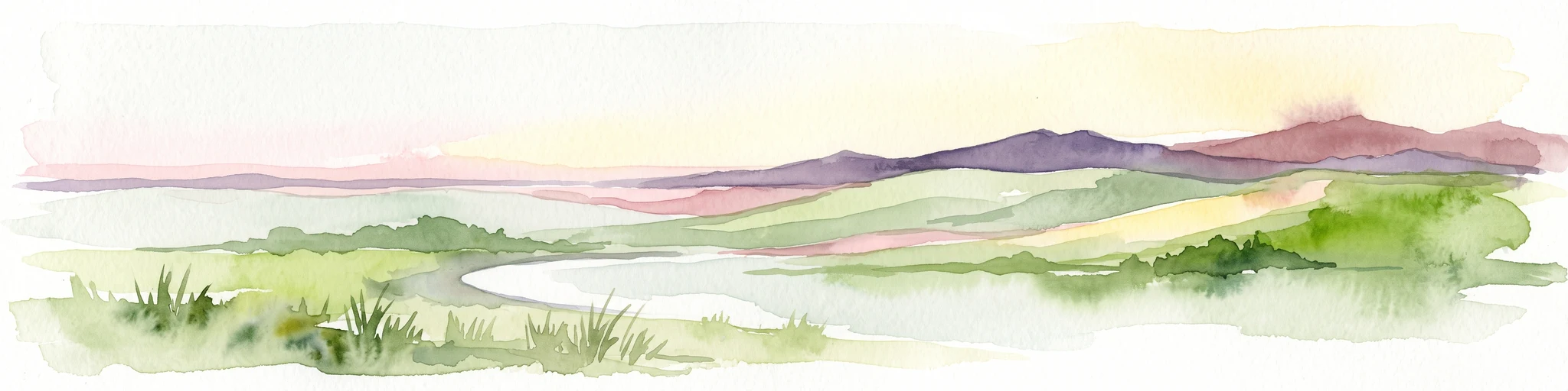
A soft watercolor illustration depicting a panoramic view of rolling green hills under a pale, warm sky with distant mountains.
State or regional parkProvence-Alpes-Côte d'Azur
About 14 km away#2 closest

North

Parc naturel départemental du Plan des Noves: Protected Landscapes and Regional Geography

Upland limestone plateau in the French Baous massif

Covering 904 hectares above the town of Vence, this park features a unique combination of Mediterranean woodlands, open pastoral mosaics, and historic agricultural terraces. The terrain serves as a vital ecological corridor, recognized for its birdlife and reptiles, while its elevation offers expansive vistas across the surrounding regional geography from the coast to the high mountain summits.

Area
9.04 km²
Established
1987
Relief
Upland
Scope
Terrestrial
Watercolor painting of distant purple hills and foreground pine trees in soft washes of green, yellow, and red on a white background.
State or regional parkProvence-Alpes-Côte d'Azur
About 17 km away#3 closest

Northeast

Parc naturel départemental du Vinaigrier: Protected Limestone Landscapes near Nice

Regional state park with diverse Mediterranean woodland ecosystems

Parc naturel départemental du Vinaigrier offers a dense, 25 hectare mosaic of limestone plateaus and slopes near the Mediterranean coast. Its landscape is defined by traditional dry stone terraces and a rare flowering ash forest, creating a significant ecological bridge between the urban expansion of Nice and the hilly interior of the Alpes-Maritimes.

Area
0.25 km²
Established
1980
IUCN
IV
A soft watercolor painting of a coastal landscape with rolling hills, distant mountains, and green vegetation against a light sky.
Marine protected areaProvence-Alpes-Côte d'Azur
About 19 km away#4 closest

Southwest

Parc maritime départemental Estérel-Théoule: Marine Protected Area and Coastal Geography

A vital Mediterranean corridor along the French Riviera coast

This marine protected area preserves a unique underwater mosaic where rocky shallows, sandy patches, and Posidonia seagrass meadows converge. Located offshore from the Estérel massif, the site provides a continuous conservation corridor between inland natural spaces and the Mediterranean Sea, offering insight into the littoral environment of the French Riviera.

Area
3.5 km²
Water
Water-dominated
Season
Seasonal
State or regional parkAlpes-Maritimes
27 km away#5 closest

North

Parc naturel départemental de l'Estéron: Riverside Geography in Alpes-Maritimes

A departmental park focusing on the wild Estéron River corridor

Located in the hinterland of the Côte d'Azur, Parc naturel départemental de l'Estéron provides a protected environment focused on the Estéron river valley. Its geography encompasses sun-exposed Mediterranean hillsides and riparian zones, reflecting the intersection of mountain terrain and historic cross-border heritage in the Alpes-Maritimes department.

Area
0.2 km²
Established
2011
Scope
Terrestrial
Water
Major water bodies
A digital illustration of a valley featuring jagged mountain peaks, a waterfall, a winding river, and pine forests in the foreground.
Marine protected areaMonaco
About 28 km away#6 closest

Northeast

Larvotto and Portier Coastal Reserve: Marine Protected Area and Coastal Habitat Atlas

Mapped marine refuge along the dense Monaco shoreline.

The Larvotto and Portier Coastal Reserve represents a distinct marine protected area in Monaco, featuring significant seagrass meadows and transplanted rocky habitats. This coastal zone acts as an essential refuge for Mediterranean biodiversity, providing a rare example of structured marine conservation embedded within a highly developed urban landscape.

Area
0.23 km²
Watercolor illustration of a mountainous landscape featuring a river, rolling hills, and green vegetation
National parkFrance
38 km away#7 closest

North

Mercantour National Park: Mapped Alpine Protected Landscape and Regional Geography

Explore France's dramatic Alps, park boundaries, and unique ecotones.

Mercantour National Park stands as a premier protected area within the French Alps, distinguished by its remarkable geographic diversity and ecological significance. This national park encompasses mountainous terrain featuring dramatic peaks, deep glacial valleys, and a unique ecotone where Mediterranean and Alpine ecosystems converge. MoriAtlas facilitates a detailed atlas-style exploration of Mercantour National Park, highlighting its mapped protected boundaries, varied natural landscapes, and its pivotal role in regional geography and conservation efforts.

Area
679 km²
Established
1979
IUCN
II
Visitors
800K annual
A watercolor illustration showing a landscape with red rock formations, green vegetation, and a winding blue river.
Nature reserveProvence-Alpes-Côte d'Azur
About 51 km away#8 closest

Northwest

Réserve naturelle régionale des gorges de Daluis: Red Rock Canyon and Geological Atlas

Protected canyon landscape in Provence-Alpes-Côte d'Azur

Defined by its vivid red pelite cliffs, Réserve naturelle régionale des gorges de Daluis functions as a significant protected canyon system. The terrain preserves rare mineralogy and diverse microhabitats, ranging from river-carved walls to upland slopes that support unique regional biodiversity in the Alpes-Maritimes.

Area
10.82 km²
Established
2012
IUCN
IV
Relief
Mountain

Common questions about visiting, size, designation, and location context for Parc de Vaugrenier

Parc de Vaugrenier FAQs for park facts, access, geography, and protected area context

Find quick answers about Parc de Vaugrenier, including protected-area facts, park geography, trail and visitor context, and how the park fits into its surrounding country and regional landscape.
MoriAtlas Explorer

Continue Your Protected Areas Search Across the Global Atlas

Deepen your exploration by continuing the structured search for national parks and protected areas worldwide. Utilize the comprehensive filtering capabilities to compare different conservation landscapes and refine your understanding of global park geography. Discover more about the distribution and characteristics of protected natural areas.

Global natural geography