

Mori Atlas logo
Natural monumentPictured Rocks National Lakeshore

Trace the mineral-stained sandstone cliffs and perched dune systems along the Lake Superior shore

Pictured Rocks National Lakeshore: Exploring the Geologic Boundaries and Coastal Landscapes

Pictured Rocks National Lakeshore spans 42 miles along the Upper Peninsula of Michigan in Alger County. This protected area preserves a complex transition between the ancient sedimentary cliffs of the Munising Formation and the immense, shifting waters of Lake Superior. Users can analyze the structural mapping of the Grand Sable Dunes, the Beaver Basin Wilderness, and the concentration of waterfalls that define this Great Lakes shoreline geography.

Lake Superior shorelinecolored sandstone cliffswaterfallsGreat Lakes coastperched dunesBeaver Basin Wilderness
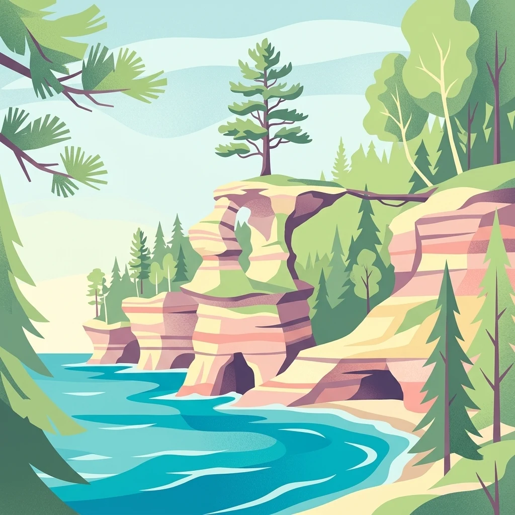
A stylized digital illustration of striped sandstone cliffs with natural arches rising above a blue lake, surrounded by pine forests.

Pictured Rocks National Lakeshore

Natural monument

Park overview

Structured park overview, official facts, and landscape profile for Pictured Rocks National Lakeshore

Pictured Rocks National Lakeshore park facts, protected area profile, and essential visitor context

Review the core facts for Pictured Rocks National Lakeshore, including designation, size, terrain, visitor scale, habitats, and operating context in one park-focused overview.

About Pictured Rocks National Lakeshore

Pictured Rocks National Lakeshore stretches across a dramatic stretch of Lake Superior's southern shoreline in Michigan's Upper Peninsula. The park captures a transition zone between the open waters of the largest Great Lake and a heavily forested interior of hills, swamps, and inland lakes. Within its boundaries lie cliffs, sand dunes, rivers, waterfalls, hardwood and conifer forests, and small lakes, all woven together by more than 40 miles of lakeshore.

The park's identity is anchored by its cliffs. The 13-mile stretch of Pictured Rocks northeast of Munising rises up to about 200 feet above lake level. These cliffs are composed largely of the 500-million-year-old Munising Formation, a Cambrian-era sandstone sitting atop the even older Jacobsville Formation. Groundwater seeping through the rock carries minerals that stain the face of the cliff, producing the reds, yellows, pinks, and blacks that give the lakeshore its name. Wave action and seasonal freeze-thaw cycles continue to reshape the rock, occasionally causing dramatic collapses such as the Inner Turret fall at Miners Castle in 2006.

The lakeshore also protects a remarkably varied inland environment. The eastern end features the Grand Sable Dunes, a five-mile perched dune system rising from the lake at a steep angle atop a glacial moraine. Inland, the Beaver Basin Wilderness protects old-growth forest, ponds, and 13 miles of undeveloped shoreline along Lake Superior. Numerous rivers and streams tumble off the uplands as waterfalls, including Munising Falls, Miners Falls, Chapel Falls, Sable Falls, and the seasonal Bridalveil Falls. Together, these features make Pictured Rocks a compact but unusually diverse showcase of Great Lakes coastal geology and ecology.

As America's first national lakeshore, Pictured Rocks set a precedent for protecting shoreline scenery and ecological values at the federal level. Its establishment reflected growing awareness that Lake Superior's natural shoreline was rapidly being altered by logging, development, and recreation, and that a meaningful sample of this coast deserved lasting protection. Today, the park continues to serve that role, offering visitors a vivid encounter with a Great Lakes shoreline shaped by ancient geology, glacial history, and the persistent forces of wind, water, and ice.

Quick facts and research context for Pictured Rocks National Lakeshore

Pictured Rocks National Lakeshore lies in Alger County, Michigan, on the Upper Peninsula's Lake Superior coast. It is administered by the National Park Service and was established on October 15, 1966, making it the first national lakeshore in the United States. The protected area extends for about 42 miles along the shoreline and encompasses roughly 73,000 acres of cliffs, dunes, forests, rivers, and inland lakes.

Key landmarks within the lakeshore include Munising Falls, Miners Falls, Bridalveil Falls, Chapel Falls, Sable Falls, and Spray Falls, as well as the Grand Sable Dunes, the Au Sable Light station, and Grand Island, which is managed separately as the Grand Island National Recreation Area. In 2009, the central 13 miles of lakeshore were further protected as the Beaver Basin Wilderness.

Protection and recognition

Examine the established protected area status and historical management framework.

Pictured Rocks National Lakeshore Protection Status and Designation History

Pictured Rocks National Lakeshore maintains a documented mixed protection status established in nineteen sixty five. Comprehensive administrative records outline the conservation framework and official designation history governing the protected landscape.

Protection details

Protection scope
Mixed
Designated year
1965
Transboundary protection
No
Park context

Deeper park guide and search-rich context for Pictured Rocks National Lakeshore

Pictured Rocks National Lakeshore history, landscape, wildlife, and travel context

Explore Pictured Rocks National Lakeshore through its history, landscape character, ecosystems, wildlife, conservation priorities, cultural context, and seasonal travel timing in a structured park guide built for atlas discovery and search intent.

Why Pictured Rocks National Lakeshore stands out

Pictured Rocks is best known for its long band of colorful sandstone cliffs along Lake Superior, where iron, manganese, limonite, and copper minerals have stained the rock face in vivid streaks. Over centuries, waves, wind, and freezing-thawing cycles have eroded this ancient Cambrian sandstone into natural arches, sea caves, and turret-like formations such as Miners Castle, Indian Head, and Chapel Rock. Beyond the cliffs, the lakeshore is recognized for its waterfalls, its perched Grand Sable Dunes formed by glacial lake action, and its inland wilderness character preserved through the Beaver Basin Wilderness. The combination of bright cliffs, dark lake water, dense forest, and shifting dunes gives Pictured Rocks an immediately recognizable Great Lakes identity.
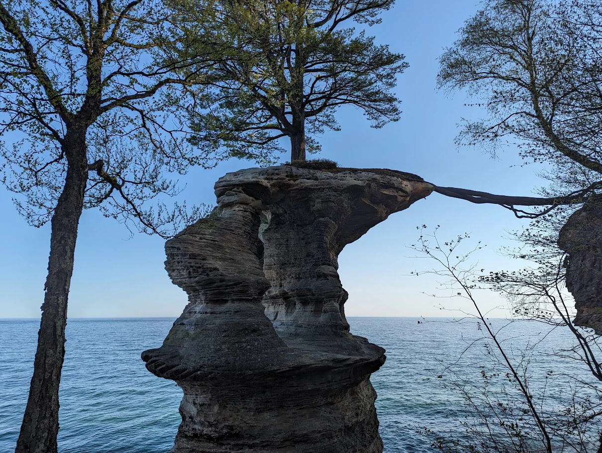
A large sandstone rock formation, Chapel Rock, stands against the backdrop of Lake Superior with a tree growing on its summit and an exposed root bridge extending to the adjacent cliff side.
Chapel Rock, a iconic sandstone formation at Pictured Rocks National Lakeshore.

Pictured Rocks National Lakeshore history and protected-area timeline

The Pictured Rocks shoreline has long been part of human experience along Lake Superior. In 1658, French fur trader Pierre Esprit Radisson traveled this stretch of coast under dangerous conditions and recorded how his Native American companions made offerings of tobacco to the spirit of the cliffs, an early reflection of the site's spiritual significance to Indigenous people such as the Ojibwe and Mississaugas.

During the 19th-century Romantic Era, American writers and explorers brought the cliffs to wider public attention. Geologist and Indian Agent Henry Rowe Schoolcraft visited in 1820 and described "some of the most sublime and commanding views in nature," while Mississaugas Ojibwe writer George Copway later cited descriptions by General Lewis Cass. Around 1850, developers proposed a resort called Grand Island City near Munising, signaling growing interest in the area as a tourist destination.

The early 20th century brought massive logging across the Upper Peninsula, and once the lumbering era ended around 1910, much of the land making up today's lakeshore reverted to the state of Michigan for unpaid property taxes. The state sought federal partnership to protect this recovering landscape, and in October 1966 the U.S. Congress passed legislation establishing Pictured Rocks National Lakeshore, with the stated purpose of preserving "a significant portion of the diminishing shoreline of the United States and its related geographic and scientific features." This made it the first National Lakeshore in the country.

In 2006, one of the lakeshore's most recognizable formations changed when the Inner Turret of Miners Castle collapsed, an event researchers linked to freeze-thaw weathering of the cliff's sandstone. Three years later, the Omnibus Public Land Management Act of 2009 designated 11,740 acres along the 13 miles of cliffs as the Beaver Basin Wilderness, giving the lakeshore an additional layer of protection. Pictured Rocks has also entered broader American culture, including its appearance on a Michigan America the Beautiful quarter and the filming of Kid Rock's "Born Free" music video on site in 2010.

Pictured Rocks National Lakeshore landscape and geographic character

The landscape of Pictured Rocks is shaped by the meeting of ancient sedimentary rock with the immense, restless waters of Lake Superior. The Munising Formation, a Cambrian-era sandstone roughly 500 million years old, forms the backbone of the cliffs and much of the inland topography. Beneath it lies the older Jacobsville Formation, whose mottled red sandstone is the oldest rock exposed in the park, while above it the harder Au Train Formation acts as a protective cap. This layered geology controls much of the scenery, from the cliff profile to the way rivers and waterfalls cascade down the face of the rock.

The shoreline itself alternates between steep, sculpted cliffs and gentler reaches backed by dunes, beaches, and forested banks. Along the 13-mile Pictured Rocks segment, wave action has cut shallow caves, arches, and turrets into the cliff face, while early visitors' imaginations recognized shapes such as Indian Head, the chapel-like Chapel Rock, and the tower-like Miners Castle. In contrast, the eastern end of the lakeshore is dominated by the Grand Sable Dunes, a perched dune system formed when sand washed ashore by waves was driven upslope by prevailing winds until it came to rest atop a glacial moraine. The result is a five-mile sand slope rising from Lake Superior at about a 35-degree angle, with summits reaching roughly 275 feet above lake level.

Behind the shoreline, the interior landscape rolls through forested hills, river valleys, swamps, inland lakes, and the forested lowlands of Beaver Basin. Drainages that originate inland tumble off the uplands as waterfalls, including Munising Falls, Miners Falls, Chapel Falls, Sable Falls, and Spray Falls, the last best viewed from the lake itself. The juxtaposition of vertical cliff, open water, bright dune sand, and dark conifer forest gives Pictured Rocks a landscape identity that feels unmistakably Great Lakes.
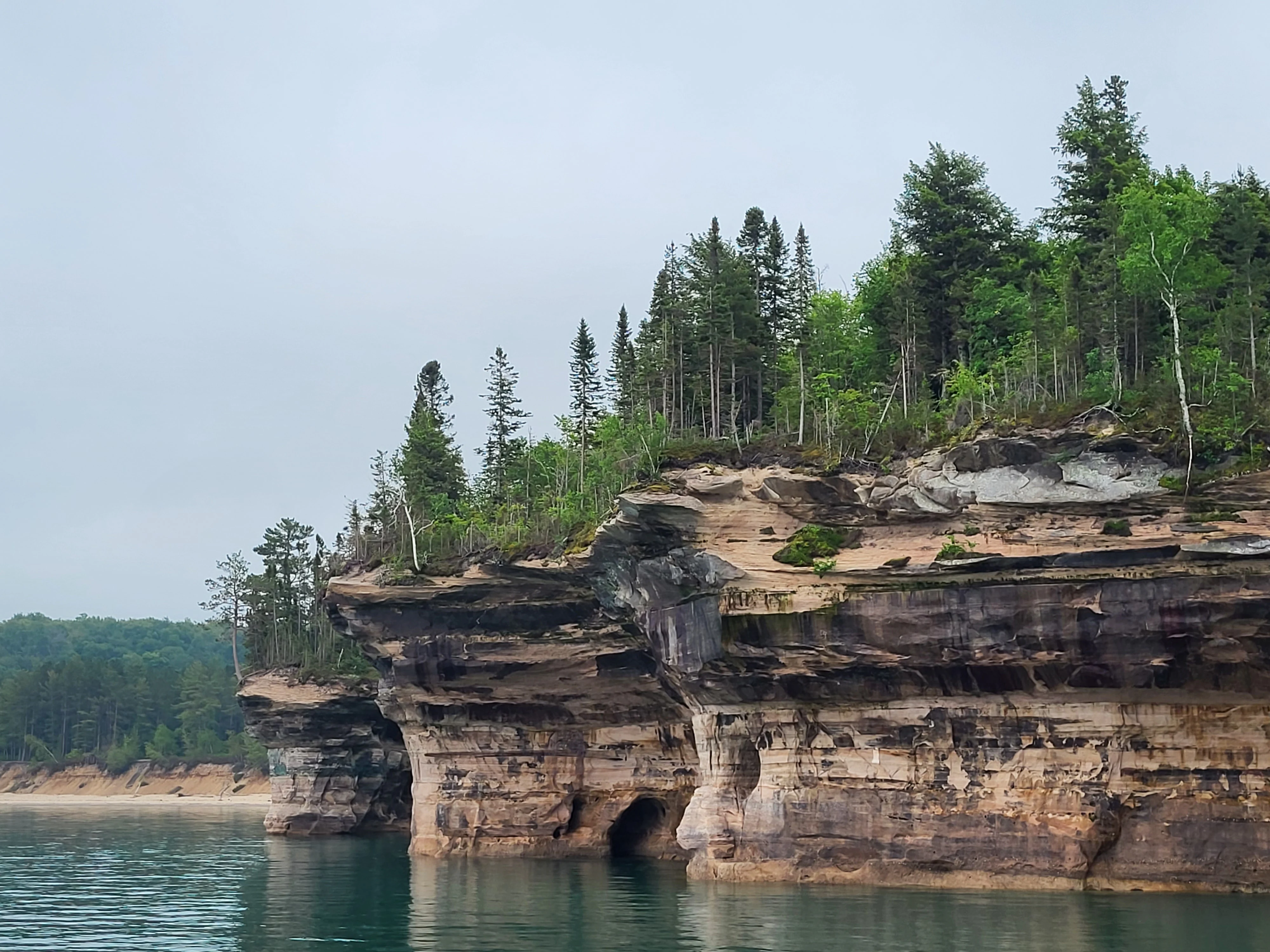
A wide view of layered, colorful sandstone cliffs rising directly from Lake Superior, topped with a dense forest of evergreen and deciduous trees under an overcast sky.
The signature multicolored sandstone cliffs rising above the waters of Lake Superior at Pictured Rocks National Lakeshore.

Pictured Rocks National Lakeshore ecosystems, habitats, and plant life

Pictured Rocks protects an unusually diverse cross-section of ecosystems along Lake Superior. The lakeshore combines aquatic environments of the largest freshwater lake in the world with terrestrial systems that include northern hardwood forests, coniferous stands, dune forests, inland lakes, rivers, and wetlands. This compressed ecological gradient, from the cool wet climate of the lakeshore up through dunes, forests, and interior uplands, makes the park an important refuge for species adapted to the harsh, lake-modified climate of the Upper Peninsula.

Along the dunes, jack pine forest clings to the edges of the Grand Sable Dunes, while more sheltered interior areas support richer mixed woodlands. The inland Beaver Basin Wilderness, designated in 2009, protects relatively undisturbed forest, ponds, and shoreline, contributing to habitat continuity in the heart of the park. The falls and streams that drain the cliffs and uplands, including the Miners River, Mosquito River, and Sable River, maintain riparian microhabitats for aquatic life and for animals that depend on clean, cold water.

The Lake Superior shoreline itself is part of the park's ecological identity. Cold, well-oxygenated lake waters support fishery resources recognized since the era of Radisson's 17th-century travels, and the same conditions have preserved numerous shipwrecks that today form underwater habitat. The combination of aquatic, riparian, dune, cliff, and forest environments within a single protected lakeshore gives Pictured Rocks a richer ecological profile than its relatively compact size might suggest.
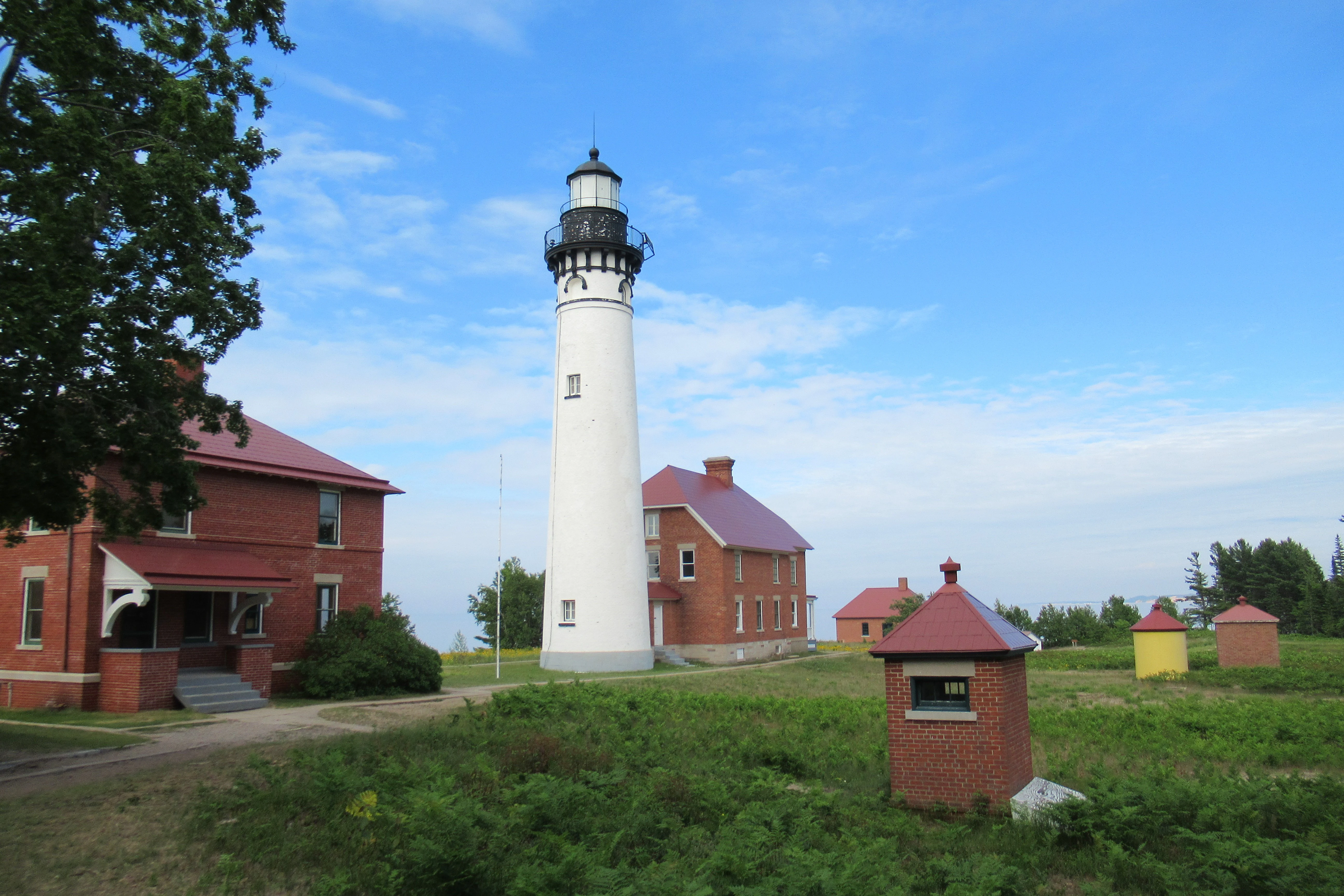
A white lighthouse tower standing tall beside brick buildings and small outbuildings in a grassy field under a blue sky.
The historic Au Sable Light Station at Pictured Rocks National Lakeshore.

Pictured Rocks National Lakeshore wildlife and species highlights

The varied habitats within Pictured Rocks support an interesting mix of wildlife typical of Michigan's Upper Peninsula. The lake itself sustains a productive cold-water fishery and, over time, has accumulated numerous shipwrecks that have themselves become part of the underwater environment. Along the rivers and waterfalls, animals such as river otters and beavers make use of clean, sheltered stream habitat, while smaller mammals such as mink can occasionally be encountered near waterfall trails.

Forests and interior wetlands provide habitat for white-tailed deer, black bears, coyotes, foxes, and a range of small mammals, while the dune forests and lakeshore woodlands host typical northern songbirds, raptors, and migratory waterfowl. Beaver Basin Wilderness, with its undeveloped shoreline and old-growth characteristics, is particularly important for species that benefit from large, unbroken tracts of habitat. Lake-effect winters bring snowy conditions that support active populations of predators and small mammals adapted to heavy snow cover.

Birdwatching and casual wildlife viewing are common visitor activities, particularly during spring and fall migrations along the lakeshore. Although Pictured Rocks is more widely recognized for its scenery than for charismatic megafauna, its wildlife contributes meaningfully to the park's identity as a complete Lake Superior ecosystem, from the surface of the lake to the top of the dunes.
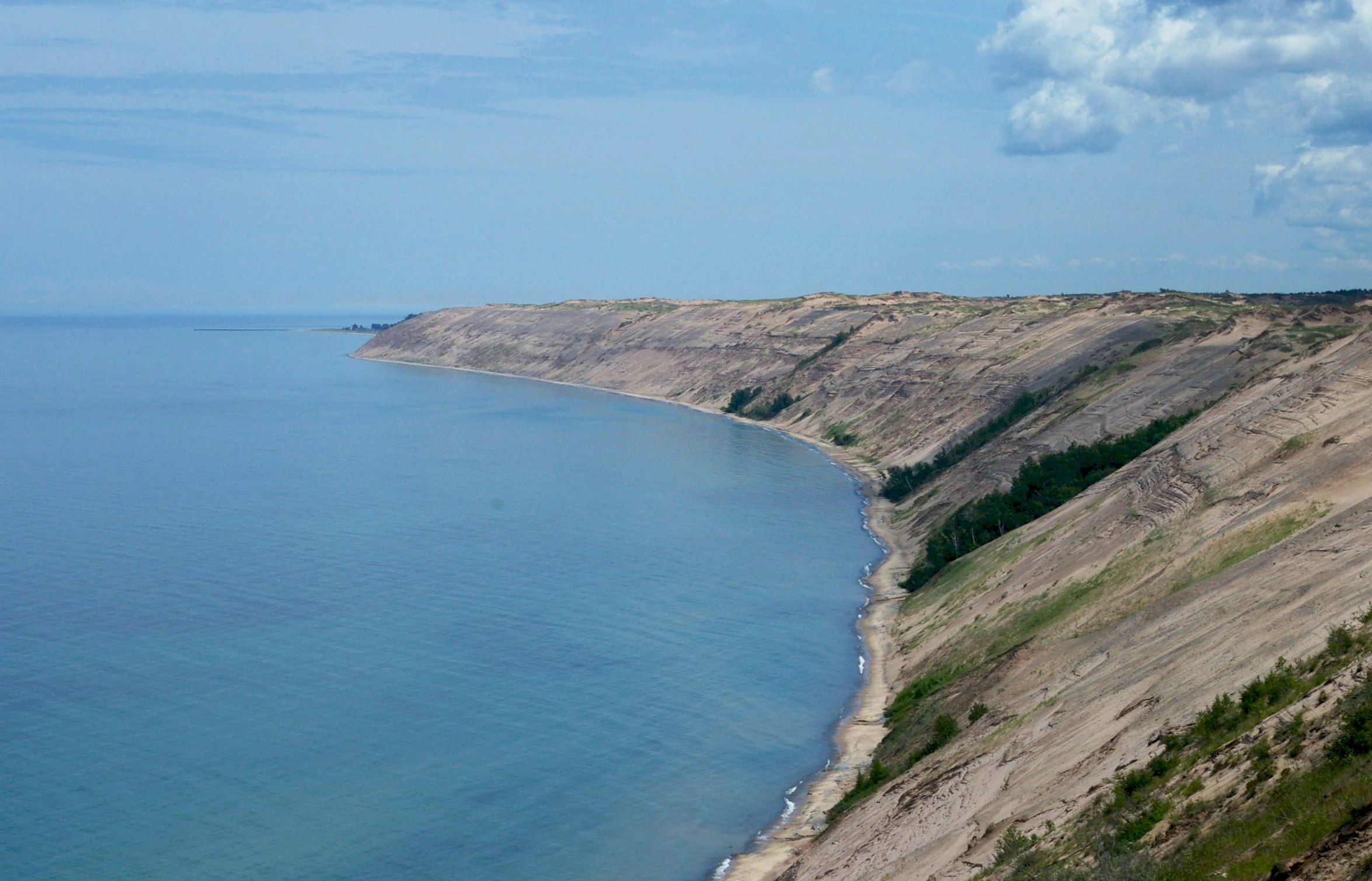
A wide angle view looking down the coastline where massive sandy dunes and cliffs meet the blue water of Lake Superior under a partly cloudy sky.
The Grand Sable Banks rise steeply above the shoreline of Lake Superior at Pictured Rocks National Lakeshore.

Pictured Rocks National Lakeshore conservation status and protection priorities

Pictured Rocks National Lakeshore was created specifically to preserve a representative piece of a rapidly changing Great Lakes shoreline. The 1966 enabling legislation explicitly aimed to safeguard "a significant portion of the diminishing shoreline of the United States and its related geographic and scientific features," reflecting the era's growing recognition that coastal scenery and ecology in the lower 48 states were disappearing under development and resource extraction.

The park protects an unusually compact sequence of conservation values: ancient sandstone cliffs and the mineralogical processes that stain them; perched dunes shaped by glacial lake action; inland forests, rivers, and waterfalls; and the cold, deep waters of Lake Superior themselves. In 2009, Congress strengthened this protection by designating the Beaver Basin Wilderness along 11,740 acres and 13 miles of shoreline, providing a higher level of preservation for the most natural section of the lakeshore.

Beyond legal designations, Pictured Rocks plays an important role as a benchmark for shoreline conservation in the Great Lakes. Its waterfalls, dunes, and cliff systems serve as reference sites for studying shoreline erosion, freeze-thaw weathering, and dune ecology, and its shipwreck-studded underwater environment supports regional understanding of cold-water aquatic systems. The park's continuing management by the National Park Service maintains these values in the face of pressures from logging history, lake-effect weather, and rising visitation.

Pictured Rocks National Lakeshore cultural meaning and human context

Pictured Rocks has held cultural meaning for the people of the Upper Peninsula long before it became a protected area. For Indigenous peoples of the region, including the Ojibwe and related Mississaugas, the cliffs were places of spiritual significance, and 17th-century European travelers such as Pierre Esprit Radisson recorded ceremonies, including offerings of tobacco to the spirit of the cliffs, performed along this dangerous stretch of shore.

The Romantic Era of the 1800s brought a new cultural framing, as American writers, geologists, and missionaries elevated the cliffs as a destination of sublime natural beauty. Henry Rowe Schoolcraft, General Lewis Cass, and George Copway all contributed to an early written tradition around the Pictured Rocks, while mid-19th-century plans for a resort called Grand Island City signaled the beginning of tourism as a regional economic force.

Logging defined the late 19th and early 20th centuries, after which the depleted landscape and unpaid property taxes set the stage for federal intervention. Today, Pictured Rocks is a touchstone of Upper Peninsula identity, appearing on Michigan's America the Beautiful quarter and serving as a recognizable backdrop in American popular culture, even as it continues to hold meaning for descendants of the Indigenous communities who first gave the cliffs their spiritual significance.
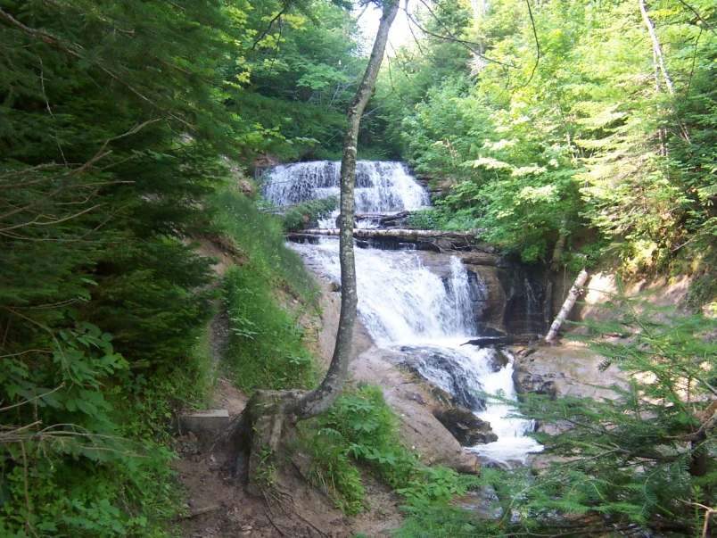
A multi-tiered waterfall cascades down rocky steps in a forest clearing, surrounded by green trees and foliage.
Sable Falls, a multi-tiered waterfall cascading through a lush forest setting in Pictured Rocks National Lakeshore.

Top sights and standout views in Pictured Rocks National Lakeshore

The most iconic stretch of Pictured Rocks is the 13 miles of multicolor sandstone cliffs northeast of Munising, where mineral-rich streaks paint the cliff face and waves have sculpted arches, caves, and formations such as Miners Castle and Indian Head. These cliffs are the visual signature of the lakeshore and the reason for its name.

Beyond the cliffs, the lakeshore protects starkly contrasting landscapes: the towering perched dunes of the Grand Sable Dunes at the eastern end, the inland forests and ponds of the Beaver Basin Wilderness, and a remarkable concentration of Great Lakes waterfalls, from the easily reached Munising Falls to the lakeside Spray Falls. Together, these features pack an unusual level of geological and ecological diversity into a single shoreline park.
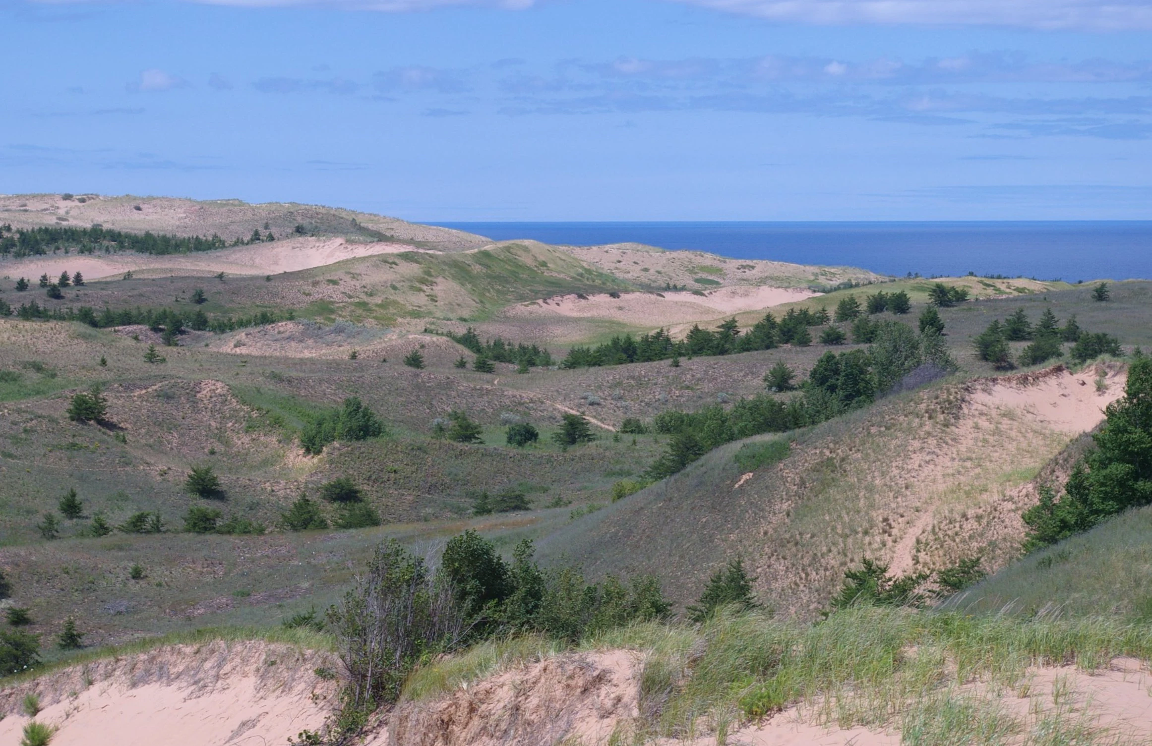
A wide, elevated view of undulating sand dunes covered in patches of grasses and sparse coniferous trees, leading toward a distant blue lake.
The rolling Grand Sable Dunes overlooking the blue expanse of Lake Superior.

Best time to visit Pictured Rocks National Lakeshore

Pictured Rocks is a true four-season park, and the best time to visit depends largely on what a visitor wants to see. Summer, from roughly June through early September, brings warm weather for kayaking and boat tours along the cliffs, and is the only season when many waterfalls are flowing strongly; some falls, such as Bridalveil, may nearly dry up in late summer. This is also the peak of the park's boat-and-beach experience, though it is also the busiest period.

Spring and fall are quieter, cooler, and especially atmospheric for hiking and waterfall viewing, as rivers run high and autumn color spreads across the lakeshore's hardwood stands. Winter brings heavy lake-effect snowfall to the Munising area, transforming Pictured Rocks into one of the Midwest's premier destinations for snowmobiling, cross-country skiing, and ice climbing, with dozens of named ice formations forming on the cliffs and waterfalls.

Monthly climate preview

Long term temperature and precipitation patterns recorded across monthly cycles

Pictured Rocks National Lakeshore Climate Normals and Annual Weather Rhythm

Representative coordinates capture measured monthly averages for temperature and precipitation spanning from sub zero winter lows to warm summer peaks at Pictured Rocks National Lakeshore. Examining the complete twelve month climate profile reveals detailed shifts in long term normals across the entire annual cycle.
Annual mean5 °C
-7 °C17 °C
Jan-7°
Feb-7°
Mar-3°
Apr
May
Jun13°
Jul17°
Aug17°
Sep14°
Oct
Nov
Dec-4°
Warmest month
August

17.4 °C

Coolest month
January

-7.3 °C

Wettest month
October

3.5 mm/day

Driest month
February

1.7 mm/day

Park location guide

Geography guide, regional context, and park location map for Pictured Rocks National Lakeshore

Pictured Rocks National Lakeshore park geography, regions, and map view in United States of America

Understand where Pictured Rocks National Lakeshore sits in United States of America through a broader geographic reading of the surrounding landscape, nearby location context, and its mapped position within the national park landscape.

How Pictured Rocks National Lakeshore fits into United States of America

The United States of America is a federal presidential republic and one of the world's largest countries by area and population. It consists of 50 states across a vast territory spanning multiple time zones, with its capital in Washington, D.C. and largest city in New York City. The nation has a diverse economy, influential political system, and significant cultural and military presence globally.

Wider geography shaping Pictured Rocks National Lakeshore in United States of America

The United States occupies a vast territory in North America, bordered by Canada to the north and Mexico to the south. The 48 contiguous states stretch from the Atlantic to the Pacific Ocean, while Alaska occupies the northwestern region and Hawaii is an archipelago in the Pacific. The country encompasses diverse terrain including the Rocky Mountains, Appalachian Mountains, Great Plains, and extensive river systems.

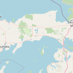
Map view of Pictured Rocks National Lakeshore

Use this park location map to pinpoint Pictured Rocks National Lakeshore in United States of America, understand its exact geographic position, and read its mapped placement within the surrounding landscape more clearly.

Pigeon | © OpenStreetMap contributors

Location context for Pictured Rocks National Lakeshore

Alger County

Explore detailed imagery of colorful sandstone cliffs, coastal forests, and perched dunes

Pictured Rocks National Lakeshore Photos and Scenic Landscapes Visual Reference

Visual documentation captures the dramatic geological features, shoreline terrain, and protected habitats that define Pictured Rocks National Lakeshore along Lake Superior. Examining high-resolution park photography reveals the layered sandstone formations, ancient sea caves, and dense forest environments shaping the region.

A large sandstone rock formation, Chapel Rock, stands against the backdrop of Lake Superior with a tree growing on its summit and an exposed root bridge extending to the adjacent cliff side.

A high-angle view of the sandstone Miners Castle rock formation extending into the bright turquoise water of Lake Superior, surrounded by green pine trees.

A wide view of layered, colorful sandstone cliffs rising directly from Lake Superior, topped with a dense forest of evergreen and deciduous trees under an overcast sky.

A white lighthouse tower standing tall beside brick buildings and small outbuildings in a grassy field under a blue sky.

A wide angle view looking down the coastline where massive sandy dunes and cliffs meet the blue water of Lake Superior under a partly cloudy sky.

A sandstone cliff formation resembling a human profile, known as Indian Head, projects into the calm blue waters of Lake Superior, with a forest canopy atop the rock.

A multi-tiered waterfall cascades down rocky steps in a forest clearing, surrounded by green trees and foliage.

A wide, elevated view of undulating sand dunes covered in patches of grasses and sparse coniferous trees, leading toward a distant blue lake.

A historic wooden boathouse interior containing a white Coast Guard motor lifeboat labeled CG-36528 and a blue rescue cart with large wheels.

A high-angle view looking down over a large, calm lake bordered by a sandy dune slope in the foreground and dense green forest along the far shoreline.

A small ice climber in blue gear is visible on a large wall of ice next to a partially frozen waterfall, surrounded by snow-covered forest trees.

A wide view of the Grand Portal sandstone arch standing above the water at Pictured Rocks National Lakeshore.

A waterfall spills over the edge of a high, layered sandstone cliff into Lake Superior, surrounded by trees along the top.

A white tour boat with passengers visible on the deck travels across blue water in front of a tall, layered sandstone cliff topped with green forest.

A thin waterfall flows over a layered sandstone cliff, framed by lush green forest trees in the foreground.

A waterfall flows down a vertical sandstone cliff face, surrounded by dense green forest foliage.

Park atlas

Compare regional geography and connected conifer forests across the Upper Peninsula

Other Parks Near Pictured Rocks National Lakeshore and Surrounding Protected Areas

Browse nearby national parks and protected areas sharing similar Great Lakes shorelines and forested terrain. Comparing these regional landscapes extends geographic discovery beyond Pictured Rocks National Lakeshore.
A watercolor painting of a rolling, soft-toned landscape with a foreground of green forest and layers of hills receding into the distance.
Protected landscapeUpper Peninsula of Michigan
About 24 km away#1 closest

Southwest

Hiawatha National Forest: Geographic Overview and Protected Area Map of the Upper Peninsula

Coastal forest landscape and wilderness river corridors.

Hiawatha National Forest spans significant portions of the Upper Peninsula of Michigan, bridging the gap between northern hardwood forests and the boreal environments of the Great Lakes. This protected landscape encompasses extensive shorelines along Lake Superior, Lake Michigan, and Lake Huron, alongside six wilderness areas and five designated wild and scenic rivers.

Area
3,621.27 km²
Established
1931
IUCN
VI
Relief
Lowland
Wildlife reserveAlger County
About 50 km away#2 closest

West

Rock River Canyon Wilderness: Geographic Atlas and Protected Landscape Overview

Sandstone canyons and unmanaged forest terrain in Alger County

Covering 4,640 acres of the Upper Peninsula, Rock River Canyon Wilderness offers a rare look at natural forest processes. This protected area is defined by two 150-foot deep sandstone canyons, the flow of the Rock River, and the scenic Rock River Falls, serving as an ecological buffer within the broader Hiawatha National Forest landscape.

Area
18.8 km²
Established
1987
IUCN
Ib
Relief
Upland
Wildlife reserveMichigan
About 122 km away#3 closest

Southeast

Mackinac Wilderness Protected Area: Glacial Terrain and River Geography in Upper Michigan

A roadless wilderness reserve within Hiawatha National Forest

Uncover the geographic significance of Mackinac Wilderness, an IUCN Category Ib protected area in Michigan. The unit provides a distinct look at northern forest recovery through a terrain of sandy ridges, aspen and birch cover, and aquatic corridors. This study examines the interplay between postglacial landforms and the ongoing natural succession occurring along the Carp River drainage basin.

Area
49.5 km²
IUCN
Ib
Relief
Lowland
Climate
Temperate
Wildlife reserveMichigan
About 125 km away#4 closest

West

McCormick Wilderness: Protected Forest and Hydrology in Michigan's Upper Peninsula

A federally protected wildlife reserve and river headwaters landscape

Centrally located within the western Upper Peninsula of Michigan, McCormick Wilderness preserves 17,000 acres of dense, regrown northern forest. The area is defined by its unusual density of river headwaters, providing significant ecological value as a quiet, roadless tract within the Ottawa National Forest network.

Area
69 km²
Established
1987
IUCN
Ib
Relief
Upland
Wildlife reserveMichigan
About 137 km away#5 closest

Southeast

Horseshoe Bay Wilderness: A Detailed Geographic Overview of Michigan Protected Lands

Protected wetland habitat and Lake Huron coastal geography

Horseshoe Bay Wilderness represents a pristine 3,787-acre protected area located along the northwestern corner of Lake Huron in Michigan. Administered as part of the Hiawatha National Forest, this wilderness features an intricate post-glacial landscape of riparian wetlands, dense northern whitecedar stands, and quiet shallow waters that serve as vital spawning ground for local aquatic life.

Area
15.33 km²
Established
1987
IUCN
Ib
Relief
Lowland
A watercolor painting showing a winding river flowing through a lush, green valley with rolling mountains in the distance.
Wildlife reserveUnited States of America
About 155 km away#6 closest

Southeast

Round Island Wilderness: Geographic Overview of the Straits of Mackinac Wildlife Reserve

Coastal marsh, conifer forest, and hardwood interior terrain

Round Island Wilderness encompasses nearly all of a 378-acre island sanctuary, distinguished by its mature beech-maple hardwood interior and boreal-leaning conifer forests. This protected land remains an essential study of Great Lakes island ecology, standing as a quiet, undisturbed wilderness edge along the transit routes of the Michigan straits.

Area
1.53 km²
Relief
Lowland
Climate
Temperate
Access
Remote access
A soft watercolor painting showing green rolling hills, a calm body of water, and small clusters of pink flowers against a light, hazy background.
National parkMichigan
About 157 km away#7 closest

South

Sleeping Bear Dunes National Lakeshore: Atlas, Maps, and Protected Landscape Geography

Great Lakes freshwater coast and glacial dune systems

Sleeping Bear Dunes National Lakeshore showcases the unique intersection of glacial geology and freshwater ecology. This protected area features massive dunes resting on ancient glacial deposits, backed by beech and maple forests. The geographic scope includes the vast shoreline of Lake Michigan, inland waters such as Glen Lake, and the distinct maritime history found across the remote North and South Manitou Islands.

Area
288.13 km²
Established
1970
IUCN
III
Visitors
1.5M annual
National parkThunder Bay District
About 161 km away#8 closest

North

Pukaskwa National Park National Park: Explore Its Protected Landscape and Geographic Identity

Discover the mapped boundaries and regional atlas context.

Pukaskwa National Park represents a key protected area, offering critical insights into the regional geography of Thunder Bay District. As a national park, its mapped boundaries and unique landscape identity are central to understanding Canada's protected lands. This entry provides the foundational geographic context for exploring Pukaskwa National Park within a structured atlas framework, detailing its place among other natural landscapes.

Area
1,878 km²
Established
1978
IUCN
II
Visitors
17.3K annual

Common questions about visiting, size, designation, and location context for Pictured Rocks National Lakeshore

Pictured Rocks National Lakeshore FAQs for park facts, access, geography, and protected area context

Find quick answers about Pictured Rocks National Lakeshore, including protected-area facts, park geography, trail and visitor context, and how the park fits into its surrounding country and regional landscape.
MoriAtlas Explorer

Continue Your Protected Areas Search Across the Global Atlas

Deepen your exploration by continuing the structured search for national parks and protected areas worldwide. Utilize the comprehensive filtering capabilities to compare different conservation landscapes and refine your understanding of global park geography. Discover more about the distribution and characteristics of protected natural areas.

Global natural geography


