
Mori Atlas logo
Protected landscapePřírodní park Bohdalov-Hartinkov

A detailed geographic overview of protected forest ridges and meadow mosaics in the Svitavy District

Přírodní park Bohdalov-Hartinkov Protected Landscape and Regional Geographic Atlas

Přírodní park Bohdalov-Hartinkov spans over 6,000 hectares of the Zábřezh Highlands, offering a distinctive protected landscape defined by its Paleozoic shales and calcium-rich Cretaceous sediments. This area creates a continuous protected corridor across the Bohemian-Moravian borderlands, where forest stands, semi-natural meadows, and registered landscape features like the Pěčíkovské stráně slopes define the terrain.

Czech Republicnature parkZábřezh HighlandsBohemian-Moravian borderlandsforested landscapemeadow mosaic
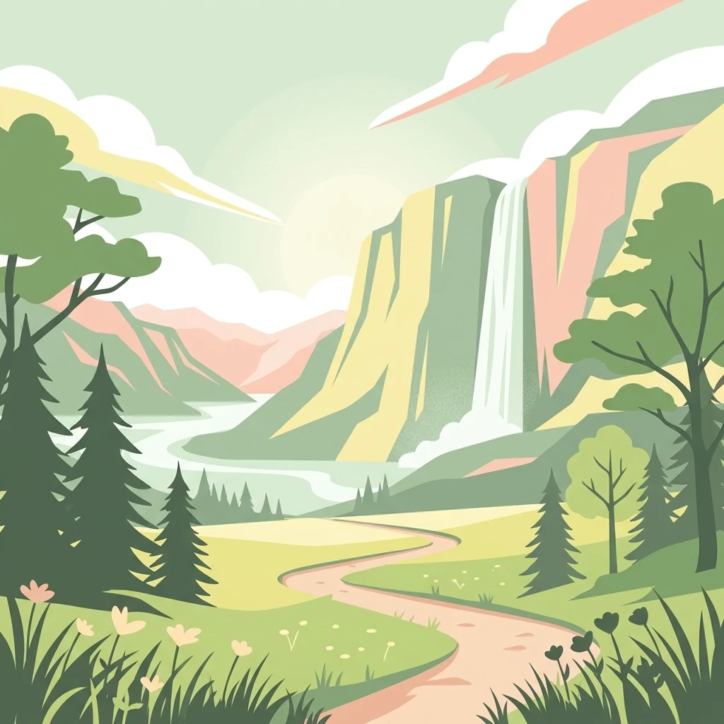
An illustration of a winding dirt path leading through a sunny valley toward a waterfall flowing down a rocky cliff, surrounded by evergreen trees.

Přírodní park Bohdalov-Hartinkov

Protected landscape

Park overview

Structured park overview, official facts, and landscape profile for Bohdalov-Hartinkov Nature Park

Bohdalov-Hartinkov Nature Park park facts, protected area profile, and essential visitor context

Review the core facts for Bohdalov-Hartinkov Nature Park, including designation, size, terrain, visitor scale, habitats, and operating context in one park-focused overview.

About Bohdalov-Hartinkov Nature Park

Bohdalov-Hartinkov Nature Park is a sizable protected landscape in the eastern Czech Republic, occupying the southwestern edge of the Zábřezh Highlands in the Svitavy District. Created in 1996 through a declaration by the Svitavy District Office, the park was designed to safeguard a countryside of considerable aesthetic and biological value, encompassing the surroundings of the villages of Bohdalov and Hartinkov and reaching toward Městečko Trnávka. With an extent of roughly 6,265 hectares, it is one of the larger nature parks of its region and forms an important green link in the Bohemian-Moravian borderlands.

The park's character is strongly shaped by its geology. The bedrock ranges from older Paleozoic shales to younger Upper Cretaceous marine and continental sediments, and the significant presence of calcium-rich layers influences soil chemistry, plant communities, and the distribution of habitats across the terrain. This geological variety, combined with the rolling relief of the Zábřezh Highlands, creates a richly textured landscape of ridges, slopes, valleys, and small watercourses rather than a single dominant landform.

In land cover, the park is predominantly forested, yet it is far from being a closed continuous woodland. A mosaic of semi-natural meadows and pastures runs through and around the forest patches, sustaining both biodiversity and the open, varied appearance typical of traditional Central European countryside. Within the park, several smaller areas are formally registered as significant landscape features, including the Pěčíkovské stráně slopes, the Strážnička locality, and the Teplice spring. These sites concentrate ecological and scenic value and add finer detail to the broader protected landscape.

Bohdalov-Hartinkov also functions as part of a wider network of protected countryside. It borders the Kladecko Nature Park in the neighboring Prostějov District, and together the two parks create a continuous trans-regional belt of protected landscape across the Bohemian-Moravian border. Administrative responsibility lies with the municipal office in Moravská Třebová and the environment departments of the Pardubice Region, while on-the-ground care and marking of the territory is carried out by the local chapter of the Czech Union for Nature Conservation based in Moravská Třebová.

Quick facts and research context for Bohdalov-Hartinkov Nature Park

Bohdalov-Hartinkov Nature Park lies in the southwestern Zábřezh Highlands in the Svitavy District of the Pardubice Region, Czech Republic. It was established in 1996 by the District Office of Svitavy and covers approximately 6,265 hectares around the villages of Bohdalov and Hartinkov, northeast of Městečko Trnávka.

The park protects a diverse geological setting ranging from Paleozoic shales to calcareous Upper Cretaceous sediments, and a landscape dominated by forest together with a mosaic of semi-natural and near-natural meadows and pastures. Administration is shared between the Moravská Třebová municipal office and the Pardubice Regional Authority, with practical marking and care handled by the Czech Union for Nature Conservation's local branch in Moravská Třebová.

Protection and recognition

Explore the documented terrestrial protection scope and management records.

Přírodní park Bohdalov-Hartinkov Protection Status and Conservation Data

Přírodní park Bohdalov-Hartinkov maintains a documented terrestrial protection scope within the regional conservation network. Review the verified designation records and management frameworks associated with this protected landscape.

Protection details

Protection scope
Terrestrial
Transboundary protection
No
Park context

Deeper park guide and search-rich context for Bohdalov-Hartinkov Nature Park

Bohdalov-Hartinkov Nature Park history, landscape, wildlife, and travel context

Explore Bohdalov-Hartinkov Nature Park through its history, landscape character, ecosystems, wildlife, conservation priorities, cultural context, and seasonal travel timing in a structured park guide built for atlas discovery and search intent.

Why Bohdalov-Hartinkov Nature Park stands out

Bohdalov-Hartinkov Nature Park is best known for its mosaic landscape of forests, semi-natural meadows, and pastures set against the rolling terrain of the Zábřezh Highlands. The park's varied geology, spanning ancient shales through calcium-rich Cretaceous sediments, gives rise to habitats that support a notable range of protected plant and animal species. Visitors and ecologists value the park for its combination of scenic countryside, registered landscape features such as the Pěčíkovské stráně slopes and the Teplice spring, and a quiet, lightly developed character typical of the Bohemian-Moravian border region.
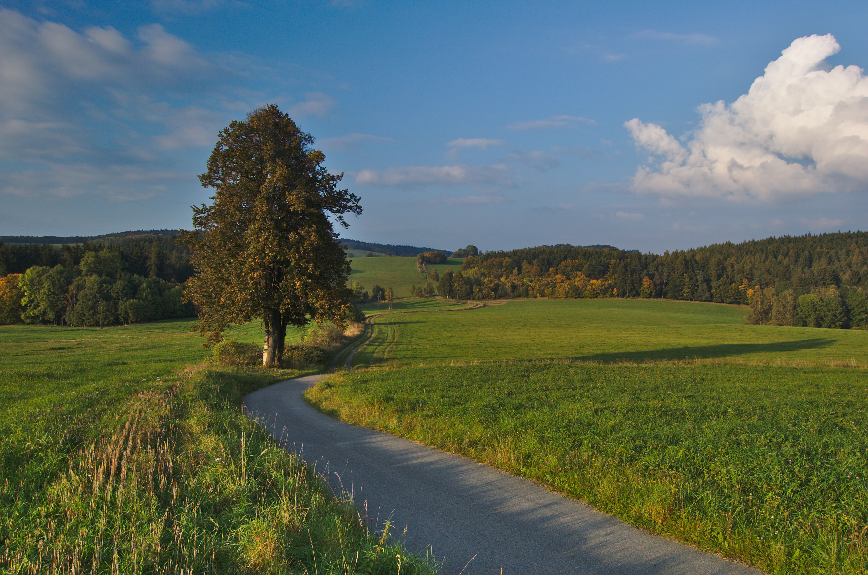
A narrow paved road winds through lush green meadows toward a forested hill under a blue sky with scattered clouds, with a large solitary tree standing by the roadside.
A scenic view of the rolling green hills, forests, and winding rural road in Přírodní park Bohdalov-Hartinkov.

Bohdalov-Hartinkov Nature Park history and protected-area timeline

Bohdalov-Hartinkov Nature Park was established in 1996, when the District Office of Svitavy declared the area around the villages of Bohdalov and Hartinkov in the southwestern Zábřezh Highlands as a protected landscape. The designation reflected recognition of the territory's aesthetic qualities and its biological richness, including the presence of multiple significant landscape features that were already individually registered.

The park was conceived as a regional instrument of nature protection within the framework of Czech nature park legislation, aimed at safeguarding a working countryside rather than a strict nature reserve. Its creation tied the protection of forests, meadows, and geological interest sites into a single administrative unit, and positioned it as a counterpart to the adjoining Kladecko Nature Park across the regional border in the Prostějov District.

Since its founding, administration has been handled by the environment offices of the Moravská Třebová municipality and the Pardubice Region, while the Czech Union for Nature Conservation's local organization in Moravská Třebová has taken responsibility for practical marking and stewardship of the protected area.

Bohdalov-Hartinkov Nature Park landscape and geographic character

The landscape of Bohdalov-Hartinkov Nature Park is defined by the southwestern slopes and ridges of the Zábřezh Highlands, a hilly region along the Bohemian-Moravian border. The terrain rolls in a series of forested ridges, valleys, and small basins, with relief shaped by the underlying geology rather than by dramatic elevation changes. Roads and paths weave between the villages of Bohdalov, Hartinkov, Březinky, and Vysoká, offering vistas across mixed woodland and open countryside.

Geologically, the park encompasses a notable range of rock types. Older Paleozoic shales appear alongside younger Upper Cretaceous sediments, and the relatively high calcium content of some layers influences soil development and habitats. This combination of contrasting bedrock, modest elevation differences, and varied exposure gives the terrain a patchwork of soil conditions and microclimates, expressed visually as alternating forest stands, meadows, pastures, and registered landscape features such as the Pěčíkovské stráně slopes and the Strážnička area. Small springs, including the Teplice spring, add further variety to the hydrology of the park.
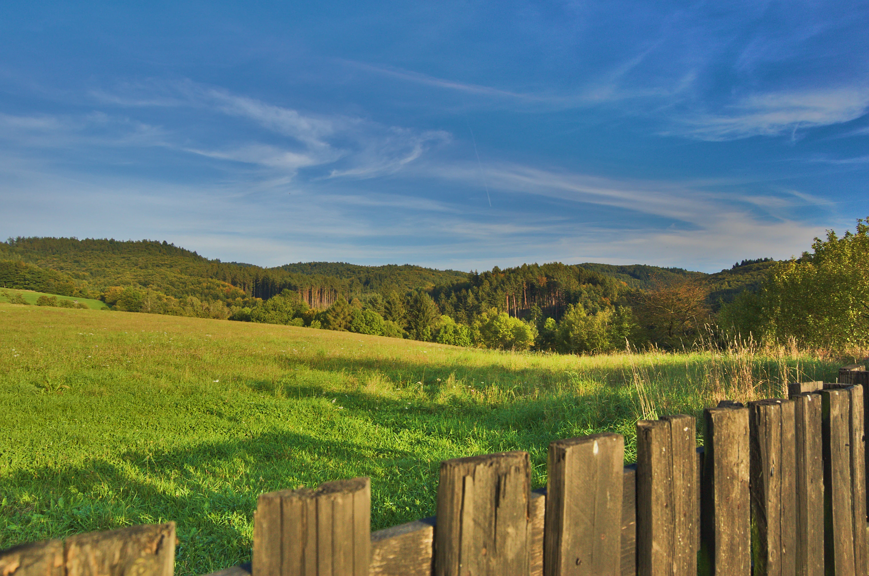
A green pasture in the foreground leads to rolling hills covered in dense forest under a bright blue sky with wispy clouds, viewed behind a weathered wooden fence.
A scenic view of the rolling hills, pastures, and forests within Přírodní park Bohdalov-Hartinkov in Czechia.

Bohdalov-Hartinkov Nature Park ecosystems, habitats, and plant life

Ecologically, Bohdalov-Hartinkov Nature Park reflects a transitional character between the Bohemian Massif and the Moravian countryside. Forests cover a large share of the park, but they are interrupted by a regular mosaic of semi-natural and near-natural grasslands, creating edge habitats and structural diversity that support a wide range of species.

The geological substrate, particularly the influence of calcium-rich Cretaceous sediments, contributes to specific plant communities on calcareous substrates, which add botanical interest to the grasslands and open slopes. Registered landscape features within the park, including the Pěčíkovské stráně slopes, the Strážnička locality, and the Teplice spring, are focal points for this ecological richness, concentrating rare and protected species and providing refuges for plants and animals that depend on undisturbed open habitats, spring environments, and rocky or stony slopes.
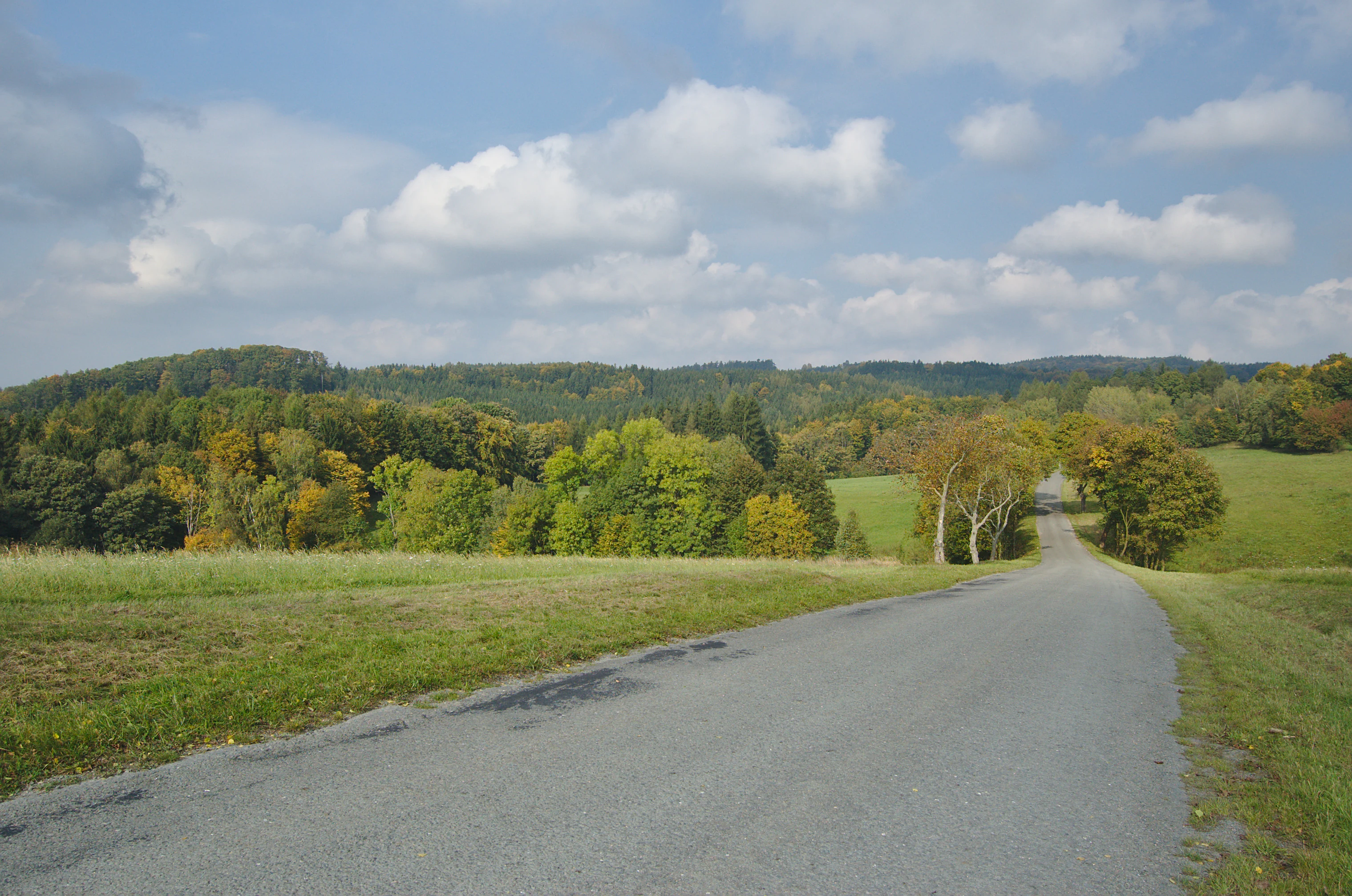
A paved road stretching into the distance through a rural landscape featuring rolling green hills, meadows, and patches of deciduous trees under a partially cloudy blue sky.
A scenic road winding through the rolling hills and forested landscape of Přírodní park Bohdalov-Hartinkov.

Bohdalov-Hartinkov Nature Park wildlife and species highlights

The park's mosaic of forest, meadows, and pastures supports a varied animal community. Amphibians such as the fire salamander are among the protected species documented in the area, finding suitable conditions in shaded, moist woodland and spring-influenced habitats. The varied structure of grasslands and shrubs also provides habitat for birds such as the red-backed shrike, a species typical of open countryside with hedgerows and scattered bushes.

The combination of older woodland, calcareous grasslands, and small wetland or spring features creates conditions that favor insect diversity, which in turn supports a broader food web of birds, amphibians, and small mammals. While the park is not primarily managed for large mammals, the extensive forest cover and low level of development provide continuity of habitat that benefits a wide spectrum of native Czech fauna typical of the Zábřezh Highlands.
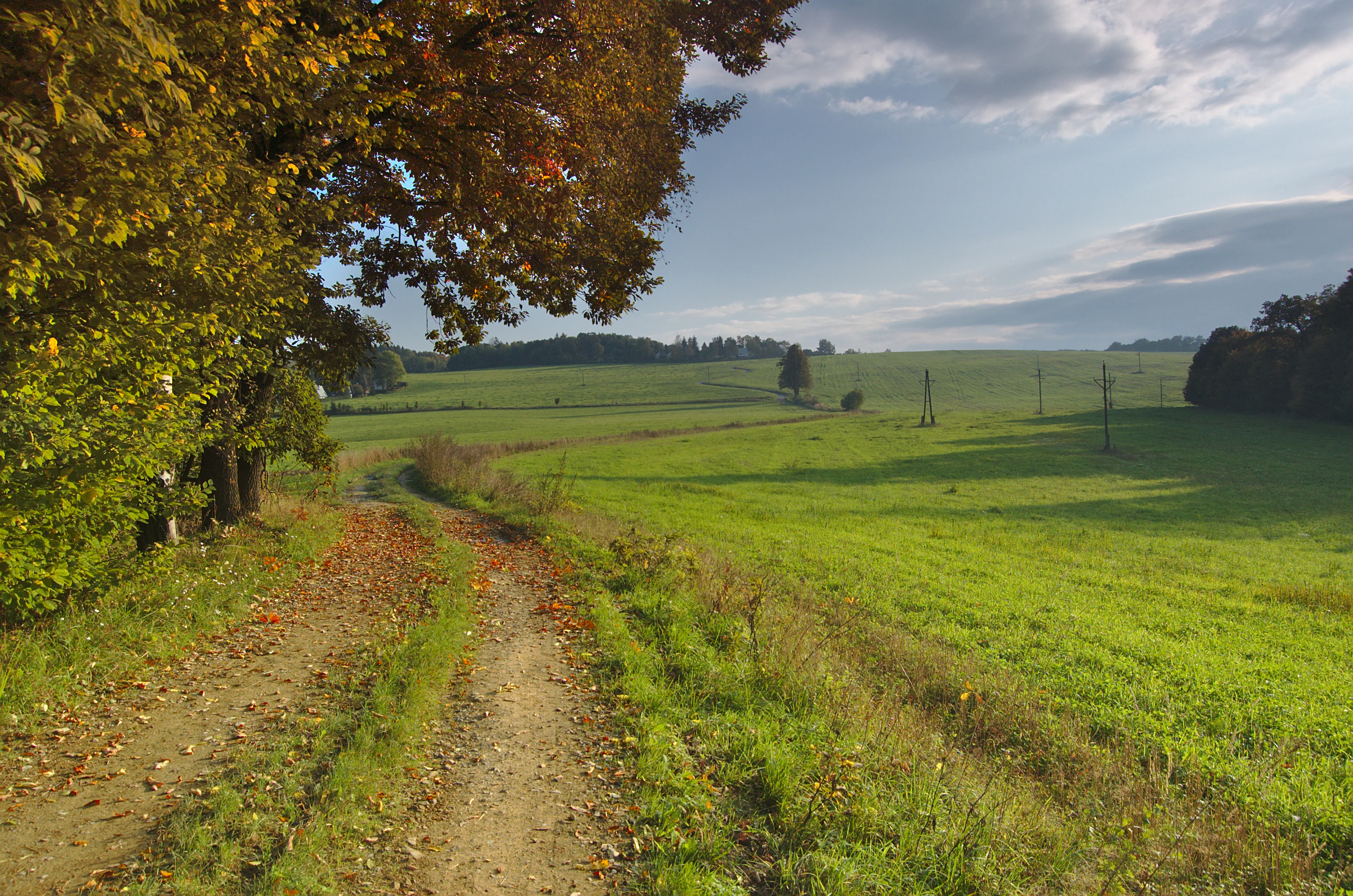
A dirt path leads through green meadows toward a forested horizon under a soft sky, with colorful autumn trees in the foreground.
A rural dirt track winding through autumn meadows in the Bohdalov-Hartinkov nature area.

Bohdalov-Hartinkov Nature Park conservation status and protection priorities

Bohdalov-Hartinkov was established specifically to protect a countryside of high aesthetic and biological value, and conservation remains central to its purpose. By encompassing a large, continuous area of forest, semi-natural meadows, and pastures, the park sustains habitat networks that would otherwise be vulnerable to intensification of land use, afforestation, or abandonment of traditional management practices.

The protection of calcareous substrates, slopes, and spring environments through registered landscape features adds a finer layer of conservation, targeting specific habitats of botanical and zoological importance. Linking with the adjacent Kladecko Nature Park across the regional border further strengthens the conservation value of the area, creating a substantial trans-regional buffer of protected countryside along the Bohemian-Moravian boundary. Practical stewardship is led by the Czech Union for Nature Conservation's local organization, which ensures ongoing marking and care of the protected territory.

Bohdalov-Hartinkov Nature Park cultural meaning and human context

The park surrounds and connects several small villages of the Svitavy District, including Bohdalov, Hartinkov, Březinky, and Vysoká, reflecting a long tradition of mixed land use in the Bohemian-Moravian borderlands. The landscape of forests interspersed with meadows and pastures is closely tied to the rural character of these communities and their historical use of the land.

The maintenance of semi-natural meadows and pastures within the park is itself a cultural-ecological link, preserving land-use patterns that have shaped the appearance of the Zábřezh Highlands for generations. The presence of registered landscape features, old roadways lined with avenues of trees, and small chapels or shrines along village approaches contribute quietly to the regional identity of this part of the Czech countryside.
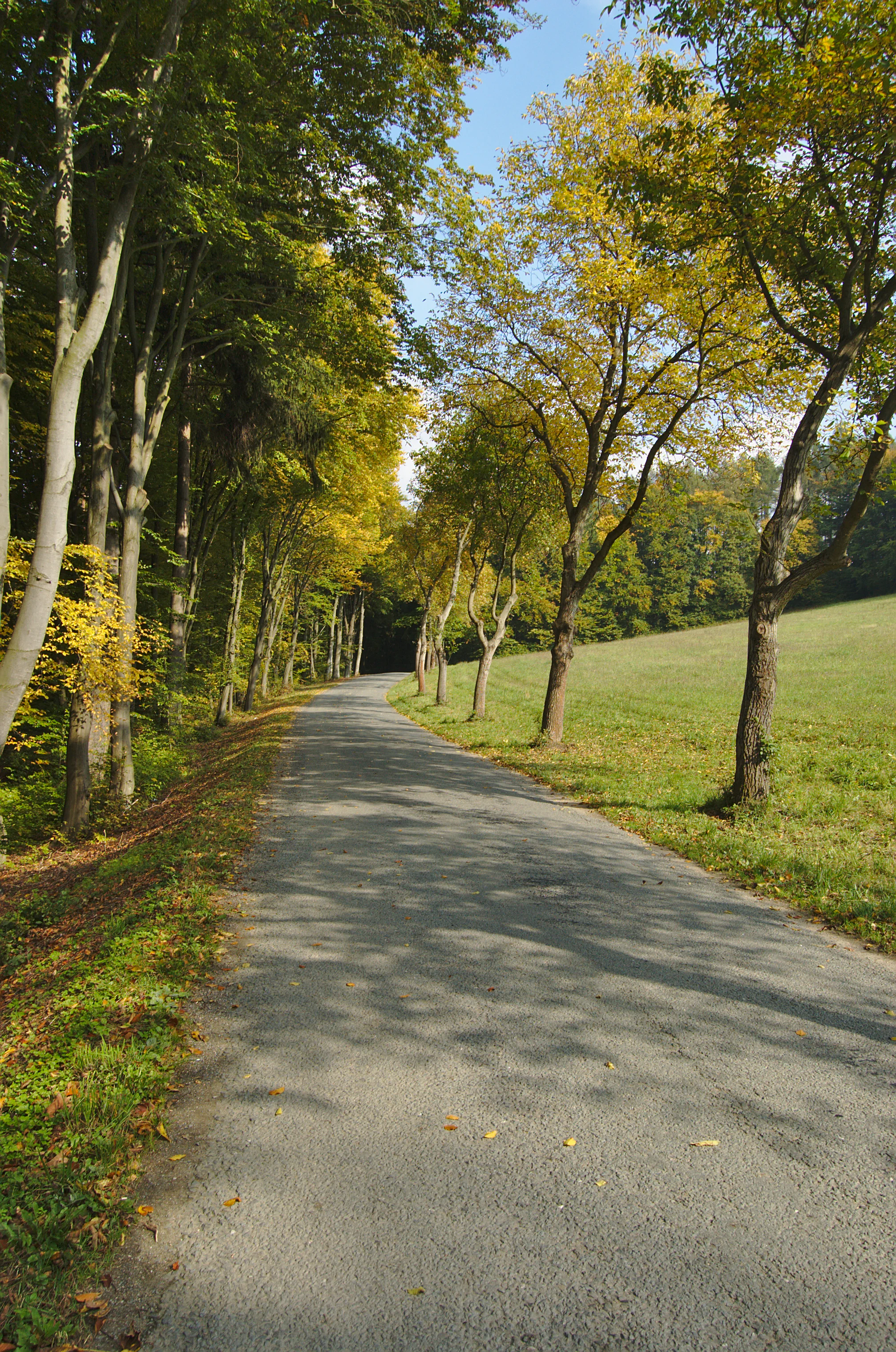
A narrow paved road flanked by tall deciduous trees with early autumn foliage, bordering an open meadow under a clear blue sky.
A tree-lined road winding through the countryside of Přírodní park Bohdalov-Hartinkov.

Top sights and standout views in Bohdalov-Hartinkov Nature Park

Bohdalov-Hartinkov Nature Park offers an extensive, gently rolling protected landscape where forests, semi-natural meadows, and pastures come together across a geologically diverse substrate. The combination of registered features such as the Pěčíkovské stráně slopes, the Strážnička locality, and the Teplice spring gives the park distinct focal points within its broader mosaic.

Its border location, connecting with the Kladecko Nature Park in the Prostějov District, also makes it a notable node in a larger network of protected countryside along the Bohemian-Moravian frontier, valued both for biodiversity and for the quiet, traditional character of the surrounding villages.
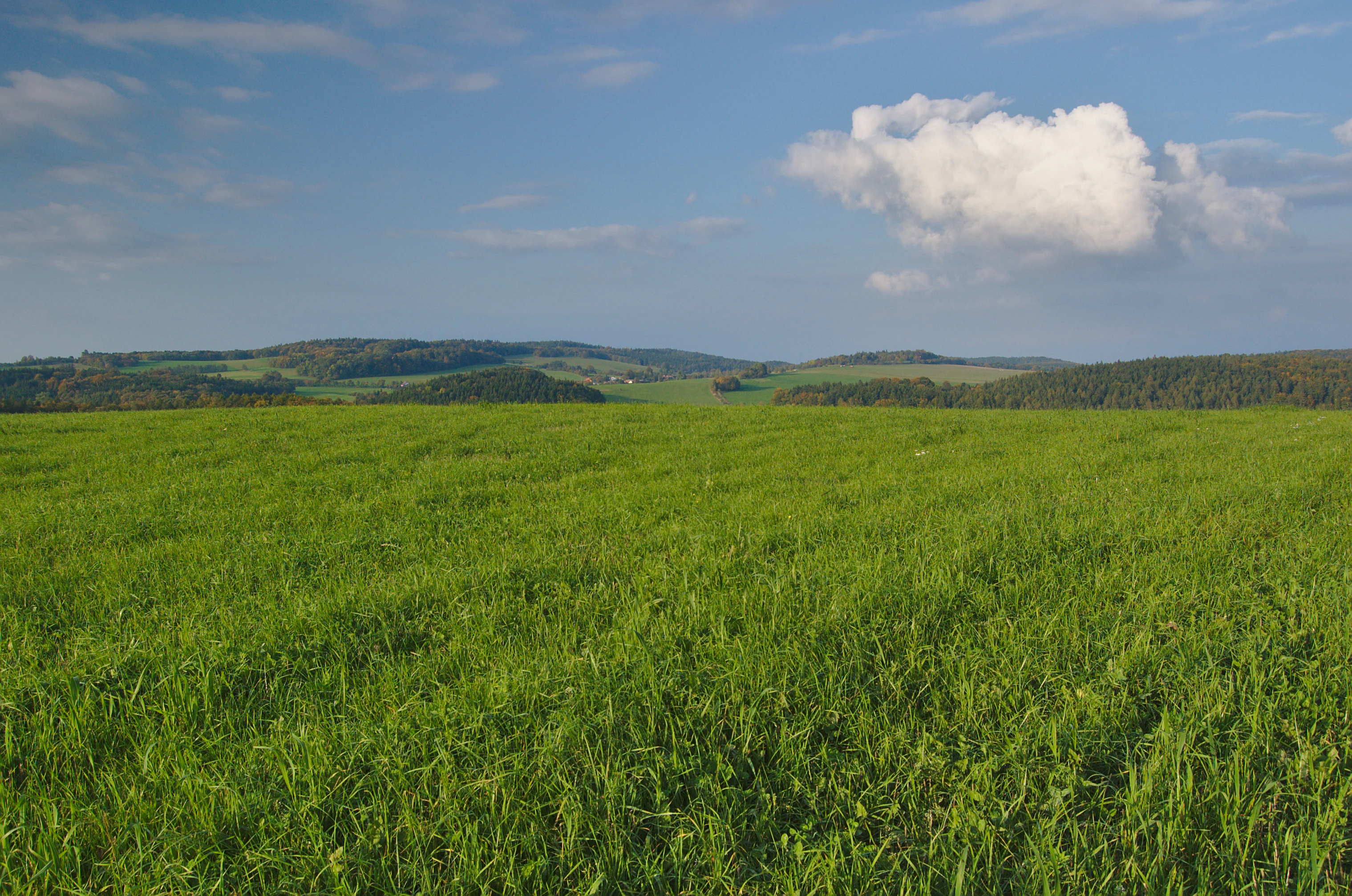
A wide, eye level landscape view featuring a vibrant green field in the foreground, leading to rolling, forested hills in the midground and distance under a blue sky with scattered clouds.
A view of the rolling meadows and forested hills in nature park Bohdalov-Hartinkov, Czechia.

Best time to visit Bohdalov-Hartinkov Nature Park

The park is shaped by the temperate climate of the Czech-Moravian Highlands, with warm, green summers that bring out the diversity of meadow flowers and full foliage in the forests, and cooler, quieter months when the structure of the bare woodlands and open landscapes becomes more visible.

Late spring and early summer are particularly suited to experiencing the mosaic of meadows and the flowering of protected plant species, while autumn offers colorful forest scenery and a peaceful atmosphere across the rolling terrain. Winter visits are possible in the generally low-relief countryside, though some smaller paths may be affected by seasonal conditions.

Monthly climate preview

Long-term representative point measurements for temperature and precipitation patterns

Přírodní park Bohdalov-Hartinkov Climate Normals and Annual Temperature Rhythm

Přírodní park Bohdalov-Hartinkov exhibits a measured annual temperature and precipitation rhythm across twelve recorded intervals based on NASA Power climatology data. Reviewing the complete monthly profile provides deeper insight into long-term averages for average minimum and maximum readings at the representative coordinate.
Annual mean8 °C
-4 °C19 °C
Jan-4°
Feb-2°
Mar
Apr
May13°
Jun17°
Jul19°
Aug19°
Sep14°
Oct
Nov
Dec-2°
Warmest month
July

19.3 °C

Coolest month
January

-3.7 °C

Wettest month
July

2.7 mm/day

Driest month
February

1.2 mm/day

Park location guide

Geography guide, regional context, and park location map for Bohdalov-Hartinkov Nature Park

Bohdalov-Hartinkov Nature Park park geography, regions, and map view in Czechia

Understand where Bohdalov-Hartinkov Nature Park sits in Czechia through a broader geographic reading of the surrounding landscape, nearby location context, and its mapped position within the national park landscape.

How Bohdalov-Hartinkov Nature Park fits into Czechia

Czech Republic is a landlocked Central European country with a population of approximately 10.9 million people. The nation was established as an independent state on January 1, 1993, following the dissolution of Czechoslovakia. Its capital and largest city is Prague, with other major urban centers including Brno, Ostrava, Plzeň, and Liberec.

Wider geography shaping Bohdalov-Hartinkov Nature Park in Czechia

The Czech Republic is a landlocked country in Central Europe. It is bordered by Germany to the west, Austria to the south, Poland to the northeast, and Slovakia to the southeast. The landscape is predominantly hilly, with the territory covering 78,871 square kilometers.

Map view of Bohdalov-Hartinkov Nature Park

Use this park location map to pinpoint Bohdalov-Hartinkov Nature Park in Czechia, understand its exact geographic position, and read its mapped placement within the surrounding landscape more clearly.

Pigeon | © OpenStreetMap contributors

Location context for Bohdalov-Hartinkov Nature Park

Pardubice Region

Visualizing the forested ridges, meadow mosaics, and protected terrain of the Zábřežská vrchovina

Přírodní park Bohdalov-Hartinkov Photos and Landscape Scenery

Photographic records reveal the rolling topography, mixed woodlands, and calcareous habitats defining the protected landscape of Přírodní park Bohdalov-Hartinkov. Visual exploration highlights the geological variety and semi-natural terrain spanning the Bohemian-Moravian borderlands.

A narrow paved road winds through lush green meadows toward a forested hill under a blue sky with scattered clouds, with a large solitary tree standing by the roadside.

A wide view of a vibrant green meadow and forested rolling hills in the background, framed by tree branches in the foreground under a partly cloudy blue sky.

A green pasture in the foreground leads to rolling hills covered in dense forest under a bright blue sky with wispy clouds, viewed behind a weathered wooden fence.

A paved road stretching into the distance through a rural landscape featuring rolling green hills, meadows, and patches of deciduous trees under a partially cloudy blue sky.

A dirt path leads through green meadows toward a forested horizon under a soft sky, with colorful autumn trees in the foreground.

A dirt path winding through green fields toward forested hills under a cloudy, overcast sky.

A narrow paved road flanked by tall deciduous trees with early autumn foliage, bordering an open meadow under a clear blue sky.

A wide, eye level landscape view featuring a vibrant green field in the foreground, leading to rolling, forested hills in the midground and distance under a blue sky with scattered clouds.

An asphalt road curves through a rural landscape with sparse, dry grassy fields in the foreground and forested hills in the distance under a clear, bright sky.

Park atlas

Compare adjacent highland terrain and connected nature reserves across the regional border

Parks near Přírodní park Bohdalov-Hartinkov and Surrounding Protected Landscapes

Browsing other protected areas near Přírodní park Bohdalov-Hartinkov reveals continuous forested ridges and diverse geological formations. Expanding the geographic scope allows observers to analyze connected regional ecosystems and neighboring conservation zones.
A soft watercolor illustration of a rural landscape with green fields and distant purple-hued hills.
Nature reserveOlomouc Region
About 15 km away#1 closest

Southeast

Průchodnice Nature Reserve: Mapped Limestone Ridges and Highland Forest Geography

Protected karst landscape in the Olomouc Region of the Czech Republic

Průchodnice Nature Reserve is defined by its dramatic 120-meter limestone ridge rising from forested slopes. This protected area supports a rich mix of rock-loving flora, mature beech forest, and essential cave habitats for rare bat populations. It serves as a study in concentrated highland karst geography within the southern Zábřežská vrchovina.

Area
0.206 km²
Established
1985
IUCN
IV
Relief
Mountain
A watercolor painting showing a stylized, rolling hilly landscape with green and light pink tones, featuring minimal foreground vegetation and soft, layered hills in the background.
Natural monumentOlomouc Region
About 16 km away#2 closest

Southeast

Na Kozénku Natural Monument: Protected Limestone Landscapes in the Olomouc Region

A localized refuge of dry grassland and thermophilic vegetation

Na Kozénku is a protected natural monument in the Czech Republic, notable for its limestone-rich soil and specialized plant communities. This site offers insight into the conservation of isolated habitats within the agricultural mosaic of the Zábřežská Highlands, providing essential shelter for sensitive anemone populations.

Area
0.01 km²
Established
1985
IUCN
IV
Relief
Upland
Natural monumentOlomouc Region
About 23 km away#3 closest

South

V chaloupkách Natural Monument: Botanical Preservation and Highland Landscape in the Olomouc Region

A protected highland meadow within the Drahanská vrchovina

V chaloupkách is a protected natural monument located in the Olomouc Region of the Czech Republic. The site preserves an essential spring fed meadow and its distinct herbaceous flora. Situated within the hilly uplands of the Drahanská vrchovina, the area serves as a focal point for understanding the ecological diversity of traditional highland landscapes in Moravia.

Area
0.046 km²
Established
1990
IUCN
IV
Relief
Upland
A soft watercolor illustration showing a landscape with a calm body of water in the foreground, rolling green hills, and distant hazy mountains under a pale sky.
Nature reservePardubický kraj
About 24 km away#4 closest

Northwest

Psí kuchyně Nature Reserve: Geographic Overview of Protected Woodland Habitats

Mapping the forest biodiversity of the Pardubický kraj region

Psí kuchyně offers a protected look at Central European woodland landscapes, integrating mature beech stands with moisture-rich ash-alder floodplains. The reserve serves as a critical habitat for specialized insect life and forest-interior bird species, all set within the geologically diverse terrain of the Svitavy and Ústí nad Orlicí districts.

Area
2.74 km²
Established
1994
IUCN
IV
Relief
Upland
A watercolor illustration of a soft, rolling landscape featuring meadows, distant hills, and coniferous forest edges in pale greens and yellow tones.
Protected landscapeBlansko District
About 25 km away#5 closest

South

Řehořkovo Kořenecko Protected Landscape: An Upland Mosaic in the Czech Republic

Geographic analysis of plateau ridges and wetland river corridors

Centered in the Blansko District, the Řehořkovo Kořenecko protected landscape offers a unique study of Czech upland geography. The area highlights the interplay between the Bělá river valley, peatland remnants of the Pavlovské mokřady, and the high-point vistas from the Paprč summit, illustrating a cohesive protected region defined by its geological substrate and forest composition.

Area
23.14 km²
Established
2000
Relief
Upland
Scope
Terrestrial
A watercolor painting showing a wide view of soft, green rolling hills against a pale, warm-toned sky.
Protected landscapeBlansko District
About 31 km away#6 closest

Southwest

Halasovo Kunštátsko Nature Park: Protected Highland Landscapes and Regional Geography

A detailed geographic study of the Blansko District highland interior.

Covering the eastern flank of the Czech-Moravian Highlands, Halasovo Kunštátsko Nature Park provides a diverse inland environment of ridges, valleys, and forest mosaics. From the high summit of Kulíšek to the transitional zones of the Boskovická brázda, this protected landscape integrates geological, botanical, and regional environmental values into a single, cohesive geographic area.

Area
68.3 km²
Established
1980
Relief
Upland
Climate
Temperate
Watercolor painting of a soft, rolling landscape with green hills, a grassy foreground, and distant purple-hued ridgelines.
Natural monumentOlomouc Region
About 32 km away#7 closest

Southeast

Na hůrkách Natural Monument: Protected Grassland and Biodiversity Reserve in Olomouc Region

Central Moravian grassland habitat and protected terrain map

Na hůrkách preserves unique dry-grassland vegetation on former pastures in the Olomouc Region. This natural monument serves as an essential refuge for protected flowering plants and grassland-dependent butterfly species, illustrating the conservation value of traditional agricultural landscapes in the Czech Republic.

Area
0.041 km²
Established
1990
IUCN
IV
Relief
Upland
A watercolor painting of a soft, rolling landscape with green hills, patches of trees, and a pale sky.
Natural monumentPardubický kraj
About 33 km away#8 closest

West

Sněženky ve Vysokém lese: Exploring the Protected Natural Monument and Forest Geography

A small-scale Bohemian botanical reserve and valley landscape

Located in the Svitavy district of Pardubický kraj, Sněženky ve Vysokém lese is a natural monument dedicated to preserving a dense, naturally occurring population of wild snowdrops. The protected hollow, carved into the broader Vysoký les spruce woodland, illustrates how specific moisture conditions and soil patterns create essential habitats for rare local wildflowers within the Czech landscape.

Area
0.022 km²
Established
1994
IUCN
IV
Relief
Upland

Common questions about visiting, size, designation, and location context for Bohdalov-Hartinkov Nature Park

Bohdalov-Hartinkov Nature Park FAQs for park facts, access, geography, and protected area context

Find quick answers about Bohdalov-Hartinkov Nature Park, including protected-area facts, park geography, trail and visitor context, and how the park fits into its surrounding country and regional landscape.
MoriAtlas Explorer

Continue Your Protected Areas Search Across the Global Atlas

Deepen your exploration by continuing the structured search for national parks and protected areas worldwide. Utilize the comprehensive filtering capabilities to compare different conservation landscapes and refine your understanding of global park geography. Discover more about the distribution and characteristics of protected natural areas.

Global natural geography