
Lakes
Park geography
A detailed look at the island geography, terrain, and regional extent of New Zealand
Rakiura National Park Geographic Profile: Mapped Boundaries and Natural Landscape Features
Review the geographic data and spatial layout of Rakiura National Park. This structured profile covers the 1,399.6 square kilometer land extent, regional coordinates, and coastal landscape characteristics including forests, wetlands, and associated island peaks.
Related tags
New Zealand national parksIslandsLowland forestsKiwi habitatBirdwatching
New Zealand's most remote national park protecting 85% of Stewart Island
Rakiura National Park
Rakiura National Park is New Zealand's newest and most geographically isolated national park, established in 2002 and encompassing approximately 85% of Stewart Island / Rakiura, the country's third-largest island. Located in the subantarctic waters of southern New Zealand, the park protects a rugged landscape of forested hills, pristine coastlines, sandy beaches, and remote wilderness that represents one of the nation's least disturbed natural environments. The park encompasses former nature reserves, scenic reserves, and State Forest areas, forming a contiguous protected landscape that excludes only the township area around Halfmoon Bay and some private or Māori-owned land parcels. Rakiura holds special significance in Māori mythology, where the island is known as Te Punga o Te Waka a Māui, meaning the anchor of the demigod Māui's canoe, a cultural heritage reflected in the prominent chain sculpture at the park entrance. The park offers exceptional ecological value as one of the few places in New Zealand where kiwi birds can be reliably observed in their natural habitat.
- Location
- New Zealand
- Park type
- National park
- Established
- 2002
- Area
- 1,399.6 km²
Location overview
Mapping the protected coastal and island geography of New Zealand
Geographic Position and Island Status of Rakiura National Park
Rakiura National Park is located within the sovereign territory of New Zealand. Its coastal and island designation establishes a distinct geographic profile defined by isolated maritime borders.
- Countries
- New Zealand
- Primary location
- New Zealand
- Geographic setting
- Coastal · Island
Boundary and coordinates
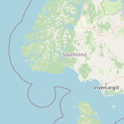
Interactive boundary geometry spanning 1399.6 square kilometers
Rakiura National Park Boundary Map and Geographic Extent
Mapped boundary outlines provide spatial context for the protected area and its surrounding terrain. Accompanying measurements supply derived area, coordinate limits, and geographic spans for spatial reference.
- Boundary area
- 1,397.9 km²
- Boundary perimeter
- 533.6 km
- Northernmost point
- 46.6834° S
- Southernmost point
- 47.29° S
- Easternmost point
- 168.1561° E
- Westernmost point
- 167.4472° E
- Geographic centre
- 46.9762° S, 167.8141° E
- North–south span
- 67.4 km
- East–west span
- 53.9 km
Terrain and natural features
Explore recorded lowland relief and distinct named natural features across the protected landscape
Rakiura National Park Terrain, Peaks, Rivers, and Coastal Features
Rakiura National Park maintains a designated lowland relief classification across its protected terrain. Stored feature cards document recorded peaks, lakes, rivers, streams, ridges, and coastal capes within the boundary.
Selected named natural features
Peaks
Hielanman
205 m
Capes
Te Upoko-o-Taepu / Mason Head
Ridges
Tin Range
Streams
Newton Creek
Rock formations
Pigeon House
Environmental setting
Temperate lowland forest ecosystems, coastal beaches, and wetland geography
Rakiura National Park Environmental Settings and Landscape Classifications
Recorded classifications group forest cover, coastal waters, and temperate habitats into complementary ways to read physical terrain. Individual categories connect directly to related atlas destinations for broader regional exploration.
- Relief
- Lowland
- Climate
- Temperate
- Water
- Major water bodies
- Forest cover
- Dense forest cover
- Seasonality
- Seasonal
Landscape features
Forest · Coast · Beach · Islands · Wetland
Habitat types
Temperate broadleaf forest · Wetland · Coastal habitat
Park atlas
Trace the diverse protected landscapes and regional park geography across New Zealand's unique island environments.
Beyond Rakiura National Park: Discover Other National Parks and Protected Areas in New Zealand
Expand your atlas exploration from Rakiura National Park to browse other national parks and protected areas, focusing on New Zealand's distinct island, coastal, and wilderness landscapes. This broader view allows for detailed geographic comparison, tracing conservation efforts and natural terrain across similar subantarctic and South Island protected regions.
Wildlife reserveNew Zealand
Mapped location lies within the park boundary#1 closest
South

Ulva Island Wildlife Reserve: Mapped Geography and Protected Forest Landscapes
An open sanctuary located in Paterson Inlet, New Zealand
Explore the unique geography of Ulva Island, a 2.7 square kilometre wildlife reserve within Rakiura National Park. This predator free island features dense temperate rainforest, sheltered coastal bays, and vital recovery habitats for native bird species, offering a distinct study in southern New Zealand's protected forest terrain.
- Area
- 2.67 km²
- Relief
- Lowland
- Climate
- Temperate
- Access
- Easy access
Nature reserveSouthland Region
About 5.3 km away#2 closest
West
Codfish Island / Whenua Hou: A Protected Nature Reserve in the Southland Region
Coastal terrain and island geography in New Zealand
Located off the coast of Stewart Island, Codfish Island / Whenua Hou functions as an essential nature reserve. The island features moderate terrain, temperate coastal forests, and a protected landscape that preserves rare species and seabird colonies. Its geography is defined by a remote maritime setting, making it a globally significant site for predator-free wildlife conservation in the Tasman Sea.
- Area
- 14 km²
- Established
- 1987
- Relief
- Upland
- Climate
- Temperate
National parkSouthland Region
57 km away#3 closest
North
Fiordland National Park: A Protected Landscape of Glacier-Carved Fiords and Alpine Wilderness
Explore its vast boundaries and unique temperate rainforest.
Fiordland National Park, located in the Southland Region of New Zealand, is a testament to dramatic geological forces, featuring fifteen major fiords like Milford Sound, whose Mitre Peak rises majestically from the water. This protected national park encompasses an immense wilderness of alpine terrain, ancient beech forests, and numerous waterfalls, fueled by exceptional rainfall. Its inclusion in the Te Wāhipounamu World Heritage Area underscores its global significance for biodiversity and natural landscape preservation.
- Area
- 12,607 km²
- Established
- 1952
- IUCN
- II
- Visitors
- 500K annual
Marine protected areaFiordland
133 km away#4 closest
Northwest
Moana Uta (Wet Jacket Arm) Marine Reserve: Mapped Protected Landscapes in Fiordland
Exploring unique fiord stratification and dense marine coral habitats
Located in the remote southwestern reaches of New Zealand, Moana Uta (Wet Jacket Arm) Marine Reserve preserves a complete fiord system. The area is notable for its exceptional physical conditions, including high black coral density and a distinct freshwater surface layer that sustains diverse underwater communities across steep rock walls, reefs, and deep basins.
- Area
- 20.07 km²
- Established
- 2005
- Relief
- Lowland
- Climate
- Temperate
Marine protected areaFiordland
147 km away#5 closest
Northwest
Taipari Roa (Elizabeth Island) Marine Reserve: Fiordland Marine Landscape and Atlas Map
Protected marine terrain and glacial fjord geography
Taipari Roa (Elizabeth Island) Marine Reserve is a protected marine area situated within the complex fjord network of Doubtful Sound. The reserve is characterized by steep underwater rock walls, deep kelp forests, and a unique freshwater cap that allows rare corals and glass sponges to thrive at shallow depths. This geographic overview examines the reserve's protected status and its structural role within the broader Fiordland ecosystem, highlighting the vertical aquatic terrain and surrounding islet environments.
- Area
- 6.13 km²
- Established
- 2005
- Relief
- Lowland
- Climate
- Temperate
Marine protected areaFiordland
159 km away#6 closest
Northwest
Kutu Parera (Gaer Arm) Marine Reserve: Fiordland Protected Marine Landscape Atlas
Mapped marine boundaries, stratified fiord ecology, and coastal terrain analysis
Explore the structured geography of Kutu Parera (Gaer Arm) Marine Reserve, a 433-hectare protected area located within the steep, mountain-flanked fjords of New Zealand. Gain insight into its complex underwater features, including vertical rock walls, estuarine basins, and stratified water columns that define this unique marine environment within the Fiordland region.
- Area
- 4.33 km²
- Established
- 2005
- Relief
- Mixed relief
- Climate
- Temperate
Marine protected areaFiordland
177 km away#7 closest
North
Kahukura (Gold Arm) Marine Reserve: Marine Protected Area and Fiordland Geographic Atlas
Submerged rocky reefs and vertical rock wall landscapes
Located in the heart of New Zealand, Kahukura (Gold Arm) Marine Reserve provides a vital map of protected coastal terrain. Its unique environment features freshwater caps, tannin-stained deep water, and diverse marine topography ranging from sheltered basin ecosystems to vertical cliff structures. This marine area offers deep insight into the complex geology and conservation dynamics of the Fiordland region.
- Area
- 4.64 km²
- Established
- 2005
- Relief
- Mixed relief
- Climate
- Temperate
Marine protected areaFiordland
207 km away#8 closest
North
Hawea (Clio Rocks) Marine Reserve: Protected Marine Geography in Fiordland, New Zealand
Mapping vertical rock walls and stratified fiord water ecosystems.
Hawea (Clio Rocks) Marine Reserve is an ecologically significant marine protected area situated within the deep waters of Hāwea / Bligh Sound. The reserve is defined by its dramatic vertical rock walls, tidal current channels, and the complex water stratification that sustains diverse black coral and reef communities. It offers a unique window into the geological and marine processes that have shaped the rugged coastal landscape of New Zealand's Fiordland.
- Area
- 4.11 km²
- Established
- 2005
- IUCN
- Ia
- Relief
- Mountain
MoriAtlas Explorer
Continue Exploring Rakiura National Park's Protected Landscape and Geographic Identity
Delve deeper into the mapped terrain and unique protected-area geography of Rakiura National Park. Understanding this remote landscape offers critical insight into the protected areas of New Zealand and the subantarctic region. Continue your exploration of its distinct features and its place within the national park atlas.
Browse next
Global natural geography
Explore related park routes
Explore MoriAtlas Global ParksBrowse All MoriAtlas ParksGlobal Park Map DiscoveryMoriAtlas: Browse All CountriesBrowse All MoriAtlas ContinentsNational Park Environment AtlasGrand Canyon National Park AtlasYellowstone National Park AtlasYosemite National Park Atlas and GeographySerengeti National Park AtlasGalápagos National Park Protected LandscapeBanff National Park Geography and AtlasKruger National Park Atlas EntryUluṟu-Kata Tjuṯa National Park AtlasExplore Uluru-Kata Tjuta National Park GeographyPlitvice Lakes National Park AtlasFiordland National Park Protected LandscapeGreat Smoky Mountains National Park AtlasAfghanistan National Parks and Protected AreasAlbania National Parks and Protected AreasAlgeria National Parks and Protected AreasAmerican Samoa National Parks and Protected AreasAndorra National Parks and Protected AreasAngola National Parks and Protected AreasAntarctica National Parks and Protected AreasAntigua and Barbuda Park List