
Mori Atlas logo
Biosphere reserveReserva Biológica de la Cordillera de Sama

Discover the geographic diversity of high-altitude lagoons, desert plains, and steep eastern mountain slopes.

Reserva Biológica de la Cordillera de Sama: Mapping a Protected Andean Mountain Landscape

Reserva Biológica de la Cordillera de Sama spans over 100,000 hectares of the southern Bolivian Andes, creating a distinct boundary between the high-altitude Puna and lower inter-Andean valleys. This protected area showcases a compressed ecological gradient that shelters highland wetlands, rare Polylepis woodlands, and expansive sand dunes within the Tajzara basin. Through its fractured terrain and diverse habitats, the reserve serves as a critical watershed and sanctuary for highland wildlife.

andean protected areapunaprepunainter-andean dry foreststucumano-bolivian foresthighland lagoons
A stylized illustration of a canyon with a multi-tiered waterfall, green hills, trees, and a pale sun in the sky.

Reserva Biológica de la Cordillera de Sama

Biosphere reserve

Park overview

Structured park overview, official facts, and landscape profile for Reserva Biológica de la Cordillera de Sama

Reserva Biológica de la Cordillera de Sama park facts, protected area profile, and essential visitor context

Review the core facts for Reserva Biológica de la Cordillera de Sama, including designation, size, terrain, visitor scale, habitats, and operating context in one park-focused overview.

About Reserva Biológica de la Cordillera de Sama

Reserva Biológica de la Cordillera de Sama represents one of southern Bolivia's most ecologically varied protected areas, because it captures an entire vertical slice of the eastern Andes within the Tarija Department. The reserve encompasses the southern portion of the Cordillera Oriental, a mountain system whose origins reach back into the older geological history of the Andes, and guards the transition between the dry Puna highlands to the west and the warmer inter-Andean valleys that descend toward the city of Tarija.

The protected area is defined less by a single iconic ecosystem than by its dramatic range of altitude and climate. Conditions shift from semi-arid, Mediterranean-like matorral in the lower valleys near Tarija and San Lorenzo, through dry inter-Andean scrub, into Tucumano-Bolivian montane forest on moister slopes, and finally upward to cold puna plateaus above 4,000 meters. Within this gradient, the Tajzara basin forms a unique landscape of seasonal and permanent lagoons surrounded by sand dunes and high plains, while the eastern flanks of the cordillera sustain deep ravines, quebradas, and quebrada-side forests that channel the headwaters of rivers flowing toward the Pilcomayo basin and the Tarija valley.

This combination of altitude, moisture variation, and ecological transitions has earned the reserve strong conservation significance. It holds one of Bolivia's documented concentrations of Andean flamingos and other vulnerable highland waterbirds, supports relict Polylepis woodlands that are increasingly rare across the Andes, and maintains important genetic resources tied to traditional Andean crops such as native tubers and maize. At the same time, the reserve remains closely tied to the human geography of Tarija, anchoring indigenous pathways, rural communities, and the regional water supply.

Quick facts and research context for Reserva Biológica de la Cordillera de Sama

Reserva Biológica de la Cordillera de Sama lies in the western Tarija Department of southern Bolivia, covering the Cordillera de Sama and parts of the provinces of Méndez, Avilés, Cercado, and Arce. Established on January 30, 1991, it is administered by the Servicio Nacional de Áreas Protegidas and encompasses roughly 108,500 hectares across four major ecoregions: Puna, Prepuna, Bolivian montane dry forests, and Tucumano-Bolivian forests.

The reserve extends across a vertical range of about 1,950 to 4,700 meters, transitioning from semi-arid inter-Andean valleys to cold, wind-swept puna plateaus. Its territory includes the Tajzara lagoon basin, ancient indigenous pathways, and source waters for the Río La Victoria, which is the main supply for the city of Tarija.

Protection and recognition

Examine the official terrestrial protection framework and designation records for the reserve.

Reserva Biológica de la Cordillera de Sama Protection Status and Documented Conservation Scope

Terrestrial protection status data outlines the baseline designation framework established for Reserva Biológica de la Cordillera de Sama. Documented records compile official conservation metrics and administrative recognition parameters for the protected area.

Protection details

Protection scope
Terrestrial
Transboundary protection
No
Park context

Deeper park guide and search-rich context for Reserva Biológica de la Cordillera de Sama

Reserva Biológica de la Cordillera de Sama history, landscape, wildlife, and travel context

Explore Reserva Biológica de la Cordillera de Sama through its history, landscape character, ecosystems, wildlife, conservation priorities, cultural context, and seasonal travel timing in a structured park guide built for atlas discovery and search intent.

Why Reserva Biológica de la Cordillera de Sama stands out

The reserve is especially known for the Tajzara basin, an endorheic highland system of permanent and seasonal lagoons set against sand dunes and puna plains, where Andean flamingos and other waterbirds concentrate. It is also notable for its steep altitudinal gradient, which compresses Puna, Prepuna, dry inter-Andean matorral, and Tucumano-Bolivian forest into a single protected landscape. Equally distinctive are the surviving relict woodlands of Polylepis (quewiña) and Azorella compacta yaretales on the upper cordillera, alongside ancient indigenous pathways known locally as the Caminos de Sama. These features combine high-Andean scenery, biodiversity, and pre-Columbian cultural heritage within one continuous reserve.
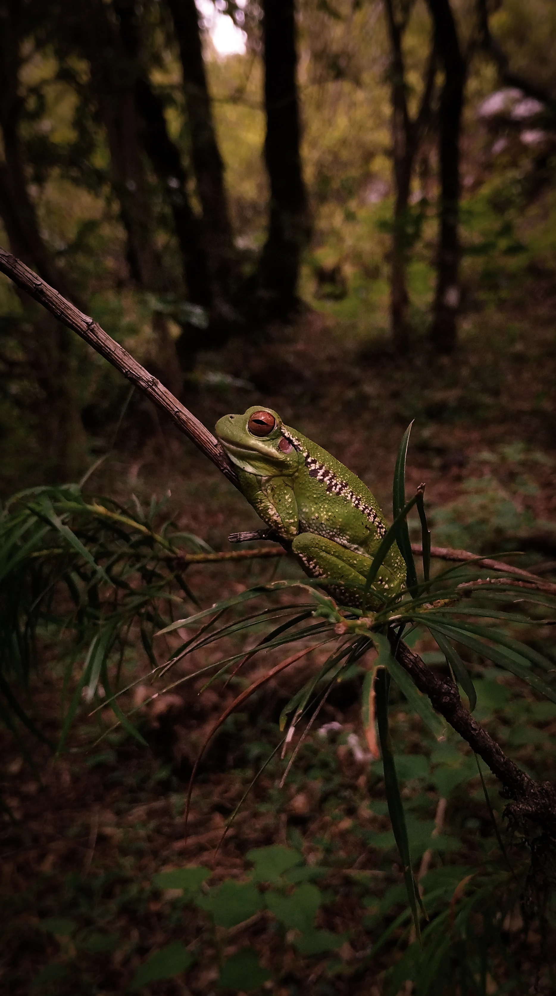
A close-up portrait of a bright green frog with red eyes resting on a thin branch amidst forest vegetation.
An endemic green frog with red eyes perched on a branch in the Cordillera de Sama Biological Reserve.

Reserva Biológica de la Cordillera de Sama history and protected-area timeline

The Reserva Biológica de la Cordillera de Sama was formally established on January 30, 1991, as a national-level protected area of Bolivia. Its creation followed growing recognition of the ecological and hydrological importance of the Cordillera de Sama, which serves both as a biological refuge and as the principal watershed feeding rivers used by the city of Tarija and surrounding agricultural communities.

Since its establishment, the reserve has been managed under Bolivia's national protected areas system, currently coordinated through the Servicio Nacional de Áreas Protegidas. While the legal protection framework is relatively recent, the cultural landscape of the cordillera is much older. The Caminos de Sama, a network of pre-Columbian indigenous pathways crossing the highlands, are believed to date to the classical period and continue to shape how local communities relate to the territory.

The reserve has also been shaped by recurring environmental pressures. Overgrazing by sheep, uncontrolled burns, fuelwood extraction from relict Polylepis stands, illegal hunting of vicuña and waterbirds, and guano harvesting at the highland lagoons have all been documented as ongoing threats. A particularly severe event occurred in August 2017, when a carelessly extinguished campfire ignited a fire that burned for three days across roughly 14,000 hectares, claimed three lives, damaged water sources and tourism sites such as San Pedro de Sola, and destroyed significant livestock. Such events have reinforced the importance of the reserve within Bolivia's broader conservation strategy.

Reserva Biológica de la Cordillera de Sama landscape and geographic character

The landscape of the reserve is dominated by the Cordillera de Sama, the southernmost section of Bolivia's Cordillera Oriental. Elevations extend from roughly 1,950 meters in the deep valleys up to about 4,700 meters at the highest peaks, producing a relief marked by abrupt slopes, rounded puna summits, and deeply dissected eastern flanks.

On the western side, the reserve is bordered by serranías such as San Roque, Cardonales, and Pamparayo, while the main cordillera runs broadly north to south, separating the Puna plains from the Tarija valleys. To the south, secondary ranges such as Ñoquera and Yunchara articulate the landscape and close off the high-altitude Tajzara basin, an endorheic depression characterized by extensive glacial-fluvial plains, fine sand dunes, and shallow lagoons fed by seasonal runoff.

The eastern flank of the cordillera contrasts sharply with the western puna. Steep slopes, deep quebradas, and narrow ravines concentrate humidity, creating the conditions for rivers such as La Victoria and the streams that descend toward the Guadalquivir basin. Overall, the reserve combines plateaus, dunes, highland lakes, precipitous mountain slopes, and fractured valley terrain into a single compact landscape mosaic.
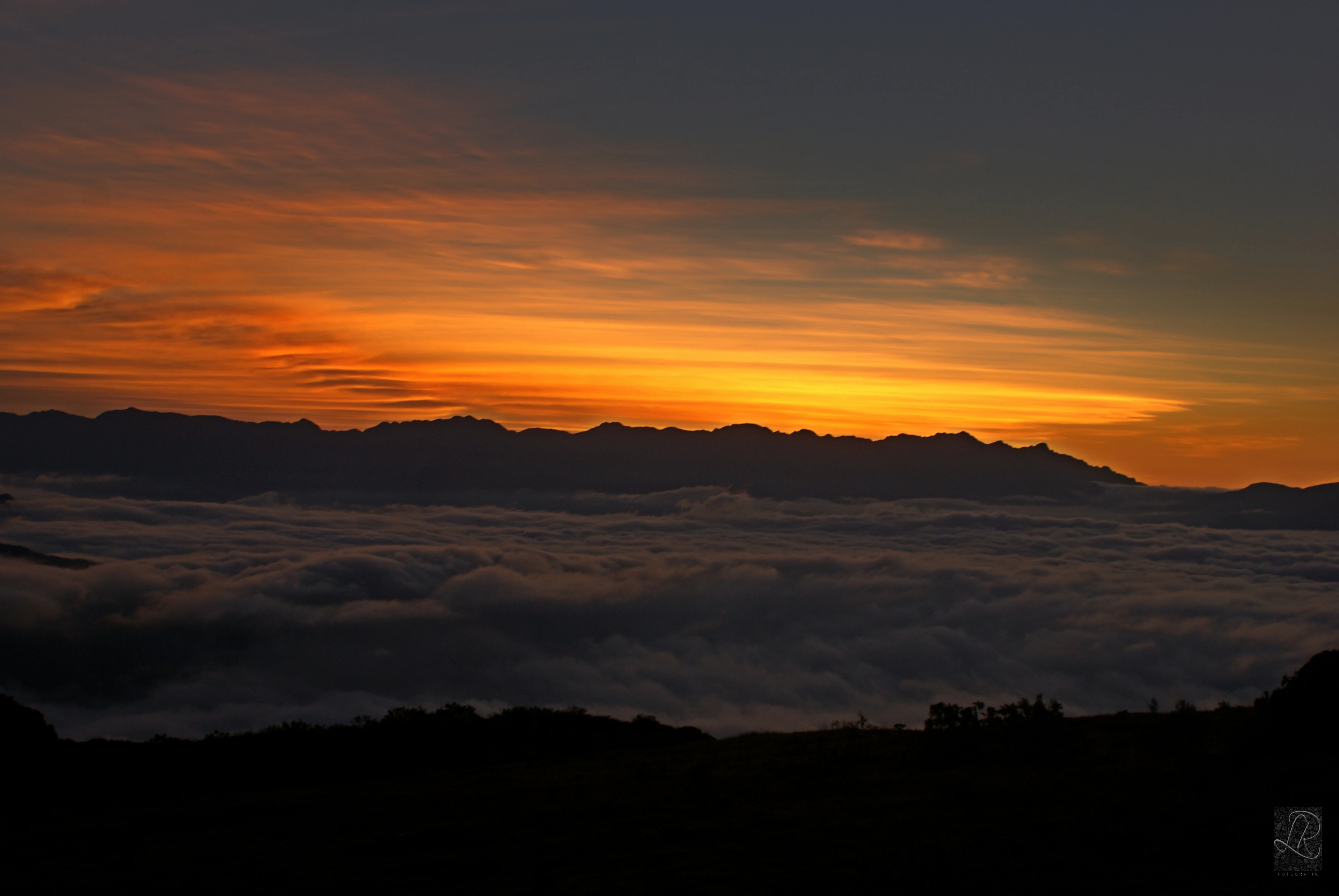
A landscape photograph showing a vibrant orange and yellow sunrise sky above a silhouetted mountain range, with a thick layer of clouds or fog in the valley below and a dark foreground.
Sunrise over the mountain range of the Cordillera de Sama, with clouds filling the valleys below.

Reserva Biológica de la Cordillera de Sama ecosystems, habitats, and plant life

Ecologically, the reserve sits at the meeting point of four major ecoregions: the Puna, the Prepuna, the Inter-Andean Dry Forests, and the Tucumano-Bolivian montane forest. This convergence creates a layered vegetation profile that shifts with altitude, slope, and exposure.

In the Puna, vegetation is dominated by tough, micro-leaved shrubs and cushion plants, with asteraceous, grass, cactus, and Solanaceae families prominently represented. The Tajzara basin supports relict patches of Polylepis tarapacana (quewiña) woodlands alongside yaretales of Azorella compacta, tolares, and a mosaic of native grasses, while aquatic vegetation in the lakes includes more than a hundred algal species and several macrophytes.

On the forested slopes and quebradas of the lower reserve, particularly in the Tucumano-Bolivian zone around the rivers Sola and Rincón de la Victoria, inventories have documented around 140 plant species, with strong representation of grasses, composites, bromeliads, Solanaceae, and Lamiaceae. Native forests, including both Polylepis stands in the puna and mixed montane forests in the upper Tucumano-Bolivian belt, cover roughly 2,000 hectares of the reserve, offering important refugia within an otherwise dry regional landscape.
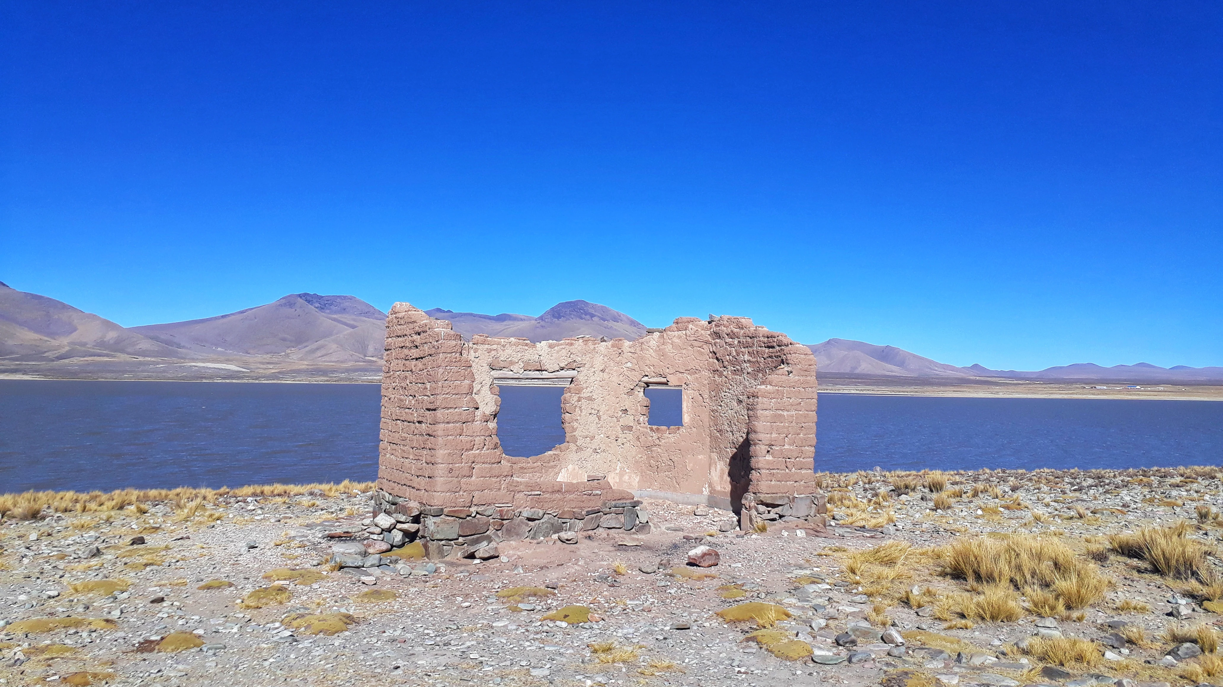
A ruined adobe structure with two window openings and a doorway stands on a rocky, grassy shore in front of a large blue lagoon, with mountains in the distance under a clear blue sky.
A view of the Tajzara Lagoon with a ruined adobe structure in the foreground within the Cordillera de Sama Biological Reserve.

Reserva Biológica de la Cordillera de Sama wildlife and species highlights

The altitudinal and ecological variety of the reserve supports a rich fauna. Inventories have recorded around 207 bird species, 57 mammal species, 23 reptile and amphibian species, plus a smaller set of fish and invertebrate records, distributed across habitats ranging from highland lagoons to valley forests.

The reserve is particularly significant for waterbirds. The Tajzara lagoons host Andean flamingos (parina grande), the smaller parina chica, Chilean flamingos, horned coots, and a range of other aquatic species, several of which are considered vulnerable. Raptors such as the Andean condor soar above the cordillera, while endemic and range-restricted passerines such as the Bolivian sierra-finch, the mountain sierra-finch, and the rufous-throated dipper reinforce the reserve's importance for bird conservation.

Among mammals, vicuña and puma are characteristic puna species, the Andean cat and the taruka huemul deer are considered endangered, and the gray fox, Geoffrey's cat, and mountain viscacha maintain established populations. The guanaco is in critical condition and its current presence requires confirmation, while two rodent species, Tapecomys wolffsohni and Ctenomys lewisi, are endemic to Bolivia. The reserve also supports endemic reptiles and amphibians, with several species still considered data-deficient, highlighting the territory's role as a frontier for ongoing biological research.
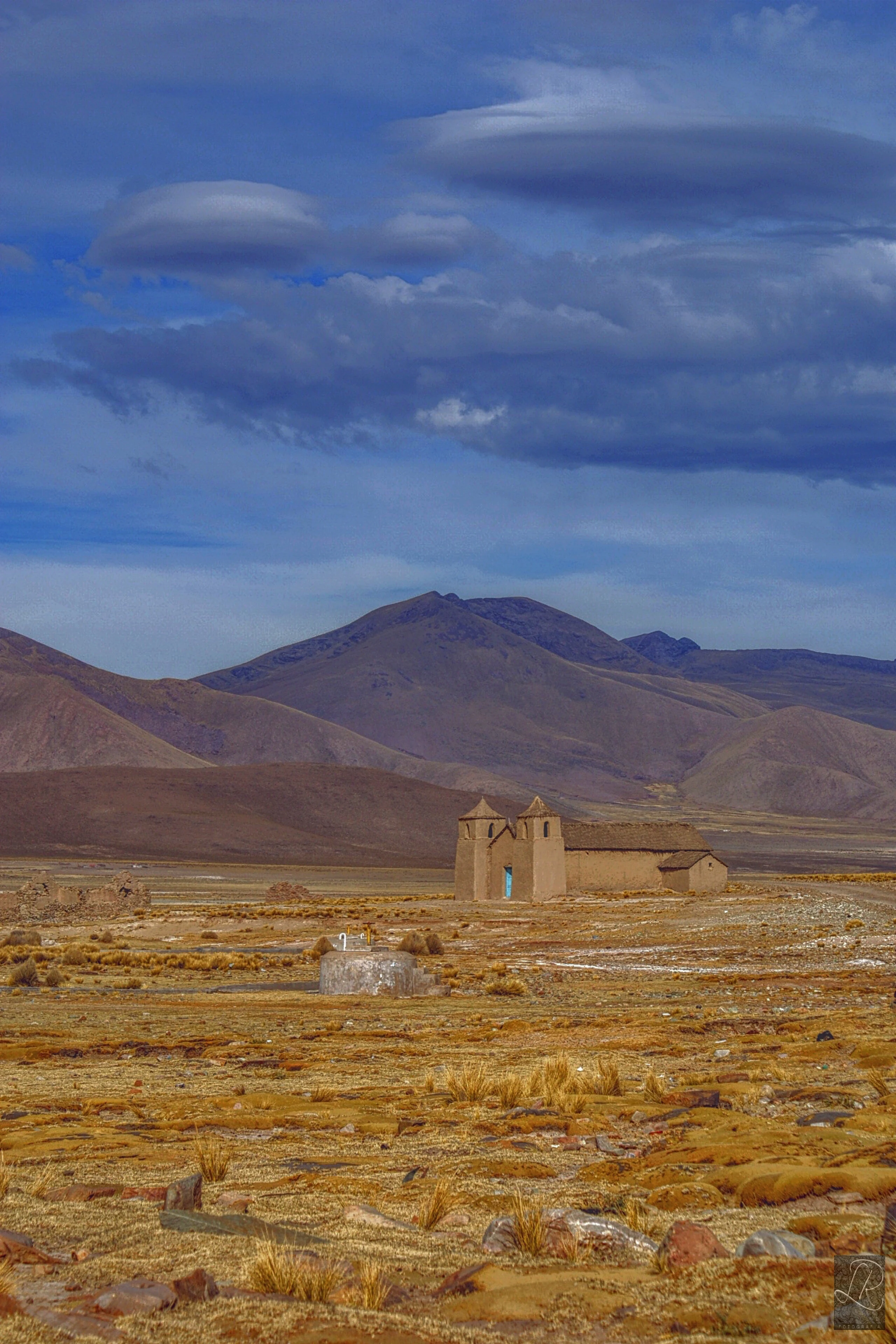
A small adobe church with two bell towers stands in a vast, dry, rocky plain with sparse yellow grass, backed by brown mountains under a dramatic blue sky with dark clouds.
View of the Copacabana community church within the arid high-altitude landscape of the Cordillera de Sama Biological Reserve.

Reserva Biológica de la Cordillera de Sama conservation status and protection priorities

The Reserva Biológica de la Cordillera de Sama is recognized as a key conservation area because it protects not only a single habitat but an entire transition between Puna, Prepuna, dry inter-Andean forests, and Tucumano-Bolivian forests within a relatively compact territory. This stacking of ecosystems makes the reserve an important refuge for species that would otherwise be lost to fragmentation across southern Bolivia.

Its conservation value extends to threatened and endemic wildlife. The reserve supports Andean flamingos and other vulnerable waterbirds, endangered mammals such as the Andean cat and taruka, and endemic rodents found only in Bolivia. It also preserves relict Polylepis woodlands, which have been heavily reduced elsewhere in the Andes through centuries of fuelwood extraction and burning, and safeguards aquatic vegetation communities in the Tajzara lagoons that have ecological value beyond the reserve.

At the same time, conservation management faces persistent pressures. Overgrazing by sheep, uncontrolled fires, illegal hunting, fuelwood harvesting from Polylepis stands, and guano extraction at lagoons all threaten the reserve's integrity. Major fire events, including the August 2017 fire that burned about 14,000 hectares and caused loss of life and livestock, have underscored the need for active fire management and stronger engagement with the 51 communities that live within or adjacent to the reserve.

Reserva Biológica de la Cordillera de Sama cultural meaning and human context

The reserve carries significant cultural weight beyond its ecological importance. The cordillera is crossed by ancient indigenous pathways known locally as the Senderos de la Cordillera, Camino de La Patanca, or Caminos de Sama, believed to date to the classical pre-Columbian period and to have been used by the Aymara- and Quechua-influenced peoples who shaped the region's toponymy.

The reserve is also tied to the agricultural heritage of southern Bolivia. Traditional Andean crops, including native tubers and maize, are recognized as part of the area's genetic resources, and highland settlements are historically linked to migrations from the valleys and Altiplano, particularly during the Chaco War period. In the lower valleys, meanwhile, the cultural imprint of Spanish colonization from 1539 onward continues to define land tenure, language, and rural community structure more than four centuries later.

Today, the reserve overlaps with 51 rural communities, only some of which lie entirely within its boundaries. These communities, alongside the archaeological sites of indigenous origin and rock paintings found in the cordillera, give the protected area a strong human dimension that complements its natural significance.
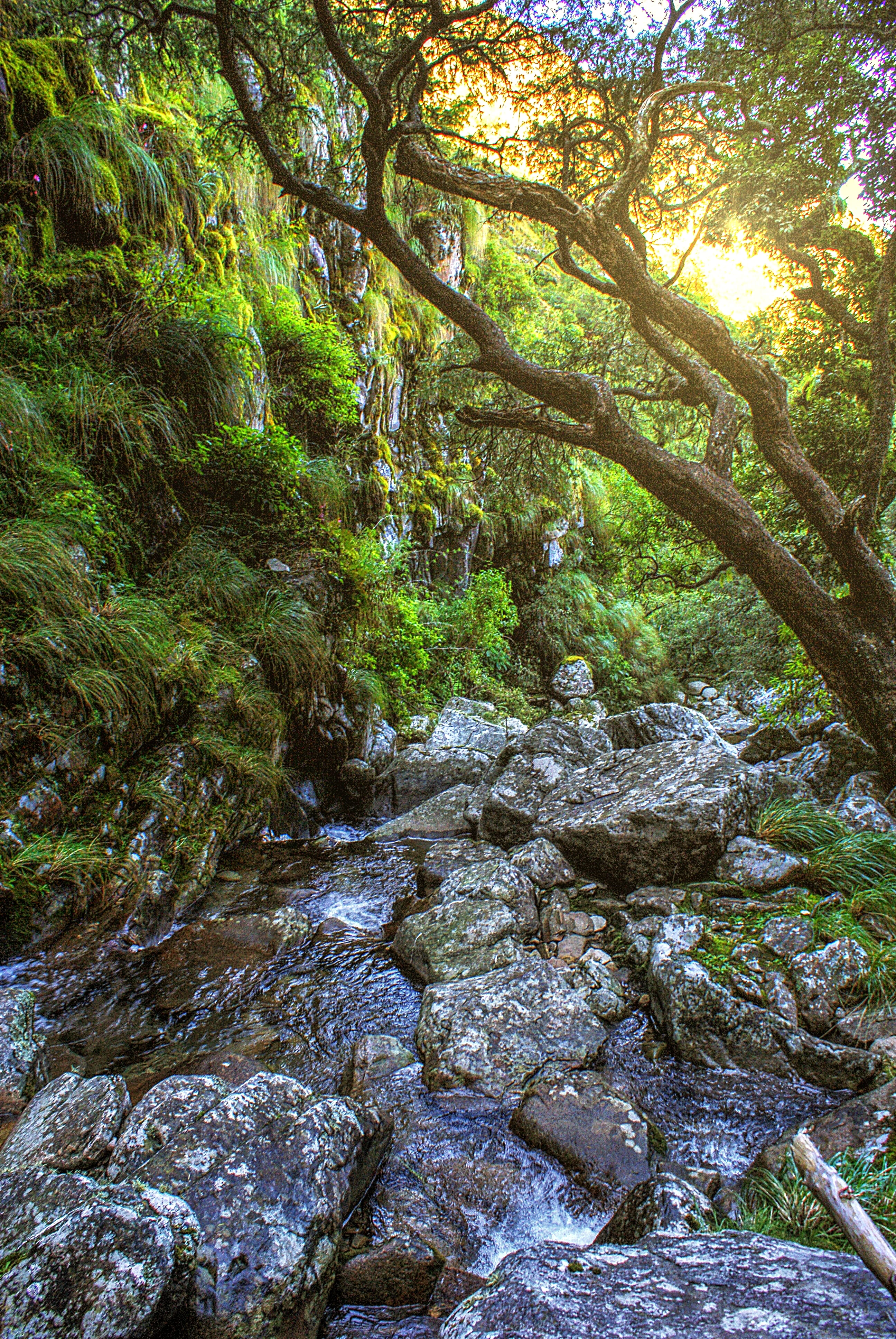
A rocky stream with water flowing over large boulders in a lush green forest, with sunlight filtering through tree branches overhead and a moss-covered cliff face in the background
Chorro Grande waterfall cascading over mossy rocks beneath a canopy of trees in the Cordillera de Sama Biological Reserve

Top sights and standout views in Reserva Biológica de la Cordillera de Sama

The reserve's strongest points of distinction are its extreme altitudinal range, the convergence of four major ecoregions within a single boundary, and the unusual combination of highland lagoons, sand dunes, relict Polylepis forests, and pre-Columbian pathways. Its high-Andean lagoons, especially in the Tajzara basin, are among the most notable in southern Bolivia and offer habitat for vulnerable Andean flamingos.

Equally important are the conservation-critical species it shelters, including Andean cat, vicuña, guanaco, endemic Bolivian rodents, and a suite of threatened and range-restricted bird species. The reserve also serves as a major upstream water source for Tarija, linking biodiversity protection directly to regional water security.
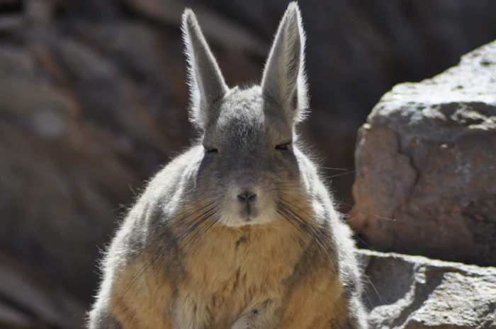
Close-up portrait of an Andean viscacha with long ears and grey-brown fur, sitting on rocky terrain.
An Andean viscacha sitting among rocks in the Cordillera de Sama.

Best time to visit Reserva Biológica de la Cordillera de Sama

Seasonal character at the reserve is strongly tied to the alternation between dry and rainy periods that define the southern Bolivian Andes. During the rainy season, the Tajzara basin expands into a much larger system of shallow lakes and wetlands, attracting waterbirds and creating dramatic high-Andean scenery, but making some higher trails and roads more difficult.

In the dry season, conditions are milder and more stable, offering better access to the cordillera's viewpoints, the indigenous pathways, and the valley sites around Tarija. Flamingos and other waterbirds remain present year-round in the permanent lagoons, while wildlife in the valleys and Tucumano-Bolivian forests is generally easier to observe outside the rains. Travelers interested in both wildlife and landscape variety tend to favor shoulder periods when water levels are still high but weather is more dependable.
Monthly climate preview

Long term temperature and precipitation measurements across twelve representative months

Reserva Biológica de la Cordillera de Sama Climate Normals and Annual Weather Rhythms

Representative coordinate records show average monthly temperatures ranging from 7.17 °C to 14.49 °C alongside distinct precipitation rhythms across the protected landscape. Examining the complete monthly climate dataset provides deeper insight into long term meteorological variations at this high elevation coordinate.
Annual mean11 °C
7 °C14 °C
Jan14°
Feb14°
Mar13°
Apr12°
May
Jun
Jul
Aug
Sep11°
Oct13°
Nov14°
Dec14°
Warmest month
December

14.5 °C

Coolest month
July

7.2 °C

Wettest month
January

5.1 mm/day

Driest month
July

0.4 mm/day

Park location guide

Geography guide, regional context, and park location map for Reserva Biológica de la Cordillera de Sama

Reserva Biológica de la Cordillera de Sama park geography, regions, and map view in Bolivia

Understand where Reserva Biológica de la Cordillera de Sama sits in Bolivia through a broader geographic reading of the surrounding landscape, nearby location context, and its mapped position within the national park landscape.

How Reserva Biológica de la Cordillera de Sama fits into Bolivia

Bolivia, officially the Plurinational State of Bolivia, is a landlocked country in central South America. It features diverse geography including the Andean mountain range, Amazonian plains, Gran Chaco, and the Pantanal wetland. The country has a population of approximately 11.4 million and is administratively divided into nine departments, with La Paz as the seat of government and Sucre as the constitutional capital.

Wider geography shaping Reserva Biológica de la Cordillera de Sama in Bolivia

Bolivia is located in central South America, bordered by Brazil to the north and east, Paraguay to the southeast, Argentina to the south, Chile to the southwest, and Peru to the west. The country is divided between a western Andean region and tropical lowlands to the east and north. It includes the Amazonian plain, Gran Chaco, temperate valleys, the high-altitude Altiplano plateau, and part of the Pantanal wetland along its eastern border.

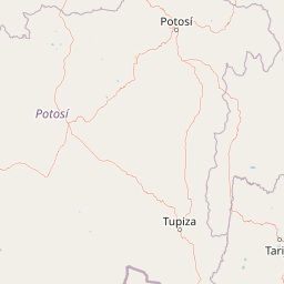
Map view of Reserva Biológica de la Cordillera de Sama

Use this park location map to pinpoint Reserva Biológica de la Cordillera de Sama in Bolivia, understand its exact geographic position, and read its mapped placement within the surrounding landscape more clearly.

Pigeon | © OpenStreetMap contributors

Visual reference for high Andean terrain, puna wetlands, and protected mountain habitats.

Reserva Biológica de la Cordillera de Sama Landscape Photos and Scenery

Visual documentation captures the dramatic altitudinal gradient and diverse ecosystems of Reserva Biológica de la Cordillera de Sama through detailed field photography. Examining these protected landscapes reveals glacial basins, high-altitude lagoons, and rugged mountain terrain across the southern Bolivian Andes.

A close-up portrait of a bright green frog with red eyes resting on a thin branch amidst forest vegetation.

A dark brown and white llama standing on sand dunes with sparse green grass, a body of water and mountains visible in the distance under a dark cloudy sky.

A landscape photograph showing a vibrant orange and yellow sunrise sky above a silhouetted mountain range, with a thick layer of clouds or fog in the valley below and a dark foreground.

A ruined adobe structure with two window openings and a doorway stands on a rocky, grassy shore in front of a large blue lagoon, with mountains in the distance under a clear blue sky.

A small adobe church with two bell towers stands in a vast, dry, rocky plain with sparse yellow grass, backed by brown mountains under a dramatic blue sky with dark clouds.

A tall waterfall flowing down through a narrow steep-walled rock canyon into a green-tinted pool below, captured with long exposure giving the water a smooth silky appearance

A rocky stream with water flowing over large boulders in a lush green forest, with sunlight filtering through tree branches overhead and a moss-covered cliff face in the background

Close-up portrait of an Andean viscacha with long ears and grey-brown fur, sitting on rocky terrain.

A wide shot of a green mountain valley with a river flowing through it, surrounded by steep slopes covered in vegetation, with a small village visible in the distance under a clear blue sky.

A large black bird with white markings flying in front of blue, hazy mountain cliffs.

Wide landscape photograph of a green mountain valley with steep slopes and a small cluster of buildings in the distance.

A stone-paved trail winds along the edge of a steep, grassy mountain slope, with misty green mountains visible in the background.

A vertical photograph showing a tall tree trunk densely covered in green moss, surrounded by other trees and branches in a forest setting.

A wide landscape view of dry, brown mountain ridges and deep valleys with a layer of white clouds below the peaks under a clear blue sky.

A large flock of pink and white flamingos wading in shallow blue water with reflections, with a sandy shoreline visible in the background.

A straight gravel road extends through open grassland toward distant mountains, with a body of water visible to the right and a fence line running alongside the road

Park atlas

Compare adjacent Andean reserves, highland wetlands, and regional protected landscapes

Parks Near Reserva Biológica de la Cordillera de Sama and Surrounding Protected Areas

Browsing other protected areas near Reserva Biológica de la Cordillera de Sama reveals broader ecological patterns across the southern Bolivian Andes. Comparing adjacent highland reserves and regional park geography provides deeper context for high-altitude ecosystems.
A watercolor painting of a simplified, abstract landscape with rolling hills in shades of green, yellow, and muted pink against a white background.
Protected landscapeTarija
About 15 km away#1 closest

Northwest

Parque natural y área de manejo integrado El Cardón: Geography and Protected Area Atlas

High-altitude puna landscapes and cactus diversity in Tarija, Bolivia.

Spanning the high-altitude plateaus of southern Bolivia, this protected area features a unique mosaic of arid terrain, specialized cactus ecosystems, and vital wildlife corridors. The landscape provides a deep look into the puna and pre-puna geography of the Tarija department, including significant archaeological sites and thriving populations of wild vicuñas within a dramatic, high-elevation Andean environment.

Area
300.56 km²
Established
2003
Relief
Mountain
Climate
Arid
Wildlife reserveTarija Department
About 20 km away#2 closest

Southwest

Tajzara Wildlife Reserve: Geographic and Landscape Overview of the Tarija Basin

High-altitude wetlands and saline lagoons in the Bolivian Andes

Tajzara Wildlife Reserve stands as a critical high-altitude wetland complex within the Tarija Department. This protected landscape sustains life across saline lake beds, seasonal pools, and marshy margins, functioning as a vital refuge for migratory waders and flamingo populations in the harsh, arid climate of the Bolivian Altiplano.

Area
13 km²
Established
1999
Relief
Highland
Climate
Alpine
A soft watercolor illustration of a river flowing through a lush landscape with gentle green hills in the distance.
Wildlife reserveTarija
About 72 km away#3 closest

Southeast

Reserva nacional de flora y fauna de Tariquía: Atlas and Geographic Protected Area Overview

Montane cloud forest and subandean river valleys in Tarija

This wildlife reserve preserves the most intact stands of Yungas Tucumano-Boliviano forest in Bolivia. Featuring a dramatic vertical zonation from foothill selva to high-elevation pine woodlands, the area serves as a primary hub for ecological research and conservation in the rugged landscapes of Tarija near the Argentine border.

Area
2,468.7 km²
Established
1989
Relief
Mountain
Climate
Subtropical
Protected areaPotosí
About 79 km away#4 closest

Southwest

Pampa Tholar de las Vicuñas: Protected Andean Puna Landscapes and Geographic Overview

Integrated management area and high-altitude habitat in Potosí, Bolivia.

Pampa Tholar de las Vicuñas covers nearly 60,000 hectares of arid puna in the municipality of Villazón, representing a key intersection of biodiversity and local pastoral traditions. The area features a complex mosaic of piedmont slopes, rolling foothills, and seasonal water networks that provide essential habitat for the Andean condor and large vicuña populations. This protected landscape offers a unique look at high-altitude land management in the transitional zone between the Altiplano and the Eastern Cordillera.

Area
584.8 km²
Established
2018
Relief
Highland
Climate
Arid
A soft watercolor painting depicting gentle, rolling hills and plains in muted shades of green, yellow, and violet.
Natural monumentSud Chichas
About 88 km away#5 closest

West

Área protegida municipal Ecoparque Encantado: Geographic Atlas and Natural Monument Overview

Mapped canyon landscapes and dry valley geography in the Sud Chichas province.

Analyze the topographic features of Área protegida municipal Ecoparque Encantado, a protected municipal monument in southern Bolivia. This area captures the dramatic transition between high-altitude puna grasslands and warm inter-Andean dry valleys. Learn about the geological history of the Tupiza Formation, the preservation of endemic vegetation, and the specific terrain dynamics that define this unique canyon-rich protected landscape.

Area
38.2 km²
Established
2015
IUCN
III
Relief
Mountain
National parkArgentina
About 91 km away#6 closest

South

Baritú National Park National Park: Mapped Protected Landscapes in Argentina's Geography

Understand the natural terrain and geographic setting of this Argentinian park.

Baritú National Park represents a distinct national park entity within Argentina, crucial for understanding the country's protected landscapes and regional geography. This page provides specific atlas-level detail on its mapped boundaries and the surrounding natural terrain. Explore Baritú National Park as a key geographic feature contributing to the broader understanding of conservation areas across South America, grounded in factual, map-oriented discovery.

Area
720 km²
Established
1974
IUCN
II
Relief
Mountain
Protected areaGran Chaco Province
About 136 km away#7 closest

East

Aguaragüe National Park and Integrated Management Natural Area: Bolivia's Easternmost Sub-Andean Protected Landscape

Explore its mapped mountain geography and ecological diversity.

Aguaragüe National Park and Integrated Management Natural Area is a crucial protected area in Bolivia's Gran Chaco Province, defined by the Serranía del Aguaragüe mountain range. This landscape offers a unique opportunity to explore a geographic transition zone where Southern Andean Yungas montane forests converge with Dry Chaco ecosystems. The park's protected boundaries encompass a rugged mountain backbone rising from the lowlands, representing a vital segment of Bolivia's Sub-Andean geography and protected natural areas.

Area
1,083.07 km²
Established
2000
IUCN
II
Relief
Mountain
National parkArgentina
About 205 km away#8 closest

South

Calilegua National Park: Mapped Protected Landscape in Argentinian Geography

Explore the national park's boundaries and regional terrain.

Calilegua National Park represents a vital protected landscape within Argentina's extensive geography. This detail page provides an atlas-focused view, highlighting the park's specific geographic setting and its importance as a national park. Understand its mapped terrain and how it fits within the broader conservation context of South America. This resource is crafted for in-depth geographic discovery and map-based analysis of the park's protected area features.

Area
763.06 km²
Established
1979
IUCN
II
Relief
Mountain

Common questions about visiting, size, designation, and location context for Reserva Biológica de la Cordillera de Sama

Reserva Biológica de la Cordillera de Sama FAQs for park facts, access, geography, and protected area context

Find quick answers about Reserva Biológica de la Cordillera de Sama, including protected-area facts, park geography, trail and visitor context, and how the park fits into its surrounding country and regional landscape.
MoriAtlas Explorer

Continue Your Protected Areas Search Across the Global Atlas

Deepen your exploration by continuing the structured search for national parks and protected areas worldwide. Utilize the comprehensive filtering capabilities to compare different conservation landscapes and refine your understanding of global park geography. Discover more about the distribution and characteristics of protected natural areas.

Global natural geography