
Mori Atlas logo
Nature reserveRéserve naturelle nationale de la mare de Vauville

Mapping the coastal freshwater lagoon and active dune cord of the Cotentin Peninsula

Réserve naturelle nationale de la mare de Vauville: Geography and Protected Dune Landscapes

The Réserve naturelle nationale de la mare de Vauville represents a compact and ecologically distinct protected landscape on the western coast of the Cotentin Peninsula. This atlas entry examines the interplay between the narrow, living dune cord and the large freshwater pond it shields from the English Channel. Through mapping these maritime and wetland environments, the site reveals the delicate balance of coastal ecosystems found across the Normandie region.

coastal lagoonfreshwater ponddune barriercoastal duneswetland reservebirdwatching
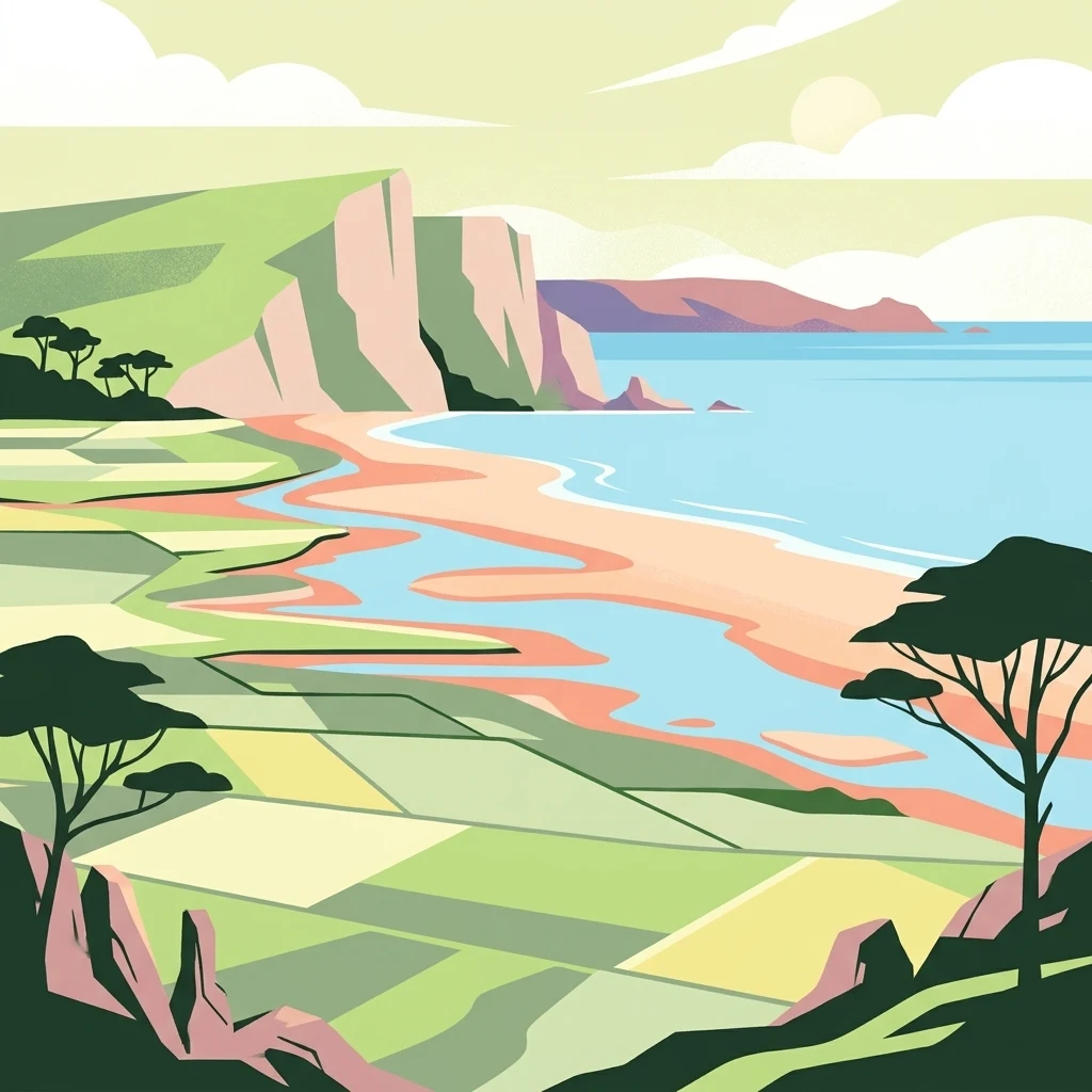
A flat-style digital illustration of a coastal nature reserve featuring green fields, a sandy beach, a calm blue sea, and high cliffs in the background.

Réserve naturelle nationale de la mare de Vauville

Nature reserve

Park overview

Structured park overview, official facts, and landscape profile for Vauville Pond National Nature Reserve

Vauville Pond National Nature Reserve park facts, protected area profile, and essential visitor context

Review the core facts for Vauville Pond National Nature Reserve, including designation, size, terrain, visitor scale, habitats, and operating context in one park-focused overview.

About Vauville Pond National Nature Reserve

The Vauville Pond National Nature Reserve occupies a narrow but ecologically intense strip of the Cotentin coastline in Normandy, facing the English Channel. The protected area revolves around a single defining feature: a coastal freshwater body held in place by a belt of dunes whose geology and vegetation work together to keep the sea out. It is this relationship between dune and pond, rather than any single dramatic landscape element, that gives the reserve its identity.

The pond stretches roughly two kilometers in length and is bordered on its seaward side by a dune cord whose neighboring dunes elsewhere along this coast can climb close to 80 meters. Inland, the reserve is framed by the granite massifs of Flamanville and Nez de Jobourg, with a sandstone substrate that underlies much of the regional geology. Together these elements form a compressed but varied setting, where rocks, sand, freshwater, and saline influence all meet within a few hundred meters.

The protected surface of about 60 hectares is small by European standards, but its compactness is itself part of its value. Visitors and researchers can walk across several distinct ecological zones in a single short outing: open sea-facing beach, mobile and fixed dunes, dune-slack vegetation, freshwater marshlands, open water, and reedbed margins. This variability, combined with the long-term stability of the freshwater body, makes the reserve a key reference site for understanding how Atlantic coastal lagoons in northern France form and persist.

The reserve is also notable for the continuity of its conservation work. Created by ministerial order in 1976, its founding decree remains the baseline for the site's protected status, while management has been entrusted since 1983 to the Normand Ornithological Group, a regional association connecting local expertise with national conservation priorities. The combination of formal protection and long-running, locally rooted management has shaped the site's character as both a legal protected area and a living field laboratory.

Quick facts and research context for Vauville Pond National Nature Reserve

The Vauville Pond National Nature Reserve lies in the Manche department of Normandy, on the commune of Vauville along the western Cotentin coast, near Cherbourg. It is a national nature reserve of France, classified on 6 May 1976, covering roughly 60 hectares. The protected area centers on a freshwater coastal lagoon about 2 kilometers long, held back from the sea by a narrow dune barrier backed by granite and sandstone surroundings.

Protection and recognition

Examine the verified protection status and recorded administrative framework for this protected area.

Protection Status and International Recognition for Réserve naturelle nationale de la mare de Vauville

Verified protection records outline the official conservation status and formal geographic designation history established for Réserve naturelle nationale de la mare de Vauville. Structured database entries aggregate official administrative identifiers and international source tracking for comprehensive geographical analysis.

Protection details

WDPA ID
4051
Park context

Deeper park guide and search-rich context for Vauville Pond National Nature Reserve

Vauville Pond National Nature Reserve history, landscape, wildlife, and travel context

Explore Vauville Pond National Nature Reserve through its history, landscape character, ecosystems, wildlife, conservation priorities, cultural context, and seasonal travel timing in a structured park guide built for atlas discovery and search intent.

Why Vauville Pond National Nature Reserve stands out

The reserve is best known for preserving one of the rare large coastal freshwater ponds on the Normandy coast, isolated from the sea by a thin, living dune cord. This unusual setting supports layered dune vegetation, extensive reedbeds, and an exceptionally rich birdlife that includes wintering waterfowl and migratory waders.
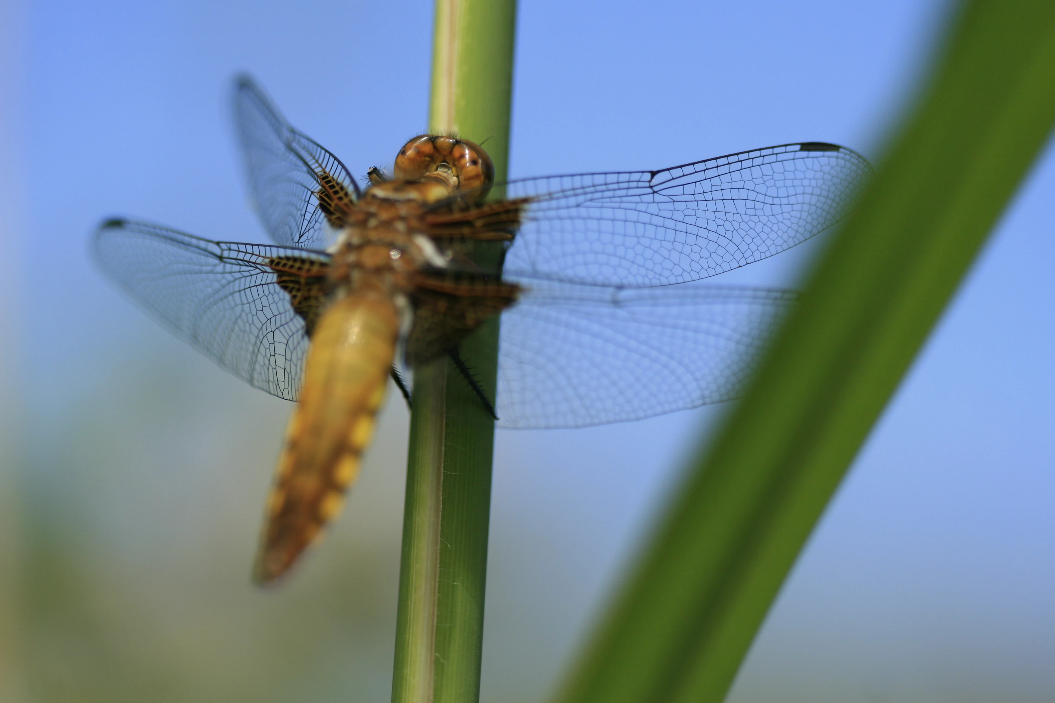
A close-up view of a broad-bodied chaser dragonfly, Libellula depressa, perched on a green reed stem against a blurred blue sky background.
A broad-bodied chaser dragonfly resting on a reed at the Réserve naturelle nationale de la mare de Vauville.

Vauville Pond National Nature Reserve history and protected-area timeline

The Vauville Pond is a young landscape by geological standards, formed during the final rise in sea level at the end of the last glacial period, roughly 10,000 years ago. Wind-shaped dunes gradually built a barrier along the coast, cutting off a low-lying area from the sea and creating the freshwater pond that now defines the site. For most of its earliest existence, the lagoon was regularly influenced by marine intrusions, alternating between saline and brackish conditions.

A research program carried out between 2006 and 2010 by the GEOPHEN laboratory at the University of Caen provided a clearer timeline of the site's evolution. The study showed that the pond has existed for at least 6,000 years and that, for roughly the first 3,000 years of that history, the marsh was repeatedly exposed to seawater incursions. Only in approximately the last 3,000 years has the site stabilized into the freshwater state seen today, sheltered from the sea by a thin and fragile dune cord that remains the single most important natural barrier protecting the pond.

Human protection of the site followed much later. The reserve was formally created by ministerial order on 6 May 1976, with that initial designation subsequently replaced by Decree No. 2002-321 of 27 February 2002, refining the regulatory framework without changing the core protection. Since 1983, day-to-day management has been handled by the Normand Ornithological Group, an association that has shaped the site's identity as a regionally managed bird-focused reserve.

Vauville Pond National Nature Reserve landscape and geographic character

The reserve's landscape is shaped by the close interplay of three elements: open Atlantic sea, an active dune barrier, and a sizable freshwater basin. The sea-facing side of the site is dominated by mobile and semi-fixed coastal dunes, while the landward side opens onto the calmer waters of the pond, fringed by reedbeds and sandy margins. The surrounding context is defined by the heavy granite outcrops of Flamanville and Nez de Jobourg, with sandstone substrate beneath much of the dune belt.

The dune cord itself is the most physically fragile and visually defining feature of the site. Although the dune heights within the reserve are modest, the same coastal system includes nearby dunes rising to around 80 meters, illustrating the dynamic range of this stretch of Cotentin coast. The narrow width of the cord and its exposure to wind and tide make the entire freshwater ecosystem downstream of it dependent on the continued integrity of the sand barrier.

The pond itself is elongated and shallow, roughly 2,000 meters long and around 500 meters wide. Water levels fluctuate with the seasons and with rainfall, producing a regularly changing shoreline and varying exposure of muddy and sandy margins. This natural variability is central to the site's character and supports the seasonal patterns of waterbirds, reedbed plants, and amphibians that depend on shifting water levels.
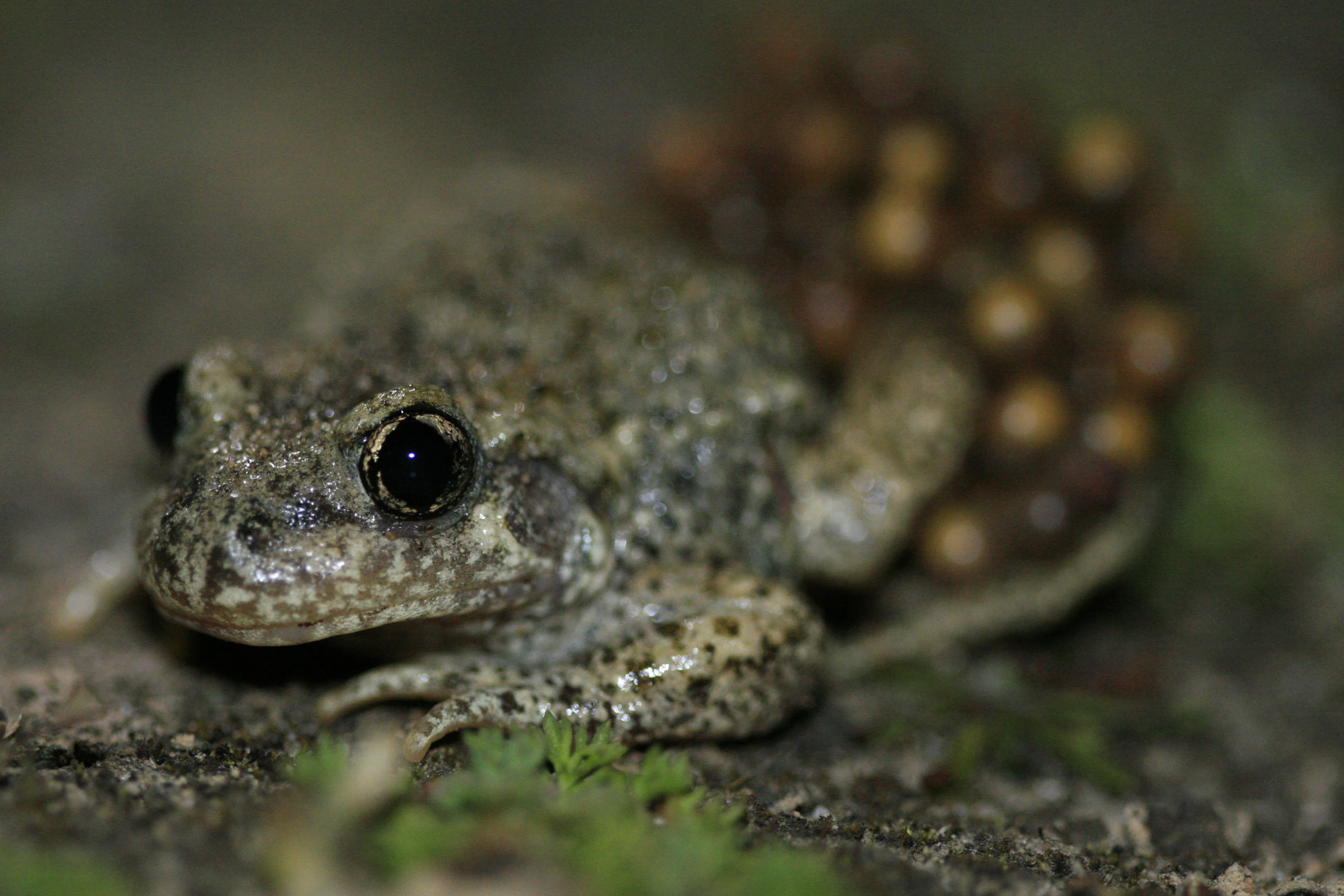
A close-up view of a common midwife toad with a cluster of brownish eggs attached to its hind legs and back, sitting on mossy ground.
A common midwife toad carrying a cluster of eggs on its back, a characteristic behavior of the species found in the Vauville nature reserve.

Vauville Pond National Nature Reserve ecosystems, habitats, and plant life

Ecologically, the reserve is a textbook example of a layered Atlantic coastal ecosystem compressed into a very small surface. Moving from the sea inland, vegetation shifts from salt-tolerant plants at the driftline, through rooted dune grasses and flowering dune-slack species, into freshwater marsh communities at the pond's edge, and finally into open water communities in the basin itself.

Near the beach, succulent-leaved plants such as sea orache and sea rocket colonize the upper shore, tolerating salt spray and dry conditions. On the exposed windward dune, marram grass with deep roots stabilizes the sand, its leaves tightly rolled to limit water loss. Slightly lower on the dune, a more diverse plant community appears, including sea spurge, yellow bedstraw, sea bindweed, sea holly, sea thrift, spiked speedwell, and burnet rose. Where freshwater conditions begin to dominate, dwarf willow and yellow flag iris line the shores, while the open water is characterized by rushes, reedmace, and common reed.

The freshwater conditions in the basin, sustained against an oceanic backdrop by the dune barrier, create an unusual combination of dune and wetland ecology in direct contact with one another. This juxtaposition is one of the principal ecological signatures of the site, distinguishing it from purely marine coastal reserves and from inland wetland reserves elsewhere in Normandy.
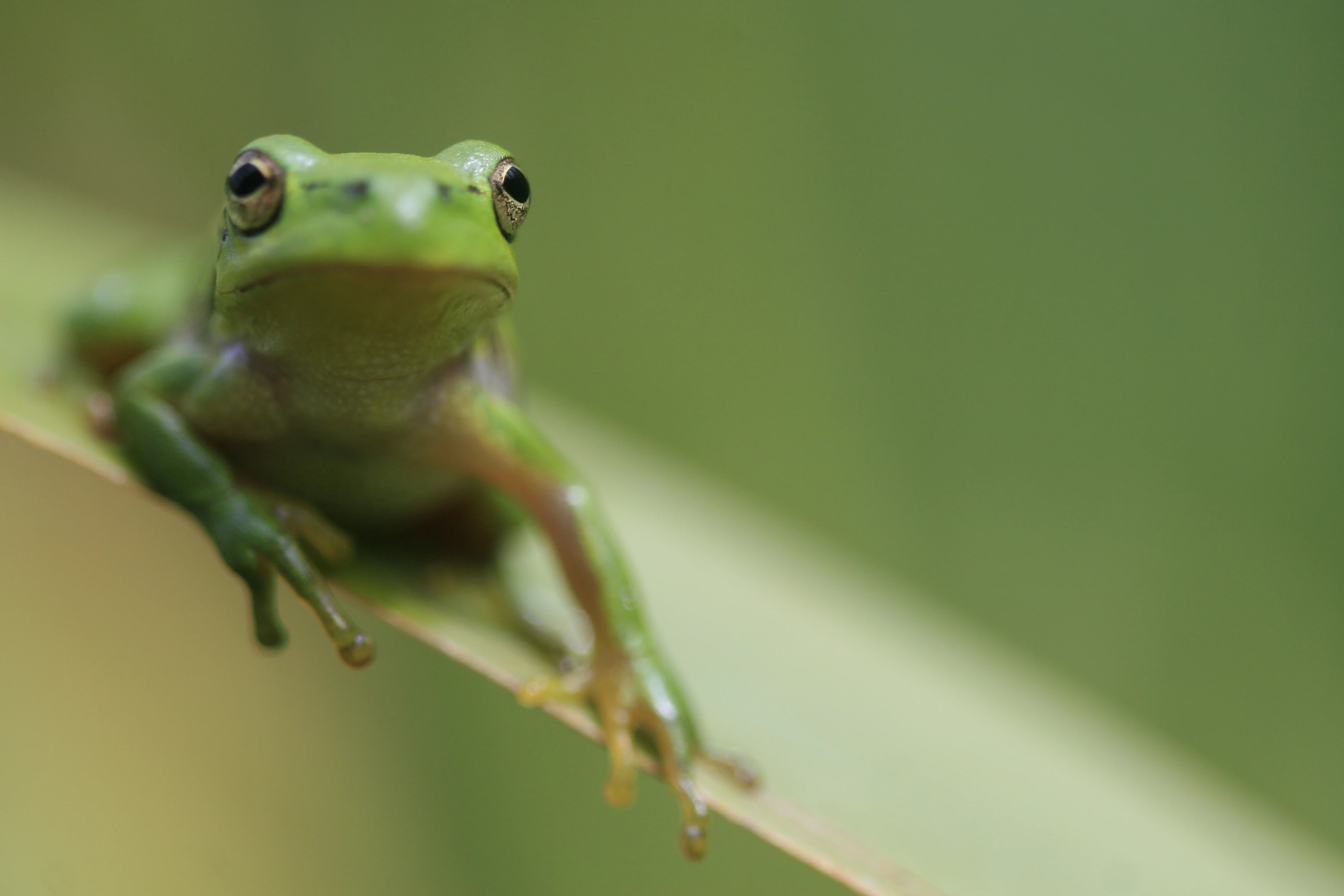
A bright green tree frog sitting on a thin, light-colored grass blade with a soft, out-of-focus green background.
A European tree frog resting on a blade of grass in the marshlands of the Vauville nature reserve.

Vauville Pond National Nature Reserve wildlife and species highlights

The reserve's wildlife significance is centered on its birdlife. The open freshwater surface attracts a wide range of resident waterbirds, including mallard, common pochard, northern shoveler, little grebe, common moorhen, and Eurasian coot. In winter, the pond becomes a staging and stopover site for migratory waterfowl arriving from northern Europe, including Eurasian teal, common snipe, northern lapwing, and the elusive Eurasian bittern.

Beyond birds, the site supports a rich invertebrate fauna of roughly 500 insect species, ranging from dragonflies and butterflies to aquatic insects tied to the pond's margins. This insect abundance in turn underpins populations of amphibians, including tree frogs and the protected great crested newt, which depend on healthy aquatic vegetation and clean, relatively undisturbed freshwater habitat. Reptiles such as the grass snake are also present in the marshy margins.

Taken together, the site's fauna reflects the broader pattern of the reserve: a relatively small surface that combines high habitat diversity with sustained freshwater conditions, allowing species typical of dunes, wetlands, and open water to coexist within a few hundred meters of one another.
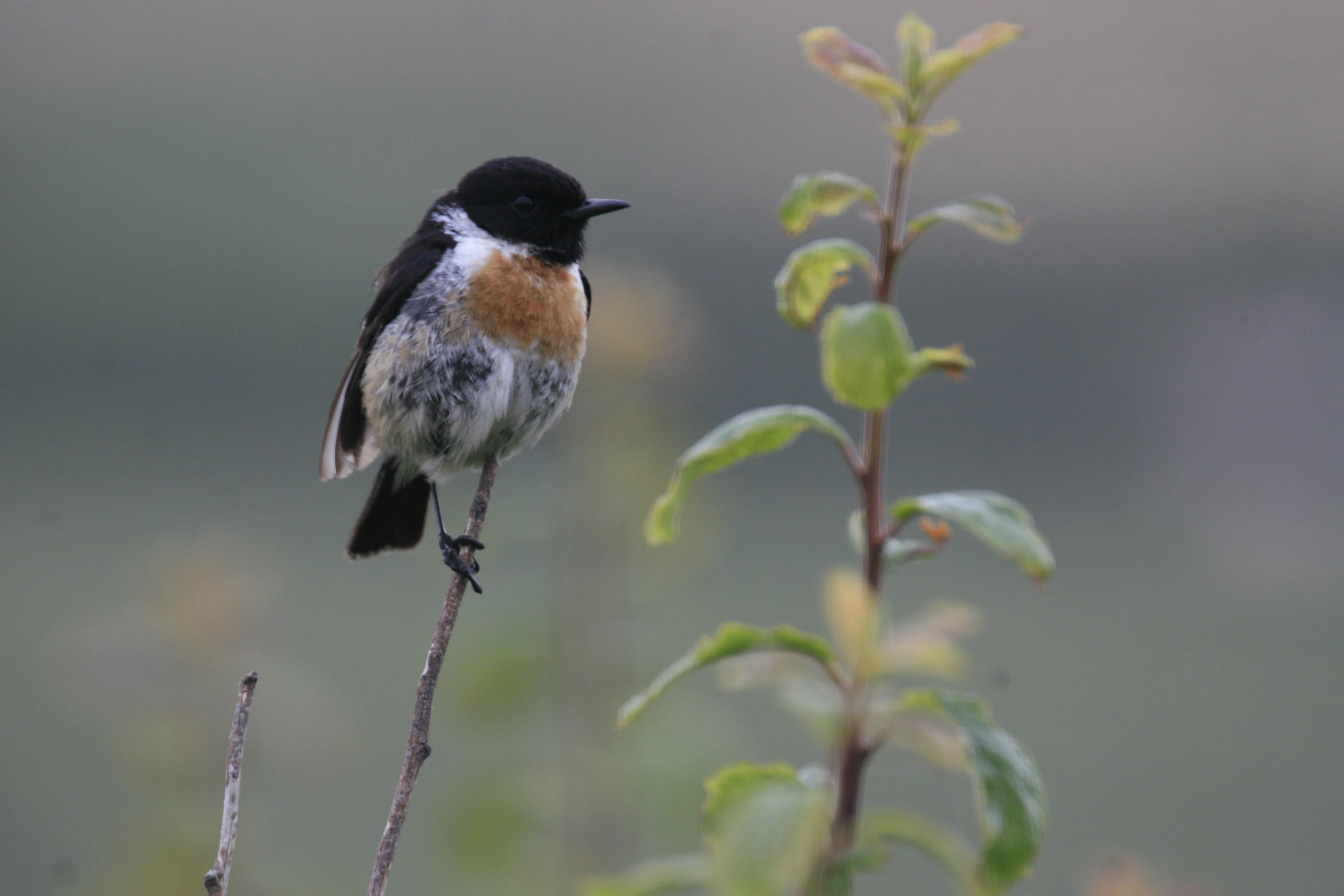
A European stonechat bird with a black head, white neck collar, and orange-brown chest perched on a thin, upright branch.
A European stonechat perched on a slender branch at the Vauville nature reserve.

Vauville Pond National Nature Reserve conservation status and protection priorities

The reserve's conservation value lies primarily in its role as one of the few stable coastal freshwater lagoons along the Normandy coast, preserved against marine intrusion by a living dune barrier. Its protection as a national nature reserve reflects the recognition that this combination of dune, freshwater pond, and surrounding granite landscape is rare in France and vulnerable to both coastal erosion and hydrological change. The site's fragility is closely tied to the thin dune cord, whose continued integrity determines whether the pond remains freshwater or shifts back toward brackish conditions as it may have done in earlier millennia.

Conservation management is grounded in long-term local involvement. Since 1983, the Normand Ornithological Group has overseen the reserve, combining habitat monitoring with public access through marked trails and an open bird observation hide. The presence of a freely accessible ornithological observatory is itself a conservation tool, enabling non-intrusive birdwatching that draws attention to the site's importance while reducing disturbance. Research collaborations, such as the GEOPHEN studies on the basin's geological and hydrological history, have deepened understanding of the site and underpin its ongoing protection strategy.

Vauville Pond National Nature Reserve cultural meaning and human context

The reserve is embedded in the cultural and natural identity of the Cotentin Peninsula, a region historically defined by its long, exposed coastline and small coastal communities. The commune of Vauville, on which the reserve lies, sits within a stretch of coast known for both its dramatic granite headlands and its dune systems, and the reserve is part of the wider network of protected sites that characterize Norman coastal management. The Normand Ornithological Group, which manages the site, reflects the strong tradition of regional naturalist associations in northern France, where local expertise has long played a central role in conservation.
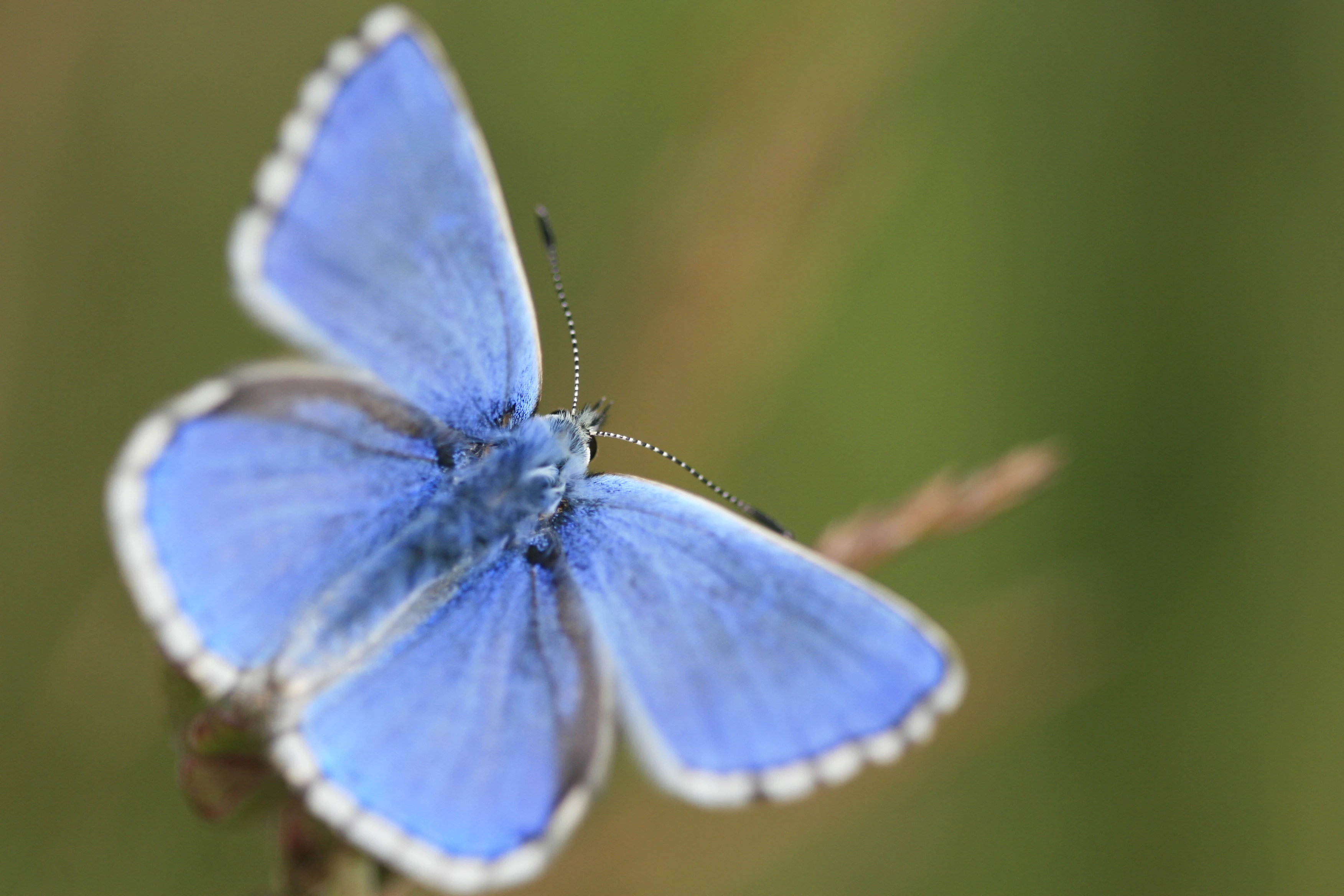
A close up view of a bright blue Adonis Blue butterfly with white-fringed wings perched on a blade of grass.
An Adonis Blue butterfly resting in the Réserve naturelle nationale de la mare de Vauville.

Top sights and standout views in Vauville Pond National Nature Reserve

A coastal freshwater lagoon held in place by a living dune cord, the reserve packs dunes, wetlands, reedbeds, and open water into a remarkably compact surface. It is a recognized site for migratory and wintering waterfowl, hosts roughly 500 insect species, and shelters protected amphibians including the great crested newt. Marked trails and a freely accessible bird observation hide make it possible to experience the site without disturbing the wildlife that defines its identity.
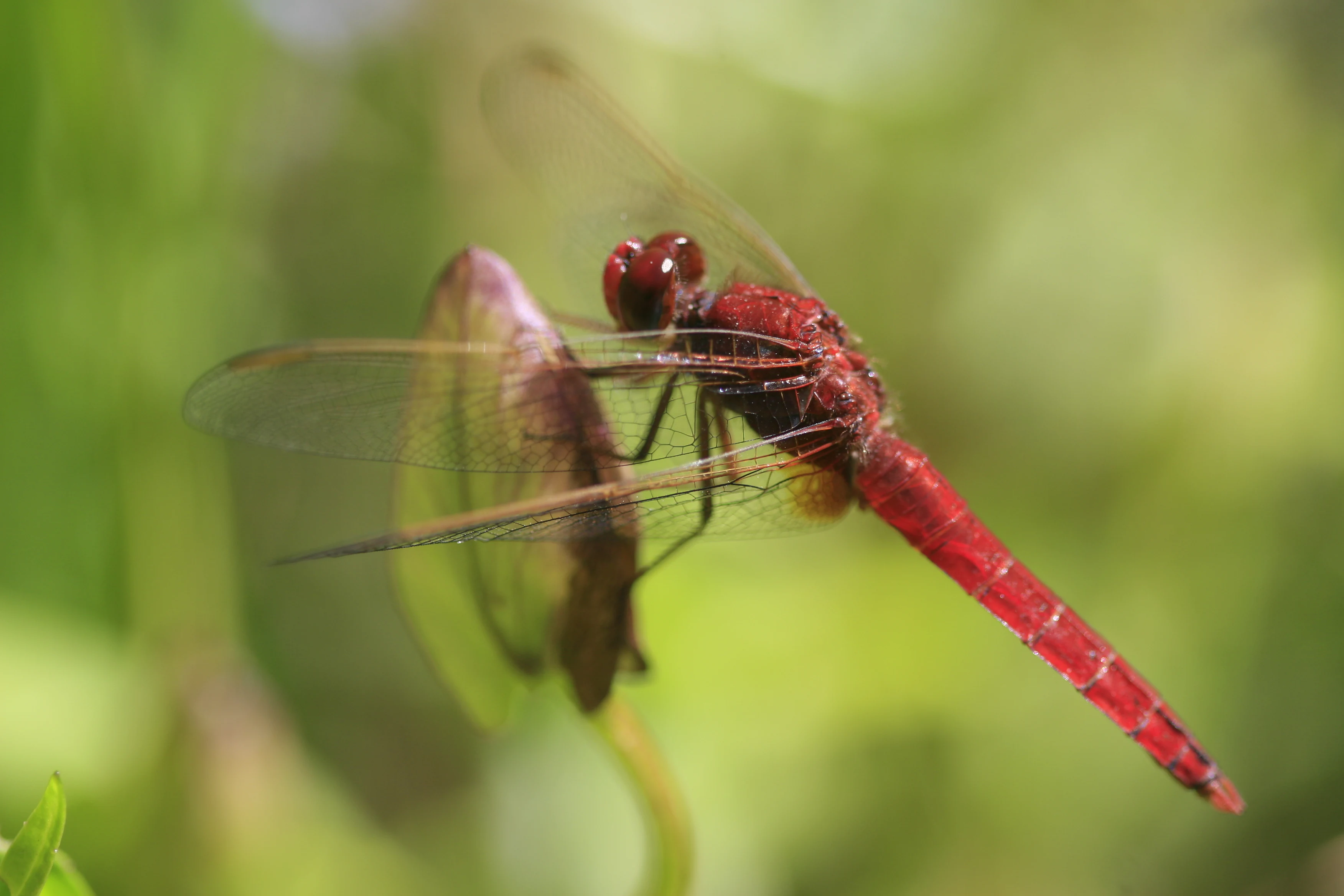
A close-up view of a vibrant red dragonfly with clear, veined wings resting on a green plant leaf against a soft, blurred background.
A scarlet dragonfly, Crocothemis erythraea, perched on vegetation at the Vauville Nature Reserve.

Best time to visit Vauville Pond National Nature Reserve

Spring and autumn tend to offer the richest conditions for visitors interested in birdlife, as migratory waterfowl pass through or settle on the pond and surrounding vegetation is most active. Winter is the principal season for northern migrants and large concentrations of waterbirds, when the pond can host the highest diversity of ducks, grebes, and waders. Summer brings warmer, drier conditions and lower water levels, exposing more of the muddy margins and supporting active dragonfly and amphibian populations, while also offering the mildest conditions for walking the dune trails.
Monthly climate preview

Long-term monthly temperature and precipitation patterns recorded across representative coordinates

Climate Normals and Annual Temperature Rhythm for Réserve naturelle nationale de la mare de Vauville

Representative coordinates record long-term monthly temperature variations alongside shifting precipitation averages throughout the year. Reviewing the complete twelve-month dataset provides a detailed baseline of historical climate normals for Réserve naturelle nationale de la mare de Vauville.
Annual mean12 °C
7 °C17 °C
Jan
Feb
Mar
Apr10°
May12°
Jun15°
Jul17°
Aug17°
Sep16°
Oct14°
Nov11°
Dec
Warmest month
August

17.5 °C

Coolest month
February

7.3 °C

Wettest month
December

3.6 mm/day

Driest month
July

1.6 mm/day

Park location guide

Geography guide, regional context, and park location map for Vauville Pond National Nature Reserve

Vauville Pond National Nature Reserve park geography, regions, and map view in France

Understand where Vauville Pond National Nature Reserve sits in France through a broader geographic reading of the surrounding landscape, nearby location context, and its mapped position within the national park landscape.

How Vauville Pond National Nature Reserve fits into France

France is a unitary semi-presidential republic and one of the world's largest economies. It borders Belgium, Luxembourg, Germany, Switzerland, Italy, Monaco, Andorra, and Spain, with a maritime border to the United Kingdom. The country is known for its cultural influence, art, cuisine, and political history spanning centuries.

Wider geography shaping Vauville Pond National Nature Reserve in France

France is located in Western Europe. Metropolitan France extends from the Rhine to the Atlantic Ocean and from the Mediterranean Sea to the English Channel and North Sea. The country borders Belgium, Luxembourg, Germany, Switzerland, Italy, Monaco, Andorra, Spain, and has a maritime border with the United Kingdom.

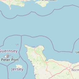
Map view of Vauville Pond National Nature Reserve

Use this park location map to pinpoint Vauville Pond National Nature Reserve in France, understand its exact geographic position, and read its mapped placement within the surrounding landscape more clearly.

Pigeon | © OpenStreetMap contributors

Location context for Vauville Pond National Nature Reserve

Normandie

Visual exploration of coastal dunes, freshwater wetlands, and fragile dune cord habitats

Réserve naturelle nationale de la mare de Vauville Photos and Protected Landscape Scenery

Visual records reveal the complex terrain where open marine waters meet active coastal dunes and shallow freshwater lagoons. Photographic documentation captures the layered vegetation zones, fragile sand barriers, and vital wetland habitats defining the reserve.

A close-up view of a broad-bodied chaser dragonfly, Libellula depressa, perched on a green reed stem against a blurred blue sky background.

A close-up photograph of a grass snake's head and neck, showing its dark skin, distinct pale collar marking, and forked tongue extended.

A close-up view of a common midwife toad with a cluster of brownish eggs attached to its hind legs and back, sitting on mossy ground.

A bright green tree frog sitting on a thin, light-colored grass blade with a soft, out-of-focus green background.

A European stonechat bird with a black head, white neck collar, and orange-brown chest perched on a thin, upright branch.

A close-up vertical photograph of a vibrant purple Loose-flowered orchid stalk standing in a grassy meadow.

A close up view of a bright blue Adonis Blue butterfly with white-fringed wings perched on a blade of grass.

A close-up view of a vibrant red dragonfly with clear, veined wings resting on a green plant leaf against a soft, blurred background.

A small brown and white bird with a striped head perched on thin green branches against a soft grey background.

A close-up photograph of a vibrant purple spiked speedwell flower spike against a soft green background.

A wide angle view of a coastal nature reserve featuring a marshy wetland area in the foreground, golden dune sands in the midground, and the sea meeting the horizon in the background under a clear sky.

A white great egret with a yellow beak standing in calm, murky water, surrounded by sparse emergent marsh vegetation.

A small dark-colored water bird swimming in a calm marshy area, viewed through a foreground of out-of-focus tall dry reeds.

A white little egret wading in shallow marsh water with green vegetation.

Park atlas

Compare adjacent coastal landscapes and regional protected areas in northern France

Other Parks Near Réserve naturelle nationale de la mare de Vauville

Discover protected areas and regional nature reserves located near Réserve naturelle nationale de la mare de Vauville. Comparing these surrounding coastal landscapes provides deeper geographic context for wetland habitats and dune ecosystems across the Cotentin Peninsula.
A watercolor illustration showing a winding river flowing through a green marshland with soft tones and minimalist trees in the background.
Nature reserveManche
About 61 km away#1 closest

Southeast

Réserve naturelle régionale des marais de la Taute: Mapped Landscape and Geography

Wetland geography and protected boundaries in Manche, France

Understand the physical characteristics of Réserve naturelle régionale des marais de la Taute, a mosaic of 147 hectares of protected wet meadows. This area serves as a significant site for marshland conservation, defined by its flat, low-lying river valley geography and fragmented parcel distribution across the Manche landscape.

Area
1.47 km²
Established
2011
Relief
Lowland
Climate
Temperate
A minimalist watercolor painting of soft green hills and light patches of color against a plain white background.
Nature reserveNormandie
About 84 km away#2 closest

Southeast

Réserve naturelle nationale de la forêt domaniale de Cerisy: A Normandy Protected Area

Ecological landscape and forest geography in France

Situated across the Calvados and Manche departments, this nature reserve protects a substantial beech-dominated state forest. The site provides a unique opportunity to study woodland ecosystems, endemic beetle conservation, and the transition between dense forest interiors and the surrounding Norman bocage landscape.

Area
21.24 km²
Established
1976
IUCN
IV
Relief
Upland
Watercolor painting of a coastline with rolling green cliffs meeting the sea, with small pink flowers in the foreground.
Protected landscapeUnited Kingdom
About 107 km away#3 closest

Northwest

Jurassic Coast Protected Landscape: Geological Mapping and Coastal Atlas

A comprehensive look at sedimentary formations in the United Kingdom

Trace the 96-mile stretch of the Jurassic Coast, a protected landscape revealing Triassic, Jurassic, and Cretaceous rock layers. The terrain serves as a vital record of Earth history, featuring distinctive geomorphological landmarks like Chesil Beach and the towering cliffs of Golden Cap, all defined by the dynamic interaction of land and sea.

Established
2001
Relief
Upland
Climate
Temperate
Access
Easy access
A soft watercolor painting of a serene natural landscape featuring foreground grasses, a small body of water, a grassy shoreline, coniferous trees, and hazy hills in the background.
Nature reserveNormandie
About 110 km away#4 closest

East

Réserve naturelle nationale de la falaise du Cap-Romain: Coastal Nature Reserve Map

Explore protected maritime cliffs and Jurassic fossil sites in Calvados, France.

The Réserve naturelle nationale de la falaise du Cap-Romain stands as a compact but rich geological archive on the Côte de Nacre. It protects maritime cliffs, rocky tidal platforms, and significant Bathonian-age sponge fossil reefs. This site offers deep insights into the region's Quaternary history, encompassing glacial deposits, loess layers, and diverse marine fossil assemblages.

Area
0.24 km²
Established
1984
IUCN
III
Protected areaEngland
About 112 km away#5 closest

North

Dorset Heaths: Protected Lowland Landscapes and Regional Geography in Southern England

A comprehensive look at the Poole Basin heathland mosaic.

Spanning the Poole Basin, the Dorset Heaths offer a distinct geographic profile of acidic sands and diverse ecological mosaics. This protected area includes rare valley mires and coastal dunes, providing a clear window into the natural landscape history and ongoing conservation efforts within southern England's coastal regions.

Area
616.62 km²
Established
1998
Relief
Lowland
Water
Major water bodies
A watercolor painting of a wide, soft-focus coastal scene with rolling green hills, distant islands, and calm water, depicted in muted pastel tones.
Protected areaDorset
About 115 km away#6 closest

North

Poole Harbour: Protected Area Geography and Coastal Map of Dorset

Coastal ria landscape and wetland habitat mapping

Poole Harbour stands as a prominent natural feature of the Dorset coast, defined by its shallow waters and varied estuarine terrain. This profile maps the protected landscape, including its salt marshes, seagrass meadows, and islands, offering deep geographic context for this significant southern England wetland.

Area
36 km²
Relief
Lowland
Climate
Temperate
Access
Easy access
Natural monumentIsle of Wight
About 117 km away#7 closest

North

The Needles Natural Monument: Coastal Chalk Geography and Protected Marine Landscapes

Geological formations and chalk headland terrain on the Isle of Wight

The Needles represents a unique geological intersection of vertical chalk strata and maritime history at the edge of the Isle of Wight. This protected area encompasses dramatic sea stacks, clifftop heathland, and critical marine habitats, offering a window into the complex coastal landscape of the English Channel and the regional geology of southern England.

Relief
Upland
Climate
Temperate
Access
Easy access
Scope
Mixed
A soft watercolor illustration of a green wetland area with rolling hills and misty silhouettes in the background, set against a white background.
Nature reserveBretagne
About 125 km away#8 closest

South

Réserve naturelle régionale du marais de Sougeal: Regional Wetland and Protected Landscape in Bretagne

A managed floodplain sanctuary near the Bay of Mont-Saint-Michel

Located in the Ille-et-Vilaine department, this regional nature reserve preserves a unique strip of wet grassland and flood-prone meadows. Use our mapping data to understand the park's specific terrain, from its narrow channel systems to its role as a key stopover for migratory waterbirds and a communal grazing area in the heart of Bretagne.

Area
1.74 km²
Established
2006
IUCN
IV
Relief
Lowland

Common questions about visiting, size, designation, and location context for Vauville Pond National Nature Reserve

Vauville Pond National Nature Reserve FAQs for park facts, access, geography, and protected area context

Find quick answers about Vauville Pond National Nature Reserve, including protected-area facts, park geography, trail and visitor context, and how the park fits into its surrounding country and regional landscape.
MoriAtlas Explorer

Continue Your Protected Areas Search Across the Global Atlas

Deepen your exploration by continuing the structured search for national parks and protected areas worldwide. Utilize the comprehensive filtering capabilities to compare different conservation landscapes and refine your understanding of global park geography. Discover more about the distribution and characteristics of protected natural areas.

Global natural geography