Mori Atlas logo
Protected areaDorset Heaths

Tracing the mapped boundaries and natural terrain of this unique southern England conservation region.

Dorset Heaths: A Detailed Geographic Survey of Protected Heathland and River Valley Landscapes

(Dorset Heaths (National Character Area 135))

The Dorset Heaths represent an expansive mosaic of lowland heathland situated within the Poole Basin of southern England. This protected landscape is defined by its undulating terrain of heather, pine, and gorse, which stands in stark contrast to the surrounding chalk downland. By integrating diverse habitats such as valley mires, estuarine environments, and conifer woodlands, the region forms one of the most critical concentrations of protected nature in the United Kingdom.

lowland heathlandheathland mosaicwet heathdry heathvalley mirepine and gorse heath

Dorset Heaths

Protected area

Park overview

Structured park overview, official facts, and landscape profile for Dorset Heaths

Dorset Heaths park facts, protected area profile, and essential visitor context

Review the core facts for Dorset Heaths, including designation, size, terrain, visitor scale, habitats, and operating context in one park-focused overview.

About Dorset Heaths

The Dorset Heaths are a large natural region in southern England, recognized by Natural England as National Character Area 135 and forming a major component of the Poole Basin landscape. Covering a substantial area in the eastern part of Dorset and reaching into parts of neighbouring counties, the region acts as a transitional belt between the chalk landscapes of central and western Dorset and the coast of the English Channel. Its character is shaped by the underlying Tertiary sands and clays, which support acidic soils and, in turn, the heather, gorse, and pine vegetation that define lowland heath.

The natural identity of the region is unusually varied for a lowland area in southern England. Dry heath on gently undulating ground is interwoven with wet heath and valley mire along the river courses, while conifer plantations, broadleaved woodland, scrub, and open farmland create a patchwork texture across the basin. The major river valleys, including those of the Frome, Stour, Moors, Piddle, Sherford, Allen, Corfe, and Dorset Avon, open out into flat-bottomed floodplain pastures and link the interior of the heathlands with the coast and Poole Harbour. Around the edges of the region, the terrain rises into low, rolling hills that mark the transition into the chalk downland that surrounds much of Dorset.

Although the natural landscape dominates much of the area, the Dorset Heaths are closely intertwined with the South East Dorset conurbation. Poole, Bournemouth, and Christchurch sit within or along the edge of the region, and smaller towns such as Wareham, Fordingbridge, and Wimborne Minster serve as local centres within the heathland. This combination of substantial protected habitat and significant human settlement makes the region both an important conservation area and a defining part of the identity of south-east Dorset.

The Dorset Heaths also exhibit a notably high concentration of overlapping nature conservation designations. International recognition includes the Dorset Heathlands Ramsar site and Special Protection Areas such as Poole Harbour and the Avon valley. European-level protections extend to multiple Special Areas of Conservation covering the heaths, the Studland dunes, and the Portland to Studland cliffs. National Nature Reserves such as Studland and Godlingston Heath, Holt Heath, Hartland Moor, Stoborough Heath, Holton Heath, Morden Bog, and Arne Reedbeds add further protection within the wider heathland mosaic.

Quick facts and research context for Dorset Heaths

The Dorset Heaths are centered on the Poole Basin in southern England and have been recognized by Natural England as National Character Area 135. The region is broadly bounded by Bockhampton and Warmwell in the west, extends northeast to Fordingbridge, reaches the coast at Hengistbury Head, and curves around via Studland and Brownsea Island before returning west beneath the Purbeck Hills and Weymouth Lowlands.

Although comparatively low-lying, with an average elevation of around 32 metres, the area rises to its highest point at Creech Barrow Hill at 193 metres. Major river valleys, including those of the Frome, Stour, Moors, Piddle, Sherford, Allen, Corfe, and Dorset Avon, cut through the heathland. In addition to its ecological significance, the Dorset Heaths include the principal South East Dorset conurbation of Poole, Bournemouth, and Christchurch, together with smaller towns such as Wareham, Fordingbridge, and Wimborne Minster. The area is also designated internationally as the Dorset Heathlands Ramsar site.

Protection and recognition

Documented conservation records and Natura 2000 framework details

Dorset Heaths Protection Status and International Recognition Data

Examine the official protection status, management scope, and verified international designations established for Dorset Heaths. Review structured source records including Natura 2000 frameworks that outline the recognized conservation framework for the protected area.
Park context

Deeper park guide and search-rich context for Dorset Heaths

Dorset Heaths history, landscape, wildlife, and travel context

Explore Dorset Heaths through its history, landscape character, ecosystems, wildlife, conservation priorities, cultural context, and seasonal travel timing in a structured park guide built for atlas discovery and search intent.

Why Dorset Heaths stands out

The Dorset Heaths are best known as one of the most important concentrations of lowland heathland remaining in lowland Britain. The defining character of the region is the open mosaic of dry heath, valley mire, gorse-clad slopes, pine and birch woodland, and conifer plantations that stretch across the Poole Basin. This heathland mosaic is closely tied to the area's underlying geology, occupying the Tertiary Beds that contrast so strongly with the surrounding chalk. The result is a sweeping landscape of heather, scattered trees, farmland, scrub, and open river valleys, framed by the sheltered waters of Poole Harbour and broken by distinctive landmarks such as the dunes of Studland and Brownsea Island. The Dorset Heaths are also notable for the unusually dense concentration of overlapping conservation designations protecting their heathland, wetland, and coastal habitats.
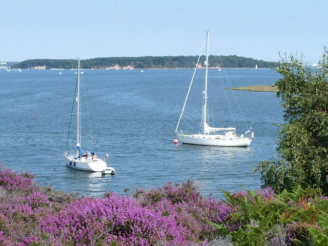
A wide shot across a calm bay with two sailboats anchored, framed by purple heather in the foreground and a forested island in the background.
A view across Poole Harbour from near Shipstal Point, with blooming heather in the foreground and boats on the water.

Dorset Heaths history and protected-area timeline

The Dorset Heaths as a recognized natural region are a relatively modern construct, formalized through the Natural England system of National Character Areas. Their identification as National Character Area 135 reflects a long-standing recognition that the heathlands of the Poole Basin form one of the most important surviving lowland heath landscapes in lowland Britain.

The international profile of the area was significantly raised in 1998, when the Dorset Heathlands were designated under the Ramsar Convention, drawing attention to the wetland values of the region on a global stage. Over the following years, a series of overlapping national and European designations were applied to different components of the heathland mosaic, including Special Protection Areas, Special Areas of Conservation, and National Nature Reserves. These successive layers of protection reflect the gradual recognition of the ecological importance of an area that had previously been shaped by centuries of common-land grazing, forestry, and low-intensity agriculture.

Dorset Heaths landscape and geographic character

The landscape of the Dorset Heaths is dominated by gently undulating lowland, where open expanses of heath, scattered pines, and gorse alternate with blocks of conifers, broadleaved woodland, scrub, and farmland. The sandy, acidic soils derived from the Tertiary Beds produce a soft, rolling terrain that sits in clear contrast to the brighter, smoother chalk landscapes that border much of the region. Creech Barrow Hill rises to 193 metres at the highest point, but the average elevation across the area is only around 32 metres, giving the region a generally low and open character.

The river system plays a defining role in shaping the heathland scenery. The valleys of the Frome, Stour, Moors, Piddle, Sherford, Allen, Corfe, and Dorset Avon cut flat-bottomed channels through the heath, opening out into floodplain pastures that interrupt the surrounding dry heath. These river corridors often shelter wet heath and valley mire, adding ecological and visual complexity to the landscape. Along the coast, the scenery changes character to include sandy shores, dunes such as those at Studland, the sheltered waters of Poole Harbour, and the wooded shoreline around Brownsea Island.

At the margins of the region, the heathland gives way to a perimeter of low, rolling hills that signal the transition into the chalk downland of Dorset and the surrounding counties. Within the basin itself, stands of conifer plantation act as locally dominant landmarks, while patches of broadleaved woodland, scrub, and rough farmland break up the otherwise open view across the heath.
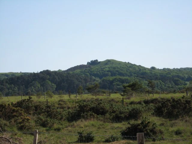
A green conical hill rising above a flat, shrubby heathland landscape under a clear sky.
The distinctive profile of Creech Barrow rising above the lowland heathland.

Dorset Heaths ecosystems, habitats, and plant life

The ecological character of the Dorset Heaths is defined by the intimate mixture of dry and wet lowland heath that covers much of the Poole Basin. The acidic, nutrient-poor soils derived from the Tertiary geology support classic heathland vegetation, dominated by heather, gorse, and scattered pines, with birch and other broadleaves adding variety in places. Where the terrain dips toward river courses, the heath becomes wetter, giving rise to mires and wet heath communities that are among the most threatened habitat types in lowland Britain.

Beyond the heath itself, the region supports a rich mosaic of supporting habitats. Conifer plantations intersperse with patches of broadleaved woodland and scrub, while open farmland, valley pastures, and floodplain meadows add further variety. Along the coast, the ecology shifts to include sand dunes, shingle, saltmarsh, and the sheltered estuarine habitats of Poole Harbour, which is internationally recognized for its bird populations.

The combination of dry heath, wet heath, mire, woodland, farmland, dunes, and estuarine environments gives the Dorset Heaths an unusually concentrated ecological identity for a lowland area. This mosaic is one of the main reasons the region has accumulated so many overlapping conservation designations over time.

Dorset Heaths wildlife and species highlights

The Dorset Heaths are particularly significant for the birdlife associated with lowland heath and the adjacent wetlands. The heathland and Poole Harbour together support internationally important numbers of birds, reflected in the region's Ramsar designation and its multiple Special Protection Areas. Species typical of lowland heath, such as those associated with dry and wet heath mosaites, benefit from the open, undisturbed character of large parts of the area.

The river valleys and wet heath components of the region extend the wildlife value beyond classic dry heath species, supporting birds and other fauna tied to mire, floodplain, and damp woodland habitats. Along the coast and within Poole Harbour, the wetlands and reedbed environments add a further faunal dimension, with the harbour widely recognized as one of the most important estuarine habitats in southern England for migratory and wintering birds.

Dorset Heaths conservation status and protection priorities

The Dorset Heaths are among the most heavily protected lowland landscapes in the United Kingdom, with a dense layering of international, European, and national conservation designations. The region as a whole is internationally recognized through the Dorset Heathlands Ramsar site, designated on 1 October 1998, which highlights the area's wetland significance on a global level.

European-level protections reinforce this status. Special Protection Areas cover the Dorset Heathlands, Poole Harbour, and the Avon valley, safeguarding important bird populations. Complementing these are multiple Special Areas of Conservation, including the Dorset Heaths SAC, the Dorset Heaths (Purbeck and Wareham) and Studland Dunes SAC, the Isle of Portland to Studland Cliffs SAC, and the River Avon SAC. Together, these sites protect the dry and wet heathland, dune, cliff, and freshwater habitats that make up much of the region's ecological value.

At the national level, National Nature Reserves add a further layer of protection. Studland and Godlingston Heath, Holt Heath, Hartland Moor, Stoborough Heath, Holton Heath, Morden Bog, and Arne Reedbeds together anchor the conservation framework within the wider heathland mosaic. The cumulative effect is a region where large areas of lowland heath, wetland, and coastal habitat are protected under multiple overlapping designations, reflecting recognition of the Dorset Heaths as a key stronghold for some of the most threatened lowland habitats in Britain.

Dorset Heaths cultural meaning and human context

The cultural context of the Dorset Heaths is shaped by centuries of low-intensity land use on the sandy soils of the Poole Basin. Heathland of this kind has traditionally supported common grazing, seasonal agriculture, forestry, and game management, practices that have helped to maintain the open character of the modern landscape. Rural settlements such as Wareham, Wimborne Minster, and Fordingbridge grew up as service centres within this heathland environment, and their relationship with the surrounding heath continues to define the regional identity.

The proximity of large towns such as Poole, Bournemouth, and Christchurch adds a modern cultural layer, in which the heathlands function both as a working landscape and as a recreational and ecological resource close to major centres of population. This blend of long-standing rural character and contemporary urban pressure gives the Dorset Heaths a distinctive place within the wider cultural geography of southern England.

Top sights and standout views in Dorset Heaths

The Dorset Heaths stand out for the exceptional density of overlapping nature conservation designations protecting their heathlands, wetlands, and coastal habitats. Few lowland regions in the United Kingdom combine so many different layers of international, European, and national protection within a single natural area.

The heathland mosaic itself, with its heather, gorse, scattered pines, conifer blocks, woodland, and open farmland, gives the region a distinctive visual and ecological identity that contrasts strongly with the chalk landscapes of surrounding Dorset. The integration of this mosaic with major river valleys, the dunes of Studland, and the sheltered waters of Poole Harbour adds further depth. The result is a region of lowland England whose ecological significance, landscape character, and position along the South East Dorset coast combine to make it one of the standout protected natural areas of southern England.

Best time to visit Dorset Heaths

Although specific seasonal opening arrangements vary across the many individual sites within the Dorset Heaths, the region's heathland character gives it a strong seasonal rhythm. Late summer and early autumn are traditionally the most atmospheric times on the heaths, when heather and gorse come into bloom and the open landscape takes on rich purple and gold tones. Spring and early summer can be rewarding for woodland and valley mire habitats, while winter brings flocks of birds to Poole Harbour and the surrounding wetlands.

Milder months generally offer easier walking conditions across the open heath, while the exposed nature of much of the terrain means that very wet or windy weather can affect access to particular sites. Visitors interested in birdlife often find that the cooler months coincide with the most concentrated wildfowl and wader activity around the harbour, while heathland flowers and insects are at their most visible in warmer weather.

Monthly climate preview

Long-term representative records for monthly temperature ranges and precipitation

Dorset Heaths Climate Normals, Annual Temperature and Precipitation Rhythm

Representative coordinate measurements track the annual temperature cycle and precipitation rhythm across Dorset Heaths from 1991 to 2020. Examining the full twelve-month profile provides complete historical averages for month-by-month weather patterns.
Annual mean12 °C
7 °C17 °C
Jan
Feb
Mar
Apr
May12°
Jun14°
Jul17°
Aug17°
Sep16°
Oct14°
Nov11°
Dec
Warmest month
August

17.2 °C

Coolest month
February

7.1 °C

Wettest month
November

3.4 mm/day

Driest month
July

1.6 mm/day

Park location guide

Geography guide, regional context, and park location map for Dorset Heaths

Dorset Heaths park geography, regions, and map view in United Kingdom

Understand where Dorset Heaths sits in United Kingdom through a broader geographic reading of the surrounding landscape, nearby location context, and its mapped position within the national park landscape.

How Dorset Heaths fits into United Kingdom

The United Kingdom is a parliamentary constitutional monarchy located in northwestern Europe, consisting of four constituent countries: England, Scotland, Wales, and Northern Ireland. As a major global power with over 69 million residents, it maintains significant international influence in politics, economics, and culture.

Wider geography shaping Dorset Heaths in United Kingdom

The United Kingdom is an island nation located in northwestern Europe, surrounded by the Atlantic Ocean, North Sea, English Channel, Celtic Sea, and Irish Sea. It shares a land border with the Republic of Ireland to the west. The territory includes the island of Great Britain, the northeastern portion of Ireland, and most of the smaller British Isles islands.

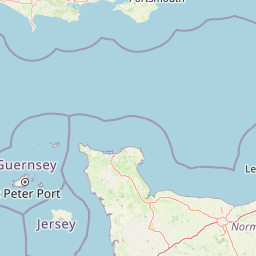
Map view of Dorset Heaths

Use this park location map to pinpoint Dorset Heaths in United Kingdom, understand its exact geographic position, and read its mapped placement within the surrounding landscape more clearly.

Pigeon | © OpenStreetMap contributors

Location context for Dorset Heaths

England
Recorded earthquake history

Explore the Historical Earthquake Records Associated with the Dorset Heaths

Browse the MoriAtlas catalogue of recorded seismic events near the Dorset Heaths. This record tracks historical earthquake occurrences by magnitude and epicentre distance, providing essential data for those examining the regional seismic profile of this unique southern England protected landscape.

Dorset Heaths Earthquake History

Catalogued events

2 events

Strongest magnitude

Magnitude 3.8

Most recent event

May 19, 2019

This history includes earthquakes recorded inside the park or within 50 km of its borders

Visual reference collection showcasing lowland heath mosaics, valley mires, and coastal habitats

Dorset Heaths Landscape Photography and Protected Area Scenery

Visual documentation captures the undulating lowland terrain, heather-clad slopes, and protected habitats defining the Poole Basin. Photographic records reveal the distinctive landscape character of southern England, from open heathland to sheltered coastal waters.

A wide shot across a calm bay with two sailboats anchored, framed by purple heather in the foreground and a forested island in the background.

Wide view of a sprawling open heathland with low shrubs and grasses in shades of brown and rust, under a muted overcast sky with scattered trees in the distance.

A green conical hill rising above a flat, shrubby heathland landscape under a clear sky.

Park atlas

Compare regional park geography and adjacent lowland conservation areas

Explore Parks Near Dorset Heaths and Surrounding Protected Landscapes

Continue exploring protected areas near Dorset Heaths by browsing adjacent lowland heathlands, river valleys, and coastal habitats across southern England. Comparing nearby national parks and protected landscapes provides valuable geographic context for the Poole Basin region.
A watercolor painting of a wide, soft-focus coastal scene with rolling green hills, distant islands, and calm water, depicted in muted pastel tones.
Protected areaDorset
Park boundaries overlap#1 closest

East

Poole Harbour: Protected Area Geography and Coastal Map of Dorset

Coastal ria landscape and wetland habitat mapping

Poole Harbour stands as a prominent natural feature of the Dorset coast, defined by its shallow waters and varied estuarine terrain. This profile maps the protected landscape, including its salt marshes, seagrass meadows, and islands, offering deep geographic context for this significant southern England wetland.

Area
36 km²
Relief
Lowland
Climate
Temperate
Access
Easy access
Watercolor painting of a coastline with rolling green cliffs meeting the sea, with small pink flowers in the foreground.
Protected landscapeUnited Kingdom
1.7 km away#2 closest

West

Jurassic Coast Protected Landscape: Geological Mapping and Coastal Atlas

A comprehensive look at sedimentary formations in the United Kingdom

Trace the 96-mile stretch of the Jurassic Coast, a protected landscape revealing Triassic, Jurassic, and Cretaceous rock layers. The terrain serves as a vital record of Earth history, featuring distinctive geomorphological landmarks like Chesil Beach and the towering cliffs of Golden Cap, all defined by the dynamic interaction of land and sea.

Established
2001
Relief
Upland
Climate
Temperate
Access
Easy access
Watercolor painting showing a landscape with green and purple vegetation, a body of water, and distant hills.
National parkEngland
3.7 km away#3 closest

Northeast

New Forest National Park: Historic Protected Landscape and Regional Geography in England

Mapped heathland, ancient woodlands, and pastoral traditions.

Explore New Forest National Park, a nationally significant protected area in England renowned for its unique blend of ancient royal forest history, traditional pastoral practices, and biologically rich lowland habitats. This page provides an atlas-focused view of its mapped boundaries, distinctive terrain, and geographic context within England, highlighting its value as a living landscape shaped by centuries of common grazing rights and supporting rare wildlife.

Area
566 km²
Established
2005
IUCN
V
Visitors
14.8M annual
Natural monumentIsle of Wight
About 12 km away#4 closest

East

The Needles Natural Monument: Coastal Chalk Geography and Protected Marine Landscapes

Geological formations and chalk headland terrain on the Isle of Wight

The Needles represents a unique geological intersection of vertical chalk strata and maritime history at the edge of the Isle of Wight. This protected area encompasses dramatic sea stacks, clifftop heathland, and critical marine habitats, offering a window into the complex coastal landscape of the English Channel and the regional geology of southern England.

Relief
Upland
Climate
Temperate
Access
Easy access
Scope
Mixed
Watercolor illustration of a coastal landscape featuring green hills, white cliffs, and a body of water
National parkSouth East England
37 km away#5 closest

East

South Downs National Park: A Distinctive Chalk Landscape in South East England's Atlas

Iconic chalk downland, coastal cliffs, and mapped terrain.

South Downs National Park is a premier protected landscape in South East England, celebrated for its unique chalk downland terrain and dramatic coastal formations. This page provides detailed geographic context for the park, highlighting its rolling hills, dry valleys, and ancient woodlands. Discover the park's mapped boundaries and its significance within England's protected areas, offering a structured atlas view for landscape exploration.

Area
1,627 km²
Established
2010
IUCN
V
Visitors
18M annual
Watercolor painting of a wetland landscape featuring a winding river, rolling green hills, and soft-focus trees under a light sky.
Protected landscapeSomerset
46 km away#6 closest

Northwest

Somerset Levels Protected Landscape: Geographic Mapping and Wetland Terrain Analysis

A low-lying coastal plain and historic wetland basin in Somerset

Examine the distinct topography of the Somerset Levels, where flat horizons, pollarded willows, and ancient drainage channels create a unique English landscape. This protected area offers deep insight into prehistoric archaeology, including preserved Neolithic trackways, alongside modern wetland conservation of international significance within a rural basin.

Area
650 km²
Established
1997
Relief
Lowland
Climate
Temperate
Watercolor painting depicting a landscape with rolling hills, a winding road, and distant mountains
National parkUnited Kingdom
81 km away#7 closest

Northwest

Exmoor National Park: A Premier Protected Landscape in South West England for Atlas Exploration

Mapped terrain, moorland, and dramatic coastal geography.

Discover Exmoor National Park, a vast protected area in South West England celebrated for its sweeping heather moorland, dramatic coastline with the highest sea cliffs on mainland Britain, and deep, ancient wooded valleys. This national park offers a unique landscape for atlas-based exploration, revealing its distinct geography, mapped boundaries, and rich terrain shaped by centuries of natural processes and human activity.

Area
692 km²
Established
1954
IUCN
V
Visitors
1.4M annual
Marine protected areaWest Sussex
About 90 km away#8 closest

East

Kingmere Marine Conservation Zone: Protected Marine Geography and Chalk Reef Landscapes

Submerged chalk cliff systems and rocky reefs in West Sussex

The Kingmere Marine Conservation Zone protects an unusual underwater landscape of chalk ridges and rocky outcrops within the English Channel. Stretching between Littlehampton and Worthing, this area serves as a vital spawning ground and exhibits some of the finest chalk reef features in European waters.

Area
47 km²
Established
2013
Relief
Lowland
Climate
Temperate

Common questions about visiting, size, designation, and location context for Dorset Heaths

Dorset Heaths FAQs for park facts, access, geography, and protected area context

Find quick answers about Dorset Heaths, including protected-area facts, park geography, trail and visitor context, and how the park fits into its surrounding country and regional landscape.
MoriAtlas Explorer

Continue Your Protected Areas Search Across the Global Atlas

Deepen your exploration by continuing the structured search for national parks and protected areas worldwide. Utilize the comprehensive filtering capabilities to compare different conservation landscapes and refine your understanding of global park geography. Discover more about the distribution and characteristics of protected natural areas.

Global natural geography