
Mori Atlas logo
Nature reserveRéserve naturelle régionale de la tourbière des Saisies - Beaufortain - Val d'Arly

Analyzing the largest acidic mountain peatland ecosystem across the Beaufortain and Val d'Arly massifs.

Mapping the Protected Landscapes of the Réserve naturelle régionale de la tourbière des Saisies - Beaufortain - Val d'Arly

(Réserve naturelle régionale de la tourbière des Saisies - Beaufortain - Val d'Arly (RNR265))

The Réserve naturelle régionale de la tourbière des Saisies - Beaufortain - Val d'Arly represents a critical protected area in the Savoie department, spanning approximately 293 hectares of high-altitude terrain. This region is defined by its extensive acidic peatlands, which support rare glacial relict flora and fauna usually found in northern latitudes. Through map-based exploration, identify the primary ecological zones including the central Saisies peatland and the high-basin areas near Queige that define this distinctive mountain habitat.

peatlandtourbièrealpine wetlandsregional nature reservebiodiversity hotspotglacial relict species
A graphic art illustration depicting a scenic alpine landscape with snow-capped mountains, a central waterfall cascading into a pond, surrounded by pine trees under a soft, sunrise-lit sky.

Réserve naturelle régionale de la tourbière des Saisies - Beaufortain - Val d'Arly

Nature reserve

Park overview

Structured park overview, official facts, and landscape profile for Réserve naturelle régionale de la tourbière des Saisies - Beaufortain - Val d'Arly

Réserve naturelle régionale de la tourbière des Saisies - Beaufortain - Val d'Arly park facts, protected area profile, and essential visitor context

Review the core facts for Réserve naturelle régionale de la tourbière des Saisies - Beaufortain - Val d'Arly, including designation, size, terrain, visitor scale, habitats, and operating context in one park-focused overview.

About Réserve naturelle régionale de la tourbière des Saisies - Beaufortain - Val d'Arly

The Réserve naturelle régionale de la tourbière des Saisies - Beaufortain - Val d'Arly stands out as one of the most ecologically distinctive protected areas in the French Alps. Although modest in size at roughly 293 hectares, it concentrates an exceptional range of rare habitats around the Col des Saisies and the small Lac des Saisies. The reserve is structured into two complementary zones: a vast acidic peatland near the col, and a smaller lake and wetland complex on the heights of the commune of Queige.

The site's identity is shaped by altitude and climate. At about 1,650 meters above sea level, it sits within a mountain climate marked by oceanic influences, heavy precipitation averaging around 1,400 millimeters per year, a mean annual temperature near 5 degrees Celsius, and a long snowy winter averaging around 162 frost days per year. These conditions, combined with a substrate of Hercynian metamorphic rocks overlain by Quaternary deposits, produce a poorly permeable, acidic soil that has favored the formation and persistence of peat over millennia.

Ecologically, the reserve is exceptional for its contiguous set of rare peatland habitats. Eighteen distinct habitats have been catalogued, the vast majority of which qualify as priority or community-interest habitats under the European Habitats Directive. These include trembling bogs dominated by Carex limosa, Nardus stricta grasslands, and Rhododendron ferrugineum heaths, among others. Approximately 274 plant species and 92 faunal species have been recorded across the reserve, including numerous species of high heritage value.

Beyond its ecological role, the site has a layered cultural and sporting history. The 1992 Albertville Winter Olympics placed the Saisies peatland on the international stage when it hosted cross-country skiing and biathlon events, and cross-country skiing has been practiced here since 1965. Today, the protected area remains a working landscape where traditional activities such as pasture, forestry, hunting, and gathering continue under strict regulation, balanced with low-impact tourism that includes guided summer visits and a 1.8-kilometer discovery boardwalk opened in 2015.

Quick facts and research context for Réserve naturelle régionale de la tourbière des Saisies - Beaufortain - Val d'Arly

The reserve lies in northern Savoie at around 1,650 meters elevation, between the Beaufortain massif and the Val d'Arly, near the towns of Megève, Ugine, and Albertville. It was classified as a regional nature reserve on July 11, 2013, by the Auvergne-Rhône-Alpes regional council, making it the first such reserve in the department, and its protection runs for a renewable ten-year term.

It is co-managed by the SIVOM des Saisies and the French National Forest Office (ONF) for Savoie. The site sits within multiple overlapping legal protections, including a 1989 prefectoral biotope protection order, the Natura 2000 Special Area of Conservation 'Tourbière et lac des Saisies', several ZNIEFF inventories, and an inscribed site covering the Col des Saisies and its surroundings.

Protection and recognition

Documented protection records, management scope, and verified registry data

Protection Status and International Recognition for Réserve naturelle régionale de la tourbière des Saisies - Beaufortain - Val d'Arly

Comprehensive protected area records outline the formal conservation framework and registry details for Réserve naturelle régionale de la tourbière des Saisies - Beaufortain - Val d'Arly. Structured datasets compile verified administrative status and international database identifiers for accurate geographical reference.

Protection details

WDPA ID
555561903
Park context

Deeper park guide and search-rich context for Réserve naturelle régionale de la tourbière des Saisies - Beaufortain - Val d'Arly

Réserve naturelle régionale de la tourbière des Saisies - Beaufortain - Val d'Arly history, landscape, wildlife, and travel context

Explore Réserve naturelle régionale de la tourbière des Saisies - Beaufortain - Val d'Arly through its history, landscape character, ecosystems, wildlife, conservation priorities, cultural context, and seasonal travel timing in a structured park guide built for atlas discovery and search intent.

Why Réserve naturelle régionale de la tourbière des Saisies - Beaufortain - Val d'Arly stands out

The reserve is best known for hosting the largest acidic high-altitude peatland in the French Alps, a habitat more commonly associated with northern Europe. Visitors and ecologists alike describe the area as 'little Lapland' because of its glacial relict species, sphagnum-rich mires, trembling bogs, and subalpine wildlife communities. The site is also renowned for its rich birdlife, including the black grouse (tétras lyre), Eurasian pygmy owl, Tengmalm's owl, common snipe, common redpoll, and Eurasian siskin, and for rare butterfly species tied to cranberry and bog habitats. In winter, it doubles as a major Nordic skiing venue, blending ecological sensitivity with a long tradition of winter sport.
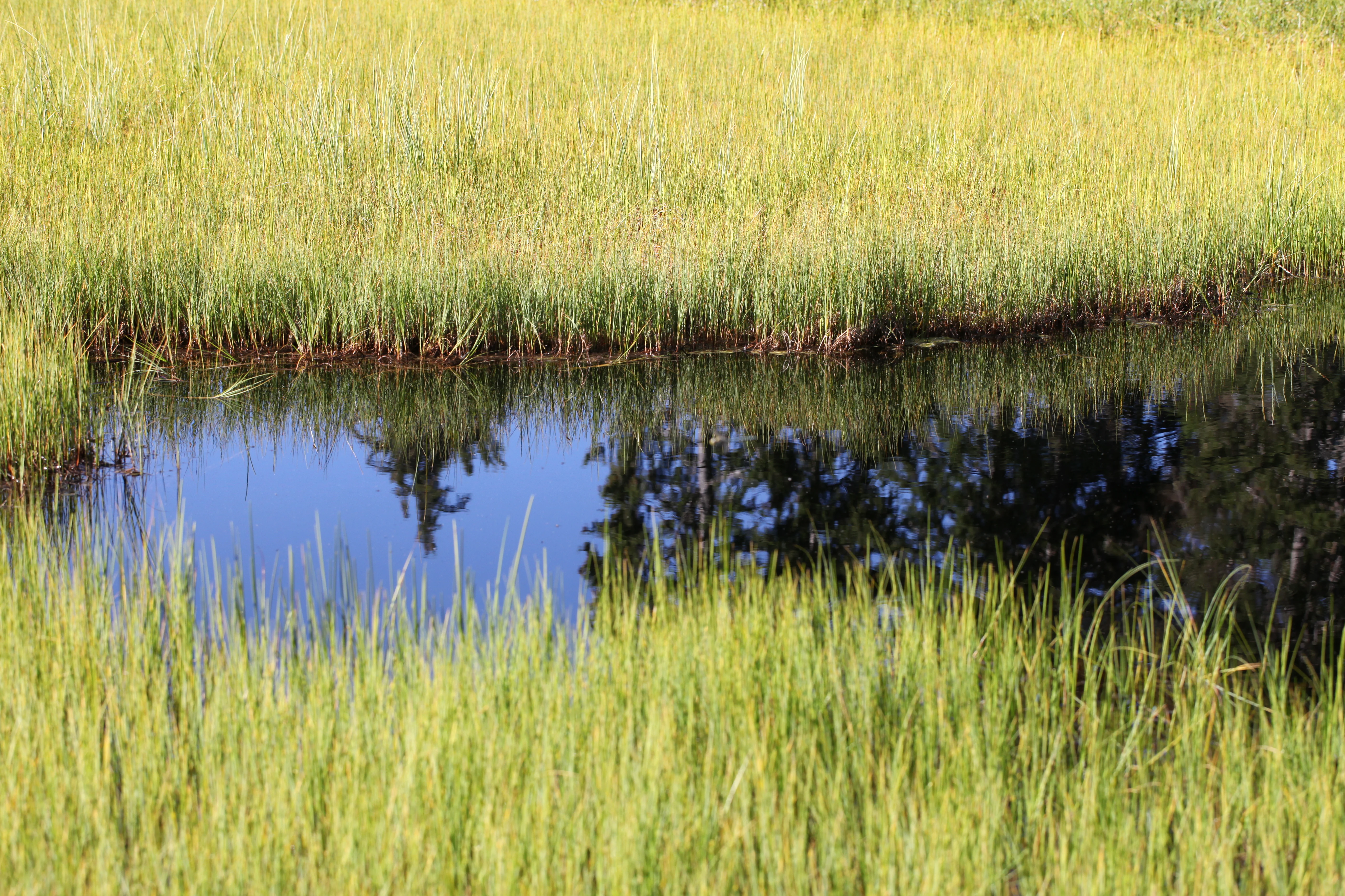
A small, still pool of water reflecting the blue sky and silhouettes of evergreen trees, surrounded by dense, yellowish-green grasses of an alpine bog.
A small, reflective pool nestled within the acidic bog landscape of the Réserve naturelle régionale de la tourbière des Saisies.

Réserve naturelle régionale de la tourbière des Saisies - Beaufortain - Val d'Arly history and protected-area timeline

The history of the Saisies peatland as a recognized natural site spans several decades. In 1965, a cross-country ski station was established directly on the peatland, an early signal of the close relationship between human activity and this fragile environment. A decade later, in 1975, the CETEGREF included the site in its pre-inventory of natural heritage for Savoie, marking the first formal scientific acknowledgment of its value. Detailed floristic and faunal studies carried out in 1984 and 1985 revealed the site's ecological richness.

In 1989, a prefectoral biotope protection order was issued, covering 288 hectares to safeguard the remarkable habitats. The site's international visibility grew sharply in 1992, when it hosted the cross-country skiing and biathlon events of the XVI Olympic Winter Games in Albertville. In 2006, it was formally designated as a Special Area of Conservation (ZSC) within the Natura 2000 network under the European Habitats Directive, deepening its legal protection.

The decisive step came on July 11, 2013, when the Auvergne-Rhône-Alpes regional council voted to classify the area as a Régionale Naturelle Reserve for an initial ten-year, renewable term. This made it the first RNR in the department of Savoie. Co-management was entrusted to the SIVOM des Saisies and the ONF Savoie. In 2015, a 1.8-kilometer discovery trail featuring 600 meters of boardwalk was inaugurated to enable low-impact public education about the peatland environment. The first formal management plan was being finalized that same year.

Réserve naturelle régionale de la tourbière des Saisies - Beaufortain - Val d'Arly landscape and geographic character

The reserve's landscape is defined by open, treeless or sparsely wooded high-altitude plateaus shaped by centuries of peat accumulation. The topography is gentle but distinctive: the Saisies peatland forms a broad, waterlogged expanse near the Col des Saisies, while the smaller Lac des Saisies occupies a high basin on the Queige side. Soft mounds of sphagnum moss, shallow pools, and saturated hollows create a mosaic that reads almost as a tundra-like scene in the heart of the Alps.

The scenery shifts with the seasons. In summer, the mosaic of green peatlands, reddish heaths, and pale grasses opens into a quiet, expansive horizon framed by surrounding peaks. In winter, the same land is buried under deep snow, becoming a vast Nordic skiing domain where the terrain appears smooth and uniform. The underlying geology, dominated by ancient Hercynian metamorphic rocks overlain by Quaternary deposits, contributes to the acidic, water-retentive conditions that give the landscape its peatland character.
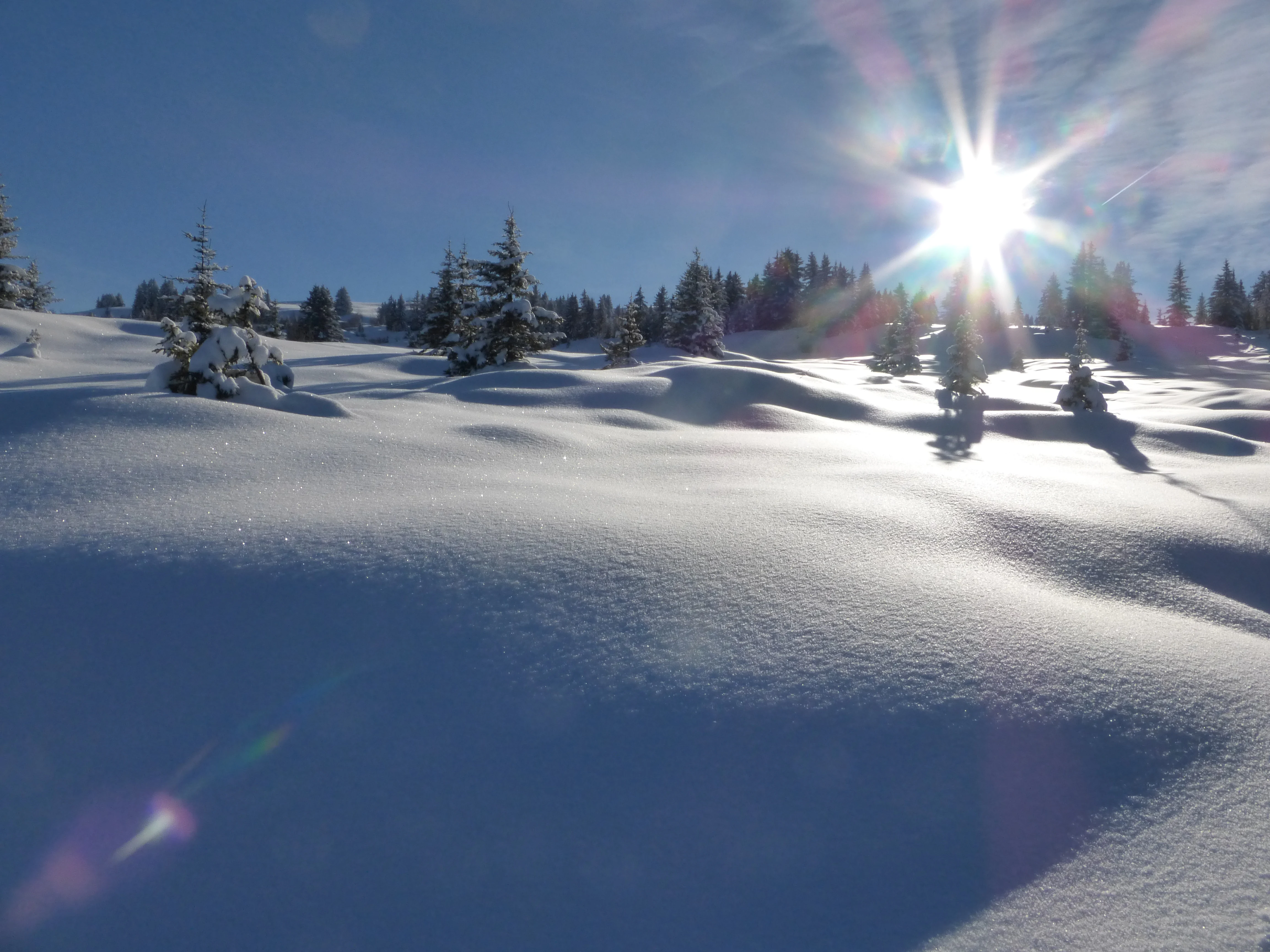
A snowy, undulating landscape of an alpine peatland with scattered snow-covered pine trees under a bright sun, creating a strong sunburst effect.
The Les Saisies peatland landscape blanketed in deep snow during winter.

Réserve naturelle régionale de la tourbière des Saisies - Beaufortain - Val d'Arly ecosystems, habitats, and plant life

The nature of the Saisies reserve is dominated by peatland ecosystems, which are otherwise rare in France and especially rare at this latitude and altitude in the Alps. About 95 percent of the 18 identified habitats are classified as priority or community-interest habitats in the European Union, underscoring how unusually concentrated this site is in terms of ecological value.

Among the most characteristic habitats are trembling bogs with Carex limosa, acidic Nardus stricta grasslands, and Rhododendron ferrugineum heaths. Sphagnum-rich mires, cranberry- and blueberry-bearing peat edges, and relict patches of subalpine vegetation contribute to a habitat mosaic that supports both boreal and montane species. Many of the plants present are considered glacial relicts specially adapted to life in wet, cold, acidic soils, contributing to the site's reputation as a fragment of 'little Lapland' deep in the Savoyard Alps.
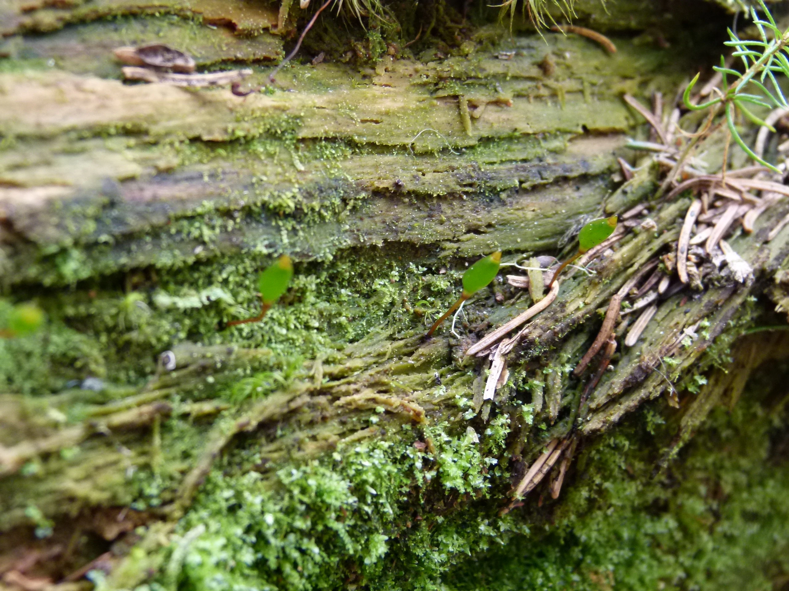
A close up view of small, green shield moss capsules growing on a textured, decaying tree trunk covered in moss and bits of conifer needles.
Buxbaumia viridis, or green shield moss, growing on decaying wood within the reserve.

Réserve naturelle régionale de la tourbière des Saisies - Beaufortain - Val d'Arly wildlife and species highlights

Wildlife at the Saisies reserve reflects the site's character as a meeting point between boreal and alpine fauna. Survey work has documented 92 animal species, with birds, mammals, and butterflies being the most species-rich groups. Black grouse (Lyrurus tetrix) are emblematic, with one of the most significant populations in the Val d'Arly during winter. The small mountain owls Eurasian pygmy owl and Tengmalm's owl are also present and protected, alongside other forest and peatland birds such as the Eurasian woodcock, common redpoll, and Eurasian siskin.

Twenty mammal species have been inventoried, including the wolf and the Eurasian lynx, reflecting the reserve's importance in a broader regional network of large carnivores. Three amphibian species, including the common frog and the alpine newt, and two reptile species, the viviparous lizard and the asp viper, inhabit the peatland and its edges. The reserve is also notable for butterflies, with 178 recorded species, including rare peatland specialists such as Colias palaeno, Boloria aquilonaris, and Agriades optilete. Twelve odonate species have been observed around the wetlands, half of which appear on national or regional red lists, including species such as the Arctic emerald (Somatochlora arctica).

Réserve naturelle régionale de la tourbière des Saisies - Beaufortain - Val d'Arly conservation status and protection priorities

The Saisies peatland matters for conservation because it combines rarity, fragility, and a high concentration of priority habitats within a relatively small area. As the largest acidic mountain peatland in the Alpine arc, it preserves peatland formations that have effectively disappeared from much of lowland Europe. Eighteen habitats are recognized, the overwhelming majority of which qualify as priority or community-interest habitats under the European Habitats Directive.

The reserve sits inside a layered protection framework. A 1989 prefectoral biotope protection order, the Natura 2000 Special Area of Conservation 'Tourbière et lac des Saisies', several ZNIEFF inventories covering the peatland and surrounding wetlands, and the broader inscribed site of the Col des Saisies all reinforce its protection. The presence of glacial relict species, sensitive bryophytes such as Buxbaumia viridis, rare peatland butterflies, and large predators such as wolf and lynx add to its conservation significance. The reserve also plays a key role in preserving a high naturalness reference point for the region's montane forests and wetlands.

Réserve naturelle régionale de la tourbière des Saisies - Beaufortain - Val d'Arly cultural meaning and human context

The cultural context of the Saisies reserve is shaped by centuries of traditional mountain use, including pastoralism, forestry, hunting, and gathering, conducted alongside modern winter tourism. The site has been used as a Nordic skiing area since 1965, and the 1992 Albertville Winter Olympics transformed the peatland into an internationally recognized sports venue when it hosted the cross-country skiing and biathlon events. The naming of the area as 'petite Laponie' captures a local perception of the site as a distinctly northern, almost Nordic landscape transplanted into the Alps. Today, the challenge for the reserve is to maintain these traditional activities and a controlled level of tourism while protecting the ecological character that makes the area singular.

Top sights and standout views in Réserve naturelle régionale de la tourbière des Saisies - Beaufortain - Val d'Arly

The defining highlights of the reserve are its acidic high-altitude peatland, its relict glacial flora and fauna, and its unusually high density of priority habitats within a compact territory. Important points of interest include the trembling bogs dominated by Carex limosa, the Rhododendron ferrugineum heaths, and the small Lac des Saisies area near Queige.

For wildlife and nature enthusiasts, key highlights include the black grouse winter population, the presence of pygmy owl and Tengmalm's owl, the peatland-specialist butterflies Colias palaeno, Boloria aquilonaris, and Agriades optilete, and the presence of large mammals such as wolf and lynx. The 1.8-kilometer discovery trail with boardwalk sections, the surrounding Beaufortain and Val d'Arly mountain scenery, and the site's Olympic heritage round out a distinctive combination of natural and cultural value.

Best time to visit Réserve naturelle régionale de la tourbière des Saisies - Beaufortain - Val d'Arly

The reserve's character changes strongly with the seasons, and the best time depends on what visitors hope to experience. In winter, the landscape is buried under prolonged snow cover, offering a smooth, open expanse that is part of the Les Saisies Nordic ski domain; this is when the site is most visited, though only along marked, regulated pistes. In summer, the peatland reveals its full ecological richness: sphagnum mounds, flowering heath, and active birdlife create the setting most often associated with the 'little Lapland' feel of the reserve. Guided summer tours and the discovery boardwalk are particularly rewarding in this season, when temperatures are mildest and the peatland's habitats are most accessible without disturbing winter-sensitive species.

Monthly climate preview

Long-term representative temperature ranges and monthly precipitation cycles across the protected terrain

Réserve naturelle régionale de la tourbière des Saisies - Beaufortain - Val d'Arly Climate Normals and Annual Weather Patterns

Historical climate data measurements reveal the shifting annual temperature and precipitation rhythm recorded at a representative elevation point within Réserve naturelle régionale de la tourbière des Saisies - Beaufortain - Val d'Arly. Detailed monthly breakdowns provide complete visibility into long-term averages for thermal variations and precipitation totals across the protected landscape.
Annual mean9 °C
-1 °C19 °C
Jan-1°
Feb
Mar
Apr
May12°
Jun16°
Jul19°
Aug19°
Sep14°
Oct10°
Nov
Dec
Warmest month
July

18.5 °C

Coolest month
January

-0.8 °C

Wettest month
December

3.5 mm/day

Driest month
March

2.6 mm/day

Park location guide

Geography guide, regional context, and park location map for Réserve naturelle régionale de la tourbière des Saisies - Beaufortain - Val d'Arly

Réserve naturelle régionale de la tourbière des Saisies - Beaufortain - Val d'Arly park geography, regions, and map view in France

Understand where Réserve naturelle régionale de la tourbière des Saisies - Beaufortain - Val d'Arly sits in France through a broader geographic reading of the surrounding landscape, nearby location context, and its mapped position within the national park landscape.

How Réserve naturelle régionale de la tourbière des Saisies - Beaufortain - Val d'Arly fits into France

France is a unitary semi-presidential republic and one of the world's largest economies. It borders Belgium, Luxembourg, Germany, Switzerland, Italy, Monaco, Andorra, and Spain, with a maritime border to the United Kingdom. The country is known for its cultural influence, art, cuisine, and political history spanning centuries.

Wider geography shaping Réserve naturelle régionale de la tourbière des Saisies - Beaufortain - Val d'Arly in France

France is located in Western Europe. Metropolitan France extends from the Rhine to the Atlantic Ocean and from the Mediterranean Sea to the English Channel and North Sea. The country borders Belgium, Luxembourg, Germany, Switzerland, Italy, Monaco, Andorra, Spain, and has a maritime border with the United Kingdom.

Map view of Réserve naturelle régionale de la tourbière des Saisies - Beaufortain - Val d'Arly

Use this park location map to pinpoint Réserve naturelle régionale de la tourbière des Saisies - Beaufortain - Val d'Arly in France, understand its exact geographic position, and read its mapped placement within the surrounding landscape more clearly.

Pigeon | © OpenStreetMap contributors

Location context for Réserve naturelle régionale de la tourbière des Saisies - Beaufortain - Val d'Arly

Auvergne-Rhône-AlpesSavoie

Examine high-altitude peatlands, sphagnum mires, and glacial relict habitats across the Beaufortain massif

Visual Explorer and Landscape Photography for Réserve naturelle régionale de la tourbière des Saisies - Beaufortain - Val d'Arly

Photographic records capture the expansive plateaus, waterlogged hollows, and unique tundra-like scenery defining the largest acidic mountain peatland in the Alpine arc. Visual documentation provides essential geographic insight into the fragile protected ecosystems and seasonal shifts characterizing the reserve.

A small, still pool of water reflecting the blue sky and silhouettes of evergreen trees, surrounded by dense, yellowish-green grasses of an alpine bog.

A wide view of a grassy, marshy clearing bordered by a dense evergreen forest under a clear blue sky.

A snowy, undulating landscape of an alpine peatland with scattered snow-covered pine trees under a bright sun, creating a strong sunburst effect.

A close up view of small, green shield moss capsules growing on a textured, decaying tree trunk covered in moss and bits of conifer needles.

Park atlas

Compare nearby protected areas and surrounding Alpine landscapes

Parks Near Réserve naturelle régionale de la tourbière des Saisies - Beaufortain - Val d'Arly

Explore connected protected landscapes and regional nature reserves adjacent to Réserve naturelle régionale de la tourbière des Saisies - Beaufortain - Val d'Arly. Comparing neighboring mountain terrain and high-altitude habitats reveals the broader ecological spread of the surrounding region.
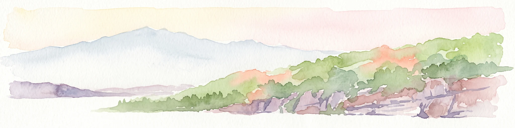
A horizontal watercolor painting depicting a gentle mountain silhouette behind a forested shoreline sloping toward the water.
Nature reserveFrance
About 27 km away#1 closest

West

Roc de Chère Nature Reserve: Mapping the Botanical Diversity and Geological Features of Haute-Savoie

A protected alpine promontory bordering Lake Annecy

Roc de Chère stands as a distinct geological landmark where limestone and sandstone soils create sharp microclimate contrasts. This protected reserve provides a critical habitat for diverse plant species and rare dragonflies within a small, defined area of the French Alps. The site acts as a key element of the Lake Annecy landscape, offering insight into the post-glacial environmental history of the Savoie region through its protected cliffs and hollows.

Area
0.69 km²
Established
1977
Relief
Mountain
Climate
Temperate
Watercolor painting depicting mountains, a river, and trees under a light sky
National parkSavoie
About 35 km away#2 closest

Southeast

Vanoise National Park: Explore France's Original National Park in the Savoie Alps

Mapped Alpine geography, glacial terrain, and protected landscape.

Vanoise National Park is France's pioneering national park, a protected landscape of immense alpine beauty situated in the Savoie department. Renowned for its dramatic glacial terrain, over 100 peaks above 3,000 meters, and the iconic Alpine ibex, this park offers a profound geographic context. Explore its mapped boundaries and discover the unique atlas-level insights into France's mountainous protected areas and their ecological significance.

Area
534 km²
Established
1963
IUCN
II
Relief
Mountain
Watercolor painting of green hills and distant pale mountain peaks against a soft pinkish sky.
Nature reserveHaute-Savoie
About 36 km away#3 closest

Northeast

Réserve naturelle nationale du Vallon de Bérard: Geography and Protected Alpine Terrain

High-altitude glacial valleys and crystalline peaks of Haute-Savoie

Situated in the heart of the Aiguilles Rouges massif, Réserve naturelle nationale du Vallon de Bérard preserves a compact mosaic of high-mountain ecosystems. From the Eau de Bérard torrent to the crystalline needles of Aiguille du Belvédère, the reserve provides a protected refuge for alpine species and a rare look at relict glacial landscapes within the French Alps.

Area
5.397 km²
Established
1992
IUCN
IV
Relief
Mountain
Watercolor illustration depicting green valleys, forests, and distant mountain peaks
National parkItaly
About 51 km away#4 closest

Southeast

Gran Paradiso National Park: Italy's National Park Protected Landscape Atlas

Mapped boundaries and regional geography for a key Italian protected area.

Gran Paradiso National Park is a distinct national park entity within Italy, offering rich potential for atlas-driven geographic discovery. This MoriAtlas profile focuses on its protected landscape identity, providing essential context for understanding its mapped boundaries and its role within the regional geography of Italy. Explore the structured geographic details that make Gran Paradiso National Park a valuable component of any mapped landscape analysis.

Area
703 km²
Established
1922
IUCN
II
Relief
Mountain
A watercolor illustration showing a soft, panoramic view of a calm lake surrounded by gentle, rolling green mountains.
Nature reserveAuvergne-Rhône-Alpes
About 59 km away#5 closest

Southwest

Réserve naturelle régionale du lac d'Aiguebelette: Protected Lake and Forest Geography

Regional nature reserve landscape in the Savoie Prealps

This protected area encompasses the glacial basin of Lake Aiguebelette and the forested slopes of the Montagne de l'Épine. Discover a terrain defined by the contrast between deep mountain water and upland ridgelines, representing a critical habitat and species management zone within the Auvergne-Rhône-Alpes region.

Area
8.442 km²
Established
2015
IUCN
IV
Relief
Mountain
A watercolor landscape painting showing green hills, trees, and marshy river banks.
Nature reserveGeneva
About 60 km away#6 closest

Northwest

Naturschutzgebiet Moulin de Vert: Protected Wetland and Forest Geography in Geneva

Detailed nature reserve map and regional landscape context

The Naturschutzgebiet Moulin de Vert nature reserve protects a mosaic of riverside woodland, meadows, and managed pond systems along the Rhône in the Canton of Geneva. Spanning approximately 132 hectares, this conservation area is recognized for supporting extensive biodiversity, from nesting peregrine falcons to diverse amphibian populations. Access this detailed geographic perspective to visualize the park boundaries, internal terrain features, and its ecological connection to the broader Swiss river landscape.

Area
1.32 km²
Established
2001
IUCN
IV
A soft, light watercolor painting of a winding river flowing through a gentle, rolling landscape with trees and distant hills against a pale, warm sky.
Nature reserveAuvergne-Rhône-Alpes
About 70 km away#7 closest

Northwest

Réserve naturelle régionale de la galerie du Pont-des-Pierres Regional Nature Reserve

Protected gorge landscapes and underground habitats in France

An essential record of the Réserve naturelle régionale de la galerie du Pont-des-Pierres, detailing its critical role in safeguarding cliff and underground habitats within the Valserine gorges. This protected land in the Ain department represents a vital ecological intersection of geological features and specialized faunal refuges.

Area
0.093 km²
Established
2009
IUCN
IV
Relief
Mountain
A soft watercolor painting depicting a wide river flowing through a lush green landscape with distant rolling purple hills in the background.
Nature reserveAuvergne-Rhône-Alpes
About 72 km away#8 closest

West

Rhône du Pont de Groslée à Murs-et-Gélignieux: Alluvial Nature Reserve & River Geography

Protected riparian habitat in Auvergne-Rhône-Alpes, France.

Analyze the complex fluvial dynamics of the Rhône du Pont de Groslée à Murs-et-Gélignieux nature reserve. This site features a well-preserved landscape of alder and ash floodplain forests, isolated side channels, and marshy meadows that provide an essential ecological corridor through the Rhône river valley.

Area
21.05 km²
Relief
Lowland
Scope
Terrestrial
Water
Water-dominated

Common questions about visiting, size, designation, and location context for Réserve naturelle régionale de la tourbière des Saisies - Beaufortain - Val d'Arly

Réserve naturelle régionale de la tourbière des Saisies - Beaufortain - Val d'Arly FAQs for park facts, access, geography, and protected area context

Find quick answers about Réserve naturelle régionale de la tourbière des Saisies - Beaufortain - Val d'Arly, including protected-area facts, park geography, trail and visitor context, and how the park fits into its surrounding country and regional landscape.
MoriAtlas Explorer

Continue Your Protected Areas Search Across the Global Atlas

Deepen your exploration by continuing the structured search for national parks and protected areas worldwide. Utilize the comprehensive filtering capabilities to compare different conservation landscapes and refine your understanding of global park geography. Discover more about the distribution and characteristics of protected natural areas.

Global natural geography