
Mori Atlas logo
Nature reserveMarais de Cambrin, Annequin, Cuinchy et Festubert Regional Nature Reserve

Understanding the hydrological boundaries, alluvial habitats, and regional biodiversity refuge within the Lys valley floodplain

Marais de Cambrin, Annequin, Cuinchy et Festubert Regional Nature Reserve: A Detailed Atlas of a Protected Wetland Landscape in Pas-de-Calais

(Réserve Naturelle Régionale des Marais de Cambrin, Annequin, Cuinchy et Festubert)

The Marais de Cambrin, Annequin, Cuinchy et Festubert Regional Nature Reserve constitutes a 74 hectare protected wetland fragment set within the alluvial plain of the Lys valley in northern France. This essential habitat mosaic combines open water, peat-filled basins, damp alluvial woodlands, and wet meadows to serve as a vital corridor for migratory waterfowl and a sanctuary for rare peat-fen botanical species. Positioned as a significant ecological refuge in the heart of Pas-de-Calais, the reserve demonstrates the complex interplay between historic hydrological systems and modern conservation management.

wetlandregional nature reservealluvial floodplainpeat fenwet woodlandwaterbirds
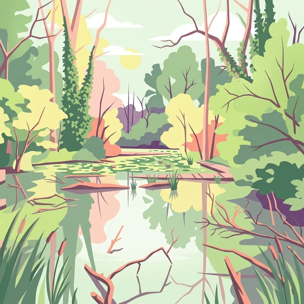
A flat-style digital illustration depicting a calm wetland scene with reflective water, lily pads, reeds, and surrounding forest vegetation under a soft sky.

Marais de Cambrin, Annequin, Cuinchy et Festubert Regional Nature Reserve

Nature reserve

Park overview

Structured park overview, official facts, and landscape profile for Marais de Cambrin, Annequin, Cuinchy et Festubert Regional Nature Reserve

Marais de Cambrin, Annequin, Cuinchy et Festubert Regional Nature Reserve park facts, protected area profile, and essential visitor context

Review the core facts for Marais de Cambrin, Annequin, Cuinchy et Festubert Regional Nature Reserve, including designation, size, terrain, visitor scale, habitats, and operating context in one park-focused overview.

About Marais de Cambrin, Annequin, Cuinchy et Festubert Regional Nature Reserve

The Marais de Cambrin, Annequin, Cuinchy et Festubert Regional Nature Reserve is one of the most important wetland protected areas in the Hauts-de-France region. It safeguards a fragment of the former alluvial marsh that once characterized the floodplain of the river Lys, in the lowlands between Lille and Béthune. Today, the reserve covers a little over 74 hectares spread across four communes in the Pas-de-Calais, with a landscape composition of about one third open water and two thirds damp alluvial woodland, interspersed with peat-rich basins, wet meadows, ponds, and a dense network of drainage ditches.

The reserve's mosaic of aquatic and wetland habitats emerged from a partly artificial, partly relict landscape that was reshaped in modern times by industrial activity, drainage, and changes in water management. A key turning point came when pumping at the Violaines power station halted, allowing water tables to rise and reviving wetland woodland that had been lost for decades. This natural rewetting is what gives the site much of its current character and supports the rich mosaic of open water, marshy woodland, peat-fen remnants, and seasonally flooded grassland seen today.

Ecologically, the reserve functions as a critical refuge for biodiversity in a region dominated by agriculture, industry, and dense settlement. It serves as a major nesting site for wetland birds in the Lys catchment, an important migratory stopover for northern waterfowl, and an exceptionally plant-rich site for its size, including rare fen and bog species that are increasingly scarce inland. Beyond its biodiversity role, the reserve also contributes to flood regulation as a flood expansion zone and helps filter surface waters, particularly reducing nutrient loads that would otherwise accelerate eutrophication downstream. Managed as a nature reserve since 2009, it is also a place for environmental education and quiet public enjoyment nearby residents.

Quick facts and research context for Marais de Cambrin, Annequin, Cuinchy et Festubert Regional Nature Reserve

The regional nature reserve occupies around 74 hectares in the Pas-de-Calais, within the communes of Cambrin, Annequin, Cuinchy, and Festubert, set in the upper alluvial floodplain of the river Lys between Lille and Béthune.

It was initially classified as a regional nature reserve on 25 May 2009 under the name Marais de Cambrin, and expanded to its current 74.15 hectare perimeter on 24 June 2013, gaining its full four-commune name. The reserve is classified under IUCN Category IV and is managed by the Conservatoire d'espaces naturels du Nord et du Pas-de-Calais.

The site lies within the Atlantic biogeographic zone, sits within the Lys river basin water planning framework (SAGE), and forms part of ZNIEFF type I number 46, the larger Marais de Beuvry, Cuinchy et Festubert complex. It also integrates into the regional green and blue corridor network (trame verte et bleue).

Protection and recognition

Documented terrestrial protection history and designation records

Marais de Cambrin, Annequin, Cuinchy et Festubert Regional Nature Reserve Protection Status

Terrestrial protection status for Marais de Cambrin, Annequin, Cuinchy et Festubert Regional Nature Reserve establishes a formal designation baseline from 2009. Official records outline management scope and registry data for the protected area without international recognition sources.

Protection details

Protection scope
Terrestrial
Designated year
2009
Transboundary protection
No
WDPA ID
555514340
Park context

Deeper park guide and search-rich context for Marais de Cambrin, Annequin, Cuinchy et Festubert Regional Nature Reserve

Marais de Cambrin, Annequin, Cuinchy et Festubert Regional Nature Reserve history, landscape, wildlife, and travel context

Explore Marais de Cambrin, Annequin, Cuinchy et Festubert Regional Nature Reserve through its history, landscape character, ecosystems, wildlife, conservation priorities, cultural context, and seasonal travel timing in a structured park guide built for atlas discovery and search intent.

Why Marais de Cambrin, Annequin, Cuinchy et Festubert Regional Nature Reserve stands out

The reserve is particularly renowned for its ornithological richness, providing a major nesting area and migratory stopover in an otherwise heavily human-modified industrial plain. Roughly a third of the reserve consists of open water that supports breeding and wintering waterfowl, while a thriving inland colony of great cormorants adds visible seasonal drama to the landscape. Equally distinctive is its botanical character: the wetland holds 319 recorded vascular plant species, of which 36 carry regional, national, or European heritage status. It preserves fragments of rare alkaline and oligotrophic peat-fen vegetation, especially at the Trou à Baudet site near Festubert, where species such as Schoenus nigricans, Carex viridula, Carex lasiocarpa, Eleocharis quinqueflora, and Utricularia species survive in a setting where such communities are otherwise vanishingly rare inland.
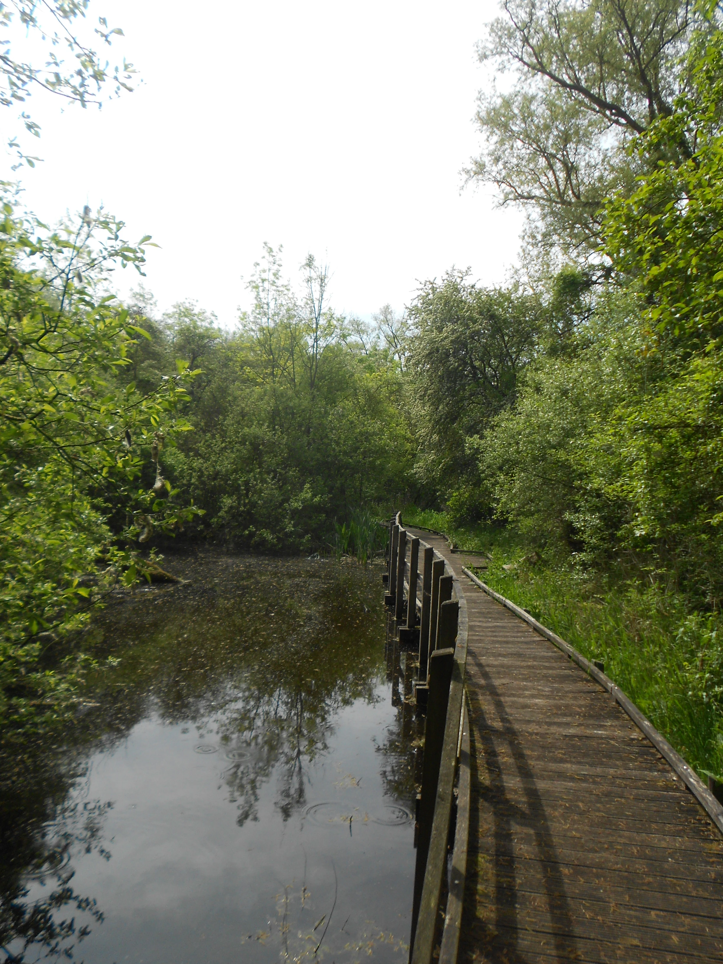
A wooden boardwalk trail with railings follows the edge of a calm, reflective pond surrounded by dense green trees and vegetation.
A wooden boardwalk winding through the lush wetland environment of the Marais de Cambrin reserve.

Marais de Cambrin, Annequin, Cuinchy et Festubert Regional Nature Reserve history and protected-area timeline

The natural heritage value of the wetlands that today make up the reserve has been recognized by naturalists since the 19th century. The marsh complex at Beuvry, Cuinchy, and Festubert was revisited in the 1960s by J.-M. Géhu, J.L. Amiet, and R. Lericq, who documented peat-rich low fens and wet meadows. Later botanical work by B. de Foucault, F. Duhamel, and J.-P. Bernard, conducted within the framework of the Nord-Pas-de-Calais ZNIEFF inventory, rediscovered a base-rich fen community featuring Schoenus nigricans at a locality known as le Malvaux on Festubert territory.

Modern conservation of the site began in October 2002, when the commune of Cambrin and the Conservatoire d'espaces naturels signed a ten-year management agreement covering 21.5 hectares of marshland, ending prior fishing and hunting leases and committing to habitat restoration for the benefit of local wildlife and residents. A formal classification request was submitted to the regional council in October 2006, validated by the regional scientific council in June 2007, and the site was officially designated as a regional nature reserve on 25 May 2009 under the original name Marais de Cambrin.

The reserve expanded rapidly thereafter through strategic land acquisition. In October 2008, the Conservatoire, working through SAFER, purchased 14 hectares of wet meadows in Cuinchy, Annequin, and Cambrin. The Pas-de-Calais departmental council transferred a further 5.62 hectares at Annequin in October 2009, and 6.9 hectares of oligotrophic peat marsh at the Trou à Baudet were pre-empted and acquired in March 2010. The most significant expansion came in December 2010, when 25.7 hectares of the Cuinchy marsh were acquired after enforcement action against the former owner. On 24 June 2013, the regional council formally extended the reserve to its current perimeter and adopted the present name reflecting the four host communes. A dramatic setback occurred on 19 March 2018, when a likely arson attack destroyed the observation facility that had been inaugurated in 2007.

Marais de Cambrin, Annequin, Cuinchy et Festubert Regional Nature Reserve landscape and geographic character

The landscape of the reserve is an unusual, gently broken alluvial plain set deep in the floodplain of the Lys. The terrain is nearly flat, with only minor elevation variation, and the biogeographic setting is firmly Atlantic, producing mild, humid conditions throughout the year. Hydrology dominates the scenery: a central area of open water covers roughly one third of the site, and the rest forms a continuous damp alluvial woodland interspersed with ponds, peat-filled hollows, wet meadows, and a dense network of drainage ditches.

Woodland cover is shaped by classic alluvial tree species, with willows, alders, and ash forming the backbone of the canopy. Between them lie open patches rich in reeds, rushes, sedges, and fen-margin plants including marsh iris, water mint, and marsh thistle. The Trou à Baudet area near Festubert stands out as a particularly distinctive pocket, preserving rare alkaline and nutrient-poor peat-fen vegetation that is highly unusual in such an inland, heavily modified setting.

Throughout the reserve, dead wood lies both standing and fallen, including trees partially or fully submerged in rising waters, lending a strong rewilding character to parts of the site. Footpaths along marshy rides cross the woodland; a relief plan and adapted trails make part of the reserve accessible to visitors with reduced mobility and to the visually impaired. The result is a layered, partially wooded wetland scenery that contrasts sharply with the surrounding intensively farmed and industrialized plain.
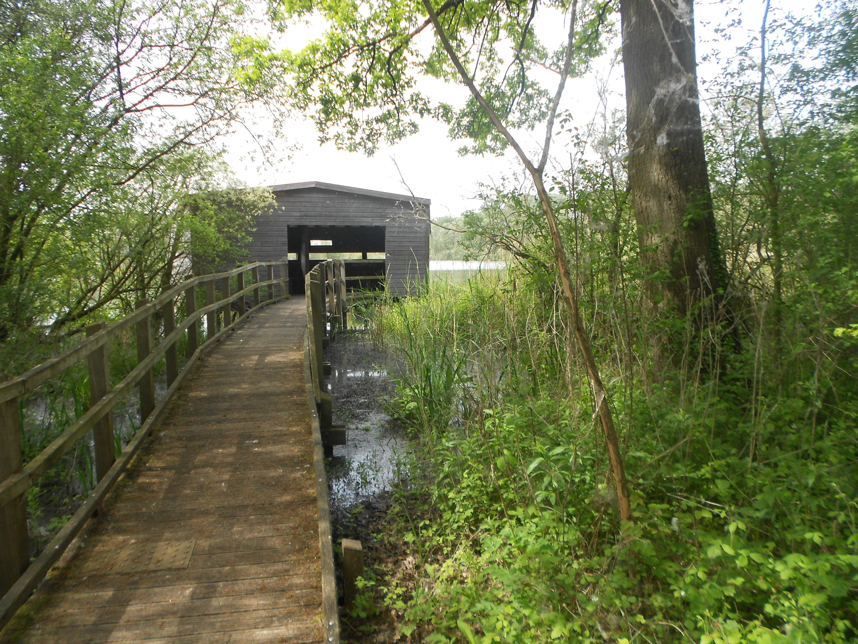
A wooden boardwalk path winds through lush green trees and vegetation leading to a small gray wooden shed built over the water of a marsh.
A wooden boardwalk leads to a small shelter at the edge of the wetlands in the Marais de Cambrin reserve.

Marais de Cambrin, Annequin, Cuinchy et Festubert Regional Nature Reserve ecosystems, habitats, and plant life

Ecologically, the reserve forms a deeply layered, highly diverse wetland mosaic for its modest size. The combination of open water, helophyte belts, peat pools, wet meadows, and damp alluvial woodland produces a wide range of microhabitats supporting different plant and animal communities. The site sits in the Atlantic biogeographic zone, with a lowland alluvial position and very gentle relief, and its water table dynamics have shifted significantly since industrial pumping ceased, allowing formerly drained woodland areas to revert to wet conditions.

The reserve is anchored by a peatland and fen component, particularly visible at Trou à Baudet, where base-rich, nutrient-poor low fens persist. These communities are extremely rare inland in northern France and provide refuge for relict species that have largely disappeared from the regional landscape. Elsewhere, the broader wetland mosaic includes eutrophic reedbeds, wet meadows, willow-alder-ash woodland, and aquatic plant communities around the open water, including species such as water dropwort and brookweed.

In 2013, a comprehensive inventory documented 319 vascular plant species across the enlarged reserve perimeter, of which 36 carry heritage status at regional, national, or European levels. Among these, several fen specialists are particularly noteworthy for their conservation value, including Schoenus nigricans, Carex viridula, Carex lasiocarpa, Eleocharis quinqueflora, and Utricularia australis and U. vulgaris. A separate bryological visit by the Conservatoire botanique national de Bailleul in 2011 recorded 39 bryophyte species, with notable records including Scorpidium scorpioides and Ricciocarpus natans. Annual fungal surveys between 2009 and 2013 found nearly 200 fungal taxa, almost half of which are saprotrophic wood-decay fungi, reflecting the abundance of dead wood in the wetland.
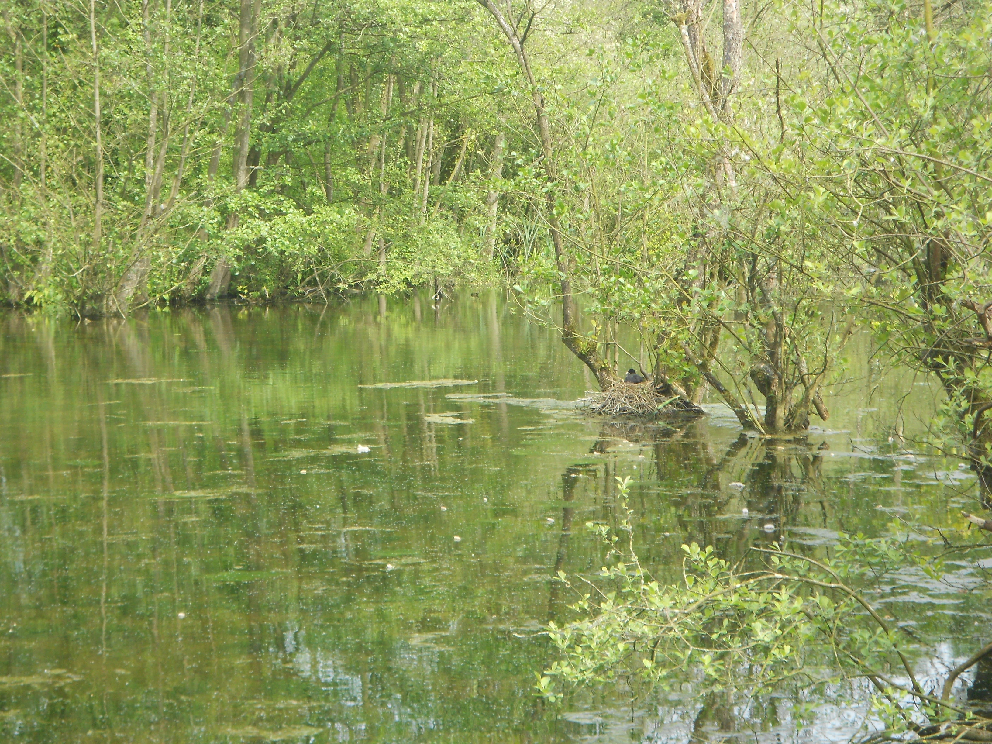
A calm, green-toned marsh with water surface reflecting dense trees and shrubs; a small patch of land or vegetation is visible in the middle of the water.
A serene view of the marshlands and surrounding alluvial woodland in the reserve.

Marais de Cambrin, Annequin, Cuinchy et Festubert Regional Nature Reserve wildlife and species highlights

Wildlife is the most publicly visible aspect of the reserve and was a central reason for its original protection. The site is especially significant for birds: between 2008 and 2013, observers recorded 137 bird species, representing roughly 30 percent of all bird species ever recorded in the Nord-Pas-de-Calais region. Of these, 71 are considered nesting species and 70 are recorded as wintering visitors, supported by a landscape combining open water, rich helophyte belts, wet meadows, and damp woodland.

Nesting waterbirds include Cetti's warbler, mute swan, black-necked grebe, gadwall, northern shoveler, Eurasian teal, common kingfisher, and a notable inland colony of great cormorants that grew from around twenty nests in 2003 to 42 in 2009 before fluctuating to 31 by 2011. Several species of high conservation concern nest on the site, including garganey, gadwall, Eurasian bittern, marsh harrier, snipe, bluethroat, and sedge warbler. During migration, the reserve becomes an important stopover for species such as northern pintail, common pochard, and garganey, reinforcing its role as a stepping stone within the Lys waterway.

The reserve also hosts amphibians and reptiles, with seven amphibian species and two reptiles documented, including the protected great crested newt, a species of European community interest. Invertebrate records are also significant: 13 butterfly species have been observed, including the declining large tortoiseshell, and 13 dragonfly species are present, among them the yellow-winged darter and the red-veined darter. Thirteen mammal species have been observed, including the Daubenton's bat, which hunts over open water and is intrinsically linked to wetland habitats.
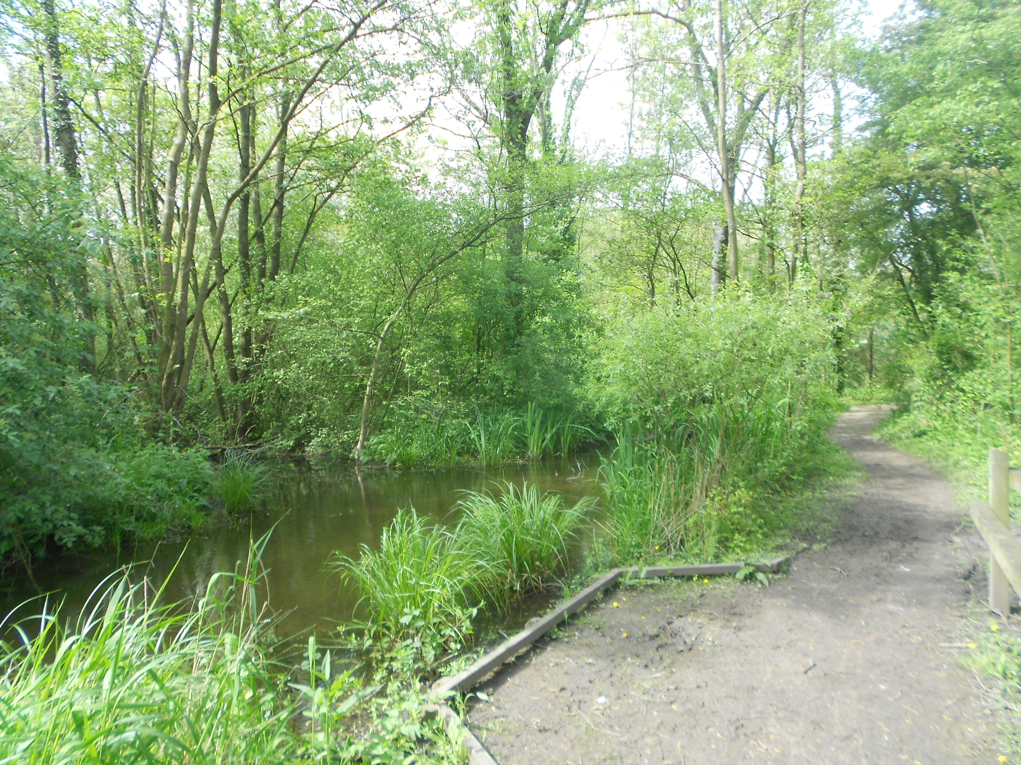
A narrow dirt path runs beside a calm marshy stream, bordered by dense deciduous trees and lush green vegetation.
A dirt trail winds alongside the marshlands of the Marais de Cambrin reserve.

Marais de Cambrin, Annequin, Cuinchy et Festubert Regional Nature Reserve conservation status and protection priorities

The reserve exists to safeguard one of the last significant fragments of the former Lys floodplain marsh system, a habitat that has almost entirely disappeared from the surrounding densely populated and industrialized plain. Its biological importance goes well beyond a simple list of species: the site preserves relict peat-fen vegetation, particularly at the Trou à Baudet area, that is genuinely rare inland in northern France and acts as a refuge for characteristic fen flora and dependent fauna.

The site's conservation value is reinforced by its integration into multiple planning frameworks. It lies within ZNIEFF type I number 46 (the Marais de Beuvry, Cuinchy et Festubert complex), is recognized as a remarkable wetland zone within the SAGE of the Lys watershed, and is part of the regional green and blue ecological network. Management is led by the Conservatoire d'espaces naturels du Nord et du Pas-de-Calais, which has progressively assembled the land base from 21.5 hectares at the outset to the full 74 hectare perimeter through successive acquisitions between 2008 and 2013.

Functional ecological services are also part of the reserve's conservation role. As a flood expansion zone, it helps attenuate flood peaks downstream and mitigates the effects of summer droughts. The wetland also contributes to the natural filtration of surface waters, reducing nutrient pollution that would otherwise accelerate eutrophication in downstream and coastal environments. The principal ongoing threats are diffuse nutrient enrichment from agriculture across the catchment and pesticide contamination carried by water and rainfall, alongside risks linked to invasive alien species such as the red-eared slider turtle, which is established in the larger ponds.

Marais de Cambrin, Annequin, Cuinchy et Festubert Regional Nature Reserve cultural meaning and human context

The reserve is embedded in a landscape with a long history of human interaction with water. The marshland itself has been shaped by centuries of drainage, farming, and more recent industrial changes, including the alterations in water table that followed the closure of pumping at the Violaines power station. Its rewetting is presented locally as a story of partial ecological recovery within an otherwise intensively modified plain, and the reserve's establishment in 2002 began in part as an effort to reconnect local residents with their immediate natural environment.

The wetland complex at Beuvry, Cuinchy, and Festubert first entered the scientific record in the 19th century, and was revisited by generations of regional botanists and naturalists in the mid-20th century. This long natural-history tradition is reflected in the dense network of volunteer observers who contribute to the reserve's records today, particularly members of the Association des Naturalistes de la Gohelle and the Groupe Ornithologique et Naturaliste du Nord de la France, whose systematic work gives the site an unusually detailed scientific footprint for its size.
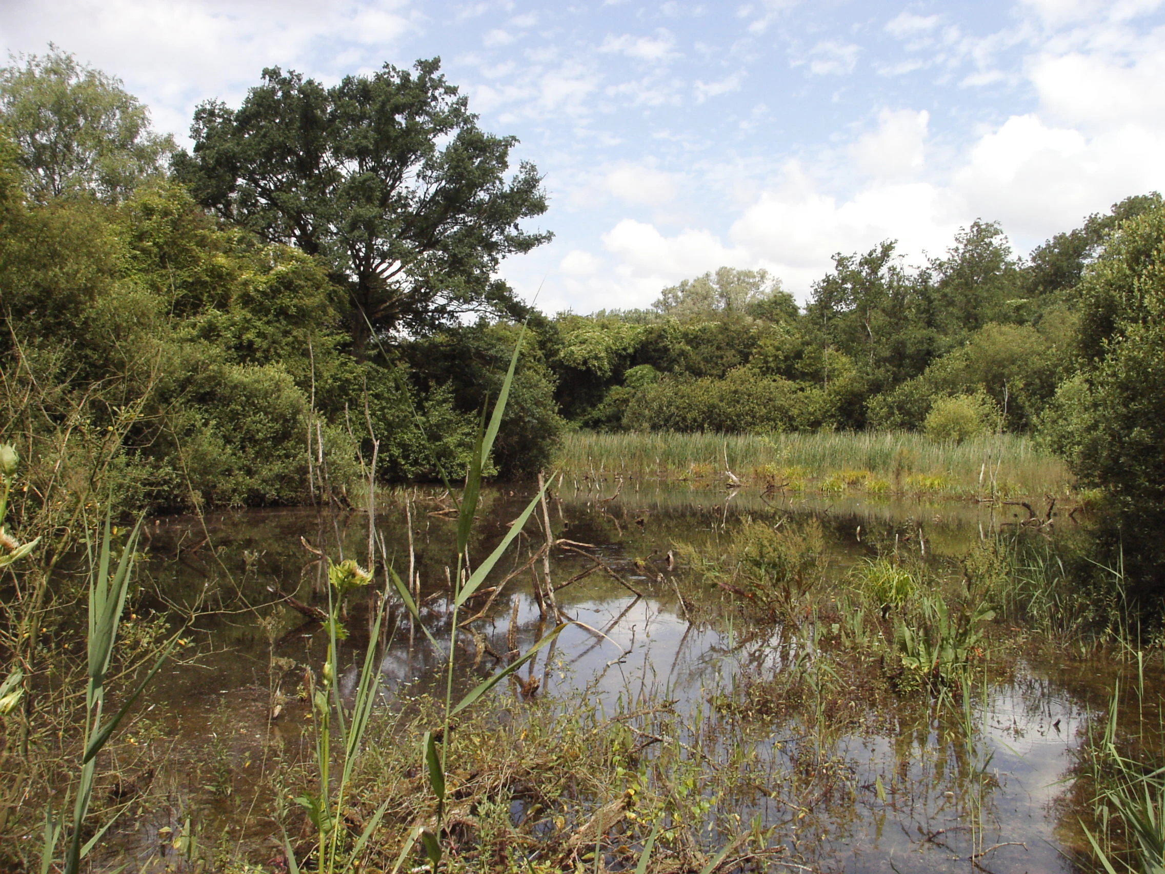
A calm, shallow pond surrounded by dense green marshland and trees under a cloudy sky.
A view of the wetland habitat within the Marais de Cambrin, Annequin, Cuinchy et Festubert Regional Nature Reserve.

Top sights and standout views in Marais de Cambrin, Annequin, Cuinchy et Festubert Regional Nature Reserve

The reserve's strongest identities converge in three areas. First, an unusually complete wetland mosaic for northern France, combining open water, reedbeds, peat fen, wet meadows, and damp alluvial woodland in a single compact site. Second, an exceptional bird assemblage for a lowland inland reserve, including nesting waterfowl, herons, and one of the more important inland great cormorant colonies in the region, with strong migratory use during seasonal passages. Third, a relict botanical heritage that preserves rare inland low-fen and oligotrophic peat vegetation, including nationally and regionally protected fen specialists.
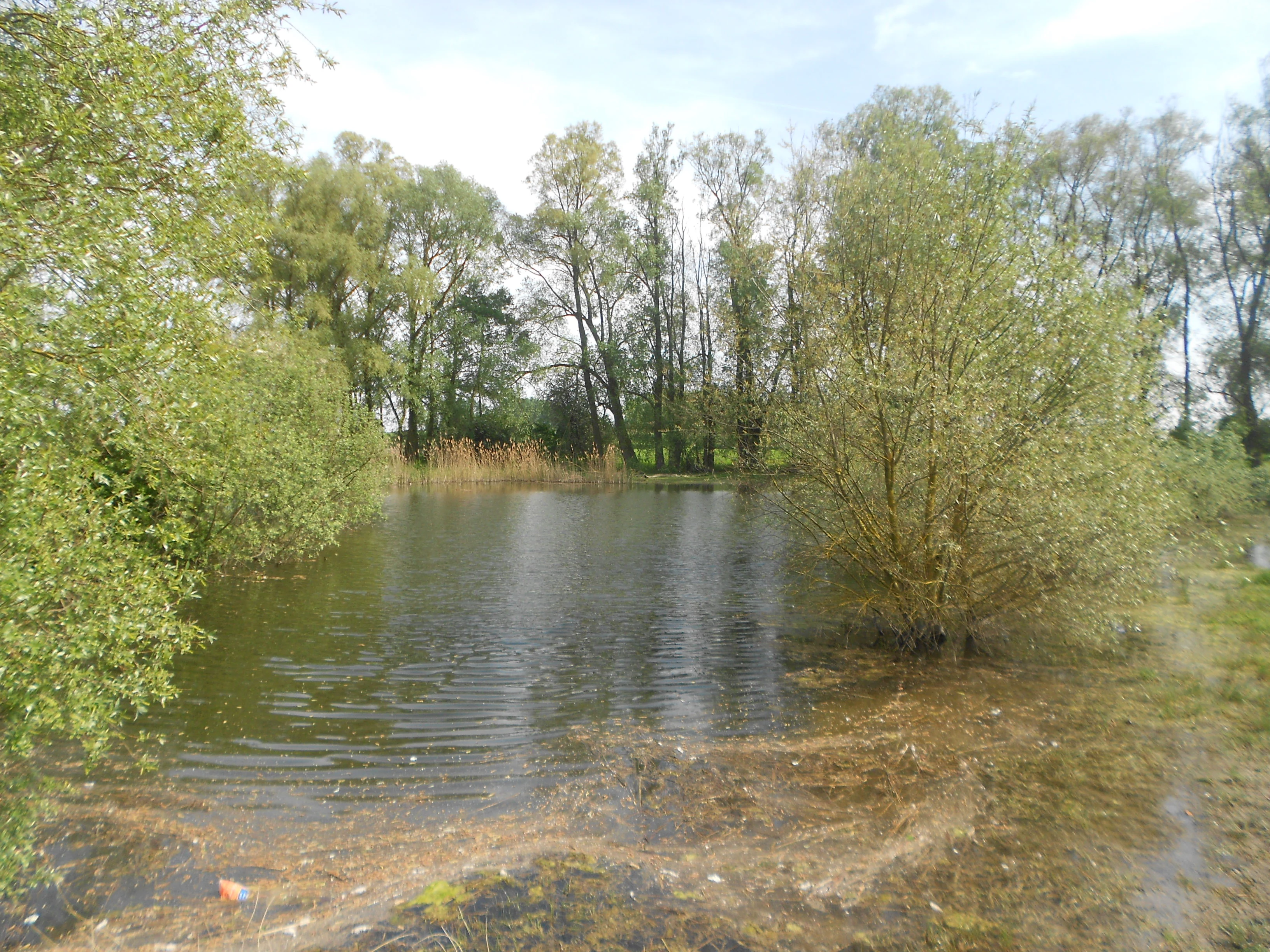
A calm, small pond surrounded by lush green trees and marshy bank vegetation in a natural setting.
A view of the wetland and marshy vegetation at the Marais de Cambrin, Annequin, Cuinchy et Festubert Regional Nature Reserve.

Best time to visit Marais de Cambrin, Annequin, Cuinchy et Festubert Regional Nature Reserve

Seasonal character in the reserve is shaped largely by water levels, vegetation cycles, and bird activity. Spring and early summer are typically the most rewarding for visitors interested in the breeding wetland bird community, when open water species such as swans, grebes, and ducks are active on the central water bodies and woodland edges come alive with warblers, kingfishers, and marshland passerines. Vegetation is also at its most visually lush at this time, with reeds, sedges, and flowering marsh plants in full growth.

Autumn brings strong migratory interest, particularly for waterfowl using the site as a stopover within the Lys valley. Winter reveals the highest numbers of overwintering birds and offers the quietest atmosphere for walking the adapted trails, while summer can be a good period for observing dragonflies and butterflies around the ponds and woodland rides. Visitors should generally plan around the wet, low-lying nature of the site; seasons of high water can make some sections of marsh impassable, and access to part of the reserve is limited to protect wildlife and to keep disturbance low.
Monthly climate preview

Long-term temperature and precipitation patterns derived from representative coordinate measurements

Marais de Cambrin, Annequin, Cuinchy et Festubert Regional Nature Reserve Climate and Weather Normals

Representative coordinate data records measured annual temperature ranges alongside steady monthly precipitation averages for Marais de Cambrin, Annequin, Cuinchy et Festubert Regional Nature Reserve. Detailed twelve-month records provide a complete statistical baseline for evaluating long-term environmental rhythms across the protected area.
Annual mean10 °C
3 °C18 °C
Jan
Feb
Mar
Apr
May13°
Jun15°
Jul18°
Aug17°
Sep15°
Oct11°
Nov
Dec
Warmest month
July

17.5 °C

Coolest month
January

3.1 °C

Wettest month
November

2.6 mm/day

Driest month
April

1.5 mm/day

Park location guide

Geography guide, regional context, and park location map for Marais de Cambrin, Annequin, Cuinchy et Festubert Regional Nature Reserve

Marais de Cambrin, Annequin, Cuinchy et Festubert Regional Nature Reserve park geography, regions, and map view in France

Understand where Marais de Cambrin, Annequin, Cuinchy et Festubert Regional Nature Reserve sits in France through a broader geographic reading of the surrounding landscape, nearby location context, and its mapped position within the national park landscape.

How Marais de Cambrin, Annequin, Cuinchy et Festubert Regional Nature Reserve fits into France

France is a unitary semi-presidential republic and one of the world's largest economies. It borders Belgium, Luxembourg, Germany, Switzerland, Italy, Monaco, Andorra, and Spain, with a maritime border to the United Kingdom. The country is known for its cultural influence, art, cuisine, and political history spanning centuries.

Wider geography shaping Marais de Cambrin, Annequin, Cuinchy et Festubert Regional Nature Reserve in France

France is located in Western Europe. Metropolitan France extends from the Rhine to the Atlantic Ocean and from the Mediterranean Sea to the English Channel and North Sea. The country borders Belgium, Luxembourg, Germany, Switzerland, Italy, Monaco, Andorra, Spain, and has a maritime border with the United Kingdom.

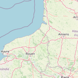
Map view of Marais de Cambrin, Annequin, Cuinchy et Festubert Regional Nature Reserve

Use this park location map to pinpoint Marais de Cambrin, Annequin, Cuinchy et Festubert Regional Nature Reserve in France, understand its exact geographic position, and read its mapped placement within the surrounding landscape more clearly.

Pigeon | © OpenStreetMap contributors

Location context for Marais de Cambrin, Annequin, Cuinchy et Festubert Regional Nature Reserve

Pas-de-Calais
Recorded earthquake history

Browse the Historical Earthquake Catalogue for this Regional Nature Reserve

Examine the historical record of seismic activity linked by proximity to the Marais de Cambrin, Annequin, Cuinchy et Festubert Regional Nature Reserve. MoriAtlas provides this data as an archival resource for understanding local geography and historical seismic events within the Pas-de-Calais department.

Marais de Cambrin, Annequin, Cuinchy et Festubert Earthquake History

Catalogued events

1 event

Strongest magnitude

Magnitude 3.1

Most recent event

Feb 27, 2005

This history includes earthquakes recorded inside the park or within 50 km of its borders

Photographic documentation of alluvial wetlands, peat-fen vegetation, and protected lowland scenery

Visual Exploration and Landscape Photography of Marais de Cambrin, Annequin, Cuinchy et Festubert Regional Nature Reserve

Visual records reveal the diverse terrain and ecological composition of Marais de Cambrin, Annequin, Cuinchy et Festubert Regional Nature Reserve across open water, reedbeds, and damp alluvial woodland. Detailed photography highlights the protected landscape features and rare wetland habitats preserved within the northern French floodplain.

A wooden boardwalk trail with railings follows the edge of a calm, reflective pond surrounded by dense green trees and vegetation.

A wooden observation deck with railings extending into a lush green wetland area with reeds and trees.

A wooden boardwalk path winds through lush green trees and vegetation leading to a small gray wooden shed built over the water of a marsh.

A calm, green-toned marsh with water surface reflecting dense trees and shrubs; a small patch of land or vegetation is visible in the middle of the water.

A narrow dirt path runs beside a calm marshy stream, bordered by dense deciduous trees and lush green vegetation.

A wide view of a marshy pond surrounded by dense green deciduous trees and shrubs, with some driftwood visible in the water.

A calm, shallow pond surrounded by dense green marshland and trees under a cloudy sky.

A calm, small pond surrounded by lush green trees and marshy bank vegetation in a natural setting.

A calm, still wetland area filled with water and fallen logs, surrounded by dense green trees and vegetation.

A calm, reflective pond surrounded by dense green trees and foliage in a wetland environment, with a partial wooden railing in the foreground.

A wide, eye-level view of a calm, reflective pond surrounded by lush green grasses, reeds, and deciduous trees under an overcast sky.

A calm, algae-covered pond surrounded by dense green trees and marsh vegetation in a protected nature area.

A wooden information sign stands on the left side of a dirt trail, with a wooden gate structure visible in the background leading into a lush, green forest.

A small pond surrounded by dense green vegetation, tall grasses, and trees in a woodland setting.

A calm, still wetland pond surrounded by dense green marshy trees and bushes, with some white blossoms visible on a branch in the left foreground.

A wetland scene with fallen tree trunks partially submerged in shallow water, surrounded by lush green foliage and trees in a forest setting.

Park atlas

Explore surrounding regional protected areas and connected wetland landscapes

Parks Near Marais de Cambrin, Annequin, Cuinchy et Festubert Regional Nature Reserve

Discover related protected areas near Marais de Cambrin, Annequin, Cuinchy et Festubert Regional Nature Reserve to compare regional wetland habitats and alluvial floodplains. Expanding the search across nearby protected landscapes provides broader context on northern France conservation zones.
A soft watercolor painting showing a panoramic landscape with light green trees and low hills in the background, set against a pale, washed-out sky.
Nature reserveHauts-de-France
About 15 km away#1 closest

North

Réserve naturelle régionale des prés du Moulin Madame: Regional Protected Meadow Map

Riverine floodplain landscapes in the Hauts-de-France region

The Réserve naturelle régionale des prés du Moulin Madame protects an 8.52 hectare corridor along the Lys river. This site highlights the preservation of traditional flood meadows that are increasingly rare in northern France. Users can examine the park boundaries, understand the flat lowland terrain, and trace the riverine geography that defines this unique protected cultural landscape.

Area
0.085 km²
Established
2015
IUCN
IV
Nature reserveHauts-de-France
About 27 km away#2 closest

Southeast

Réserve naturelle régionale du marais de Wagnonville: Protected Wetland and Bog Geography

A resilient marshland ecosystem in the Douai urban landscape.

This reserve provides a comprehensive look at the surviving wetlands of the Escrebieux valley. Covering 20 hectares, the area hosts a dense variety of habitats from open ponds to rare sphagnum peat bogs, marking an essential node of biodiversity and ecological restoration within the northern French administrative landscape.

Area
0.2 km²
Established
1994
IUCN
IV
Relief
Lowland
Nature reserveHauts-de-France
About 28 km away#3 closest

Southeast

Réserve naturelle régionale des Annelles, Lains et Pont Pinnet: Protected Landscape Geography

A unique biodiversity refuge in the Hauts-de-France region of France.

The Réserve naturelle régionale des Annelles, Lains et Pont Pinnet showcases a dense patchwork of 26 natural habitats across a 14-hectare expanse. Its mapped boundaries reveal a mosaic of wet marshes, coal-shale terrils, and peat-forming ecosystems that support a significant variety of amphibians, dragonflies, and metallophyte flora. This protected area offers a clear look at how industrial landscapes can transition into essential botanical refuges within the northern French coal basin.

Area
0.146 km²
Established
2010
IUCN
IV
Relief
Lowland
Protected areaNord
29 km away#4 closest

East

Vallées de la Scarpe et de l'Escaut Protected Landscape Geography and Map Context

Wetland mosaic, subsidence lakes, and river floodplains in Nord

Examine the physical geography of the Scarpe and Escaut Valleys, a premier wetland site in northern France. The protected area features a mosaic of marshes, wet meadows, and mining-subsidence lakes that provide vital habitats for migratory waterbirds and support carbon storage through rare alkaline peatlands.

Area
276.22 km²
Established
2020
Relief
Lowland
Scope
Terrestrial
Nature reserveHauts-de-France
32 km away#5 closest

Northwest

Réserve naturelle régionale du plateau des landes: Regional Nature Reserve Landscape Profile

Protected heathland geography in the Pas-de-Calais corridor.

Understand the ecological structure of the Réserve naturelle régionale du plateau des landes. This protected area features a unique crescent shape and mosaic of heathland sectors spread across several communes, offering a focused study of low-elevation inland conservation management in the heart of northern France.

Area
1.811 km²
Established
2009
IUCN
IV
A watercolor illustration of a natural reserve landscape featuring foreground shrubs and grasses with a distant treeline, set against a plain white background.
Nature reserveHauts-de-France
33 km away#6 closest

Northeast

Réserve naturelle régionale du Héron: Wetland and Birding Landscape in Hauts-de-France

Periurban protected area near Lille.

Located in the Hauts-de-France region, Réserve naturelle régionale du Héron serves as an important ornithological site centered on the Lac du Héron. The protected boundaries encompass a diverse terrain of wetlands, reed-fringed margins, and woodland that support significant migratory avian populations within an urban-adjacent setting.

Area
0.732 km²
Established
2012
IUCN
IV
Relief
Lowland
A panoramic watercolor painting showing a winding river in a green meadow, with a line of trees on the right and purple mountains in the background.
Nature reserveHauts-de-France
About 38 km away#7 closest

East

Réserve naturelle régionale de la tourbière de Vred: Protected Peatbog and Wetland Map

Geographic landscape in the Hauts-de-France alluvial plain

Vred Peatbog is an ecologically significant protected site in northern France, known for its floating sphagnum-bearing peat formation. The reserve contains a mosaic of managed drainage channels, reedbeds, and woodlands that provide a critical sanctuary for wetland species within the Scarpe valley landscape. This mapping data provides a detailed look at the site's unique alluvial basin and regional conservation status.

Area
0.41 km²
Established
2008
IUCN
IV
Relief
Lowland
Watercolor painting of a soft, hazy landscape featuring low hills in the background and marshy wetlands in the foreground with pastel shades of green, yellow, and soft pink.
Nature reserveHauts-de-France
About 38 km away#8 closest

East

Réserve naturelle régionale du pré des Nonnettes: Regional Nature Reserve and Wetland Atlas

Alluvial marshland and hay meadow terrain in the Hauts-de-France

The Réserve naturelle régionale du pré des Nonnettes preserves a rare wet hay meadow habitat within the Marais du Vivier. Located in the lower Scarpe river valley, this nature reserve integrates marshy ground, ponds, and riparian woods to support a concentrated mosaic of wetland biodiversity. MoriAtlas provides detailed geographic context for this protected site and its significance within the larger Hauts-de-France wetland conservation network.

Area
0.173 km²
Established
2008
IUCN
IV
Relief
Lowland

Common questions about visiting, size, designation, and location context for Marais de Cambrin, Annequin, Cuinchy et Festubert Regional Nature Reserve

Marais de Cambrin, Annequin, Cuinchy et Festubert Regional Nature Reserve FAQs for park facts, access, geography, and protected area context

Find quick answers about Marais de Cambrin, Annequin, Cuinchy et Festubert Regional Nature Reserve, including protected-area facts, park geography, trail and visitor context, and how the park fits into its surrounding country and regional landscape.
MoriAtlas Explorer

Continue Your Protected Areas Search Across the Global Atlas

Deepen your exploration by continuing the structured search for national parks and protected areas worldwide. Utilize the comprehensive filtering capabilities to compare different conservation landscapes and refine your understanding of global park geography. Discover more about the distribution and characteristics of protected natural areas.

Global natural geography