Mori Atlas logo
Nature reserveRéserve naturelle régionale du plateau des landes

Mapping the consolidated heathland landscapes and protected corridors of the Pas-de-Calais department.

Réserve naturelle régionale du plateau des landes: A Regional Nature Reserve in Hauts-de-France

The Réserve naturelle régionale du plateau des landes consists of a crescent-shaped protected landscape covering 181 hectares across the Pas-de-Calais department. This site manages fragmented heathland habitats through coordinated regional conservation efforts, creating a significant ecological corridor within the wider agricultural terrain of the Aa valley. By consolidating multiple voluntary reserves into a single management unit, it maintains rare lowland habitat continuity in northern France.

regional nature reserveheathlandlowlandPas-de-CalaisHauts-de-Francenorthern France

Réserve naturelle régionale du plateau des landes

Nature reserve

Park overview

Structured park overview, official facts, and landscape profile for Plateau des Landes Regional Nature Reserve

Plateau des Landes Regional Nature Reserve park facts, protected area profile, and essential visitor context

Review the core facts for Plateau des Landes Regional Nature Reserve, including designation, size, terrain, visitor scale, habitats, and operating context in one park-focused overview.

About Plateau des Landes Regional Nature Reserve

The Plateau des Landes Regional Nature Reserve is a regionally protected nature area in the Pas-de-Calais, in the northern part of France. It sits on a low plateau south of Saint-Omer, where the landscape is shaped by gentle elevations, agricultural surroundings, and patches of open habitat that contrast with the surrounding farmland. The reserve was created to preserve what remained of the heathland and related ecological communities along this part of the Aa valley corridor, which had been heavily affected by infrastructure development.

The reserve covers around 181 hectares and stretches across a long, narrow crescent of land about ten kilometers in length and generally one to two kilometers wide. Its territory is split into five ecological sectors that fall within four different communes, namely Blendecques, Helfaut, Heuringhem, and Racquinghem. The site sits at a modest average elevation of around seventy meters, giving it a soft, undulating character rather than dramatic topography, yet the fragmented nature of the land made coordinated conservation planning essential.

The reserve was originally assembled from a set of voluntary nature reserves, each of which had been created earlier as compensatory areas linked to the construction of the new road through the Aa valley, referred to in French as the VNVA, or Voie Nouvelle de la Vallée de l'Aa. When the Regional Council formally established the current reserve on 9 November 2009, it merged four predecessor reserves into a single, unified conservation framework, providing a more coherent management strategy and a clearer institutional identity for the site.

The reserve is managed by EDEN 62, a public syndicate responsible for sensitive natural spaces across the Pas-de-Calais. Under the IUCN classification system, it falls within Category IV as an area devoted to habitat and species management. Although it is small compared to major national parks or large regional nature reserves in other parts of France, it plays a measurable role in regional biodiversity by maintaining habitat continuity in a lowland agricultural setting where heathland fragments would otherwise be vulnerable to further loss or degradation.

Quick facts and research context for Plateau des Landes Regional Nature Reserve

Located in the Pas-de-Calais within the Hauts-de-France region of northern France, the Plateau des Landes Regional Nature Reserve lies just south of the town of Saint-Omer and covers approximately 181 hectares of low plateau terrain. The reserve is classified as a regional nature reserve, the French designation that falls under IUCN Category IV as an area managed primarily for the protection of habitats and species. It was formally established by a deliberation of the Regional Council on 9 November 2009, and today it combines four earlier voluntary nature reserves that had been created along the corridor affected by the construction of the Aa valley road. Day-to-day management is carried out by the Syndicat Mixte EDEN 62, the public body in charge of sensitive natural sites across the department.

Protection and recognition

Examine the verified protection status, management records, and dataset identifiers for this protected area.

Protection Status and International Recognition for Réserve naturelle régionale du plateau des landes

Examine the verified protection records, designation data, and international database identifiers associated with Réserve naturelle régionale du plateau des landes. Review the structured conservation status, management scope, and official records maintained within the global protected area registry.

Protection details

WDPA ID
555514392
Park context

Deeper park guide and search-rich context for Plateau des Landes Regional Nature Reserve

Plateau des Landes Regional Nature Reserve history, landscape, wildlife, and travel context

Explore Plateau des Landes Regional Nature Reserve through its history, landscape character, ecosystems, wildlife, conservation priorities, cultural context, and seasonal travel timing in a structured park guide built for atlas discovery and search intent.

Why Plateau des Landes Regional Nature Reserve stands out

The reserve is best known for protecting and restoring dry heathland habitat in a low-elevation inland area of northern France. It is a rare example in the Hauts-de-France region of an effort to merge multiple small voluntary reserves into a single coordinated conservation area, and it represents the kind of compensatory land management that grew out of French road infrastructure planning in the late twentieth century.

Plateau des Landes Regional Nature Reserve history and protected-area timeline

The history of the Plateau des Landes Regional Nature Reserve is closely tied to road construction in the Aa valley. When the new road through the valley, the Voie Nouvelle de la Vallée de l'Aa, was planned and built, French environmental law required that compensating natural areas be set aside to offset the project's impact. In response, several voluntary nature reserves were created along the affected corridor, managed cooperatively with local landowners and stakeholders.

There were four such voluntary reserves in total, covering different parts of what would eventually become the Plateau des Landes reserve. These included the Landes de Blendecques reserve, the Landes d'Heuringhem reserve, the Landes d'Helfaut reserve, and the Landes de Racquinghem reserve. Each was modest in size but contributed ecological value to the broader landscape.

Over time, the patchwork of small reserves proved difficult to manage as a coherent whole. On 9 November 2009, the Regional Council adopted a deliberation that created the Plateau des Landes Regional Nature Reserve as a single, unified entity. The new reserve inherited the four predecessor voluntary reserves and absorbed them into a combined management framework under the Syndicat Mixte EDEN 62, the body now responsible for the site's everyday administration and long-term conservation planning.

Plateau des Landes Regional Nature Reserve landscape and geographic character

The landscape of the Plateau des Landes reserve is shaped by the soft contours of a low inland plateau in northern France. Elevations across the site average around seventy meters, giving the terrain a gentle and undulating character rather than a dramatic one. The land stretches in a narrow crescent approximately ten kilometers long and one to two kilometers wide, producing a fragmented mosaic of habitat patches set against broader agricultural surroundings.

The reserve is divided into five distinct sectors spread across the communities of Blendecques, Helfaut, Heuringhem, and Racquinghem. These sectors are not contiguous in every case, which gives the site a patchwork structure typical of lowland conservation areas assembled from previously separate reserves. The visual character combines open heathland expanses with wooded transitions and field edges, all set within a wider farming landscape shaped by long-standing human land use along the Aa valley corridor.

Top sights and standout views in Plateau des Landes Regional Nature Reserve

The Plateau des Landes reserve is notable for several reasons. It preserves an unusually consolidated block of lowland heathland habitat in a heavily farmed region of northern France. It also represents a distinctive example of French voluntary-to-regional reserve consolidation, having emerged from four separate compensatory reserves linked to road infrastructure in the Aa valley. Its management by EDEN 62, a dedicated department-wide body for sensitive natural sites, adds institutional coherence to what had once been a fragmented set of small protected areas.
Monthly climate preview

Long-term monthly temperature averages and precipitation patterns at a representative park coordinate

Climate Normals and Temperature Rhythms for Réserve naturelle régionale du plateau des landes

Representative coordinate records show measured monthly temperature variations alongside steady precipitation rates across the annual cycle for Réserve naturelle régionale du plateau des landes. Detailed monthly comparisons provide complete long-term climate normals for the protected area without relying on live weather forecasts.
Annual mean10 °C
3 °C18 °C
Jan
Feb
Mar
Apr
May13°
Jun15°
Jul18°
Aug17°
Sep15°
Oct11°
Nov
Dec
Warmest month
July

17.5 °C

Coolest month
January

3.1 °C

Wettest month
November

2.6 mm/day

Driest month
April

1.5 mm/day

Park location guide

Geography guide, regional context, and park location map for Plateau des Landes Regional Nature Reserve

Plateau des Landes Regional Nature Reserve park geography, regions, and map view in France

Understand where Plateau des Landes Regional Nature Reserve sits in France through a broader geographic reading of the surrounding landscape, nearby location context, and its mapped position within the national park landscape.

How Plateau des Landes Regional Nature Reserve fits into France

France is a unitary semi-presidential republic and one of the world's largest economies. It borders Belgium, Luxembourg, Germany, Switzerland, Italy, Monaco, Andorra, and Spain, with a maritime border to the United Kingdom. The country is known for its cultural influence, art, cuisine, and political history spanning centuries.

Wider geography shaping Plateau des Landes Regional Nature Reserve in France

France is located in Western Europe. Metropolitan France extends from the Rhine to the Atlantic Ocean and from the Mediterranean Sea to the English Channel and North Sea. The country borders Belgium, Luxembourg, Germany, Switzerland, Italy, Monaco, Andorra, Spain, and has a maritime border with the United Kingdom.

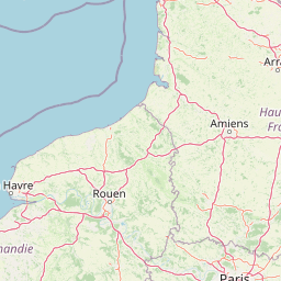
Map view of Plateau des Landes Regional Nature Reserve

Use this park location map to pinpoint Plateau des Landes Regional Nature Reserve in France, understand its exact geographic position, and read its mapped placement within the surrounding landscape more clearly.

Pigeon | © OpenStreetMap contributors

Location context for Plateau des Landes Regional Nature Reserve

Hauts-de-France
Recorded earthquake history

Explore Historical Earthquake Records for Réserve naturelle régionale du plateau des landes

Examine the historical catalogue of recorded seismic events surrounding Réserve naturelle régionale du plateau des landes. Review event dates and epicentre proximity details to gain insight into the regional seismic history of this protected area, as documented in available geographic datasets.

Earthquake History Records

Catalogued events

4 events

Strongest magnitude

Magnitude 4

Most recent event

Jan 27, 1992

This history includes earthquakes recorded inside the park or within 50 km of its borders

Park atlas

Compare adjacent lowland conservation landscapes and regional reserves in northern France

Parks Near Réserve naturelle régionale du plateau des landes and Surrounding Protected Areas

Browse protected areas and regional reserves located near Réserve naturelle régionale du plateau des landes. Comparing these nearby lowland habitats provides broader context on northern French conservation corridors and fragmented heathland ecosystems.
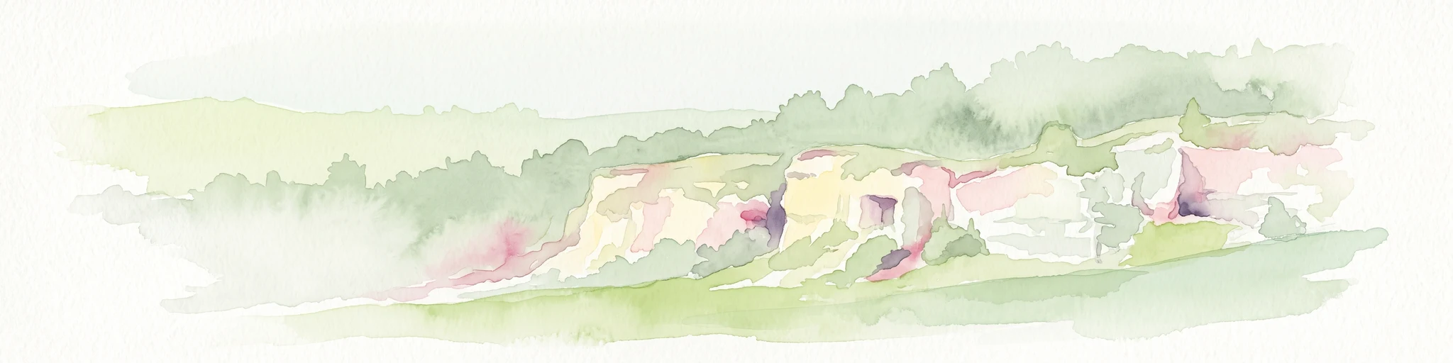
A soft watercolor painting of a grassy landscape with exposed limestone rock faces and green vegetation.
Nature reserveHauts-de-France
About 7.1 km away#1 closest

Southwest

Réserve naturelle régionale des anciennes carrières de Cléty: Protected Geological Landscape

Regional nature reserve in the Hauts-de-France, France

A significant geological protected area in the Pas-de-Calais, this reserve features an exposed chalk quarry face that serves as a stratigraphic record for the Cretaceous period. The landscape hosts a rare intersection of geological heritage and diverse ecosystems, including orchids, butterflies, and bat colonies, within a compact footprint.

Area
0.02 km²
Established
2011
IUCN
IV
A soft watercolor painting of a green meadow, featuring gentle hills in the distance, a small stream flowing through the center, and a few scattered trees, all set against a white background.
Nature reserveHauts-de-France
About 9 km away#2 closest

North

Réserve naturelle régionale des prairies du Schoubrouck: Geography and Protected Area Overview

Wet-meadow habitats and historic watergang networks in northern France.

Located in the Hauts-de-France region, Réserve naturelle régionale des prairies du Schoubrouck provides a focused look at the cultural and ecological heritage of Flemish lowland landscapes. This site preserves an essential mosaic of wet grasslands and traditional drainage systems, serving as a key example of habitat-specific conservation stewardship within the rural fabric of the Nord department.

Area
0.102 km²
Established
2012
IUCN
IV
A horizontal watercolor illustration depicting a soft, impressionistic landscape of wetland meadows, grassy patches, and distant trees in pastel shades of green, yellow, and soft purple.
Nature reserveHauts-de-France
About 26 km away#3 closest

Northeast

Réserve naturelle régionale du vallon de la Petite Becque: Protected Area Map and Geography

Flemish Houtland wetland conservation and regional green infrastructure

This protected area in Hauts-de-France functions as a compact, high-value laboratory for habitat restoration within the modernized Flemish countryside. It provides essential sanctuary for relict marsh flora, orchid-rich meadows, and specialized invertebrate communities, effectively acting as an ecological island amidst a vast expanse of intensively cultivated arable farmland.

Area
0.009 km²
Established
2010
IUCN
IV
Relief
Lowland
Nature reserveHauts-de-France
26 km away#4 closest

Northwest

Réserve naturelle régionale de Pont d'Ardres: Mapped Wetland Geography and Protected Lands

A restored industrial landscape in the Hauts-de-France coastal hinterland.

Situated southeast of Calais, this reserve represents a rare success in ecological restoration. The former sugar factory basins now provide vital habitats for shorebirds and nesting species, maintaining an essential wetland presence in an otherwise cultivated landscape of northern France.

Area
0.663 km²
Established
2012
IUCN
IV
Relief
Lowland
A soft watercolor painting showing a panoramic landscape with light green trees and low hills in the background, set against a pale, washed-out sky.
Nature reserveHauts-de-France
About 29 km away#5 closest

East

Réserve naturelle régionale des prés du Moulin Madame: Regional Protected Meadow Map

Riverine floodplain landscapes in the Hauts-de-France region

The Réserve naturelle régionale des prés du Moulin Madame protects an 8.52 hectare corridor along the Lys river. This site highlights the preservation of traditional flood meadows that are increasingly rare in northern France. Users can examine the park boundaries, understand the flat lowland terrain, and trace the riverine geography that defines this unique protected cultural landscape.

Area
0.085 km²
Established
2015
IUCN
IV
Watercolor painting of a marshy wetland landscape featuring rolling hills, green trees, and foreground grasses against a white background.
Nature reservePas-de-Calais
32 km away#6 closest

Southeast

Marais de Cambrin, Annequin, Cuinchy et Festubert Regional Nature Reserve: Protected Wetland Atlas

Alluvial floodplains and biodiversity refuges in Pas-de-Calais

Trace the boundaries and protected features of the Marais de Cambrin, Annequin, Cuinchy et Festubert Regional Nature Reserve. This site preserves an essential mosaic of open water, peat-rich fens, and damp alluvial woods that function as a crucial nesting ground for waterfowl and a repository for rare botanical heritage in northern France.

Area
0.742 km²
Established
2009
IUCN
IV
Relief
Lowland
A watercolor painting of a rolling rural landscape with bare trees, grassy hills, and distant purple and red hills against a pale sky.
Nature reserveHauts-de-France
32 km away#7 closest

West

Réserve naturelle régionale du Molinet: Protected Calcareous Woodlands and Grassland Mosaic

Geographic and Habitat Analysis of a Pas-de-Calais Nature Reserve

Located in the Boulonnais landscape of northern France, this protected area serves as a vital refuge for calcareous flora. The reserve preserves a rare mosaic of limestone woodlands and grasslands, serving a dual role in both ecological conservation and water catchment protection within the Hauts-de-France administrative region.

Area
0.067 km²
Established
1987
IUCN
IV
Relief
Lowland
Nature reserveHauts-de-France
32 km away#8 closest

North

Réserve naturelle régionale de Grande-Synthe: Protected Geography and Regional Mapping

Nature reserve landscapes in the Hauts-de-France coastal plain

Spanning 174 hectares on the edge of the Dunkirk urban zone, this protected area serves as a model for ecological restoration. Examine the patchwork of sandy grasslands, wetlands, and mature hedgerows that define the reserve, and see its position as a link in the regional green and blue ecological corridor of northern France.

Area
1.74 km²
Established
2015
Relief
Lowland
Climate
Temperate

Common questions about visiting, size, designation, and location context for Plateau des Landes Regional Nature Reserve

Plateau des Landes Regional Nature Reserve FAQs for park facts, access, geography, and protected area context

Find quick answers about Plateau des Landes Regional Nature Reserve, including protected-area facts, park geography, trail and visitor context, and how the park fits into its surrounding country and regional landscape.
MoriAtlas Explorer

Continue Your Protected Areas Search Across the Global Atlas

Deepen your exploration by continuing the structured search for national parks and protected areas worldwide. Utilize the comprehensive filtering capabilities to compare different conservation landscapes and refine your understanding of global park geography. Discover more about the distribution and characteristics of protected natural areas.

Global natural geography