Mori Atlas logo
Nature reserveRéserve naturelle régionale de Pont d'Ardres

A regional nature reserve defined by transformed industrial basins and wetland habitats.

Réserve naturelle régionale de Pont d'Ardres: Mapped Protected Landscapes and Geography

The Réserve naturelle régionale de Pont d'Ardres sits in the Pas-de-Calais department of northern France, offering a distinct example of industrial land reclamation. Spanning sixty-six hectares, this protected area features shallow open water, muddy banks, and reed beds that serve as a critical stopover for migratory birds. Its unique structure, split into two sites by a departmental road, provides an essential refuge for waterbirds within the broader Hauts-de-France agricultural plain.

regional nature reservewetlandsartificial basinswaterbirdsmigratory birdsnesting habitat

Réserve naturelle régionale de Pont d'Ardres

Nature reserve

Park overview

Structured park overview, official facts, and landscape profile for Réserve naturelle régionale de Pont d'Ardres

Réserve naturelle régionale de Pont d'Ardres park facts, protected area profile, and essential visitor context

Review the core facts for Réserve naturelle régionale de Pont d'Ardres, including designation, size, terrain, visitor scale, habitats, and operating context in one park-focused overview.

About Réserve naturelle régionale de Pont d'Ardres

The Réserve naturelle régionale de Pont d'Ardres occupies a quietly remarkable place in the network of regional nature reserves of France. Located in the commune of Ardres in the Pas-de-Calais, roughly ten kilometers southeast of Calais, it consists of two distinct sites straddling a departmental road, each corresponding to a former settling basin of the historic Pont d'Ardres sugar factory. What was once a wastewater treatment infrastructure for the beet sugar industry has, over the course of a few decades, evolved into one of the most important artificial wetland sites for waterbirds in northern France.

The reserve's identity is defined by the unusual transformation of an industrial site into a thriving wetland ecosystem. The settling basins, originally used to clarify water carrying the soil washed from sugar beets, were abandoned after the sugar factory closed in 2003. Nature moved in quickly: hygrophilous vegetation colonized the damp margins, invertebrates flourished in the nutrient-rich sediments, and birds discovered an unexpectedly reliable refuge of shallow water in an otherwise intensively cultivated coastal plain. By the time the area was classified as a regional nature reserve in 2012, it had already developed into a site of genuine ornithological importance, both for nesting species and for the seasonal movements of migratory avifauna.

Within the broader Hauts-de-France context, the reserve plays a complementary role to the larger coastal wetland systems of the region. While major estuarine and lagoon habitats dominate the public image of northern French bird conservation, Pont d'Ardres offers a small-scale but remarkably productive substitute for the open, shallow waters that many waders, grebes, and ducks depend on during migration and winter. Its protected status, managed by the Conservatoire d'espaces naturels du Nord et du Pas-de-Calais, secures the long-term future of these basins as both a biodiversity hotspot and a quietly valuable educational and recreational resource.

Quick facts and research context for Réserve naturelle régionale de Pont d'Ardres

The Réserve naturelle régionale de Pont d'Ardres is located in the Pas-de-Calais, in the commune of Ardres near Calais, and lies within the Hauts-de-France region of northern France. It was officially classified as a regional nature reserve on October 15, 2012, for an initial renewable term of thirty years, placing it under France's IUCN Category IV classification as a habitat and species management area.

The reserve is managed by the Conservatoire d'espaces naturels du Nord et du Pas-de-Calais, in joint ownership with the Fédération des chasseurs du Pas-de-Calais. Its territory covers approximately sixty-six hectares spread across two separate former settling basins of the historic Pont d'Ardres sugar factory, and it is recognized for its rich wetland avifauna, including nesting, wintering, and migratory bird species of regional, national, and community-level interest.

Protection and recognition

Documented terrestrial protection scope, management framework, and recognized designation records

Protection Status and International Recognition for Réserve naturelle régionale de Pont d'Ardres

Terrestrial protection status records outline the administrative framework governing Réserve naturelle régionale de Pont d'Ardres within global databases. Formal recognition records establish the baseline conservation scope, management context, and designated boundaries.

Protection details

Protection scope
Terrestrial
Transboundary protection
No
WDPA ID
555559609
Park context

Deeper park guide and search-rich context for Réserve naturelle régionale de Pont d'Ardres

Réserve naturelle régionale de Pont d'Ardres history, landscape, wildlife, and travel context

Explore Réserve naturelle régionale de Pont d'Ardres through its history, landscape character, ecosystems, wildlife, conservation priorities, cultural context, and seasonal travel timing in a structured park guide built for atlas discovery and search intent.

Why Réserve naturelle régionale de Pont d'Ardres stands out

The reserve is best known for its role as a major wetland stopover and nesting site for waterbirds in the Pas-de-Calais, where former sugar factory settling basins have been transformed into open-water habitats with reed beds and muddy shores. It is particularly notable for hosting community-interest species such as the Black-necked Grebe, the Pied Avocet, and the Black-winged Stilt, as well as rare passage migrants including the Little Stint, Wilson's Phalarope, and several other uncommon shorebirds. Its other defining trait is the way industrial heritage has given way to ecological value. The artificial basins created for wastewater treatment have, through natural recolonization, become one of the most important artificial wetland sites for birds in the northern French coastal hinterland, offering an exceptional combination of open water, mudflats, and reedbed habitats in a landscape otherwise dominated by farmland.

Réserve naturelle régionale de Pont d'Ardres history and protected-area timeline

The history of the Pont d'Ardres site is intimately tied to the sugar industry of the Pas-de-Calais. The Pont d'Ardres sugar factory, operated by the Say company (later Béghin-Say), was established and exploited from 1873 onward. In addition to its processing facilities, including a râperie and a drying installation, the factory operated two sets of settling basins totaling roughly sixty-six hectares. These basins were used to treat wastewater loaded primarily with soil residues from the washing of sugar beets, contributing over time to a significant nutrient enrichment of the water bodies.

Even while the factory was still in operation, the basins had already begun to function as an attractive environment for birds, particularly during migration periods. After the factory ceased activity in 2003, the reconversion of the site provided an opportunity to channel this ecological potential into formalized protection. The reserve project was initiated in 2004, and the favorable conditions for wetland species accelerated the natural reclamation of the abandoned basins.

The site was officially designated as a regional nature reserve by deliberation on October 15, 2012, for an initial period of thirty years, renewable thereafter. This classification marked the culmination of a gradual shift from industrial use to ecological sanctuary, and placed the management of the basins under the Conservatoire d'espaces naturels du Nord et du Pas-de-Calais, in cooperation with the Fédération des chasseurs du Pas-de-Calais, which jointly owns the site.

Réserve naturelle régionale de Pont d'Ardres landscape and geographic character

The physical setting of the reserve is shaped decisively by its industrial past. The two former settling basins, one of about thirty-four hectares and the other of about thirty-two hectares, sit on either side of the RD 943 road and together define the reserve's spatial structure. Their surfaces are characterized by shallow open water, soft muddy banks, and broad fringes of reed beds that have developed naturally since the abandonment of the factory.

The terrain is therefore largely flat and water-dominated, without dramatic relief, but visually distinctive through the contrast between open reflective water and the dense, tall vegetation of the peripheral reedbeds. The surrounding landscape of the Pas-de-Calais coastal hinterland is largely agricultural, which makes the wetland complex stand out as a notable interruption in an otherwise cultivated plain. The protection of these artificial yet ecologically rich basins represents the reserve's core landscape value.

Réserve naturelle régionale de Pont d'Ardres ecosystems, habitats, and plant life

Ecologically, the Pont d'Ardres reserve is a textbook example of how human-made habitats can support rich wetland biodiversity when allowed to evolve under appropriate management. The basins, originally enriched through decades of agricultural runoff from sugar beet processing, exhibit mild eutrophication but do not generate pollution that excludes wildlife. Instead, the nutrient-rich sediments have proven highly favorable for invertebrates, which in turn support complex food webs extending to fish, amphibians, and birds.

The vegetation patterns of the site reflect a classic wetland zonation. Open water dominates the centers of the basins, giving way to muddy shorelines and ultimately to dense reedbeds at the periphery. Hygrophilous plant communities established themselves rapidly after the factory's closure, and the reserve now hosts twenty-one distinct plant formations, including four formations considered heritage formations of regional importance, alongside a flora of roughly 187 plant species.

This combination of open water, exposed mud, and emergent vegetation provides a rare local substitute for the shallow coastal wetlands that have largely disappeared from the wider northern French landscape. It is this ecological configuration, more than any specific species, that defines the natural character of the reserve.

Réserve naturelle régionale de Pont d'Ardres wildlife and species highlights

The wildlife of Pont d'Ardres is dominated by birds, for which the reserve has acquired its strong reputation. The fauna inventory records 222 species overall, of which 75 are considered heritage species of conservation concern. The site hosts around 55 breeding bird species that are present on a permanent basis, including six species of community interest such as the Black-necked Grebe, the Pied Avocet, and the Black-winged Stilt, and twelve species that are considered threatened at the regional or national level, including the Bluethroat and the Little Bittern.

Winter brings roughly 50 additional bird species to the reserve, drawn by the relative mildness of the lowland basins and their open water. Migration periods are even more spectacular: passage bird surveys have documented approximately 150 migratory species, an exceptional diversity for such a small wetland site. Among the rarer passage visitors, the reserve has recorded the Little Stint, Wilson's Phalarope, the Spotted Sandpiper, the Marsh Sandpiper, and the White-winged Tern, attesting to its significance for vagrant and scarce waders along the Atlantic flyway.

Beyond birds, the nutrient-rich sediments and reedbeds host abundant invertebrate life, which underpins the site's value for waterbirds and contributes to broader aquatic and semi-aquatic ecosystems. The combination of high invertebrate productivity and a protected mosaic of habitats makes the reserve an important local refuge for wetland fauna.

Réserve naturelle régionale de Pont d'Ardres conservation status and protection priorities

From a conservation perspective, the Pont d'Ardres reserve illustrates the strategic value of protecting artificial wetland habitats in heavily modified agricultural landscapes. Many of the shallow open-water environments historically used by waterbirds in northern France have been drained or converted to other uses, leaving important ecological functions orphaned. By securing these former industrial basins through formal protection, the reserve replaces a vanished habitat type within a working agricultural and coastal hinterland.

The protection framework, established in 2012 for a renewable thirty-year term, places the site in IUCN Category IV, recognizing it as an area dedicated to the management of habitats and species. Management by the Conservatoire d'espaces naturels du Nord et du Pas-de-Calais, jointly with the Fédération des chasseurs du Pas-de-Calais, integrates habitat protection with wildlife-oriented interests and helps anchor the site's long-term conservation trajectory.

The conservation significance of the reserve extends beyond its own boundaries. The presence of community-interest species, several nationally and regionally threatened breeding birds, and a remarkable diversity of passage migrants makes the site a meaningful component of regional and European conservation networks, contributing to the maintenance of migratory bird populations along one of Europe's busiest flyways.

Réserve naturelle régionale de Pont d'Ardres cultural meaning and human context

The cultural context of the reserve is closely woven into the industrial and agricultural history of the Pas-de-Calais. The sugar beet industry shaped the economic and social identity of this part of northern France for more than a century, and the Pont d'Ardres sugar factory, in operation from 1873 to 2003, was a notable part of that story. The reserve's landscape is therefore not only an ecological artifact but also an industrial inheritance, where the physical memory of beet processing lingers in the form of the settling basins themselves.

The transformation of this site from an active industrial facility to a protected natural area reflects a broader pattern of rural and peri-industrial reconversion in Hauts-de-France, where former production sites have gradually been reclaimed for ecological, recreational, and educational purposes. The joint ownership by the Conservatoire d'espaces naturels and a hunting federation also illustrates the integration of conservation with long-standing regional traditions of hunting and land management.

Top sights and standout views in Réserve naturelle régionale de Pont d'Ardres

The Pont d'Ardres reserve stands out for the quality of its artificial wetland habitats, the remarkable diversity of bird species packed into a small area, and the unusual origin of its ecological richness in a decommissioned sugar factory. Its two-site structure, straddling a busy road, gives it a distinctive spatial character and offers contrasting views of open water and reedbeds in close succession.

Equally notable is the site's role in filling a regional gap in shallow-water bird habitat, providing refuge for breeding, wintering, and migratory species in a part of France where such environments have become scarce. The combination of community-interest breeders, regionally threatened species, and rare passage migrants makes it a high-value destination for ornithological interest, while its accessible setting near Ardres gives it educational and recreational relevance for the local population.

Best time to visit Réserve naturelle régionale de Pont d'Ardres

The reserve offers different ornithological and scenic experiences throughout the year. Spring and early summer are particularly rewarding for observing nesting species, including Black-necked Grebes, Pied Avocets, Black-winged Stilts, Bluethroats, and Little Bitterns among the reedbeds and along the muddy margins of the basins. This is also when water levels and vegetation create an attractive wetland atmosphere.

Autumn migration is arguably the most dynamic period, when the reserve records its greatest bird diversity and the chance of unusual passage waders. Winter brings a quieter but still interesting complement of about fifty species, with open water available for waterfowl and other waterbirds. Spring, autumn, and winter therefore each offer distinct reasons to visit, while midsummer can be less productive for passage birds though still pleasant for general wetland observation.
Monthly climate preview

Long-term monthly temperature and precipitation data sampled at a representative park coordinate

Réserve naturelle régionale de Pont d'Ardres Climate Normals and Annual Weather Patterns

Historical climatology records for Réserve naturelle régionale de Pont d'Ardres track measured monthly temperature ranges alongside daily precipitation averages from 1991 to 2020. Examining the complete twelve-month normals dataset reveals detailed long-term environmental trends across the protected area.
Annual mean11 °C
5 °C18 °C
Jan
Feb
Mar
Apr
May12°
Jun15°
Jul17°
Aug18°
Sep16°
Oct13°
Nov
Dec
Warmest month
August

17.6 °C

Coolest month
February

5.3 °C

Wettest month
November

2.9 mm/day

Driest month
April

1.5 mm/day

Park location guide

Geography guide, regional context, and park location map for Réserve naturelle régionale de Pont d'Ardres

Réserve naturelle régionale de Pont d'Ardres park geography, regions, and map view in France

Understand where Réserve naturelle régionale de Pont d'Ardres sits in France through a broader geographic reading of the surrounding landscape, nearby location context, and its mapped position within the national park landscape.

How Réserve naturelle régionale de Pont d'Ardres fits into France

France is a unitary semi-presidential republic and one of the world's largest economies. It borders Belgium, Luxembourg, Germany, Switzerland, Italy, Monaco, Andorra, and Spain, with a maritime border to the United Kingdom. The country is known for its cultural influence, art, cuisine, and political history spanning centuries.

Wider geography shaping Réserve naturelle régionale de Pont d'Ardres in France

France is located in Western Europe. Metropolitan France extends from the Rhine to the Atlantic Ocean and from the Mediterranean Sea to the English Channel and North Sea. The country borders Belgium, Luxembourg, Germany, Switzerland, Italy, Monaco, Andorra, Spain, and has a maritime border with the United Kingdom.

Map view of Réserve naturelle régionale de Pont d'Ardres

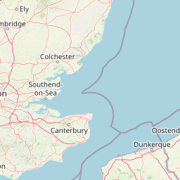
Use this park location map to pinpoint Réserve naturelle régionale de Pont d'Ardres in France, understand its exact geographic position, and read its mapped placement within the surrounding landscape more clearly.

Pigeon | © OpenStreetMap contributors

Location context for Réserve naturelle régionale de Pont d'Ardres

Hauts-de-France
Recorded earthquake history

View Historical Seismic Records for Réserve naturelle régionale de Pont d'Ardres

Explore a documented collection of seismic events recorded in the vicinity of this regional nature reserve. Reviewing these historical data points provides context for the regional geological background surrounding the wetlands of the Pas-de-Calais. Discover historical earthquake metrics through the MoriAtlas seismic catalogue.

Pont d'Ardres Earthquake History

Catalogued events

5 events

Strongest magnitude

Magnitude 4

Most recent event

Nov 25, 1998

This history includes earthquakes recorded inside the park or within 50 km of its borders

Park atlas

Compare adjacent wetland habitats, regional nature reserves, and coastal plain landscapes.

Parks Near Réserve naturelle régionale de Pont d'Ardres and Surrounding Protected Areas

Visitors exploring Réserve naturelle régionale de Pont d'Ardres can discover other protected areas across the surrounding Pas-de-Calais region. Comparing these nearby wetland habitats and coastal refuges provides broader geographic context for northern French conservation landscapes.
A horizontal watercolor painting showing a soft coastal scene with rolling dunes, sparse grasses, and a calm shoreline under a light sky.
Nature reservePas-de-Calais
13 km away#1 closest

Northeast

Réserve naturelle nationale du Platier d'Oye: Protected Coastal Landscape and Wetland Geography

Coastal dunes and migratory bird habitats in Pas-de-Calais

Located along the Opal Coast, the Réserve naturelle nationale du Platier d'Oye represents a complex mosaic of tidal flats, mobile sand dunes, and humid polder meadows. This protected area offers unique insight into the ecological intersection of maritime forces and terrestrial environments, functioning as a primary staging ground for diverse migratory species within the Hauts-de-France coastal region.

Area
3.91 km²
Established
1987
IUCN
IV
Relief
Lowland
Nature reserveHauts-de-France
About 14 km away#2 closest

West

Réserve naturelle régionale de la forteresse de Mimoyecques: Regional Nature Reserve Geography

Protected subterranean habitat and wartime heritage in Hauts-de-France.

Located in the rolling lowlands of the Pas-de-Calais, the Réserve naturelle régionale de la forteresse de Mimoyecques is a uniquely managed protected area. Its landscape integrates historical military architecture with modern biodiversity conservation, focusing on the protection of rare underground roosting environments for diverse bat species within the regional Hauts-de-France terrain.

Area
0.016 km²
Established
2012
Relief
Lowland
Climate
Temperate
A horizontal watercolor painting showing a soft landscape with green vegetation, pink accents, and a winding body of water leading towards distant hills.
Nature reserveFrance
About 18 km away#3 closest

West

Réserve naturelle régionale du mont de Couple: Protected Chalk Escarpment and Coastal Viewpoint

A limestone ridge sanctuary in the northern French Boulonnais region

Spanning a rare chalk cuesta in northern France, this protected area balances ecological conservation with distinct geological features. The reserve provides critical habitat for orchids and protected flora while serving as a strategic viewpoint across the Straits of Dover and the surrounding Opal Coast terrain.

Area
0.136 km²
Established
1997
Relief
Upland
Climate
Temperate
Nature reserveHauts-de-France
24 km away#4 closest

Northeast

Réserve naturelle régionale de Grande-Synthe: Protected Geography and Regional Mapping

Nature reserve landscapes in the Hauts-de-France coastal plain

Spanning 174 hectares on the edge of the Dunkirk urban zone, this protected area serves as a model for ecological restoration. Examine the patchwork of sandy grasslands, wetlands, and mature hedgerows that define the reserve, and see its position as a link in the regional green and blue ecological corridor of northern France.

Area
1.74 km²
Established
2015
Relief
Lowland
Climate
Temperate
Nature reserveHauts-de-France
About 25 km away#5 closest

West

Réserve naturelle régionale du pré communal d'Ambleteuse: Regional Nature Reserve Geography

Coastal dune relics and protected marshland in Hauts-de-France.

This protected area provides an essential look at the coastal geography of the Opal Coast. Featuring a complex mosaic of ancient dune turf, dry heath, and wet meadows, the reserve stands as a landmark for biodiversity and traditional land management in northern France.

Area
0.605 km²
Established
1991
IUCN
IV
Relief
Lowland
Nature reserveHauts-de-France
26 km away#6 closest

Southeast

Réserve naturelle régionale du plateau des landes: Regional Nature Reserve Landscape Profile

Protected heathland geography in the Pas-de-Calais corridor.

Understand the ecological structure of the Réserve naturelle régionale du plateau des landes. This protected area features a unique crescent shape and mosaic of heathland sectors spread across several communes, offering a focused study of low-elevation inland conservation management in the heart of northern France.

Area
1.811 km²
Established
2009
IUCN
IV
A soft watercolor painting of a green meadow, featuring gentle hills in the distance, a small stream flowing through the center, and a few scattered trees, all set against a white background.
Nature reserveHauts-de-France
About 28 km away#7 closest

Southeast

Réserve naturelle régionale des prairies du Schoubrouck: Geography and Protected Area Overview

Wet-meadow habitats and historic watergang networks in northern France.

Located in the Hauts-de-France region, Réserve naturelle régionale des prairies du Schoubrouck provides a focused look at the cultural and ecological heritage of Flemish lowland landscapes. This site preserves an essential mosaic of wet grasslands and traditional drainage systems, serving as a key example of habitat-specific conservation stewardship within the rural fabric of the Nord department.

Area
0.102 km²
Established
2012
IUCN
IV
A soft watercolor painting of a grassy landscape with exposed limestone rock faces and green vegetation.
Nature reserveHauts-de-France
About 29 km away#8 closest

Southeast

Réserve naturelle régionale des anciennes carrières de Cléty: Protected Geological Landscape

Regional nature reserve in the Hauts-de-France, France

A significant geological protected area in the Pas-de-Calais, this reserve features an exposed chalk quarry face that serves as a stratigraphic record for the Cretaceous period. The landscape hosts a rare intersection of geological heritage and diverse ecosystems, including orchids, butterflies, and bat colonies, within a compact footprint.

Area
0.02 km²
Established
2011
IUCN
IV

Common questions about visiting, size, designation, and location context for Réserve naturelle régionale de Pont d'Ardres

Réserve naturelle régionale de Pont d'Ardres FAQs for park facts, access, geography, and protected area context

Find quick answers about Réserve naturelle régionale de Pont d'Ardres, including protected-area facts, park geography, trail and visitor context, and how the park fits into its surrounding country and regional landscape.
MoriAtlas Explorer

Continue Your Protected Areas Search Across the Global Atlas

Deepen your exploration by continuing the structured search for national parks and protected areas worldwide. Utilize the comprehensive filtering capabilities to compare different conservation landscapes and refine your understanding of global park geography. Discover more about the distribution and characteristics of protected natural areas.

Global natural geography