Mori Atlas logo
Nature reserveRéserve naturelle régionale de la forteresse de Mimoyecques

Examining the intersection of subterranean military infrastructure and critical bat colony conservation landscapes.

Réserve naturelle régionale de la forteresse de Mimoyecques: A Protected Regional Nature Reserve in Hauts-de-France

(Réserve naturelle régionale de la forteresse de Mimoyecques (RNR253))

The Réserve naturelle régionale de la forteresse de Mimoyecques represents a specialized protected landscape in the Pas-de-Calais department of northern France. Covering 1.57 hectares, this site serves as a vital refuge for cave-dwelling wildlife, utilizing the stable underground galleries of a historic wartime fortress to sustain essential bat populations. This park boundary is defined by its role as a managed habitat, providing insight into how human-built structures in the Hauts-de-France region have become significant environmental sanctuaries.

batsunderground habitatwartime heritageregional nature reservesmall protected areaPas-de-Calais

Réserve naturelle régionale de la forteresse de Mimoyecques

Nature reserve

Park overview

Structured park overview, official facts, and landscape profile for Réserve naturelle régionale de la forteresse de Mimoyecques

Réserve naturelle régionale de la forteresse de Mimoyecques park facts, protected area profile, and essential visitor context

Review the core facts for Réserve naturelle régionale de la forteresse de Mimoyecques, including designation, size, terrain, visitor scale, habitats, and operating context in one park-focused overview.

About Réserve naturelle régionale de la forteresse de Mimoyecques

The Réserve naturelle régionale de la forteresse de Mimoyecques sits in the Pas-de-Calais department of northern France, near the village of Landrethun-le-Nord. It is one of many regional nature reserves in France but stands out because its core conservation interest is anchored to a man-made structure rather than a natural landscape feature.

The reserve surrounds part of the Mimoyecques fortress, a massive underground bunker complex built during the Second World War to house the V3 cannon. After the war, the site was abandoned as a military installation, and over time the cool, stable conditions inside the galleries attracted bats seeking suitable roosting habitat. The colonization of these tunnels made the fortress an unexpected but ecologically significant site.

In recognition of this role, the regional authorities classified the area as a nature reserve in October 2012, giving formal protection to the galleries used as bat shelters as well as to the quarry face at the entrance of the fortress. Today, the reserve protects a small footprint of just 1.57 hectares, but its ecological significance is disproportionate to its size because of the rarity and fragility of the underground habitat it preserves.

Management is provided by the Conservatoire d'espaces naturels du Nord et du Pas-de-Calais, an organization dedicated to preserving natural spaces across the region. Access to the galleries is restricted to avoid disturbing the bat colony, although the fortress itself remains open to the public as a heritage and educational site.

Quick facts and research context for Réserve naturelle régionale de la forteresse de Mimoyecques

The Réserve naturelle régionale de la forteresse de Mimoyecques is a regional nature reserve located in the commune of Landrethun-le-Nord, in the Pas-de-Calais department of the Hauts-de-France region. Classified on 15 October 2012, it covers a very small surface area of 1.57 hectares and is focused on protecting bat habitat within the galleries of a former wartime fortress.

It is recorded under the identifier RNR253 and listed in the World Database on Protected Areas as entry 555559576. Administratively, the reserve falls under the management of the Conservatoire d'espaces naturels du Nord et du Pas-de-Calais, and it is designated as IUCN Category IV, meaning its primary purpose is habitat and species management rather than wilderness preservation.

Protection and recognition

Official terrestrial protection metrics, designation records, and management scope.

Réserve naturelle régionale de la forteresse de Mimoyecques Protection Status and Designation History

Terrestrial protection status for Réserve naturelle régionale de la forteresse de Mimoyecques is established through documented designation records dating from 2012. Systematic conservation metrics trace official recognition history without international listings.

Protection details

Protection scope
Terrestrial
Designated year
2012
Transboundary protection
No
WDPA ID
555559576
Park context

Deeper park guide and search-rich context for Réserve naturelle régionale de la forteresse de Mimoyecques

Réserve naturelle régionale de la forteresse de Mimoyecques history, landscape, wildlife, and travel context

Explore Réserve naturelle régionale de la forteresse de Mimoyecques through its history, landscape character, ecosystems, wildlife, conservation priorities, cultural context, and seasonal travel timing in a structured park guide built for atlas discovery and search intent.

Why Réserve naturelle régionale de la forteresse de Mimoyecques stands out

The reserve is best known for protecting an important bat colony that roosts in the underground galleries of the Mimoyecques fortress. While the fortress itself was originally built as a military bunker during the Second World War to house the V3 cannon, its network of tunnels has since become a vital refuge for several bat species, including the greater horseshoe bat, Geoffroy's bat, and the pond bat. This unusual combination of a wartime relic functioning as a wildlife sanctuary is the defining character of the site. The reserve exists specifically because the gallery systems offer stable, sheltered conditions that are increasingly rare in the surrounding landscape, making them critical habitat for bat conservation in northern France.
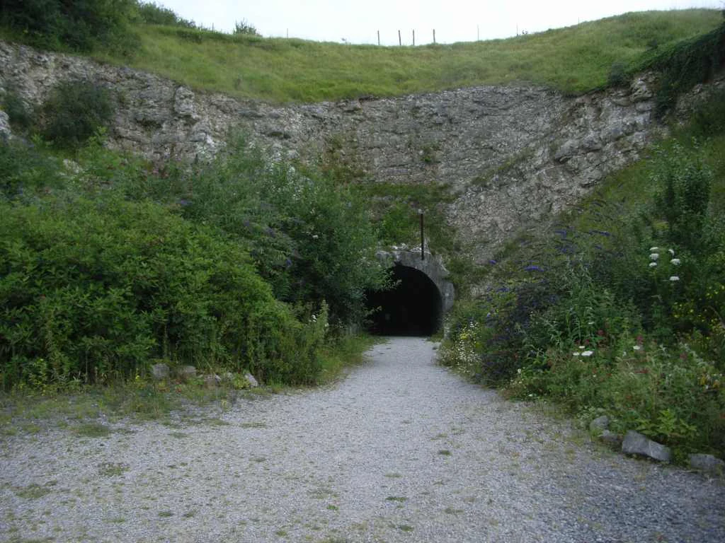
A dirt path leading into a dark, tunnel-like entrance carved into a grassy, rocky hillside.
The entrance to the historic V3 fortress site at Mimoyecques.

Réserve naturelle régionale de la forteresse de Mimoyecques history and protected-area timeline

The history of the reserve is closely tied to the history of the Mimoyecques fortress itself. The fortress was constructed during the Second World War as a major German military project intended to serve as an underground installation for the V3 cannon, a long-range supergun developed late in the war. The site was heavily fortified and included extensive tunnel galleries carved into the chalk landscape of the Pas-de-Calais.

The fortress never saw operational use as intended, and the military complex was eventually abandoned. In the decades that followed, the underground galleries gradually became colonized by wildlife, particularly bats, which found the stable, sheltered conditions ideal for roosting.

By the early 2010s, ecologists recognized the growing importance of this bat colony and worked toward formal protection. On 15 October 2012, the site was officially classified as a Réserve naturelle régionale, giving it legal status as a protected area. The classification was specifically aimed at safeguarding the galleries used by bats and the front of the quarry at the entrance to the fortress, marking the site's transition from a military ruin to a recognized center for biodiversity conservation.

Réserve naturelle régionale de la forteresse de Mimoyecques landscape and geographic character

The reserve's landscape is defined by both its natural setting and its built military remains. The site lies in the rolling lowlands of the Pas-de-Calais, a region characterized by gently undulating terrain, agricultural fields, and small rural communities. The Mimoyecques fortress sits within this landscape as a largely subterranean complex, with only the quarry face at the entrance visible above ground.

The underground galleries are the most distinctive landscape feature of the reserve. These tunnels, originally excavated into the chalk bedrock for military purposes, now create a network of sheltered spaces with stable temperature and humidity conditions. The reserve boundary extends 1.57 hectares around the entrance area and the relevant gallery sections, making it one of the smallest protected natural areas in France in terms of surface area.

Réserve naturelle régionale de la forteresse de Mimoyecques ecosystems, habitats, and plant life

Ecologically, the reserve is defined less by surface habitats than by the value of its underground environment. The gallery system provides dark, thermally stable conditions that have become essential roosting habitat for bats. The surrounding land at the surface is still influenced by its rural Pas-de-Calais setting, with agricultural surroundings and patches of semi-natural vegetation.

The reserve's classification reflects its role as a habitat and species management area rather than a wilderness or ecosystem-level protection zone. Its ecological value lies in a very specific microhabitat: the tunnels themselves, which serve as both a winter and a transitional roost for multiple bat species.

Réserve naturelle régionale de la forteresse de Mimoyecques wildlife and species highlights

The wildlife significance of the reserve is overwhelmingly focused on bats. The gallery system hosts an important colony, and three species in particular are highlighted as present: the greater horseshoe bat, the Geoffroy's bat, and the pond bat. These species are sensitive to disturbance and rely on stable underground environments for roosting, particularly during sensitive periods of their annual cycle.

The protection of the galleries is intended to ensure that this colony can continue to thrive without the pressures of human access. Because the bat population represents the core reason for the reserve's existence, all other elements of the site, including the surface vegetation and the quarry face, are managed in relation to their potential impact on the underground colony.

Réserve naturelle régionale de la forteresse de Mimoyecques conservation status and protection priorities

From a conservation standpoint, the reserve is notable because it protects habitat that would otherwise have been lost or degraded. The galleries were not originally natural features, but their abandonment has transformed them into artificial yet ecologically valuable roosting sites. Their formal protection under the regional nature reserve designation ensures that the bat colony is shielded from disturbance.

The reserve is classified as an IUCN Category IV protected area, signifying that its primary purpose is the management of habitats and species rather than the preservation of an entire ecosystem or wilderness. This classification matches its narrow but critical focus on bat conservation in a very localized setting. By restricting access to the galleries, the reserve reduces the risks of human disturbance during sensitive periods, allowing the bat colony to maintain and develop its population within a secure environment.

Réserve naturelle régionale de la forteresse de Mimoyecques cultural meaning and human context

The reserve carries a distinctive cultural dimension through its association with the Second World War. The Mimoyecques fortress is a major historical site tied to the German V3 cannon project, and the underground galleries reflect an important period of 20th-century military history in northern France. This wartime heritage now intertwines with a conservation purpose, transforming a relic of conflict into a sanctuary for wildlife.

Today, the fortress is also presented as a place of public memory and education, with the broader site open to visitors. The creation of the nature reserve reflects a recognition that the same structures built for destruction can, decades later, serve a completely different and ecologically valuable role.

Top sights and standout views in Réserve naturelle régionale de la forteresse de Mimoyecques

Key highlights of the reserve include the protected underground galleries, the formal bat conservation focus, and the unusual overlap of wartime heritage with modern biodiversity protection. The reserve is also notable for being among the smallest protected natural areas in France by surface area, yet meaningfully important due to the rare underground habitat it safeguards.

Best time to visit Réserve naturelle régionale de la forteresse de Mimoyecques

Because the reserve itself is restricted to protect the bat colony from disturbance, any visit is effectively a visit to the fortress site rather than to the protected galleries. The bat species present are sensitive to disruption during roosting and breeding periods, and the galleries are not open to the public. Visitors interested in the broader fortress and its historical context can approach the site year-round, while the natural value of the reserve is best appreciated indirectly, through its role in conserving a locally important bat population.

Monthly climate preview

Long term monthly temperature and precipitation rhythm across representative coordinates

Climate Normals and Temperature Patterns at Réserve naturelle régionale de la forteresse de Mimoyecques

Representative coordinate records show measured monthly temperature variations alongside steady precipitation rates throughout the year at Réserve naturelle régionale de la forteresse de Mimoyecques. Examining the complete twelve month climate profile reveals detailed temperature bounds and precipitation normals across every recorded period.
Annual mean11 °C
5 °C18 °C
Jan
Feb
Mar
Apr
May12°
Jun15°
Jul17°
Aug18°
Sep16°
Oct13°
Nov
Dec
Warmest month
August

17.6 °C

Coolest month
February

5.3 °C

Wettest month
November

2.9 mm/day

Driest month
April

1.5 mm/day

Park location guide

Geography guide, regional context, and park location map for Réserve naturelle régionale de la forteresse de Mimoyecques

Réserve naturelle régionale de la forteresse de Mimoyecques park geography, regions, and map view in France

Understand where Réserve naturelle régionale de la forteresse de Mimoyecques sits in France through a broader geographic reading of the surrounding landscape, nearby location context, and its mapped position within the national park landscape.

How Réserve naturelle régionale de la forteresse de Mimoyecques fits into France

France is a unitary semi-presidential republic and one of the world's largest economies. It borders Belgium, Luxembourg, Germany, Switzerland, Italy, Monaco, Andorra, and Spain, with a maritime border to the United Kingdom. The country is known for its cultural influence, art, cuisine, and political history spanning centuries.

Wider geography shaping Réserve naturelle régionale de la forteresse de Mimoyecques in France

France is located in Western Europe. Metropolitan France extends from the Rhine to the Atlantic Ocean and from the Mediterranean Sea to the English Channel and North Sea. The country borders Belgium, Luxembourg, Germany, Switzerland, Italy, Monaco, Andorra, Spain, and has a maritime border with the United Kingdom.

Map view of Réserve naturelle régionale de la forteresse de Mimoyecques

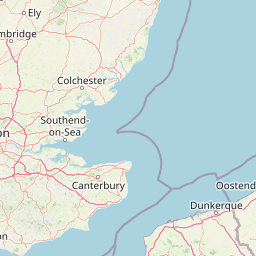
Use this park location map to pinpoint Réserve naturelle régionale de la forteresse de Mimoyecques in France, understand its exact geographic position, and read its mapped placement within the surrounding landscape more clearly.

Pigeon | © OpenStreetMap contributors

Location context for Réserve naturelle régionale de la forteresse de Mimoyecques

Hauts-de-France

Visual reference of underground galleries, habitat terrain, and regional sanctuary features

Réserve naturelle régionale de la forteresse de Mimoyecques Photos and Protected Landscape Scenery

Visual documentation of Réserve naturelle régionale de la forteresse de Mimoyecques reveals the unique blend of subterranean wartime architecture and protected natural habitats. Examining these site photographs helps researchers understand underground gallery structures and regional wildlife refuge conditions.

A dirt path leading into a dark, tunnel-like entrance carved into a grassy, rocky hillside.

Park atlas

Compare nearby protected landscapes and regional nature reserves across northern France

Parks Near Réserve naturelle régionale de la forteresse de Mimoyecques and Regional Protected Areas

Browsing other protected areas near Réserve naturelle régionale de la forteresse de Mimoyecques reveals broader ecological patterns across the Hauts-de-France region. Comparing adjacent nature reserves helps place specialized underground habitats and regional wildlife sanctuaries into wider geographic context.
A horizontal watercolor painting showing a soft landscape with green vegetation, pink accents, and a winding body of water leading towards distant hills.
Nature reserveFrance
About 4.4 km away#1 closest

Northwest

Réserve naturelle régionale du mont de Couple: Protected Chalk Escarpment and Coastal Viewpoint

A limestone ridge sanctuary in the northern French Boulonnais region

Spanning a rare chalk cuesta in northern France, this protected area balances ecological conservation with distinct geological features. The reserve provides critical habitat for orchids and protected flora while serving as a strategic viewpoint across the Straits of Dover and the surrounding Opal Coast terrain.

Area
0.136 km²
Established
1997
Relief
Upland
Climate
Temperate
Nature reserveHauts-de-France
About 11 km away#2 closest

Southwest

Réserve naturelle régionale du pré communal d'Ambleteuse: Regional Nature Reserve Geography

Coastal dune relics and protected marshland in Hauts-de-France.

This protected area provides an essential look at the coastal geography of the Opal Coast. Featuring a complex mosaic of ancient dune turf, dry heath, and wet meadows, the reserve stands as a landmark for biodiversity and traditional land management in northern France.

Area
0.605 km²
Established
1991
IUCN
IV
Relief
Lowland
Nature reserveHauts-de-France
About 14 km away#3 closest

East

Réserve naturelle régionale de Pont d'Ardres: Mapped Wetland Geography and Protected Lands

A restored industrial landscape in the Hauts-de-France coastal hinterland.

Situated southeast of Calais, this reserve represents a rare success in ecological restoration. The former sugar factory basins now provide vital habitats for shorebirds and nesting species, maintaining an essential wetland presence in an otherwise cultivated landscape of northern France.

Area
0.663 km²
Established
2012
IUCN
IV
Relief
Lowland
A watercolor painting of a rolling rural landscape with bare trees, grassy hills, and distant purple and red hills against a pale sky.
Nature reserveHauts-de-France
About 23 km away#4 closest

South

Réserve naturelle régionale du Molinet: Protected Calcareous Woodlands and Grassland Mosaic

Geographic and Habitat Analysis of a Pas-de-Calais Nature Reserve

Located in the Boulonnais landscape of northern France, this protected area serves as a vital refuge for calcareous flora. The reserve preserves a rare mosaic of limestone woodlands and grasslands, serving a dual role in both ecological conservation and water catchment protection within the Hauts-de-France administrative region.

Area
0.067 km²
Established
1987
IUCN
IV
Relief
Lowland
A soft watercolor illustration showing a low-lying landscape with gentle rolling hills, grassy foreground vegetation, and light, hazy atmospheric tones.
Nature reserveHauts-de-France
About 25 km away#5 closest

Southwest

Réserve naturelle régionale du marais de Condette: Wetland Geography and Protected Landscape

A vital ecological corridor within the Hauts-de-France region

Spanning 35 hectares, the Réserve naturelle régionale du marais de Condette protects a unique mosaic of marshland, peat-forming habitats, and forested massifs. This wetland reserve near the Opal Coast acts as an essential green infrastructure link, providing critical sanctuary for flora and fauna while maintaining hydrological balance in a heavily transformed northern French landscape.

Area
0.35 km²
Established
2009
IUCN
IV
Relief
Lowland
A horizontal watercolor painting showing a soft coastal scene with rolling dunes, sparse grasses, and a calm shoreline under a light sky.
Nature reservePas-de-Calais
About 25 km away#6 closest

Northeast

Réserve naturelle nationale du Platier d'Oye: Protected Coastal Landscape and Wetland Geography

Coastal dunes and migratory bird habitats in Pas-de-Calais

Located along the Opal Coast, the Réserve naturelle nationale du Platier d'Oye represents a complex mosaic of tidal flats, mobile sand dunes, and humid polder meadows. This protected area offers unique insight into the ecological intersection of maritime forces and terrestrial environments, functioning as a primary staging ground for diverse migratory species within the Hauts-de-France coastal region.

Area
3.91 km²
Established
1987
IUCN
IV
Relief
Lowland
Watercolor painting of a coastal landscape with sand dunes, beach grasses, and distant hills under a light sky.
Nature reservePas-de-Calais
About 34 km away#7 closest

South

Réserve naturelle nationale de la baie de Canche Protected Area Map and Geography

Coastal dune ecosystems and tidal estuary landscapes in Pas-de-Calais

This protected area offers a look into the geomorphology of the Canche estuary, where longshore drift, salt marshes, and rare chalk-cliff dune systems create a distinct environment. Understand the landscape context of this French national nature reserve, serving as a sanctuary for migratory bird populations and a site for active coastal research along the English Channel.

Area
5.05 km²
Established
1987
IUCN
IV
Relief
Lowland
A soft watercolor painting of a grassy landscape with exposed limestone rock faces and green vegetation.
Nature reserveHauts-de-France
About 36 km away#8 closest

Southeast

Réserve naturelle régionale des anciennes carrières de Cléty: Protected Geological Landscape

Regional nature reserve in the Hauts-de-France, France

A significant geological protected area in the Pas-de-Calais, this reserve features an exposed chalk quarry face that serves as a stratigraphic record for the Cretaceous period. The landscape hosts a rare intersection of geological heritage and diverse ecosystems, including orchids, butterflies, and bat colonies, within a compact footprint.

Area
0.02 km²
Established
2011
IUCN
IV

Common questions about visiting, size, designation, and location context for Réserve naturelle régionale de la forteresse de Mimoyecques

Réserve naturelle régionale de la forteresse de Mimoyecques FAQs for park facts, access, geography, and protected area context

Find quick answers about Réserve naturelle régionale de la forteresse de Mimoyecques, including protected-area facts, park geography, trail and visitor context, and how the park fits into its surrounding country and regional landscape.
MoriAtlas Explorer

Continue Your Protected Areas Search Across the Global Atlas

Deepen your exploration by continuing the structured search for national parks and protected areas worldwide. Utilize the comprehensive filtering capabilities to compare different conservation landscapes and refine your understanding of global park geography. Discover more about the distribution and characteristics of protected natural areas.

Global natural geography