
Mori Atlas logo
Nature reserveRéserve naturelle régionale des marais, dunes et baies de Guissény

Explore the geographic mosaic of dunes, marshland, and marine boundaries in northern Finistère

Réserve naturelle régionale des marais, dunes et baies de Guissény: Coastal Protected Landscape

(Réserve naturelle régionale des marais, dunes et baies de Guissény (RNR346))

The Réserve naturelle régionale des marais, dunes et baies de Guissény protects a unique continuum of terrestrial and marine habitats along the Côte des Légendes. This regional nature reserve spans 608 hectares, encompassing the brackish étang du Curnic, the dunes of La Sécherie, and the coastal waters of the Anse de Tresseny. Visitors and researchers use this map-based reference to study the transition between Breton wetlands and the Atlantic shore.

coastal reservewetlandsmarshesdunesbrackish lagoonmarine protected area
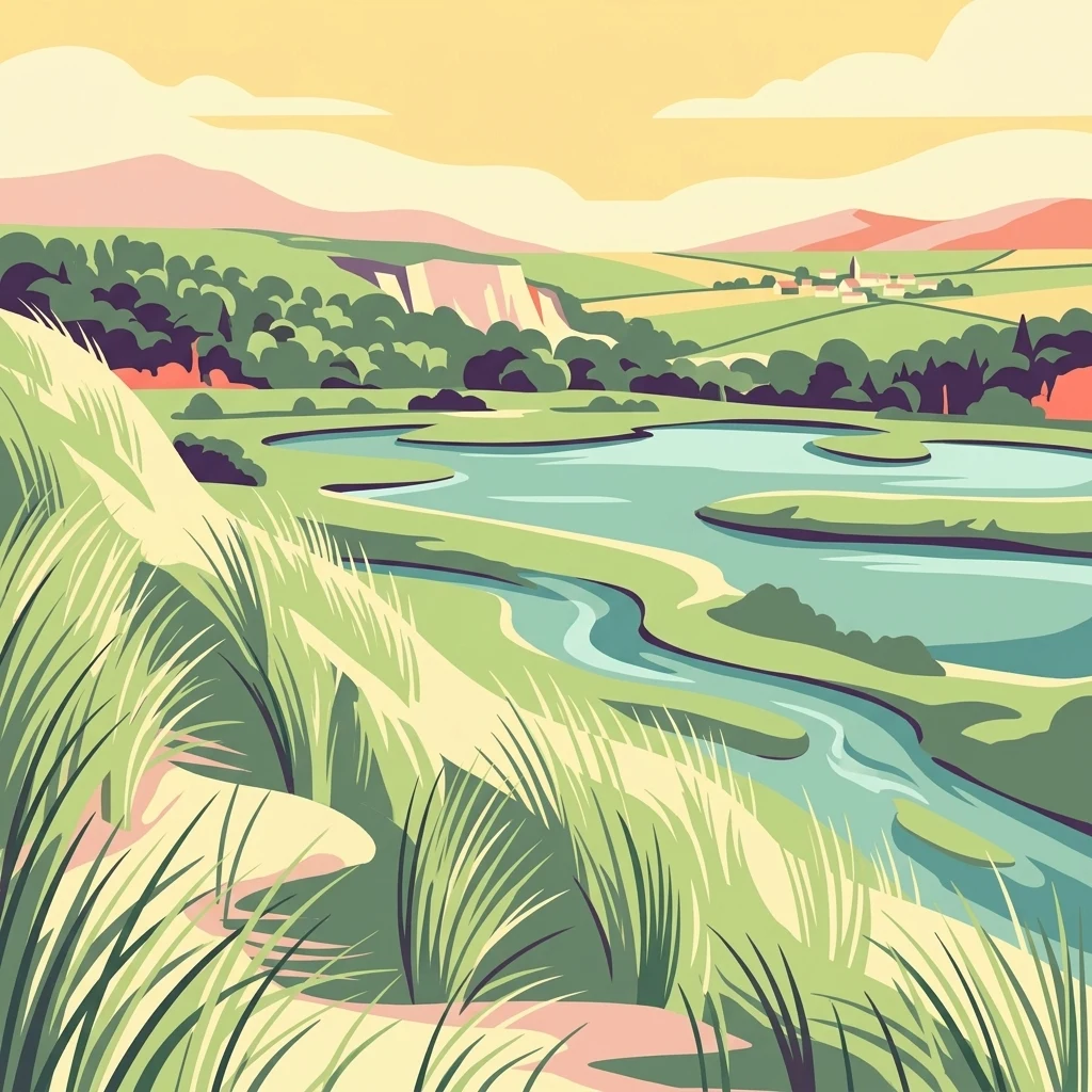
A stylized illustration showing a grassy dune in the foreground sloping down to a winding river or estuary surrounded by green marshlands, with rolling hills and a small settlement in the distance under a warm, soft sky.

Réserve naturelle régionale des marais, dunes et baies de Guissény

Nature reserve

Park overview

Structured park overview, official facts, and landscape profile for Réserve naturelle régionale des marais, dunes et baies de Guissény

Réserve naturelle régionale des marais, dunes et baies de Guissény park facts, protected area profile, and essential visitor context

Review the core facts for Réserve naturelle régionale des marais, dunes et baies de Guissény, including designation, size, terrain, visitor scale, habitats, and operating context in one park-focused overview.

About Réserve naturelle régionale des marais, dunes et baies de Guissény

The Réserve naturelle régionale des marais, dunes et baies de Guissény represents a relatively recent addition to Brittany's network of protected coastal areas, formalised on 17 October 2025 through a deliberation of the Regional Council of Brittany. It sits within the Finistère department, spanning parts of the communes of Guissény, Kerlouan, and Plouguerneau, on the historic coastline known as the Côte des Légendes. Its designation brings long-standing local conservation efforts into a single, coherent legal framework.

In geographic terms, the reserve is shaped by the interplay of freshwater, brackish, and marine environments that characterises much of the northern Breton shoreline. The terrestrial portion, around 223 hectares, is dominated by the coastal marsh complex associated with the étang du Curnic and extending through the hamlets of Toullouarn and Prat Lédan. This wetland matrix, much of it owned by the Conservatoire du littoral, gives the site its strong marshland identity and anchors its ecological continuity. Adjacent to it, the dunes of La Sécherie and the back-dune depressions of Vougo add a sand-dune dimension typical of the Atlantic coast.

The marine portion, covering around 385 hectares, encompasses the Anse de Tresseny and a coastal band running along the Plage du Vougo. Together with a reedbed at the mouth of the Quillimadec in the inner part of the bay, the reserve covers a transitional seascape where open Atlantic waters meet sheltered brackish inlets and sandy beaches. Ownership across the site is varied, involving the Conservatoire du littoral, the commune of Guissény, the department, the state, and several private parcels, reflecting the fragmented but cooperative management of the Breton coast.

What distinguishes Guissény from many purely terrestrial reserves is precisely this joined protection of sea and land. By including both the dune-marsh continuum and the coastal marine strip under a single regional reserve status, it acknowledges that ecological processes along this coast do not stop at the high-water line. The reserve's identity is therefore inseparable from the broader Breton coastal landscape, where centuries of agricultural use, fishing tradition, and natural dynamics have produced a finely balanced mosaic of habitats.

Quick facts and research context for Réserve naturelle régionale des marais, dunes et baies de Guissény

Location: Finistère department, Brittany, northern France, on the Côte des Légendes.

Coverage: approximately 608 hectares, split between around 223 hectares of terrestrial habitats and 385 hectares of marine habitat.

Status: Regional nature reserve (réserve naturelle régionale) classified on 17 October 2025 under IUCN Category IV, registered as RNR346.

Key habitats: coastal marshes, reedbeds, dunes, back-dune depressions, brackish lagoon (étang du Curnic), sandy bays, and nearshore marine strip.

Land ownership: a patchwork involving the Conservatoire du littoral, the municipality of Guissény, departmental land, state property, and private parcels.

Pre-existing protections: Anse de Tresseny has been a hunting reserve since the 1970s, and the area was included in the Natura 2000 network in 1999.

Park context

Deeper park guide and search-rich context for Réserve naturelle régionale des marais, dunes et baies de Guissény

Réserve naturelle régionale des marais, dunes et baies de Guissény history, landscape, wildlife, and travel context

Explore Réserve naturelle régionale des marais, dunes et baies de Guissény through its history, landscape character, ecosystems, wildlife, conservation priorities, cultural context, and seasonal travel timing in a structured park guide built for atlas discovery and search intent.

Why Réserve naturelle régionale des marais, dunes et baies de Guissény stands out

The reserve is best known for its linked mosaic of marshes, dunes, and bays along the Côte des Légendes in northern Finistère. The étang du Curnic, surrounded by reedbed marshes owned by the Conservatoire du littoral, forms the ecological heart of the site and anchors the reserve's wetland character. Its coastal profile is equally distinctive. The dunes of La Sécherie and the back-dune zone of Vougo represent classic Breton Atlantic dune systems, while the Anse de Tresseny and Plage du Vougo bring in a substantial marine component. This land-and-sea continuity is what makes the reserve stand out, rather than any single habitat alone. It is also recognised for its ornithological richness, with breeding and wintering bird surveys recording notable seasonal totals that reflect the value of the area as a refuge for coastal and wetland birdlife on this stretch of the Breton Atlantic coast.
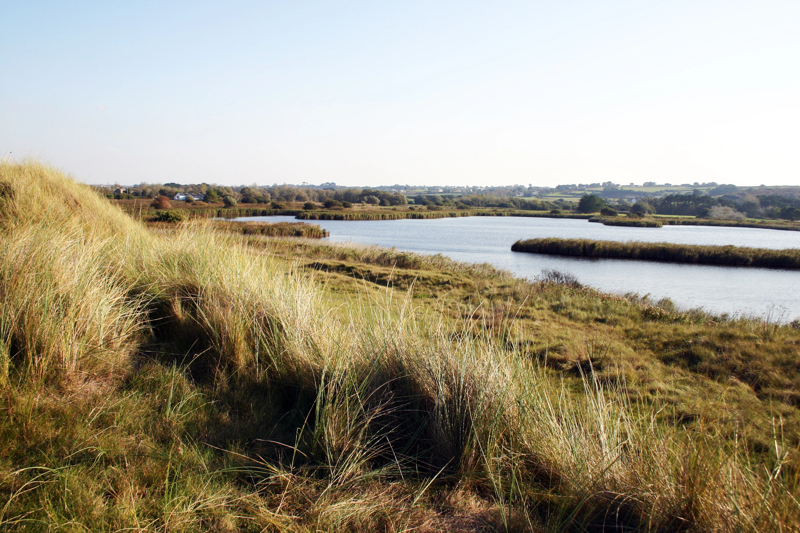
A landscape view of a coastal pond with grassy dunes in the foreground and a calm body of water stretching toward a distant shoreline.
View of the Etang du Curnic, a coastal pond characteristic of the Reserve naturelle regionale des marais, dunes et baies de Guisseny.

Réserve naturelle régionale des marais, dunes et baies de Guissény history and protected-area timeline

The reserve's formal history is recent. It was created by a deliberation of the Conseil régional de Bretagne on 17 October 2025, giving it the official designation RNR346.

Before this classification, the area had already benefited from earlier layers of protection that shaped its conservation trajectory. The Anse de Tresseny had been designated a hunting reserve (réserve de chasse) since the 1970s, providing an early framework for limiting disturbance in the bay. In 1999, an area of roughly 612 hectares, more than half of which lay at sea, was included in the Natura 2000 network. This integration came at the very beginning of Natura 2000 implementation in France, anchoring the site within the broader European effort to protect valued natural habitats.

The 2025 creation of the regional reserve can therefore be understood as a consolidation of these earlier steps. Rather than starting from a blank slate, the reserve builds on decades of local awareness, the active involvement of the Conservatoire du littoral in acquiring marshland parcels since the late twentieth century, and the gradual recognition of the site's combined terrestrial and marine interest.

Réserve naturelle régionale des marais, dunes et baies de Guissény landscape and geographic character

The landscape of Guissény is defined by the close proximity of very different coastal environments. Inland, the étang du Curnic forms a brackish coastal lagoon ringed by marshes, reedbeds, and wet meadow fragments. This is a typical feature of the northern Breton coast, where small drowned valleys interact with rising sea levels to produce sheltered, biologically rich lagoons.

Around the lagoon, the terrain rises slightly into the dunes of La Sécherie and the back-dune zone of Vougo. Here the landscape shifts to open sand, low marram-grass cover, and the more sheltered depressions of the arrière-dune, where freshwater seepage supports distinct vegetation communities. The transition from marsh to dune to beach takes place over very short distances, giving the reserve a strong sense of compressed ecological variety.

The marine component continues this story. The Anse de Tresseny forms a wide, gently curved bay, fringed by the Quillimadec river mouth and its reedbed, while the coastal strip along the Plage du Vougo exposes long sandy shores to the Atlantic. The result is a landscape where brackish lagoon, freshwater marsh, dune ridge, sandy beach, and open bay are visually and ecologically interwoven.

Réserve naturelle régionale des marais, dunes et baies de Guissény ecosystems, habitats, and plant life

Ecologically, the reserve sits at the interface between terrestrial and marine Brittany and is shaped by that transitional character. The marshes around the étang du Curnic are dominated by reedbeds and wet grasslands typical of the Breton coast, supporting both freshwater and brackish plant communities. These marshes are the principal inland biodiversity reservoir of the site.

Coastal dunes add a separate but linked ecosystem. The dunes of La Sécherie and the back-dune depressions of Vougo carry the classic vegetation sequence of Atlantic dune systems, from strand line colonisers inland to more stabilised dune grasslands. The back-dune in particular harbours humid microhabitats that further connect the dune system to the marshland.

The marine portion of the reserve includes the Anse de Tresseny and adjacent coastal waters. These sheltered and semi-exposed waters are ecologically important for shoreline dynamics, benthic habitats, and the exchange of nutrients between the open Atlantic and the brackish lagoon system. The combined ecological story of the reserve is therefore one of continual exchange: fresh water, brackish water, and marine water all contribute to a single dynamic coastal ecosystem.

Réserve naturelle régionale des marais, dunes et baies de Guissény wildlife and species highlights

Birdlife is the most clearly documented wildlife dimension of the reserve. Ornithological surveys have recorded 83 breeding bird species within the reserve's perimeter, and 121 species present during winter. This dual richness reflects the mosaic of habitats available: reedbeds and marshes for breeding and wintering waterbirds, dunes and back-dune habitats for passerines and ground-nesting species, and the bay and coastal waters for seabirds and shorebirds.

The Anse de Tresseny, both as a former hunting reserve and now as a key component of the regional reserve, plays a particularly notable role for waterbirds and seabirds, while the Quillimadec reedbed adds value for reedbed-dependent species. The seasonal contrast between breeding and wintering totals highlights the importance of the site along bird migration and wintering routes of the Atlantic coast.

Other fauna is less directly documented in the source material, but the combination of marshland, dune, and marine habitats provides room for a wide range of coastal invertebrates, fish, and small mammals typical of northern Brittany's sheltered coastlines.

Réserve naturelle régionale des marais, dunes et baies de Guissény conservation status and protection priorities

From a conservation perspective, the reserve is significant for the way it bundles multiple, already recognised natural assets into a single regionally administered framework. Its earlier integration into the Natura 2000 network in 1999, alongside the longstanding hunting reserve status of the Anse de Tresseny, shows that the area had been identified as an ecological priority long before the 2025 regional classification.

The reserve plays a particularly important role in protecting transitional coastal habitats. The marshes linked to the étang du Curnic and the Quillimadec reedbed are key to maintaining the hydrology and biodiversity of a coastline where brackish ecosystems are especially vulnerable to alteration. The dune and back-dune systems, although modest in size, contribute to habitat connectivity along the Côte des Légendes and protect a distinctive part of the regional coastal dune network.

By folding a substantial marine strip into the reserve, the 2025 designation also raises the protection profile of coastal waters, extending management attention beyond the shoreline. The IUCN Category IV status reflects a management-oriented approach focused on habitats and species rather than on wilderness preservation.

Réserve naturelle régionale des marais, dunes et baies de Guissény cultural meaning and human context

The reserve lies firmly within the Côte des Légendes, a culturally distinctive stretch of the northern Breton coast where maritime tradition, small-scale agriculture, and local heritage are tightly woven into the landscape. Villages such as Guissény, Kerlouan, and Plouguerneau have long histories of fishing, coastal farming, and seasonal land use, all of which have shaped the current patchwork of marshes, dunes, and bays.

The very name Côte des Légendes reflects the strong presence of Breton legend and oral tradition in the area. Although the reserve is defined primarily by its natural assets, its location within this cultural landscape gives it an additional layer of regional identity and meaning, linking ecological protection to the broader heritage of the Léon coastline.

Top sights and standout views in Réserve naturelle régionale des marais, dunes et baies de Guissény

The reserve's most distinctive feature is its dual terrestrial-marine protection: marshes and dunes on land, combined with bay and coastal waters at sea, under a single designation. This makes it an unusual addition to Brittany's regional reserve network.

The étang du Curnic, the dunes of La Sécherie, and the Anse de Tresseny stand out as its three primary anchor sites, each representing a different facet of the Côte des Légendes. The high combined count of breeding and wintering bird species underlines the area's ecological credibility.

Best time to visit Réserve naturelle régionale des marais, dunes et baies de Guissény

The reserve offers different experiences through the year. Late spring and early summer are well suited to observing breeding birdlife in the marshes and reedbeds, when many species are at their most active and visible around the étang du Curnic and the Quillimadec reedbed. Dawn and dusk tend to be the most rewarding periods for sightings.

In autumn and winter, the area shifts into a different character. The bay and coastal waters attract wintering waterbirds and seabirds, and the open landscape takes on a softer, more muted atmosphere typical of the Breton coast in the colder months. The mild, oceanic climate of northern Finistère means that visits remain feasible through much of the year, although weather and sea conditions can change rapidly.
Monthly climate preview

Long-term representative temperature and monthly precipitation averages for Finistère protected geography

Climate Normals and Annual Weather Patterns at Réserve naturelle régionale des marais, dunes et baies de Guissény

Representative coordinate sampling records measured monthly temperature ranges and precipitation rates across the annual cycle at Réserve naturelle régionale des marais, dunes et baies de Guissény. Detailed monthly climate normals provide deeper statistical context for evaluating long-term environmental patterns across the protected landscape.
Annual mean12 °C
7 °C17 °C
Jan
Feb
Mar
Apr10°
May13°
Jun15°
Jul17°
Aug17°
Sep16°
Oct13°
Nov10°
Dec
Warmest month
August

17.2 °C

Coolest month
February

7.4 °C

Wettest month
December

3.6 mm/day

Driest month
July

1.6 mm/day

Park location guide

Geography guide, regional context, and park location map for Réserve naturelle régionale des marais, dunes et baies de Guissény

Réserve naturelle régionale des marais, dunes et baies de Guissény park geography, regions, and map view in France

Understand where Réserve naturelle régionale des marais, dunes et baies de Guissény sits in France through a broader geographic reading of the surrounding landscape, nearby location context, and its mapped position within the national park landscape.

How Réserve naturelle régionale des marais, dunes et baies de Guissény fits into France

France is a unitary semi-presidential republic and one of the world's largest economies. It borders Belgium, Luxembourg, Germany, Switzerland, Italy, Monaco, Andorra, and Spain, with a maritime border to the United Kingdom. The country is known for its cultural influence, art, cuisine, and political history spanning centuries.

Wider geography shaping Réserve naturelle régionale des marais, dunes et baies de Guissény in France

France is located in Western Europe. Metropolitan France extends from the Rhine to the Atlantic Ocean and from the Mediterranean Sea to the English Channel and North Sea. The country borders Belgium, Luxembourg, Germany, Switzerland, Italy, Monaco, Andorra, Spain, and has a maritime border with the United Kingdom.

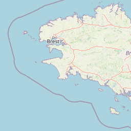
Map view of Réserve naturelle régionale des marais, dunes et baies de Guissény

Use this park location map to pinpoint Réserve naturelle régionale des marais, dunes et baies de Guissény in France, understand its exact geographic position, and read its mapped placement within the surrounding landscape more clearly.

Pigeon | © OpenStreetMap contributors

Location context for Réserve naturelle régionale des marais, dunes et baies de Guissény

BretagneFinistère

Explore photographic records of coastal wetlands, sand dunes, and marine habitats across the reserve.

Visualizing Réserve naturelle régionale des marais, dunes et baies de Guissény Photos and Landscapes

Visual records capture the complex terrain of brackish lagoons, tidal marshes, and Atlantic sand systems defining the protected landscape. Examining these field photographs reveals the intricate ecological transitions connecting terrestrial wetlands to open coastal waters along the shoreline.

A landscape view of a coastal pond with grassy dunes in the foreground and a calm body of water stretching toward a distant shoreline.

Park atlas

Compare nearby protected areas and regional coastal landscapes across northern Finistère

Other Parks Near Réserve naturelle régionale des marais, dunes et baies de Guissény

Browse other parks and protected areas sharing the coastal wetlands and marine characteristics of Réserve naturelle régionale des marais, dunes et baies de Guissény. Comparing adjacent regional reserves helps place local dune habitats and brackish lagoons into a wider geographic context.
Watercolor painting of soft, rolling green hills and pinkish, jagged coastal cliffs on a white background.
Nature reserveBretagne
About 44 km away#1 closest

South

Réserve naturelle régionale des sites d'intérêt géologique de la presqu'île de Crozon: Protected Area and Atlas

Coastal geological heritage and maritime landscapes in the heart of Bretagne.

Spanning 27 distinct locations, the Réserve naturelle régionale des sites d'intérêt géologique de la presqu'île de Crozon documents millions of years of volcanic, tectonic, and sedimentary evolution. The reserve anchors its scientific value in its open-air exposures of Paleozoic rock, while simultaneously providing a sanctuary for specialized coastal flora and fauna along the Atlantic edge of Bretagne.

Area
1.564 km²
Established
2013
IUCN
IV
Relief
Upland
A watercolor painting showing a wide, panoramic view of a marshy landscape with green clumps of grass in the foreground and soft purple hills in the distance.
Nature reserveFinistère
About 51 km away#2 closest

Southeast

Réserve naturelle nationale du Venec: Protected Peatland and Monts d'Arrée Geography

A core nature reserve and active sphagnum bog ecosystem in Finistère

Located in central Brittany, the Réserve naturelle nationale du Venec represents the only remaining large, active raised bog in the region. This protected area within the Finistère department offers deep insight into the geomorphology of the Yeun-Elez basin, mapping the transition from granite-edged dry moorland through marshy transition zones to the central, ombrotrophic peat dome.

Area
3.341 km²
Established
1993
IUCN
IV
Relief
Upland
A horizontal watercolor illustration of a soft green landscape with rolling hills, patches of grass, and distant tree lines against a white background.
Nature reserveBretagne
About 52 km away#3 closest

East

Réserve naturelle régionale des landes et tourbières du Cragou et du Vergam: Regional Park Geography

Protected granite ridges and Atlantic peatland ecosystems in Finistère

The Réserve naturelle régionale des landes et tourbières du Cragou et du Vergam stands as a critical reference for understanding Breton upland ecology. Spanning the Monts d'Arrée, these protected sites provide a distinct map of wet heath, acidic flushes, and diverse botanical habitats that define the inland character of northwestern France.

Area
3.434 km²
Established
2008
IUCN
IV
Relief
Upland
Nature reserveFinistère
About 54 km away#4 closest

Southeast

Vallée de l'Aulne Nature Reserve: A Detailed Mapping of Finistère River Valley Geography

Protected riparian landscapes, watershed ecology, and regional basin boundaries

The Vallée de l'Aulne serves as a central artery for the natural landscapes of western France. Spanning from inland Brittany toward the Atlantic, this protected reserve encompasses riverine corridors, bocage terrain, and tidal estuary zones. Use this detailed profile to examine the geographic distribution of protected habitats, river basin features, and the integrated environmental protections that define this key Finistère landscape.

Area
35.64 km²
Established
2014
Relief
Lowland
Climate
Temperate
Nature reserveBretagne
About 66 km away#5 closest

East

Réserve naturelle régionale des landes, prairies et étangs de Plounérin: Protected Habitat Atlas

Inland Bretagne landscape mosaic and regional nature reserve mapping

This protected area in the heart of Brittany serves as a vital refuge for heathland, meadows, and ponds. Examine the site's mapped boundaries and understand its role as an IUCN Category IV conservation landscape within the broader geography of the Côtes-d'Armor department.

Area
1.607 km²
Established
2016
IUCN
IV
A watercolor painting showing a soft, stylized landscape of green hills, marshy fields, and patches of pink wildflowers or heathland against a white background.
Nature reserveBretagne
About 91 km away#6 closest

Southeast

Réserve naturelle régionale des landes et marais de Glomel: Protected Bog and Heathland Atlas

A rare inland wetland refuge within the Bretagne Montagnes Noires

Explore the geographic mosaic of the Réserve naturelle régionale des landes et marais de Glomel, a protected area in Bretagne comprising dual sites of peat bogs, wet heaths, and marshy meadows. This atlas entry details the internal terrain, including the Grazius stream network and the historic canal environment, essential for understanding the habitat distribution and conservation of this distinct inland landscape.

Area
1.078 km²
Established
2008
IUCN
IV
Relief
Upland
A soft watercolor painting showing a green landscape with a small pond in the foreground and rolling hills in the background under a pastel sky.
Nature reserveMorbihan
About 119 km away#7 closest

Southeast

Réserve naturelle régionale des étangs du Petit et du Grand Loc'h: Wetland Landscape Atlas

Coastal protected area in Morbihan, Brittany

Located along the Atlantic coast near Guidel, this regional nature reserve protects a vital corridor of freshwater ponds, wet meadows, and reclaimed polders. The area is defined by its complex hydrology and serves as a key refuge for wintering and migratory bird populations within the Morbihan landscape, showcasing the intersection of maritime and terrestrial environments.

Area
1.18 km²
Established
2008
IUCN
IV
Relief
Lowland
A soft watercolor illustration showing a calm coastal bay with distant low hills, green shorelines, and sandy patches under a pale sky.
Nature reserveCôtes-d'Armor
About 130 km away#8 closest

East

Réserve naturelle nationale de la baie de Saint-Brieuc: Coastal Geography and Protected Terrain

Tidal mudflats and salt marshes on the North-Armorican coast.

Located in the Côtes-d'Armor department, this French nature reserve spans over 1,000 hectares of intertidal terrain. The area features a complex mosaic of sandy flats, brackish marshes, and dune systems, providing a critical study of coastal processes and tidal ecosystems along the Brittany shoreline.

Area
11.4 km²
Established
1998
IUCN
IV
Relief
Lowland

Common questions about visiting, size, designation, and location context for Réserve naturelle régionale des marais, dunes et baies de Guissény

Réserve naturelle régionale des marais, dunes et baies de Guissény FAQs for park facts, access, geography, and protected area context

Find quick answers about Réserve naturelle régionale des marais, dunes et baies de Guissény, including protected-area facts, park geography, trail and visitor context, and how the park fits into its surrounding country and regional landscape.
MoriAtlas Explorer

Continue Your Protected Areas Search Across the Global Atlas

Deepen your exploration by continuing the structured search for national parks and protected areas worldwide. Utilize the comprehensive filtering capabilities to compare different conservation landscapes and refine your understanding of global park geography. Discover more about the distribution and characteristics of protected natural areas.

Global natural geography