
Why Réserve naturelle régionale géologique de Pontlevoy stands out
The reserve is best known for its exceptionally compact but scientifically valuable exposures of faluns, a fossil-rich sediment type that accumulated on the floor of a shallow tropical sea during the Middle Miocene, roughly 14 to 16 million years ago. These faluns, which cap layers of Beauce limestone in an old quarry face, contain a diverse assemblage of marine fossils that make the site a key reference locality for the regional geology of the Loire Basin. Its identity is closely tied to educational quarry geology. Visitors and school groups can observe multiple stratigraphic layers, including faluns, grey sands, marls, and limestone, directly in the section, making it a natural outdoor laboratory for understanding the Cainozoic marine history of the Paris Basin margin.
Réserve naturelle régionale géologique de Pontlevoy history and protected-area timeline
The site's history as a protected area begins in 1979, when it was first recognized for its natural value and subsequently classed as a réserve naturelle volontaire (voluntary nature reserve) on 21 September 1986. This initial designation reflected a grass-roots protection model common in France during that era, in which landowners and local associations voluntarily committed to preserving notable natural features.
Following changes in French environmental law that introduced the regional nature reserve category, the site was reclassified by a deliberation of the Centre-Val de Loire Regional Council on 15 April 2011 as a réserve naturelle régionale. This new designation formalized long-term regional protection and clarified the management responsibilities for the site.
A public consultation in 2019 led to a further adjustment of the reserve's perimeter, which was extended to its current extent of 1.91 hectares in 2020. This small expansion refined the boundaries to better protect the most scientifically significant exposures of faluns and associated Miocene sediments.
Réserve naturelle régionale géologique de Pontlevoy landscape and geographic character
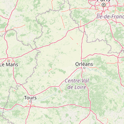
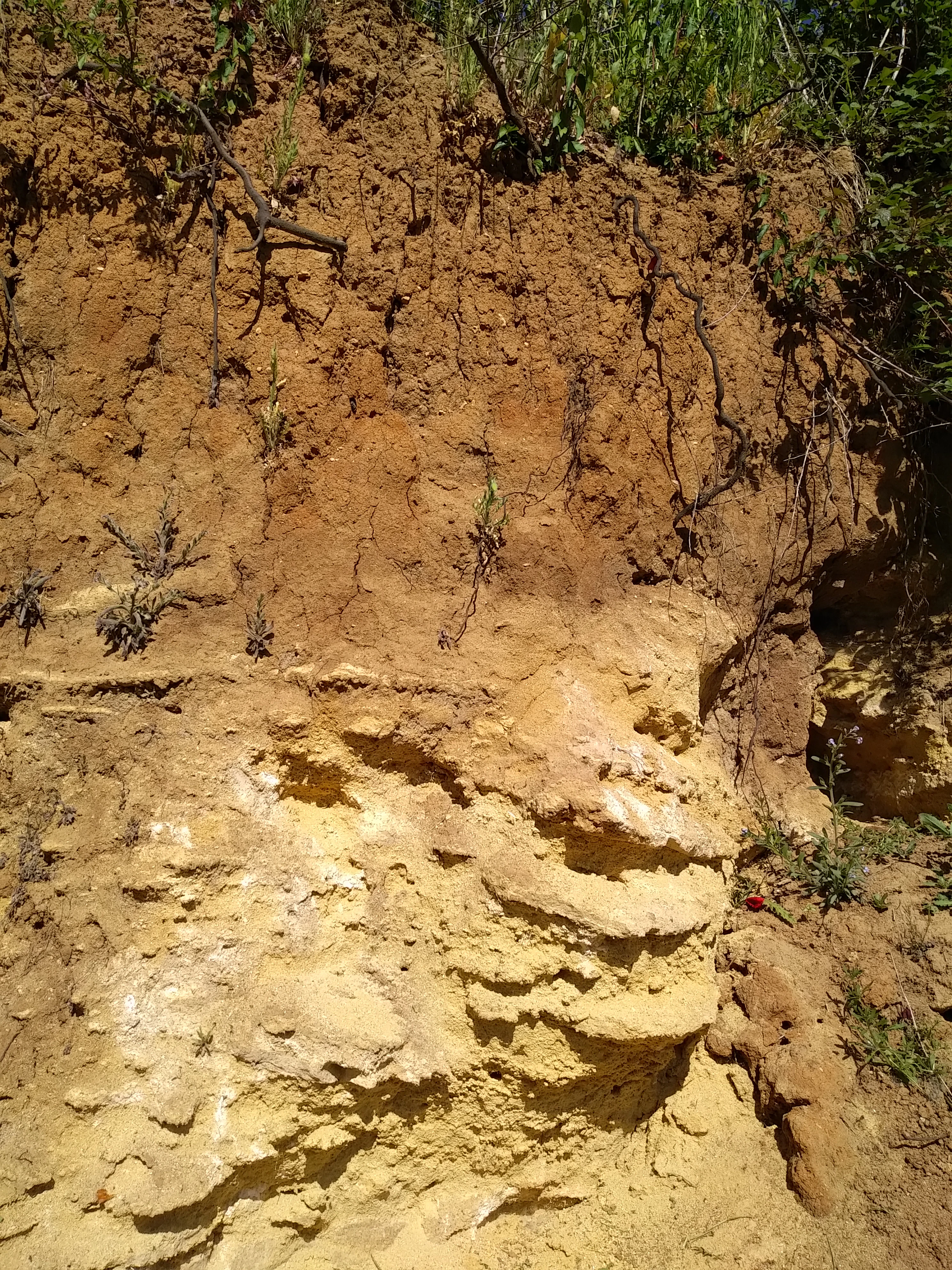
The reserve's visible landscape is modest in scale but geologically expressive. The surface expression consists of a former quarry cut into the flat agricultural terrain of the Beauce plateau, an open, gently rolling limestone country typical of central France. The quarry exposes a vertical section of rock that, although only a few meters thick in places, displays a clear stratigraphic succession from the underlying Beauce limestone upward through marls, grey sands, and finally the fossil-rich faluns.
The surrounding terrain is largely rural, with farmland extending in most directions. The reserve sits near the D764 road on the northern fringe of Pontlevoy, and its external landscape is shaped more by agricultural patterns than by dramatic relief. The interpretive value of the site lies almost entirely in the quarry face itself, where visitors can see distinct color and texture changes between the pale limestone base and the warmer, more granular falun deposits above.
Because the reserve is so small, its protected area does not contain extensive forest, wetland, or river scenery. Instead, the landscape significance is geological: the quarry face reads almost like a cross-section diagram, allowing the eye to trace ancient transitions from terrestrial or shallow marine limestone through subsequent marine incursions.
Réserve naturelle régionale géologique de Pontlevoy ecosystems, habitats, and plant life
In the conventional ecological sense, the reserve is not primarily a habitat reserve; its natural significance is overwhelmingly geological. The protected area does not enclose large tracts of forest, wetland, or meadow, and its biodiversity narrative is dominated by the fossil record rather than by living ecosystems.
The present-day vegetation within the reserve is limited and largely confined to the quarry margins, disturbed ground, and edge habitats created by past extraction. These thin vegetation communities are tolerated rather than featured, since the site's designation centers on the underlying rock sequence.
The richer 'nature' of Pontlevoy is, by design, paleontological. The faluns and associated sediments preserve an unusually rich record of marine life from the Miocene, functioning as a window into ancient biodiversity rather than as a habitat for current flora and fauna.
Réserve naturelle régionale géologique de Pontlevoy wildlife and species highlights
The reserve does not emphasize living wildlife in its management or interpretive identity. Its protected status is geological rather than faunal, and the area it covers is too small and too disturbed by former quarrying activity to support notable populations of mammals, birds, or other large fauna.
The most important 'wildlife' associated with the site is, strictly speaking, fossil fauna preserved within the faluns. These deposits contain a diverse assemblage of marine organisms from the Middle Miocene, providing paleontologists with evidence of sharks, rays, shellfish, and other sea life that inhabited the warm shallow seas of the period.
Observers visiting the reserve today are more likely to encounter typical rural-edge species associated with farmland and disturbed ground than any specially protected fauna.
Réserve naturelle régionale géologique de Pontlevoy conservation status and protection priorities
The conservation value of the Réserve naturelle régionale géologique de Pontlevoy lies primarily in the protection of an irreplaceable geological and paleontological record. The site's faluns and associated Miocene deposits offer a scientifically important reference section for understanding the evolution of marine environments in the Paris Basin margin during the early to middle Miocene. Without active protection, such exposures are vulnerable to weathering, dumping, vegetation overgrowth, and unauthorized fossil collecting.
By classing the site as a regional nature reserve, regional authorities have placed it under a stable, long-term protection framework. The reserve's management plan forbids excavation and fossil removal, preserving the stratigraphy and its fossil content for continued scientific research and public education.
The conservation approach at Pontlevoy is also pedagogical. Interpretive panels and guided visits communicate not just the identity of the rocks but the broader story of changing seas, climate shifts, and the deep-time history of the Loire region, positioning the reserve as a small but high-value reference site within France's network of geological protected areas.
Réserve naturelle régionale géologique de Pontlevoy cultural meaning and human context
The reserve lies within a region deeply shaped by human history and the cultural landscape of the Loire Valley. Although the reserve itself is a geological site, it sits within a broader countryside known for its châteaux, agricultural traditions, and centuries of interaction with the underlying limestone terrain. Quarrying for building stone and agricultural lime has long been part of the local economy, and the Pontlevoy quarry is itself a relic of that activity, repurposed from an extractive site into a place of scientific and educational value.
Pontlevoy itself, and the surrounding communes, are tied to the rural rhythms and built heritage of the Loir-et-Cher department. The reserve contributes to this regional identity by offering a tangible link to the deep geological past that underpins the modern landscape, complementing the better-known historical and architectural heritage of the area with a focus on natural and earth-science heritage.
Top sights and standout views in Réserve naturelle régionale géologique de Pontlevoy
A compact geological reserve dedicated to the protection of an ancient Beauce limestone quarry capped by fossil-bearing Miocene faluns, the Réserve naturelle régionale géologique de Pontlevoy offers one of the most accessible exposures of Middle Miocene marine sediments in the Loire Valley.
Its highlights include the visible stratigraphic succession of faluns, grey sands, marls, and limestone; a richly fossiliferous Langhian horizon dating to roughly 14 to 16 million years ago; and a tightly focused interpretive program featuring guided visits and educational panels. Despite its very small area, the reserve stands out as a reference site for Cainozoic stratigraphy and a useful field destination for anyone interested in the deep-time history of the Paris Basin.
Best time to visit Réserve naturelle régionale géologique de Pontlevoy
The reserve's geological character means it can be visited meaningfully at any time of year, since the quarry face and its interpretive panels are the main focus. Spring and early autumn are typically the most comfortable periods for outdoor geological visits in this part of central France, offering mild conditions for walking and examining exposed rock faces without summer heat or winter mud.
For visitors specifically interested in accompanied, guided tours, consultation with the managing association ahead of time is advisable, since the site's small size and conservation focus mean visits are usually organized in small groups rather than open-access self-guiding arrangements.