

Mori Atlas logo
Biosphere reserveRiverland Biosphere Reserve

Understanding the ecological geography of this expansive South Australian protected area network

Riverland Biosphere Reserve: A Mapped Analysis of Mallee Woodlands and Murray River Floodplain Landscapes

The Riverland Biosphere Reserve spans approximately 9,000 square kilometres, defining a unique convergence between the arid mallee shrublands of the Murray Mallee and the vibrant riparian corridors of the Murray River. This protected landscape integrates diverse environments, ranging from sandy woodland terrain to seasonally inundated floodplain wetlands. This analysis provides a structured geographic overview of the reserve, mapping its vital role as a conservation corridor and its status within the UNESCO framework.

biosphere reservemallee woodlandshrublandMurray Riverfloodplain wetlandsRamsar site
A flat-style digital illustration of an arid Australian landscape with red earth, mallee trees, and a waterfall cascading down red rocky cliffs under a sunset sky.

Riverland Biosphere Reserve

Biosphere reserve

Park overview

Structured park overview, official facts, and landscape profile for Riverland Biosphere Reserve

Riverland Biosphere Reserve park facts, protected area profile, and essential visitor context

Review the core facts for Riverland Biosphere Reserve, including designation, size, terrain, visitor scale, habitats, and operating context in one park-focused overview.

About Riverland Biosphere Reserve

The Riverland Biosphere Reserve is one of Australia's most significant large-scale conservation landscapes, occupying around 9,000 square kilometres of eastern South Australia. Its setting straddles two distinct regional characters: the semi-arid mallee country of the Murray Mallee to the north and west, and the river-influenced Riverland along the Murray River to the south and east. This juxtaposition of dry inland woodland with floodplain and riverine systems gives the reserve an unusually varied ecological profile within a single contiguous framework.

Rather than functioning as a single national park, the reserve is a biosphere, meaning that it is a network of properties with different ownerships and management purposes that are working toward shared conservation and sustainability goals. These properties include formal protected areas such as conservation parks, wilderness protection areas, and regional reserves, alongside pastoral leases and private holdings. Bringing these lands together under one biosphere designation allows coordinated planning across a much larger working landscape than any single reserve could secure on its own.

The reserve is particularly valued for the way it demonstrates how conservation can be integrated into a low-productivity Australian landscape that faces many shared land-management challenges, such as dryland salinity, grazing pressure, fragmentation, and the need for fire management appropriate to mallee ecosystems. By coordinating efforts across tenures, it provides a long-term testing ground for ecologically sustainable development in the Australian context. Add to this its UNESCO recognition since 1977, Ramsar-listed floodplain wetlands, and overlap with the Riverland Mallee Important Bird Area, and the reserve emerges as a landscape of both national and international ecological importance.

Quick facts and research context for Riverland Biosphere Reserve

The Riverland Biosphere Reserve is located in eastern South Australia, stretching toward the borders with New South Wales and Victoria, and is centred on the Riverland and Murray Mallee regions. It has been part of UNESCO's World Network of Biosphere Reserves since 1977 and is one of fourteen biosphere reserves in Australia.

The reserve covers roughly 9,000 square kilometres of mallee woodland, shrubland, riverine corridors, and floodplain wetlands. It is composed of multiple contiguous properties with different owners, including protected areas, pastoral leases, and private land, all united by a shared goal of demonstrating ecologically sustainable development in a low-productivity landscape.

Protection and recognition

Terrestrial protected area classification and international recognition facts

Riverland Biosphere Reserve Protection Status and Governance Records

Riverland Biosphere Reserve maintains documented terrestrial protection status within the global conservation network. Structured facts outline the recorded designation framework and management scope for this conservation area.

Protection details

Protection scope
Terrestrial
Transboundary protection
No
Park context

Deeper park guide and search-rich context for Riverland Biosphere Reserve

Riverland Biosphere Reserve history, landscape, wildlife, and travel context

Explore Riverland Biosphere Reserve through its history, landscape character, ecosystems, wildlife, conservation priorities, cultural context, and seasonal travel timing in a structured park guide built for atlas discovery and search intent.

Why Riverland Biosphere Reserve stands out

The reserve is perhaps best known for its extensive mallee woodland landscapes, shaped by the dry, sandy conditions of the Murray Mallee, and for the ecological richness of its Murray River floodplains. The wetland systems along the river are internationally significant for migratory birds and have been recognised under the Ramsar Convention. It is also recognised for assembling a large, multi-tenure landscape, including conservation parks, wilderness protection areas, game reserves, pastoral leases, and private land, under a single biosphere framework. Key component areas such as Gluepot Reserve, Chowilla Regional Reserve, Danggali Conservation Park, and Murray River National Park contribute strongly to its identity as a refuge for threatened mallee birds and other native species.
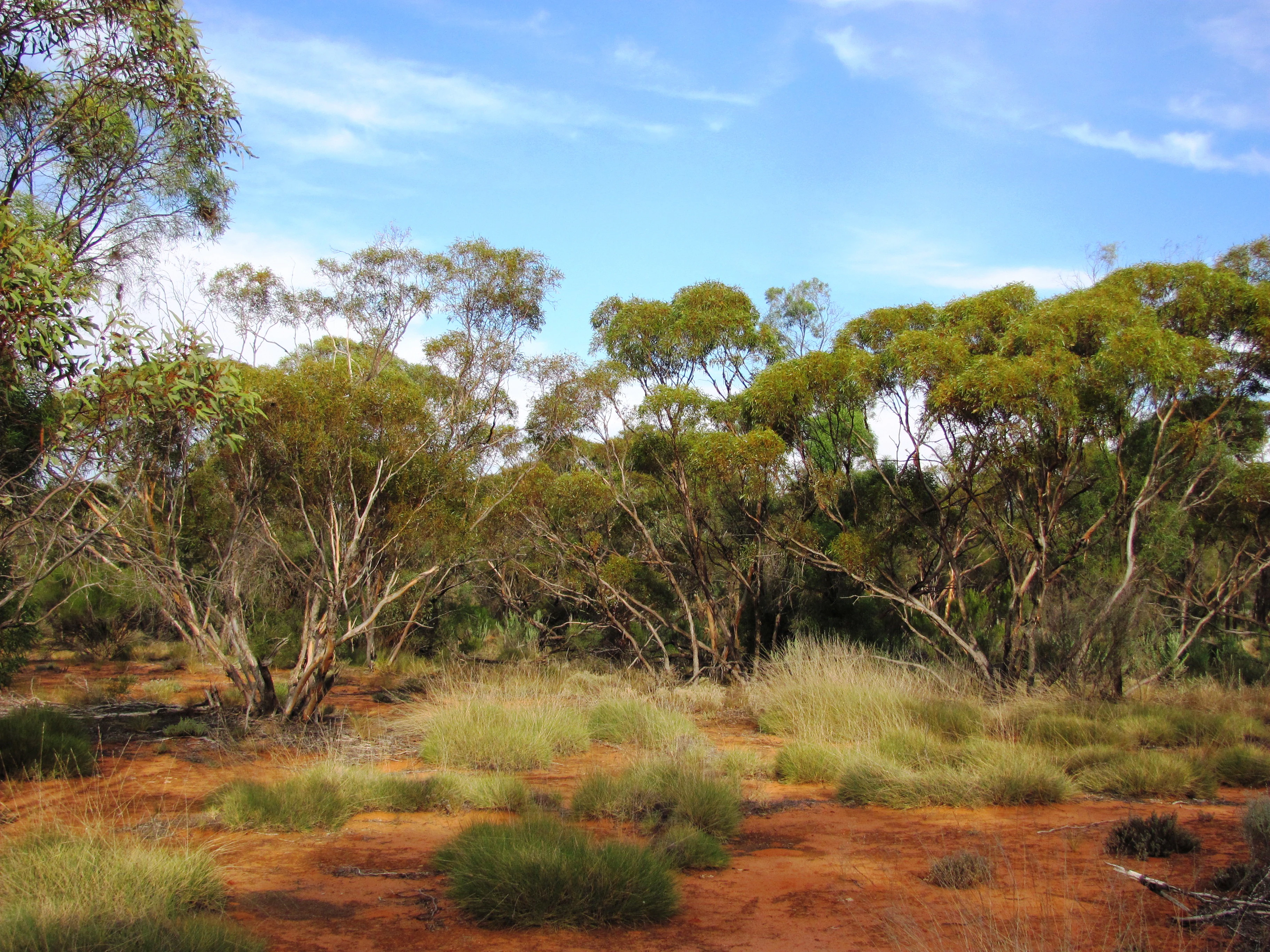
A landscape shot of mallee woodland featuring multi-stemmed eucalyptus trees over red sandy soil and patches of dry shrubs under a blue sky.
Mallee woodland vegetation within the Gluepot Reserve, part of the Riverland Biosphere Reserve in South Australia.

Riverland Biosphere Reserve history and protected-area timeline

The Riverland Biosphere Reserve was formally established in 1977, when it received recognition as part of UNESCO's World Network of Biosphere Reserves. It was originally known as the Bookmark Biosphere Reserve, reflecting an earlier name tied to the surrounding region, before being later redesignated under its current Riverland identity.

Its development reflects a broader shift in conservation thinking toward biosphere reserves as landscapes that combine core protected areas with surrounding multiple-use lands. Rather than being created as a single fenced national park, the reserve grew as a coordinated framework that brought together pre-existing properties of varying tenures and management objectives. Over time, properties such as Chowilla Regional Reserve, Danggali Conservation Park, Gluepot Reserve, and Murray River National Park became recognised component parts of the larger biosphere landscape, reinforced by additional recognition through listings such as the Riverland Mallee Important Bird Area.

Riverland Biosphere Reserve landscape and geographic character

The landscape of the Riverland Biosphere Reserve is defined by the meeting of two very different Australian environments. Across much of its area, especially in the Murray Mallee portion, the terrain is shaped by low rainfall, sandy soils, and an open cover of mallee woodland and shrubland. Mallee vegetation, with its multi-stemmed eucalypts and dense understorey of hardy shrubs, creates a characteristically dry, textured, low-canopy landscape adapted to fire and aridity.

Running along the southern and eastern edge of the reserve, the Murray River introduces a contrasting riverine corridor. Here, the land is shaped by water, with river channels, anabranches, and broad floodplains that periodically fill and recede. The result is a network of wetlands, riparian vegetation, and open floodplain habitats that stand in sharp visual contrast to the surrounding dry mallee. This mosaic of arid woodland and riverine floodplain gives the reserve a varied topography despite its generally low relief, and it is the foundation for much of the area's ecological significance.

Riverland Biosphere Reserve ecosystems, habitats, and plant life

Ecologically, the reserve is dominated by mallee woodland and associated shrubland, vegetation types highly adapted to dry, nutrient-poor conditions and to fire as a recurring influence. These habitats form a semi-arid mosaic where trees, shrubs, and open ground alternate across the landscape, supporting a specialised community of birds, reptiles, and small mammals.

Along the Murray River corridor, however, the ecological character shifts toward riverine vegetation, wetlands, and floodplain systems. These areas introduce aquatic and semi-aquatic habitats, dense stands of plants tolerant of periodic inundation, and seasonal wetlands that draw waterbirds in large numbers. The combination of dry woodland and seasonally inundated floodplain wetlands gives the reserve a strong duality, supporting both arid-adapted terrestrial species and waterbirds that depend on wet phases of the floodplain.

Riverland Biosphere Reserve wildlife and species highlights

The reserve's wildlife profile is shaped by its two main habitat systems: mallee woodland and Murray River floodplain wetlands. The mallee country supports a suite of bird species specifically associated with this habitat type, including the endangered black-eared miner, a species that has prompted an active national recovery effort. The broader mallee bird community is recognised as significant enough that the reserve overlaps with the Riverland Mallee Important Bird Area identified by BirdLife International.

Along the river and across the floodplain, the wetlands function as internationally significant habitat for migratory birds. Under the Ramsar Convention, these floodplain wetlands have been recognised for their role in supporting species that move between Australia and other countries on annual migrations. Together, the dryland bird fauna and the waterbird populations give the reserve a rich and contrasting wildlife character that bridges arid and aquatic ecological worlds.

Riverland Biosphere Reserve conservation status and protection priorities

The Riverland Biosphere Reserve is significant from a conservation perspective because it demonstrates how biodiversity protection can be pursued across a vast, multi-tenure Australian landscape rather than within a single fenced reserve. Its UNESCO listing since 1977 places it within a global framework for testing approaches to reconciling conservation with sustainable human use, and its component properties collectively protect an unusually large area of mallee habitat and Murray River floodplain.

At an international level, the floodplain wetlands have been recognised under the Ramsar Convention for their value to migratory waterbirds, giving the reserve a global standing in wetland conservation. At a national level, participation in the recovery plan for the endangered black-eared miner highlights its role in safeguarding one of Australia's most threatened mallee specialists. The reserve also overlaps with the Riverland Mallee Important Bird Area, reinforcing its importance for bird conservation. By integrating protected areas, pastoral leases, and private land into a single coordinated framework, the reserve offers an important working model of landscape-scale conservation in a low-productivity Australian setting.

Top sights and standout views in Riverland Biosphere Reserve

Few Australian protected landscapes combine UNESCO biosphere recognition, Ramsar-listed wetlands, and a nationally important bird recovery program within a single boundary, but the Riverland Biosphere Reserve achieves exactly this. Its scale, around 9,000 square kilometres, makes it one of the largest coordinated conservation frameworks of its kind in the country.

Internal highlights include Gluepot Reserve for mallee bird conservation, Chowilla Regional Reserve and Chowilla Game Reserve for floodplain ecosystems, Danggali Conservation Park and Danggali Wilderness Protection Area for more remote mallee wilderness, and Murray River National Park for riverine scenery. The reserve's mix of arid woodland and Murray River floodplain, combined with overlapping recognition from UNESCO, the Ramsar Convention, and BirdLife International, makes it a landscape of unusually broad ecological and conservation significance.

Best time to visit Riverland Biosphere Reserve

Seasonal timing changes the character of a visit to the Riverland Biosphere Reserve substantially, because the landscape is shaped by the contrast between dry mallee country and water-influenced riverine corridors. In the cooler months, mallee bird activity can be productive for observing species such as the black-eared miner and other dryland specialists, and conditions for outdoor exploration in the woodland are generally more comfortable than during peak summer heat in this semi-arid environment.

Along the Murray River floodplains, filling and drying cycles influence both scenery and wildlife, with higher water levels often drawing larger numbers of waterbirds. Visitors interested in migratory waterbirds and wetland scenery will find seasonal conditions along the river and its associated floodplain wetlands particularly important, while those focused on mallee landscapes will appreciate the cooler months for traversing the dry woodland under more moderate conditions. The reserve's diverse habitats mean that visitors with different interests may find different times of year rewarding.
Monthly climate preview

Long-term monthly temperature averages and precipitation measurements for South Australia

Riverland Biosphere Reserve Climate Normals and Annual Temperature Rhythm

Representative coordinates track recorded monthly temperature swings from warm maximums to cooler winter lows alongside steady precipitation rates across the year. Reviewing the complete twelve-month climatology profile provides deeper context on measured environmental baselines and seasonal shifts.
Annual mean19 °C
10 °C27 °C
Jan27°
Feb26°
Mar23°
Apr18°
May14°
Jun11°
Jul10°
Aug12°
Sep15°
Oct19°
Nov22°
Dec25°
Warmest month
January

27.1 °C

Coolest month
July

10.3 °C

Wettest month
February

0.8 mm/day

Driest month
March

0.4 mm/day

Park location guide

Geography guide, regional context, and park location map for Riverland Biosphere Reserve

Riverland Biosphere Reserve park geography, regions, and map view in Australia

Understand where Riverland Biosphere Reserve sits in Australia through a broader geographic reading of the surrounding landscape, nearby location context, and its mapped position within the national park landscape.

How Riverland Biosphere Reserve fits into Australia

Australia is a constitutional monarchy and federal parliamentary democracy comprising six states and ten territories. With a population of nearly 28 million, it is one of the world's most urbanised countries, with most people concentrated on the eastern seaboard. The country has a high Human Development Index and is known for its cultural diversity, ancient Aboriginal heritage, and unique wildlife.

Wider geography shaping Riverland Biosphere Reserve in Australia

Australia occupies the entire Australian continent, the island of Tasmania, and numerous smaller islands. It is the world's flattest and driest inhabited continent, featuring vast deserts in the interior (the Outback), tropical rainforests along the eastern coast, and a coastline bordering the Indian and Pacific Oceans.

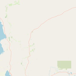
Map view of Riverland Biosphere Reserve

Use this park location map to pinpoint Riverland Biosphere Reserve in Australia, understand its exact geographic position, and read its mapped placement within the surrounding landscape more clearly.

Pigeon | © OpenStreetMap contributors

Location context for Riverland Biosphere Reserve

South Australia

Explore photographic records of native mallee woodland habitats, sandy terrain, and Murray River wetlands.

Riverland Biosphere Reserve Photos and Landscapes: Visualizing Arid Mallee Terrain and River Floodplains

Visual records capture the striking ecological contrast between dry sandy mallee woodlands and dynamic river floodplains across the protected landscape. Examining photography helps researchers and visitors understand the varied terrain, native habitats, and distinct visual character of the reserve.

A landscape shot of mallee woodland featuring multi-stemmed eucalyptus trees over red sandy soil and patches of dry shrubs under a blue sky.

Park atlas

Compare regional conservation areas, mallee woodlands, and riverine floodplains across the border region.

Parks Near Riverland Biosphere Reserve and Surrounding Protected Landscapes

Browsing other protected areas near Riverland Biosphere Reserve reveals connected mallee woodlands and riverine wetland corridors across the surrounding region. Extending the geographic comparison helps trace similar arid ecosystems and floodplain habitats in adjacent terrain.
Nature reserveSouth Australia
About 39 km away#1 closest

Southeast

Danggali Conservation Park: Semi-Arid Protected Land and Murray-Mallee Geography

Nature reserve geography and inland landscape context in South Australia.

Danggali Conservation Park preserves a substantial inland landscape north of the Riverland, characterised by open mallee scrubland, sandy dune systems, and dry eucalypt woodlands. This protected area acts as a crucial ecological bridge, showcasing the distinct shift from river-influenced environments to the arid interior of South Australia.

Area
484.16 km²
Established
1976
IUCN
Ia
Relief
Upland
Nature reserveNew South Wales
About 47 km away#2 closest

East

Scotia Sanctuary: Protected Nature Reserve and Mallee Landscape Geography in New South Wales

Arid zone conservation and dune-swale mapping.

Scotia Sanctuary serves as a primary example of arid-zone conservation in south-western New South Wales. This reserve protects vast tracts of intact eucalypt mallee shrubland and sheoak woodland, set across a distinctive landscape of parallel sand dunes and calcareous swales. Its geographic position within the Murray-Darling Depression makes it a critical site for understanding the intersection of land management, habitat restoration, and regional ecological patterns.

Area
650 km²
Established
1994
Relief
Lowland
Climate
Arid
Nature reserveSouth Australia
About 56 km away#3 closest

South

Calperum Station Nature Reserve: Mallee Landscapes and Riverland Wetlands in South Australia

Detailed geographic overview of a major Australian nature reserve.

Spanning over 2,300 square kilometers, Calperum Station preserves a vital stretch of mallee woodland and Murray River floodplain. This nature reserve serves as an international site for wetland conservation and provides a crucial stronghold for threatened bird species. The mapped area highlights the intersection of dryland dune-field ecology and riparian corridors, offering insight into large-scale habitat restoration.

Area
2,386 km²
Established
1993
Relief
Lowland
Climate
Arid
Wildlife reserveSouth Australia
About 74 km away#4 closest

Southwest

Taylorville Station Wildlife Reserve: Mallee Woodland Map and Regional Geography

Protected mallee landscapes in the Murray-Mallee, South Australia.

Taylorville Station provides a critical refuge for mallee-dependent species within its 92 square kilometres of semi-arid woodland. As a cornerstone of the Riverland Biosphere Reserve, this protected area in South Australia offers a unique look at the ecological significance of the Murray-Mallee region's persistent eucalypt vegetation and habitat management frameworks.

Area
92.6 km²
Established
2005
IUCN
IV
Visitors
2.7K annual
National parkAustralia
About 85 km away#5 closest

Southeast

Murray-Sunset National Park: Iconic Pink Lakes and Mallee Wilderness in Victoria's Semi-Arid Interior

Explore its unique landscape, mapped boundaries, and regional geography.

Murray-Sunset National Park offers a compelling glimpse into Australia's semi-arid heart, featuring a dramatic landscape of salt lakes, gypsum plains, extensive sand dunes, and dense mallee woodlands. This vast protected area is renowned for the vibrant pink hue of its salt lakes, a phenomenon created by microscopic algae that flourishes in the hypersaline conditions during warmer months. The park's rich biodiversity and unique ecosystem make it a significant conservation asset, providing crucial habitat for numerous species adapted to this challenging yet beautiful environment.

Area
6,330 km²
Established
1991
IUCN
II
Relief
Lowland
National parkSouth Australia
About 88 km away#6 closest

South

Murray River National Park: Protected Wetland Ecosystems in South Australia

Explore South Australia's unique river red gum floodplains.

Murray River National Park is a significant protected area in South Australia, renowned for its expansive wetland and floodplain environments situated along the Murray River. This national park preserves crucial habitats within the Murray-Darling Basin, characterized by river red gum woodlands, permanent water bodies, and dynamic seasonal floodplains. Its detailed maps and geographic context offer deep insights into one of Australia's most important riverine conservation landscapes.

Area
148.79 km²
Established
1991
IUCN
VI
Relief
Lowland
State or regional parkSouth Australia
About 91 km away#7 closest

South

Cooltong Conservation Park: Geography and Protected Mallee Woodland in South Australia

A regional conservation area defined by dune and shale flat topography

Cooltong Conservation Park is a protected state area in South Australia's Riverland. It features 37 square kilometres of mallee shrubland shaped by undulating dunes and shale flats. This conservation landscape is a recognized stronghold for birdlife, particularly the iconic Malleefowl, offering an authentic look at Australia's inland semi-arid terrain and its ecological connectivity.

Area
37.1 km²
Established
1993
IUCN
VI
Relief
Lowland
Wildlife reserveSouth Australia
About 105 km away#8 closest

Southwest

Hogwash Bend Conservation Park: Protected Riverland Habitat and Geographic Overview

A vital wildlife reserve anchoring riparian and mallee ecosystems

Located near Cadell in South Australia, Hogwash Bend Conservation Park secures a unique cross-section of river red gum forest and dryland mallee. The reserve serves as a targeted breeding refuge for the vulnerable eastern Regent Parrot, illustrating the importance of localized conservation within the broader Murray River corridor.

Area
4.02 km²
Established
2012
IUCN
III
Relief
Lowland

Common questions about visiting, size, designation, and location context for Riverland Biosphere Reserve

Riverland Biosphere Reserve FAQs for park facts, access, geography, and protected area context

Find quick answers about Riverland Biosphere Reserve, including protected-area facts, park geography, trail and visitor context, and how the park fits into its surrounding country and regional landscape.
MoriAtlas Explorer

Continue Your Protected Areas Search Across the Global Atlas

Deepen your exploration by continuing the structured search for national parks and protected areas worldwide. Utilize the comprehensive filtering capabilities to compare different conservation landscapes and refine your understanding of global park geography. Discover more about the distribution and characteristics of protected natural areas.

Global natural geography