
Why Rookery Bay National Estuarine Research Reserve stands out
Rookery Bay is most recognized for protecting what is widely described as a nearly pristine subtropical mangrove forested estuary. Few places in North America still combine continuous mangrove shoreline, tidal estuarine waters, and adjacent uplands in such an undisturbed condition, and this ecological integrity is central to the reserve's identity. The reserve also serves as a hub for estuarine research, monitoring, and education. Scientists across multiple wildlife specializations study its habitats, while the reserve's staff and volunteers use that knowledge to guide habitat restoration, invasive species control, prescribed fire, and protection of listed species across the broader Ten Thousand Islands region.
Rookery Bay National Estuarine Research Reserve history and protected-area timeline
The story behind Rookery Bay's protection begins with a development threat. In 1963, a proposed ten-mile loop road through the bay raised the prospect of large-scale coastal transformation along this stretch of southwest Florida. The Collier County Conservancy, the Nature Conservancy, the Collier Audubon Society, and a network of private investors joined together in a grassroots campaign that ultimately resulted in the purchase of an initial 3,362 acres.
Those pioneering acquisitions became the foundation for what would be designated the Rookery Bay National Estuarine Sanctuary by the National Oceanic and Atmospheric Administration in 1980. Shortly after that designation, the site's name was broadened to the Rookery Bay National Estuarine Research Reserve, reflecting a stronger emphasis on ongoing scientific study and long-term monitoring rather than purely passive protection.
From that early nucleus of preserved land, the reserve grew into a multi-decade conservation effort, with additional acquisitions, restoration work, and the development of education and outreach programs. Its evolution from a single threatened tract to one of the largest estuarine reserves in the national system mirrors the broader shift in Florida coastal conservation from ad hoc land purchases toward coordinated, ecosystem-scale management of estuarine watersheds.
Rookery Bay National Estuarine Research Reserve landscape and geographic character
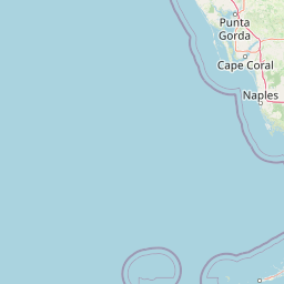
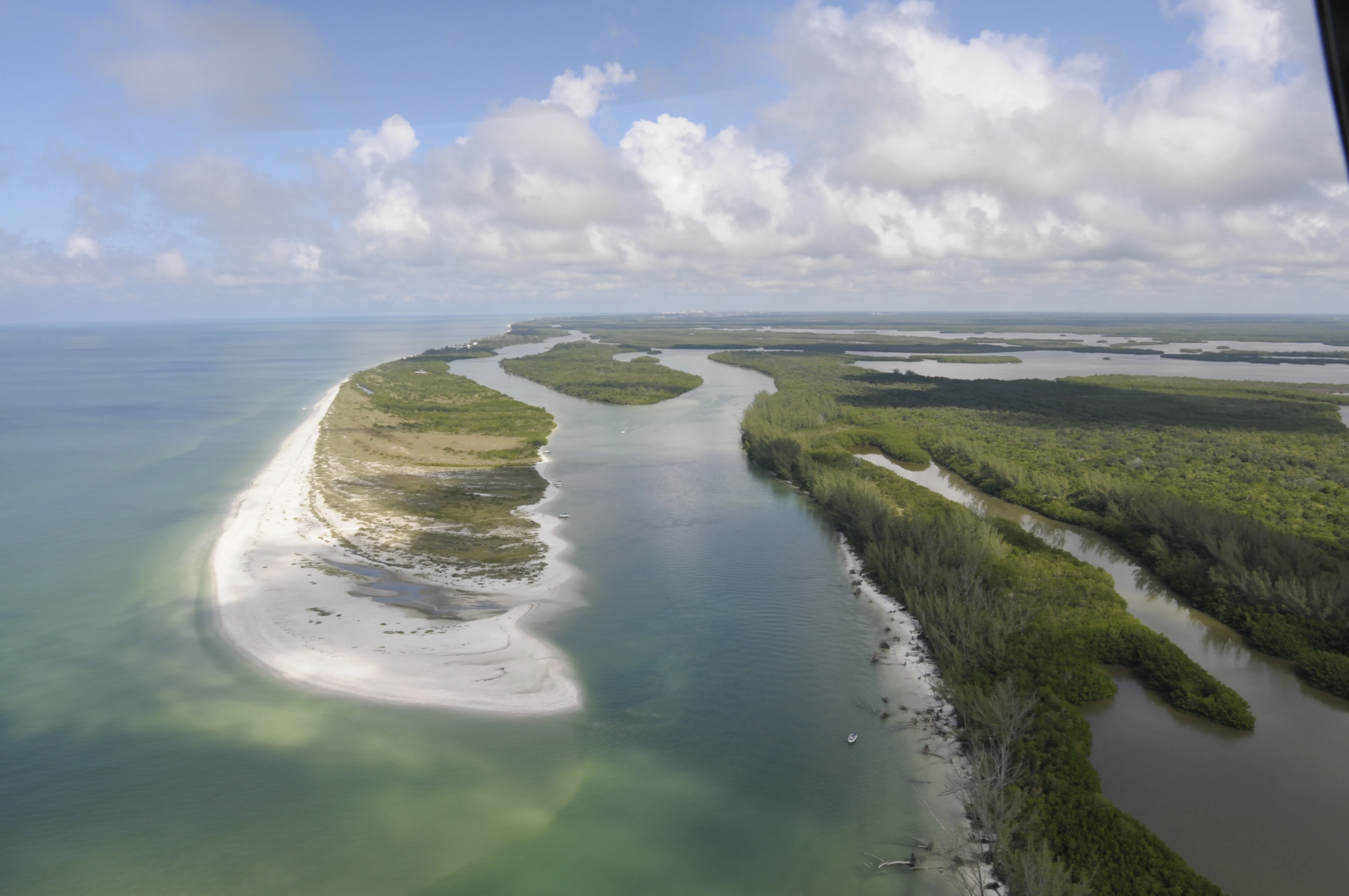
The landscape of Rookery Bay is shaped by the meeting of mangrove forest and tide. Dense stands of mangroves fringe a network of shallow bays, winding tidal creeks, and open Gulf waters, while small islands and oyster bars rise above the calm estuarine surface. To the east, the reserve gives way to the broader sweep of the Ten Thousand Islands, a labyrinth of mangrove keys that stretches for miles along the southwest Florida shoreline.
Because the reserve protects such a continuous belt of mangrove shoreline, the terrain feels less like a defined park with trails and overlooks and more like an interwoven seascape where land and water are impossible to separate cleanly. Tidal fluctuations regularly transform shallow flats into exposed banks, and storm-driven water movement can rearrange sediments and reshape the edges of islands over time.
The result is an estuarine landscape that is dynamic rather than static. Visitors moving through the reserve by boat encounter a layered scenery of mangrove tunnels, open bay vistas, oyster shoals, and distant horizons where the Gulf of Mexico meets tropical-looking coast. It is this unbroken tidal forest character, more than any single viewpoint, that defines the geography of Rookery Bay.
Rookery Bay National Estuarine Research Reserve ecosystems, habitats, and plant life
The reserve's nature is fundamentally estuarine. Mangrove forest is the dominant habitat, providing shelter for juvenile fish, crustaceans, and shellfish while filtering and stabilizing the shoreline. Beneath the water surface, seagrass beds and oyster reefs extend the habitat complexity, creating the food web foundation on which the rest of the system depends.
Because Rookery Bay sits within the West Indian Biogeographic Region, the area exhibits a tropical character uncommon elsewhere in the continental United States. The combination of mangrove, seagrass, and tidal marsh habitats supports ecological processes typical of Caribbean and tropical American coastlines, including seasonal migrations of tropical species and reliance on mangrove-derived detritus as a primary energy source for the estuarine food web.
The reserve's management activities reflect this integration of habitats. Habitat and hydrology restoration projects, control of invasive plants and animals, and carefully applied prescribed fire all work to maintain a mosaic of mangrove, marsh, and upland communities rather than a single uniform environment.
Rookery Bay National Estuarine Research Reserve wildlife and species highlights
Rookery Bay's wildlife community is shaped first by its mangroves. The forests serve as nursery grounds for a wide range of fish and invertebrates that later move into the Gulf of Mexico, supporting both local biodiversity and regional fisheries. Wading birds, shorebirds, and seabirds use the shallow bays and exposed flats as feeding and roosting habitat, while raptors patrol the edges of the mangrove forest.
Turtles, manatees, and dolphins are among the larger and more recognizable species that pass through or depend on the reserve, and the area has a documented record of marine mammal strandings that staff and trained volunteers respond to as part of the reserve's stewardship work. Listed and sensitive species receive specific protection measures, reflecting the reserve's role in conserving species that depend on the integrity of the estuarine system.
The reserve also serves as a long-term study site for researchers from many wildlife specializations. Their work, combined with the reserve's own monitoring, helps track how populations and ecological relationships respond to pressures ranging from coastal development elsewhere in Florida to changes in freshwater flow and climate.
Rookery Bay National Estuarine Research Reserve conservation status and protection priorities
Rookery Bay matters for conservation because of what it still represents: a subtropical mangrove estuary that has largely avoided the disturbances that have reshaped most of Florida's coastline. Protecting such a system at the northern edge of the Ten Thousand Islands preserves ecological processes that are difficult or impossible to restore once lost, from the structure of mangrove forests to the nursery function they perform for commercially and ecologically important fish and shellfish.
As one of the sites in NOAA's National Estuarine Research Reserve system, Rookery Bay contributes to national-scale monitoring of estuarine health, water quality, and habitat change. The reserve's staff combine that broader monitoring role with active management, including invasive species control, prescribed fire, habitat and hydrology restoration, and rapid response to marine mammal strandings. Together these efforts form a working conservation program rather than a purely passive designation.
The reserve's location also gives it a buffer function for the surrounding Ten Thousand Islands region, helping to ensure that even as southwest Florida continues to grow, a substantial core of undisturbed estuarine habitat remains for species and ecological processes that depend on it.
Rookery Bay National Estuarine Research Reserve cultural meaning and human context
The lands and waters around Rookery Bay have long been shaped by human ties to estuarine resources. Before modern conservation, this stretch of southwest Florida supported fishing communities, and the surrounding Ten Thousand Islands remain associated with a coastal heritage of small-boat livelihoods and seasonal rhythms connected to the mangrove environment.
Today, much of the reserve's cultural connection is expressed through education and volunteer stewardship rather than traditional resource use. The Friends of Rookery Bay, programs like Team OCEAN that promote ethical boating and Leave No Trace practices, and school programs such as Estuary Explorers and Rookery Bay Survivors all link the reserve to the lived environment of local communities. These programs reflect a community identity that sees the estuary not just as scenery but as a working landscape whose health is tied to the well-being of nearby towns.
Top sights and standout views in Rookery Bay National Estuarine Research Reserve
The single most striking quality of Rookery Bay is the sheer continuity of its mangrove estuary. Where much of Florida's coastline has been broken up by development, dredging, and altered freshwater flows, this reserve still offers long stretches of forest-fringed tidal waters that look and function much as they have for generations.
Equally significant is the reserve's dual role as a refuge and a research platform. Its protected status preserves a subtropical estuarine ecosystem at an almost continental scale, while its institutional mission generates ongoing scientific work, long-term monitoring, and structured education that help translate that protection into actionable understanding. The combined effect is a place where conservation, science, and community engagement reinforce one another.
Best time to visit Rookery Bay National Estuarine Research Reserve
Rookery Bay's subtropical character means that seasons are defined more by changes in temperature, rainfall, and wildlife activity than by dramatic snowfall or leaf change. Cooler months from roughly late fall through early spring tend to bring drier conditions, calmer winds, and increased activity from wading birds, shorebirds, and other wintering wildlife, which can make boat and kayak travel on the estuarine waters more comfortable.
Warmer and wetter months bring higher humidity, more frequent thunderstorms, and richer insect and fish activity, but also stronger sun and more variable boating conditions. Because much of the reserve is experienced from the water rather than from trails, calmer wind and tidal conditions generally matter more than any single calendar window. Visitors interested in a particular wildlife spectacle, such as peak bird presence or turtle nesting activity, will benefit from aligning timing with the species or event they most hope to see.