
Mori Atlas logo
Protected areaRuby Gap Nature Park

Explore the remote river corridors, granite cliffs, and layered history of this East MacDonnell Ranges protected area.

Ruby Gap Nature Park: A Protected Arid Gorge Landscape in the Northern Territory of Australia

Ruby Gap Nature Park encompasses a dramatic arid-land wilderness along the Hale River, carving through the ancient rock formations of the eastern MacDonnell Ranges. This protected area features soaring cliff lines, granite-studded riverbeds, and a profound historical landscape that spans from traditional Eastern Arrernte Country to the intense 19th-century mining rush. Visitors can trace the rugged terrain and natural boundaries of this unique regional enclave where the legacy of early exploration meets the enduring silence of the Central Australian interior.

gorgearid landscapedry climatecliff countryriver corridormining history
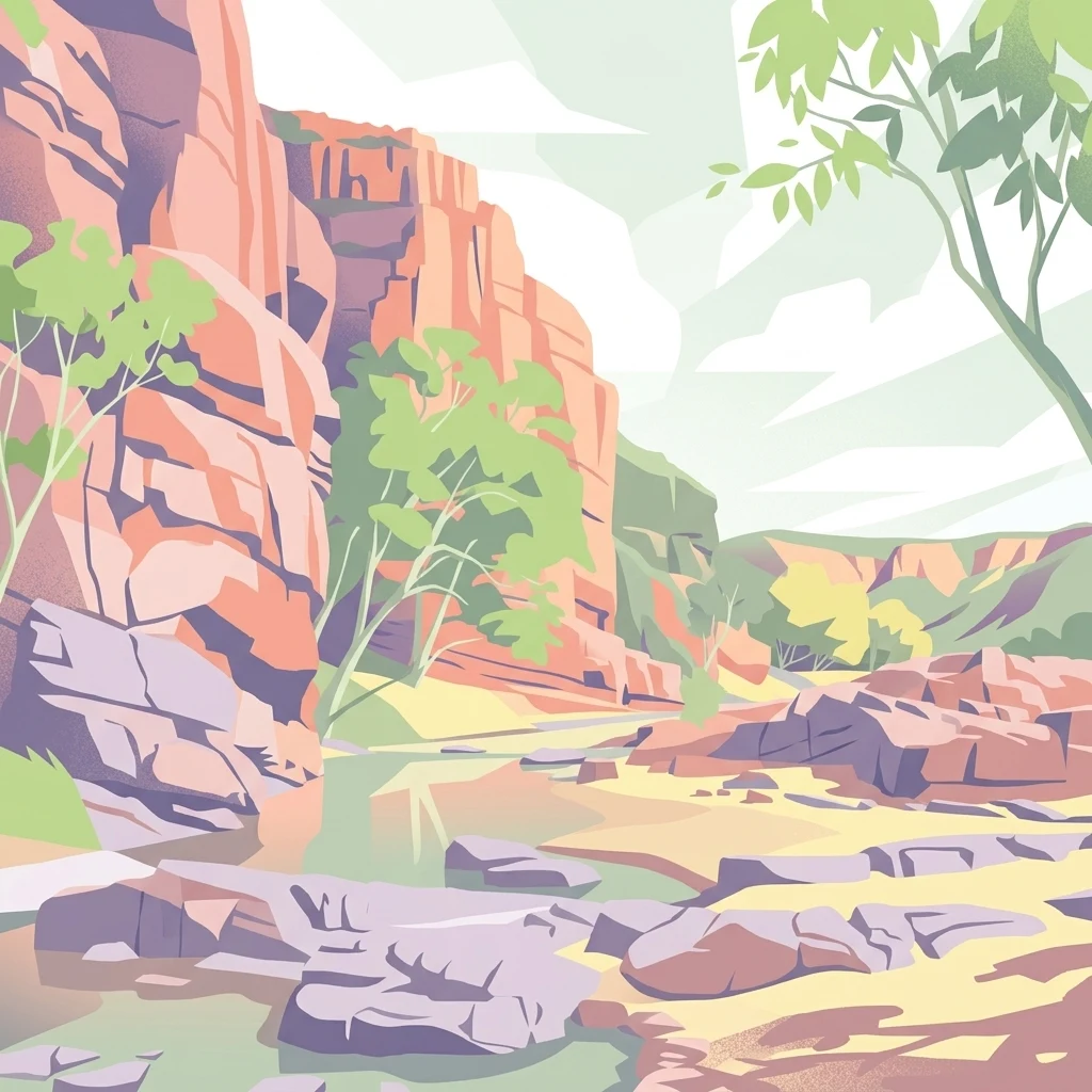
A digital illustration depicting a rocky canyon with tall red sandstone cliffs on the left, green trees, and a rocky riverbed in the foreground under a pale sky.

Ruby Gap Nature Park

Protected area

Park overview

Structured park overview, official facts, and landscape profile for Ruby Gap Nature Park

Ruby Gap Nature Park park facts, protected area profile, and essential visitor context

Review the core facts for Ruby Gap Nature Park, including designation, size, terrain, visitor scale, habitats, and operating context in one park-focused overview.

About Ruby Gap Nature Park

Ruby Gap Nature Park occupies a remote and visually striking section of the East MacDonnell Ranges in Australia's Northern Territory. The park's 9,257 hectares encompass deep gorge country where the Hale River cuts through ancient ranges, producing layered cliffs, weathered rock faces, and sandy creek flats dotted with hardy arid-zone vegetation. Its location, around 150 kilometres east of Alice Springs and adjoining the Arltunga Historical Reserve, places it firmly within the broader cultural landscape of Central Australia's settler and mining history.

The identity of the park is unusually layered. Before it became a protected area, the gorge was the focus of what is sometimes called Australia's first ruby rush, a brief but intense period of speculative activity that began in March 1886 when explorer David Lindsay found red stones glittering in a granite bar crossing the Hale River bed. Lindsay recorded the discovery in his diary and later described the find in a report to the Royal Geographical Society of Australasia, calling the stones rubies and setting in motion a stampede of claims, syndicates, and investment. The story became an enduring episode in Central Australian history, partly because its premise proved false: by mid-1888, rigorous scientific examination confirmed the stones were garnets rather than rubies, the speculative market collapsed, and many of the prospectors redirected their efforts to the neighbouring Arltunga goldfields.

Despite the boom's brevity, the episode left a permanent physical and cultural mark. Mining infrastructure was assembled and dismantled, working parties came and went, and at least one terminally ill participant, F. H. Fox, manager of the MacDonnell Ranges Ruby Mining Company, died as the market collapse broke and was buried where he fell, his grave now forming a poignant ruin within the park. The brief Afghan cameleer presence at the field, memorialised through the death of Achta Mahomed in the same period, further testifies to the multicultural character of the late nineteenth-century mining frontier.

For the broader region, Ruby Gap represents an important node in the network of Central Australian heritage and arid-zone reserves. It connects the geological drama of the MacDonnell Ranges with the prospecting and pastoral history that shaped European-era settlement of the Northern Territory, and it overlays these layers onto a landscape long managed and known by the Eastern Arrernte people. As a protected area, the park preserves not only rugged gorge ecology but also the storied ground of one of Australia's more unusual nineteenth-century mining episodes.

Quick facts and research context for Ruby Gap Nature Park

Ruby Gap Nature Park is a 9,257 hectare protected area located in the Northern Territory of Australia, approximately 150 kilometres east of Alice Springs. Access is via the Arltunga Historical Reserve to the west. The park sits along the Hale River, where a geological formation of garnet-studded granite gave the locality its name and triggered Central Australia's earliest mining boom.

The site is recognised for both its natural and historical values. It is the traditional Country of the Eastern Arrernte people, who continue to maintain cultural connections with the area. The park also preserves tangible reminders of the 1886 to 1888 ruby rush, including the grave of MacDonnell Ranges Ruby Mining Company manager F. H. Fox.

Protection and recognition

Documented terrestrial protection scope and designation records

Ruby Gap Nature Park Protection Status and International Recognition

Ruby Gap Nature Park maintains a documented terrestrial protection scope without imported international recognition sources. Reviewing these verified administrative records clarifies the official conservation status and management framework associated with the landscape.

Protection details

Protection scope
Terrestrial
Transboundary protection
No
Park context

Deeper park guide and search-rich context for Ruby Gap Nature Park

Ruby Gap Nature Park history, landscape, wildlife, and travel context

Explore Ruby Gap Nature Park through its history, landscape character, ecosystems, wildlife, conservation priorities, cultural context, and seasonal travel timing in a structured park guide built for atlas discovery and search intent.

Why Ruby Gap Nature Park stands out

Ruby Gap Nature Park is best known as the epicentre of Central Australia's first mining rush, a fleeting boom founded on stones that were initially mistaken for rubies and later identified as high quality garnets. The 1886 discovery by David Lindsay in the bed of the Hale River drew hundreds of prospectors, syndicates, and companies within a year, only for the market to collapse in mid-1888 once expert analysis overturned the ruby claim. The park is also known for its dramatic arid-land scenery, especially the steep cliff lines and the gorge through which the Hale River flows. Layered rocky walls, granite outcrops, and the heavily garneted riverbed give the landscape its distinctive character and continue to make Ruby Gap a quiet icon of the East MacDonnell Ranges.
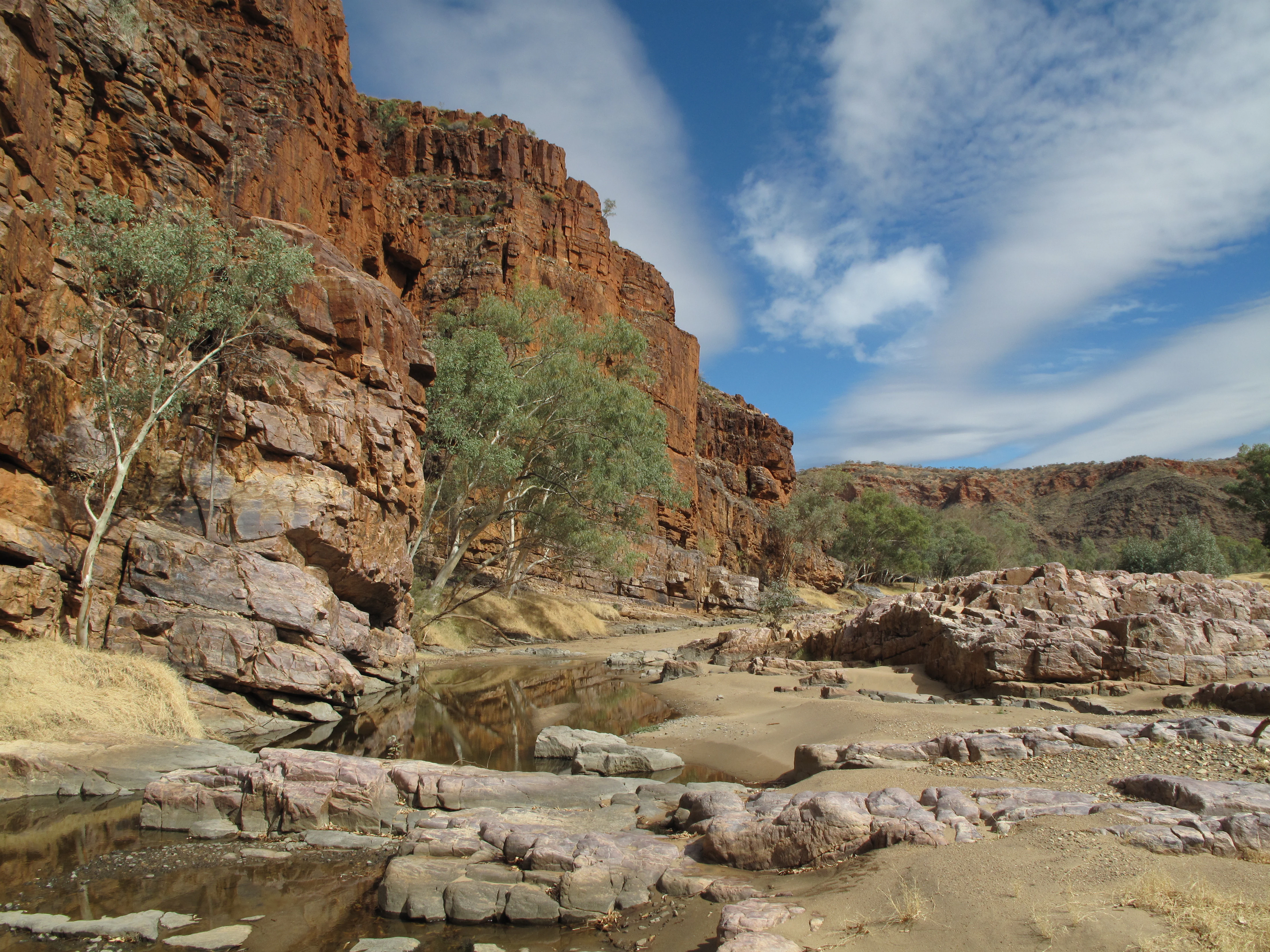
A landscape view of reddish-brown rocky cliffs and a dry riverbed with shallow pools of water and sparse green trees under a blue sky with white clouds.
Red cliff lines and rocky riverbed in Ruby Gap Nature Park, Northern Territory, Australia

Ruby Gap Nature Park history and protected-area timeline

The documented history of Ruby Gap begins well before its formal recognition as a nature park, with stories that trace back to traditional Eastern Arrernte land use and continue through the European exploration, mining, and pastoral phases of Central Australian settlement. Geologically, the area is notable for a granite bar cutting across the Hale River bed, heavily studded with bright red garnets that an early European observer could easily mistake for rubies in the harsh desert light.

The crucial episode began in March 1886, when explorer David Lindsay, moving eastward through what is now the Northern Territory, found what he believed to be rubies embedded in the granite. His diary entry of 8 March 1886 records a granite crossing of the creek that was "completely studded with garnets or rubies," with further detachment of what seemed like beautiful gem sand from beneath a rocky cliff. In a subsequent report to the Royal Geographical Society of Australasia, Lindsay described the stones with growing excitement, calling some red gems of great brilliancy "rubies" after careful examination. Whether or not he or his companion Arthur Warman was the true first discoverer, the announcement transformed the locality into a centre of speculation within months.

By April 1887 an eight-member syndicate had formed, soon incorporating as the MacDonnell Ranges Ruby Mining Company Ltd. They arrived at the field in late May 1887 and collected tens of thousands of stones within a fortnight. Public claims of single-gem values of around £8,000 and total field values near £60,000 attracted further outside investment, including a serious but ultimately failed offer of £200,000 from British speculators after the syndicate's representative, Richard Pearson, sailed to London in August 1887 with a large parcel of stones. The collapse came in May 1888 when Edward Rennie, president of the Royal Society of South Australia, delivered a detailed scientific paper demonstrating that the precious stones under discussion were in fact high quality garnets rather than true rubies. The report effectively ended the rush, although some lingering popular belief in a distinct "Alice Springs ruby" variety persisted, as reflected in Ernestine Hill's later writings.

Among the more poignant legacies of the rush is the grave of F. H. Fox, the company's manager, who died on 25 May 1888, the day after the scientific reassessment reached the field. Although officially recorded as dying of illness, long-standing local accounts suggest Fox took his own life when the speculative enterprise that had drawn him there collapsed. His grave, known colloquially as Fox's Grave, remains within the park and is reached by a popular walking track, though more recent investigation suggests the surviving headstone may not mark the original burial location exactly. Other deaths of the period, including that of the Afghan cameleer Achta Mahomed, further enrich the sense of the human cost of the brief boom.

Ruby Gap Nature Park landscape and geographic character

Ruby Gap Nature Park is defined by an arid gorge landscape shaped by the Hale River as it cuts through part of the eastern MacDonnell Ranges. Layered cliff lines rise above the sandy creek bed, exposing ancient sedimentary and metamorphic rocks that have weathered into dramatic, stepped formations. Above the cliffs, the broader terrain is dry, sparsely vegetated, and characterised by rounded ridges, granite outcrops, and the deep red and ochre tones typical of Central Australian ranges.

The Hale River itself is central to the park's identity. Within the protected area, its corridor narrows into the rocky gorge that gives the site its name, framed by high walls and littered with stones that include the distinctive garnet-bearing granite from which the original ruby rush took its inspiration. Beyond the principal gorge, smaller side gorges, such as the nearby Glen Annie gorge named by Lindsay after his wife, add further topographic variety. Across the whole reserve, drainage lines, stony flats, and isolated rocky hills combine to produce a visually commanding but fragile environment, where exposure to sun, wind, and seasonal floods continues to sculpt both rock surface and vegetation cover.

Ruby Gap Nature Park ecosystems, habitats, and plant life

Although Ruby Gap Nature Park is most celebrated for its human story, its ecological character is quietly significant within Central Australia's arid-land network. The park sits within a hot, dry climate zone where vegetation is sparse, low-growing, and well adapted to periods of drought and intense heat. Hardy chenopod and acacia shrublands dominate much of the open country, while the riparian corridor of the Hale River supports a narrower band of trees and denser shrub cover that benefits from subsurface moisture.

The gorge environment of the Hale River and its tributary gullies provides relatively sheltered microhabitats that contrast with the exposed ridges above. Rock ledges, shaded cliff faces, and sandy creek margins host a distinct assemblage of plants, invertebrates, reptiles, and small mammals able to use the cooler, less exposed conditions. By protecting such a corridor of remote gorge country, the park contributes to broader ecological connectivity across the East MacDonnell Ranges and adjacent reserves, complementing nearby areas such as the Arltunga Historical Reserve and other Central Australian parks that share similar lithology, climate, and flora.

Ruby Gap Nature Park wildlife and species highlights

Wildlife use of the park reflects the patterns typical of arid Central Australian landscapes, where animal presence is closely tied to rainfall, water availability, and the structure of rocky and riverine habitats. Reptiles, including various lizards, are well represented across the hot rocky terrain, taking advantage of exposed stones for thermoregulation. The gorge country and Hale River corridor also provide refuge for birds adapted to both arid uplands and intermittently flowing inland watercourses, and mammals able to survive in sparse, dry conditions.

The park's value for wildlife lies less in any single charismatic species and more in its role as protected habitat within a wider arid-zone mosaic. By keeping the Hale River gorge, its cliff lines, and its associated vegetation outside the most intensive forms of land use, the park helps maintain ecological processes that extend well beyond its 9,257 hectares, supporting animal movement and seasonal habitat use in an environment where such refuges are geographically limited.

Ruby Gap Nature Park conservation status and protection priorities

Conservation significance at Ruby Gap Nature Park arises from the combination of its geological, ecological, and cultural values. The Hale River gorge and surrounding ranges shelter a piece of arid Central Australian landscape that has retained much of its natural condition, free from the most disruptive kinds of pastoral, mining, or urban development that have affected neighbouring areas. Protecting the 9,257 hectare core helps preserve a connected corridor of habitat within the East MacDonnell Ranges and contributes to the broader network of reserves in the Northern Territory.

The park's conservation framework also embraces its historical dimension. By including documented sites such as F. H. Fox's grave within the protected area, the management regime recognises that the heritage values of the ruby rush and earlier Eastern Arrernte land use are themselves resources worth conserving. This makes the park a small but meaningful example of integrated natural and cultural heritage protection in the Australian outback.

Ruby Gap Nature Park cultural meaning and human context

Long before any European explorer reached the Hale River gorge, the country that now forms Ruby Gap Nature Park was part of the traditional estate of the Eastern Arrernte people, known as Ulpmerre. Rock features, waters, and ceremonial sites across the broader East MacDonnell Ranges carry deep cultural meaning for this community, and the park continues to hold significance as part of an enduring ancestral landscape rather than simply a scenic reserve.

The late nineteenth century brought a second cultural layer to the area. The 1886 to 1888 ruby and garnet rush introduced European prospectors, investors, and managers, together with the Afghan cameleers who served as vital transport workers across Central Australia. The death of Achta Mahomed in 1888, the collapse of the MacDonnell Ranges Ruby Mining Company, and F. H. Fox's grave are all part of this short but intense chapter of frontier mining history. Together, these threads give the park a layered identity that combines Aboriginal custodianship with the mythology of Central Australia's earliest mining boom.

Top sights and standout views in Ruby Gap Nature Park

Among the standout features of Ruby Gap Nature Park are the dramatic cliff lines that frame the Hale River gorge, the granite-bar crossings studded with garnets that first attracted European attention, and the remote, light-and-shadow atmosphere of the East MacDonnell Ranges. Walking tracks within the park connect visitors to culturally and historically significant sites, including the grave of F. H. Fox, whose death on the day the ruby illusion broke remains a powerful symbol of the boom's human cost.

Equally striking is the sense of layered history that surrounds the reserve: an ancient Eastern Arrernte landscape, a short-lived but intense 1880s mining rush, and a quiet modern protected area that lets both stories coexist. The combination of arid gorge scenery and direct historical storytelling makes Ruby Gap distinctive within the catalogue of Northern Territory parks.

Best time to visit Ruby Gap Nature Park

Visiting Ruby Gap Nature Park is most rewarding in the cooler months of the Central Australian year, generally falling within the late autumn, winter, and early spring period, when daytime temperatures are milder and walking to sites such as Fox's Grave is more comfortable. The dry season also brings clearer skies, sharper light on the cliff faces, and generally more reliable conditions on the unpaved roads leading in from Alice Springs via the Arltunga Historical Reserve.

Wet-season visits can transform the park's atmosphere, with the Hale River corridor occasionally flowing and gorge scenery becoming greener and more dramatic, though access may be restricted and heat or storms can make exploration difficult. For most visitors, the cooler dry months offer the best balance of stable access and comfortable conditions to appreciate both the natural and historical character of the reserve.

Monthly climate preview

Long-term monthly temperature and precipitation data recorded at a representative park coordinate

Ruby Gap Nature Park Climate Normals and Annual Temperature Patterns

Historical climate records for Ruby Gap Nature Park reveal a measured annual rhythm of shifting temperatures and low precipitation across twelve distinct months. Examining the complete monthly profile provides deeper analytical context for long-term meteorological patterns at this location.
Annual mean22 °C
13 °C30 °C
Jan30°
Feb29°
Mar26°
Apr22°
May17°
Jun13°
Jul13°
Aug15°
Sep21°
Oct24°
Nov28°
Dec29°
Warmest month
January

30.5 °C

Coolest month
July

12.8 °C

Wettest month
January

1.8 mm/day

Driest month
August

0.1 mm/day

Park location guide

Geography guide, regional context, and park location map for Ruby Gap Nature Park

Ruby Gap Nature Park park geography, regions, and map view in Australia

Understand where Ruby Gap Nature Park sits in Australia through a broader geographic reading of the surrounding landscape, nearby location context, and its mapped position within the national park landscape.

How Ruby Gap Nature Park fits into Australia

Australia is a constitutional monarchy and federal parliamentary democracy comprising six states and ten territories. With a population of nearly 28 million, it is one of the world's most urbanised countries, with most people concentrated on the eastern seaboard. The country has a high Human Development Index and is known for its cultural diversity, ancient Aboriginal heritage, and unique wildlife.

Wider geography shaping Ruby Gap Nature Park in Australia

Australia occupies the entire Australian continent, the island of Tasmania, and numerous smaller islands. It is the world's flattest and driest inhabited continent, featuring vast deserts in the interior (the Outback), tropical rainforests along the eastern coast, and a coastline bordering the Indian and Pacific Oceans.

Map view of Ruby Gap Nature Park

Use this park location map to pinpoint Ruby Gap Nature Park in Australia, understand its exact geographic position, and read its mapped placement within the surrounding landscape more clearly.

Pigeon | © OpenStreetMap contributors

Location context for Ruby Gap Nature Park

Northern Territory

Explore protected area photography highlighting rugged cliff lines, dry riverbeds, and unique terrain features.

Ruby Gap Nature Park Photos and Scenery: Visualizing Arid Gorge Landscapes

Visual records capture the stark geology and dramatic rock formations defining the protected park environment. Field photography reveals the remote character of arid river corridors and ancient range topography.

A landscape view of reddish-brown rocky cliffs and a dry riverbed with shallow pools of water and sparse green trees under a blue sky with white clouds.

Park atlas

Compare adjacent arid terrain, river corridors, and regional conservation areas

Explore Other Parks Near Ruby Gap Nature Park and Surrounding Protected Landscapes

Compare adjacent arid reserves, river corridors, and remote protected landscapes after exploring Ruby Gap Nature Park. Examining surrounding regional terrain provides deeper geographic context for Central Australian wilderness areas.
Protected areaNorthern Territory
About 31 km away#1 closest

West

Arltunga Historical Reserve: A Heritage Protected Area in Northern Territory Australia

Mapping nineteenth century mining ruins and arid terrain

Arltunga Historical Reserve offers a distinct window into the outback mining era through its well-preserved stone structures and desolate desert setting. This protected area within the Northern Territory highlights the intersection of European settlement history and the traditional cultural heritage of the Eastern Arrernte people.

Area
50 km²
Established
1975
Relief
Upland
Climate
Arid
A wide watercolor illustration showing a winding river or creek bed flanked by green trees, with pink and red rocky hills in the background under a pale sky.
Nature reserveNorthern Territory
About 60 km away#2 closest

West

N'Dhala Gorge Nature Park: Mapped Geography and Protected Cultural Heritage

Nature reserve located in the eastern MacDonnell Ranges

This nature reserve protects a vital valley corridor in the Northern Territory where sandstone ridges and sandy terrain meet. The park serves as a repository for approximately 6,000 ancient petroglyphs and sustains specialized arid plant species. Use this resource to understand the park's structural boundaries and its place within the broader geography of Central Australia.

Area
5.01 km²
Established
1962
IUCN
V
Relief
Mountain
Protected landscapeNorthern Territory
About 64 km away#3 closest

West

Trephina Gorge Nature Park: Mapped Geography and Protected Landscape Context

East MacDonnell Ranges, Northern Territory Australia

Trephina Gorge Nature Park represents a central feature of the arid MacDonnell Ranges, characterized by its deep gorge, white ghost gums against red rock, and expansive spinifex ridges. This record outlines the park boundaries, its role as a jointly managed conservation area, and its position within the broader geography of central Australia.

Established
1965
Relief
Mountain
Climate
Arid
Access
Access unknown
Protected landscapeNorthern Territory
About 85 km away#4 closest

West

Corroboree Rock Conservation Reserve: Geological and Cultural Protected Area in Central Australia

Mapped protected landscape within the East MacDonnell Ranges

Corroboree Rock Conservation Reserve features a striking dolomite rock formation tied to ancient Precambrian salt lake sediments. Located east of Alice Springs, the reserve provides a protected glimpse into central Australian arid range geography and holds profound cultural importance for the Eastern Arrernte Traditional Owners within the surrounding pastoral landscape.

Area
0.07 km²
Established
1962
IUCN
V
Visitors
15K annual
National parkNorthern Territory
About 106 km away#5 closest

Northeast

Dulcie Range National Park National Park: Mapped Protected Landscape in Northern Territory

Explore its geographic boundaries and regional terrain.

Dulcie Range National Park, a protected national park in Australia's Northern Territory, offers a focus for structured geographic discovery. This page details its mapped protected area, contributing to an understanding of the regional landscape and terrain. It serves as a vital entry point for exploring the park's specific natural and geographic identity within the vast context of Northern Australia.

Area
191.12 km²
Established
1991
IUCN
II
Relief
Upland
National parkNorthern Territory
About 118 km away#6 closest

West

Tjoritja / West MacDonnell National Park: National Park Atlas and Protected Landscape

Explore the dramatic MacDonnell Ranges terrain and geography.

Delve into the protected geography of Tjoritja / West MacDonnell National Park, a significant national park in Australia's Northern Territory. This landscape features striking mountain formations, deep gorges like Standley Chasm and Glen Helen, and is intrinsically linked to the famous Larapinta Trail and the Arrernte people's cultural heritage. Understanding its mapped boundaries and regional context provides essential insight into this iconic Central Australian protected area.

Area
2,568.61 km²
Established
1992
IUCN
II
Relief
Mountain
Watercolor painting of a soft, abstract landscape with a line of trees against rolling hills and light, hazy colors.
Nature reserveNorthern Territory
About 124 km away#7 closest

Southwest

Napwerte / Ewaninga Rock Carvings Conservation Reserve: Protected Desert Landscape Map

Cultural heritage and arid basin geography in the Northern Territory

Napwerte / Ewaninga Rock Carvings Conservation Reserve protects a unique desert site defined by its extensive collection of prehistoric Arrernte rock engravings. The landscape encompasses rocky outcrops, red sand dunes, and a seasonal claypan that captures rare rainfall, creating a significant intersection of archaeological history and arid-zone ecology in central Australia.

Area
0.06 km²
Established
1970
IUCN
V
Relief
Lowland
Wildlife reserveNorthern Territory
About 132 km away#8 closest

West

Kuyunba Conservation Reserve: Wildlife Protected Landscape in Central Australia

Mapped geography and rocky habitat near Alice Springs

Kuyunba Conservation Reserve represents a focused approach to habitat protection in the Northern Territory. The terrain is defined by its rocky hills and boulder-filled escarpments, offering critical shelter for wildlife in an arid, drought-adapted desert region. This site provides a clear view of how targeted land management supports specialized ecological niches in inland Australia.

Area
6.29 km²
Established
1970
IUCN
V
Relief
Upland

Common questions about visiting, size, designation, and location context for Ruby Gap Nature Park

Ruby Gap Nature Park FAQs for park facts, access, geography, and protected area context

Find quick answers about Ruby Gap Nature Park, including protected-area facts, park geography, trail and visitor context, and how the park fits into its surrounding country and regional landscape.
MoriAtlas Explorer

Continue Your Protected Areas Search Across the Global Atlas

Deepen your exploration by continuing the structured search for national parks and protected areas worldwide. Utilize the comprehensive filtering capabilities to compare different conservation landscapes and refine your understanding of global park geography. Discover more about the distribution and characteristics of protected natural areas.

Global natural geography