
Mori Atlas logo
Marine protected areaSaltstraumen

A study of high-energy tidal dynamics and coastal fjord topography in Northern Norway

Saltstraumen Marine Protected Area: Geographic Mapping and Landscape Context in Nordland

Saltstraumen stands as one of the most powerful tidal straits on Earth, serving as a vital marine protected area that links the outer Saltfjorden to the inner Skjerstadfjorden. This mapping surface explores the complex channels and islands that define the strait, tracing how immense volumes of seawater navigate a narrow 2.2 kilometer passage near the Nordland coast. Beyond the physical geography of its swirling eddies and rapid currents, the area offers a window into the interconnected marine systems and coastal mountain landscapes of northern Norway.

tidal currentfjordmarine protected areatidal straitnorthern NorwayNordland
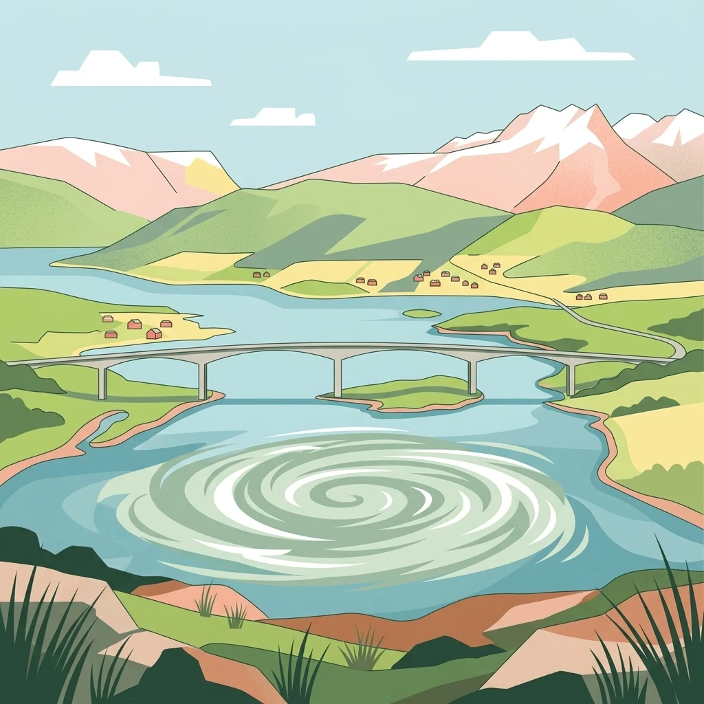
A flat vector-style illustration showing a large swirling whirlpool in a tidal strait, spanned by a concrete arch bridge, with mountains and green coastal terrain in the background.

Saltstraumen

Marine protected area

Park overview

Structured park overview, official facts, and landscape profile for Saltstraumen

Saltstraumen park facts, protected area profile, and essential visitor context

Review the core facts for Saltstraumen, including designation, size, terrain, visitor scale, habitats, and operating context in one park-focused overview.

About Saltstraumen

Saltstraumen is a defining geographic and natural feature of the Bodø region in Nordland, northern Norway. Sitting roughly eleven kilometers southeast of the city of Bodø, the strait forms a compact but visually dramatic passage between the outer coastline, represented by the Saltfjorden, and the more sheltered inner Skjerstadfjorden. It is flanked by the islands of Straumøya to the west and Knaplundsøya to the east, with the small Storholmen dividing the flow into two narrow channels at the constriction.

The defining character of Saltstraumen is its tidal force. Unlike river rapids, which are driven by elevation differences alone, Saltstraumen is the product of a dynamic struggle between the open sea and the inner fjord. As ocean tides rise and fall roughly four times a day, the Skjerstadfjorden cannot fill and empty fast enough through the narrow entrance. The result is a measurable difference in water level on either side of the strait, sometimes reaching about one meter, which is equalized by powerful surges of seawater moving in and out. Estimates suggest that on the order of 400 million cubic meters of water may move through the system during each major tidal exchange.

At its narrowest, the strait is only around 150 meters wide, and water speeds commonly range from about 10 to 12 knots, with peak surface velocities reaching approximately 20 knots near spring tides. The currents create standing waves, whirlpools, and turbulent eddies that change direction with each tidal phase, producing an ever-shifting seascape that is both scientifically fascinating and visually striking. Because the timing of high and low water inside Skjerstadfjorden lags the open sea by roughly two hours, a phenomenon known internationally as tidal choking, Saltstraumen is one of the most studied examples of this effect.

Beyond its hydrology, Saltstraumen is also a significant ecological and cultural site. The churning waters bring oxygen and nutrients to the surface, supporting thriving populations of fish and seabirds and making the surrounding area one of the most biologically productive stretches of coast in northern Norway. A small cold-water coral reef has even been documented near the strait. On land, the area has been inhabited for thousands of years, and Saltstraumen today remains a major visitor attraction, easily viewed from bridges and shorelines in Bodø municipality.

Quick facts and research context for Saltstraumen

Saltstraumen lies in Bodø municipality, Nordland county, roughly eleven kilometers southeast of the city of Bodø. It is a strait and tidal current connecting the Saltfjorden and Skjerstadfjorden, flowing between the islands of Straumøya and Knaplundsøya. The passage is about 2.2 kilometers long and narrows to roughly 150 meters, producing one of the world's most powerful tidal flows. It functions as a designated marine protected area and is a noted wildlife site with rich fish stocks and seabird populations.

Protection and recognition

Examine documented conservation scope and international recognition facts for Saltstraumen.

Saltstraumen Protection Status and Marine Designated Area Records

Marine protection status and management records for Saltstraumen outline the documented administrative scope for this conservation area. Factual designation details provide a clear baseline for reviewing official protection measures and regional geography.

Protection details

Protection scope
Marine
Park context

Deeper park guide and search-rich context for Saltstraumen

Saltstraumen history, landscape, wildlife, and travel context

Explore Saltstraumen through its history, landscape character, ecosystems, wildlife, conservation priorities, cultural context, and seasonal travel timing in a structured park guide built for atlas discovery and search intent.

Why Saltstraumen stands out

Saltstraumen is best known for being one of the strongest tidal currents on Earth, a place where roughly 400 million cubic meters of water rush through a narrow fjord passage each tidal cycle. The strait is also celebrated for the abundance of marine life it supports, including cod, saithe, halibut, monkfish, and catfish, alongside wintering seabirds and white-tailed eagles in the surrounding area. Its recognition as a marine reserve and selection by National Geographic and WWF as one of the Wild Wonders of Europe further underscore its ecological fame, while its sheer visible power makes it a landmark natural spectacle in northern Norway.
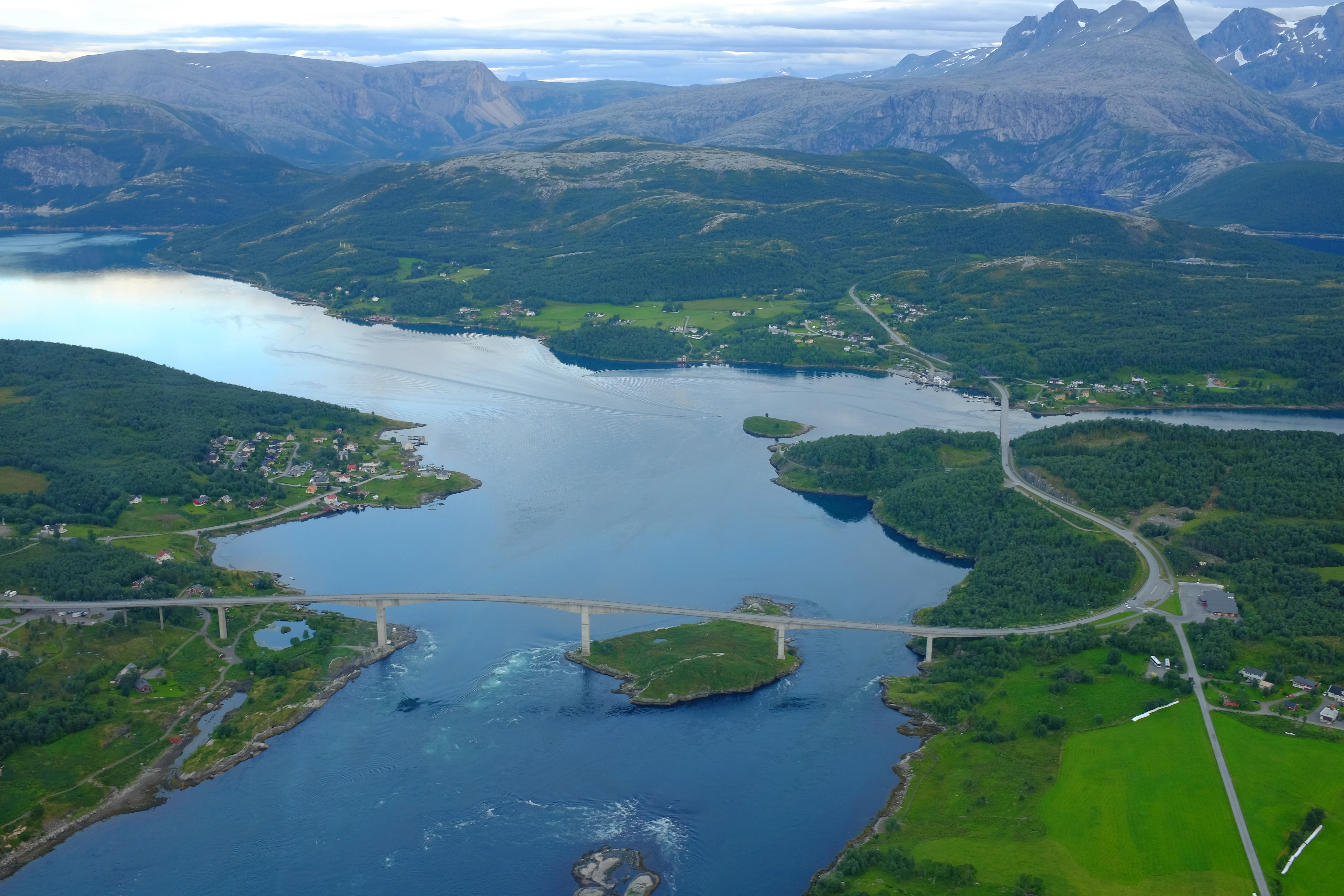
An aerial view of the Saltstraumen tidal strait in Norway, featuring a long bridge crossing the water, surrounded by green hills, forests, and distant mountains.
Aerial perspective of the Saltstraumen strait, showing its distinct tidal waters and the connecting Saltstraumen Bridge.

Saltstraumen history and protected-area timeline

Saltstraumen has a long history of human use that reflects its position as both a natural crossroads and a rich source of food. Archaeologists have identified Stone Age settlement sites on both sides of the strait that are up to about 11,000 years old, with the remains located roughly 80 meters above present sea level. These may represent some of the earliest known habitation in Norway and are thought to reflect the abundance of marine life created by the currents. The strong tidal flow itself is a relatively young feature; the strait as it exists today is estimated to be only around 3,000 years old, because higher sea levels in earlier times kept the passage much wider and less constricted.

The area also preserves a rich Iron Age record, with 33 recorded graves and traces of early farming that predate, by roughly 500 years, what had previously been considered the oldest agricultural evidence in northern Norway. During the Viking Age, the Norse sagas place the chieftain Raud den rame at Saltstraumen, where he famously clashed with King Olav Tryggvason as retold in Snorri Sturlason's writings. Excavations in the area have uncovered remains of longhouses from both the Viking Age and the Iron Age, as well as arrowheads, knife tips, and an oval bone identify that has been recognized as a jaw harp, reportedly the oldest musical instrument found in Norway.

In the literary tradition, the seventeenth-century poet priest Petter Dass immortalized Saltstraumen in his work Nordlands trompet, cementing its place in Norwegian cultural memory. Today a local museum curates the area's archaeological finds and leads historical walks through the landscape surrounding the strait.

Saltstraumen landscape and geographic character

The landscape of Saltstraumen is shaped by the meeting of fjord systems along Norway's northern coast. The strait itself cuts through a tightly constrained passage about 2.2 kilometers long, flanked by the islands of Straumøya and Knaplundsøya and split by the small island of Storholmen. The result is a layered seascape of channels, eddies, and rapids, where flat stretches of dark water alternate with violently swirling sections where the current piles up against itself.

The surrounding terrain is classic Nordland coastal scenery: a mosaic of low forested islands, rocky shorelines, and rising ridges that culminate in peaks such as the Børvasstindene visible from the Saltstraumen bridge. The combination of sheltered inner fjord waters and exposed outer coastline creates a visually varied setting, with calm bays and quiet beaches lying within easy sight of the turbulent narrows. Bridges and shoreline viewpoints frame the strait against this mix of island silhouettes and mountain backdrop, making the landscape itself part of the attraction.
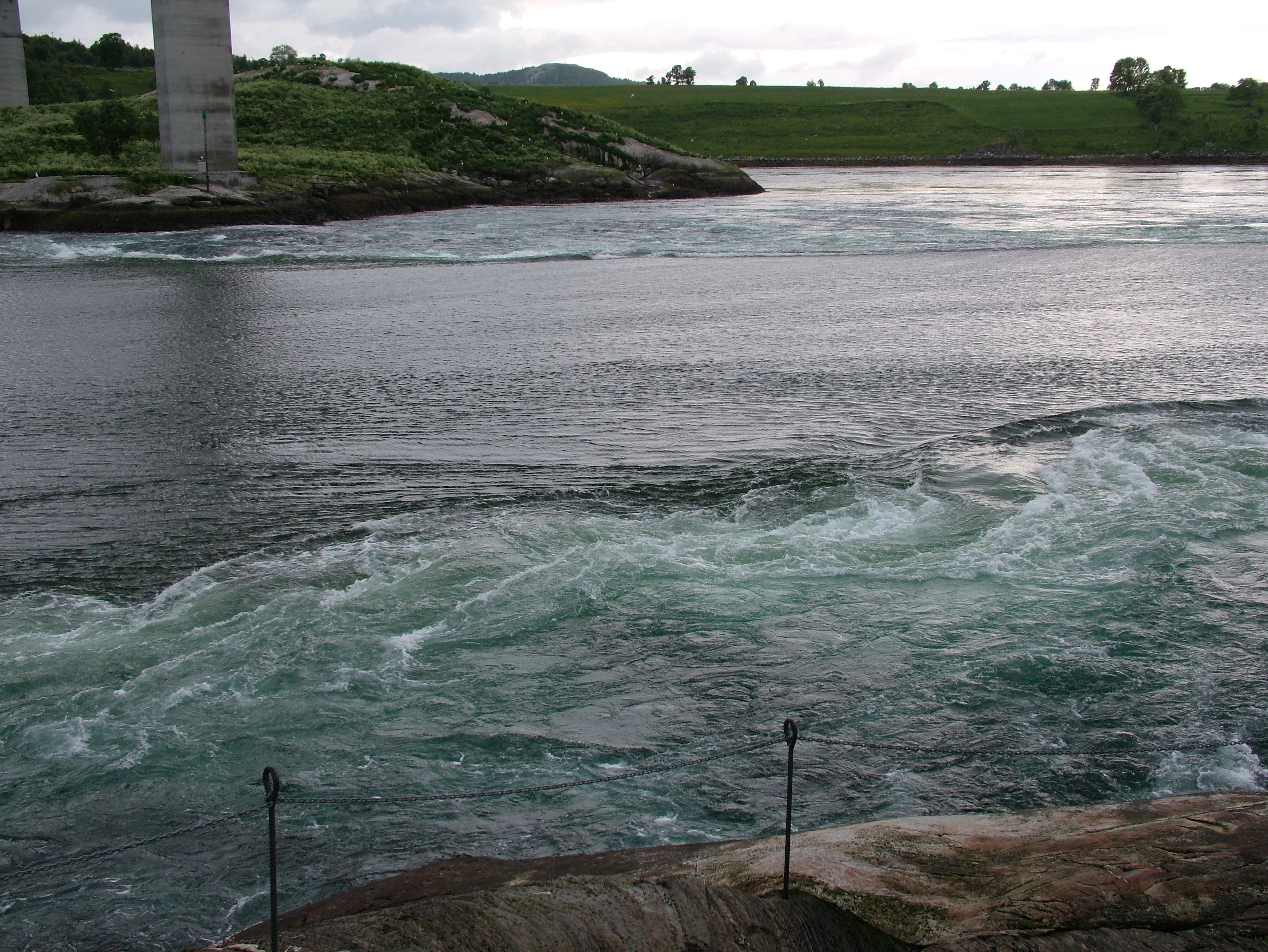
A view of the swirling tidal currents of Saltstraumen with the concrete support of a large bridge in the upper left corner and a metal railing in the immediate foreground.
The powerful tidal currents of Saltstraumen, featuring the Saltstraumen Bridge supports in the background.

Saltstraumen ecosystems, habitats, and plant life

The natural character of Saltstraumen is dominated by the interplay between tidal energy and marine productivity. The constant churning of water through the narrow passage oxygenates the sea and brings nutrients upward, fueling a rich marine food web. This makes the area unusually productive for northern Norway, supporting dense populations of fish, invertebrates, and seabirds in a relatively confined space.

Habitats around the strait range from fast-moving tidal channels and deep mid-water zones to quieter sublittoral areas where divers have documented a small reef of cold-water horn corals just outside the main current. On land, the surrounding islands and coastlines carry coastal vegetation typical of the region, providing resting and nesting habitat for birds that feed in the productive waters.

Saltstraumen wildlife and species highlights

Saltstraumen is recognized as one of the more ecologically dynamic stretches of coastline in northern Norway. The currents support large populations of commercially and recreationally important fish species, including cod, saithe, halibut, monkfish, and catfish, with cod and catfish particularly common catches for sport fishers working the strait. These fish resources in turn attract significant numbers of seabirds that overwinter and feed in the area.

Birds are a constant presence around the strait, with flocks of common eiders visible on nearby waters and white-tailed eagles, or sea eagles, ranging over the surrounding landscape. The combination of high fish density and sheltered coastline makes the area attractive for both resident and seasonal birdlife. Divers exploring the calmer waters just outside the main flow have additionally documented the presence of a small cold-water coral reef, an unusual ecological feature for these latitudes that adds to the area's biological significance.

Saltstraumen conservation status and protection priorities

Saltstraumen has been formally designated as a marine protected area, reflecting both its ecological value and its importance as a showcase of natural tidal processes. The Norwegian designation recognizes the strait as a national example of marine conservation in a tidal current environment, building on its earlier inclusion in the Wild Wonders of Europe project, a joint initiative of National Geographic and WWF that highlighted ecologically significant sites across the continent.

The conservation significance of the area stems from the unusual combination of high physical energy and biological productivity. The currents that generate Saltstraumen also drive oxygen and nutrient exchange that supports rich fish stocks, seabird populations, and even cold-water corals in adjacent calmer waters. Protecting the strait means conserving not just the dramatic current itself but the entire dynamic ecosystem that depends on it, from foraging seabirds and white-tailed eagles at the surface to reef-building corals in the deeper, quieter water just outside the main flow.

Saltstraumen cultural meaning and human context

Saltstraumen sits within a landscape that has been continuously inhabited since the Stone Age, making it as much a cultural site as a natural one. The earliest known settlements along the strait date back roughly 11,000 years and were positioned to take advantage of the rich fishing grounds that the currents still support today. Later Iron Age communities left graves, longhouse remains, and early agricultural evidence that significantly extended the known timeline of farming in northern Norway.

In the Viking Age, the area was home to the chieftain Raud den rame, whose confrontation with Olav Tryggvason is preserved in Snorri Sturlason's sagas. The seventeenth-century poet priest Petter Dass further embedded Saltstraumen in Norwegian literary heritage by describing it in his poem cycle Nordlands trompet. Today a local museum presents archaeological finds and leads historical walks along the strait, keeping this long human story connected to the natural spectacle that surrounds it.

Top sights and standout views in Saltstraumen

Saltstraumen offers a rare combination of extreme natural power and rich biodiversity in one compact location. Its tidal currents, peaking near 20 knots and shifting direction four times a day, make it one of the most energetic marine environments accessible to visitors in Norway. The strait is also a productive ecosystem, supporting cod, saithe, halibut, monkfish, catfish, large seabird flocks, and a documented cold-water coral reef in calmer adjacent waters.

Beyond the natural drama, Saltstraumen carries deep cultural weight, with Stone Age and Viking Age archaeology, a place in the sagas, and a literary tradition stretching back to Petter Dass. Its protection as a marine reserve and its inclusion among Europe's Wild Wonders by National Geographic and WWF confirm its standing as both a national icon and an internationally recognized natural wonder.

Best time to visit Saltstraumen

Saltstraumen is a year-round destination, since the tidal currents are strongest in any season around the times of new and full moon, known as spring tides. Visiting around these lunar phases will give the most dramatic whirlpools and fastest water. Late spring through early autumn brings milder weather, long daylight hours in northern Norway, and good conditions for combining the visit with other coastal attractions around Bodø.

Winter visits offer a different atmosphere, with snow-covered shorelines and the chance to see large numbers of seabirds overwintering in the productive waters, though travelers should be prepared for short days and potentially harsh weather. In any season, checking a local tide table for Saltstraumen in advance will help align an outing with the most powerful and visually striking phases of the flow.
Monthly climate preview

Review long-term representative point measurements for Saltstraumen weather by month

Saltstraumen Climate Normals: Measured Annual Temperature and Precipitation Rhythm

Historical data from 1991 to 2020 documents the measured annual temperature and precipitation rhythm across Saltstraumen at a representative coordinate elevation of 384 meters. Examining the complete monthly climate normals reveals detailed long-term averages for temperature swings and daily precipitation patterns.
Annual mean2 °C
-5 °C11 °C
Jan-5°
Feb-5°
Mar-4°
Apr
May
Jun
Jul11°
Aug11°
Sep
Oct
Nov-2°
Dec-4°
Warmest month
July

11 °C

Coolest month
February

-5.4 °C

Wettest month
December

6.2 mm/day

Driest month
May

3.6 mm/day

Park location guide

Geography guide, regional context, and park location map for Saltstraumen

Saltstraumen park geography, regions, and map view in Norway

Understand where Saltstraumen sits in Norway through a broader geographic reading of the surrounding landscape, nearby location context, and its mapped position within the national park landscape.

How Saltstraumen fits into Norway

Norway, officially the Kingdom of Norway, is a Nordic country in Northern Europe located on the Scandinavian Peninsula. It encompasses mainland Norway, the Arctic islands of Svalbard and Jan Mayen, and maintains dependencies including Bouvet Island and Antarctic claims. The country has a population of about 5.6 million and is bordered by Sweden, Finland, and Russia. Norway is a unitary parliamentary constitutional monarchy with Oslo as its capital and largest city.

Wider geography shaping Saltstraumen in Norway

Norway occupies the western and northern portions of the Scandinavian Peninsula in Northern Europe. The country shares a long eastern border with Sweden, and borders Finland and Russia to the northeast. Norway has an extensive coastline facing the Skagerrak, North Sea, Norwegian Sea, and Barents Sea. The terrain is predominantly mountainous with numerous fjords along the coastline.

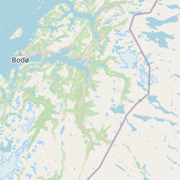
Map view of Saltstraumen

Use this park location map to pinpoint Saltstraumen in Norway, understand its exact geographic position, and read its mapped placement within the surrounding landscape more clearly.

Pigeon | © OpenStreetMap contributors

Location context for Saltstraumen

Nordland

Examine the terrain, coastal habitats, and turbulent fjord scenery surrounding the marine reserve.

Saltstraumen Photos and Landscape Imagery for Visual Park Exploration

Visual documentation captures the extreme physical dynamics and intricate coastal terrain defining Saltstraumen. Photographic records reveal the complex interaction between narrow fjord passages, rocky shorelines, and tidal currents.

An aerial view of the Saltstraumen tidal strait in Norway, featuring a long bridge crossing the water, surrounded by green hills, forests, and distant mountains.

A wide shot of the Saltstraumen tidal strait under a blue sky, featuring a long concrete bridge stretching across the water, with snow-capped mountain peaks in the distance and green grass in the foreground.

A view of the swirling tidal currents of Saltstraumen with the concrete support of a large bridge in the upper left corner and a metal railing in the immediate foreground.

Park atlas

Compare coastal landscapes, marine reserves, and regional fjord geography

Explore Parks Near Saltstraumen and Surrounding Protected Areas

Browsing other protected areas near Saltstraumen reveals the diverse coastal geography and marine ecosystems characteristic of northern Norway. Comparing adjacent park entities provides deeper context into regional fjord terrain and connected conservation landscapes.
Watercolor illustration of a landscape with rolling hills, forests, and distant mountains
National parkNordland
About 14 km away#1 closest

Northeast

Sjunkhatten National Park: Norway's Protected National Park Identity and Geographic Atlas

Mapped landscape context and regional geography details.

Explore the structured geographic data and protected landscape context for Sjunkhatten National Park, a significant national park in Nordland, Norway. This page provides detailed insights into its mapped boundaries and regional setting, offering an atlas-driven view of its natural terrain. Understand how this protected area contributes to the broader geography of Norway through factual, map-oriented discovery.

Area
417.5 km²
Established
2010
IUCN
II
Relief
Mountain
Watercolor illustration showing mountains, a river, and colorful landscape regions
National parkNorway
About 36 km away#2 closest

South

Saltfjellet, Svartisen National Park: Glacial Terrain & Protected Arctic Wilderness

Norway's vast national park with Svartisen glacier and unique flora.

Saltfjellet, Svartisen National Park spans over 2,100 square kilometers of diverse protected wilderness in Northern Norway. Renowned for Svartisen, Scandinavia's second-largest glacier, its landscape transitions from coastal influences to alpine plateaux. The park's calcareous bedrock supports a rich flora, rare in the region, contributing to its distinct geographic identity. Explore the mapped boundaries and natural terrain of this significant protected landscape.

Area
2,192 km²
Established
1989
IUCN
II
Relief
Mixed relief
National parkNorway
About 46 km away#3 closest

South

Láhko National Park: Northern Norway's Protected Arctic Landscape and Geographic Atlas Entry

Mapped boundaries and terrain of a key Finnmark national park.

Láhko National Park is a significant protected area within Norway's Finnmark region, representing a vast expanse of sub-Arctic wilderness and characteristic tundra ecosystems. This park serves as a crucial element in the atlas of northern European protected lands, offering insights into the geographic features and ecological integrity of high-latitude environments. Explore Láhko National Park through MoriAtlas to understand its landscape context, mapped terrain, and its role in preserving Nordic wilderness.

IUCN
II
Watercolor illustration of a landscape with rolling hills, a river, and trees
National parkNordland
About 50 km away#4 closest

Southeast

Junkerdal National Park: Protected Arctic-Alpine Landscape in Nordland, Norway

Explore mapped boundaries and unique geographic context.

Delve into Junkerdal National Park, a significant protected area within Nordland county, Norway. This national park is celebrated for its rich arctic-alpine flora, including rare plant species that thrive at their southernmost European range. The varied landscape, shaped by glacial activity, features dramatic mountain valleys and alpine plateaus, offering a distinct geographic profile. Understand its protected status and mapped terrain, providing a critical point of discovery for regional landscape context.

Area
682 km²
Established
2004
IUCN
II
Relief
Mountain
Watercolor illustration showing mountains, a river, and forests in a landscape
National parkNordland
About 54 km away#5 closest

East

Rago National Park: Northern Norway's Protected Mountain Wilderness and Transboundary Atlas

Explore the mapped terrain and unique landscape context of this significant protected area.

Rago National Park is a protected national park in Nordland, Norway, recognized for its challenging mountainous terrain and its crucial role as part of a vast transboundary protected area complex spanning into Sweden. The park's landscape features alpine lakes and glaciers, offering a stark representation of northern Scandinavian mountain wilderness. Understanding Rago National Park provides insight into regional conservation efforts and the geographic significance of large-scale protected lands in Europe.

Area
171 km²
Established
1971
IUCN
II
Relief
Mountain
Watercolor illustration of a winding river through a green landscape with distant mountains
National parkNorrbotten County
About 67 km away#6 closest

East

Padjelanta National Park: Sweden's Largest National Park Protected Plateau Landscape

Explore subarctic terrain, large lakes, and Laponia World Heritage Site geography.

Padjelanta National Park, situated in Norrbotten County, is Sweden's largest national park. It features a distinctive subarctic plateau ecosystem centered around two vast lakes, offering a starkly open landscape compared to adjacent alpine areas. This protected area is renowned for its exceptional botanical and lichen diversity, a vital part of the Laponia World Heritage Site. Users can explore its mapped geography, unique terrain, and the cultural significance of this expansive arctic wilderness.

Area
1,984 km²
Established
1963
IUCN
II
Relief
Highland
Watercolor painting showing a landscape with green hills, distant mountains, and scattered vegetation
National parkNordland
About 100 km away#7 closest

Northwest

Lofotodden National Park: Iconic Arctic Coastal Protected Landscape in Nordland

Mapped terrain and protected area details for a dramatic Nordic landscape.

Delve into the protected landscape of Lofotodden National Park, a key protected area within Norway's Nordland county. This national park showcases the dramatic convergence of the Lofotenveggen mountain range with the North Atlantic coast, featuring rugged granite peaks and unique coastal terrain. MoriAtlas offers a structured view of its mapped boundaries and geographic context, facilitating detailed discovery of this significant Arctic natural heritage.

Area
99 km²
Established
2018
IUCN
II
Relief
Mountain
Watercolor illustration of a mountainous landscape with a river, grass, and distant hills
National parkNorrbotten County
About 108 km away#8 closest

East

Sarek National Park: Mapping Sweden's Rugged Alpine Wilderness and Glacial Terrain

Explore the mapped geography of Norrbotten County's largest alpine national park.

Sarek National Park represents the heart of Sweden's alpine wilderness, a protected landscape defined by its towering mountain peaks, expansive glaciers, and deeply carved glacial valleys. Situated in Norrbotten County, the park's geography is characterized by a remote and rugged terrain, making it a prime destination for understanding high-altitude natural environments through mapped context. Discover the unique contours of this iconic national park and its place within the broader regional geography of Swedish Lapland.

Area
1,970 km²
Established
1909
IUCN
II
Relief
Mountain

Common questions about visiting, size, designation, and location context for Saltstraumen

Saltstraumen FAQs for park facts, access, geography, and protected area context

Find quick answers about Saltstraumen, including protected-area facts, park geography, trail and visitor context, and how the park fits into its surrounding country and regional landscape.
MoriAtlas Explorer

Continue Your Protected Areas Search Across the Global Atlas

Deepen your exploration by continuing the structured search for national parks and protected areas worldwide. Utilize the comprehensive filtering capabilities to compare different conservation landscapes and refine your understanding of global park geography. Discover more about the distribution and characteristics of protected natural areas.

Global natural geography