
Mori Atlas logo
Park earthquake history

Reviewing documented seismic events and epicentre data within the surrounding regional terrain.

Historical Earthquake Records Associated with Saxon Switzerland National Park Geography

This collection provides a structured view of historical seismic activity recorded in the vicinity of Saxon Switzerland National Park. Users can browse earthquake events mapped by epicentre distance, date, and magnitude to understand the regional seismic context. Each record utilizes data sources to correlate seismic occurrences with the protected landscape, offering a transparent view of historical ground movement history without implying future risk.

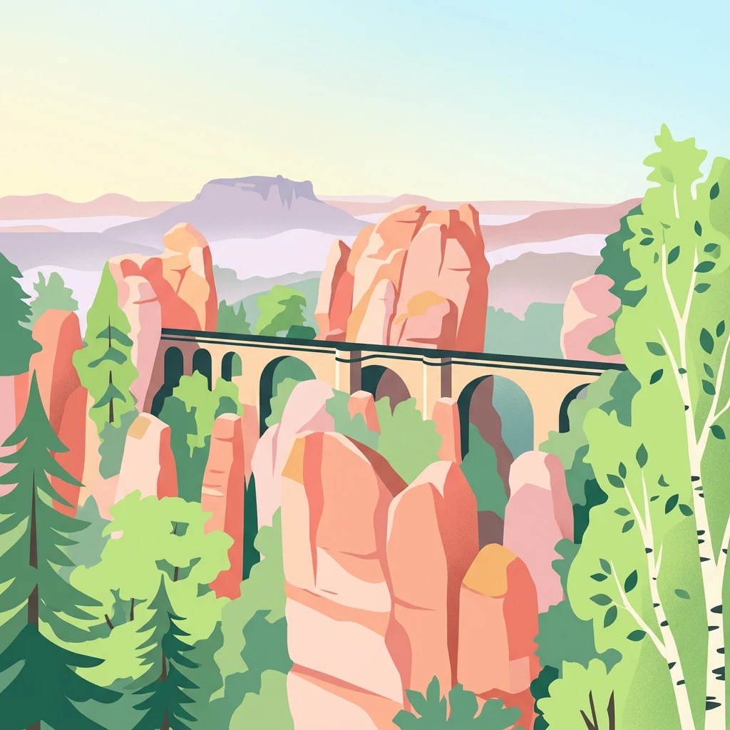
Stylized illustration of a stone bridge spanning between sandstone rock formations with green trees and distant mountains.

Germany's dramatic sandstone canyon wilderness in the Elbe Sandstone Mountains

Saxon Switzerland National Park

Saxon Switzerland National Park is a protected area in the German state of Saxony, established in 1990 as part of the former East Germany's national park program. The park encompasses 93.5 square kilometers of rugged sandstone terrain in the heart of the Elbe Sandstone Mountains, a landscape characterized by deeply fissured canyons, dramatic cliff formations, and unique rock towers that have made the region famous throughout Central Europe. The park is divided into two geographically separate areas in the Sächsische Schweiz-Osterzgebirge district, with the western section centered around the iconic Bastei rock formation and the eastern region encompassing the Schrammsteine rocks and Großer Winterberg, the park's highest peak at 556 meters. Approximately 40 percent of the park's area is covered in woodland, with the park forming part of a larger 710 square kilometer natural landscape that extends across the border into the Czech Republic as Bohemian Switzerland National Park. The park receives approximately 1.7 million visitors annually and supports significant tourism infrastructure while maintaining its conservation mission.

Location
Germany
Park type
National park
Established
1990
Area
93.5 km²
Highest point
556 m
Saxon Switzerland National Park Atlas

Geographic catalog of regional seismic epicentres mapped by proximity to the sandstone landscape

Historical Seismic Activity Records Near Saxon Switzerland National Park

Map-based queries and structured datasets associate historical regional seismic events with Saxon Switzerland National Park using precise epicentre distance calculations. Individual records present factual geological details such as event dates, magnitude levels, focal depths, reported locations, and links to the original monitoring sources.

Sort by
Magnitude
Location

This page describes catalogued earthquakes associated with the park by epicentre location and distance. It does not establish causation, assess current danger, or predict future earthquakes.

No earthquake records match the current filters

Park atlas

Continue your geographic discovery with other mapped reserves and protected landscapes.

Explore More National Parks and Protected Areas Beyond Saxon Switzerland

Expanding your search beyond Saxon Switzerland National Park allows you to browse a wider network of globally recognized national parks and wilderness sanctuaries. Navigating distinct regional directories helps map diverse terrains, compare various level designations, and locate new destinations for conservation-focused exploration.
Watercolor illustration of rolling green hills, forests, and distant mountains
National park
About 6 km away#1 closest

South

Bohemian Switzerland National Park: Czech Sandstone Protected Landscape and Map Exploration

Discover its unique terrain and protected area geography.

Bohemian Switzerland National Park is a protected area in the Czech Republic known for its exceptional sandstone geology. This national park showcases a dramatic landscape of towering rock formations, deep gorges, and striking canyons, forming a significant part of the Elbe Sandstone Mountains. Through MoriAtlas, users can explore its mapped protected boundaries, understand its regional geographic context, and appreciate its unique natural heritage.

Area
79 km²
Established
2000
IUCN
II
Relief
Mixed relief
Watercolor painting showing a river, grassy banks, scattered trees, and distant hills
Protected landscape
About 70 km away#2 closest

Southeast

Bohemian Paradise Protected Landscape: Discover Czech Republic's Sandstone Geology and Park Boundaries

Mapped sandstone formations and historic regional geography.

Delve into Bohemian Paradise, a protected landscape in the Czech Republic celebrated for its dramatic sandstone rock formations and ancient castles. This detailed entry provides context on its unique geological character, the extent of its protected boundaries, and its significant position within the regional geography. Explore the mapped terrain and understand the atlas value of this historic protected area.

Area
181.17 km²
Established
1955
IUCN
V
Relief
Upland
Watercolor painting showing green forests, a valley, and distant mountains under a soft sky
National parkLiberec Region
70 km away#3 closest

East

Krkonoše National Park: Central European Alpine Protected Area and Map Context

Discover glacial landforms and unique ecosystems in the Giant Mountains.

Krkonoše National Park, situated in the Liberec Region, is a premier example of a protected alpine landscape in Central Europe. This page facilitates exploration of its significant glacial geography, including distinct cirques, rockfields, and valleys, providing vital context for understanding its protected area status. Engage with the mapped terrain and discover the unique ecological features that make this national park a cornerstone of conservation and geographic study within the Czech Republic.

Area
363.52 km²
Established
1963
IUCN
II
Visitors
12.1M annual
Watercolor illustration of a mountain range with green hills, pink and yellow sky, and sparse vegetation
National park
About 89 km away#4 closest

East

Karkonosze National Park: A Premier National Park in Poland's Giant Mountains

Discover alpine terrain and unique glacial landscapes.

Karkonosze National Park is a significant protected area in Poland, renowned for its dramatic alpine topography carved by ancient glaciers. As the highest range in the Polish Sudetes, it features striking U-shaped valleys, U-shaped glacial cirques, and diverse subalpine to alpine ecosystems. This national park provides a rich context for understanding Central European mountain geography and exploring its mapped protected boundaries.

IUCN
II
Relief
Mountain
Scope
Terrestrial
Watercolor artwork depicting a landscape with green hills, distant mountains, and pastel sky
National parkLower Silesian Voivodeship
141 km away#5 closest

Southeast

Stołowe Mountains National Park: Explore Poland's Sandstone Rock Cities and Protected Terrain

National Park in Lower Silesian Voivodeship: Geological Wonders.

Stołowe Mountains National Park is a protected national park in Poland celebrated for its unparalleled sandstone geological features. Within the Lower Silesian Voivodeship, the park showcases a dramatic landscape dominated by flat-topped rock plateaus, natural labyrinths, and vertical sandstone formations that create a visually stunning and geologically significant environment. Its protected status ensures the preservation of these unique landforms and the rare ecosystems, such as raised peat bogs, offering extensive opportunities for atlas exploration and understanding the region's distinct natural context.

Area
63.39 km²
Established
1993
IUCN
II
Visitors
1.3M annual
Watercolor illustration showing a river winding through rolling green hills with sparse vegetation
National parkLubusz Voivodeship
177 km away#6 closest

North

Warta Mouth National Park: A National Park Protecting Vital European Wetlands

Explore mapped protected areas and bird habitats in Lubusz Voivodeship.

Warta Mouth National Park, located in Poland's Lubusz Voivodeship, is a significant protected landscape safeguarding the ecologically rich confluence of the Warta and Oder rivers. As the nation's most recently established national park, it provides critical habitat for a vast array of migratory and breeding bird species within its extensive marshlands and floodplains. This park offers a unique opportunity for atlas-driven exploration of Central European wetland geography and the mapped boundaries of a vital conservation area.

Area
80.38 km²
Established
2001
IUCN
II
Visitors
52K annual
Watercolor illustration of a river flowing through a forested landscape with rolling hills in the background
National parkSouth Bohemian Region
199 km away#7 closest

South

Šumava National Park: Czech Republic's Premier Forested National Park and Protected Landscape

Explore the unique glacial lakes, peat bogs, and regional geography.

Šumava National Park, situated in the South Bohemian Region of the Czech Republic, is the nation's largest protected area and a vital component of Central Europe's forest ecosystems. This entry details its expansive terrain, highlighting the significant peat bog complexes and ancient glacial lakes that define its unique landscape. Discover the park's geographic context, mapped boundaries, and its importance as a protected natural asset within the broader regional atlas.

Area
680.64 km²
Established
1991
IUCN
II
Visitors
2M annual
Watercolor painting showing mountains, forests, and valleys in a landscape.
National park
208 km away#8 closest

South

Bavarian Forest National Park: Protected Landscape and Regional Geography Atlas

Explore mapped terrain and protected park boundaries in Germany.

Dive into the specifics of Bavarian Forest National Park, a key protected area noted for its distinct landscape and geographic importance. This MoriAtlas entry details the park's mapped boundaries and its setting within the surrounding regional geography, offering a clear atlas-style view of its natural terrain. Understand its identity as a national park and discover its place in Germany's protected lands.

Area
242.45 km²
Established
1970
IUCN
II
Visitors
1.3M annual
MoriAtlas Explorer

Continue Exploring Saxon Switzerland National Park's Geographic Atlas

Delve deeper into the structured geographic data and mapped landscape context of Saxon Switzerland National Park. Understanding its protected area identity provides a gateway to exploring adjacent terrains and regional park distributions, enhancing your comprehension of Germany's protected natural heritage through focused atlas navigation.

