Mori Atlas logo
National parkSaxon Switzerland National Park

Detailed geographic boundaries and regional park atlas information for Saxon Switzerland.

Saxon Switzerland National Park: Protected Landscape & Geographic Context on the Map

(Nationalpark Sächsische Schweiz)

Saxon Switzerland National Park represents a significant protected area within Germany's diverse geography, offering rich opportunities for map-based exploration. As a designated national park, its boundaries define a unique landscape crucial for understanding regional natural context. MoriAtlas provides structured data and mapping tools to navigate and comprehend the geographic identity of this protected natural area, facilitating deeper discovery beyond its borders.

sandstone landscapecanyon terrainrock climbinghiking trailsnature reservesmountain forests
Stylized illustration of a stone bridge spanning between sandstone rock formations with green trees and distant mountains.

Saxon Switzerland National Park

National park

Park overview

Structured park overview, official facts, and landscape profile for Saxon Switzerland National Park

Saxon Switzerland National Park park facts, protected area profile, and essential visitor context
Review the core facts for Saxon Switzerland National Park, including designation, size, terrain, visitor scale, habitats, and operating context in one park-focused overview.

About Saxon Switzerland National Park

Saxon Switzerland National Park represents one of Germany's most distinctive protected landscapes, encompassing the dramatic terrain of the Elbe Sandstone Mountains in the Free State of Saxony. The park was established on October 1, 1990, through the East German national park program and officially opened on April 28, 1991, making it one of the newer additions to Germany's national park system. The protected area is remarkable for its deeply dissected sandstone landscape, where millions of years of erosion have created a maze of narrow gorges, towering rock pillars, and expansive cliff faces that define the visual identity of the region. The park is administered from Bad Schandau and is divided into two main sections that are geographically separated, each offering distinct landscape characters and recreational opportunities. The western region centers on the world-famous Bastei area, where the Bastei Bridge offers sweeping views over the Polenz valley, while the eastern region encompasses the more remote and wilderness-like terrain of the Großer Winterberg and the Schrammsteine rock formation. The park's management operates under a zoning system that includes strict core zones where nature is allowed to develop without intervention, nature zones at various levels of protection, and smaller maintenance zones, with the goal of eventually designating 75 percent of the area as wilderness.

Quick facts and research context for Saxon Switzerland National Park

Saxon Switzerland National Park covers 93.5 square kilometers of sandstone canyon landscape in Saxony, Germany, near Dresden. Established in 1990, it protects the German portion of the Elbe Sandstone Mountains with two main regions: the western area around the Bastei and Lilienstein, and the eastern region featuring the Schrammsteine rocks and Großer Winterberg peak. The park forms a transboundary protected area with Bohemian Switzerland National Park in the Czech Republic and is part of the European Natura 2000 network. The park contains 400 kilometers of marked hiking trails and 50 kilometers of cycling paths.

Park context

Deeper park guide and search-rich context for Saxon Switzerland National Park

Saxon Switzerland National Park history, landscape, wildlife, and travel context
Explore Saxon Switzerland National Park through its history, landscape character, ecosystems, wildlife, conservation priorities, cultural context, and seasonal travel timing in a structured park guide built for atlas discovery and search intent.

Why Saxon Switzerland National Park stands out

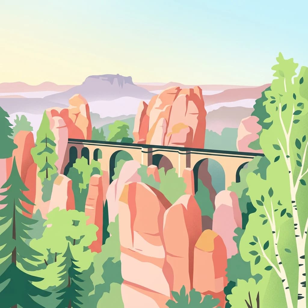
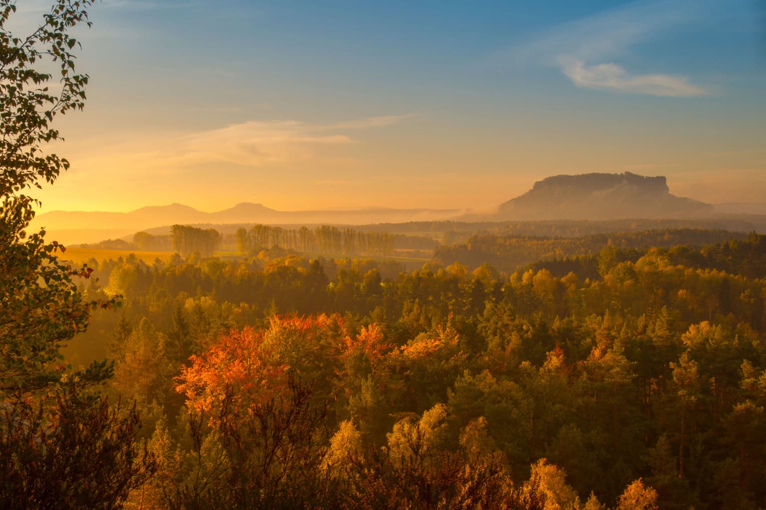
Saxon Switzerland is renowned for its extraordinary sandstone rock formations, including the famous Bastei with its dramatic bridge and the towering cliff systems of the Schrammsteine. The park is one of Central Europe's most significant climbing areas, with over 1,147 climbing peaks and more than 15,000 climbing routes. The landscape features deeply incised canyon valleys, unique gorges with distinctive microclimates, and the distinctive wind-shaped cliff pines that create a visual character unlike any other German protected area. The region has a long artistic heritage, famously inspiring the Romantic painters of the 19th century, and the 116-kilometer Malerweg (Painter's Trail) remains one of Germany's most beloved long-distance hiking routes.

Stone bridge with multiple arches connecting large sandstone rock formations in a misty mountain landscape
Bastei Bridge spanning between sandstone rock formations in misty conditions within Saxon Switzerland National Park

Saxon Switzerland National Park history and protected-area timeline

The protection of Saxon Switzerland has a long history extending back to the late 19th century, making it one of Germany's earliest regions where conservation concerns emerged. Initial protective measures began in 1850 with the protection of the Tiedgestein rock formation in the Rathen area, and the Polenz valley became the first entire area protected in 1912. Local conservation organizations, including the Landesverein Sächsischer Heimatschutz founded in 1908 and the Verein zum Schutz der Sächsische Schweiz founded in 1910, worked tirelessly to advocate for broader protection of the region. The idea of establishing a full national park emerged in the 1930s, and by 1938 the Bastei area was designated as a nature reserve covering 7.85 square kilometers, followed by protection of the Polenz valley in 1940. After World War II, efforts to establish a national park were thwarted by the East German government, which did not include the national park category in its conservation legislation. Instead, a unified landscape protection area of 368 square kilometers was created in 1956, and various smaller nature reserves were established within this framework. The political changes of 1990 enabled the creation of a true national park, and the Ministerrat of the German Democratic Republic approved the establishment on September 12, 1990, with the park formally coming into existence on October 1 of that year.

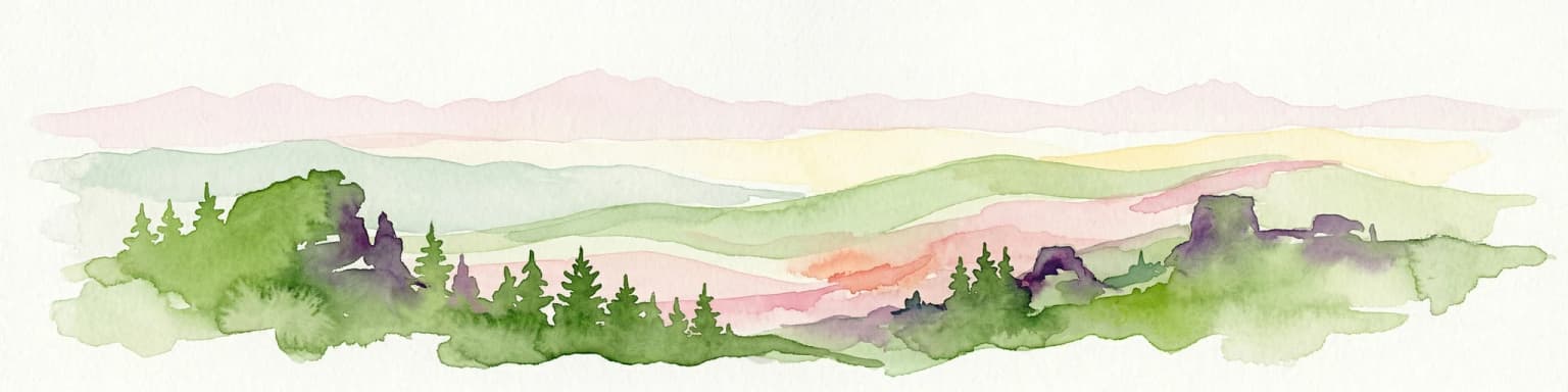
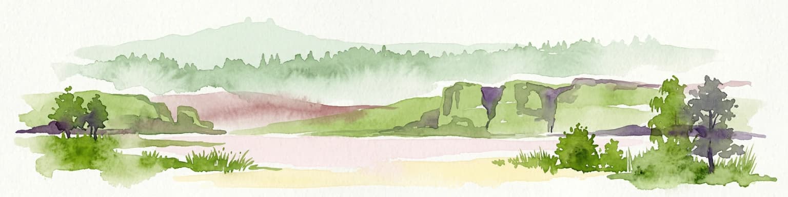
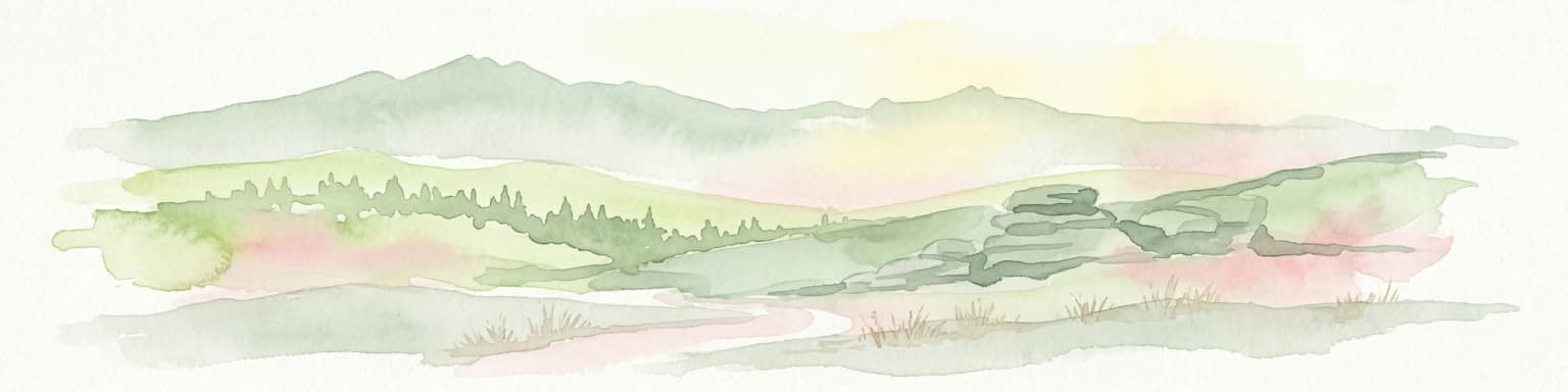
Saxon Switzerland National Park landscape and geographic character

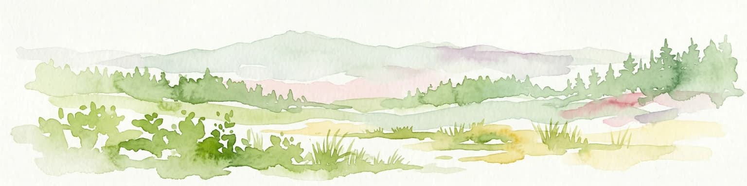
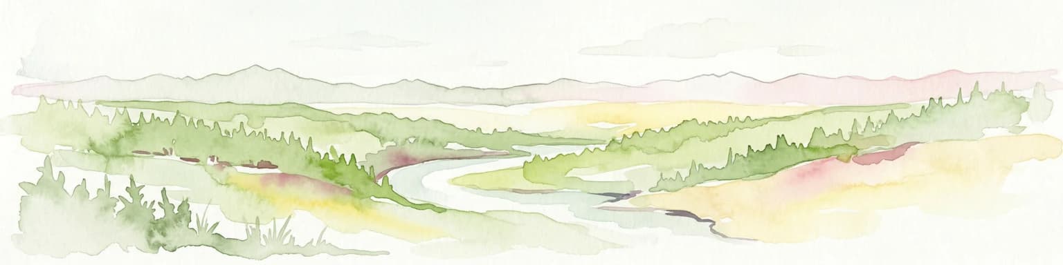
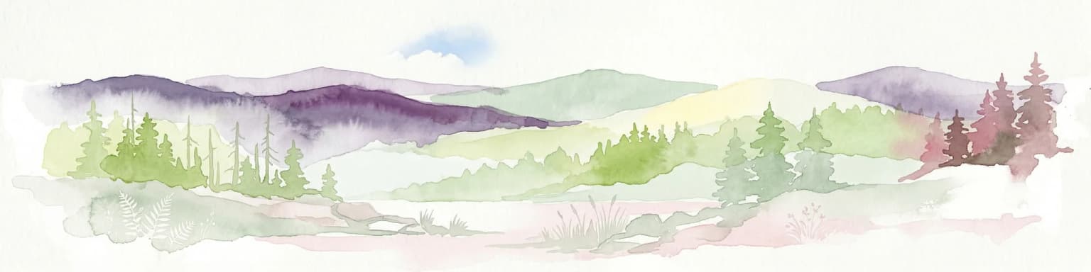
The landscape of Saxon Switzerland National Park is defined by its distinctive sandstone geology, which has produced one of Central Europe's most visually dramatic terrains. The Elbe Sandstone Mountains, formed over millions of years through erosion and tectonic processes, present a landscape of deeply incised valleys, narrow gorges, and towering cliff walls that create a canyon-like character throughout much of the park. The highest point within the park is the Großer Winterberg at 556 meters above sea level, while the valley floor of the Elbe river lies at only 110 to 120 meters, creating significant vertical relief across short distances. The western region features the iconic Bastei rock formation rising to 305 meters, the isolated Lilienstein peak at 415 meters, and the Polenz valley with its small streams and the Amselsee lake. The eastern region encompasses the impressive Schrammsteine rock towers, the remote Großer Zschand valley, and the dramatic Kuhstall natural arch at 337 meters. The landscape is characterized by its strong vertical division, which creates numerous microclimate zones ranging from cool, humid canyon bottoms to exposed cliff tops experiencing extreme temperature fluctuations.

Stone arch bridge connecting two sandstone cliffs with forested mountains and misty horizon in background
Morning view of Bastei Bridge spanning sandstone rock formations in Saxon Switzerland National Park, Germany

Saxon Switzerland National Park ecosystems, habitats, and plant life

The park's ecological character is shaped by its complex topography and the interaction between its sandstone substrates and the region's climate. Without human intervention, the park would today consist largely of oak-hornbeam forests, though two centuries of spruce plantation forestry have altered much of the woodland. The park management is working to restore these forests toward more natural deciduous-dominated communities. The special geological conditions, including volcanic rock intrusions in areas like the Großer Winterberg and Raumberg, support distinctive plant communities. The exposed sandstone cliffs host specialized pine forests adapted to harsh conditions, while the cool, humid gorges create an inversion of forest zones with conditions more typical of much higher elevations. The park is home to approximately 500 moss species, 370 lichens, and 30 to 40 fern species, making it a significant center of biodiversity. TheKirnitzsch valley contains small riparian meadows, and the park's position within the European Natura 2000 network recognizes its importance for conservation of various habitat types including rocky slopes, pine forests, beech forests, and flowing waters.

Rock formations and forested landscape with prominent sandstone cliffs in the midground and background
A view of the Affensteine rock formations in Saxon Switzerland National Park

Saxon Switzerland National Park wildlife and species highlights

Saxon Switzerland National Park supports a remarkable diversity of wildlife, with over 250 bird species recorded within its boundaries and approximately 120 species breeding in the Elbe Sandstone Mountains. The park has been the site of successful species reintroduction programs, including the recovery of the peregrine falcon, which had completely disappeared by the 1970s and has now established a stable population. The black stork, a species requiring large tracts of continuous forest, also breeds in the park. The mammalian fauna includes 16 of Germany's 18 bat species, and the European otter has been successfully reintroduced along the Elbe and its tributaries. The lynx, exterminated in the 18th century, has been recorded again since the 1930s and may now have a small population in the area. Red deer and wild boar are the primary large mammals present, while the European beaver has been reintroduced successfully. The park's reptile and amphibian communities include the adder as the only venomous snake species in the region. Fish communities in the Elbe and its tributaries support 40 species, including the Atlantic salmon, which has been reintroduced after being locally extinct.

Green sign on wooden post reading 'KERNZONE' with German text 'Betreten nur auf den im Gelände markierten Wegen erlaubt. Übernachten im Freien nicht gestattet.' surrounded by forest vegetation and moss-covered rocks
Green sign marking the core zone (KERNZONE) of Saxon Switzerland National Park with German text instructions

Saxon Switzerland National Park conservation status and protection priorities

The park's conservation framework operates under IUCN Category II and is part of the European Natura 2000 network, designated as both a Special Protection Area for birds and an FFH (Fauna-Flora-Habitat) site. The park's zoning system designates approximately 23 percent as strict core zones where natural processes are allowed to proceed without human intervention, with the goal of eventually expanding this to 75 percent of the park area to meet international wilderness standards. The management faces significant challenges, including a high density of trails and access routes that fragment the wilderness zones, and the spread of invasive species such as the Himalayan balsam and the Weymouth pine. The park experienced significant ecological stress from 2017 to 2021 due to a massive bark beetle infestation that affected large areas of the spruce plantations, particularly in the core zone around Großer Winterberg and Großer Zschand. Major wildfires in 1842 and most notably in July and August 2022, which burned across the German-Czech border, have also shaped recent management priorities and sparked debate about forest management and wildfire prevention strategies.

Saxon Switzerland National Park cultural meaning and human context

The landscape of Saxon Switzerland has inspired artists, writers, and musicians for centuries, becoming a central site of the German Romantic movement in the early 19th century. The region attracted painters who created works that helped define the Romantic aesthetic, and the Malerweg (Painter's Trail), a 116-kilometer circuit starting and ending in Pirna, follows routes that these artists took through the landscape. The historical development of the park's trail network began in the first half of the 19th century and was largely completed by the early 20th century, with historic route guides documenting the paths that remain in use today. The region's cultural identity is deeply intertwined with its landscape, and the communities within and around the park maintain strong connections to the traditional use of the terrain for recreation, climbing, and forestry. Recent debates have emerged between conservation objectives and community development interests, with some municipalities calling for the designation to be changed from national park to nature park, reflecting ongoing tensions between protection and sustainable use.

Landscape view of Lilienstein rock formation at sunrise with forested hills and distant mountains under a clear sky
Sunrise view of Lilienstein rock formation in Saxon Switzerland National Park

Top sights and standout views in Saxon Switzerland National Park

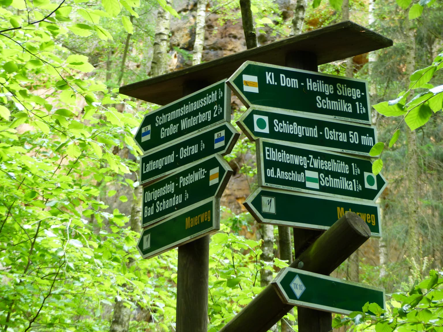
The Bastei area remains the park's most visited location, with the Bastei Bridge offering spectacular views over the Polenz valley and attracting approximately 1.5 million visitors annually. The Schrammsteine rock formation provides a dramatic wilderness experience, while the Großer Winterberg at 556 meters offers the park's highest accessible terrain. The 400-kilometer network of marked hiking trails includes the international E3 long-distance trail and the historic Malerweg, while approximately 50 kilometers of cycling paths connect to the regional Elberadweg. Rock climbing is a major activity, with over 1,147 peaks and 15,000 routes available under the traditional Saxon climbing rules that prohibit the use of chalk and require techniques specific to the sandstone. The park contains several historic information posts including the Zeughaus in Großer Zschand and various mountain restaurants at key viewpoints.

Green directional signs with white text on wooden posts in a forested area
Directional signpost showing hiking trails in Saxon Switzerland National Park

Best time to visit Saxon Switzerland National Park

The park can be visited year-round, though each season offers distinct experiences and challenges. The summer months of July and August typically bring the highest visitor numbers and the most stable weather for hiking and climbing, though the exposed sandstone cliffs can experience extreme temperature variations between day and night. Spring and autumn offer fewer crowds and often excellent conditions for hiking, though weather can be more changeable. The winter months provide a very different experience of the landscape, with snow covering the rock formations and frozen waterfalls creating dramatic ice formations in the gorges. However, some trails may be closed or difficult to access during winter, and the cold, humid climate of the canyon floors can make hiking uncomfortable in colder months. The park's high visitor numbers mean that planning is advisable during peak season, and staying in the park's vicinity requires advance reservation, particularly for the popular Bastei area.

Park location guide

Geography guide, regional context, and park location map for Saxon Switzerland National Park

Saxon Switzerland National Park park geography, regions, and map view in Germany
Understand where Saxon Switzerland National Park sits in Germany through a broader geographic reading of the surrounding landscape, nearby location context, and its mapped position within the national park landscape.

How Saxon Switzerland National Park fits into Germany

Germany is a federal republic in Western and Central Europe with a population of over 83 million across sixteen constituent states. It is Europe's largest economy by nominal GDP and a major global exporter and importer. The capital is Berlin, and the country borders Denmark, Poland, Czech Republic, Austria, Switzerland, France, Luxembourg, Belgium, and the Netherlands.

Wider geography shaping Saxon Switzerland National Park in Germany

Germany is located in Western and Central Europe, spanning 357,022 km². It borders Denmark to the north, Poland and the Czech Republic to the east, Austria and Switzerland to the south, and France, Luxembourg, Belgium, and the Netherlands to the west. The country has coastlines on the Baltic Sea and North Sea to the north, with the Alps located in the southern region.

Map view of Saxon Switzerland National Park

Use this park location map to pinpoint Saxon Switzerland National Park in Germany, understand its exact geographic position, and read its mapped placement within the surrounding landscape more clearly.

Pigeon | © OpenStreetMap contributors

Location context for Saxon Switzerland National Park

Saxony

Visually explore the distinctive Elbe Sandstone Mountains, dramatic rock formations, and unique forest environments that define this protected landscape.

Saxon Switzerland National Park: Imagery, Scenery, and Protected Sandstone Landscapes
Browse comprehensive photography of Saxon Switzerland National Park to visually explore its famous sandstone rock formations, deeply incised canyons, and varied forest environments. These images offer crucial context for understanding the park's unique geological character, diverse microclimates, and the distinct protected natural areas of the Elbe Sandstone Mountains landscape.

Stone bridge with multiple arches connecting large sandstone rock formations in a misty mountain landscape

Panoramic view of sandstone rock formations, forested hills, and distant mountains under a clear blue sky

Stone arch bridge connecting two sandstone cliffs with forested mountains and misty horizon in background

Rock formations and forested landscape with prominent sandstone cliffs in the midground and background

Green sign on wooden post reading 'KERNZONE' with German text 'Betreten nur auf den im Gelände markierten Wegen erlaubt. Übernachten im Freien nicht gestattet.' surrounded by forest vegetation and moss-covered rocks

Close-up of white flowers on marsh rosemary plant growing in a moist, rocky crevice surrounded by green vegetation

Landscape view of Lilienstein rock formation at sunrise with forested hills and distant mountains under a clear sky

Green directional signs with white text on wooden posts in a forested area

Stone signpost with two inscribed panels in a forested area, surrounded by fallen leaves and trees.

Green sign on wooden post displaying German text 'KEIN WANDERWEG!' with climbing access symbols, set in a forested hiking trail with wooden steps and trees

Moss-covered sandstone cliffs with a small waterfall flowing into a pool, surrounded by green vegetation and ferns

Green signpost with 'NATIONALPARK SÄCHSISCHE SCHWEIZ' text and park logo, standing in a forest with tall trees and leaf-covered ground

Close-up of a common toad (Bufo bufo) on a stone surface with textured skin and orange eyes

Narrow dirt hiking trail through dense green forest with tall trees and a large sandstone rock formation in the background

Forest fire with large smoke plume rising from wooded area in mountainous landscape

Green signpost on wooden pole showing park information, dirt trail through grassy area with trees and forest in background

Park atlas

Map the surrounding protected areas and compare unique sandstone canyon landscapes with adjacent regional terrain.

Explore Other National Parks and Protected Areas Near Saxon Switzerland National Park
Explore national parks and diverse protected areas located near Saxon Switzerland National Park, tracing the geographic spread of conservation landscapes across the Elbe Sandstone Mountains and surrounding terrain. Compare these regional park entities to gain essential context for understanding the varied geology, ecosystems, and human interaction that define Central European protected area geography.
National park

Bohemian Switzerland National Park: Czech Sandstone Protected Landscape and Map Exploration

Discover its unique terrain and protected area geography.

Bohemian Switzerland National Park is a protected area in the Czech Republic known for its exceptional sandstone geology. This national park showcases a dramatic landscape of towering rock formations, deep gorges, and striking canyons, forming a significant part of the Elbe Sandstone Mountains. Through MoriAtlas, users can explore its mapped protected boundaries, understand its regional geographic context, and appreciate its unique natural heritage.

Area
79 km²
Established
2000
IUCN
II
Relief
Mixed relief
Protected landscape

Bohemian Paradise Protected Landscape: Discover Czech Republic's Sandstone Geology and Park Boundaries

Mapped sandstone formations and historic regional geography.

Delve into Bohemian Paradise, a protected landscape in the Czech Republic celebrated for its dramatic sandstone rock formations and ancient castles. This detailed entry provides context on its unique geological character, the extent of its protected boundaries, and its significant position within the regional geography. Explore the mapped terrain and understand the atlas value of this historic protected area.

Area
181.17 km²
Established
1955
IUCN
V
Relief
Upland
Watercolor artwork depicting a landscape with green hills, distant mountains, and pastel sky
National parkLower Silesian Voivodeship

Stołowe Mountains National Park: Explore Poland's Sandstone Rock Cities and Protected Terrain

National Park in Lower Silesian Voivodeship: Geological Wonders.

Stołowe Mountains National Park is a protected national park in Poland celebrated for its unparalleled sandstone geological features. Within the Lower Silesian Voivodeship, the park showcases a dramatic landscape dominated by flat-topped rock plateaus, natural labyrinths, and vertical sandstone formations that create a visually stunning and geologically significant environment. Its protected status ensures the preservation of these unique landforms and the rare ecosystems, such as raised peat bogs, offering extensive opportunities for atlas exploration and understanding the region's distinct natural context.

Area
63.39 km²
Established
1993
IUCN
II
Visitors
1.3M annual
Watercolor illustration showing a river winding through rolling green hills with sparse vegetation
National parkLubusz Voivodeship

Warta Mouth National Park: A National Park Protecting Vital European Wetlands

Explore mapped protected areas and bird habitats in Lubusz Voivodeship.

Warta Mouth National Park, located in Poland's Lubusz Voivodeship, is a significant protected landscape safeguarding the ecologically rich confluence of the Warta and Oder rivers. As the nation's most recently established national park, it provides critical habitat for a vast array of migratory and breeding bird species within its extensive marshlands and floodplains. This park offers a unique opportunity for atlas-driven exploration of Central European wetland geography and the mapped boundaries of a vital conservation area.

Area
80.38 km²
Established
2001
IUCN
II
Visitors
52K annual
Watercolor painting showing mountains, forests, and valleys in a landscape.
National park

Bavarian Forest National Park: Protected Landscape and Regional Geography Atlas

Explore mapped terrain and protected park boundaries in Germany.

Dive into the specifics of Bavarian Forest National Park, a key protected area noted for its distinct landscape and geographic importance. This MoriAtlas entry details the park's mapped boundaries and its setting within the surrounding regional geography, offering a clear atlas-style view of its natural terrain. Understand its identity as a national park and discover its place in Germany's protected lands.

Area
242.45 km²
Established
1970
IUCN
II
Visitors
1.3M annual
National park

Wielkopolska National Park: Poland's Glacial Landscape and Lake District Protected Area

Explore the mapped terrain and protected landscape.

Wielkopolska National Park is a vital protected landscape in western Poland, notable for its characteristic post-glacial terrain. Featuring a landscape defined by numerous kettle lakes nestled within mixed forests and gently rolling hills, this national park offers a representative sample of the Greater Poland lake district's natural heritage. Its mapped boundaries delineate an area of ecological importance, providing valuable context for understanding regional geography and protected area distribution through structured atlas exploration.

Watercolor painting depicting a river flowing through a valley with green vegetation and distant mountains
National parkBrandenburg

Lower Oder Valley National Park: Unique Polder Landscape and Bird Sanctuary

Discover protected area maps and regional geography in Brandenburg

Delve into the Lower Oder Valley National Park, a national park recognized for its extraordinary polder landscape and extensive wetland ecosystems. This page provides detailed geographic context, highlighting the park's unique engineered floodplain, its role as a sanctuary for numerous bird species, and its position within the regional geography of Brandenburg. Understand the mapped boundaries and ecological importance of this exceptional protected area.

Area
103.23 km²
Established
1995
IUCN
II
Visitors
150K annual
Protected landscapeSouth Moravian Region

Moravian Karst Protected Landscape: Detailed Geographic and Cave System Atlas

Mapped protected boundaries and karst phenomena in the South Moravian Region.

Moravian Karst, designated a Protected Landscape Area, offers a profound look into complex karst geology within the South Moravian Region. This entry within MoriAtlas facilitates a structured discovery of its approximately 92 square kilometers, featuring an intricate network of over 1,100 caves and gorges. Users can explore the mapped extent of this geological treasure, understand its relationship with the surrounding regional geography, and appreciate the unique formations sculpted by underground water systems, including the iconic Macocha Abyss.

Area
92 km²
Scope
Terrestrial
Water
Minor water

Common questions about visiting, size, designation, and location context for Saxon Switzerland National Park

Saxon Switzerland National Park FAQs for park facts, access, geography, and protected area context
Find quick answers about Saxon Switzerland National Park, including protected-area facts, park geography, trail and visitor context, and how the park fits into its surrounding country and regional landscape.
MoriAtlas Explorer

Continue Your Protected Areas Search Across the Global Atlas

Deepen your exploration by continuing the structured search for national parks and protected areas worldwide. Utilize the comprehensive filtering capabilities to compare different conservation landscapes and refine your understanding of global park geography. Discover more about the distribution and characteristics of protected natural areas.

Global natural geography