
Mori Atlas logo
Nature reserveStephens Island (New Zealand)

Understanding the maritime terrain, predator-free sanctuary status, and island geography

Stephens Island (New Zealand) Nature Reserve: A Detailed Geographic and Protected Landscape Atlas

(Stephens Island Nature Reserve)

Stephens Island, known as Takapourewa, serves as a vital protected landscape within the Marlborough Region of New Zealand. This rugged 1.5 square kilometre island rises sharply above the currents of the Cook Strait, functioning as a critical sanctuary for endemic species like the tuatara and Hamilton's frog. The island features a complex geological profile belonging to the Maitai Group, with a terrain shaped by persistent maritime winds and salt spray that create a unique and isolated ecological environment.

island sanctuarytuatara refugeseabird breeding groundCook StraitMarlborough Soundsnature reserve
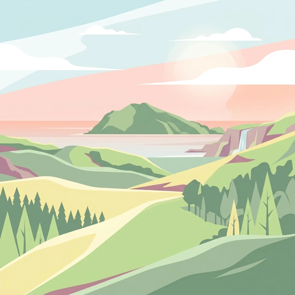
A digital illustration of a coastal scene featuring rolling green hills, a small island in the distance, a waterfall on a cliff, and a forest in the foreground under a pastel sky.

Stephens Island (New Zealand)

Nature reserve

Park overview

Structured park overview, official facts, and landscape profile for Stephens Island / Takapourewa

Stephens Island / Takapourewa park facts, protected area profile, and essential visitor context

Review the core facts for Stephens Island / Takapourewa, including designation, size, terrain, visitor scale, habitats, and operating context in one park-focused overview.

About Stephens Island / Takapourewa

Stephens Island, or Takapourewa, sits at the northern entrance to the Marlborough Sounds, separated by only a few kilometres of rough Cook Strait water from the northern tip of D'Urville Island. Although it covers just 1.5 square kilometres and has no permanent population, the island punches well above its size in ecological importance. Its rugged terrain climbs sharply from the sea to a summit of 283 metres, creating strong gradations of exposure between the often cloud-covered heights and the wave-lashed shores below.

The island lies within a heavily marine-influenced environment of strong winds, strong currents and restless seas. Mean annual wind speeds around the island are high, and the surrounding waters are part of a major whale migration corridor, especially for humpback whales. New Zealand fur seals and several species of dolphins are regularly seen offshore, reflecting the broader richness of Cook Strait's marine ecosystem.

Following decades of modification for farming, which removed around 90 percent of the original vegetation cover, the island was designated a wildlife sanctuary in 1966 and a nature reserve in 1997. In 2012 a Treaty of Waitangi settlement between Ngāti Koata and the New Zealand Government established a joint management arrangement with the Department of Conservation. Today Stephens Island is recognised internationally for nature conservation, both for its protected reptile population and for its role as a predator-free refuge for seabirds and endemic invertebrates.

Protection and recognition

Documented terrestrial protection scope, designation timeline, and official recognition records

Stephens Island, New Zealand Protection Status and Protected Area History

Stephens Island, New Zealand holds a documented terrestrial protection status established in the year 1997. Designated records outline management scope and historical protection context for conservation analysis.

Protection details

Protection scope
Terrestrial
Designated year
1997
Transboundary protection
No
Park context

Deeper park guide and search-rich context for Stephens Island / Takapourewa

Stephens Island / Takapourewa history, landscape, wildlife, and travel context

Explore Stephens Island / Takapourewa through its history, landscape character, ecosystems, wildlife, conservation priorities, cultural context, and seasonal travel timing in a structured park guide built for atlas discovery and search intent.

Why Stephens Island / Takapourewa stands out

Stephens Island is renowned primarily as one of the most important sanctuaries for the tuatara, an ancient reptile whose closest relatives disappeared globally more than 60 million years ago. The island also hosts Hamilton's frog, considered one of the rarest frogs in the world, and the flightless Ngaio weevil, an endemic species found nowhere else. Beyond these signature animals, the island is celebrated for its extraordinary seabird density, with more than a million seabirds nesting across its 1.5 square kilometre area. Its predator-free status, dramatic maritime setting above one of the great whale migration routes, and unusually high concentration of endemic invertebrates make it a small but globally significant natural refuge.
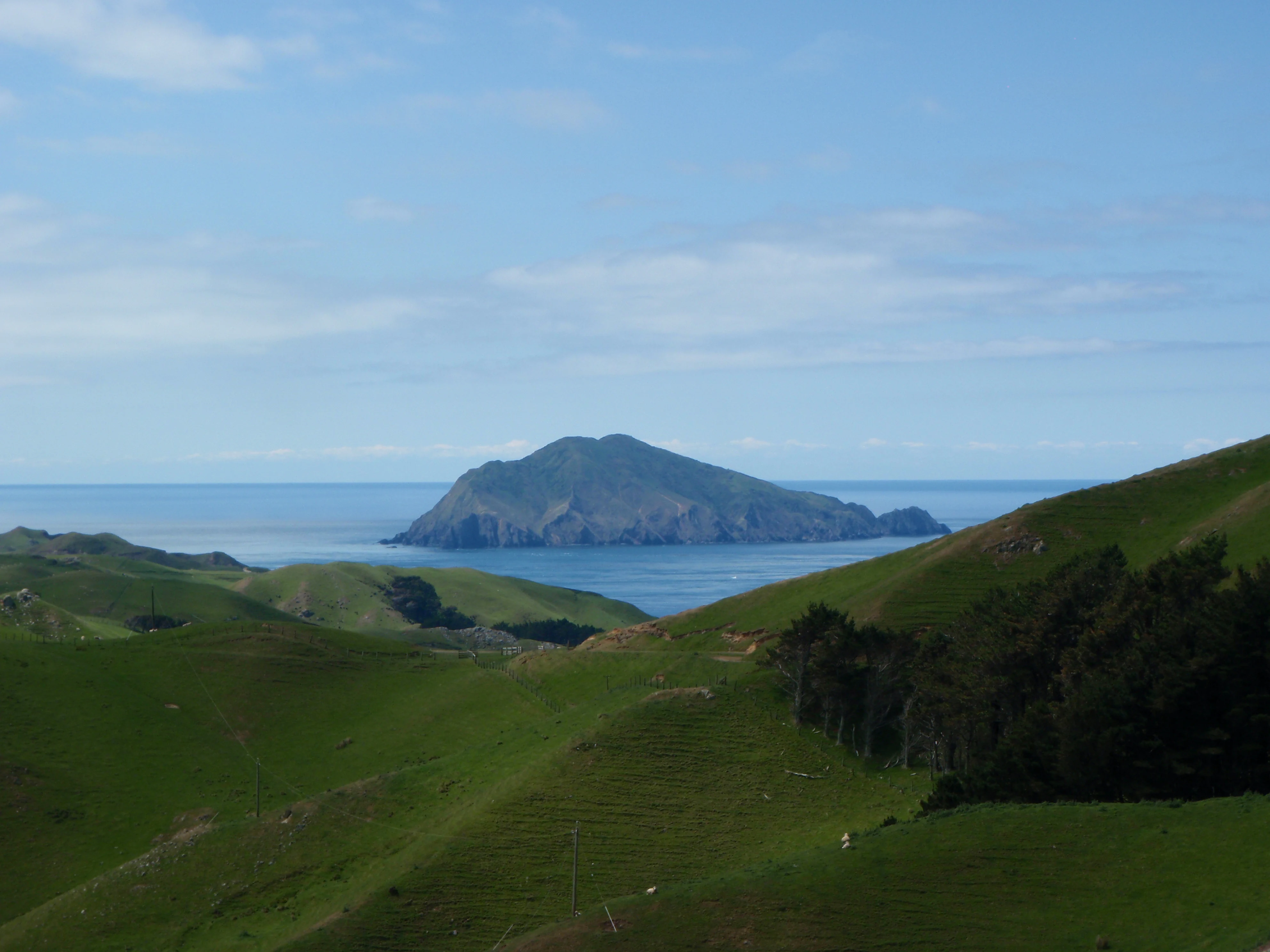
A distant view of a rugged, grassy island surrounded by blue sea, seen from rolling green hills in the foreground.
View of Stephens Island, Takapourewa, looking across from the hills of D'Urville Island.

Stephens Island / Takapourewa history and protected-area timeline

Stephens Island was originally owned by the Ngāti Koata iwi, who knew it as Takapourewa, meaning roughly "around the tower" in reference to a later lighthouse structure. In 1891 the New Zealand government took the island for lighthouse construction, adding it to a chain of navigational aids around the dangerous Cook Strait. The European name was given in 1770 by Captain James Cook, who named the island after Sir Philip Stephens, Secretary of the Admiralty.

The island became famous in local lore through the story of Tibbles, the lighthouse keeper's cat, once popularly credited with causing the extinction of the flightless Lyall's wren in 1894. Modern research has shown this tale to be an urban legend: while the cat did capture one of the last known individuals, the species had already survived in very small numbers for several more years. Lyall's wren had in fact been confined to Stephens Island as a final refuge long after disappearing from the mainland many centuries earlier because of Polynesian rat predation.

By the mid-twentieth century, farming and grazing had stripped the island of roughly 90 percent of its original vegetation cover. Recovery began when the island was declared a wildlife sanctuary in 1966, followed by elevation to nature reserve status in 1997. A significant turning point came in 2012 with the Treaty of Waitangi settlement between Ngāti Koata and the Crown, which recognised Ngāti Koata's ongoing connection to Takapourewa and established joint management of the reserve with the Department of Conservation.

Stephens Island / Takapourewa landscape and geographic character

Stephens Island is a rugged, compact landmass shaped almost entirely by its maritime surroundings. The terrain rises steeply from the sea to a high point of 283 metres, producing dramatic weather differences between the frequently cloud-covered summit and the wave-battered coastline. The western shores face the full force of Cook Strait's open seas, while the eastern side, somewhat more sheltered, supports a subtly different coastal character.

The island is the largest of a family of islands, islets and rock stacks that define the southwestern approaches to the Cook Strait. From the sea, the historic lighthouse and associated buildings form a prominent visual anchor on the skyline, while from above the modified farmland patterns are clearly visible against the surrounding ocean. Strong winds averaging 14 knots year-round, strong tidal currents and broken seas give the entire setting a restless, exposed quality.

Rainfall on the island is comparatively modest, averaging around 800 millimetres annually, but the combination of wind, salt spray and thin soils shapes a tough, wind-pruned environment. Geologically, the island is marked by the Stephens Formation, a sequence of southeast-dipping sedimentary rocks, mudstones, volcanic sandstones and conglomerates belonging to the Maitai Group and representing the most northerly exposure of the Nelson Regional Syncline. Late Quaternary deposits of loess and windblown sand mantle parts of the surface, reflecting the ongoing interplay of marine, atmospheric and geological forces.

Stephens Island / Takapourewa ecosystems, habitats, and plant life

Although heavily modified by past land clearance, Stephens Island retains a wild and ecologically distinct natural character. The vegetation cover that survived grazing has regenerated under protected status, and the combination of a wet, windy maritime climate and predator-free conditions has produced an unusually rich habitat mosaic on a very small land area. The island's ecosystems are inseparable from the surrounding ocean, which feeds nutrients into the system through immense seabird colonies.

Habitat contrast on the island is pronounced: sheltered eastern slopes support different plant communities from the more exposed western faces, and the cloud-shrouded summit creates conditions distinct from those at sea level. This range of microclimates within just 1.5 square kilometres helps explain how such an unusual concentration of endemic and rare species can persist on a single small island.

Stephens Island / Takapourewa wildlife and species highlights

The single most iconic resident of Stephens Island is the tuatara, a reptile representing an entire ancient order largely extinct elsewhere for more than 60 million years. Tuatara populations were wiped out on the New Zealand mainland long ago, leaving Stephens Island and a few other carefully managed offshore refuges as key sanctuaries for the species' continued survival.

Equally significant is Hamilton's frog, considered one of the rarest frogs in the world, which lives nowhere else. The flightless Ngaio weevil is another species found only on Stephens Island, while the Stephen's Island gecko and the Cook Strait click beetle are rare species for which the island acts as a major stronghold. Vast numbers of wētā and darkling beetles also inhabit the island in extraordinary densities.

Seabirds are perhaps the most visible wildlife feature. More than a million seabirds breed on and around the island, linking the small landmass to a vast marine foraging ecosystem. The surrounding waters support New Zealand fur seals, several dolphin species, and migrating humpback whales, reinforcing the island's role as both a terrestrial sanctuary and a node within a much larger oceanic food web.

Stephens Island / Takapourewa conservation status and protection priorities

Stephens Island is internationally important for nature conservation, recognised for the rare and unique combination of species it protects within a very small area. Its predator-free status allows species that have been lost from the mainland to maintain viable populations, while its position at the edge of a productive marine zone amplifies its ecological value.

Conservation significance stems from several distinct factors. The island supports endemic species found nowhere else, such as Hamilton's frog and the Ngaio weevil. It shelters unusual survivors like the tuatara, a living representative of an otherwise vanished reptile lineage. It is a stronghold for rare species including the Stephen's Island gecko and the Cook Strait click beetle, and it hosts common species in unusually high abundance, from more than a million seabirds to enormous populations of wētā and darkling beetles.

Equally importantly, Stephens Island links a small piece of land to a vast ocean ecosystem. Seabirds transport marine nutrients to the island, creating a functioning predator-free sanctuary for nesting birds, while the surrounding sea supplies the productivity that sustains them. Protection of the reserve was formalised in 1966 as a wildlife sanctuary and strengthened in 1997 with nature reserve status; the 2012 Treaty of Waitangi settlement placed the island under joint management by Ngāti Koata and the Department of Conservation, recognising both its ecological and cultural significance.

Stephens Island / Takapourewa cultural meaning and human context

For Ngāti Koata, the island known as Takapourewa is a taonga with deep ancestral significance, a name tied in tradition to a tower-like feature on the landscape. The 2012 Treaty of Waitangi settlement acknowledged this ongoing connection and established a formal co-management role for the iwi alongside the Department of Conservation, embedding cultural responsibility into the island's modern conservation framework. The naming layered onto this; with Captain Cook's 1770 renaming after Sir Philip Stephens adding a parallel European label that persists in everyday use today.

Top sights and standout views in Stephens Island / Takapourewa

A compact Cook Strait island with global conservation importance, Stephens Island stands out for its density of endemic and evolutionary significant species. Its tuatara population and Hamilton's frog colony are among the most celebrated wildlife features in New Zealand, while its seabird numbers, exceeding a million birds, make it one of the most seabird-rich small islands in the region.

The dramatic interplay of strong winds, currents, cloud and sea has shaped both the island's physical form and its ecological character. Geologically, it offers exposures of the Stephens Formation within the Maitai Group, while culturally it remains a living taonga for Ngāti Koata under joint management with the Department of Conservation.

Best time to visit Stephens Island / Takapourewa

Stephens Island is uninhabited and managed primarily for conservation, so any visit is dictated by weather and sea conditions rather than seasonal attractions on the island itself. Conditions around the Marlborough Sounds and Cook Strait are most settled in the warmer months from late spring through early autumn, when lighter winds and calmer seas make the surrounding waters easier to approach, and the island's vegetation is at its most verdant.

In winter the area is battered by strong winds, heavy swells and frequent cloud cover, giving the island a more austere and dramatic character. This period, however, coincides with peaks of seabird activity and whale migration movements offshore, making it the most rewarding season for those interested in the broader marine wildlife the island supports.
Monthly climate preview

Measured monthly weather patterns and average temperature cycles across the representative coordinate

Stephens Island (New Zealand) Climate Normals, Long-Term Temperature and Precipitation Rhythm

Representative coordinate records show average temperatures ranging from 11.68 °C to 19.99 °C alongside varying monthly precipitation rhythms between 2.08 mm/day and 4.35 mm/day. Examining the complete twelve-month record provides detailed monthly climate normals for Stephens Island (New Zealand) to support thorough geographic analysis.
Annual mean14 °C
12 °C18 °C
Jan17°
Feb18°
Mar17°
Apr16°
May14°
Jun13°
Jul12°
Aug12°
Sep12°
Oct13°
Nov14°
Dec16°
Warmest month
February

17.7 °C

Coolest month
August

11.7 °C

Wettest month
June

4.4 mm/day

Driest month
January

2.1 mm/day

Park location guide

Geography guide, regional context, and park location map for Stephens Island / Takapourewa

Stephens Island / Takapourewa park geography, regions, and map view in New Zealand

Understand where Stephens Island / Takapourewa sits in New Zealand through a broader geographic reading of the surrounding landscape, nearby location context, and its mapped position within the national park landscape.

How Stephens Island / Takapourewa fits into New Zealand

New Zealand is an island nation in the southwestern Pacific Ocean comprising two main islands and numerous smaller islands. Located east of Australia across the Tasman Sea, it features varied topography with the Southern Alps running along the South Island and volcanic terrain on the North Island. The country was settled by Maori people between 1280 and 1350, followed by European exploration beginning in 1642, and became a Dominion in 1907 before gaining full independence in 1947.

Wider geography shaping Stephens Island / Takapourewa in New Zealand

New Zealand lies in the southwestern Pacific Ocean, east of Australia across the Tasman Sea. The country consists of two main islands, the North Island and South Island, plus over 600 smaller islands. The North Island features volcanic plateaus and hills while the South Island is dominated by the Southern Alps mountain range. The country has a long coastline and is surrounded by the Pacific Ocean.

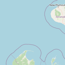
Map view of Stephens Island / Takapourewa

Use this park location map to pinpoint Stephens Island / Takapourewa in New Zealand, understand its exact geographic position, and read its mapped placement within the surrounding landscape more clearly.

Pigeon | © OpenStreetMap contributors

Location context for Stephens Island / Takapourewa

Marlborough Region

Visual exploration of rugged coastal terrain, maritime habitats, and island sanctuary features

Stephens Island (New Zealand) Landscape Photos and Protected Area Scenery

Examine detailed photographs of Stephens Island (New Zealand) to understand its rugged coastal terrain, wind-pruned vegetation, and exposed Cook Strait environment. Visual records capture the dramatic topography, historic lighthouse structures, and protected habitats that define this isolated island sanctuary.

A distant view of a rugged, grassy island surrounded by blue sea, seen from rolling green hills in the foreground.

Park atlas

Discover related island sanctuaries and coastal reserves across the surrounding maritime region

Explore Protected Areas Near Stephens Island (New Zealand)

Compare Stephens Island (New Zealand) with other protected landscapes and regional island sanctuaries across the surrounding maritime zone. Browsing adjacent coastal reserves provides broader geographic context for Cook Strait conservation geography.
Nature reserveNew Zealand
About 42 km away#1 closest

South

Maud Island Nature Reserve: Geographic Overview and Protected Coastal Landscape

A pivotal conservation sanctuary in the Marlborough Sounds region

Maud Island represents a critical protected area in the Pelorus Sound of New Zealand. Defined by 320 hectares of forested, hilly terrain and a unique narrow isthmus, the island serves as a foundational refuge for species recovery. Its sheltered maritime setting makes it a key feature of the Marlborough Sounds geography and an essential location for scientific ecological research.

Area
3.2 km²
Established
1971
Relief
Upland
Climate
Temperate
A horizontal watercolor illustration depicting rolling green hills, scattered trees, and soft, muted tones against a plain white background.
Nature reserveMarlborough Sounds
About 53 km away#2 closest

Southeast

Motuara Island Nature Reserve: Protected Landscape and Geographic Discovery

Marlborough Sounds Coastal Reserve and Sanctuary

Motuara Island is a significant nature reserve characterized by its regenerating forest, rugged coastline, and elevated summit lookout. Serving as a sanctuary for native birds and a landmark of colonial and Māori history, this 59-hectare island remains a central point of geographic interest within the Marlborough Sounds ria system.

Area
0.59 km²
Established
1976
Relief
Upland
Climate
Temperate
Marine protected areaMarlborough Region
About 54 km away#3 closest

Southeast

Long Island-Kokomohua Marine Reserve: Mapped Geography and Protected Reef Systems

Explore marine boundaries in the Marlborough Region

Located at the entrance to Queen Charlotte Sound, Long Island-Kokomohua Marine Reserve encompasses significant island and submerged reef features. This protected area serves as an essential site for understanding coastal ecosystem restoration, featuring varied terrain from shallow near-shore reefs to deeper rocky pinnacles that support diverse marine populations.

Area
6.19 km²
Established
1993
Relief
Lowland
Climate
Temperate
Protected landscapeMarlborough Region
About 56 km away#4 closest

Southwest

Mount Richmond Forest Park: Geography and Protected Landscapes in the Marlborough Region

Expansive native bush and mountain peak terrain

Mount Richmond Forest Park stands as one of the largest protected forest areas on the South Island of New Zealand. Dominated by dense native bush and rugged subalpine ridges, the park offers a complex topography of river valleys and high-altitude peaks, including its namesake Mount Richmond. It serves as a vital conservation landscape and a core segment of the regional geography between Nelson and the Marlborough district.

Area
1,659 km²
Established
1977
Relief
Mountain
Scope
Terrestrial
National parkTasman District
About 82 km away#5 closest

West

Abel Tasman National Park: Coastal Protected Landscape and Mapped Geography in Tasman District

New Zealand's smallest national park offering iconic coastal hiking and wildlife.

Delve into the mapped boundaries and unique geography of Abel Tasman National Park, New Zealand's smallest national park located in the Tasman District. This protected landscape features renowned golden beaches, forested hills, and vital island ecosystems. Explore its coastal trails, understand its ecological restoration context, and appreciate its historical significance as a site of early European and Māori interaction, making it a key destination for atlas-driven geographic discovery.

Area
237.1 km²
Established
1942
IUCN
II
Relief
Upland
Protected landscapeWellington Region
About 85 km away#6 closest

Southeast

Whitireia Park: Coastal Headland and Protected Landscape in the Wellington Region

Explore mapping of coastal terrain, forests, and harbour boundaries.

Whitireia Park is a prominent coastal reserve in the Wellington Region that balances deep Ngāti Toa cultural significance with a unique geological history shaped by centuries of earthquake uplift. The headland features open grasslands, remnant kohekohe forest, and ongoing wetland restoration that offers a layered view of New Zealand's natural and social history across its accessible harbour-edge geography.

Area
1.8 km²
Established
1976
Relief
Upland
Climate
Temperate
Nature reserveWellington
About 96 km away#7 closest

Southeast

Te Kopahou Reserve: Nature Reserve Geography and Coastal Landscapes in Wellington

A rugged intersection of forested hills, ridgelines, and coastal cliffs.

Situated on the southern edge of Wellington, Te Kopahou Reserve offers a diverse protected landscape ranging from the summit of Hawkins Hill to the iconic red rocks of the Cook Strait shoreline. This nature reserve provides a critical geographic transition, hosting regenerating native bush, exposed ridgeline trails, and vital habitats for local wildlife, making it a prominent example of regional conservation land on the North Island of New Zealand.

Area
6 km²
Relief
Mountain
Climate
Temperate
Access
Easy access
Watercolor painting of mountains, green valleys, and a winding river under a soft sky
National parkWest Coast Region
About 100 km away#8 closest

Southwest

Kahurangi National Park: A National Park of Ancient Geology and Diverse Protected Landscapes in New Zealand

Explore the mapped natural terrain and regional geographic context.

Kahurangi National Park is distinguished by its extraordinary geological diversity, representing New Zealand's finest Paleozoic rock sequence and expansive karst features. Covering a vast area in the West Coast Region, it protects a remarkable array of natural landscapes, from coastal cliffs and nikau palm forests to alpine tussock basins and deep gorges. This national park is crucial for understanding New Zealand's natural heritage, offering a rich tapestry of mapped terrain and protected biodiversity for dedicated geographic exploration.

Area
5,193 km²
Established
1996
IUCN
II
Relief
Mixed relief

Common questions about visiting, size, designation, and location context for Stephens Island / Takapourewa

Stephens Island / Takapourewa FAQs for park facts, access, geography, and protected area context

Find quick answers about Stephens Island / Takapourewa, including protected-area facts, park geography, trail and visitor context, and how the park fits into its surrounding country and regional landscape.
MoriAtlas Explorer

Continue Your Protected Areas Search Across the Global Atlas

Deepen your exploration by continuing the structured search for national parks and protected areas worldwide. Utilize the comprehensive filtering capabilities to compare different conservation landscapes and refine your understanding of global park geography. Discover more about the distribution and characteristics of protected natural areas.

Global natural geography