
Why Tanjung Piai stands out
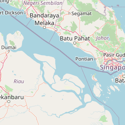
Tanjung Piai is best known as the symbolic southernmost point of mainland Asia, anchored by a distinctive globe monument that draws visitors to pose at the foot of the continent. That human landmark, however, sits within a Ramsar-listed mangrove ecosystem that is the park's deeper identity. The cape is recognized for its relatively intact mangrove forests, its tidal mudflats, and its role as a roosting and feeding area for migratory and resident waterbirds. It also forms the southern anchor of the southwest Johor Important Bird Area, a stretch of coastline with regional significance for waders, herons, and species of conservation concern.
Tanjung Piai history and protected-area timeline
The site's formal protection story is relatively recent. Tanjung Piai was designated as a Ramsar Wetland of International Importance on 31 January 2003, under reference number 1289. It was also recognized as one of only five Ramsar sites in Malaysia and was listed as the third designated park under the Johor National Park Corporation, placing it within an established state-level system of protected natural areas.
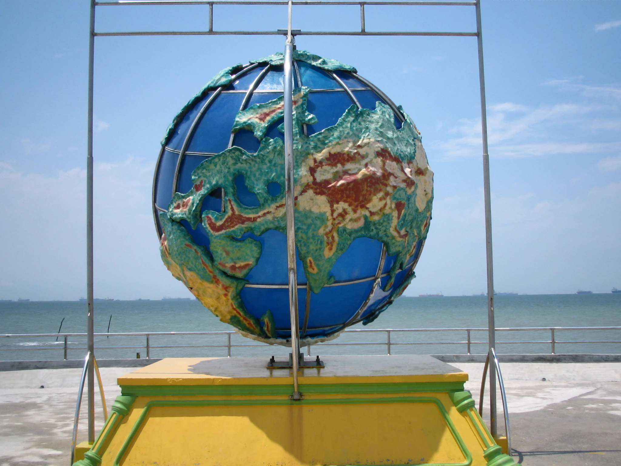
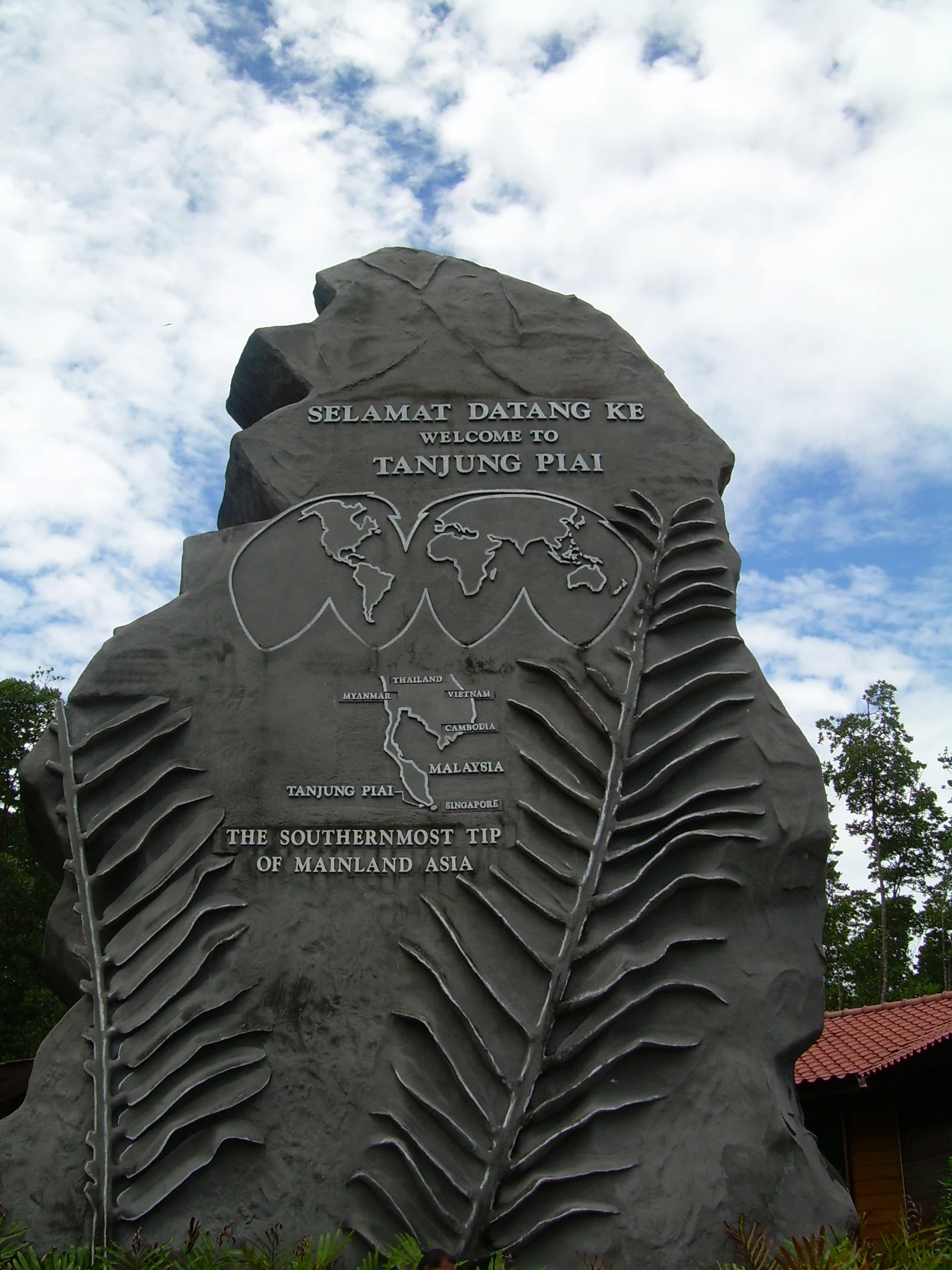
In 2001, the Johor state government built a monument at the cape to formalize its status as the southernmost point of mainland Asia. The monument, constructed with environmentally friendly concrete, is approximately 20 meters tall and 10 meters wide. Its grey color was chosen to evoke the mangrove forests and muddy flats of the cape, and its surface carries carved fronds of the Paku Piai fern (Acrostichum aureum), a plant that grows abundantly alongside the mangroves here and that gave the cape its name.
Long before any monument, the mangrove forests, mudflats, and tidal channels of the cape supported local fishing communities. Over time, the site's combination of ecological value, symbolic geography, and proximity to Singapore has shaped its development into a managed ecotourism destination, while the Ramsar designation has placed international conservation obligations on maintaining the mangrove ecosystem and minimizing erosion.
Tanjung Piai landscape and geographic character
Tanjung Piai's landscape is a low-energy coastal scene rather than a dramatic one. There are no mountains, cliffs, or sweeping highlands; instead the cape is built from tidal mudflats, shallow channels, and mangrove stands that reach seaward from the Johor shoreline.
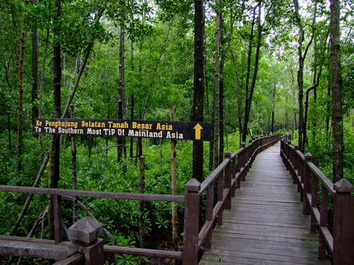
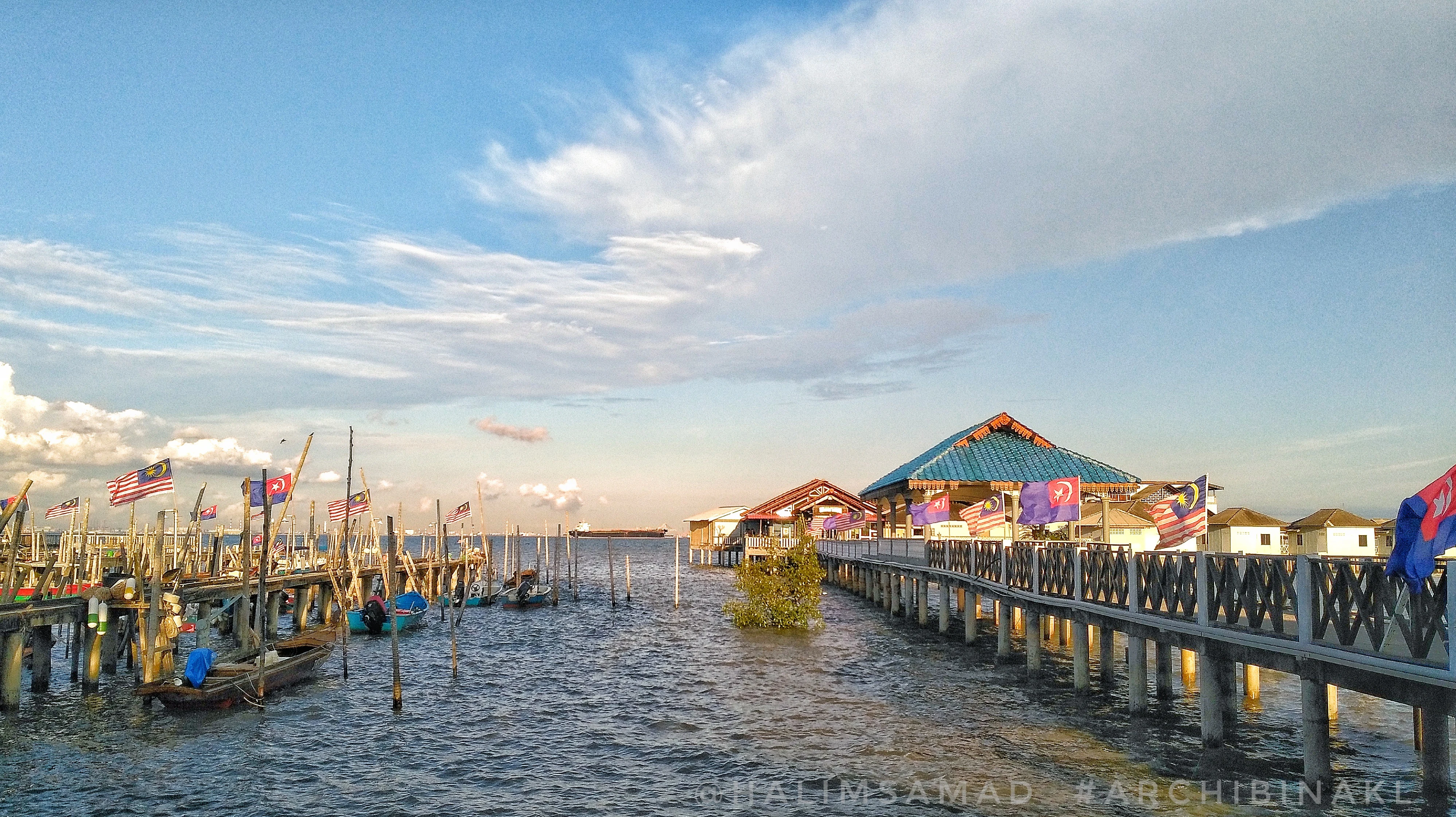
The terrain is flat and waterlogged, laced with sinuous tidal creeks that fill and empty with the tide. Wooden jetties and boardwalks rise above the mud, giving physical structure to an otherwise shifting surface. At the seaward edge, the cape tapers into a low promontory where a 15-meter light tower stands near the edge of the drying flats, flashing once every three seconds and equipped with a radar transponder beacon.
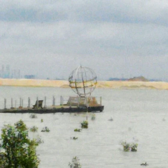
Looking north and east from the point, the view opens across the Johor Strait toward the urban skyline of Singapore. Looking inward, the land transitions to coastal villages and farmland protected by the mangrove fringe. The grey monument at the tip of the cape echoes the muted palette of mud, root, and sky that defines the surrounding scenery.
Tanjung Piai ecosystems, habitats, and plant life
The dominant ecological character of Tanjung Piai is mangrove and tidal mudflat. Twenty-two species of mangrove tree have been recorded across the cape, forming layered stands of varying height and density along the creeks and shoreline. These trees drop their leaves and propagules into the tidal waters, fueling a fertility cycle that supports invertebrates, juvenile fish, and the birds that come to feed on them.
Tanjung Piai sits within a broader ecological mosaic. The southwest Johor coastline, stretching from the Sunda Trench to Tanjung Piai, is one of the most significant coastal mangrove and mudflat complexes in the region. The mangroves act as a natural barrier, reducing wave energy during storm events and helping to stabilize sediment along a coastline that would otherwise be vulnerable to erosion.
The tidal flats also make the cape ecologically productive far beyond its area. The combination of sheltered mangrove interior, exposed mudflat at low tide, and open water at high tide creates a layered habitat where different species can feed, roost, and shelter at different stages of the tidal cycle. This mosaic is what allows the site to support both resident wildlife and passing migratory species.
Tanjung Piai wildlife and species highlights
Wildlife at Tanjung Piai is shaped around the tidal cycle. The mudflats exposed at low tide attract wading birds, while the mangrove canopy shelters arboreal and nest-building species. The cape is a recognized stopover and feeding area for migratory shorebirds moving along the East Asian flyway, and it supports resident populations of herons, egrets, and other waterbirds.
Among the species associated with the site, the Lesser Adjutant Stork has been recorded here and is listed as Vulnerable by the IUCN, adding regional conservation weight to the cape's bird list. The broader bird importance of the area is reflected in the designation of the southwest Johor Important Bird Area, which extends along the coast and uses Tanjung Piai as its southern anchor.
Beneath the bird layer, the mangroves and mudflats host crustaceans, mollusks, and small fish that underpin local fisheries. These smaller species are not always visible to casual visitors, but they are ecologically central: they convert mangrove productivity into food for birds and into a harvest that supports coastal livelihoods.
Tanjung Piai conservation status and protection priorities
Conservation at Tanjung Piai operates on several overlapping layers. International recognition comes from its Ramsar Wetland designation, which obliges Malaysia to maintain the ecological character of the site, including its mangrove ecosystem and the services it provides. The cape's inclusion in the southwest Johor Important Bird Area adds a parallel recognition for its bird values.
At the state level, Tanjung Piai is managed as one of the parks under the Johor National Park Corporation, giving it an institutional framework for visitor management and habitat protection. The site is also explicitly listed as a priority destination for national ecotourism, framing its future as a balance between conservation, education, and low-impact visitor use.
A persistent challenge is erosion along the cape. The conservation response emphasizes both reducing the immediate erosional impact and addressing its root causes, recognizing that without stable substrates the mangrove fringe cannot continue to protect inland communities from storm events or to maintain the habitat that wildlife depends on.
Tanjung Piai cultural meaning and human context
Tanjung Piai carries cultural meaning through a mix of symbolic geography, local livelihood, and naming heritage. As the southernmost point of mainland Asia, it has acquired an outsized identity in Malaysian public consciousness; people travel to the cape to be photographed at the symbolic foot of the continent.
The name itself reflects the local environment. 'Tanjung' means a stretch of land or headland that projects into the sea, while 'Piai' refers to the Piai fern (Acrostichum aureum), which grows abundantly alongside the mangroves here. That naming heritage is preserved on the cape's monument, whose carved fronds celebrate the plant that both defines the shoreline ecology and gave the site its identity.
Local culture is also tied to fishing. The mangroves and mudflats sustain small-scale fisheries, and the seafood restaurants perched on jetties around the cape represent a long-standing marriage between fishing livelihoods and visitor activity. Rather than treating the cape as purely a wilderness reserve, the surrounding communities remain a living part of how the place is experienced.
Top sights and standout views in Tanjung Piai
Tanjung Piai's standout quality is the layering of meaning on a single small headland. A Ramsar-recognized mangrove ecosystem, a continental-scale geographic landmark, an Important Bird Area anchor, and a working seafood and ecotourism economy all coexist on the same stretch of Johor coast.
The site is especially distinctive for pulling together mangrove conservation, migratory and resident bird habitat, and coastal protection functions in one place. Few sites of comparable size combine international wetland status, a national park designation, and a strong symbolic identity. Against this backdrop, simple experiences such as walking a boardwalk through the mangroves, eating at a stilted seafood restaurant, or looking across the Johor Strait at the Singapore skyline acquire a layered meaning.
Best time to visit Tanjung Piai
Tanjung Piai's character shifts with the tidal and seasonal cycles rather than with dramatic weather variation. The mangrove forests, boardwalks, and monument are accessible throughout the year, but the birdlife and visibility of the mudflats vary with the tides and with migratory seasons.
Periods when migratory shorebirds are passing through, and times when low tide exposes the mudflats, give a more active wildlife experience, while higher tides push mangrove ecology closer to the eye level of the boardwalks. The Johor climate is broadly tropical, with relatively consistent warmth and humidity, so timing a visit is less about avoiding bad weather and more about choosing conditions that favor bird activity and tidal exposure.