

Mori Atlas logo
Nature reserveTanjung Piai

A vital Ramsar wetland and coastal sanctuary located on the southern tip of the Malay Peninsula.

Tanjung Piai Nature Reserve: Exploring the Southernmost Continental Geography and Mangrove Landscapes

Tanjung Piai Nature Reserve defines the southern anchor of mainland Eurasia within the Johor region of Malaysia. This protected coastal landscape encompasses expansive mangrove forests, tidal mudflats, and sinuous creek systems that provide essential habitat for migratory bird species. As a designated Ramsar site, the area serves as a critical wetland for regional conservation while offering a distinct vantage point over the Johor Strait and the urban skyline of Singapore.

mangrovewetlandRamsar siteImportant Bird Areacoastalcape
Stylized flat vector illustration of a tiered waterfall cascading between rocky cliffs and pine forests under a bright sun.

Tanjung Piai

Nature reserve

Park overview

Structured park overview, official facts, and landscape profile for Tanjung Piai

Tanjung Piai park facts, protected area profile, and essential visitor context

Review the core facts for Tanjung Piai, including designation, size, terrain, visitor scale, habitats, and operating context in one park-focused overview.

About Tanjung Piai

Tanjung Piai occupies a small but symbolically outsized corner of Malaysia. It is a tidal cape where mangrove forests meet the Johor Strait, far enough southwest that it marks the end of Peninsular Malaysia and the entire Eurasian landmass. The combination of continental-scale geography with a quiet estuarine landscape gives the site an unusual identity: it is at once a tourist landmark celebrated for being 'the bottom of Asia' and a working coastal ecosystem shaped by tides, mud, and mangroves.

The mangrove forests that wrap the cape are the backbone of the site's natural value. Twenty-two species of mangrove tree have been recorded here, forming dense stands along tidal channels and across the mudflats that fringe the cape. These forests are not just scenic; they function as a natural coastal defense, buffering inland villages and agricultural lands from storm surges and tsunami events. Their roots stabilize sediment, their canopy shelters juvenile fish and crustaceans, and their leaf litter fuels a tidal food web that ties directly into local fisheries.

Tanjung Piai is also an important node in regional bird conservation. It sits at the southern end of the southwest Johor Important Bird Area, a long stretch of coastal habitat that runs roughly from the Sunda Trench to the cape. Migratory shorebirds, egrets, herons, and species of conservation concern use the mudflats and mangroves for feeding and roosting.

On the human side, the cape balances conservation with a modest but long-standing ecotourism presence. Seafood restaurants have grown up on wooden jetties that stretch over the tidal flats, giving visitors a chance to eat while looking out over the strait. Boardwalks and a viewing monument encourage slow exploration of the mangroves rather than high-impact tourism. The result is a site where ecological protection, symbolic heritage, and everyday local livelihood intersect on the same stretch of coast.

Quick facts and research context for Tanjung Piai

Tanjung Piai lies within the Mukim of Kukup in Pontian District, Johor, at roughly 1 degree 16 minutes north latitude and 103 degrees 31 minutes east longitude. It is the southernmost tip of Peninsular Malaysia and, by extension, the southernmost point on mainland Eurasia; the only part of Malaysia that extends further south is Sarawak.

The site is a designated Ramsar Wetland of International Importance, listed on 31 January 2003 under reference number 1289, and it was the third park designated under the Johor National Park Corporation. Tanjung Piai combines mangrove conservation, bird habitat protection, and a small-scale ecotourism economy based around seafood, jetty restaurants, and wooden boardwalks.

Protection and recognition

Documented conservation history and official international designations established in 2003

Tanjung Piai Protection Status and International Ramsar Recognition

Tanjung Piai holds a documented mixed protection status established in 2003 alongside official Ramsar wetland recognition. Verified records outline international designation history and management scope without implying specific conservation outcomes.

International recognition

Protection details

Protection scope
Mixed
Designated year
2003
Transboundary protection
No
Park context

Deeper park guide and search-rich context for Tanjung Piai

Tanjung Piai history, landscape, wildlife, and travel context

Explore Tanjung Piai through its history, landscape character, ecosystems, wildlife, conservation priorities, cultural context, and seasonal travel timing in a structured park guide built for atlas discovery and search intent.

Why Tanjung Piai stands out

Tanjung Piai is best known as the symbolic southernmost point of mainland Asia, anchored by a distinctive globe monument that draws visitors to pose at the foot of the continent. That human landmark, however, sits within a Ramsar-listed mangrove ecosystem that is the park's deeper identity. The cape is recognized for its relatively intact mangrove forests, its tidal mudflats, and its role as a roosting and feeding area for migratory and resident waterbirds. It also forms the southern anchor of the southwest Johor Important Bird Area, a stretch of coastline with regional significance for waders, herons, and species of conservation concern.
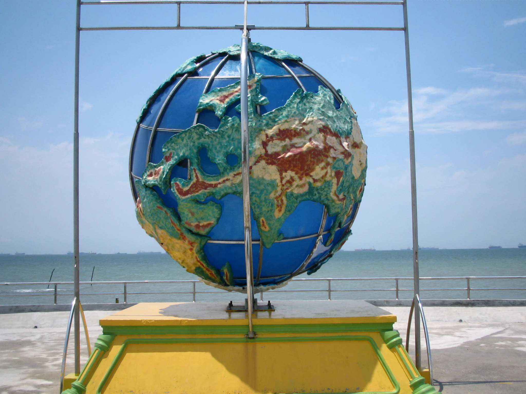
A globe monument on a yellow pedestal overlooking the sea under a blue sky.
The monument marking the southernmost point of mainland Eurasia at Tanjung Piai.

Tanjung Piai history and protected-area timeline

The site's formal protection story is relatively recent. Tanjung Piai was designated as a Ramsar Wetland of International Importance on 31 January 2003, under reference number 1289. It was also recognized as one of only five Ramsar sites in Malaysia and was listed as the third designated park under the Johor National Park Corporation, placing it within an established state-level system of protected natural areas.

In 2001, the Johor state government built a monument at the cape to formalize its status as the southernmost point of mainland Asia. The monument, constructed with environmentally friendly concrete, is approximately 20 meters tall and 10 meters wide. Its grey color was chosen to evoke the mangrove forests and muddy flats of the cape, and its surface carries carved fronds of the Paku Piai fern (Acrostichum aureum), a plant that grows abundantly alongside the mangroves here and that gave the cape its name.

Long before any monument, the mangrove forests, mudflats, and tidal channels of the cape supported local fishing communities. Over time, the site's combination of ecological value, symbolic geography, and proximity to Singapore has shaped its development into a managed ecotourism destination, while the Ramsar designation has placed international conservation obligations on maintaining the mangrove ecosystem and minimizing erosion.

Tanjung Piai landscape and geographic character

Tanjung Piai's landscape is a low-energy coastal scene rather than a dramatic one. There are no mountains, cliffs, or sweeping highlands; instead the cape is built from tidal mudflats, shallow channels, and mangrove stands that reach seaward from the Johor shoreline.

The terrain is flat and waterlogged, laced with sinuous tidal creeks that fill and empty with the tide. Wooden jetties and boardwalks rise above the mud, giving physical structure to an otherwise shifting surface. At the seaward edge, the cape tapers into a low promontory where a 15-meter light tower stands near the edge of the drying flats, flashing once every three seconds and equipped with a radar transponder beacon.

Looking north and east from the point, the view opens across the Johor Strait toward the urban skyline of Singapore. Looking inward, the land transitions to coastal villages and farmland protected by the mangrove fringe. The grey monument at the tip of the cape echoes the muted palette of mud, root, and sky that defines the surrounding scenery.
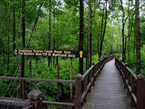
A wooden boardwalk path winds through a dense mangrove forest with a sign pointing toward the southernmost tip of mainland Asia.
A wooden boardwalk leads visitors through the lush mangrove forest toward the southernmost point of mainland Asia at Tanjung Piai.

Tanjung Piai ecosystems, habitats, and plant life

The dominant ecological character of Tanjung Piai is mangrove and tidal mudflat. Twenty-two species of mangrove tree have been recorded across the cape, forming layered stands of varying height and density along the creeks and shoreline. These trees drop their leaves and propagules into the tidal waters, fueling a fertility cycle that supports invertebrates, juvenile fish, and the birds that come to feed on them.

Tanjung Piai sits within a broader ecological mosaic. The southwest Johor coastline, stretching from the Sunda Trench to Tanjung Piai, is one of the most significant coastal mangrove and mudflat complexes in the region. The mangroves act as a natural barrier, reducing wave energy during storm events and helping to stabilize sediment along a coastline that would otherwise be vulnerable to erosion.

The tidal flats also make the cape ecologically productive far beyond its area. The combination of sheltered mangrove interior, exposed mudflat at low tide, and open water at high tide creates a layered habitat where different species can feed, roost, and shelter at different stages of the tidal cycle. This mosaic is what allows the site to support both resident wildlife and passing migratory species.
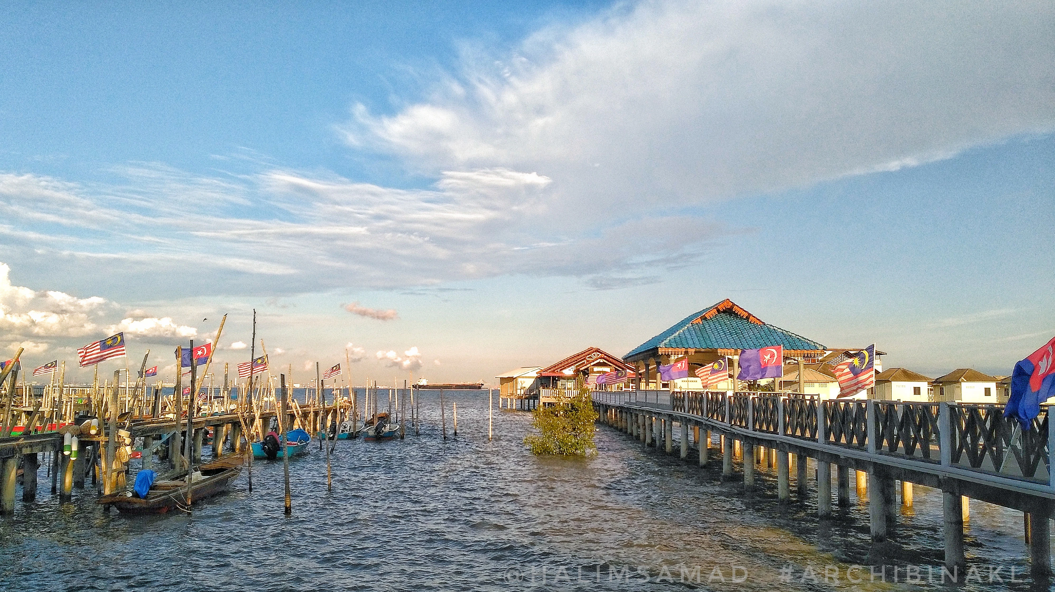
A wide view of a long wooden boardwalk leading to covered structures over the water in a mangrove coastal area with Malaysian flags displayed.
A wooden boardwalk and coastal structures at Tanjung Piai, the southernmost point of mainland Eurasia.

Tanjung Piai wildlife and species highlights

Wildlife at Tanjung Piai is shaped around the tidal cycle. The mudflats exposed at low tide attract wading birds, while the mangrove canopy shelters arboreal and nest-building species. The cape is a recognized stopover and feeding area for migratory shorebirds moving along the East Asian flyway, and it supports resident populations of herons, egrets, and other waterbirds.

Among the species associated with the site, the Lesser Adjutant Stork has been recorded here and is listed as Vulnerable by the IUCN, adding regional conservation weight to the cape's bird list. The broader bird importance of the area is reflected in the designation of the southwest Johor Important Bird Area, which extends along the coast and uses Tanjung Piai as its southern anchor.

Beneath the bird layer, the mangroves and mudflats host crustaceans, mollusks, and small fish that underpin local fisheries. These smaller species are not always visible to casual visitors, but they are ecologically central: they convert mangrove productivity into food for birds and into a harvest that supports coastal livelihoods.
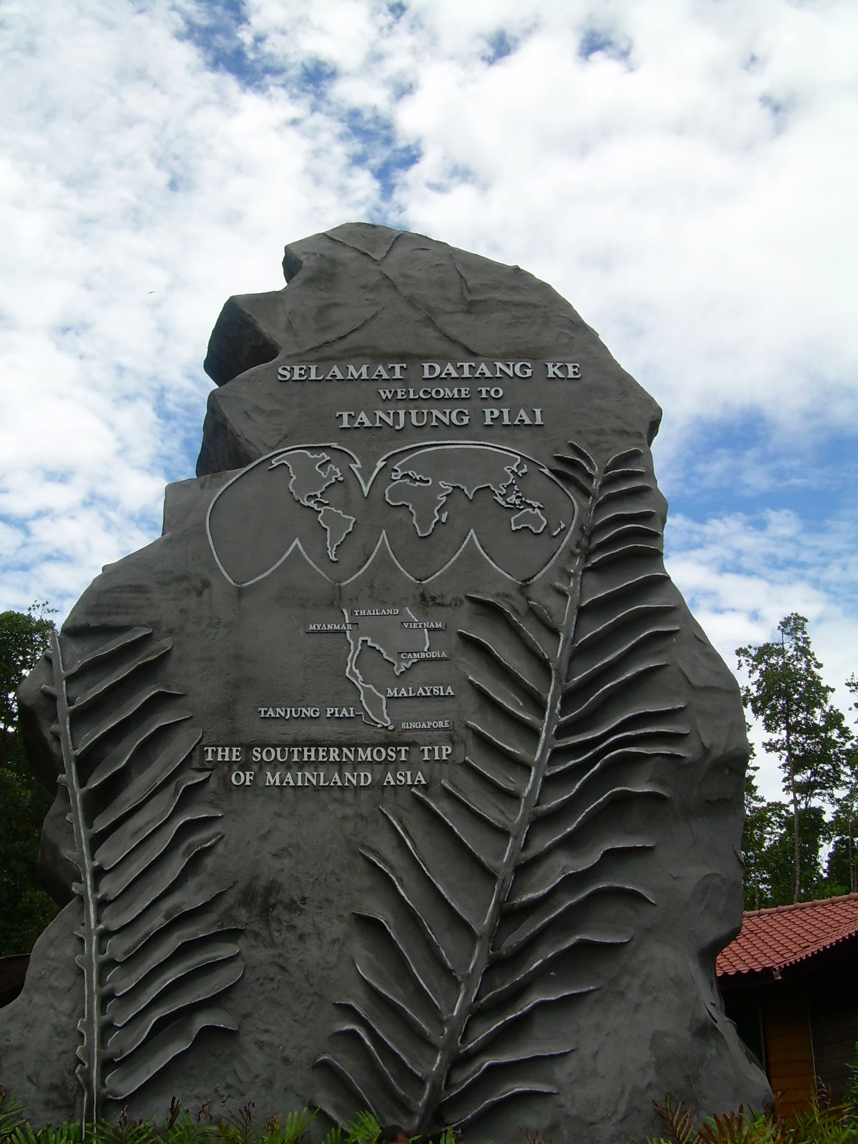
A large gray stone monument with a world map and text reading Welcome to Tanjung Piai, The Southernmost Tip of Mainland Asia.
The monument marking the southernmost point of mainland Asia at Tanjung Piai National Park.

Tanjung Piai conservation status and protection priorities

Conservation at Tanjung Piai operates on several overlapping layers. International recognition comes from its Ramsar Wetland designation, which obliges Malaysia to maintain the ecological character of the site, including its mangrove ecosystem and the services it provides. The cape's inclusion in the southwest Johor Important Bird Area adds a parallel recognition for its bird values.

At the state level, Tanjung Piai is managed as one of the parks under the Johor National Park Corporation, giving it an institutional framework for visitor management and habitat protection. The site is also explicitly listed as a priority destination for national ecotourism, framing its future as a balance between conservation, education, and low-impact visitor use.

A persistent challenge is erosion along the cape. The conservation response emphasizes both reducing the immediate erosional impact and addressing its root causes, recognizing that without stable substrates the mangrove fringe cannot continue to protect inland communities from storm events or to maintain the habitat that wildlife depends on.

Tanjung Piai cultural meaning and human context

Tanjung Piai carries cultural meaning through a mix of symbolic geography, local livelihood, and naming heritage. As the southernmost point of mainland Asia, it has acquired an outsized identity in Malaysian public consciousness; people travel to the cape to be photographed at the symbolic foot of the continent.

The name itself reflects the local environment. 'Tanjung' means a stretch of land or headland that projects into the sea, while 'Piai' refers to the Piai fern (Acrostichum aureum), which grows abundantly alongside the mangroves here. That naming heritage is preserved on the cape's monument, whose carved fronds celebrate the plant that both defines the shoreline ecology and gave the site its identity.

Local culture is also tied to fishing. The mangroves and mudflats sustain small-scale fisheries, and the seafood restaurants perched on jetties around the cape represent a long-standing marriage between fishing livelihoods and visitor activity. Rather than treating the cape as purely a wilderness reserve, the surrounding communities remain a living part of how the place is experienced.
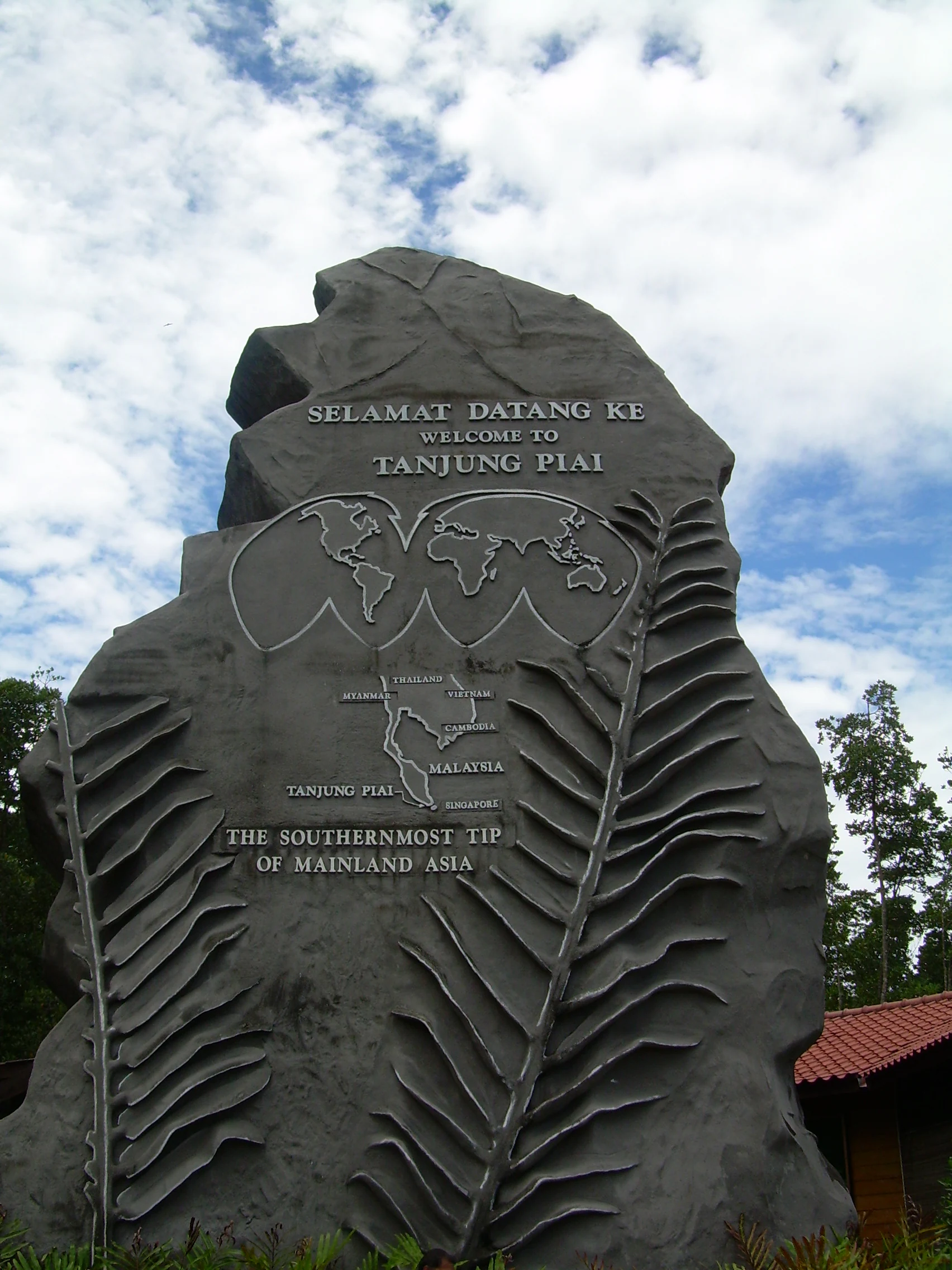
A large grey stone monument shaped like a stylized leaf with an embedded world map and text identifying it as the southernmost tip of mainland Asia in Tanjung Piai.
The monument marking the southernmost point of mainland Asia at Tanjung Piai.

Top sights and standout views in Tanjung Piai

Tanjung Piai's standout quality is the layering of meaning on a single small headland. A Ramsar-recognized mangrove ecosystem, a continental-scale geographic landmark, an Important Bird Area anchor, and a working seafood and ecotourism economy all coexist on the same stretch of Johor coast.

The site is especially distinctive for pulling together mangrove conservation, migratory and resident bird habitat, and coastal protection functions in one place. Few sites of comparable size combine international wetland status, a national park designation, and a strong symbolic identity. Against this backdrop, simple experiences such as walking a boardwalk through the mangroves, eating at a stilted seafood restaurant, or looking across the Johor Strait at the Singapore skyline acquire a layered meaning.
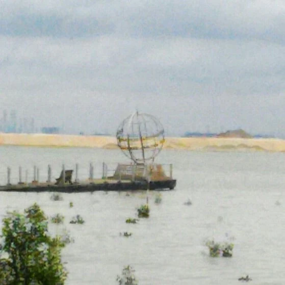
A metal globe sculpture sits at the end of a wooden boardwalk extending into a body of water, marking the southernmost point of mainland Asia in Tanjung Piai.
The globe monument at the southernmost point of mainland Eurasia in Tanjung Piai.

Best time to visit Tanjung Piai

Tanjung Piai's character shifts with the tidal and seasonal cycles rather than with dramatic weather variation. The mangrove forests, boardwalks, and monument are accessible throughout the year, but the birdlife and visibility of the mudflats vary with the tides and with migratory seasons.

Periods when migratory shorebirds are passing through, and times when low tide exposes the mudflats, give a more active wildlife experience, while higher tides push mangrove ecology closer to the eye level of the boardwalks. The Johor climate is broadly tropical, with relatively consistent warmth and humidity, so timing a visit is less about avoiding bad weather and more about choosing conditions that favor bird activity and tidal exposure.

Monthly climate preview

Long term temperature averages and precipitation statistics for Johor

Tanjung Piai Climate Normals and Measured Monthly Weather Patterns

Historical coordinate measurements indicate steady average monthly temperatures alongside consistent daily precipitation records throughout the year at Tanjung Piai. Detailed monthly climate profiles provide deeper context regarding temperature ranges and precipitation variations across the protected area.
Annual mean27 °C
26 °C28 °C
Jan26°
Feb26°
Mar27°
Apr28°
May28°
Jun28°
Jul27°
Aug27°
Sep27°
Oct27°
Nov27°
Dec26°
Warmest month
May

28 °C

Coolest month
January

25.9 °C

Wettest month
December

9.8 mm/day

Driest month
February

3.6 mm/day

Park location guide

Geography guide, regional context, and park location map for Tanjung Piai

Tanjung Piai park geography, regions, and map view in Malaysia

Understand where Tanjung Piai sits in Malaysia through a broader geographic reading of the surrounding landscape, nearby location context, and its mapped position within the national park landscape.

How Tanjung Piai fits into Malaysia

Malaysia is a federal constitutional monarchy located in Southeast Asia. The country consists of 13 states and three federal territories, divided by the South China Sea into Peninsular Malaysia on the Indochinese Peninsula and East Malaysia on the island of Borneo. With a population of over 34 million, it achieved independence from Britain in 1957 and became a modern federation in 1963. The country is recognized for its multicultural population, tropical climate, and significant economic role in the region.

Wider geography shaping Tanjung Piai in Malaysia

Malaysia occupies a strategic position in Southeast Asia, split by the South China Sea into two distinct regions. Peninsular Malaysia lies on the Indochinese Peninsula, sharing a land border with Thailand to the north and maritime borders with Singapore, Vietnam, and Indonesia. East Malaysia occupies the northern portion of Borneo, sharing land borders with Brunei and Indonesia, and maritime borders with the Philippines and Vietnam. The country's terrain includes coastal plains, mountain ranges such as the Titiwangsa in the peninsula, and extensive tropical rainforests.

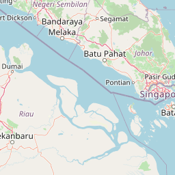
Map view of Tanjung Piai

Use this park location map to pinpoint Tanjung Piai in Malaysia, understand its exact geographic position, and read its mapped placement within the surrounding landscape more clearly.

Pigeon | © OpenStreetMap contributors

Location context for Tanjung Piai

Johor

Explore visual records of tidal mudflats, wetland habitats, and the southernmost point of mainland Asia.

Tanjung Piai Photos and Landscape Scenery: Visualizing the Mangrove Ecosystem and Coastal Terrain

Visual documentation captures the intricate network of mangrove forests, tidal creeks, and mudflats that define the protected coastal environment. Examining these habitat views reveals the distinct ecological character and flat terrain of the continental cape.

A globe monument on a yellow pedestal overlooking the sea under a blue sky.

A sign with text in Malay and English stating that you are standing at the southernmost tip of mainland Asia, mounted on a railing overlooking the sea.

A wooden boardwalk path winds through a dense mangrove forest with a sign pointing toward the southernmost tip of mainland Asia.

A wide view of a long wooden boardwalk leading to covered structures over the water in a mangrove coastal area with Malaysian flags displayed.

A large gray stone monument with a world map and text reading Welcome to Tanjung Piai, The Southernmost Tip of Mainland Asia.

A covered wooden boardwalk and jetty stretching out over the water, featuring gazebo-like structures with tiled roofs.

A large grey stone monument shaped like a stylized leaf with an embedded world map and text identifying it as the southernmost tip of mainland Asia in Tanjung Piai.

A metal globe sculpture sits at the end of a wooden boardwalk extending into a body of water, marking the southernmost point of mainland Asia in Tanjung Piai.

Park atlas

Continue regional comparison across coastal mangroves and protected habitats

Exploring Parks Near Tanjung Piai and Related Protected Landscapes in Johor

Browse protected areas near Tanjung Piai to compare coastal ecosystems and regional wetland geography. Extended park comparison reveals wider conservation patterns across the surrounding coastal terrain.
Nature reserveJohor
About 8.7 km away#1 closest

Northeast

Pulai River Nature Reserve: Johor Coastal Mangrove and Estuarine Geography

Protected Ramsar wetland and coastal landscape in southern Malaysia.

Spanning from the highlands of Mount Pulai to the Tebrau Straits, Pulai River Nature Reserve acts as a major ecological interface in Johor. This site encompasses dense mangrove forest reserves and the country's single largest seagrass bed, serving as a primary study area for regional coastal conservation and wetland management.

Established
2003
Relief
Lowland
Scope
Mixed
Water
Water-dominated
Watercolor illustration of a mangrove ecosystem with wooden structures over mudflats.
National parkJohor
About 11 km away#2 closest

Northwest

Kukup Island National Park: Mapping the Mangrove Forests and Tidal Geography of Johor

An uninhabited wetland sanctuary on the Strait of Malacca

Kukup Island National Park represents a significant protected area in Johor, Malaysia, known for its near-total cover of dense mangrove forest. This uninhabited island features five tidal river systems and an extensive system of surrounding intertidal mudflats. The park provides an essential geographic case study for coastal wetland ecosystems, supporting migratory waterbird populations and serving as a vital natural coastal barrier within the Strait of Malacca.

Area
4.88 km²
Established
1997
Relief
Lowland
Climate
Tropical
Marine protected areaJohor
About 121 km away#3 closest

Northeast

Sibu Island: Marine Protected Area and Coastal Landscape Analysis

Mapping the coral reefs and pyroclastic terrain of the Johor coast

Sibu Island is a protected marine area in the South China Sea, distinguished by its unique pyroclastic geology and surrounding coral reef ecosystems. This entry provides a structured look at the island's coastal geography, vegetation, and maritime boundaries off the coast of Mersing, Johor. Access detailed geographic context for this tropical landscape.

Area
4.05 km²
Established
1993
Relief
Lowland
Climate
Tropical
National parkJohor
About 124 km away#4 closest

North

Endau-Rompin National Park: Ancient Tropical Rainforest Protected Landscape in Johor, Malaysia

Explore unique mapped geography and ancient geological features.

Endau-Rompin National Park in Johor, Malaysia, is a testament to Earth's ancient history, housing tropical rainforests built upon geological formations around 248 million years old. This protected area offers a detailed look at rugged mountainous terrain, vital river systems, and a diverse mapped landscape, crucial for understanding regional geography and conservation. Its status as one of the oldest rainforest complexes makes it a significant site for exploring the planet's prehistoric natural heritage and protected land distribution.

Area
870 km²
Established
1993
IUCN
II
Relief
Mountain
Protected areaJohor
About 133 km away#5 closest

Northeast

Tinggi Island Protected Area: Geography, Rainforest Terrain, and Johor Coastal Map

Mountainous forest meets extensive coral-rich coastal waters.

Located southeast of Mersing, Tinggi Island is defined by its dramatic silhouette and dense rainforest interior. The protected landscape stretches from the elevated peak of Mount Semundu down to a shoreline of white sand and coastal caves, creating a distinct marine and terrestrial environment unique to the Johor region.

Water
Major water bodies
Season
Year-round
A minimalist watercolor illustration depicting a tropical island coastline with sand beaches, green trees, and rolling hills in the background.
Marine protected areaJohor
About 140 km away#6 closest

North

Besar Island Marine Protected Area: Coastal Geography and Protected Waters in Johor

Mapping the island's reef ecosystems and tropical landscape

Besar Island offers a distinct look at a small-scale marine protected area off the Johor coast. Its geography encompasses a transition from sandy beach fronts to a hilly, jungle-clad interior, all contained within a gazetted two-nautical-mile conservation zone. The surrounding waters support approximately 60 marine species, making this an essential case study for understanding protected marine habitats within the Babi Islands archipelago.

Area
4.77 km²
Relief
Upland
Climate
Tropical
Access
Easy access
A watercolor painting showing layers of soft green and pink rolling hills, with a line of trees in the midground and an open, flat foreground.
Protected areaJohor
About 148 km away#7 closest

North

Rawa Island Protected Area: Coastal Geography and Island Landscape Context in Johor

A protected coral island within the Johor archipelago

Rawa Island serves as a significant protected landscape off the coast of Johor, Malaysia. Defined by its sharp contrast between rocky cliffs and clear, coral-filled waters, the island represents a crucial node in regional island geography. Delve into the spatial characteristics and environmental features of this South China Sea destination through our map-driven atlas framework.

Area
0.23 km²
Water
Water-dominated
Protected areaJohor
About 171 km away#8 closest

Northeast

Pemanggil Island Protected Landscape: Johor Offshore Geography and Island Topography

Mapping coastal features and inland terrain in the South China Sea.

Pemanggil Island serves as a significant geographic landmark within the Mersing cluster of Johor. This detailed atlas entry focuses on the island's structural composition, including its prominent central hill, the rocky interior, and coastal features such as Teluk Lancang. Understand the maritime geography and spatial character of this protected area within the context of the southern Malay Peninsula.

Area
8.82 km²
Relief
Upland
Climate
Tropical
Access
Moderate access

Common questions about visiting, size, designation, and location context for Tanjung Piai

Tanjung Piai FAQs for park facts, access, geography, and protected area context

Find quick answers about Tanjung Piai, including protected-area facts, park geography, trail and visitor context, and how the park fits into its surrounding country and regional landscape.
MoriAtlas Explorer

Continue Your Protected Areas Search Across the Global Atlas

Deepen your exploration by continuing the structured search for national parks and protected areas worldwide. Utilize the comprehensive filtering capabilities to compare different conservation landscapes and refine your understanding of global park geography. Discover more about the distribution and characteristics of protected natural areas.

Global natural geography