
Mori Atlas logo
National parkTatrzański Park Narodowy

Examining vertical zonation, glacial features, and transboundary alpine geography in Lesser Poland Voivodeship

Tatrzański Park Narodowy: Analyzing the High Mountain Protected Landscapes of the Polish Tatra Range

Tatrzański Park Narodowy represents the only true alpine-style mountain range in Poland, spanning 211 square kilometers of granite peaks and deep glacial valleys. This protected landscape exhibits dramatic vertical zonation, rising from dense montane beech and spruce forests to subalpine dwarf pine and rugged alpine summits reaching nearly 2,500 meters. The park preserves a vital transboundary mountain ecosystem that supports diverse endemic plant life and iconic species found nowhere else in the country.

alpine mountainsTatrasglacial lakesmountain valleyssubalpine meadowsdwarf pine zone
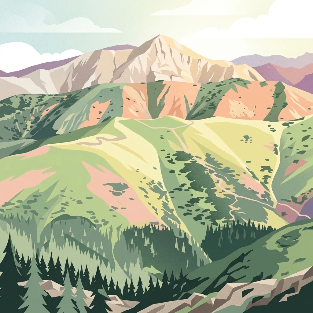
A digital illustration of a mountainous landscape with a forest in the foreground, grassy meadows on the slopes, and rocky peaks in the background under a light sky.

Tatrzański Park Narodowy

National park

Park overview

Structured park overview, official facts, and landscape profile for Tatra National Park

Tatra National Park park facts, protected area profile, and essential visitor context

Review the core facts for Tatra National Park, including designation, size, terrain, visitor scale, habitats, and operating context in one park-focused overview.

About Tatra National Park

Tatra National Park encompasses the entire Polish portion of the Tatra Mountains, the highest range in the Carpathians and the only mountains in Poland with a true alpine character. Stretching along the southern border with Slovakia, the park encompasses the High Tatras and the Western Tatras, where jagged granite peaks, deep glacial valleys, and crystal-clear mountain lakes form a compact and dramatically varied landscape.

The park protects one of the richest high-mountain ecosystems in Central Europe. Its vertical relief of roughly 1,730 meters creates strong climatic and vegetation zonation, supporting beech and spruce forests at lower elevations, dwarf mugo pine above the tree line, alpine meadows at higher levels, and sparse plant life on the rocky summits. Many species found here, including the Tatra chamois and Tatra marmot, exist in the Tatra as distinct subspecies, while roughly 200 vascular plant species have their only Polish occurrence within these mountains.

Beyond its ecological role, the park is a deeply rooted part of Polish cultural and mountaineering identity. Its valleys, peaks, and refuges such as the historic shelters near Morskie Oko and in the Valley of the Five Polish Ponds have shaped Polish highland traditions, climbing history, and public engagement with nature. Through its combination of scientific, conservation, recreational, and cultural significance, Tatra National Park stands as one of the most important protected natural areas in Poland.

Quick facts and research context for Tatra National Park

Tatra National Park lies in the Lesser Poland (Małopolskie) voivodeship in southern Poland, with its administrative seat in Zakopane. Created on 1 January 1955 by decree of the Council of Ministers, it protects around 211 square kilometers of the Polish Tatra Mountains plus a small buffer zone.

The Polish Tatra is divided into the High Tatras and the Western Tatras, with a relief of nearly 1,730 meters between the highest point, Rysy at 2,499 meters, and the lowest valley. The park uses a tiered protection system that includes strict, active, and landscape protection zones, with strict protection covering the majority of the area. Together with the Slovak Tatra National Park it forms a UNESCO Biosphere Reserve.

Protection and recognition

Documented terrestrial protection scope and conservation history

Tatrzański Park Narodowy Protection Status and Recognition Data

Tatrzański Park Narodowy maintains a documented terrestrial protection scope within the regional conservation network. Official records compile available management frameworks and designation data for structured analysis.

Protection details

Protection scope
Terrestrial
Transboundary protection
No
Buffer area
1.81 km²
Park context

Deeper park guide and search-rich context for Tatra National Park

Tatra National Park history, landscape, wildlife, and travel context

Explore Tatra National Park through its history, landscape character, ecosystems, wildlife, conservation priorities, cultural context, and seasonal travel timing in a structured park guide built for atlas discovery and search intent.

Why Tatra National Park stands out

The park is best known for being home to Poland's only alpine mountains and for the wildlife and plants that occur nowhere else in the country. The Tatra chamois and Tatra marmot are flagship species that symbolize the park's high-mountain character, while glacial lakes such as Morskie Oko and the Valley of the Five Polish Ponds are defining landscape features. Its layered vegetation, ranging from beech and spruce forest through mugo pine scrub to alpine meadows, supports a large number of Western Carpathian and Tatra endemics. Around 200 vascular plant species have their only Polish occurrence in the Tatra, underscoring the park's exceptional botanical importance.
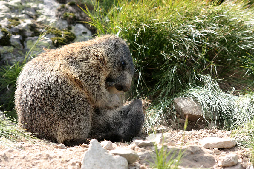
Two young, furry brown marmots sitting closely together on a rocky, grassy slope.
Two Tatra marmots interacting in their natural alpine habitat.

Tatra National Park history and protected-area timeline

The idea of protecting the Tatra developed gradually as awareness grew of the damage caused by industry, grazing, and unregulated forestry. In 1868 the Galician Sejm passed one of Europe's earliest modern wildlife laws, prohibiting the capture and sale of marmots and chamois, and appointed former poachers, including Jędrzej Wala and Maciej Sieczka, as the new guardians of the mountains.

The Tatra Society, founded in 1873, extended protection to alpine plants such as edelweiss and to individual trees like yew and Swiss stone pine. In the early twentieth century, the Society for the Protection of the Polish Tatras and private foundations such as the Kórnicka Foundation began buying land, and by the 1930s the state had acquired substantial areas. In 1939 a special State Forests entity called the Nature Park in the Tatras was created, laying the groundwork for a full national park.

After the Second World War, former private holdings were nationalized and an initial protected area called the Tatra National Reserve was created in 1947. The current Tatra National Park was established by the 1954 decree of the Council of Ministers and formally opened on 1 January 1955. Six years later than its Slovak counterpart, the park at last brought the highest Polish mountains under unified national protection. Following creation, the state undertook compulsory buyouts of remaining private grazing lands, ending centuries of unregulated sheep pasturing in the high meadows and beginning the long restoration of the alpine landscape.

Tatra National Park landscape and geographic character

The Tatra Mountains are part of the Alpine orogeny, built around a core of crystalline rocks dominated by granite, with limestone and dolomite formations adding distinctive karst features such as caves and dolomitic crags in parts of the range. Glaciation has shaped the highest valleys, leaving behind cirques, moraines, and clear post-glacial lakes (locally called "stawy") such as those in the Valley of the Five Polish Ponds and around Morskie Oko.

Relief in the park is dramatic, with the highest summit, Rysy, reaching almost 2,500 meters, while the lowest valleys near the Poroniec river descend to roughly 770 meters. This 1,700-meter range of elevation produces sharp transitions between forested foothills, rocky mid-mountain slopes, stark high-mountain ridges, and gentler alpine meadows.

The Polish Tatry are divided into the High Tatras and the Western Tatras, each with a distinct geomorphological personality. The High Tatras include the park's most iconic spires, glacial lakes, and shelters, while the Western Tatras display broader ridges, rolling subalpine meadows, and extensive dwarf pine stands that are slowly regenerating after the cessation of large-scale grazing.
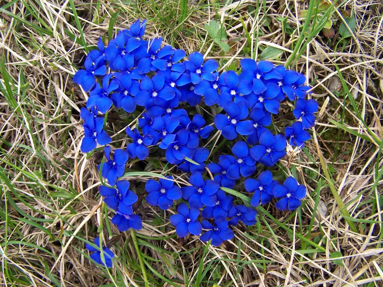
A cluster of small, star-shaped, bright blue spring gentian flowers growing in dry, sparse mountain grass.
A cluster of vibrant blue spring gentian flowers in Tatra National Park.

Tatra National Park ecosystems, habitats, and plant life

The climate and natural systems of the park are defined by clear elevational layers, giving the Tatra one of the most pronounced vegetation zonations in Poland. The lowest forest belt, the lower montane zone, originally supported mixed beech, fir, and spruce forests, while today's lower forests are often secondary spruce stands resulting from past forestry.

Above lies the upper montane belt, dominated by spruce forest with rare relict stands of Swiss stone pine. Between roughly 1,550 and 1,800 meters, dense thickets of mugo pine (krummholz) form a transition zone, giving way higher up to alpine meadows rich in gentians, glacier pink (Dianthus glacialis), alpine pasqueflower (Pulsatilla alpina), and other colorful specialists. In the highest alpine and nival zones, only the hardiest rock-dwelling plants survive, including the transparent gentian and the glacier buttercup.

The park's flora includes plant endemics exclusive to the Tatra, such as the Tatar whitlowgrass and Tatra meadow-grass, while glacial relicts such as eight-petaled dryas and net-leaved willow mark the legacy of the Ice Age. The combination of bedrock variety, elevation range, and climatic layering produces the unusually high botanical richness that defines the park's ecological identity.
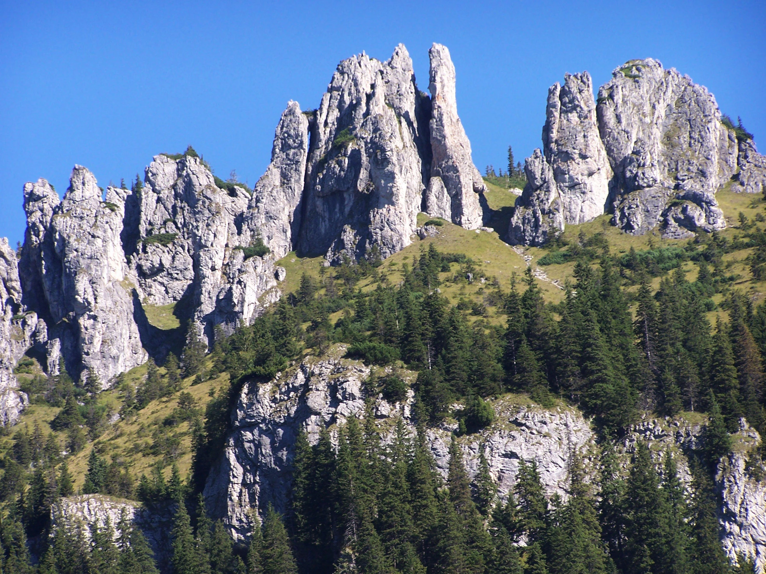
Jagged light-colored limestone rock spires rising above a dense green conifer forest against a clear blue sky.
The Mnichy Chochołowskie rock formations rising above the forest in Tatra National Park.

Tatra National Park wildlife and species highlights

The Tatra chamois (Rupicapra rupicapra tatrica) and the Tatra marmot (Marmota marmota latirostris) are the park's most iconic mammals, each having evolved in the Tatra as a distinct subspecies. After historic declines due to poaching and traditional uses, both species have recovered under protection, and the park remains their only Polish home.

Larger mammals also inhabit the lower slopes, including red deer, roe deer, brown bear, Eurasian lynx, and weasel, while game management remains a delicate balance between wildlife conservation and historical land-use pressures. Endemic invertebrates add a less visible but ecologically important layer of biodiversity, with species such as the caddisfly Allogamus starmachi found nowhere else.

Birdlife is unusually rich for a small national park, with around 192 recorded species and approximately 107 breeding species in the Polish Tatry. The golden eagle, hunted out in the nineteenth century, returned to breed from 1976 onward, and the park now supports a small but stable breeding population. Peregrine falcon, black stork, hazel grouse, and the wallcreeper, with its striking red wings, all breed within the park, alongside owls such as the Ural owl, Tengmalm's owl, and pygmy owl, illustrating the diversity of habitats from lowland forests to high crags.
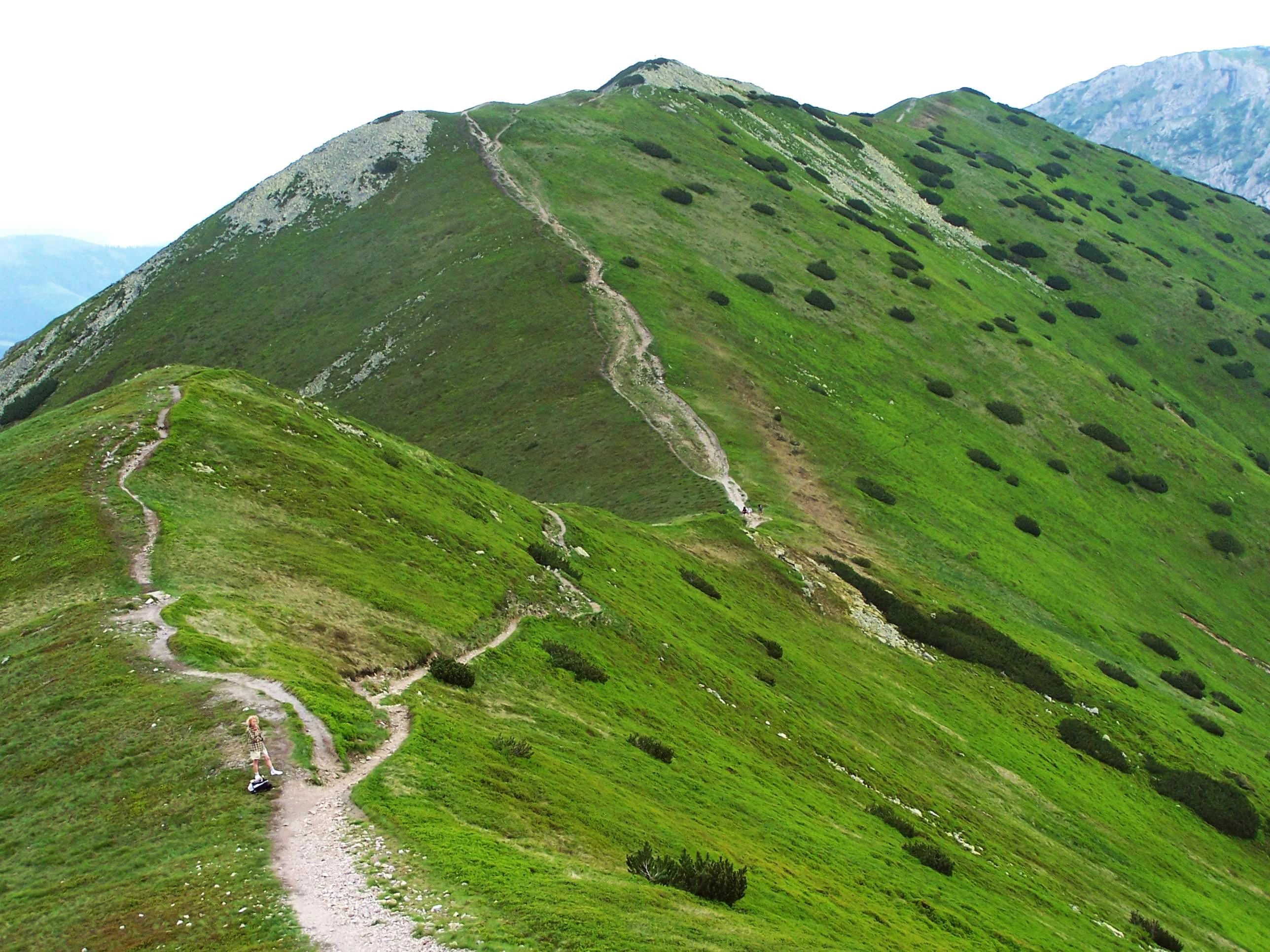
A dirt hiking trail winding up a steep, grassy green mountain ridge with scattered dwarf pine shrubs, leading to a prominent peak in the background.
A hiking trail following the ridgeline toward the summit of Ornak in the West Tatra Mountains.

Tatra National Park conservation status and protection priorities

Tatra National Park was created to halt and reverse long-running human pressure that had sharply degraded the mountains, including iron smelting and papermaking, large-scale deforestation, sheep grazing, and poaching. Strict protection covers the majority of its area, with the remainder under active or landscape protection, allowing carefully controlled traditional activities such as seasonal grazing and hay cutting that are themselves part of the Tatra's ecological history.

Together with the adjoining Slovak Tatra National Park (TANAP), the park forms a contiguous transboundary protected area covering roughly 100,000 hectares of high-mountain habitat. This connectivity is crucial for wildlife movement and genetic exchange, and was recognized in 1993 when the combined Tatra parks were inscribed as a UNESCO Biosphere Reserve.

The park also faces significant contemporary challenges, including the impacts of mass tourism on fragile valley ecosystems, infrastructure such as cableways and ski lifts, long-range air pollution from the Upper Silesia-Kraków industrial region and across borders, climate-related stresses, and ongoing debates over the management of trails, refuges, and visitor numbers. These pressures shape an active conservation program that balances protection of threatened habitats and species with the cultural significance of traditional highland land use.

Tatra National Park cultural meaning and human context

The Polish Tatry are deeply embedded in national identity, associated with highland (Górale) culture, folk traditions, and centuries of pastoral life. Sheep grazing, cheesemaking, hay cutting, and local handicrafts have shaped not only the mountain landscape but also the distinctive culture of villages such as Zakopane and the surrounding Podhale region.

Remnants of earlier industrial use, including iron smelters that consumed much of the lower beech forest and paper mills that fed on local timber, can still be traced in place names and surviving infrastructure. The Tatra also hold a special place in the history of Polish mountaineering and exploration, with pioneers of Polish speleology and alpinism contributing both to scientific knowledge of the range and to its growing popularity as a recreational destination. Mountain refuges, marked trails, and historic shelters are now integral to the cultural fabric of the park, while ongoing debates over tourism, skiing, and grazing reflect the continuing tension between tradition, livelihood, and modern conservation.
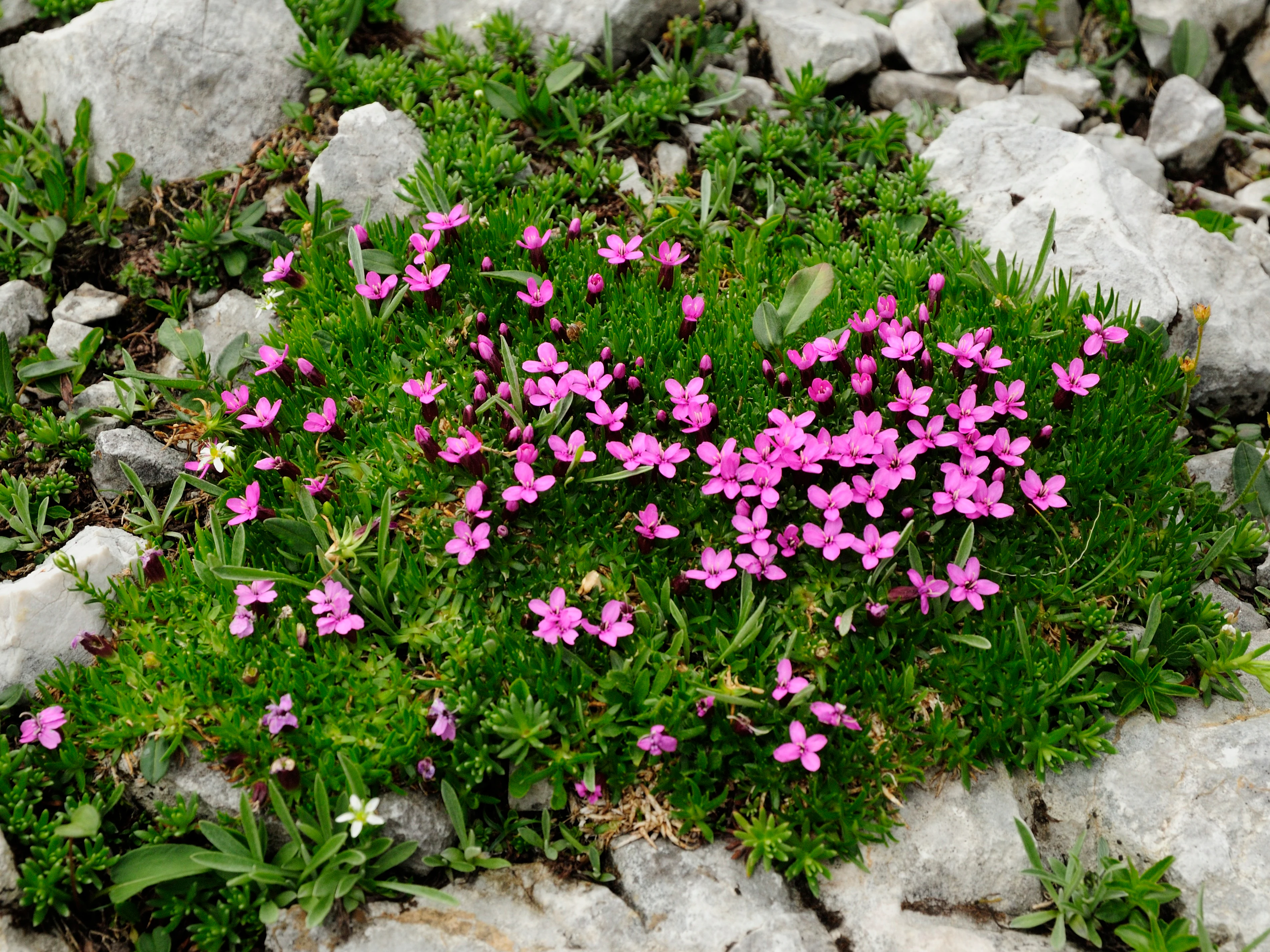
A low-growing green cushion plant called moss campion covered in many small, bright pink, star-shaped flowers, surrounded by pale gray rocks.
A cluster of moss campion, Silene acaulis, blooming among rocks in the Tatra Mountains.

Top sights and standout views in Tatra National Park

Tatra National Park contains Poland's only true alpine landscape, with deep glacial valleys, towering granite peaks, and exceptionally clear mountain lakes. The park's identity is shaped by its vertical zonation, from beech and spruce forest through mugo pine to alpine meadows and bare crags, a layering that supports a remarkable number of plants and animals found nowhere else in Poland.

The Tatra chamois and Tatra marmot are emblematic of the park's high-mountain character, while species such as the golden eagle, peregrine falcon, and wallcreeper add to its wildlife prestige. The transboundary partnership with the Slovak national park, recognized through the 1993 UNESCO Biosphere Reserve designation, makes the Polish Tatry a cornerstone of Central European mountain conservation.
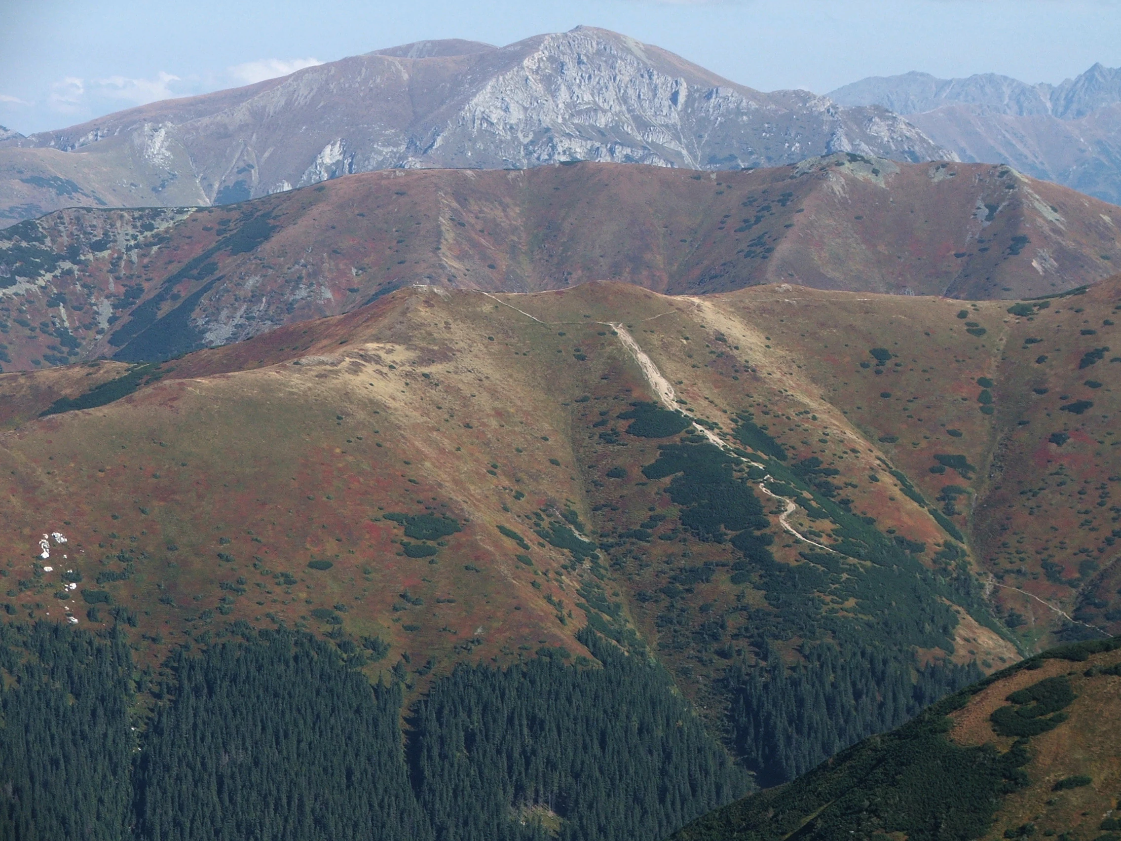
A wide, eye-level mountain landscape view featuring layered ridges, peaks, and alpine slopes covered in brownish-red autumn vegetation and dark green pine forests.
A wide view of the Western Tatra Mountains in autumn.

Best time to visit Tatra National Park

The Tatra experience changes markedly across the seasons. Late spring and early summer bring flowering alpine meadows, with crocuses on the lower meadows and later gentians, glacier pink, and edelweiss appearing in higher zones, while snow can still linger on many trails. Mid- and late-summer conditions are generally most favorable for high-mountain hikes, with longer daylight hours and most valley and ridge trails free of snow, though midsummer also brings the park's heaviest visitor pressure, particularly around Morskie Oko and the High Tatra valleys.

Winter transforms the park into a quieter landscape of snow-covered ridges and frozen lakes, with skiing concentrated around Kasprowy Wierch and a handful of chair and T-bar lifts. Access to higher trails becomes restricted by avalanche risk and weather, and the snow cover is initially thin and ecologically sensitive. Shoulder seasons in late spring and autumn can offer quieter, more atmospheric visits, though they are also marked by changing weather and short daylight.

Monthly climate preview

Long-term monthly temperature averages and precipitation measurements for Tatrzański Park Narodowy

Tatrzański Park Narodowy Climate Normals and Annual Weather Rhythm

Representative point records for Tatrzański Park Narodowy capture long-term monthly temperature swings and precipitation rates across the coordinate. Accessing the complete twelve-month profile provides deeper analytical depth for examining annual climate patterns in Lesser Poland Voivodeship.
Annual mean6 °C
-5 °C17 °C
Jan-5°
Feb-4°
Mar
Apr
May11°
Jun15°
Jul17°
Aug17°
Sep12°
Oct
Nov
Dec-4°
Warmest month
July

16.7 °C

Coolest month
January

-4.9 °C

Wettest month
July

4.4 mm/day

Driest month
December

1.7 mm/day

Park location guide

Geography guide, regional context, and park location map for Tatra National Park

Tatra National Park park geography, regions, and map view in Poland

Understand where Tatra National Park sits in Poland through a broader geographic reading of the surrounding landscape, nearby location context, and its mapped position within the national park landscape.

How Tatra National Park fits into Poland

Poland, officially the Republic of Poland, is a Central European country spanning from the Baltic Sea in the north to the Carpathian Mountains in the south. It borders Germany, Czech Republic, Slovakia, Ukraine, Belarus, Lithuania, and Kaliningrad Oblast. The country has a temperate climate, diverse landscapes, and is known for its rich history, cultural heritage, and strong economic position within the EU.

Wider geography shaping Tatra National Park in Poland

Poland occupies 312,696 km2 in Central Europe, extending from the Baltic Sea coast in the north to the Sudetes and Carpathian Mountains in the south. It borders Germany to the west, Czech Republic and Slovakia to the south, Ukraine and Belarus to the east, and Lithuania and Kaliningrad Oblast to the northeast. The landscape includes lowland plains, uplands, and mountain ranges.

Map view of Tatra National Park

Use this park location map to pinpoint Tatra National Park in Poland, understand its exact geographic position, and read its mapped placement within the surrounding landscape more clearly.

Pigeon | © OpenStreetMap contributors

Location context for Tatra National Park

Lesser Poland Voivodeship
Natural feature types

Browse the Full Geography of Tatrzański Park Narodowy Natural Features

Continue your study of the Tatra mountain terrain by browsing this structured dataset of natural landforms, glacial basins, and summits. MoriAtlas provides a clear geographic view of the features that define the ecology and geology of this significant protected landscape.
Recorded earthquake history

Review Recorded Seismic Events Near Tatrzański Park Narodowy

Examine the historical catalogue of earthquakes mapped near the high peaks of Tatrzański Park Narodowy. This collection offers clear access to event dates, recorded magnitudes, and proximity data to assist in understanding the seismic context of this significant mountain region.

Tatrzański Park Narodowy Earthquake History

Catalogued events

9 events

Strongest magnitude

Magnitude 4.8

Most recent event

Jun 25, 2006

This history includes earthquakes recorded inside the park or within 50 km of its borders

Visual exploration of high-mountain terrain and protected habitats

Tatrzański Park Narodowy Photos and Landscape Scenery

Visual documentation captures rugged peaks, deep glacial valleys, and the distinct vertical zonation defining Tatrzański Park Narodowy. National park photography reveals alpine ecosystems, granite spires, and protected forest habitats across the mountain terrain.

Two young, furry brown marmots sitting closely together on a rocky, grassy slope.

A wide, sunny landscape shot showing a foreground meadow filled with blooming purple crocuses and patches of melting snow. In the background, forested slopes rise toward snow-covered mountain peaks. A small wooden structure stands in the middle ground.

A cluster of small, star-shaped, bright blue spring gentian flowers growing in dry, sparse mountain grass.

Jagged light-colored limestone rock spires rising above a dense green conifer forest against a clear blue sky.

A dirt hiking trail winding up a steep, grassy green mountain ridge with scattered dwarf pine shrubs, leading to a prominent peak in the background.

An elevated, high-angle view looking down at a mountain pass in the Tatra Mountains, featuring multiple worn gravel hiking trails cutting through green and brown alpine slopes.

A low-growing green cushion plant called moss campion covered in many small, bright pink, star-shaped flowers, surrounded by pale gray rocks.

A wide, eye-level mountain landscape view featuring layered ridges, peaks, and alpine slopes covered in brownish-red autumn vegetation and dark green pine forests.

An Alpine Accentor, a small bird with gray head, chestnut brown sides, and a white, speckled throat, standing on a large gray rock with yellow lichen.

Park atlas

Compare connected mountain landscapes and regional protected areas

Other Parks and Protected Areas Near Tatrzański Park Narodowy

Explore related national parks and protected landscapes situated near Tatrzański Park Narodowy across the surrounding border region. Comparing adjacent mountain terrain provides broader geographic context for alpine conservation units and regional ecosystems.
Watercolor painting of mountain ranges, forests, and a winding river
National parkLesser Poland Voivodeship
Park boundaries overlap#1 closest

East

Tatra National Park: An Atlas Discovery of Poland's Alpine High-Mountain Protected Landscape

Glacial valleys, granite peaks, and mountain biodiversity in Lesser Poland.

Tatra National Park stands as a vital sanctuary for Poland's alpine mountain ecosystems. The protected area features a striking landscape of high-altitude rock formations, glacial cirques holding deep blue lakes, and extensive subterranean cave systems. By studying the park boundaries and vertical zonation, users gain insight into the ecological diversity of the Carpathian arc and the physical geography of the Lesser Poland region.

Area
211.64 km²
Established
1954
IUCN
II
Visitors
3.9M annual
Watercolor painting showing a lake surrounded by trees and mountains in the background
National parkSlovakia
Park boundaries overlap#2 closest

South

Tatra National Park: Mapping the Alpine Peaks and Glacial Landscapes of Slovakia

Protected Mountain Terrain in the Carpathian Range

Examine the geographic framework of Tatra National Park, a significant protected area in Slovakia defined by dramatic glacial valleys, over three hundred caves, and high-altitude mountain ecosystems. This authoritative entry provides a detailed look at the park's alpine boundaries, hydrological networks, and role as a transboundary biosphere reserve in the Carpathian Mountains.

Area
738 km²
Established
1949
IUCN
II
Relief
Mountain
Nature reserveLesser Poland Voivodeship
12 km away#3 closest

Northwest

Torfowiska Orawsko-Nowotarskie Nature Reserve: Mapped Geography and Protected Bog Landscapes

A vital peatland complex within the Polish Carpathian foothills.

Torfowiska Orawsko-Nowotarskie stands as one of the most comprehensive peatland conservation sites in the Polish Carpathians. Its landscape is defined by dome-shaped raised bogs, marshy pools, and boggy woodlands that occupy the broad intermontane basin of the Kotlina Orawsko-Nowotarska, offering a unique look at post-glacial wetland ecology.

Area
82.667 km²
Established
2007
Relief
Upland
Climate
Temperate
Watercolor painting showing rolling green hills, forests, and distant mountains under a pale sky
National parkLesser Poland Voivodeship
16 km away#4 closest

North

Gorce National Park: A Comprehensive Geographic Profile and Protected Area Analysis

Mountain meadows and Carpathian forest landscapes in southern Poland

Gorce National Park preserves an essential segment of the Western Beskids, offering a look into the region's arched ridges and forested terrain. The area serves as a critical protected landscape featuring significant biodiversity, ancient woodland, and open mountain meadows that distinguish the local geography of the Lesser Poland Voivodeship.

Area
70.3 km²
Established
1981
IUCN
II
Visitors
80K annual
A horizontal watercolor illustration depicting rolling, layered mountains in shades of purple, red, and soft green, with a foreground of green evergreen forest silhouettes against a white background.
National parkLesser Poland Voivodeship
16 km away#5 closest

Northeast

Gorczański Park Narodowy: Protected Mountain Geography in Lesser Poland Voivodeship

Carpathian forest and mountain clearing atlas

Gorczański Park Narodowy serves as a critical protected landscape in the Polish Carpathians. This atlas entry details the park's topography, including the dominant Turbacz massif, extensive forest corridors, and the ecological significance of its seepage meadows and high-altitude grasslands.

Area
70.3 km²
Established
1981
Visitors
92K annual
Relief
Mountain
A horizontal watercolor painting showing stylized Pieniny mountain ridges, coniferous forests, and a prominent limestone rock formation against a soft pastel landscape.
National parkLesser Poland Voivodeship
16 km away#6 closest

Northeast

Pieniński Park Narodowy: Mapping the Limestone Mountains of Lesser Poland Voivodeship

A historic protected area featuring the iconic Dunajec River gorge

Discover the unique geography of Pieniński Park Narodowy, an essential protected area in the Polish Carpathians. The terrain spans limestone cliffs, deep river gorges, and mountain ridges, offering deep insights into the region's karstic landscape and natural history.

Area
23.46 km²
Established
1932
Visitors
815K annual
Relief
Mountain
Watercolor illustration of a mountainous landscape with green forests and a river
National parkLesser Poland Voivodeship
16 km away#7 closest

Northeast

Pieniny National Park: Geographic and Protected Area Map Analysis of Lesser Poland

Limestone karst landscapes and Carpathian mountain terrain

Examine the topography of Pieniny National Park, from the towering Trzy Korony peaks to the narrow channels of the Dunajec River gorge. This detailed overview covers the protected limestone ridges and species-rich meadows that define one of the most prominent natural landscapes in the Lesser Poland region.

Area
23.46 km²
Established
1932
IUCN
II
Visitors
815K annual
Nature reserveLesser Poland Voivodeship
17 km away#8 closest

Northeast

Ostoja Gorczańska: Protected Area Mapping and Carpathian Mountain Geography in Lesser Poland

Ecological corridors across the Gorce and Beskid Wyspowy ranges

Covering nearly 18,000 hectares, Ostoja Gorczańska represents a significant biodiversity reservoir in the Polish Carpathians. The site integrates multiple protection frameworks, safeguarding varied habitats from subalpine grasslands to dense montane forests and peatland depressions. Use this resource to examine the structural connectivity of these mountain units and the expansive wilderness corridors found within the Lesser Poland Voivodeship.

Area
179.979 km²
Established
2008
Relief
Mountain
Climate
Temperate

Common questions about visiting, size, designation, and location context for Tatra National Park

Tatra National Park FAQs for park facts, access, geography, and protected area context

Find quick answers about Tatra National Park, including protected-area facts, park geography, trail and visitor context, and how the park fits into its surrounding country and regional landscape.
MoriAtlas Explorer

Continue Your Protected Areas Search Across the Global Atlas

Deepen your exploration by continuing the structured search for national parks and protected areas worldwide. Utilize the comprehensive filtering capabilities to compare different conservation landscapes and refine your understanding of global park geography. Discover more about the distribution and characteristics of protected natural areas.

Global natural geography