
Mori Atlas logo
Nature reserveTeichlandschaft Buchwäldchen-Muckwar

Trace the historic interconnected water systems and restorative woodland habitats of this German nature reserve.

Teichlandschaft Buchwäldchen-Muckwar Protected Area: Mapping the Lusatian Pond Landscape in Brandenburg

Teichlandschaft Buchwäldchen-Muckwar is a significant nature reserve in Brandenburg, Germany, defined by a mosaic of nine historic fishponds and varying forest types. The landscape features a complex hydrological network of ditches draining toward the Vetschauer Mühlenfließ, linking alder swamp forests with oak-hornbeam stands. This protected area offers insight into active forest conversion and ecological recovery, where native broadleaf species are replacing historical pine and non-native conifer stands to restore natural habitats.

fishpondspond landscapemixed forestalder swampoak-hornbeam forestwet meadows
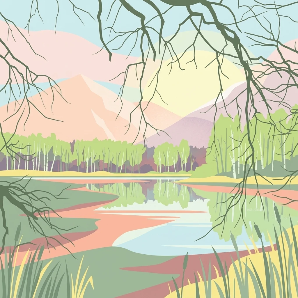
An illustration depicting a calm pond with reflective water, surrounded by light green birch trees and distant muted-colored mountains, framed by overhanging dark tree branches.

Teichlandschaft Buchwäldchen-Muckwar

Nature reserve

Park overview

Structured park overview, official facts, and landscape profile for Teichlandschaft Buchwäldchen-Muckwar

Teichlandschaft Buchwäldchen-Muckwar park facts, protected area profile, and essential visitor context

Review the core facts for Teichlandschaft Buchwäldchen-Muckwar, including designation, size, terrain, visitor scale, habitats, and operating context in one park-focused overview.

About Teichlandschaft Buchwäldchen-Muckwar

Teichlandschaft Buchwäldchen-Muckwar is a compact but ecologically rich protected area in the Lower Lusatia region of Brandenburg. Although modest in size, it packs a remarkable variety of habitats into a single compact landscape, ranging from open water and marshy ground through wet meadows and forest stands of very different character. This diversity, combined with the site's long history of human use, gives the reserve a particular ecological and cultural identity that distinguishes it from the larger, more uniform woodlands of the surrounding region.

Geographically, the reserve sits in the northeastern part of the municipal area of Luckaitztal, with most of the protected area falling within the village of Muckwar and a smaller northeastern extension into the locality of Buchwäldchen. Both place names are reflected in the official title of the site. To the west of the reserve runs the Lübbenau-Kamenz railway line, whose Luckaitztal halt lies nearby. Within the boundaries of the nature reserve once stood the now-deserted village of Berlinchen, a reminder that the landscape has been shaped by centuries of settlement, water management, and land use.

The defining feature of the area is its chain of nine fishponds. The largest of these, the Großer Paul, has a documented history stretching back to at least 1933, when it was already listed as a particularly valuable natural monument of the Province of Brandenburg. The ponds were originally created by Cistercian monks for fish farming and are still interconnected by a system of ditches that drain ultimately into the Vetschauer Mühlenfließ. Beyond the open water, the reserve is dominated by extensive forest, giving it a strongly wooded character overall and reinforcing the impression of a quiet, traditional rural landscape in transition.

Quick facts and research context for Teichlandschaft Buchwäldchen-Muckwar

Teichlandschaft Buchwäldchen-Muckwar is a nature reserve (Naturschutzgebiet) in Brandenburg, Germany, formally protected since 1997 under IUCN Category IV as a habitat and species management area. It lies in the municipality of Luckaitztal within the Oberspreewald-Lausitz district and is part of the Naturpark Niederlausitzer Landrücken.

The reserve covers around 95 hectares and centers on a chain of nine fishponds of medieval origin, drained by ditches into the Vetschauer Mühlenfließ. In 2004, a substantial portion of the area was transferred to the Stiftung Naturschutzfonds Brandenburg, which has since managed forest conversion, amphibian habitat creation, and forest-edge development on the site.

Protection and recognition

Documented terrestrial protection scope and Natura 2000 registry data

Teichlandschaft Buchwäldchen-Muckwar Protection Status and Recognition

Teichlandschaft Buchwäldchen-Muckwar maintains documented terrestrial protection records and official Natura 2000 designation entries. Public records consolidate verified administrative scopes and international recognition sources for regional conservation analysis.

International recognition

Protection details

Protection scope
Terrestrial
Transboundary protection
No
WDPA ID
165849
Park context

Deeper park guide and search-rich context for Teichlandschaft Buchwäldchen-Muckwar

Teichlandschaft Buchwäldchen-Muckwar history, landscape, wildlife, and travel context

Explore Teichlandschaft Buchwäldchen-Muckwar through its history, landscape character, ecosystems, wildlife, conservation priorities, cultural context, and seasonal travel timing in a structured park guide built for atlas discovery and search intent.

Why Teichlandschaft Buchwäldchen-Muckwar stands out

The reserve is best known for its system of historic fishponds, originally created by Cistercian monks, set within a mosaic of alder swamp woodland, oak-hornbeam forest, pine stands, and wet meadows. It is also recognized as a refuge for rare amphibians such as the red-bellied toad and the northern crested newt, and as breeding or hunting habitat for the common crane, the black stork, and the white-tailed eagle. Its second defining trait is the active restoration work being carried out on its forests, where commercial pine and non-native Douglas fir are being phased out in favor of native broadleaf species such as sessile oak, gradually reshaping the wooded character of the protected area.
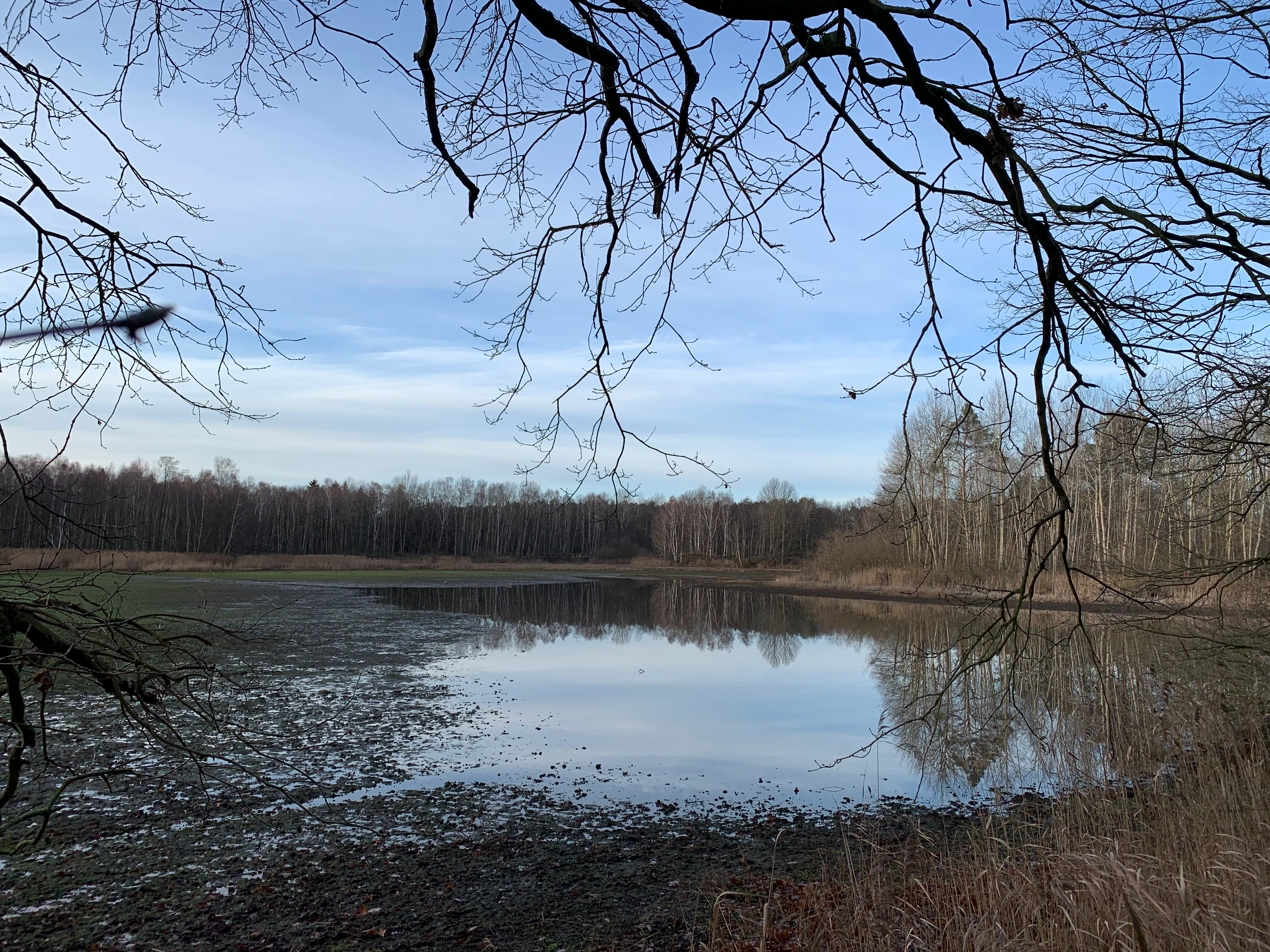
A calm, shallow pond in the Teichlandschaft Buchwäldchen-Muckwar nature reserve, framed by bare tree branches in the foreground and a dense forest in the background under an overcast sky.
A view of the Großer Paul pond in the Teichlandschaft Buchwäldchen-Muckwar nature reserve.

Teichlandschaft Buchwäldchen-Muckwar history and protected-area timeline

The history of the reserve is closely tied to the long tradition of pond-based fish farming in Lower Lusatia. The nine ponds that define the area were originally laid out centuries ago by Cistercian monks, who used them to raise fish in a region where wet ground and slow-flowing streams made pond cultivation a natural form of land use. The largest of the ponds, the Großer Paul, had already been singled out as a particularly valuable natural monument in the 1933 register of natural monuments for the Province of Brandenburg.

During the second half of the twentieth century, the hydrology of the area was strongly affected by the lignite opencast mining that transformed much of the Lusatian landscape. The lowered water table caused the Großer Paul to dry out between 1987 and 1993, and the pond had to be artificially refilled in order to prevent the loss of its ecological values. The episode illustrates how vulnerable the historical pond system is to changes in groundwater levels brought about by regional industrial activity.

Formal protection came in 1997, when the area was designated as the Naturschutzgebiet Teichlandschaft Buchwäldchen-Muckwar. In 2004, 38 hectares of the reserve were transferred to the Stiftung Naturschutzfonds Brandenburg, allowing a long-term program of habitat management to begin. Since then, the foundation has led the conversion of pine-dominated stands toward more natural mixed forests, the establishment of new small water bodies for amphibians, and the gradual development of structured, ecologically valuable forest edges.

Teichlandschaft Buchwäldchen-Muckwar landscape and geographic character

The landscape of Teichlandschaft Buchwäldchen-Muckwar is shaped by a gentle interplay of water and woodland typical of the Lusatian region. The ponds themselves vary considerably in size, with the Großer Paul and the Kleiner Paul forming the central core of the system, supported by Borschteich to the west and a cluster of smaller ponds in the north and south, including the Großer and Kleiner Brauerteich, Frauenteich, Herrenteich, Bindeteich, and Krummetteich. Flowing water is just as important as standing water: a network of ditches links the ponds and conveys their water into the Vetschauer Mühlenfließ, creating a continuous hydrological chain.

Beyond the water surfaces, the terrain is largely wooded. Below the Großer Paul lies a stretch of alder swamp forest, complemented by oak-hornbeam stands and patches of alluvial forest along the wetter ground. Much of the remaining area is covered by pine forest, some of it established through historical afforestation and including non-native species such as Douglas fir. Between the forested patches, the relief opens up into grass meadows, wet herbaceous fringes, and lowland hay meadows, producing a fine-grained mosaic of habitats that shifts visibly across short distances.

The broader setting is gently rolling rather than dramatic, with the railway line to the west and the open agricultural surroundings of the Oberspreewald-Lausitz district framing the reserve. The result is a calm, intimate landscape in which water, forest edge, and meadow alternate in a pattern that has been continuously shaped, yet repeatedly reshaped, by human activity over the centuries.

Teichlandschaft Buchwäldchen-Muckwar ecosystems, habitats, and plant life

Ecologically, the reserve functions as a small-scale refuge for habitat types that have become scarce in the surrounding agricultural landscape. The pond network, with its associated ditches and wet ditches draining to the Vetschauer Mühlenfließ, provides a suite of aquatic and semi-aquatic habitats ranging from open-water surfaces through reed margins to periodically fluctuating water bodies. This hydrological variety is the foundation on which the rest of the reserve's biodiversity is built.

The forest communities reflect the same fine-grained pattern. Below the Großer Paul, alder swamp forest dominates, grading into oak-hornbeam woodland and small patches of alluvial forest. Much of the remainder carries pine forest, partly of older origin and partly the product of afforestation that has, in places, relied on non-native conifers such as Douglas fir. Where the canopy opens, the reserve holds small open habitats of high ecological value, including Molinia grass meadows, wet tall-herb communities, and lowland hay meadows, each supporting a distinct set of plants and invertebrates.

Botanically, the area is notable for several threatened species. The royal fern, the marsh calla, and the broad-leaved marsh orchid have all been documented here, reflecting the combination of acidic boggy ground, calcareous influences, and unimproved grassland that the reserve manages to maintain within a relatively small footprint.

Teichlandschaft Buchwäldchen-Muckwar wildlife and species highlights

The wildlife profile of Teichlandschaft Buchwäldchen-Muckwar is anchored by its amphibians, which benefit directly from the mosaic of ponds, ditches, and small water bodies maintained across the reserve. The red-bellied toad and the northern crested newt are both present in the pond systems, and the management work of recent years has deliberately added small new water bodies to strengthen their habitat. Tree frogs also use the wet margins, while the European otter moves along the connecting waterways, using the ditches and the Vetschauer Mühlenfließ as a travel corridor through the landscape.

The reserve is also an important site for reptiles, with grass snakes recorded on land and using the pond edges as foraging habitat. Among birds, the area is notable for larger, sensitive species whose presence often depends on a combination of open water, undisturbed forest, and traditional land use. The common crane uses the area, the black stork breeds in the sheltered woodland, and the white-tailed eagle ranges over the reserve as a hunting species, taking advantage of the rich mosaic of water, meadow, and forest edge.

Overall, the wildlife value of the reserve lies less in any single species than in the way its habitat mosaic supports a relatively dense community of pond-associated amphibians, wetland-using reptiles, and forest- and water-dependent birds within a very compact area, neighboring agricultural land, and active forestry.

Teichlandschaft Buchwäldchen-Muckwar conservation status and protection priorities

From a conservation perspective, Teichlandschaft Buchwäldchen-Muckwar is a textbook example of small-scale, targeted habitat management within a historically shaped landscape. The site is officially classified under IUCN Category IV as a habitat and species management area, a designation that reflects the active, intervention-led character of its protection rather than purely passive conservation.

A central element of the conservation strategy is forest conversion. The Stiftung Naturschutzfonds Brandenburg, which took over ownership of 38 hectares in 2004, has been gradually removing pine trees and, where appropriate, non-native conifers such as Douglas fir, replacing them with native broadleaf species. On particularly degraded areas, a preliminary planting with sessile oak was carried out in 2009 to re-establish a natural broadleaf-dominated canopy. The medium-term aim is a near-natural mixed forest better suited to the local soil and hydrological conditions.

Alongside woodland work, the foundation has created new small water bodies specifically to improve the habitat of the red-bellied toad, and it has begun to develop the forest edge to provide a structured zone of food, breeding, and retreat habitat for both plants and animals. Together, these measures are turning the reserve into a working example of how a culturally rooted pond landscape can be brought back into ecological balance while preserving its historical character.

Teichlandschaft Buchwäldchen-Muckwar cultural meaning and human context

The reserve sits within a region whose cultural identity has long been tied to water and fish farming. The nine ponds that define the site were originally laid out by Cistercian monks, whose monastic communities shaped much of the rural land use across Central Europe, and the continued presence of the ponds is a direct legacy of this medieval agricultural tradition. The historical importance of the ponds is acknowledged in the long-standing recognition of the Großer Paul as a natural monument from as early as 1933.

Equally important is the human geography of the reserve itself. The nature reserve takes its name from two localities, Muckwar and Buchwäldchen, with a third, now-deserted settlement, Berlinchen, lying within its boundaries. The presence of this lost village is a quiet reminder of the demographic and economic shifts that have marked the Lusatian countryside over the past century, alongside the broader transformation of the region by lignite mining. Together, the monastic pond system, the place-name heritage, and the layered settlement history give the reserve a cultural depth that complements its ecological value.

Top sights and standout views in Teichlandschaft Buchwäldchen-Muckwar

Among the most memorable features of Teichlandschaft Buchwäldchen-Muckwar is the Großer Paul itself, a centuries-old fishpond already listed as a natural monument in 1933 and saved from permanent drying by artificial refilling after the lignite mining era. The chain of nine ponds linked by ditches into the Vetschauer Mühlenfließ is, in itself, an unusually compact and well-preserved example of the Lusatian pond landscape.

Equally distinctive is the active forest conversion underway on the site, in which pine and non-native conifer stands are being replaced step by step with native broadleaf species, including a 2009 preliminary planting of sessile oak. Combined with small new water bodies for the red-bellied toad and a developing forest edge, this gives the reserve the character of a working, evolving landscape rather than a static monument.

Best time to visit Teichlandschaft Buchwäldchen-Muckwar

Because Teichlandschaft Buchwäldchen-Muckwar is valued primarily for its ecological character, the seasons shape its atmosphere in distinctly different ways. In spring, rising water levels and warmer temperatures bring amphibians, including the red-bellied toad and the northern crested newt, into active breeding behavior in the ponds, while wet meadows and tall-herb fringes begin to green up. Late spring and early summer are also when forest birds, including the black stork, are most actively present around woodland edges and canopy gaps.

In summer, the mixed character of the reserve, with open water, wet meadows, and shaded forest, gives a layered, lush impression, and dragonflies, damselflies, and reed margin species are at their most visible. Autumn brings changes in the broadleaf component as oak-hornbeam trees color up against the darker conifer stands, while crane movements overhead often become noticeable as the season advances. Visiting in winter emphasizes the openness of the pond surfaces, the structure of the forest edges, and the quiet of the surrounding Lusatian countryside.

Monthly climate preview

Long-term representative measurements of monthly temperature and precipitation rhythms

Teichlandschaft Buchwäldchen-Muckwar Climate Normals and Annual Weather Patterns

Representative coordinates record measured monthly temperature and precipitation normals across the year at Teichlandschaft Buchwäldchen-Muckwar. Examining the complete twelve-month record provides detailed insight into long-term climatic variations.
Annual mean10 °C
-1 °C21 °C
Jan-1°
Feb
Mar
Apr
May14°
Jun18°
Jul21°
Aug20°
Sep15°
Oct10°
Nov
Dec
Warmest month
July

20.5 °C

Coolest month
January

-0.8 °C

Wettest month
July

2.6 mm/day

Driest month
April

1.2 mm/day

Park location guide

Geography guide, regional context, and park location map for Teichlandschaft Buchwäldchen-Muckwar

Teichlandschaft Buchwäldchen-Muckwar park geography, regions, and map view in Germany

Understand where Teichlandschaft Buchwäldchen-Muckwar sits in Germany through a broader geographic reading of the surrounding landscape, nearby location context, and its mapped position within the national park landscape.

How Teichlandschaft Buchwäldchen-Muckwar fits into Germany

Germany is a federal republic in Western and Central Europe with a population of over 83 million across sixteen constituent states. It is Europe's largest economy by nominal GDP and a major global exporter and importer. The capital is Berlin, and the country borders Denmark, Poland, Czech Republic, Austria, Switzerland, France, Luxembourg, Belgium, and the Netherlands.

Wider geography shaping Teichlandschaft Buchwäldchen-Muckwar in Germany

Germany is located in Western and Central Europe, spanning 357,022 km². It borders Denmark to the north, Poland and the Czech Republic to the east, Austria and Switzerland to the south, and France, Luxembourg, Belgium, and the Netherlands to the west. The country has coastlines on the Baltic Sea and North Sea to the north, with the Alps located in the southern region.

Map view of Teichlandschaft Buchwäldchen-Muckwar

Use this park location map to pinpoint Teichlandschaft Buchwäldchen-Muckwar in Germany, understand its exact geographic position, and read its mapped placement within the surrounding landscape more clearly.

Pigeon | © OpenStreetMap contributors

Location context for Teichlandschaft Buchwäldchen-Muckwar

Brandenburg
Recorded earthquake history

Examine Recorded Seismic History Near Teichlandschaft Buchwäldchen-Muckwar

Access a detailed catalogue of historical earthquakes documented in the vicinity of Teichlandschaft Buchwäldchen-Muckwar. This MoriAtlas resource provides transparent, location-based event records for those studying the regional geographic and seismic history of the Brandenburg nature reserve.

Teichlandschaft Buchwäldchen-Muckwar Earthquake History

Catalogued events

1 event

Strongest magnitude

Magnitude 3.2

Most recent event

Aug 4, 1998

This history includes earthquakes recorded inside the park or within 50 km of its borders

Visual reference for historic fishponds, alder swamps, and mixed woodland

Teichlandschaft Buchwäldchen-Muckwar Landscape Photos and Scenery

Visual documentation of Teichlandschaft Buchwäldchen-Muckwar reveals the intricate geometry of historic fishponds and recovering native woodlands. Photographic records of the protected terrain help researchers examine habitat mosaics, wetland restoration, and regional scenery.

A calm, shallow pond in the Teichlandschaft Buchwäldchen-Muckwar nature reserve, framed by bare tree branches in the foreground and a dense forest in the background under an overcast sky.

A dirt forest path leads into a dense deciduous forest during late autumn or winter, with a small white trail marker sign on a post in the foreground.

Park atlas

Discover related regional nature reserves and connected Lusatian landscapes.

Explore Protected Areas and Parks Near Teichlandschaft Buchwäldchen-Muckwar

Browse other protected areas and regional nature reserves located near Teichlandschaft Buchwäldchen-Muckwar. Comparing adjacent terrain helps trace the wider ecological and hydrological patterns across the surrounding Brandenburg countryside.
Nature reserveBrandenburg
11 km away#1 closest

East

Koselmühlenfließ Nature Reserve: A Protected Stream Valley in the Brandenburg Region

Geographic overview of the Lusatian land ridge brook habitat

Koselmühlenfließ protects a largely natural lowland stream and its floodplain corridor set amidst the undulating landscapes of the Lusatian land ridge. This nature reserve in the Spree-Neisse district represents a focused contribution to the Brandenburg conservation network, highlighting the value of small-scale brook environments in northeast Germany.

Area
1.12 km²
Established
2006
IUCN
IV
Relief
Lowland
Protected landscapeBrandenburg
About 16 km away#2 closest

Northwest

Naturpark Niederlausitzer Landrücken: A Protected Landscape in Brandenburg, Germany

Mapped terrain, post-mining wetlands, and glacial moraine features.

Located in the Lower Lusatia region of Brandenburg, Naturpark Niederlausitzer Landrücken showcases a remarkable geological and ecological narrative. The area contrasts traditional farmsteads and the forested Rochauer Heide with a vast, water-filled mosaic of opencast mining pits. This park serves as a primary site for understanding how industrial legacies evolve into significant wildlife habitats and protected natural terrain within the German state.

Area
587 km²
Established
1997
Relief
Upland
Climate
Temperate
Nature reserveBrandenburg
About 18 km away#3 closest

South

Sorno-Rosendorfer-Buchten Nature Reserve: Geographic Overview and Protected Landscape Maps

Lusatian lake district protected area and post-mining restoration terrain.

This nature reserve in Brandenburg provides a deep look at the ecological evolution of post-industrial land. The area features a mix of flooded mining pits, sheltered bays, and nutrient-poor sandy soils that support pioneering plant communities and remnant forest patches. Explore the mapped boundaries and the specific geographic context of this unique German protected landscape.

Area
10.9 km²
Established
2014
IUCN
IV
A horizontal watercolor painting showing a soft, impressionistic landscape with a winding stream, surrounding marshy vegetation, trees, and distant rolling hills in pale green and pink tones.
Nature reserveBrandenburg
About 23 km away#4 closest

Northwest

Borcheltsbusch und Brandkieten: Nature Reserve and Protected Landscape in Brandenburg

Wetland and forest mosaic on the Lower Lusatian land ridge.

Borcheltsbusch und Brandkieten is a nature reserve in Brandenburg, preserving critical moorland and forest habitats. Its geography includes the Berste river corridor and a connection to nearby protected forest zones. This site provides a clear view into the region's managed peatland and lowland forest ecosystems and their long-term conservation importance.

Area
1.42 km²
Established
1981
IUCN
IV
Scope
Terrestrial
Nature reserveBrandenburg
27 km away#5 closest

Southwest

Welkteich Nature Reserve: Brandenburg Industrial Legacy and Protected Habitat Mapping

Mapping a unique mosaic of post-mining terrain and historic pond systems

Located in the district of Oberspreewald-Lausitz, Welkteich represents a distinct example of how industrial-era mining scars and artificial ridges can evolve into protected nature reserves. The site serves as a vital ecological corridor, featuring a dense interspersion of aquatic basins, forest patches, and dry ground that provides a sanctuary for diverse species within the broader Brandenburg landscape.

Area
1.13 km²
Established
1981
IUCN
IV
Relief
Lowland
Nature reserveBrandenburg
31 km away#6 closest

North

Wiesenau Nature Reserve: Mapped Habitat Mosaic and Protected Landscapes in Brandenburg

Essential geographic overview of the Spreewald floodplain ecosystems.

Located near Lübben, Wiesenau protects a rich array of ponds, oxbows, and sediment zones integrated into the Spreewald Biosphere Reserve. The area serves as a prime example of the diverse, interconnected woodland and wetland terrain characteristic of the Brandenburg lowland region.

Area
1.35 km²
Established
1990
IUCN
IV
Nature reserveBrandenburg
31 km away#7 closest

West

Lehmannsteich Nature Reserve: Geographic Atlas of Brandenburg Protected Lowlands

Atlantic wet heath and bog-hollow conservation landscapes.

Discover the complex landscape of Lehmannsteich, a 140-hectare nature reserve in Brandenburg. This protected area showcases a distinctive transition from wet heath and peat-filled sloughs to surrounding pine woodland, illustrating the rare inland habitat types found within the Elbe-Elster region.

Area
1.405 km²
Established
1981
IUCN
IV
A pale, soft watercolor painting of a serene moorland landscape with rolling green hills and a light, misty background.
Nature reserveSaxony
32 km away#8 closest

South

Dubringer Moor Nature Reserve: Geographic Atlas and Protected Landscape Mapping

Extensive mire and wetland complex in the Saxony region

Spanning over 1,700 hectares, Dubringer Moor serves as a prime example of a through-flow moor system with deep peat deposits. The reserve features a unique integration of old fish-pond culture, open heath-mire, and coniferous forest, all situated within a glacial landscape that anchors the wetland ecology of northern Saxony. Examine the boundaries and environmental context of this significant habitat.

Area
17.11 km²
Established
1995
IUCN
IV
Relief
Lowland

Common questions about visiting, size, designation, and location context for Teichlandschaft Buchwäldchen-Muckwar

Teichlandschaft Buchwäldchen-Muckwar FAQs for park facts, access, geography, and protected area context

Find quick answers about Teichlandschaft Buchwäldchen-Muckwar, including protected-area facts, park geography, trail and visitor context, and how the park fits into its surrounding country and regional landscape.
MoriAtlas Explorer

Continue Your Protected Areas Search Across the Global Atlas

Deepen your exploration by continuing the structured search for national parks and protected areas worldwide. Utilize the comprehensive filtering capabilities to compare different conservation landscapes and refine your understanding of global park geography. Discover more about the distribution and characteristics of protected natural areas.

Global natural geography