Mori Atlas logo
Park earthquake history

A structured overview of geological events recorded within the regional geographic proximity.

Historical Earthquake Records and Seismic Activity Near Teichlandschaft Buchwäldchen-Muckwar

Explore a curated catalogue of seismic events documented in the surroundings of the Teichlandschaft Buchwäldchen-Muckwar nature reserve in Brandenburg. This data collection organizes historical earthquake records by proximity to the protected landscape, providing insights into recorded epicentres, magnitudes, and focal depths. The records presented here are sourced from standard geological monitoring and facilitate geographic study of the Lusatian region without implying local geological causation.

An illustration depicting a calm pond with reflective water, surrounded by light green birch trees and distant muted-colored mountains, framed by overhanging dark tree branches.

A small chain of medieval fishponds and recovering mixed forest in the Lusatian landscape of Brandenburg.

Teichlandschaft Buchwäldchen-Muckwar

Teichlandschaft Buchwäldchen-Muckwar is a small protected nature reserve in the southern part of Brandenburg, Germany, covering roughly 95 hectares of interconnected fishponds, mixed woodland, wet meadows, and marshy ground. It lies within the municipality of Luckaitztal, in the district of Oberspreewald-Lausitz, and forms part of the broader Niederlausitzer Landrücken Nature Park. The reserve is built around nine fishponds of varying size that were originally laid out centuries ago by Cistercian monks for fish farming. Today the ponds are linked by a network of ditches that drain toward the Vetschauer Mühlenfließ stream, creating a characteristic Lusatian pond landscape that alternates with alder swamp forest, oak-hornbeam stands, pine woodland, and open grass meadows. The protected area also shelters threatened plants, pond-breeding amphibians, otters, grass snakes, and a number of notable breeding birds, including the common crane, the black stork, and the white-tailed eagle. The site is valued both for its historical cultural landscape and for the ecological recovery work being carried out on its forests, where pine trees are gradually being replaced by native broadleaf species in an effort to restore a more natural, mixed woodland.

Location
Germany
Park type
Nature reserve
Established
1997
Area
1 km²
Teichlandschaft Buchwäldchen-Muckwar Nature Reserve

Explore Teichlandschaft Buchwäldchen-Muckwar event distances

Recorded earthquakes near Teichlandschaft Buchwäldchen-Muckwar

Explore earthquake records around Teichlandschaft Buchwäldchen-Muckwar, a 0.9534 km² terrestrial lowland reserve in Germany with major waters; results preserve epicentres, timing, magnitude, depth, locality, citation, and reserve distance. Geographic nearness does not prove boundary occurrence or turn its forest, grassland, wetland, lake, and river profile into evidence of seismic cause, danger, or forecasts.

Sort by
Magnitude
Location

This page describes catalogued earthquakes associated with the park by epicentre location and distance. It does not establish causation, assess current danger, or predict future earthquakes.

No earthquake records match the current filters

Park atlas

Beyond Teichlandschaft Buchwäldchen-Muckwar earthquake records

More protected parks after Teichlandschaft Buchwäldchen-Muckwar

The collection after Teichlandschaft Buchwäldchen-Muckwar shifts from its earthquake context to separately described protected places. Their presence says nothing about shared fishponds, mixed forest, alder swamp, German status, nearby location, seismic history, hazard, or earthquake-page availability, and each destination stands on its own geographic record.
Nature reserveBrandenburg
11 km away#1 closest

East

Koselmühlenfließ Nature Reserve: A Protected Stream Valley in the Brandenburg Region

Geographic overview of the Lusatian land ridge brook habitat

Koselmühlenfließ protects a largely natural lowland stream and its floodplain corridor set amidst the undulating landscapes of the Lusatian land ridge. This nature reserve in the Spree-Neisse district represents a focused contribution to the Brandenburg conservation network, highlighting the value of small-scale brook environments in northeast Germany.

Area
1.12 km²
Established
2006
IUCN
IV
Relief
Lowland
Protected landscapeBrandenburg
About 16 km away#2 closest

Northwest

Naturpark Niederlausitzer Landrücken: A Protected Landscape in Brandenburg, Germany

Mapped terrain, post-mining wetlands, and glacial moraine features.

Located in the Lower Lusatia region of Brandenburg, Naturpark Niederlausitzer Landrücken showcases a remarkable geological and ecological narrative. The area contrasts traditional farmsteads and the forested Rochauer Heide with a vast, water-filled mosaic of opencast mining pits. This park serves as a primary site for understanding how industrial legacies evolve into significant wildlife habitats and protected natural terrain within the German state.

Area
587 km²
Established
1997
Relief
Upland
Climate
Temperate
Nature reserveBrandenburg
About 18 km away#3 closest

South

Sorno-Rosendorfer-Buchten Nature Reserve: Geographic Overview and Protected Landscape Maps

Lusatian lake district protected area and post-mining restoration terrain.

This nature reserve in Brandenburg provides a deep look at the ecological evolution of post-industrial land. The area features a mix of flooded mining pits, sheltered bays, and nutrient-poor sandy soils that support pioneering plant communities and remnant forest patches. Explore the mapped boundaries and the specific geographic context of this unique German protected landscape.

Area
10.9 km²
Established
2014
IUCN
IV
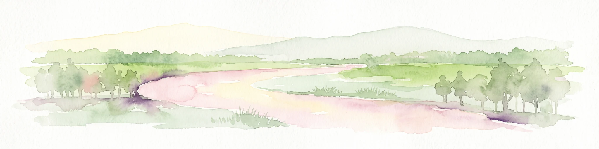
A horizontal watercolor painting showing a soft, impressionistic landscape with a winding stream, surrounding marshy vegetation, trees, and distant rolling hills in pale green and pink tones.
Nature reserveBrandenburg
About 23 km away#4 closest

Northwest

Borcheltsbusch und Brandkieten: Nature Reserve and Protected Landscape in Brandenburg

Wetland and forest mosaic on the Lower Lusatian land ridge.

Borcheltsbusch und Brandkieten is a nature reserve in Brandenburg, preserving critical moorland and forest habitats. Its geography includes the Berste river corridor and a connection to nearby protected forest zones. This site provides a clear view into the region's managed peatland and lowland forest ecosystems and their long-term conservation importance.

Area
1.42 km²
Established
1981
IUCN
IV
Scope
Terrestrial
Nature reserveBrandenburg
27 km away#5 closest

Southwest

Welkteich Nature Reserve: Brandenburg Industrial Legacy and Protected Habitat Mapping

Mapping a unique mosaic of post-mining terrain and historic pond systems

Located in the district of Oberspreewald-Lausitz, Welkteich represents a distinct example of how industrial-era mining scars and artificial ridges can evolve into protected nature reserves. The site serves as a vital ecological corridor, featuring a dense interspersion of aquatic basins, forest patches, and dry ground that provides a sanctuary for diverse species within the broader Brandenburg landscape.

Area
1.13 km²
Established
1981
IUCN
IV
Relief
Lowland
Nature reserveBrandenburg
31 km away#6 closest

North

Wiesenau Nature Reserve: Mapped Habitat Mosaic and Protected Landscapes in Brandenburg

Essential geographic overview of the Spreewald floodplain ecosystems.

Located near Lübben, Wiesenau protects a rich array of ponds, oxbows, and sediment zones integrated into the Spreewald Biosphere Reserve. The area serves as a prime example of the diverse, interconnected woodland and wetland terrain characteristic of the Brandenburg lowland region.

Area
1.35 km²
Established
1990
IUCN
IV
Nature reserveBrandenburg
31 km away#7 closest

West

Lehmannsteich Nature Reserve: Geographic Atlas of Brandenburg Protected Lowlands

Atlantic wet heath and bog-hollow conservation landscapes.

Discover the complex landscape of Lehmannsteich, a 140-hectare nature reserve in Brandenburg. This protected area showcases a distinctive transition from wet heath and peat-filled sloughs to surrounding pine woodland, illustrating the rare inland habitat types found within the Elbe-Elster region.

Area
1.405 km²
Established
1981
IUCN
IV
A pale, soft watercolor painting of a serene moorland landscape with rolling green hills and a light, misty background.
Nature reserveSaxony
32 km away#8 closest

South

Dubringer Moor Nature Reserve: Geographic Atlas and Protected Landscape Mapping

Extensive mire and wetland complex in the Saxony region

Spanning over 1,700 hectares, Dubringer Moor serves as a prime example of a through-flow moor system with deep peat deposits. The reserve features a unique integration of old fish-pond culture, open heath-mire, and coniferous forest, all situated within a glacial landscape that anchors the wetland ecology of northern Saxony. Examine the boundaries and environmental context of this significant habitat.

Area
17.11 km²
Established
1995
IUCN
IV
Relief
Lowland
MoriAtlas Explorer

Explore the Protected Geography of Teichlandschaft Buchwäldchen-Muckwar

Delve into the mapped landscapes of Teichlandschaft Buchwäldchen-Muckwar to understand its role in regional conservation. Use MoriAtlas to examine how historic pond systems and native woodland restoration define this unique nature reserve in Brandenburg, Germany.