
Mori Atlas logo
Nature reserveTirasberge

Tracing the geological transition between rocky massifs, red dune seas, and arid steppe ecosystems.

Tirasberge Nature Reserve: A Crossroads of Mountain, Desert, and Savanna Landscapes in Southern Namibia

Tirasberge stands as a significant protected landscape in southern Namibia, defined by its unique status as a meeting point for four distinct desert and mountain environments. The reserve spans a compact range where sharp rocky slopes, expansive red dune fields, and open succulent steppe converge, offering a visual and ecological interface between the interior plateau and the broader Namib desert fringe. This mapped territory highlights the complexity of working conservation lands, featuring ancient rock art sites embedded within high-standing massifs and savanna corridors.

mountainsprivate reserveNamibian escarpmentsand dunessavannasucculent steppe
A flat-style digital illustration depicting a mountainous landscape with a prominent granite dome, waterfalls, and pine trees.

Tirasberge

Nature reserve

Park overview

Structured park overview, official facts, and landscape profile for Tiras Mountains

Tiras Mountains park facts, protected area profile, and essential visitor context

Review the core facts for Tiras Mountains, including designation, size, terrain, visitor scale, habitats, and operating context in one park-focused overview.

About Tiras Mountains

The Tiras Mountains occupy a transition zone in the geography of southern Namibia, where several major landscape units of the country meet. Although they are locally elevated and rugged, they are best understood as a hinge between the western dune-dominated Namib and the eastern semi-arid interior. Their position directly north of the Namib-Naukluft National Park, and their connection to the wider escarpment system through the Rooirand and Tsaris Mountains, makes them a structural part of the central southern Namibian landscape.

The range rises from plains that are geologically part of the older interior of southern Africa, but the surrounding lowlands carry the influence of much younger aeolian processes. To the west and southwest lie the Neisib area and the Homs Plateau, where red dunes migrated outward from the main Namib sand sea and now interact visually with the foot of the mountains. To the east and southeast the terrain descends into a grassy and succulent savanna that gradually grades into the wider Kalahari-type vegetation of the region. This layered setting means that the Tiras Mountains are not an isolated massif but a central node where four distinct habitat systems converge.

The reserve itself is privately owned and managed, combining conservation objectives with extensive agricultural land use. Since 1998, eight separate farms, including Gunsbewys, Tiras, Koiimasis, Landsberg, Numis, Weissenborn, Korais, and Excelsior, have been united under a single private reserve designation. They serve as both working farms, especially for cattle production in the more open savanna zones, and as conservation land, maintaining the natural vegetation, water sources, and wildlife populations of the area. Tourism is concentrated on a smaller number of guest farms, most prominently in the southern part of the reserve.

Because the mountains sit at a real boundary between ecosystems rather than in the middle of a single biome, their ecological value is as much about transition and edge habitat as about any single dominant landscape. This makes them both a meaningful component of Namibia's broader conservation network and a distinctive destination for travelers interested in geographic diversity packed into one reserve.

Quick facts and research context for Tiras Mountains

The Tiras Mountains are a privately protected mountain range in the ǁKaras Region of southern Namibia, situated a short distance southwest of Helmeringhausen. The highest point in the range, the unnamed Tiras High Point, reaches 1,979 meters, making these mountains one of the more elevated features of Namibia's central south.

The reserve was formally established in March 1998 and covers roughly 125,000 hectares, or about 1,250 square kilometers. It is composed of eight individual former farms that were consolidated into a single privately managed conservation unit. The protected area borders the Namib-Naukluft National Park to the west, and its landscape blends the dune sea of the western Namib with mountainous terrain, savanna, and succulent steppe further east.

Protection and recognition

Examine documented terrestrial conservation frameworks and administrative scope for Tirasberge.

Tirasberge Protection Status and International Recognition Overview

Tirasberge maintains a documented terrestrial protection scope within its designated natural landscape. Review the verified administrative boundaries and conservation status details compiled for this protected area.

Protection details

Protection scope
Terrestrial
Transboundary protection
No
Park context

Deeper park guide and search-rich context for Tiras Mountains

Tiras Mountains history, landscape, wildlife, and travel context

Explore Tiras Mountains through its history, landscape character, ecosystems, wildlife, conservation priorities, cultural context, and seasonal travel timing in a structured park guide built for atlas discovery and search intent.

Why Tiras Mountains stands out

The Tiras Mountains are best known for being a four-way landscape crossroads in southern Namibia. Within a relatively compact area, the reserve brings together true mountain terrain, the red sand dunes characteristic of the Namib Desert, and two ecologically different arid landscapes to the east. The mountains form a natural visual and ecological interface between the eastern edge of the Namib dune sea and the higher terrestrial habitats of the interior plateau. The western flanks of the Tirasberge transition directly into the dunes and gravel plains associated with the Namib-Naukluft National Park, while the eastern and southern zones carry the open vegetation patterns of the southern Kalahari margin. The combination of ancient San rock art sites on the eastern escarpment with active conservation land use in the valleys below also gives the reserve a distinct cultural and historical layer that is unusual for a purely mountain-focused Namibian protected area.
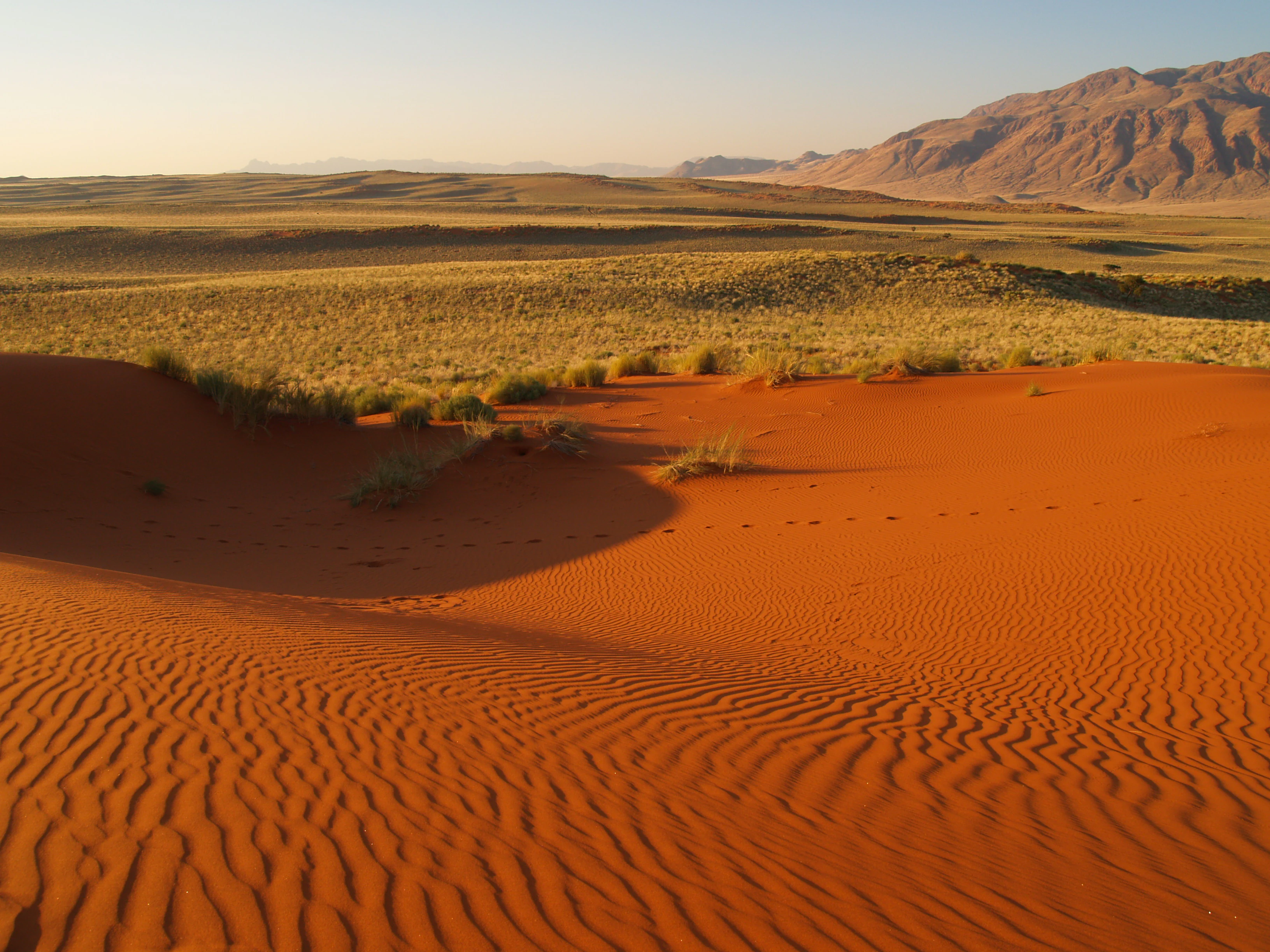
A wide view of a red sand dune in the foreground, leading to a vast, semi-arid desert plain with low yellow grasses and rugged mountains in the distance under a clear sky.
The arid desert landscape of the Tirasberge region, featuring iconic red sand dunes and distant granite mountains.

Tiras Mountains history and protected-area timeline

The history of the Tiras Mountains as a conservation unit is relatively recent and closely tied to Namibia's post-independence period of private land reform and conservation expansion. Prior to the late 1990s, the land that now forms the reserve was divided into several individual farms used mainly for livestock grazing, particularly cattle ranching in the more open savanna and steppe zones to the east and southeast of the range.

In March 1998, the eight farms that today make up the reserve, including Gunsbewys, Tiras, Koiimasis, Landsberg, Numis, Weissenborn, Korais, and Excelsior, were formally consolidated into a single private nature reserve covering approximately 125,000 hectares. This made the Tiras Mountains one of the early large-scale examples in Namibia of bringing together separate agricultural properties into a unified conservation entity, a model that has become important in southern Namibia. The reserve was designed to retain extensive agricultural use while formally protecting the surrounding natural environment, especially in the mountainous and ecologically sensitive portions of the properties.

Earlier historical references to the mountains appear in sources from the German colonial era, including the Deutsches Kolonial-Lexikon of 1920, which recorded the range under the name Tirasgebirge. The mountains also have a longer human history visible in their landscape. Ancient rock engravings attributed to the San, the indigenous hunter-gatherer people of southern Africa, are present in the southeastern part of the range, indicating that the area has been inhabited and used for many generations, even if the modern reserve itself is a product of the past several decades.

Tiras Mountains landscape and geographic character

The Tiras Mountains themselves form a compact, high-standing massif within a much broader ring of contrasting terrain. The highest point, referred to as the Tiras High Point, has no separate named summit and reaches 1,979 meters, giving the range a noticeably raised profile above the surrounding plains. Its ridges and valleys create varied slopes and sheltered catchments that influence how vegetation and wildlife are distributed across the reserve.

To the north and northeast, the mountain slopes blend smoothly into the rocky red ridge country of the Rooirand, often called the Rotrand, which itself connects further north with the Tsaris Mountains. This belt forms a continuous chain of elevated, reddish terrain that visually frames the Tirasberge from the north and supplies corridors of rocky habitat away from the heart of the reserve.

To the west and southwest, the landscape opens into the flat, dune-strewn expanses of the Neisib area and the Homs Plateau, where red sand dunes from the Namib sea reach up to the foothills of the mountains. This is the area where the Tirasberge meet the Namib-Naukluft National Park, and the boundary between dune sea and mountain front is unusually sharp and dramatic in this part of Namibia. From the high ridges of the Tirasberge, the dune fields stretch westward for many kilometers, and the contrast between dark rocky slopes and bright red sand is one of the defining visual signatures of the area.

To the east and southeast, the terrain descends into savanna and succulent steppe, with broad grassy plains interrupted by rocky outcrops. Further from the mountains, in the direction of the regional highway connections, the vegetation takes on a more short-shrub savanna character that supports traditional livestock use, particularly cattle ranching. This southeastern zone is also where the area's known San rock art sites are located, embedded in the rocky landscape between the mountains and the open plains.
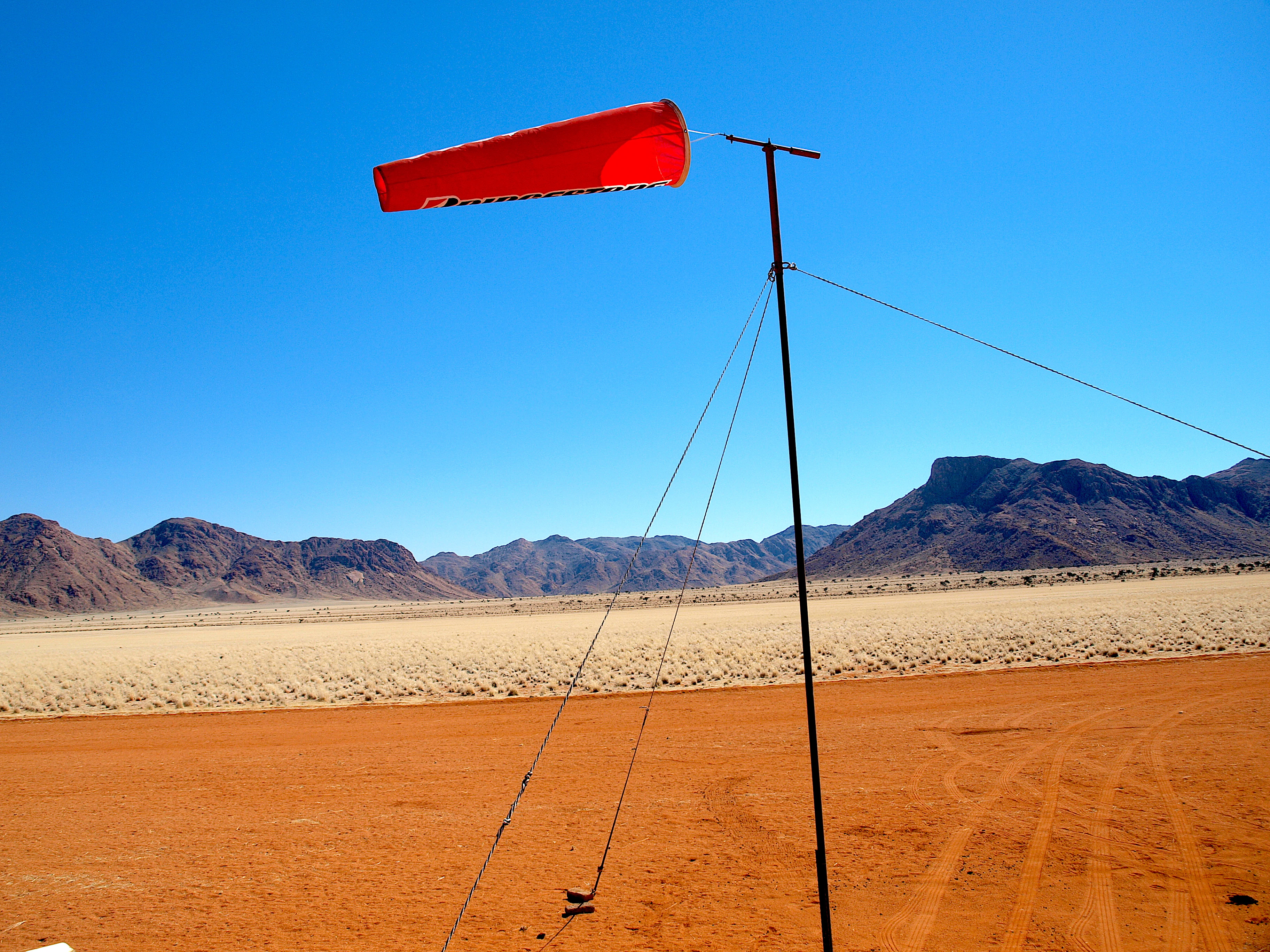
An orange windsock on a thin metal pole stands in the foreground, with an arid desert landscape and distant rocky mountains behind it.
A windsock at the Namtib airfield in the Tirasberge region of Namibia.

Tiras Mountains ecosystems, habitats, and plant life

The ecological identity of the Tiras Mountains originates from the unusual fact that four distinct environmental zones meet on a single reserve. Each of these zones carries its own vegetation and habitat character, and together they produce an ecosystem mosaic that is richer than what any single landscape would offer.

The western and southwestern zones resemble the margins of the Namib desert, dominated by red dunes, gravel plains, and sparse, drought-adapted vegetation. The mountainous core itself supports rocky ridges and slope vegetation that is more diverse and more sheltered than the open desert to the west. The northeastern flank, connected through the Rooirand to the Tsarisberge, extends this rocky habitat into a continuous network of ranges.

In contrast, the eastern and southeastern flanks are characterized by savanna and succulent steppe, with grass cover and hardy succulent plants adapted to lower rainfall and higher seasonal temperature swings. This vegetation type carries both wild plant communities and the open land-use patterns associated with extensive livestock ranching. The presence of cattle farming, particularly in the southeastern short-shrub savanna, means that the reserve is a working landscape as well as a protected one.

The convergence of dune, mountain, savanna, and steppe within one reserve is what makes the natural profile of the Tirasberge distinctive. Where the red dunes meet the dark mountain front, for example, edge effects create very specific microhabitats that differ from either zone alone. Where the southern rocky steppe meets the savanna line, similar transitions occur. These interfaces typically support a wider range of species than the interiors of any of the single zones.

Tiras Mountains wildlife and species highlights

Wildlife in the Tiras Mountains reflects the reserve's identity as a transition area rather than a single-habitat park. The combination of dune country, rocky mountain terrain, and savanna to the east means that the fauna is drawn from multiple Namibian ecological zones, and individual sightings often depend on which part of the reserve visitors enter.

In the rocky and mountainous sections, the species composition resembles that of other escarpment areas in southern Namibia, with animals adapted to rugged terrain and more variable water availability. The dune and gravel plain areas to the west and southwest carry a more typical Namib-adapted community, while the eastern savanna and short-shrub landscape supports grazing-dependent species more typical of the southern Kalahari fringe.

The reserve is privately managed and combines conservation aims with traditional cattle farming, particularly on the southeastern farms. This mixed-use approach influences both the visibility of wildlife and the pattern of human activity within the reserve, with most guest farms and tourism infrastructure concentrated in the southern zone, allowing the more mountainous and desert-edge portions to retain a quieter profile.

Tiras Mountains conservation status and protection priorities

The Tiras Mountains carry conservation significance as a large, privately managed protected area at a critical geographic junction in southern Namibia. The reserve covers about 125,000 hectares, an area large enough to absorb ecological gradients rather than just a single habitat, and it directly borders one of Africa's largest national parks, the Namib-Naukluft National Park.

The private reserve model in Namibia is significant in itself, since many of the country's most important conservation areas outside the formal state network are managed through private or community-led initiatives. By consolidating eight farms into a single protected unit in 1998, the Tirasberge reserve added a meaningful block to the network of privately conserved land along the eastern edge of the Namib dune sea.

The reserve also retains cultural and archaeological value. Rock engravings attributed to the San are present in the southeastern part of the mountains, placing the cultural heritage of the area within a protected landscape. The combination of intact natural habitat, archaeological heritage, and active sustainable land use makes the reserve a multi-layered conservation site rather than just a fenced nature reserve.

Tiras Mountains cultural meaning and human context

The Tiras Mountains carry a layered cultural record that goes well beyond their modern status as a private reserve. The presence of ancient rock engravings attributed to the San, the indigenous hunter-gatherer peoples of southern Africa, in the southeastern part of the range indicates long-standing human use of the area, well before the arrival of colonial-era or modern land use practices.

In more recent history, the land has been shaped by colonial-era and post-independence farming traditions. Under German colonial administration, the mountains were documented in reference works of the early twentieth century, reflecting awareness of the range as a recognizable geographic feature. In the late twentieth and early twenty-first century, the individual farms that today make up the area supported cattle ranching under extensive farming methods typical of southern Namibia.

The modern reserve blends these older land-use traditions with contemporary conservation and tourism. Guest farms, particularly in the southern part of the reserve, operate alongside the older agricultural patterns, and the reserve as a whole represents a continuation of human presence on the land, rather than a sudden enclosure of previously unused wilderness.

Top sights and standout views in Tiras Mountains

The Tiras Mountains stand out for the unusual density of contrasting landscapes packed into a single privately managed reserve. Within the same protected area, visitors encounter red dunes, rocky mountain slopes, open savanna, and semi-arid succulent steppe, each with its own vegetation regime and visual character.

The visual interface between the red dunes of the western Namib and the dark slopes of the eastern mountain front is one of the strongest aesthetic features of the area. Similarly, the transition from the rocky higher elevations down to the southeastern savanna and short-shrub plains gives the reserve a stratified appearance that rewards both travel across its length and exploration at different elevations.

The cultural heritage of the San rock art sites, combined with the working agricultural landscape that survives within the reserve, adds a human dimension that complements the natural setting. Together, these elements make the Tirasberge a place where landscape diversity, conservation, and continuing land use intersect within one geographically compact unit.

Best time to visit Tiras Mountains

The Tiras Mountains, like much of southern Namibia, experience a climate where temperatures and vegetation cover shift meaningfully between seasons, even if extreme seasonal swings are moderated compared to more tropical parts of Africa. Cooler months generally bring softer light, more comfortable conditions for hiking and game viewing in the higher and more open parts of the reserve, while the wetter periods can refresh vegetation and attract grazers.

The dune and desert-edge zones in the west are particularly sensitive to temperature, and traversing the reserve on foot or by vehicle is more comfortable outside of the hottest months. The savanna and steppe to the east and southeast, where most of the guest farms and human activity are concentrated, follow a more typical southern-African pattern, with grazing and visible wildlife activity often tied to the periods following rainfall. Travelers interested primarily in landscape photography tend to favor periods with softer angled light and clearer skies, while those interested in the cultural layer of the area can visit throughout the year, since the rock art sites and farm landscapes are not seasonal in the same way.
Monthly climate preview

Long-term monthly temperature averages and precipitation records for Namibia

Tirasberge Climate Normals and Measured Annual Temperature Patterns

Representative coordinate measurements reveal the annual rhythm of average temperatures and low precipitation across Tirasberge. Detailed monthly breakdowns provide deeper insight into long-term climate normals and seasonal variations.
Annual mean20 °C
13 °C26 °C
Jan26°
Feb25°
Mar24°
Apr21°
May17°
Jun14°
Jul13°
Aug14°
Sep18°
Oct21°
Nov23°
Dec24°
Warmest month
January

25.5 °C

Coolest month
July

13.2 °C

Wettest month
February

0.7 mm/day

Driest month
October

0 mm/day

Park location guide

Geography guide, regional context, and park location map for Tiras Mountains

Tiras Mountains park geography, regions, and map view in Namibia

Understand where Tiras Mountains sits in Namibia through a broader geographic reading of the surrounding landscape, nearby location context, and its mapped position within the national park landscape.

How Tiras Mountains fits into Namibia

Namibia is a sovereign country in Southern Africa that gained independence from South Africa in 1990. It is the driest country in sub-Saharan Africa, characterized by the Namib Desert along its coast. The population is approximately 3 million, with Windhoek as the capital and largest city. Namibia operates as a unitary semi-presidential republic with a multi-party system.

Wider geography shaping Tiras Mountains in Namibia

Namibia occupies 825,615 km2 in Southern Africa, making it the 34th largest country in the world. It is bordered by the Atlantic Ocean to the west, Angola and Zambia to the north, Botswana to the east, and South Africa to the south. The country features the Namib Desert along its coastal region, with varied terrain including savannas, mountains, and plateaus inland. A notable geographic feature is that Zimbabwe lies less than 200 metres away along the Zambezi river near Kazungula in the northeast.

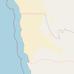
Map view of Tiras Mountains

Use this park location map to pinpoint Tiras Mountains in Namibia, understand its exact geographic position, and read its mapped placement within the surrounding landscape more clearly.

Pigeon | © OpenStreetMap contributors

Explore photographic records of dune fields, rocky escarpments, and arid habitats across the protected area.

Tirasberge Landscape Photos and Scenery Views: Visualizing the Namibian Mountain Reserve

Visual documentation captures the striking convergence of red sand dunes, dark mountain ridges, and succulent steppe within the protected reserve. Examining these photographic records reveals the distinct ecological transitions and rugged terrain defining the southern Namibian landscape.

A wide view of a red sand dune in the foreground, leading to a vast, semi-arid desert plain with low yellow grasses and rugged mountains in the distance under a clear sky.

A long dirt road cuts through a vast, dry, golden-grass plain towards a range of mountains under a clear sky in Namibia.

An orange windsock on a thin metal pole stands in the foreground, with an arid desert landscape and distant rocky mountains behind it.

Park atlas

Compare regional reserves, mountain ranges, and adjoining desert terrain across southern Namibia

Explore Parks Near Tirasberge and Connected Protected Landscapes

Browse national parks and protected areas sharing geographic traits with the rugged mountain terrain and dune transitions of Tirasberge. Comparing adjacent reserves reveals broader ecological patterns across the Namibian escarpment and surrounding arid plains.
National parkNamibia
About 15 km away#1 closest

Northwest

Namib-Naukluft National Park: Namibia's Iconic Desert Landscape and Protected Terrain

Explore its ancient dunes, Naukluft mountains, and coastal geography.

Namib-Naukluft National Park is a colossal protected area in Namibia, holding the distinction of being Africa's largest national park. This park is renowned for its iconic sand dunes, particularly at Sossusvlei, which are among the highest in the world and display dramatic colors due to iron oxidation. The landscape also features the rugged Naukluft Mountains and vital coastal fog zones, creating a diverse arid environment. Delve into the mapped geography and unique terrain of this ancient desert setting, understanding its protected landscape significance within Namibia's atlas.

Area
49,768 km²
Established
1907
IUCN
II
Relief
Mixed relief
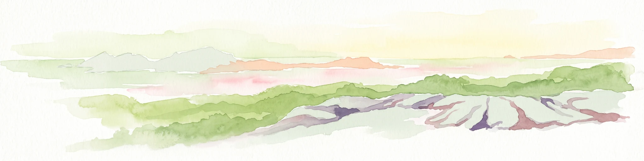
A pale, minimalist watercolor painting showing layers of coastal hills, greenery, and dunes fading into a distant, hazy horizon.
Marine protected areaNamibia
About 146 km away#2 closest

West

Meob-Chamais Islands’ Marine Protected Area: Mapped Coastal and Marine Sanctuary

A protected Atlantic marine region in coastal Namibia

Spanning from Meob Bay to Chamais Bay, this expansive marine protected area preserves the vital intersection between Namibia's arid desert shoreline and the cold, productive waters of the Atlantic. The region comprises ten primary islands and numerous islets that provide essential breeding platforms for bank cormorants and African penguins. This site remains a foundational element of regional coastal conservation and marine geography.

Area
20,000 km²
Established
2009
IUCN
VI
Scope
Marine
National parkNamibia
About 153 km away#3 closest

Southwest

Tsau ǁKhaeb National Park: Namibia's Protected Area and Geographic Identity

Mapped natural landscape and park boundaries in Namibia.

Tsau ǁKhaeb National Park represents a vital protected area within Namibia, offering deep insights into the country's unique arid environments. This park detail page serves as an atlas entry focused on its mapped geography, highlighting its protected boundaries and its role within the broader landscape of Southern Africa. Explore the inherent geographic characteristics and conservation significance of this national park.

Watercolor painting of a pastoral landscape featuring rolling green hills, a small winding river, and soft-toned mountains under a pale sky.
National parkNorthern Cape
About 218 km away#4 closest

South

Richtersveld National Park: Geographic and Protected Area Map Context

Exploring arid volcanic landscapes in Northern Cape

Richtersveld National Park represents a vast, complex protected area defined by its rugged mountain ridges and arid desert ecology. Centered in South Africa's Northern Cape, the landscape is shaped by the Orange River and high-altitude volcanic formations. This profile offers detailed insight into the park's natural boundaries, endemic plant habitats, and its role as a living cultural landscape within the wider regional geography.

Area
1,624.45 km²
Established
1991
Relief
Mountain
Climate
Arid
Wildlife reserveNamibia
About 219 km away#5 closest

South

ǀAi-ǀAis Hot Springs Game Park: A Namibian Wildlife Reserve Bridging Desert and Geothermal Landscapes

Explore mapped boundaries and regional park geography.

ǀAi-ǀAis Hot Springs Game Park represents a vital protected area within Namibia's arid southern reaches. This wildlife reserve is characterized by its namesake hot springs, which foster unique riparian ecosystems against a backdrop of rugged desert mountains and the impressive Fish River canyon. Its inclusion in a transfrontier conservation effort underscores its significance for regional landscape mapping and the preservation of stark desert beauty and geothermal features.

IUCN
II
Relief
Mixed relief
Climate
Arid
Access
Remote access
Protected areaNamibia
About 219 km away#6 closest

South

Ai-Ais/Richtersveld Transfrontier Park: Mapped Boundaries of a Southern African Protected Area

Exploring its desert terrain and cross-border conservation geography.

Ai-Ais/Richtersveld Transfrontier Park is a significant protected area that spans across Namibia and South Africa, embodying a vital component of Southern Africa's conservation efforts. This page focuses on the park's geographic identity, detailing its arid landscape characteristics and the mapped extent of its protected boundaries. Understanding this transfrontier park offers insight into cross-border ecological cooperation and the unique desert terrain it encompasses, providing a foundation for structured geographic discovery.

Area
6,045 km²
Established
2003
IUCN
II
Relief
Mountain
National parkKgalagadi District
About 351 km away#7 closest

East

Kgalagadi Transfrontier Park National Park: Explore Its Mapped Protected Landscape

Discover the desert geography and unique terrain of the southern Kalahari.

Kgalagadi Transfrontier Park is a monumental protected area within the Kgalagadi District, embodying the vastness and stark beauty of the Kalahari Desert. This national park page offers an atlas-centric view of its sweeping red dunes, sparse vegetation, and the crucial dry river systems that shape its arid environment. Understand the geographic scope and the protected landscape character of this significant cross-border conservation area, perfect for detailed map exploration and understanding regional desert ecosystems.

Area
38,000 km²
Established
2000
IUCN
II
Visitors
52.5K annual
National parkNamibia
About 368 km away#8 closest

Northwest

Dorob National Park: Namibia's Expansive Coastal Desert and Protected Bird Habitat

Explore mapped landscapes and regional geography.

Dorob National Park is a prime example of a protected coastal desert landscape, stretching along Namibia's Atlantic coast. This national park is renowned for its significant bird populations, making it an Important Bird Area with extensive mapped habitats supporting diverse species. Understand the park's geographic context, from its dramatic dunes to its ephemeral river systems, and its role as a key conservation area within the region.

Area
107,540 km²
Established
2010
IUCN
II
Relief
Lowland

Common questions about visiting, size, designation, and location context for Tiras Mountains

Tiras Mountains FAQs for park facts, access, geography, and protected area context

Find quick answers about Tiras Mountains, including protected-area facts, park geography, trail and visitor context, and how the park fits into its surrounding country and regional landscape.
MoriAtlas Explorer

Continue Your Protected Areas Search Across the Global Atlas

Deepen your exploration by continuing the structured search for national parks and protected areas worldwide. Utilize the comprehensive filtering capabilities to compare different conservation landscapes and refine your understanding of global park geography. Discover more about the distribution and characteristics of protected natural areas.

Global natural geography