
Planning Essentials
When to visit Volcan Nevado de Colima National Park: the short answer
Determining the ideal period for a visit to Volcán Nevado de Colima National Park requires balancing stable, accessible conditions against the dramatic, lush beauty that follows the rainy season. There is no single universal window that serves every traveler, as the park experience changes significantly based on the interplay between elevation and seasonal precipitation. For those prioritizing clear skies, photography, and easier access to the high-elevation zones, the months spanning from November through April offer the most consistent weather. During this dry phase, lower humidity and minimal rainfall characterize the environment, creating reliable conditions for hiking the pine-oak forests and navigating the steep terrain surrounding the volcanic massif.
The seasonal trade-off of volcanic vistas
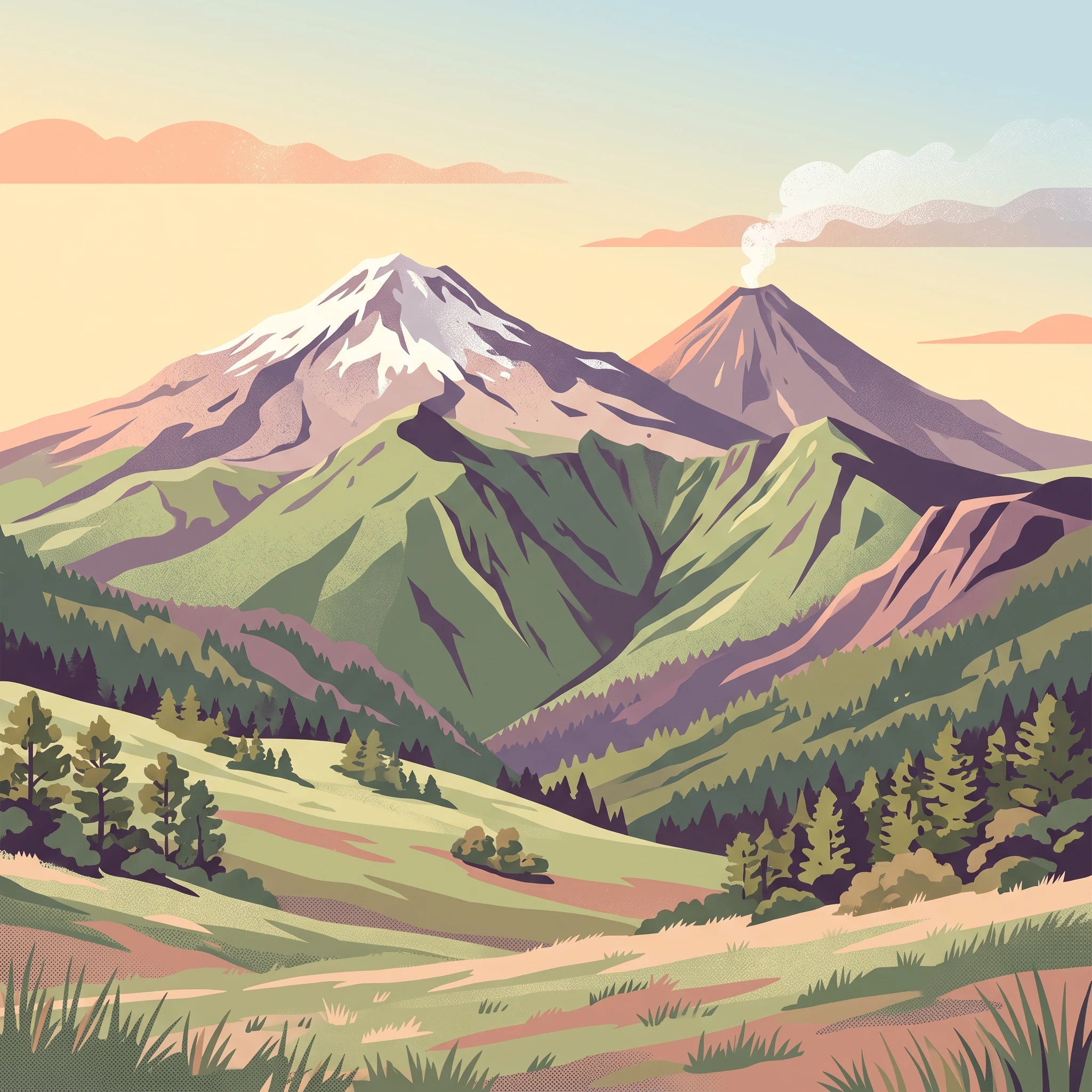
The most important factor for visitors to consider is the shift in landscape character between the dry winter months and the humid summer months. From June through September, the park receives significantly higher precipitation, which transforms the subalpine grasslands and forested slopes into a vibrant, lush environment. While this period introduces greater challenges for navigation due to wetter terrain, it also provides the most atmospheric, mist-filled vistas of Volcán de Fuego. The contrast between the active volcano and the dormant massif is often sharpened by the moody, cloud-heavy conditions common in the late afternoon during these months, though this also increases the likelihood of restricted visibility on the high trails.
Elevation and atmospheric conditions
Because the park encompasses a dramatic range of altitudes, weather patterns are rarely uniform. Conditions near the peaks of Nevado de Colima can differ sharply from the experience at the park entrance or lower transit points. Regardless of the general seasonal trend, temperatures at high elevations can reach near-freezing levels throughout the year. Visitors should expect rapid shifts in weather as they ascend toward the summit regions, where wind speeds and humidity can fluctuate independently of the base climate normals. These elevation-driven changes mean that even during the drier months, preparing for temperature drops and unpredictable mountain weather is essential for a safe visit. By recognizing that the primary trade-off exists between the dry stability of winter and the fertile, dramatic intensity of summer, travelers can align their timing with their own preference for either clear-sky visibility or the vibrant ecological activity of the rainy season.
Timing Comparison
Best months to visit Volcan Nevado de Colima National Park at a glance
The Dry Season Advantage for Mountain Trekkers
The months of November through April represent the most consistent window for visitors prioritizing physical access and clear conditions. During this period, precipitation levels remain at their lowest annual point, particularly in March and April when rainfall is negligible. This creates the most stable environment for hiking the rugged terrain leading toward the summits. Travelers who aim to explore the high-altitude trails or engage in mountain photography will find that the reduced cloud cover during these months provides the clearest views of the contrasting volcanic peaks. Because the relative humidity also reaches its annual low during this window, the atmosphere is generally sharper, supporting better visibility of the complex volcanic massif.
Embracing the Humidity of the Wetter Months
For those who prefer a vibrant landscape, the period from June through September marks the peak of the rainy season. Precipitation totals rise significantly, with the highest values often recorded in August and September. While this period introduces challenges regarding mud and trail saturation, it offers a starkly different experience. The increased moisture fosters rapid growth in the surrounding flora, transforming the subalpine grasslands and forested slopes into a lush, intense green. Visitors during this window should expect frequent mist and dramatic, shifting cloud patterns around the craters, which can add an ethereal quality to the volcanic landscape. This time of year is generally less about summit views and more about experiencing the park's dense, high-elevation ecosystems and the atmospheric intensity of the volcanic environment.
Navigating Transitions and Temperature Extremes
Transition months such as May and October often serve as the bridge between the dry and wet regimes. May typically sees the onset of rising humidity and the first substantial increases in rainfall as the region moves toward the mid-year wet peak. Conversely, October captures the tail end of the rainy season, where precipitation begins to decline but the residual ground moisture remains high. Beyond rainfall, temperature variations also dictate the best visiting periods. While mean temperatures remain relatively consistent year-round due to the moderate altitude, the minimum temperatures at the highest elevations can drop to freezing levels throughout the year. Visitors planning for the colder, winter-influenced months from October through January should specifically anticipate frost or even snow, especially during early morning hours near the peaks. Regardless of the chosen month, the rapid changes in conditions with elevation mean that even a warm, sunny day at the park entrance can shift into hazardous or frigid weather near the summit. Always prepare for significant temperature drops and potential wind exposure, particularly during the transition phases when mountain weather patterns are least predictable.
Annual Climate Overview
Interpreting the annual weather and climate patterns at Volcán Nevado de Colima
The Annual Temperature and Humidity Progression
Understanding the climate of the park requires viewing the year as a balance between temperature intensity and moisture availability. As you move from the start of the year toward the peak of the dry season in April, mean temperatures climb steadily from their annual low of roughly 18 degrees Celsius in January toward an annual maximum of nearly 25 degrees Celsius in May. This period is defined not only by increasing heat at lower monitoring elevations but also by a distinct decline in relative humidity. As the air dries out, the landscape undergoes a significant transition where visibility typically improves, which is a critical factor for mountain photography and general navigation across the park's volcanic terrain.
Conversely, the onset of the summer months introduces a swift reversal in atmospheric patterns. Beginning in June and continuing through September, relative humidity levels rise significantly, often surpassing 80 percent. This influx of moisture is coupled with a sharp increase in precipitation, peaking in September. Visitors during these months should anticipate a shift in the feel of the environment: the higher humidity and frequent moisture can create a dense, persistent mist that obscures the peaks of both Volcan de Fuego and Nevado de Colima. While the cooling effect of the rains provides a break from the peak heat of May, the damp, heavy air creates an entirely different set of environmental challenges for those planning time on the trail.
Patterns in Daylight and Precipitation
The annual cycle of daylight follows a predictable pattern, shifting from approximately 11 hours during the winter months of December and January to a maximum of over 13 hours in June and July. While this shift may seem marginal, it directly influences the amount of time available for daylight-dependent activities. Planning a trek during the longer days of mid-year provides a logistical advantage, but this benefit must be weighed against the highest precipitation averages of the year. The precipitation data reveals a concentrated wet period from June through September, during which rainfall is at its most consistent. In contrast, the months of March and April represent the driest window, with extremely low daily precipitation averages that create the most stable conditions for surface activities.
Evaluating Climate Normals vs. Local Realities
It is essential for travelers to interpret these climate normals as historical indicators for the sampled elevation of approximately 1,178 meters, rather than live forecasts. Because the park encompasses a massive range of altitudes, the conditions at the summit or along high-elevation ridges often bear little resemblance to these baseline measurements. Temperatures at the peaks can dip significantly below the regional means, and frost or snowfall is possible even when lower-elevation areas remain temperate. Wind speeds, while relatively moderate at the monitored elevation, are often magnified by the exposed volcanic topography at higher altitudes. Visitors must recognize that these data points are not a guarantee of specific daily weather or trail accessibility. Planning should always involve checking the most current bulletins from park authorities or local meteorological services, especially given the active nature of Volcan de Fuego, where seismic activity can influence local safety protocols regardless of the season.
Annual Climate Phases
Understanding Seasonal Patterns at Volcan Nevado de Colima National Park
Defining the Dry Window: November to April
The climate at this high-altitude park is primarily defined by a pronounced dry phase that spans from November through April. During these months, the atmospheric conditions stabilize significantly compared to the rest of the year. Visitors will notice a steady decrease in relative humidity, which drops to its lowest annual levels by April, often falling below 50 percent. This period acts as the most reliable window for mountain activities, as the lower precipitation values ensure that trails, including those accessing the volcanic slopes and subalpine grasslands, remain relatively firm. While temperature variations occur as you ascend from the base, the predictability of the weather during this phase makes it the preferred period for photography and hiking, as cloud cover tends to be less pervasive than in the humid months.
Transitioning Toward Humidity: May and October
The months of May and October function as critical buffer zones between the dry and wet phases. May serves as a transitional precursor to the rainy season, characterized by a gradual rise in humidity and the arrival of earlier, shorter rainfall events. It is a time of shifting atmospheric pressure where the landscape begins to respond to increased moisture. Conversely, October represents the waning of the peak rainy period. While precipitation levels begin to drop from their September highs, the soil remains saturated, and the risk of mist and localized showers persists. For visitors, these months are marked by uncertainty, as the park can swing between the bright, clear days of the dry season and the sudden, heavy cloud cover typical of the wet months. Proper gear for changing weather is essential during these times, as the transition does not follow a linear path.
The Peak Rainy Phase: June to September
Starting in June, the park enters its most humid and precipitation-heavy phase, lasting through September. This period is driven by increased moisture influx, which results in the highest monthly rainfall levels, peaking in August and September. During this time, relative humidity frequently climbs above 80 percent, creating an environment defined by frequent cloud cover, dense mist, and dramatic, atmospheric lighting around the peaks. While these conditions can obscure the dramatic silhouettes of the Nevado de Colima and the Volcán de Fuego, they also transform the lower slopes into a vibrant, lush landscape. The subalpine vegetation thrives in this moisture-rich cycle. Mountaineers and hikers should be aware that the high humidity and persistent rain can affect trail surfaces, making them muddier and more challenging to traverse compared to the stable conditions found in the dry winter months. This period is less about visibility and more about experiencing the rugged, moisture-laden character of these high-elevation ecosystems.
Seasonal Experiences
Experiencing the landscapes of Volcan Nevado de Colima National Park throughout the year
Navigating mountain environments through the seasons
Visiting the high-altitude landscapes of the park involves managing significant elevation changes, which fundamentally dictate what experiences remain accessible and comfortable. Because the terrain encompasses both the dormant Nevado de Colima and the active Volcán de Fuego, the choice of season acts as a filter for how these geological features are experienced. The dry window, typically spanning November through April, offers the most predictable ground conditions for hiking across the subalpine grasslands. During these months, the reduction in humidity and minimal precipitation minimizes the risk of muddy, unstable paths on the approach to high-altitude camps like La Joya or La Caperuza. Hikers looking to spend extended time at elevation often favor this period because the lack of afternoon cloud cover improves visibility toward the summit of the dormant massif.
Observing the active and dormant peaks
The dual nature of the volcanoes provides two distinct observation experiences that fluctuate with annual climate patterns. Observing the active Volcán de Fuego is a central draw, and the timing of your visit affects how you interact with this dynamic landscape. During the height of the summer wet season, from July through September, the area experiences high relative humidity and significant precipitation. While this climate shift often obscures the peaks in dense mountain mist, it also fosters a vibrant, dense green cover throughout the park. Travelers interested specifically in the stark, raw character of the volcanic debris and the dramatic silhouette of the summits often find the late autumn and winter months more conducive to photography, as the air is less saturated and the chances of clear mountain vistas are higher.
Accessing high-altitude nature and endemic species
The park supports specialized habitats, such as the pine-oak forests and high-altitude zacatonal grasslands, which serve as home to endemic species like the red warbler. For those prioritizing nature observation, the shift in seasonal humidity is a primary consideration. The moist conditions of the wetter months sustain the forest ecosystems, leading to lush vegetation in the lower and mid-elevation zones. However, the higher, more exposed slopes remain subject to the temperature drops associated with altitude, regardless of the month. Because mean temperatures fluctuate between the cooler winter period, where averages can hover in the high teens at mid-elevation, and the warmer spring months, hikers must remain prepared for rapid cooling near the summits. Regardless of the time chosen, visitors should prioritize mid-day exploration to maximize natural light and mitigate the chill that sets in once the sun drops behind the volcanic ridge lines, as daylight hours remain relatively consistent throughout the year compared to the more volatile regional temperature swings.
Visitor Priorities
Optimizing Your Visit to Volcan Nevado de Colima by Travel Interest
Balancing Climate for Mountain Hiking
For travelers focused on hiking, the primary priority is securing stable trail conditions and high-altitude visibility. The most reliable window for these goals is the late dry season, specifically March and April. During these months, precipitation levels reach their annual minimum, significantly reducing the risk of rain-slicked rock or mud on the steep access paths. While March introduces higher daily maximum temperatures, the lower relative humidity,often dipping toward 50 percent,makes physical exertion more manageable compared to the stifling conditions of the peak rainy season. The trade-off for this period is the increased intensity of the sun at altitude and the potential for dusty trail surfaces that require careful footing, especially during descents on loose volcanic soil.
Prioritizing Cooler Temperatures and Lower Humidity
Visitors who prefer crisp air and lower humidity for mountain activity should target the late autumn and early winter months, primarily November and December. At these times, the atmospheric humidity remains moderate as the region exits the wet season, and the lower average temperatures,with mean values falling toward 18-20 degrees Celsius at mid-elevation,provide a comfortable baseline. This period is particularly attractive for those looking to avoid the intense solar heat of the April and May months, which can see temperatures rise significantly as the sun climbs higher. The main compromise for a trip during this window is that the lingering moisture from the preceding months may result in higher cloud cover, which can occasionally obscure the summit vistas of Volcan de Fuego.
Seeking Maximum Daylight Hours
If your priority is maximizing daylight for long days of photography or extended exploration of the subalpine zacatonal grasslands, the months of May, June, and July offer the longest available hours, peaking near 13 hours per day. This extended window is ideal for those who prefer early starts to beat the mid-day heat or who wish to spend more time observing the endemic red warbler and other high-altitude species. However, these months sit squarely within the transition to and the height of the wet season. The trade-off is almost guaranteed afternoon cloud buildup or precipitation. Travelers selecting this period must be prepared for dynamic weather patterns and prioritize completing their main objectives before midday, when atmospheric moisture typically increases and visibility drops.
Navigating the Impact of Seasonal Shifts
It is essential to weigh the trade-offs between physical trail comfort and the aesthetic value of the park's environment. The dry, dusty months of March and April provide the most consistent accessibility, yet they lack the verdant, mist-wrapped atmosphere that characterizes the landscape following the onset of the rains in June. Conversely, visiting when the park is at its most vibrant requires accepting that the very conditions fueling the growth,the high humidity and daily precipitation,will limit long-range views and may necessitate shorter outings. Rather than looking for a perfect month, visitors should align their specific activities with these established climate trends, recognizing that the mountains themselves, particularly the active peak, will always dictate the final viability of any outdoor plan.
Access and Logistics
Seasonal access and trip planning for Volcan Nevado de Colima
Navigating the terrain of the national park requires careful planning, as the high-altitude volcanic environment imposes specific demands on transport and access. While the dry season from November to April generally provides more predictable road conditions for travel, the mountain routes remain rugged throughout the year. Visitors should always verify current road status, infrastructure integrity, and access permissions with the official park management or local authorities in Ciudad Guzman before departure. Infrastructure can be affected by weather events, seismic activity, or administrative updates, and relying on older reports or general seasonal expectations is not a substitute for checking current conditions.
Access and vehicle requirements
The climb to the higher elevations of the park, including the base camp areas near La Joya, involves navigating steep and often rough mountain tracks. A high-clearance vehicle, preferably a 4WD truck or Jeep, is strongly recommended for reaching the upper parking areas. During the wet season from June through September, increased precipitation can lead to mud, washouts, or debris on these routes, further complicating access. Even in the drier months, the nature of the terrain necessitates cautious driving and preparation for slow, demanding progress. Travellers should confirm if local road maintenance or seasonal weather patterns have restricted vehicle access to specific trailheads.
Logistics and regional transit
Most visitors utilize Ciudad Guzman as the primary staging point for entry into the park. Whether arriving via regional road networks or utilizing the train service from Guadalajara, the final leg of the journey requires a vehicle capable of handling unpaved volcanic slopes. If you are not renting an appropriate vehicle, you will need to arrange for local transport, such as a hired driver with experience navigating these mountain roads. It is essential to confirm the current availability and reliability of local transport services in Ciudad Guzman, as these options may fluctuate. Always inquire about the current feasibility of reaching specific points of interest, as mountain access rules are subject to change based on park policy and environmental conditions.
Official status and real time verification
Because the park encompasses an active volcanic system, administrative procedures regarding access to specific zones can shift with little notice based on volcanic safety protocols. Do not assume that seasonal weather trends indicate that all trails or campsites are open. Areas like La Joya, La Caperuza, Curva del Leñador, and Paraje La Calle may have specific usage guidelines or temporary closures depending on the time of year or current park management decisions. Before finalizing your travel dates or itinerary, contact the designated park authorities or visit the official government website for the most recent updates on park status, permit requirements, and safety warnings.
Safety and Preparation
Seasonal Weather Hazards and Packing for Volcan Nevado de Colima
Adapting to Thermal Shifts and High Elevation
Preparation for visiting this national park requires a recognition that atmospheric conditions change significantly with altitude and season. While the park entrance and lower forested slopes often experience mild, temperate conditions, the upper reaches toward the summit of Nevado de Colima involve substantial temperature drops that occur regardless of the time of year. Visitors planning to hike toward the higher-elevation zacatonal grasslands or the crater areas must be prepared for the reality that mean temperatures recorded at lower elevations do not represent the summit environment. Layering clothing is the most effective approach for managing these transitions, as you may experience significant warming during sunny, clear days in the dry season while encountering sudden cooling as you ascend or when moving into the shade of dense pine-oak forests.
Managing Exposure During Seasonal Weather Extremes
Your preparation strategy should shift based on the predictable rhythm of the annual weather cycle. During the dry season from November to April, the primary environmental challenge is managing intense solar exposure during the midday hours, when cloud cover is minimal and humidity levels reach their annual lows. Conversely, the rainy period between June and September demands robust protection against persistent moisture and rapid cooling that often follows afternoon precipitation. Humidity levels during these wetter months can exceed 80 percent, which can make physical exertion feel more demanding and increase the likelihood of gear becoming saturated.
Because wind speeds remain relatively consistent throughout the year, expect consistent breeze patterns at higher altitudes that can accelerate heat loss. Regardless of the month, the volcanic terrain is exposed and lacks consistent shelter from the elements. If you are planning a trip, verify current conditions through official park bulletins or local monitoring agencies, as they provide the most accurate assessment of active volcanic trends and trail integrity that climate normals cannot predict.
Essential Considerations for Mountain Navigation
Safety in this environment is largely a matter of planning for the variables you can control. Rather than relying on rigid lists, focus on the following:
- Daylight Hours: Plan your routes to account for the variation in available daylight, which peaks in June and July and shortens significantly in the winter months. Aim to complete higher-altitude treks well before the late afternoon, as visibility and temperatures can shift rapidly once the sun begins to descend.
- Forecast Sensitivity: Use the long-term monthly normals only as a broad baseline. Always check the localized weather forecast for the specific high-altitude zones you intend to visit within 24 hours of your arrival.
- Self-Sufficiency: Because the park's terrain is steep and features deep ravines, ensure your preparations for movement are matched to the specific demands of your planned trail, prioritizing stable, high-traction footwear and reliable navigation tools.
Decision Framework
How to choose the right time to visit Volcan Nevado de Colima National Park
Choosing the right date for your excursion depends primarily on your tolerance for trail moisture and your desire for clear, expansive volcanic vistas. The most critical decision factor is whether you prioritize the high-visibility, stable ground conditions of the dry season or the verdant, atmospheric landscapes that define the more humid months. There is no singular ideal time that satisfies every traveler, as the trade-offs between climate stability and seasonal aesthetics are significant. If your primary goal is mountain photography or challenging summit hikes, the dry window from November through April provides the most consistent access to dry trails and clear horizons. This period is favored by those who need to minimize the risk of weather-related trail closures or visibility issues caused by frequent heavy cloud cover. During these months, the lower precipitation levels and reduced humidity create the most predictable environment for outdoor activities. Conversely, visitors who are drawn to the dramatic, mist-filled atmosphere of volcanic peaks and lush, high-altitude vegetation may find the wetter months from June through September more rewarding. While these months bring higher precipitation and more frequent overcast conditions, they also transform the subalpine zacatonal grasslands and surrounding forests into a vibrant, high-contrast landscape. Travelers selecting this period should expect significantly more humidity and should prepare for the possibility of rapid weather shifts that can obscure views of the peaks. Regardless of the month you choose, remember that the high-altitude nature of these mountains means that localized freezing temperatures are possible at any time of year. Climate normals provide a helpful baseline for your planning, but they are not daily forecasts. Before finalizing your travel dates or setting out on the trail, you must verify current conditions, park access, and any local volcanic alerts, as environmental factors and safety protocols take priority over long-term seasonal averages. A successful visit relies on your ability to monitor official communication channels alongside your chosen seasonal window, ensuring that you match your personal activity goals with the reality of current mountain weather.