Mori Atlas logo
National parkVolcán Nevado de Colima National Park

Mapping the protected boundaries and natural terrain within this national park in Jalisco, Mexico.

Volcán Nevado de Colima National Park: Protected Landscape Identity and Geographic Atlas

(Parque Nacional Volcán Nevado de Colima)

Volcán Nevado de Colima National Park represents a significant protected landscape within the Jalisco region of Mexico. This page serves as a dedicated entry for understanding the park's geographic setting and its identity as a national park. Discover its mapped boundaries and the natural terrain context that defines this protected area for detailed atlas exploration.

Volcanic landscapesActive volcanoProtected areaMexico national parksHigh-altitude ecosystemsTrans-Mexican Volcanic Belt

Volcán Nevado de Colima National Park

National park

Park overview

Structured park overview, official facts, and landscape profile for Volcán Nevado de Colima National Park

Volcán Nevado de Colima National Park park facts, protected area profile, and essential visitor context

Review the core facts for Volcán Nevado de Colima National Park, including designation, size, terrain, visitor scale, habitats, and operating context in one park-focused overview.

About Volcán Nevado de Colima National Park

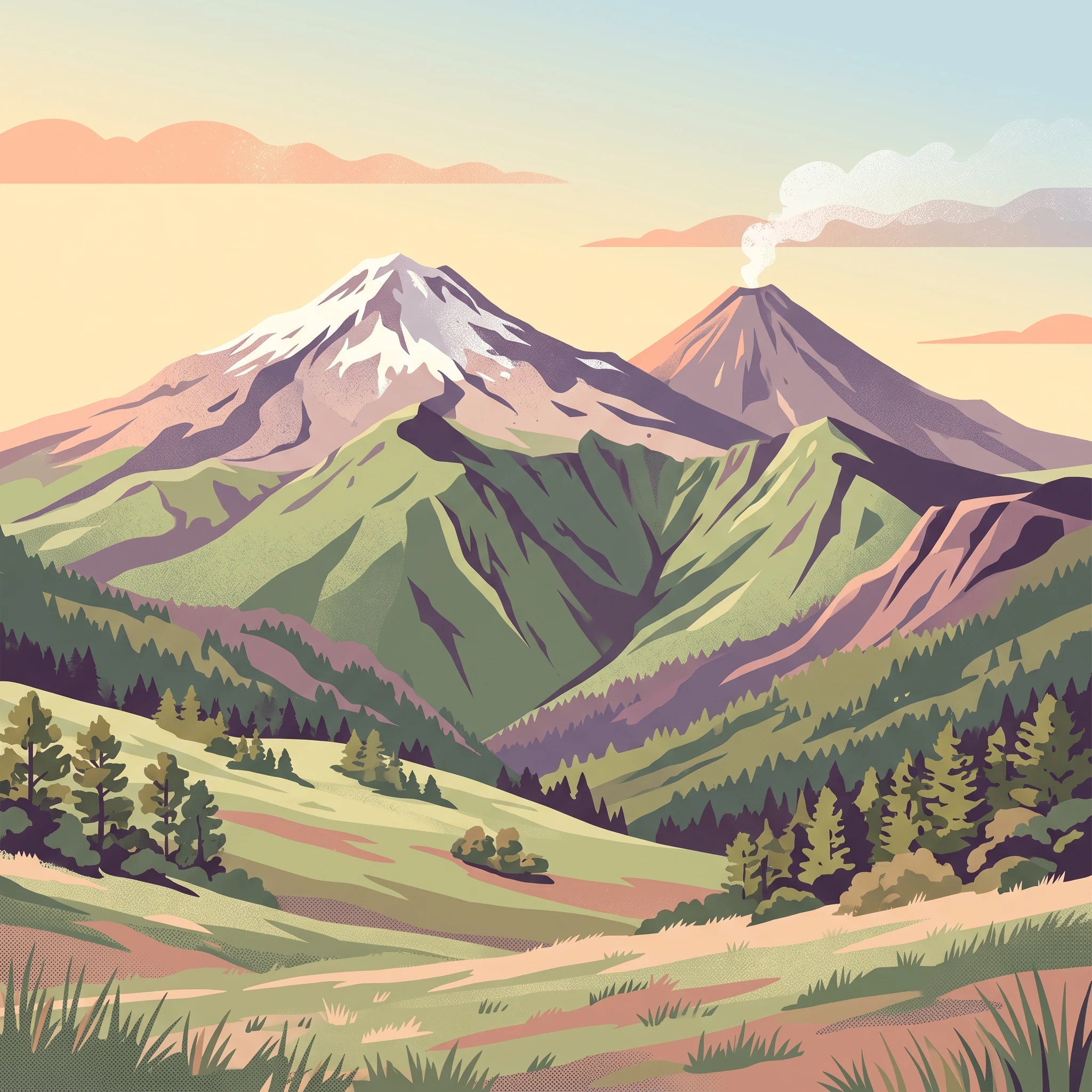
Volcán Nevado de Colima National Park occupies a remarkable position in Mexico's system of protected areas, preserving a volcanic landscape of exceptional geological and ecological significance. The park is located in the southern portion of the Sierra de Manantlán, a mountain range that forms part of the broader Trans-Mexican Volcanic Belt, a arc of volcanic activity that crosses central Mexico. The park's dual peaks represent distinct phases of volcanic evolution: Nevado de Colima is an older, eroded stratovolcano that has been inactive for thousands of years, while Volcán de Colima (Volcán de Fuego) is a younger, highly active cone that has been continuously erupting for centuries and remains the most active volcano in Mexico. The park covers approximately 65 square kilometers of mountainous terrain, with elevations ranging from the park boundary at 3,200 meters up to the summit of Nevado de Colima at 4,330 meters. The landscape is characterized by steep volcanic slopes, deep barrancas (canyons), and rocky terrain composed primarily of volcanic ash, basalt, and andesite. The park lies adjacent to the El Jabalí Flora and Fauna Protection Area to the southwest and is bordered by the Bosque Mesófilo Nevado de Colima State Park in Jalisco, which comprises several enclaves that adjoin the national park on the eastern and western flanks of the two peaks. This configuration creates an extended protected landscape that encompasses the entire volcanic complex.

Quick facts and research context for Volcán Nevado de Colima National Park

Located in the Trans-Mexican Volcanic Belt in western Mexico, the park straddles the border between Jalisco (approximately 89% of the area) and Colima states. It protects two volcanic peaks that lie approximately 9 kilometers apart: the older, inactive Nevado de Colima and the active Volcán de Fuego de Colima, Mexico's most frequently erupting volcano. The park's boundary follows the 3,200-meter elevation contour. Elevation ranges from around 2,200 meters to 4,260 meters at the summit of Nevado de Colima. The park features volcanic ash soils and contains ravines, forests, canyons, rivers, and small lakes. It was one of Mexico's earliest national parks, originally declared in 1936 under President Lázaro Cárdenas del Río.

Protection and recognition

Verifying the terrestrial protection scope and official designation history of the volcanic reserve

Volcán Nevado de Colima National Park Protected Area Status and History

Established in 1940, Volcán Nevado de Colima National Park represents a dedicated terrestrial conservation territory under national protection guidelines. Reviewing the documented status of the reserve clarifies its designation timeline and terrestrial boundaries within the network of protected volcanic landscapes.

Protection details

Protection scope
Terrestrial
Designated year
1940
Transboundary protection
No
Park context

Deeper park guide and search-rich context for Volcán Nevado de Colima National Park

Volcán Nevado de Colima National Park history, landscape, wildlife, and travel context

Explore Volcán Nevado de Colima National Park through its history, landscape character, ecosystems, wildlife, conservation priorities, cultural context, and seasonal travel timing in a structured park guide built for atlas discovery and search intent.

Why Volcán Nevado de Colima National Park stands out

The park is most distinctive for protecting both Mexico's most active volcano and a significant dormant volcanic peak within a single protected area. Volcán de Colima (Volcán de Fuego) has a history of continuous activity including frequent Strombolian eruptions, ash emissions, and periodic larger eruptions such as the significant event in June 2005. The contrasting character of the two peaks, one perpetually active and the other a quiescent ancient massif, creates a striking visual landscape. The park also protects important high-elevation pine-oak forests and subalpine grasslands (zacatonal) that represent rare habitat types in western Mexico, as well as supporting the red warbler (Cardellina rubra), an endemic Mexican bird species that has been adopted as the park's symbolic species.

Volcán Nevado de Colima National Park history and protected-area timeline

The park was established through presidential decree on September 5, 1936, during the administration of President Lázaro Cárdenas del Río, making it one of the first national parks created in Mexico following the revolution. The original decree recognized the exceptional natural value of the volcanic landscape and the need to protect its forests and watersheds. In 1940, the Mexican government modified the original decree, establishing the current boundaries of the park and publishing the final designation in the Diario Oficial de la Federación on December 6, 1940. The establishment of the park predates modern conservation frameworks and reflects an early recognition by the Mexican government of the importance of preserving unique volcanic landscapes. Over the decades, the park has faced ongoing challenges including illegal hunting, deliberate wildfires, and unauthorized logging, but significant advances have also been made in conservation infrastructure and community engagement. The creation of the Centro de Educación Ambiental La Joya, featuring an audiovisual hall, interactive exhibits, and a botanical laboratory, represents a major investment in environmental education. Additionally, a high-altitude nursery unique in Mexico has been established, along with a Centro de Cultura Ambiental that supports research and visitor education. Organized civil society through the Patronato del Nevado de Colima y Cuencas Adyacentes now plays an active role in conservation decisions and fundraising.

Volcán Nevado de Colima National Park landscape and geographic character

The park's landscape is defined by its volcanic origins, featuring two prominent stratovolcanoes that rise dramatically from the surrounding terrain. Nevado de Colima presents an ancient, heavily eroded cone with a summit crater approximately 150 meters in diameter, its slopes carved by erosion into deep barrancas and ravines. The mountain's name (meaning snow-covered) reflects its occasional snow-capped appearance at higher elevations, though it has been dormant for millennia. In contrast, Volcán de Colima (Volcán de Fuego) is an active stratovolcano with a summit crater measuring 1,800 meters in diameter and 250 meters deep, continuously emitting gases and vapors. The two peaks lie approximately 9 kilometers apart, creating a distinctive twin-peak silhouette visible from throughout the region. The park's terrain includes steep volcanic slopes, rocky ridgelines, and meadow areas at the highest elevations. The soils are predominantly volcanic ash, with exposures of basalt, andesite, and pumice. At subalpine elevations, the terrain opens into rolling grasslands known as zacatonal, creating a stark contrast to the forested lower slopes.

Volcán Nevado de Colima National Park ecosystems, habitats, and plant life

The park protects a critical ecological transition zone that spans multiple biomes. Plant communities transition from mixed pine-oak forests at lower elevations through fir (oyamel) forests to subalpine grassland at the highest elevations. The lower slopes support mixed forests dominated by pine species along with oak, while the mid-elevations feature fir forests in the moister microclimates. At the summit levels, the zacatonal grassland community comprises grasses and herbaceous plants adapted to the cold, windy conditions. According to national biodiversity surveys, the park supports more than 940 species of plants and animals, with 63 species listed in some category of risk under Mexican environmental regulations and 12 exotic species recorded. The diversity of habitats, from cloud forest to subalpine meadow, contributes to the park's ecological significance within the Trans-Mexican Volcanic Belt.

Volcán Nevado de Colima National Park wildlife and species highlights

The park supports a diverse mammalian fauna adapted to the mountainous environment. Native mammals include white-tailed deer (Odocoileus virginianus), puma (Puma concolor), coyote (Canis latrans), and collared peccary (Pecari tajacu). Additional species documented in the Spanish source include armadillo, raccoon, squirrel, and the collared peccary (referred to as pecarí). The park is also traversed periodically by jaguar (Panthera onca) moving between mountain ranges, though it is not a resident species. Avian diversity is particularly notable, with 102 bird species recorded within the park. These include the long-tailed wood partridge (Dendrortyx macroura), white-striped woodcreeper (Lepidocolaptes leucogaster), russet nightingale-thrush (Catharus occidentalis), brown-backed solitaire (Myadestes occidentalis), gray silky-flycatcher (Ptiliogonys cinereus), chestnut-sided shrike-vireo (Vireolanius melitophrys), golden-browed warbler (Basileuterus belli), red warbler (Cardellina rubra), crescent-chested warbler (Oreothlypis superciliosa), rufous-capped brushfinch (Atlapetes pileatus), green-striped brushfinch (Arremon virenticeps), and collared towhee (Pipilo ocai). The red warbler holds special significance as an endemic species to Mexico that has been chosen as the park's symbolic species.

Volcán Nevado de Colima National Park conservation status and protection priorities

The park represents an important conservation unit within Mexico's protected areas system, safeguarding both geological and biological values. As a Category II protected area under IUCN classification, the park aims to protect natural ecosystems while allowing for sustainable visitor use. The protection of the volcanic complex is significant given the ongoing geological activity of Volcán de Colima and the need to manage both the volcanic hazards and the natural values. The park's elevation range and location in the Trans-Mexican Volcanic Belt position it to protect rare high-elevation habitats that are limited in western Mexico. The presence of 63 species in risk categories under Mexican law (NOM-059) underscores the conservation importance of the area. Recent conservation advances include the establishment of educational facilities and research infrastructure, though ongoing challenges from illegal hunting, logging, and fire remain significant management concerns.

Volcán Nevado de Colima National Park cultural meaning and human context

The park lies in a region with deep historical roots in western Mexico, where the volcanic peaks have cultural significance for local communities. The park encompasses portions of municipalities in both Jalisco (Zapotitlán de Vadillo, Tuxpan, Tonila) and Colima (Cuauhtémoc, Comala), reflecting the administrative boundary that follows the volcanic ridge. Access to the park is via the road from Ciudad Guzmán to El Grullo, a route that passes through traditional rural communities. The natural resources of the area have historically supported local economies through forestry, agriculture, and more recently, ecotourism. Educational visits by schools and institutions are common, with programs focused on environmental education and field study of the park's biodiversity.

Top sights and standout views in Volcán Nevado de Colima National Park

The park offers a unique combination of active volcanic activity and protected high-altitude ecosystems in western Mexico. Visitors can experience the dramatic contrast between the perpetually active Volcán de Fuego and the ancient, dormant Nevado de Colima. The subalpine zacatonal grasslands at high elevation represent rare habitat in the region, while the diverse bird communities, including the endemic red warbler, attract ornithologists and nature enthusiasts. The park's historical significance as one of Mexico's earliest national parks, combined with ongoing conservation infrastructure including environmental education centers, provides context for its value. Hiking, mountaineering, and mountain biking are popular activities, with designated camping areas at La Joya, La Caperuza, Curva del Leñador, and Paraje La Calle.

Best time to visit Volcán Nevado de Colima National Park

The park's high-elevation location means that temperature and weather conditions vary significantly by season. Winter months (December through February) bring cold temperatures that can drop below freezing at night, with occasional snow on the higher peaks, though daytime conditions can be clear and pleasant. The summer months from April through September bring warmer temperatures ranging from 16 to 34 degrees Celsius, with the rainy season providing lush vegetation but also afternoon thunderstorms. The spring months of March and April offer a balance of mild temperatures and clearer conditions, while the early dry season in November can provide good visibility for viewing the volcanic landscape. Visitors planning activities should be prepared for the rapid changes in weather that occur at high elevation, and those attempting to summit the peaks should be equipped for alpine conditions regardless of the season.
Park guides

Focused questions and temporal insights for volcanic terrain exploration

Published Guides for Volcán Nevado de Colima National Park

Targeted guides provide structured answers for planning visits across the dual volcanic peaks of Volcán Nevado de Colima National Park. Specific reference material covers seasonal weather patterns and optimal visitation windows for evaluating dry hiking conditions versus humid mist vistas.
Monthly climate preview

Long-term temperature and precipitation patterns mapped at a representative park coordinate

Volcán Nevado de Colima National Park Climate and Monthly Weather Normals

Long-term observations at the representative elevation show a warm thermal cycle peaking before a pronounced wet phase, with daily precipitation dropping below one millimeter for multiple months. Accessing the full monthly breakdown reveals detailed minimum and maximum temperature swings across the annual cycle of the protected Jalisco landscape.
Annual mean21 °C
18 °C25 °C
Jan18°
Feb19°
Mar21°
Apr23°
May25°
Jun24°
Jul22°
Aug22°
Sep22°
Oct21°
Nov20°
Dec19°
Warmest month
May

24.5 °C

Coolest month
January

18 °C

Wettest month
September

6.7 mm/day

Driest month
April

0 mm/day

Park location guide

Geography guide, regional context, and park location map for Volcán Nevado de Colima National Park

Volcán Nevado de Colima National Park park geography, regions, and map view in Mexico

Understand where Volcán Nevado de Colima National Park sits in Mexico through a broader geographic reading of the surrounding landscape, nearby location context, and its mapped position within the national park landscape.

How Volcán Nevado de Colima National Park fits into Mexico

Mexico, officially the United Mexican States, is a country in North America spanning the Sierra Madre mountain ranges, coastal plains, and tropical regions. It borders the United States to the north, Guatemala and Belize to the southeast, and has coastlines along the Pacific Ocean, Gulf of Mexico, and Caribbean Sea. With a population exceeding 130 million, Mexico is home to one of the world's most significant concentrations of Indigenous languages alongside Spanish.

Wider geography shaping Volcán Nevado de Colima National Park in Mexico

Mexico occupies a land area of 1,972,550 km2, making it the thirteenth-largest country in the world. The terrain is highly diverse, featuring the Sierra Madre Occidental and Sierra Madre Oriental mountain ranges, the Mexican Plateau, coastal lowlands along the Pacific and Gulf/Caribbean margins, and the Yucatan Peninsula. The country spans multiple climate zones from desert in the north to tropical rainforest in the south.

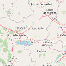
Map view of Volcán Nevado de Colima National Park

Use this park location map to pinpoint Volcán Nevado de Colima National Park in Mexico, understand its exact geographic position, and read its mapped placement within the surrounding landscape more clearly.

Pigeon | © OpenStreetMap contributors

Location context for Volcán Nevado de Colima National Park

ColimaJalisco
Park atlas

Explore regional protected area geography and diverse conservation landscapes surrounding Volcán Nevado de Colima.

Explore Other National Parks and Protected Areas Near Volcán Nevado de Colima National Park

After exploring Volcán Nevado de Colima National Park, browse a curated selection of other national parks and protected areas across western Mexico. Compare their diverse volcanic terrains, high-altitude ecosystems, and distinct conservation landscapes to understand broader regional patterns of protection.
Wildlife reserveColima
About 9.8 km away#1 closest

South

El Jabalí Flora and Fauna Protection Area: Volcanic Terrain and Forest Reserves in Colima

Mapping a diverse protected landscape in western Mexico

Located in the state of Colima, El Jabalí Flora and Fauna Protection Area presents a layered geography of volcanic slopes, pine-oak forests, and high-humidity cloud forest pockets. The area is defined by a series of permanent lagoons and streams that create a vital aquatic refuge. This entry provides a structured look at the physical boundaries and landscape characteristics of this essential Mexican wildlife sanctuary.

Area
51.79 km²
Established
2000
IUCN
VI
Relief
Mountain
State or regional parkJalisco
About 25 km away#2 closest

Northwest

Bosque Mesófilo Nevado de Colima State Park: Atlas and Geographic Landscape Overview

Protected montane ecosystems of the Jalisco volcanic complex

Bosque Mesófilo Nevado de Colima State Park serves as a crucial protected area on the volcanic slopes of western Mexico. The territory captures an entire elevational gradient, shielding rare cloud forest stands from disturbance while providing a detailed study of volcanic topography, ranging from deep barrancas to high-altitude subalpine zacatonal grassland.

Area
72.14 km²
Established
2009
Relief
Mountain
Scope
Terrestrial
Protected areaJalisco
About 63 km away#3 closest

North

Laguna de Sayula Protected Area: Exploring the Salt Lake Basins and Geography of Jalisco

Ramsar wetland habitat within the Neo-Volcanic Axis

Laguna de Sayula spans a shallow tectonic depression in central-western Mexico, defined by its endorheic lake system and saline margins. This protected area provides a critical flyway for migratory birds while preserving a unique landscape of volcanic mountains, tropical deciduous forest, and ancestral salt harvesting sites. Trace the boundaries and natural features of this significant wetland in the southern region of Jalisco.

Area
168 km²
Relief
Lowland
Climate
Subtropical
Access
Access unknown
Wildlife reserveJalisco
About 93 km away#4 closest

Northwest

Sierra de Quila: Protected Mountain Geography and Forested Wildlife Reserve in Western Jalisco

Mapped terrain, watershed boundaries, and high-altitude forest ecosystems

Sierra de Quila stands as a prominent protected mountain range in western Jalisco, offering a unique mosaic of pine, oak, and mesophilic cloud forests. This wildlife reserve serves as a essential natural anchor for regional biodiversity and watershed protection, with its rugged canyons and dramatic elevation changes providing a distinct geographical profile within the broader Mexican landscape.

Area
151.92 km²
Established
1982
Relief
Mountain
Climate
Temperate
Wildlife reserveJalisco
About 108 km away#5 closest

Northeast

Lake Chapala Wildlife Reserve: A Geographic Exploration of Mexico's Largest Freshwater Basin

Highland volcanic landscapes and protected wetland boundaries in Jalisco

Lake Chapala functions as the central hydrological anchor of the Lerma-Santiago watershed. Situated on a high volcanic plateau, this protected wildlife reserve spans a broad valley floor surrounded by dramatic sierras. Gain detailed perspective on its unique endemic fauna, including rare fish species and migratory waterbirds, while navigating the mapped geography of its shoreline, islands, and basin-wide ecological footprint.

Area
1,100 km²
Established
2009
Relief
Mixed relief
Climate
Temperate
Biosphere reserveJalisco
About 126 km away#6 closest

North

La Primavera Biosphere Reserve: Mapping Volcanic Landscapes and Protected Watersheds

Ecological geography and forest distribution in Jalisco, Mexico

Centering on the Sierra la Primavera volcanic complex, this biosphere reserve functions as an essential green corridor and water catchment zone. The terrain consists of a complex mosaic of vegetation types, including pine-oak forests and relict cloud forest patches across high-elevation ridges. Discover the structural role of these protected lands in moderating the climate and supporting biodiversity in the Guadalajara metropolitan region.

Area
305 km²
Established
2000
IUCN
VI
Relief
Mountain
Nature reserveJalisco
About 133 km away#7 closest

North

Barranca de Oblatos: Protected Canyon Nature Reserve and Geographical Landmark in Jalisco

Urban-adjacent nature reserve and protected river corridor

Barranca de Oblatos is a striking geological feature and nature reserve that anchors the biodiversity of the Guadalajara metropolitan region. Featuring a deep canyon system carved by the Rio Grande de Santiago, this protected area holds a complex mosaic of tropical deciduous forests and historical landmarks within its dramatic vertical walls. Explore the landscape context and natural boundaries that define this essential western Mexican wilderness area.

Area
11.37 km²
Established
1997
Relief
Highland
Climate
Subtropical
Protected areaZapopan
About 136 km away#8 closest

North

Bosque el Nixticuil Protected Area: Mapping the Urban Forest Landscape in Zapopan

Volcanic terrain and watershed protection in Jalisco

Bosque el Nixticuil represents a key case of community-led urban conservation. Covering roughly 1,860 hectares in the municipality of Zapopan, this area protects a rare old-growth oak and pine ecosystem from metropolitan development. The park encompasses diverse topographic features including shallow canyons and plains, serving as a vital ecological anchor for the surrounding Río Blanco basin.

Area
18.6 km²
Established
2008
Visitors
3.2M annual
Relief
Mixed relief

Common questions about visiting, size, designation, and location context for Volcán Nevado de Colima National Park

Volcán Nevado de Colima National Park FAQs for park facts, access, geography, and protected area context

Find quick answers about Volcán Nevado de Colima National Park, including protected-area facts, park geography, trail and visitor context, and how the park fits into its surrounding country and regional landscape.
MoriAtlas Explorer

Continue Your Protected Areas Search Across the Global Atlas

Deepen your exploration by continuing the structured search for national parks and protected areas worldwide. Utilize the comprehensive filtering capabilities to compare different conservation landscapes and refine your understanding of global park geography. Discover more about the distribution and characteristics of protected natural areas.

Global natural geography