
Why Laguna de Sayula stands out
Laguna de Sayula is best known as a high-elevation salt lake that serves as an important stopover for migratory North American birds. Its Ramsar designation in 2004 reflects the lake's international significance for waterbird conservation along a key flyway in central-western Mexico. The lake is also recognized for its setting within a closed basin bordered by volcanic mountain ranges, which gives it a distinct endorheic character. Salt-tolerant vegetation and tropical deciduous forest surrounding the lake add ecological complexity, while the lake's long history of human use, especially Indigenous salt harvesting going back more than two millennia, makes it a notable cultural as well as ecological landmark of Jalisco.
Laguna de Sayula history and protected-area timeline
Laguna de Sayula has a long pre-Hispanic history of human settlement around its shores, dating back more than two thousand years. Archaeological research in the region has identified four major occupation phases: the Usmajac phase (roughly 200 BCE to 200 CE), the Verdía phase (approximately 0 to 450 CE), the Sayula phase (450 to roughly 1100 CE), and the Amacueca phase (1100 to around 1530 CE).
During the Sayula phase, communities organized monumental architecture, expanded agricultural terracing, and developed an industry based on extracting salt from the lake margins. Their iconic cuencos salineros Sayula; bowl-shaped earthen pits used to concentrate brine and harvest salt, became a defining feature of the local economy. Throughout all these phases, the lake served as a center of settlement, resource extraction, and regional exchange.
In the late pre-Hispanic period, the surrounding region was incorporated into the Tarascan sphere of influence, leaving traces of broader Mesoamerican connections in the archaeological record. Today, more than 170 archaeological sites have been documented around the lagoon, several of which show evidence of planned urban layouts, making the Laguna de Sayula basin one of the most archaeologically dense lake settings in Jalisco.
In modern times, recognition of the lake's ecological importance culminated on 2 February 2004, when it was designated a Ramsar Wetland of international importance. This formal protection highlights the lake's continuing role as habitat for migratory birds and acknowledges the slow environmental changes, especially the gradual decline in water levels since the 1990s, that have affected the basin.
Laguna de Sayula landscape and geographic character
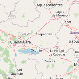
Laguna de Sayula occupies a broad, shallow tectonic depression in central-western Mexico, framed dramatically by the Sierra de Tapalpa to the west and the Sierra de Mazamitla to the east. This setting, within the larger Zacoalco-Guzmán system of faults and basins, places the lake among a chain of endorheic basins running along Mexico's Neo-Volcanic Axis.
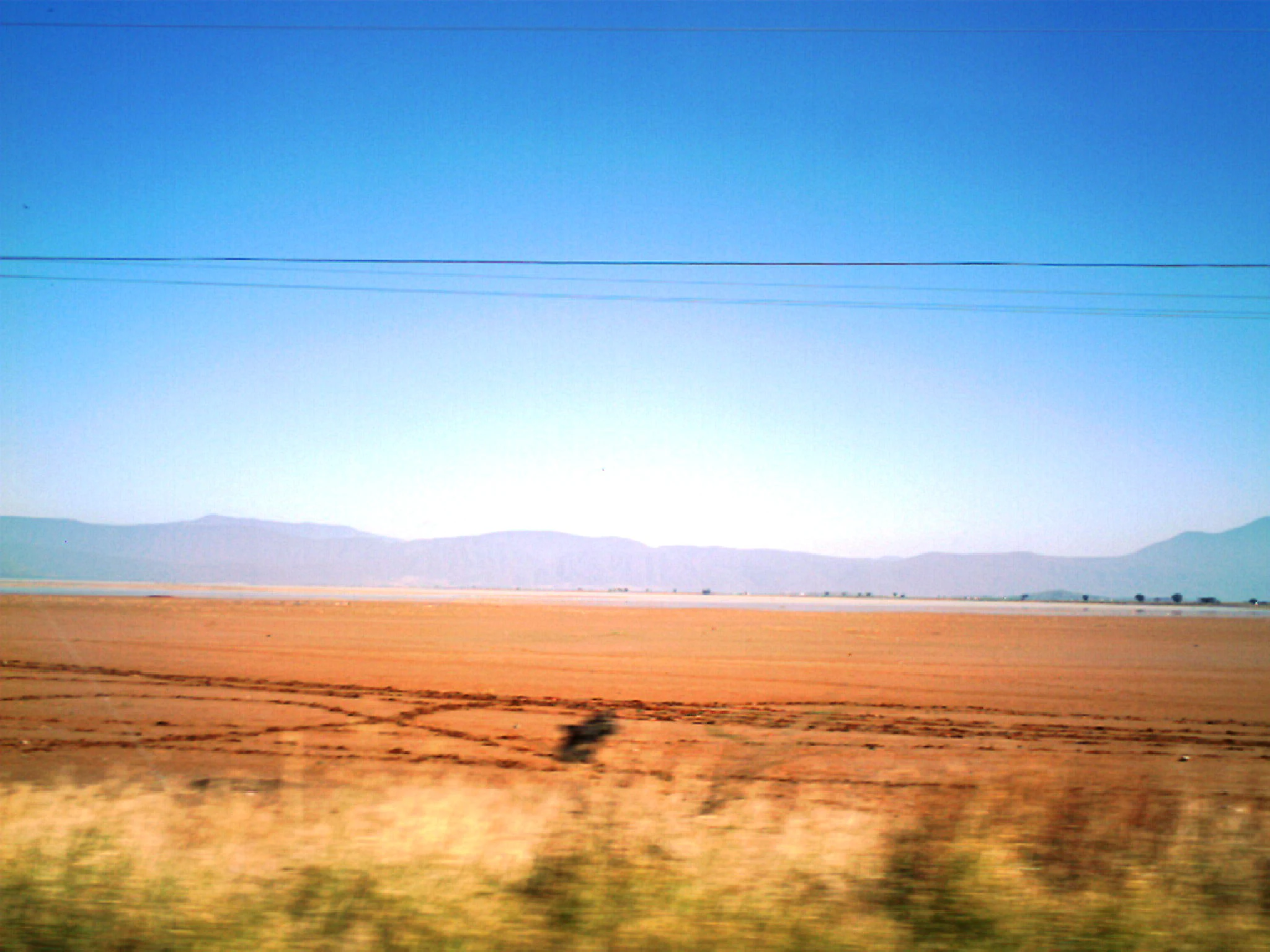
At about 1,350 meters above sea level, the lake sits in a mid-elevation landscape characterized by rolling hills, volcanic terrain, and seasonal aridity. The shoreline is long and irregular, roughly 90 km in extent, and includes beaches of fine sediment, muddy flats, and shallow margins that gradually grade into halophytic vegetation zones. The two small islands, Isla Chica and Isla Grande, break the open surface of the lake and rise as low oval features of less than a square kilometer each.
Because the basin is closed, the lake does not drain outward to the sea; instead, it loses water through evaporation and depends on seasonal rainfall and local inflows from streams and springs. This produces a dynamic landscape where shallow saline margins, occasional freshwater pockets, and exposed flats all coexist within a relatively small geographic footprint, giving the lake a varied and visually rich shoreline.
Laguna de Sayula ecosystems, habitats, and plant life
Laguna de Sayula is a wetland ecosystem defined by the interplay of saline conditions, volcanic basin geography, and seasonal waterbird migration. Its Ramsar designation reflects its importance as a habitat for migratory birds traveling along North American flyways, and the wetland's character is shaped by the fact that water, more than soil or altitude, controls vegetation and animal life here.
Vegetation around the lake is strongly adapted to the saline environment. Halophytic plant communities dominate the immediate shoreline, with low-lying salt-tolerant grasses, succulents, and shrubs forming an important ecological buffer. Slightly inland and on the surrounding hills, including the two islands, tropical deciduous forest becomes more prominent, with mesquite, acacias, bursera, and fig trees forming characteristic canopies. Aquatic vegetation is limited and tends to concentrate in small pockets of fresher water within the otherwise saline lake.
As part of the closed Sayula-Atotonilco basin, the lake functions within a broader endorheic hydrological system where evaporation, not outflow, is the main water exit. This creates conditions that both concentrate salts and amplify the lake's sensitivity to climate variability, giving rise to an ecological system that is highly specialized and tightly adapted to its setting.
Laguna de Sayula wildlife and species highlights
The wildlife of Laguna de Sayula is characteristic of wetland and semi-arid environments in central Mexico, with a particularly strong seasonal component related to migratory birds. In winter, the lake is an important destination for North American migratory species, including snow geese (Chen caerulescens) and the killdeer (Charadrius vociferus), as well as other shorebirds that use the saline margins and shallow flats as feeding and resting habitat.
Beyond migratory visitors, the lake supports year-round populations of raptors, with eagles and hawks patrolling the open water and surrounding hills. Turtles are also reported in the lake and its margins, and a diverse insect community supports the broader food web of the wetland. Local reptiles, small mammals, and typical birdlife of the surrounding tropical deciduous forest further enrich the fauna of the area.
Although the lake has experienced gradual reduction in water levels since the early 1990s, its mix of saline flats, shallow water, islands, and adjacent forest continues to support a diversity of species that depends on this particular combination of habitats.
Laguna de Sayula conservation status and protection priorities
Laguna de Sayula's principal conservation significance lies in its role as an internationally recognized wetland for migratory birds. Its designation as a Ramsar site on 2 February 2004 confirmed its value as habitat for waterbirds along a major North American flyway and placed it within a global network of protected wetlands.
The lake's ecological importance is heightened by its position within an endorheic basin, making its water and salinity balance particularly sensitive. Gradual lowering of water levels since the 1990s has been a significant ecological concern, affecting the extent and quality of habitat available for both resident and migratory species. Conservation attention therefore focuses on preserving the wetland's hydrology, its halophytic vegetation, and the mosaic of habitats that together support its biodiversity.
Recognition of the area's archaeological richness, with more than 170 documented sites around the lake, has also contributed to a broader understanding of the basin as a landscape of both natural and cultural value. Together, these factors give Laguna de Sayula a dual profile as an ecological priority and a protected cultural landscape in Jalisco.
Laguna de Sayula cultural meaning and human context
Laguna de Sayula has been a center of human life in southern Jalisco for more than 2,000 years, with the surrounding basin containing an unusually high density of archaeological sites. The lake is closely associated with the pre-Hispanic tradition of salt extraction using the cuencos salineros, bowl-shaped earthen pits in which brine was concentrated and salt harvested, a practice tied especially to the Sayula phase (c. 450-1100 CE) but influential across the region.
Settlement around the lake evolved over four main occupational phases, from early agricultural communities of the Usmajac phase through the structured monumental architecture of the Sayula phase to the politically complex and more externally connected Amacueca phase. In its later pre-Hispanic stage, the region became part of the broader Tarascan sphere, an affiliation visible in ceramic styles and other archaeological evidence.
Today, the lake sits within a landscape of several municipalities, including Sayula, Amacueca, Techaluta de Montenegro, and Atoyac, and remains a defining element of local identity. Its combination of salt-making heritage, Indigenous settlement history, and ongoing ecological importance makes it a place where natural and cultural history continue to intersect visibly in the present-day landscape.
Top sights and standout views in Laguna de Sayula
Laguna de Sayula stands out as one of the few endorheic salt lakes in Jalisco with both Ramsar recognition and a major pre-Hispanic archaeological footprint. Its location between the Sierra de Tapalpa and the Sierra de Mazamitla gives it a visually distinct basin setting, while its shallow waters, small islands, and long irregular shoreline create a varied wetland environment within a relatively compact area.
The lake is a key seasonal destination for migratory waterbirds, and its saline margins support specialized halophytic vegetation that is unusual at this elevation. Layered on top of these natural features is a richer cultural heritage than most Mexican lakes of comparable size, shaped by centuries of Indigenous salt production and dense archaeological occupation around its shores.
Best time to visit Laguna de Sayula
Laguna de Sayula is most striking from late autumn through winter, when migratory North American birds, including snow geese and killdeer, arrive in the area and concentrate along the lake's shallow margins and saline flats. The cooler, drier months typically bring clearer skies and more comfortable conditions for exploring the surrounding basin, while also highlighting the muted tones of the halophytic shoreline vegetation.
Spring and early summer can produce greener surroundings as the tropical deciduous forest on the surrounding hills leafs out, but seasonal aridity and evaporation remain dominant in the lake basin. Because the lake has experienced gradual reductions in water levels since the 1990s, the precise extent and condition of wetland habitat can vary from year to year, influencing bird numbers and visibility at any given time.