
Mori Atlas logo
Nature reserveWälder mit Schluchten zwischen Wartburg und Hohe Sonne

A detailed geographic overview of the protected forest gorges and ridgelines in central Thuringia

Wälder mit Schluchten zwischen Wartburg und Hohe Sonne Nature Reserve Landscape and Atlas Geography

(Naturschutzgebiet Wälder mit Schluchten zwischen Wartburg und Hohe Sonne)

Wälder mit Schluchten zwischen Wartburg und Hohe Sonne represents a vital protected landscape in the northwestern Thuringian Forest of central Germany. This nature reserve is defined by its deeply incised gorges such as the Drachenschlucht and Landgrafenschlucht, which cut through extensive mixed deciduous woodlands. Beyond its complex forest terrain and rocky ravines, the area includes the historic cultural landmark of the Wartburg, creating a uniquely layered regional topography that serves as a reference for protected habitats in the Thuringia region.

protected forestmixed deciduous forestgorges and ravinesThuringian ForestWartburg landscapenature reserve
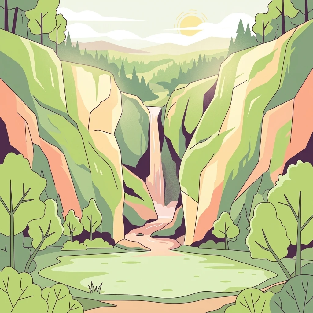
A flat-style digital illustration showing a deep, tree-lined canyon with a waterfall cascading into a small pool, set against a soft sunset sky.

Wälder mit Schluchten zwischen Wartburg und Hohe Sonne

Nature reserve

Park overview

Structured park overview, official facts, and landscape profile for Wälder mit Schluchten zwischen Wartburg und Hohe Sonne

Wälder mit Schluchten zwischen Wartburg und Hohe Sonne park facts, protected area profile, and essential visitor context

Review the core facts for Wälder mit Schluchten zwischen Wartburg und Hohe Sonne, including designation, size, terrain, visitor scale, habitats, and operating context in one park-focused overview.

About Wälder mit Schluchten zwischen Wartburg und Hohe Sonne

Wälder mit Schluchten zwischen Wartburg und Hohe Sonne is a protected nature reserve that anchors the southern edge of Eisenach within the forested uplands of the Thuringian Forest. Designated and expanded in 2015, it built on a much earlier reserve first declared in 1961 under the former East German nature conservation law. Today it represents the only Naturschutzgebiet within the city boundary of Eisenach, with a small additional portion reaching into the Gerstungen municipality.

The reserve lies in the natural landscape region known as the Northwestern Thüringer Wald, a transitional section of the Thuringian Forest where the upland ridge descends toward the Werra valley. It straddles both sides of federal road B 19 where this road crosses the crest of the Thuringian Forest between Wilhelmsthal and Eisenach, and it sits close to the B 84 corridor to the northwest. This central transport position across the ridge has not diminished the area's ecological value; rather, it places the protected forest right at the historic passage points of the region.

Ecologically, the reserve is a representative example of the mixed deciduous forest communities typical of the northwestern Thuringian Forest. Its woodland mosaic includes beech forests on more acidic substrates as well as richer herb beech forests on favorable soils, creating a structured forest landscape that has been protected, in various forms, for several decades. The combination of closed forest canopy, steep gorge walls, and small aquatic features such as the Knöpfelsteiche ponds gives the area both habitat diversity and visual drama.

The reserve is equally significant as a cultural landscape. Within its boundary lies the Wartburg, the UNESCO-listed castle associated with Martin Luther and the medieval Landgraves of Thuringia, while the Hohe Sonne ridge marks the point where the historic Rennsteig trail intersects the B 19. This overlap of forest protection with nationally and internationally important cultural sites distinguishes the area from purely natural reserves and makes it a key reference point for Thuringia's combined natural and heritage identity.

Quick facts and research context for Wälder mit Schluchten zwischen Wartburg und Hohe Sonne

Wälder mit Schluchten zwischen Wartburg und Hohe Sonne is a Thuringian nature reserve within the Wartburgkreis district, covering parts of Eisenach and the municipality of Gerstungen. It is classified as an IUCN Category IV habitat and species management area and is registered in the World Database on Protected Areas. The reserve lies in the natural region of the Northwestern Thüringer Wald and straddles the ridge of the Thuringian Forest where federal road B 19 crosses the upland. The territory includes the Wartburg, a UNESCO World Heritage site, and touches the historic crossing of the Rennsteig long-distance path at the Hohe Sonne. The current designation followed a 2015 expansion and renaming of a reserve first established in 1961.

Protection and recognition

Review documented protected area designation details and formal registry records.

Wälder mit Schluchten zwischen Wartburg und Hohe Sonne Protection Status and Data

Examine the recorded protection status and official designation history associated with Wälder mit Schluchten zwischen Wartburg und Hohe Sonne. Registry records provide foundational conservation data including structured WDPA identifier references for this protected landscape.

Protection details

WDPA ID
14486
Park context

Deeper park guide and search-rich context for Wälder mit Schluchten zwischen Wartburg und Hohe Sonne

Wälder mit Schluchten zwischen Wartburg und Hohe Sonne history, landscape, wildlife, and travel context

Explore Wälder mit Schluchten zwischen Wartburg und Hohe Sonne through its history, landscape character, ecosystems, wildlife, conservation priorities, cultural context, and seasonal travel timing in a structured park guide built for atlas discovery and search intent.

Why Wälder mit Schluchten zwischen Wartburg und Hohe Sonne stands out

The reserve is best known for its deeply incised forest gorges, most prominently the Drachenschlucht and the Landgrafenschlucht, which cut through the forested ridge just south of Eisenach. These dramatic narrow ravines, set within old mixed beech and oak woodland, are among the most iconic landscape features of the northwestern Thuringian Forest. Wartburg Castle, a UNESCO World Heritage site, sits within the protected area, giving the reserve an unusual blend of high-conservation forest habitat and internationally recognized cultural heritage. The combination of gorge scenery, ridge forest, and the historic Rennsteig crossing at Hohe Sonne defines the reserve's identity.
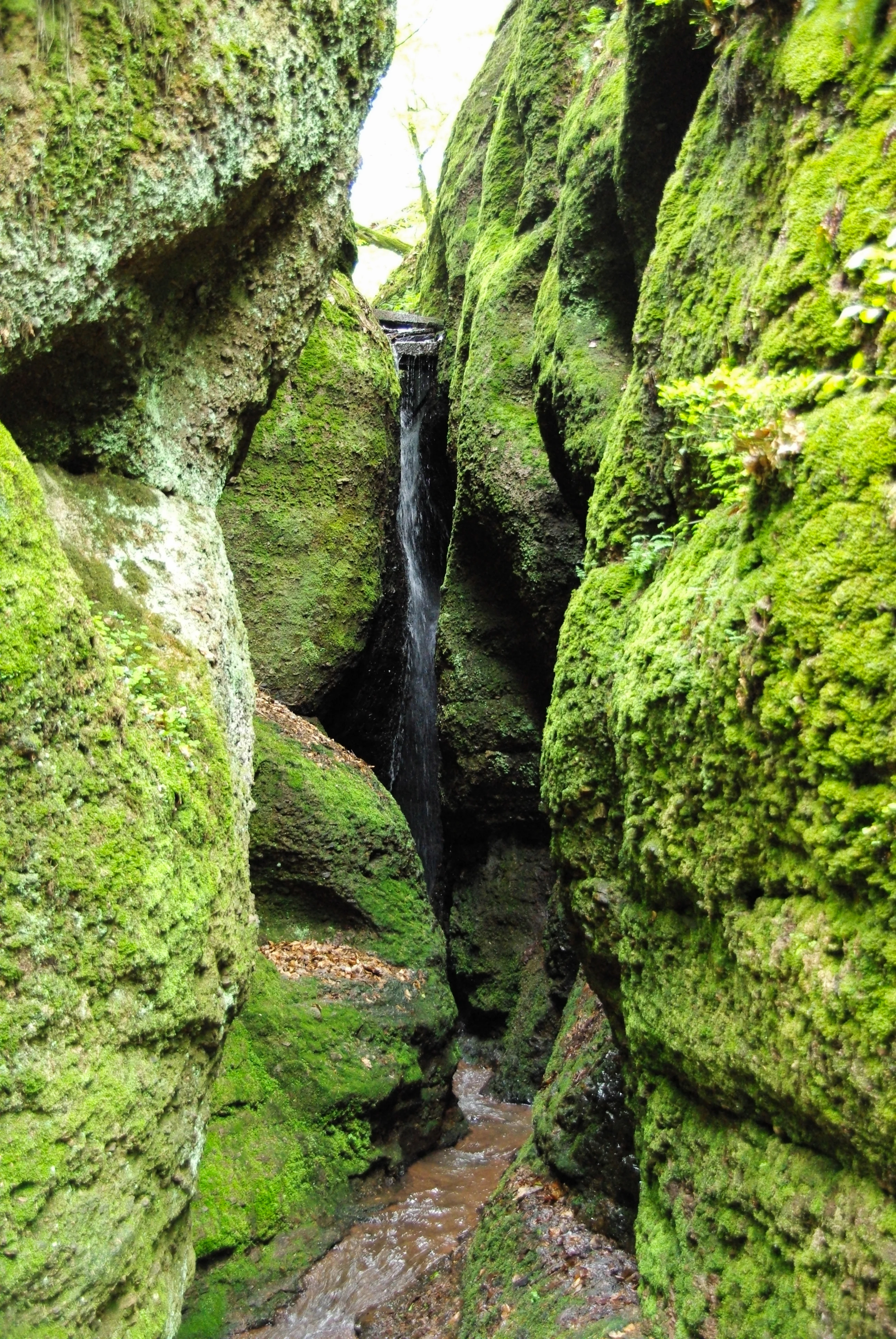
A narrow, vertical gorge with steep, moss-covered rock walls and a small waterfall cascading into a narrow stream at the base.
A narrow section of the Drachenschlucht gorge featuring a small waterfall between moss-covered rock walls.

Wälder mit Schluchten zwischen Wartburg und Hohe Sonne history and protected-area timeline

The area now known as Wälder mit Schluchten zwischen Wartburg und Hohe Sonne was first protected in 1961, when roughly 586 hectares were designated as the Naturschutzgebiet "Wartburg – Hohe Sonne" under the East German law for the preservation and care of native nature. That early designation already recognized both the forest communities along the Eisenach ridge and the narrow gorges of the Drachenschlucht and Landgrafenschlucht as worthy of formal protection.

After German reunification, responsibility for the reserve passed to Thuringia's nature conservation authorities. In 2015, the protected area was significantly redrawn and enlarged to about 788 hectares, and the name was updated to Wälder mit Schluchten zwischen Wartburg und Hohe Sonne to reflect the expanded boundaries and the growing emphasis on the gorge landscapes. The renewed designation kept the original conservation intent but strengthened it under modern Thuringian and federal nature protection law.

The area's broader significance had long been shaped by its association with Wartburg Castle, which had been recognized as a UNESCO World Heritage site well before the reserve's 2015 redesign, and by the historic Rennsteig long-distance path, whose crossing at the Hohe Sonne has shaped travel through the Thuringian Forest for centuries. The 2015 enlargement explicitly incorporated more of the wooded slopes and gorges that connect these cultural landmarks with the surrounding forest landscape.

Wälder mit Schluchten zwischen Wartburg und Hohe Sonne landscape and geographic character

The landscape of the reserve is shaped by the forested ridge of the northwestern Thuringian Forest and the steep gorges that cut into it. The terrain rises from the southern outskirts of Eisenach into the wooded upland, with the crest of the Thuringian Forest running through the protected area. Forest cover is continuous across the ridge and slopes, broken only by narrow valleys, road corridors, and the occasional rocky gorge wall.

The most distinctive landforms are the deeply incised gorges. The Drachenschlucht, southeast of Eisenach, is a narrow, steep-sided ravine that has become one of the Thuringian Forest's most visited natural attractions. Nearby, the Landgrafenschlucht adds another system of forested clefts and rock walls, together creating a varied micro-topography of shaded rock faces, boulder fields, and cool humid woodland. Small ponds, including the Knöpfelsteiche, punctuate the gentler parts of the reserve and add open water features to an otherwise heavily forested terrain.

The reserve sits at a key crossing point on the ridge, where federal road B 19 traverses the Thuringian Forest and where the historic Rennsteig trail meets the B 19 at the Hohe Sonne. The Wartburg, a medieval hilltop castle and UNESCO World Heritage site, rises from the northwestern part of the protected area, lending the landscape a strong cultural silhouette against the wooded slopes.

Wälder mit Schluchten zwischen Wartburg und Hohe Sonne ecosystems, habitats, and plant life

The ecological character of the reserve is dominated by mixed deciduous forest, which is the defining habitat type across the ridge and the gorge slopes. The woodland communities of the Northwestern Thüringer Wald include acid-sensitive beech forests on poorer substrates, mixed oak forests, and richer herb-rich beech forests on more favorable soils, together supporting a varied herb layer and a diverse forest structure.

Within the gorges, the microclimate is distinctly cooler and more humid than on the open ridge, allowing moisture-loving plants, ferns, and mosses to thrive on rock faces and along streams. Fallen deadwood, rocky outcrops, and stable boulder fields add structural diversity that supports a wide range of forest-dwelling invertebrates, fungi, and lichens. Outside the gorges, the more uniform ridge forest still maintains a closed canopy age structure typical of long-protected stands.

The Knöpfelsteiche ponds and smaller wet features contribute aquatic and amphibious habitats within an otherwise dry forest setting, and the transition zones between open water, wet soil, and surrounding woodland create valuable edge habitats. The combined effect of gorge, ridge, and small water body habitats gives the reserve a reputation as a representative forest reference area for the northwestern Thuringian Forest.

Wälder mit Schluchten zwischen Wartburg und Hohe Sonne wildlife and species highlights

Wildlife in the reserve reflects the closed-canopy, structurally diverse mixed forest typical of the northwestern Thüringer Wald. The mature beech and oak stands, with abundant deadwood and rocky terrain, support a rich community of forest birds, small forest mammals, and woodland invertebrates. The gorge environments, in particular, are known for their sheltered conditions that sustain species more sensitive to disturbance and drought.

The ponds and damp microhabitats of the reserve add amphibian and aquatic invertebrate interest to a generally dry forest landscape. Overall, the reserve functions primarily as a habitat and species management area, with its wildlife value tied closely to the continuity and structural richness of its forest and gorge habitats rather than to any single charismatic species.

Wälder mit Schluchten zwischen Wartburg und Hohe Sonne conservation status and protection priorities

Conservation significance in the reserve centers on the long-term protection of the mixed deciduous forest communities that exemplify the northwestern Thüringer Wald, and on the protection of the gorge systems of the Drachenschlucht and Landgrafenschlucht. By maintaining large contiguous forest stands and steep ravine habitats, the reserve helps preserve forest interior conditions, deadwood continuity, and the microclimatic refuges that exist within the gorges.

The 2015 expansion from the original 1961 boundary broadened the area to roughly 788 hectares, increasing the buffer around the gorges and the Wartburg area and placing additional forest and rock habitats under formal protection. The reserve is classified as an IUCN Category IV habitat and species management area, confirming its role in targeted protection rather than strict wilderness preservation. Overlap with the UNESCO-listed Wartburg also gives the conservation effort a strong cultural landscape dimension, linking forest protection with the stewardship of one of Germany's most important historical sites.

Wälder mit Schluchten zwischen Wartburg und Hohe Sonne cultural meaning and human context

The reserve is deeply intertwined with the cultural landscape of Thuringia. The Wartburg, a medieval castle that has been a UNESCO World Heritage site since 1999, lies within the protected area, anchoring the reserve to centuries of German political, religious, and literary history; Martin Luther translated the New Testament there, and the castle remains a national symbol.

The Hohe Sonne, where the historic Rennsteig long-distance trail crosses federal road B 19, marks another long-standing cultural node within the reserve. The Rennsteig has shaped travel and identity across the Thuringian Forest for centuries, and its passage through the protected area ties the reserve into the broader cultural narrative of the Thüringer Wald as a landscape of paths, forest uses, and traditional regional identity.

Top sights and standout views in Wälder mit Schluchten zwischen Wartburg und Hohe Sonne

Standout features of the reserve include the deeply carved Drachenschlucht and Landgrafenschlucht ravines, which provide some of the most dramatic forest gorge scenery in the northwestern Thuringian Forest. Equally notable is the inclusion of Wartburg Castle, a UNESCO World Heritage site that gives the protected area an unusual blend of natural and cultural significance. The continuous mixed deciduous forest, the small Knöpfelsteiche ponds, and the ridge crossing of the historic Rennsteig together make the reserve a compact yet richly layered landscape at the southern edge of Eisenach.

Best time to visit Wälder mit Schluchten zwischen Wartburg und Hohe Sonne

The reserve can be experienced across the seasons, but each brings a different character. Spring and early summer highlight fresh green beech foliage, flowering forest herbs, and active birdlife in the canopy and gorges, while also offering comfortable walking conditions along the Drachenschlucht and broader forest trails. Late summer and early autumn bring the dense, shaded forest atmosphere of the gorges into focus, with cooler air in the ravines and warmer conditions on the more open ridge. In winter, the deciduous canopy opens up, the gorge rock walls and castle silhouette become more visible against bare branches, and snow conditions can transform the forest into a quiet, low-light landscape ideal for reflective walking along established paths.


Monthly climate preview

Long term temperature and precipitation patterns across the representative park coordinate

Wälder mit Schluchten zwischen Wartburg und Hohe Sonne Climate Normals and Weather by Month

Representative coordinate records trace long term annual temperature ranges and steady precipitation rates across the protected landscape. Full monthly climate profiles provide detailed breakdown metrics for twelve distinct meteorological cycles.
Annual mean8 °C
-1 °C18 °C
Jan-1°
Feb
Mar
Apr
May12°
Jun16°
Jul18°
Aug18°
Sep14°
Oct
Nov
Dec
Warmest month
July

18.3 °C

Coolest month
January

-1.1 °C

Wettest month
July

2.6 mm/day

Driest month
April

1.4 mm/day

Park location guide

Geography guide, regional context, and park location map for Wälder mit Schluchten zwischen Wartburg und Hohe Sonne

Wälder mit Schluchten zwischen Wartburg und Hohe Sonne park geography, regions, and map view in Germany

Understand where Wälder mit Schluchten zwischen Wartburg und Hohe Sonne sits in Germany through a broader geographic reading of the surrounding landscape, nearby location context, and its mapped position within the national park landscape.

How Wälder mit Schluchten zwischen Wartburg und Hohe Sonne fits into Germany

Germany is a federal republic in Western and Central Europe with a population of over 83 million across sixteen constituent states. It is Europe's largest economy by nominal GDP and a major global exporter and importer. The capital is Berlin, and the country borders Denmark, Poland, Czech Republic, Austria, Switzerland, France, Luxembourg, Belgium, and the Netherlands.

Wider geography shaping Wälder mit Schluchten zwischen Wartburg und Hohe Sonne in Germany

Germany is located in Western and Central Europe, spanning 357,022 km². It borders Denmark to the north, Poland and the Czech Republic to the east, Austria and Switzerland to the south, and France, Luxembourg, Belgium, and the Netherlands to the west. The country has coastlines on the Baltic Sea and North Sea to the north, with the Alps located in the southern region.

Map view of Wälder mit Schluchten zwischen Wartburg und Hohe Sonne

Use this park location map to pinpoint Wälder mit Schluchten zwischen Wartburg und Hohe Sonne in Germany, understand its exact geographic position, and read its mapped placement within the surrounding landscape more clearly.

Pigeon | © OpenStreetMap contributors

Location context for Wälder mit Schluchten zwischen Wartburg und Hohe Sonne

Thuringia

Explore protected forest environments, steep gorges, and ridge terrain through detailed visual references.

Visualizing Wälder mit Schluchten zwischen Wartburg und Hohe Sonne: Landscape and Scenery Photography

Examine high-resolution photography documenting the rugged forest ravines, mixed deciduous canopies, and distinct topographical features of Wälder mit Schluchten zwischen Wartburg und Hohe Sonne. Photographic records provide clear visual context for the deep rock gorges, shaded woodland habitats, and historic protected landscapes defining the region.

A narrow, vertical gorge with steep, moss-covered rock walls and a small waterfall cascading into a narrow stream at the base.

A small, calm pond covered in a layer of light green algae, surrounded by dense deciduous trees and grassy banks.

Park atlas

Compare adjacent forest reserves and regional protected landscapes across the Thuringian upland.

Other Protected Areas and Parks Near Wälder mit Schluchten zwischen Wartburg und Hohe Sonne

Browsing nearby protected areas allows visitors to compare the ridge forests and deep ravines of Wälder mit Schluchten zwischen Wartburg und Hohe Sonne with other regional conservation landscapes. Extending the geographic review helps map the broader ecological spread and woodland terrain across central Germany.
Nature reserveThuringia
About 8 km away#1 closest

North

Werra bis Treffurt mit Zuflüssen: Protected River and Floodplain Network in Thuringia

Mapping an extensive 191 kilometer Natura 2000 river corridor.

The Werra bis Treffurt mit Zuflüssen protected area serves as a vital ecological corridor in Thuringia. This site encompasses a complex mosaic of fast-flowing highland brooks, expansive floodplain meadows, inland salt sites, and rare dissolution lakes. Its geography bridges high-altitude source regions with lower river valleys, creating a distinctive landscape transect that supports essential freshwater habitats and rare aquatic species across the state.

Area
22.6 km²
Established
2008
IUCN
IV
Relief
Mixed relief
Nature reserveThuringia
About 10 km away#2 closest

North

Werra-Aue zwischen Breitungen und Creuzburg: Protected Floodplain and River Geography

Nature reserve sanctuary in western Thuringia

Spanning over 33 kilometers of the Werra river, this protected floodplain is defined by its distinctive geological sinkholes, seasonal wetlands, and diverse bird habitats. Discover the layered conservation status and riparian terrain that mark this significant Thuringian nature reserve as a crucial node for European ecological connectivity.

Area
25.78 km²
Established
2007
IUCN
IV
Relief
Lowland
Watercolor illustration of a landscape featuring green fields, trees, a river, and distant hills under a pale sky
National parkThuringia
About 10 km away#3 closest

North

Hainich National Park: Protected Ancient Beech Forest Landscape in Thuringia, Germany

Regional geography and primeval forest boundaries

Hainich National Park occupies 75 square kilometers of the larger Hainich forest in western Thuringia. This canonical protected area is defined by its ancient beech woodland and ongoing forest restoration processes. The geography of the region, situated between Eisenach and Bad Langensalza, provides a critical example of primary forest dynamics and central European biodiversity, serving as an anchor for environmental research and landscape analysis.

Area
75 km²
Established
1997
IUCN
II
Climate
Temperate
A watercolor painting of a rolling, forested landscape with soft green and pink tones, featuring gentle hills and vegetation.
National parkThuringia
About 10 km away#4 closest

North

Nationalpark Hainich: Exploring the Geography of Thuringia's Beech Forest Wilderness

Mapped protected landscapes in the German heartland

Nationalpark Hainich protects one of the most important remaining deciduous woodlands in Central Europe. This detailed atlas entry covers the park's rolling terrain, the transition of its former training grounds into wild forest, and the geographic context of its position within the broader Thuringian landscape.

Area
75 km²
Established
1997
Relief
Upland
Climate
Temperate
A horizontal watercolor illustration showing a landscape with rolling, misty purple hills in the background and a line of stylized green and pink trees in the foreground, with a meandering river winding through the scene.
Nature reserveThuringia
About 11 km away#5 closest

North

Creuzburger Werratal-Hänge Nature Reserve: Geography and Protected Landscape Analysis

Muschelkalk cliffs and calcareous dry grasslands in Thuringia

Located in western Thuringia, the Creuzburger Werratal-Hänge nature reserve features an intricate mosaic of cliff faces, ravine forests, and nutrient-poor dry grasslands. This protected area stands out for its high density of orchid species and mosses, all sculpted by the erosional force of the river Werra through the regional limestone bedrock.

Area
1.47 km²
Established
2000
IUCN
IV
Relief
Mountain
Nature reserveThuringia
About 11 km away#6 closest

Northwest

Wilhelmsglücksbrunn Nature Reserve and Werra Valley Protected Landscape Geography

A mapped overview of inland saline springs in Thuringia

The Wilhelmsglücksbrunn nature reserve preserves a rare inland saline ecosystem within the flat Werra floodplain of western Thuringia. This site sustains a complex landscape of reed beds, wet meadows, and brine-fed habitats that connect to the broader Green Band ecological corridor, providing essential staging grounds for diverse migratory bird populations.

Area
0.773 km²
Established
2000
IUCN
IV
Relief
Lowland
Watercolor illustration of a lush river valley with gently rolling hills and trees under a soft, light sky.
Nature reserveWartburgkreis
About 12 km away#7 closest

North

Klosterholz und Nordmannssteine: Geography and Protected Area Landscape Context

Essential nature reserve mapping in the Wartburgkreis district

Klosterholz und Nordmannssteine is a significant nature reserve situated along the Werra river. This protected area features a striking vertical profile defined by exposed shell-limestone cliffs, diverse ravine forests, and remnants of industrial activity. It serves as a key site for calcareous flora and avian conservation within the broader ecological network of the Eichsfeld-Hainich-Werratal nature park region.

Area
1.395 km²
Established
1961
IUCN
IV
A soft watercolor painting showing a green landscape with a winding river and a prominent cliff face on the left, set against a white background.
Nature reserveWartburgkreis
About 13 km away#8 closest

North

Ebenauer Köpfe und Wisch Protected Landscape Map and Regional Geography

Nature reserve featuring Muschelkalk cliffs in the Wartburgkreis district

Analyze the geological formation and ecological importance of Ebenauer Köpfe und Wisch. This nature reserve encompasses steep canyon slopes, rare calcareous dry grasslands, and ancient rock communities essential to the Werra valley network.

Area
0.797 km²
Established
1996
IUCN
IV
Relief
Upland

Common questions about visiting, size, designation, and location context for Wälder mit Schluchten zwischen Wartburg und Hohe Sonne

Wälder mit Schluchten zwischen Wartburg und Hohe Sonne FAQs for park facts, access, geography, and protected area context

Find quick answers about Wälder mit Schluchten zwischen Wartburg und Hohe Sonne, including protected-area facts, park geography, trail and visitor context, and how the park fits into its surrounding country and regional landscape.
MoriAtlas Explorer

Continue Your Protected Areas Search Across the Global Atlas

Deepen your exploration by continuing the structured search for national parks and protected areas worldwide. Utilize the comprehensive filtering capabilities to compare different conservation landscapes and refine your understanding of global park geography. Discover more about the distribution and characteristics of protected natural areas.

Global natural geography