Viewpoints
Darßer Ort Lighthouse
35 m high

Detailed analysis of park boundaries, elevation ranges, and coastal landscape characteristics.
The geography profile of Western Pomerania Lagoon Area National Park provides data on its 805 square kilometer expanse within Mecklenburg-Vorpommern. This dataset includes boundary dimensions, elevation metrics ranging from 0 to 20 meters, and a comprehensive inventory of terrain features such as bays, reefs, and coastal ridges.
Germany's third-largest national park protecting Baltic Sea lagoons, shallow coastal waters, and critical migratory bird habitats
Western Pomerania Lagoon Area National Park is Germany's third-largest national park and the largest in the state of Mecklenburg-Vorpommern, spanning approximately 805 square kilometers along the Baltic Sea coast in northeastern Germany. The park encompasses a complex coastal landscape of peninsulas, islands, and shallow lagoon systems known as "bodden" waters, creating a distinctive marine and terrestrial protected area. The park's territory includes the Darß peninsula, the western coast of Rügen, the islands of Hiddensee and Ummanz, numerous smaller islets, and the connecting lagoon waters of the Darss-Zingst Bodden Chain and West Rügen Bodden. The protected area is characterized by extremely shallow coastal waters, with the marine boundary following the ten-meter depth contour. This unique hydrological setting supports a rich diversity of brackish water habitats where the differing salinity levels of the Baltic Sea and the lagoons create exceptional ecological complexity. The park protects one of the most important migratory bird rest stops in Western Europe, where tens of thousands of cranes and geese gather during their autumn migration. The landscape also features pine and beech forests covering much of the land areas, while coastal bogs and wetlands occupy treeless zones.
Coastal, Island, and Marine Geography within Mecklenburg-Vorpommern
Interactive boundary geometry and derived spatial measurements across 805 square kilometers
Lowland relief spans and recorded natural physical features
Viewpoints
35 m high
Islands
Peaks
Viewpoints
Peaks
Streams
Temperate lowland terrain featuring dominant coastal water and partial forest cover
Coast · Lakes · Wetland · Bog · Forest · Woodland · Beach · Cliffs · Islands
Temperate broadleaf forest · Riverine habitat · Coastal habitat · Wetland
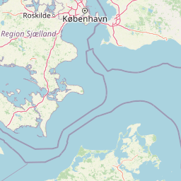
Map the diverse coastal and lagoon protected areas, comparing their unique geography within the broader Baltic Sea region.
East

Explore the protected geography of Mecklenburg-Vorpommern's Rügen island.
Jasmund National Park showcases one of Northern Europe's most dramatic natural formations, defined by its striking white chalk cliffs plunging into the Baltic Sea and its UNESCO-recognized primeval beech forests. This protected area offers a profound look into geological heritage and undisturbed forest ecosystems. Navigate its mapped boundaries and understand its unique landscape context within the Mecklenburg-Vorpommern region through detailed atlas exploration on MoriAtlas.
South
Glacial lakes and Peene river valley geography
Located in Mecklenburg-Vorpommern, this protected landscape encompasses broad glacial lakes including Malchiner See and Kummerower See. The region is defined by its slow-moving river systems, ancient oak woodlands, and a historic network of manor estates that shape the surrounding terrain and biodiversity.
West

Mapped protected wetlands, coastal spits, and polder terrain in southern Denmark.
The Saksfjed-Hyllekrog nature reserve protects a mosaic of woodland, coastal meadows, and shorelines on the southern coast of Lolland. This geographic record details the reserve's polder embankments, the Hyllekrog coastal spit, and the interaction between reclaimed land and open marine waters, highlighting its importance as a Ramsar and Natura 2000 site.
Southeast
Coastal cliffs, lagoon systems, and diverse forest terrain in Mecklenburg-Vorpommern
Naturpark Insel Usedom encompasses the German side of Usedom Island, offering a condensed landscape that bridges the Baltic Sea with inland brackish lagoons. This protected area integrates sandy shorelines, steep moraine cliffs, and varied wetland habitats, making it an essential subject for understanding the ecological and geographic character of northeastern Germany.
West
Glacial lake ecosystems on the island of Lolland
The landscape of Naturpark Maribosøerne centers on four interconnected glacial lakes, characterized by twisting shorelines and shallow, nutrient-rich water. This protected area on Lolland blends ancient ice age terrain with historic manor estates, extensive wetlands, and managed forest zones. Its formal status as a Natura 2000 habitat and bird protection zone highlights the ecological importance of this unique southern Danish environment.
East

Extensive marine protected landscape in the Baltic Sea
Ostoja na Zatoce Pomorskiej encompasses over 243,000 hectares of the southern Baltic Sea, serving as a primary marine nature reserve for the Polish coast. The sanctuary is defined by complex underwater features such as shallow sandy banks, gravel plains, and the prominent Odrzańska Ławica, which collectively support essential migratory waterbird populations and protected aquatic species within the European ecological network.
West
Submerged trench, boulder reefs, and marine migration corridors
Fehmarnbelt is an ecologically significant nature reserve in the German Baltic Sea, recognized for its role in water exchange between two major seas. The area features a deep trench, dynamic megaripple formations, and boulder reefs that support complex benthic communities. This site stands as a key protected landscape for marine biodiversity and harbor porpoise preservation within the region.
Northwest
A shallow fjord system on the southwestern coast of Zealand
Dybsø Fjord represents a primary protected landscape in Denmark, featuring a broad and exceptionally shallow lagoon environment. By tracing its boundaries and surrounding peninsulas, users can analyze a critical wetland habitat that supports international bird protection networks and reflects the unique coastal scenery of the Baltic region.
Deepen your understanding of Western Pomerania Lagoon Area National Park by continuing your exploration on MoriAtlas. Investigate its precise mapped boundaries, its contribution to the regional geography of Mecklenburg-Vorpommern, and the unique characteristics of its protected coastal landscape. Discover how this national park fits into the broader context of protected areas and natural landscapes, offering a structured gateway to geographic discovery.